Water Cycle and Climate The water cycle is


 usually have cooler summers and warmer")


 receive a lot of precipitation.")


- Slides: 55
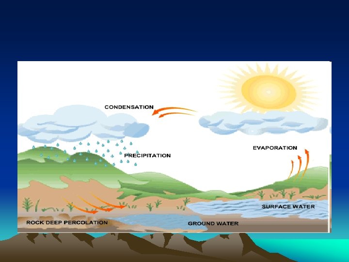
Water Cycle and Climate The water cycle is the circulation of water from the surface of Earth into the atmosphere and back again (evaporation, condensation, precipitation).
Precipitation may infiltrate Earth’s surface, runoff, or evaporate.
The release of water vapor into the atmosphere by plants is called transpiration.
Earth has been continuously been recycling water since the outgassing of water early in it’s history.
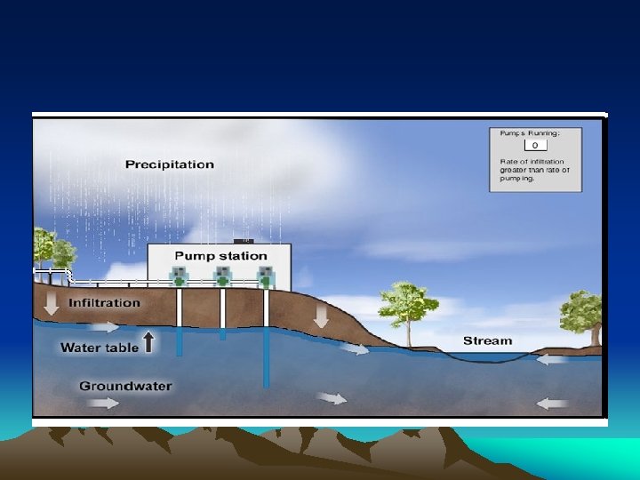
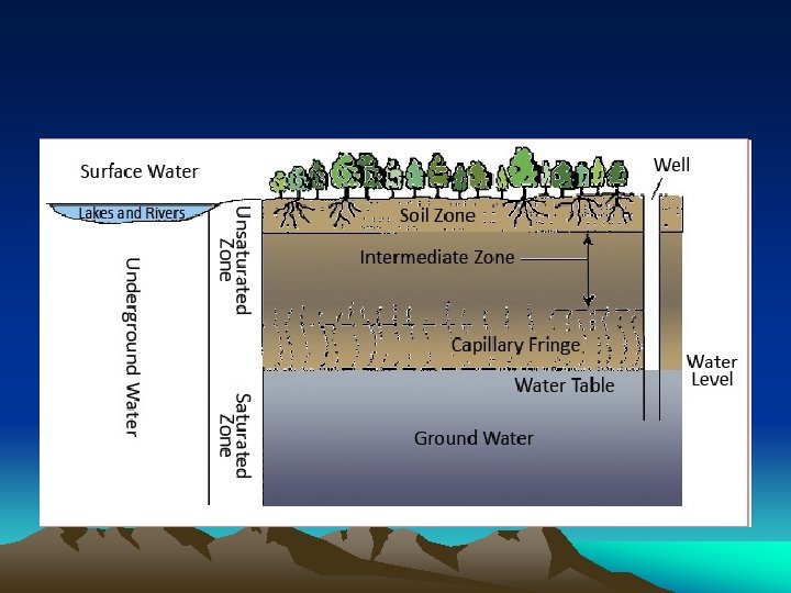
Water movement in the ground.
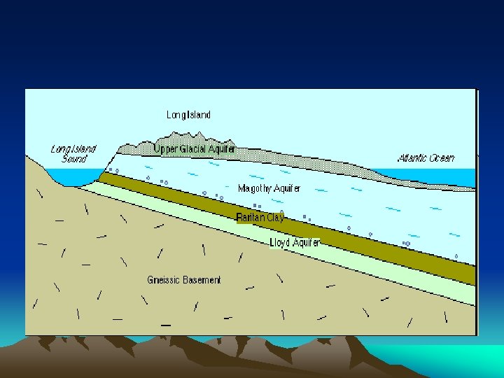
less than 3 percent of Earth’s water is fresh, and over two thirds of that is frozen. Most usable fresh water is underground.
Infiltration can occur if the surface is permeable and unsaturated and the slope is gentle enough.
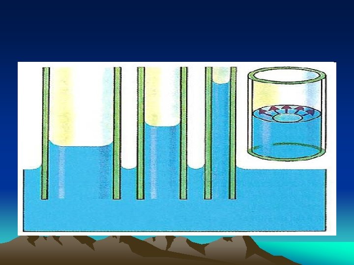
The rate of infiltration is determined by the porosity and permeability of the soil.
Porosity is the percentage of open space in a sample compared with its total volume.
Porosity is determined by the shape of the particles, how they are packed, and whether or not they are sorted by size.
Particle size does not affect porosity. A 500 ml sample of small beads and a 500 ml of large beads will have the same percentage of porosity.
The permeability of a material is a measure of how fast water will pass through it.
Permeability depends on pore size and whether or not the pores are interconnected.
Permeability increases as pore size increases.
• http: //www. eram. k 12. ny. us/education/page /download. php? fileinfo=c. GVyb. S 5 wb 3 Jvcy 5 zd 2 Y 6 Ojovd 3 d 3 L 3 Nja. G 9 vb. HMvc 2 Mvcm Vtb 3 Rl. L 2 lt. YWdlcy 9 kb 2 Nt. Z 3 Iv. NDQ 3 Zmls. Z TE 3 NDcuc 3 dm
Runoff can occur when rainfall exceeds the permeability rate, when the soil is saturated, or when the slope is too great to allow time for infiltration.
Capillarity is the upward movement of water into tiny pore spaces.
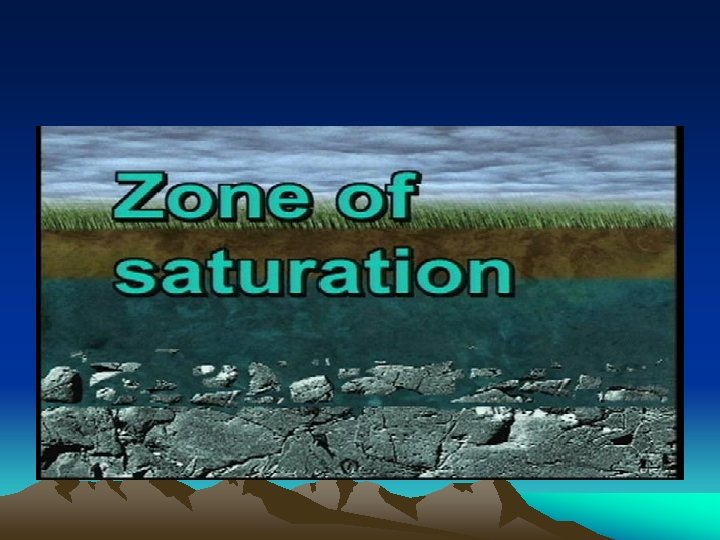
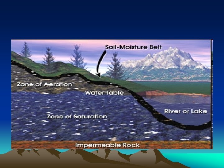
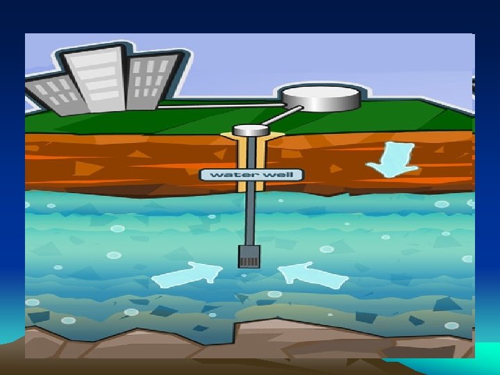
Zone of Saturation – Ground water zone where all available pore spaces are filled with water.
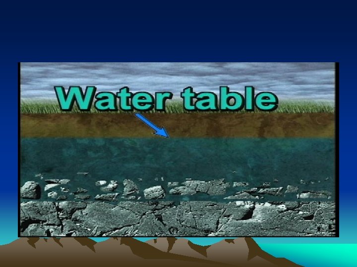
Water Table – The top of the zone of saturation.
Zone of aeration – Zone that extends from the surface to the water table. Pore spaces may be moist but are not saturated.
A productive well must extend below the water table into the zone of saturation.
Climate
Climate is the average weather for a region over a long period of time.
Climate is usually described in terms of precipitation and temperature.
Local climates can be influenced by latitude, being near a large body of water, ocean currents, prevailing winds, vegetative cover, elevation, as well as many other factors.
Human influences on climate include deforestation, urbanization, and the production of greenhouse gases such as carbon dioxide.
Moderating effect of nearby large bodies of water.
Land heats up and cools down much more quickly than water because it has a lower specific heat.
Throughout the year the temperature of the ocean doesn't change as much as the temperature of the land.
Locations near large bodies of water (like us) usually have cooler summers and warmer winters.
Inland locations are usually hotter during the summer and colder during the winter.
Effect of altitude and latitude on climate.
Places at low latitudes are warm because they receive a high angle of insolation.
Places at high latitudes are cold because they receive a low angle of insolation.
Locations at high altitudes are cool.
Locations at low altitudes tend to be warmer.
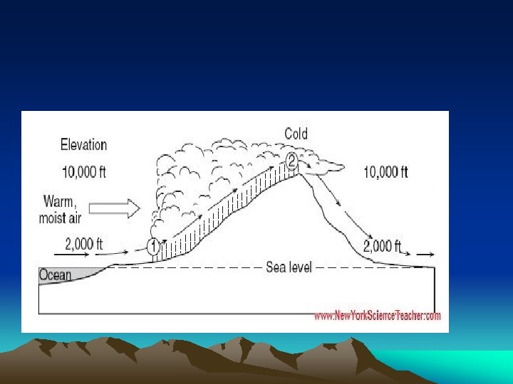
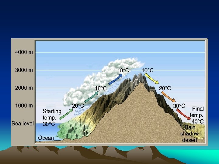
Windward and Leeward Climates
The windward side of a mountain is the side that the prevailing winds blow against. In the U. S. this is the west side of the mountain.
The leeward side of a mountain is the other side.
Wind blowing against a mountain is forced to rise.
Rising air expands and cools, condensing into clouds.
Places on the windward side of a mountain (Seattle) receive a lot of precipitation.
When the wind blows down the leeward side of the mountain, it becomes compressed, dry, and warm.
Places on the windward side of a mountain tend to have a dry climate.