Topic 8 Water Climate Water in the Earth


 Porosity is the percentage")


 Rate of infiltration depends on: 1. Porosity of the soil (how much")


: P/Ep < 0.")


 = An abnormal warming of surface ocean waters in")


- Slides: 48
Topic 8 Water & Climate
Water in the Earth Water enters the atmosphere through evaporation and transpiration Water leaves the atmosphere through condensation and precipitation This constant circulation, called the Water Cycle or Hydrologic Cycle, maintains a dynamic equilibrium for Earth. Precipitation can: 1. evaporate 2. run off 3. infiltrate Water cycle song
HYDROLOGIC CYCLE condensation precipitation transpiration evaporation infiltration runoff Water table aquifer Groundwater flow Stream, spring, lake, or ocean
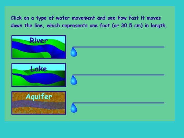
GROUND WATER Groundwater is always moving -but very slowly
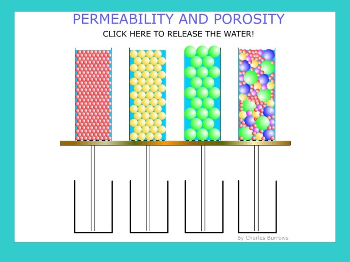
Porosity All soils, and even rocks, have pores (empty spaces) Porosity is the percentage of open space in soil or rock, compared with its total volume. Porosity is determined by: 1. Particle Shape Rounder particles = higher porosity 2. Particle Packing Loosely packed, freshly deposited = higher porosity
3. Particle Sorting Sorted soil = higher porosity How does the size of the particles affect porosity? When considering round, tightly packed particles, size has no effect on porosity. Average soil porosity = 35 -40%
Permeability is the rate that water can pass through a material. This depends on pore size and whether the pores are interconnected.
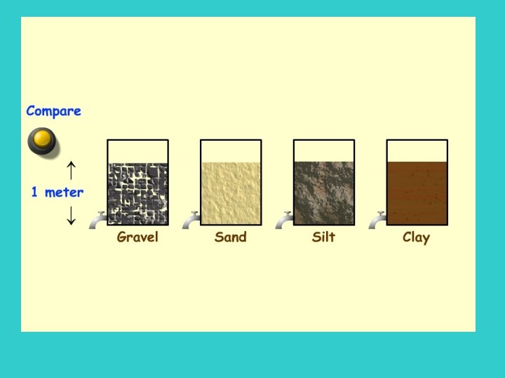
some sample soils and rocks
PERMEABILITY GRAVEL Rapid drainage FINE SAND Moderate drainage CLAY Slow drainage
Infiltration (percolation) Rate of infiltration depends on: 1. Porosity of the soil (how much space there is) 2. Permeability of the soil (how easily water can get through spaces) 3. Slope of the land (water will runoff a steep hill before it can infiltrate) 4. Rate of rainfall (a gentle rain gives the water time to sink in) If the pores are already filled with water the soil is said to be saturated and the excess water becomes runoff
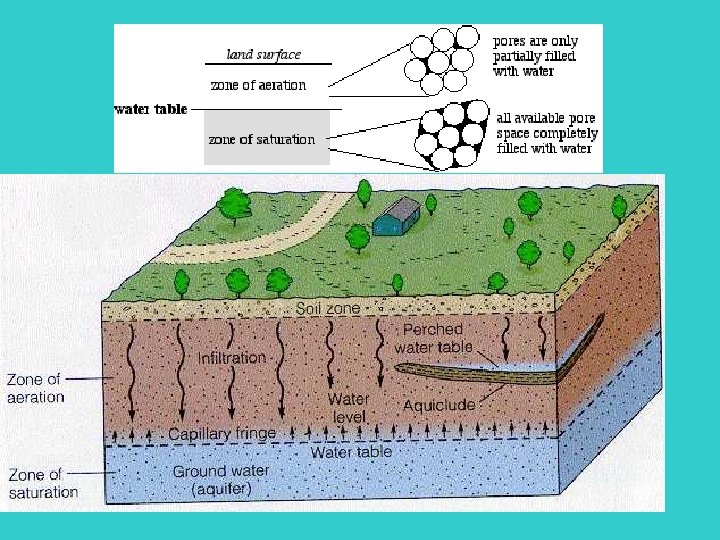
Zones of Subsurface Water will infiltrate the soil until it reaches an impermeable layer (< 3 km), then it will begin to accumulate in the permeable rock (aquifer) and is referred to as groundwater. The top of the groundwater is called the water table. In the zone of aeration/unsaturated zone, pore spaces contain mostly air, but are also coated with water if it has recently rained. Above the water table, pores are kept filled because of capillary action. The smaller the spaces, the greater the capillary action.
CAPILLARITY – WATER MOVES UPWARD • SMALLER SIZED PARTICLES INCREASE CAPILLARITY
INFILTRATION Infiltration refers to water soaking into the ground: Infiltration rate Porosity Infiltration rate Permeability Infiltration rate Slope Soil Storage Saturation
GROUND WATER - Aquifer 1. WATER INFILTRATES 2. EVENTUALLY REACHES AN IMPERMEABLE LAYER 3. ALL PORE SPACES FILLED WITH WATER – CALLED ZONE OF SATURATION – THE WATER IN THIS ZONE IS CALLED GROUNDWATER -AQUIFER 4. TOP OF SATURATED ZONE IS CALLED THE WATER TABLE 5. UNSATURATED ZONE – AIR AND WATER 6. CAPILLARY FRINGE – WATER RISES TO FEED ROOTS
WATER TABLE RISES AND FALLS ACCORDING TO RAINFALL AND SNOWMELT
Water infiltrating the ground also flows slowly downhill below the surface, so the water table usually follows the general topography of the land above it.
A river or lake or spring is simply a place where the water table comes up to the surface. Even during long periods without rain, most stream beds are fed by groundwater
How wells affect the water table
Groundwater contamination
Caves
Cave formation is common in limestone bedrock
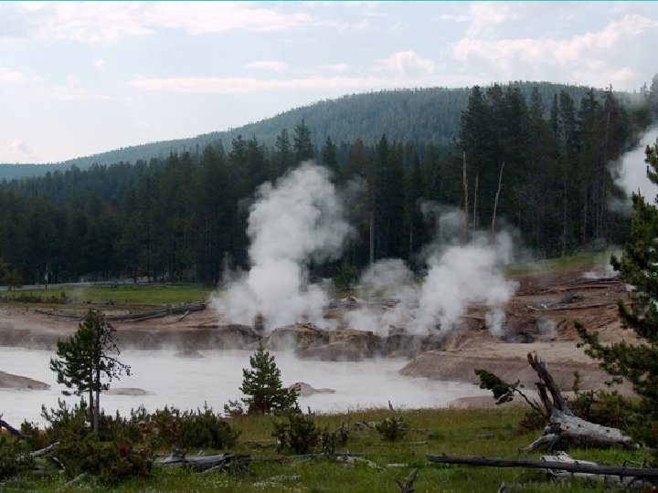
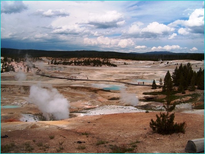
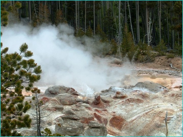
Hot springs and Geysers A geyser is a special type of hot spring that erupts periodically. For both geysers and hot springs, groundwater circulating at depth becomes heated by the hot rock below and moves by convection, toward the surface. As it rises, it follows zones of weakness that become channels leading upward. In a geyser, these channels have constrictions which prevent the water from circulating freely to the surface where the heat would escape. The water becomes progressively hotter at depth, exceeding the surface boiling point (199° F. , 93° C). Yet it will not vaporize in the geyser tube at this temperature because of the greatly increased pressure exerted by the enormous weight of the overlying water. Bubbling upward, steam expands as it nears the top of the water column until the bubbles are too large and numerous to pass freely through the tight spots. At a critical point, the confined bubbles actually lift the water above, causing the geyser to overflow. This decreases pressure on the system and violent boiling results. A tremendous volume of steam is instantly produced, forcing water explosively out of the vent in a superheated mass. The eruption begins. In an eruption, water is expelled faster than it can enter the geysers plumbing system at depth. As the eruption continues, the heat and pressure gradually decrease. The eruption stops when the water resevoir is exhausted or when the gas bubbles diminish enough to be able to rise through the water column without ejecting it. Fountain type geysers generally shoot water out in various directions, most often from a pool. Cone type geysers generally erupt in a narrow jet of water, usually from a cone or nozzle-like formation.
Hot springs and geysers Yellowstone National Park
Water Budgets A local water budget shows how precipitation, evapotranspiration, and soil storage of water vary throughout the year. This shows when there are possible droughts and water surpluses (flooding) in an average year. Ep = potential evapotranspiration (depends on the temperature)
How is climate determined? By comparing the precipitation and temperature (Ep): P/Ep < 0. 4 arid climate P/Ep = 0. 4 – 0. 8 semiarid climate P/Ep = 0. 8 – 1. 2 subhumid climate P/Ep > 1. 2 humid climate Ex/ Reno, Nevada gets 193 mm of precipitation in a year but demands 628. 193 / 628 = 0. 3 arid climate
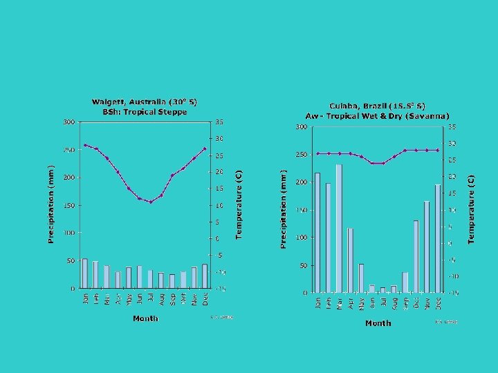
Climographs are similar to water budgets and help to classify the type of climate for a location
Climate
Factors that affect climate 1. Latitude – temperature decreases as latitude increases
2. Elevation – temperature decreases as elevation increases
3. Nearness to large bodies of water – coastal areas have milder temperatures and a smaller temperature range Why? Because water has a higher specific heat than land. For example, Hong Kong and Nagpur in India have almost the same latitude, but the daily temperature range is very different between the two cities. For a typical day in October, the daily temperature range in Nagpur is 12. 8 C while for Hong Kong it is only about 4. 8 C.
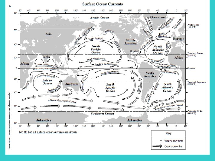
4. Ocean currents – water coming from higher latitudes will have a cooling effect on the land that the current encounters (lower temp. year round)
5. Mountains – The Orographic Effect Windward side of mountain is cool and wet, leeward side is warm and dry. This only works, however, if there is moisture on the side of the prevailing winds
How does this affect NY? The Tug Hill Plateau holds the world record for snowfall!
6. Planetary Wind Belts
El Niño (aka: Southern Oscillation) = An abnormal warming of surface ocean waters in the eastern tropical Pacific Under normal conditions in the Pacific, ocean water upwells from deep ocean currents along the west coast of South America. Currents are driven by strong winds created by pressure differences. This cold water is rich in oxygen and nutrients During El Niño conditions, the atmospheric pressures reverse, which brings warmer, nutrientdepleted water to the coast. This warm water affects storm development and can cause serious droughts. Although it typically occurs around Christmas, conditions can persist for many months.
Monsoons are strong, often violent winds, that change direction with the season. India’s climate is dominated by monsoons. Monsoons blow from the land toward the sea in winter, and from the sea toward land in the summer. India’s winters are hot and dry. The monsoon winds blow from the northeast and carry little moisture. The summer monsoons roar onto the subcontinent from the southwest. The winds carry moisture from the Indian Ocean and bring heavy rains from June to September. The torrential rainstorms often cause violent landslides.
Temperature and precipitation patterns are altered by natural events such as El Niño and volcanic eruptions, but it is also important to recognize how human influence can affect them. Activities like deforestation, urbanization, and the production of greenhouse gases have huge impacts on global climate patterns.