The Quaternary Period 1 64 Ma Only 38


- Slides: 58

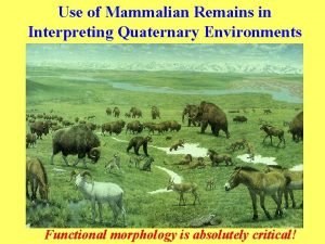
The Quaternary Period • 1. 64 Ma • Only 38 seconds long!

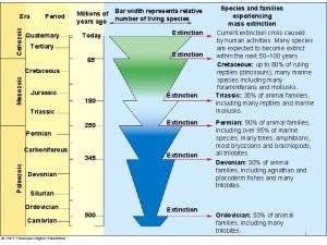
Cenozoic Time Scale

Pleistocene—Holocene Tectonism and Volcanism • Best known for glaciation – but also a time of volcanism and tectonic activity • Continuing orogeny – Himalayas – Andes Mountains • Deformation at convergent plate boundaries – Aleutian Islands – Japan – Philippines

Uplift and Deformation • Interactions between – North American and Pacific plates – along the San Andreas transform plate boundary – produced folding, faulting, and a number of basins and uplifts • Marine terraces – covered with Pleistocene sediments – attest to periodic uplift in southern California

Marine Terraces – marine terraces on San Clemente Island, California – each terrace represents a period when that area was at sea level – highest terrace is now about 400 m above sea level

N Ca marine terraces

Cascade Range • Ongoing subduction of remnants of the Farallon plate – beneath Central America and the Pacific Northwest – account for volcanism in these two areas • The Cascade Range • of California, Oregon, Washington, and British Columbia – has a history dating back to the Oligocene – but the large volcanoes now present formed during the last 1. 6 million years

Lassen Peak—Lava Dome • Lassen Peak, a large lava dome, – formed on the flank of an older, eroded composite volcano in California about 27, 000 years ago – It erupted most recently from 1914 to 1917

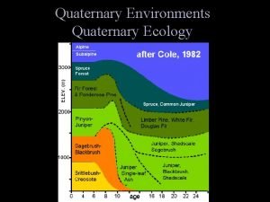
Pleistocene Stratigraphy • Began 1. 6 Ma • Ended 10, 000 years ago • Pleistocene-Holocene (Recent) boundary • Based on – climate change to warmer conditions concurrent with melting of most recent ice sheets • oxygen isotope ratios determined from shells of marine organisms – changes in vegetation

Glaciers in North America

Glaciers in Europe

Four Glacial Stages • Detailed mapping reveals several glacial advances and retreats • North America had at least four major episodes of Pleistocene glaciation • Each advance was followed by warmer climates • The four glacial stages • • Wisconsin Illinoian Kansan Nebraskan – named for the states of the southernmost advance

Four Glacial Stages

How Many Stages? • Recent detailed studies of glacial deposits indicate – there were an as yet undetermined number of pre. Illinoian glacial events – history of glacial advances and retreats in North America is more complex than previously thought

Correlation – six or seven major glacial advances and retreats are recognized in Europe – at least 20 major warm–cold cycles can be detected in deep-sea cores • Why isn't there better correlation among the different areas if glaciation was such a widespread event? • chaotic sediments difficult to correlate • minor fluctuations

Evidence for Climatic Fluctuations • Changes in surface ocean temperature – recorded in the O 18/O 16 ratio in the shells of planktonic foraminifera – provide data about climatic events

Oxygen Isotope Ratio

Onset of the Ice Age QUATERNARY CENOZOIC ERA Today 10, 000 ~2 Ma - Northern Hemisphere ~30 Ma - West Antarctic ~45 Ma - East Antarctic 60 Ma Cenozoic Glaciations

Why the Icehouse? • Long-term climate drivers: – Plate tectonics • Opening/closing of seaways – Ocean currents are our heat and AC • Uplift and erosion of mountains – Weathering reduces atmospheric CO 2 – Life: catastrophic evolution of new capabilities – O 2 – Astronomical drivers • Other bodies (moon, sun) pull on the Earth, changing its distance to the sun

Why the Pleistocene Icehouse ? • Long-term tectonic driver: – Redirection of ocean currents: • Isolation of Antarctica • Collision of N and S America – New mountains = more weathering • Mineral weathering reduces atmospheric CO 2 • less CO 2 = less greenhouse effect

Antarctica became isolated: – ocean circulation changes, cools

Why the Icehouse? • Shut off E/W global ocean flow Isthmus of Panama: North & South American plates collided ~ 3. 5 Ma

Glaciers need precipitation Caribbean warms Gulf Stream moves warm water north Increases ocean evaporation and precipitation on land

Pleistocene Underway • By Middle Miocene time – an Antarctic ice sheet had formed – accelerating the formation of very cold oceanic waters • About 1. 6 million years ago – continental glaciers began forming in the Northern Hemisphere • The Pleistocene Ice Age was underway

But we didn’t just get ONE ice age… You Are Here!

We got dozens of them.

The Milankovitch Theory • Put forth by the Serbian astronomer – Milutin Milankovitch while interned by Austro. Hungarians during WWI • Minor irregularities in Earth's rotation and orbit – are sufficient to alter the amount of solar radiation that Earth receives at 65° N – and hence can change climate – (criticism at the time: why 65° N? !? )

Three Variables Ellipticity • about 100, 000 years

Axis Tilt • The angle between – Earth's axis – and a line perpendicular to the plane of its orbit around the Sun • This angle shifts about 1. 5° – from its current value of 23. 5° – during a 41, 000 -year cycle

Precession • Earth moves around the Sun – spinning on its axis – which is tilted at 23. 5° to the plane of its orbit • Earth’s axis of rotation – slowly moves – and traces out the path of a cone in space Plane of Earth’s Orbit

Effects of Precession • At present, Earth is closer to the Sun in January • In about 11, 000 years, closer to the Sun in July

Makes a tippy system

Convolve 100, 000 + 41, 000 + 26, 000 years…

Pleistocene Glacial cycles

Warming Trend • 10, 000 -6, 000 years ago, a warming trend – pollen – tree rings – ice advance/retreat • Then the climate became cooler and moister – favoring the growth of valley glaciers on the Northern Hemisphere continents • Three episodes of glacial expansion took place during this neoglaciation

Little Ice Age • The most recent glacial expansion – between 1500 and the mid- to late 1800 s – was a time of generally cooler temperatures • It had a profound effect on – the social and economic fabric of human society – accounting for several famines – migrations of many Europeans to the New World – Local phenomenon Pieter Bruegel the Elder (1525– 1569)

Glaciers—What Are They and How Do They Form? • Geologists define a glacier – as a mass of ice on land that moves by plastic flow • internal deformation in response to pressure – and by basal slip • sliding over its underlying surface

How do glaciers form? • Any area receiving more snow in cold seasons – than melts in warm seasons – has a net accumulation over the years • As accumulation takes place – snow at depth is converted to ice – when it reaches a critical thickness of about 40 m – it begins to flow in response to pressure Marguerite Bay, 2002

Glaciers Move • Once a glacier forms – it moves from a zone of accumulation – toward its zone of wastage • As long as a balance exists between the zones, – the glacier has a balanced budget Amundsen Sea, 1999

Glaciation and Its Effects • • • Climate itself Sea level change Sediments Landforms and topography Isostatic rebound

Isostatic Rebound in Eastern Canada • Uplift in meters – during the last 6000 years

U-Shaped Glacial Trough • This U-shaped glacial trough in Montana – was eroded by a valley glacier

Proglacial Lakes • Form where meltwater accumulates along a glacier's margin • Deposits in proglacial lakes – vary considerably from gravel to mud – of special interest are the finely laminated mud deposits – consisting of alternating dark and light layers • Each dark–light couplet is a varve – representing an annual deposit

Characteristics of Varves • Light-colored layer of silt and clay – formed during the summer • The dark layer made up of smaller particles and organic matter – formed during the winter when the lake froze over Varves with a dropstone

Moraines • Most important glacial deposits – chaotic mixtures of poorly sorted sediment deposited directly by glacial ice – An end moraine is deposited – when a glacier’s terminus remains stationary for some time Mt. Cook, 1999

Recessional Moraine • If the glacier’s terminus – should recede and then stabilize once again – another end moraine forms – known as a recessional moraine

Glacial Features • Features seen in areas once covered by glaciers • glacial polish – the sheen • striations – scratches? Devil’s Postpile National Monument, California

Glacial Sediment • Glaciers typically deposit poorly sorted nonstratified sediment

Cape Cod Lobe • Position of the Cape Cod Lobe of glacial ice – 23, 000 to 16, 000 years ago – when it deposited the terminal moraine – that would become Cape Cod and nearby islands

Recessional Moraine • Deposition of a recessional moraine – following a retreat of the ice front

Cape Cod • By about 6000 years ago – the sea covered the lowlands – between the moraines – and beaches and other shoreline features formed

Changes in Sea Level • Today, between 28 and 35 million km 3 of water – frozen in glaciers • During the maximum extent of Pleistocene glaciers – more than 70 million km 3 of ice • These huge masses of ice contained enough frozen water – to lower sea level by 130 m

Land Bridge • Large areas of today's continental shelves were exposed • The Bering Strait exposed – Alaska connected with Siberia via a broad land bridge – Native Americans and various mammals, such as the bison, migrated

What would happen if all glaciers melted? • Sea level would rise about 70 m – many of the world's large population centers would be flooded

Where is all that ice? 66 m is in Antarctic a

Isn't it stable? We can watch it breaking up

Change is ongoing Anderson et al. , 2002

Difficult to Predict
 Frilled shark geological era
 Site do professor
 Quaternary economic activities
 Primary secondary tertiary health care definition
 Secondary to tertiary structure
 Binary to quaternary
 Is myoglobin tertiary or quaternary
 Quaternary consumer
 What are quaternary consumers
 What is quaternary consumer
 Quaternary structure of protein
 Nitrogen base
 Quaternary economic activity
 Advantage and disadvantage of quaternary ammonium compounds
 Primary vs secondary vs tertiary vs quaternary structures
 Advantage of quaternary ammonium compounds
 Bisguanides
 Level of economic activity
 Quaternary extinction
 Quinary sector examples
 Primary aliphatic amines
 Food web for owls
 Take only photographs leave only footprints
 Critical period vs sensitive period
 In what year is the period of activism
 Absolute refractory period and relative refractory period
 Less complicated texture than baroque (more homophonic)
 Stability period vs measurement period
 Critical period vs sensitive period
 Trustee period and royal period
 Critical period vs sensitive period
 Critical/sensitive periods
 Nonmetallic, period 3, atomic mass 32
 Prehistory vs history
 Absolute refractory period and relative refractory period
 Vẽ hình chiếu vuông góc của vật thể sau
 Làm thế nào để 102-1=99
 Tỉ lệ cơ thể trẻ em
 Lời thề hippocrates
 đại từ thay thế
 Vẽ hình chiếu đứng bằng cạnh của vật thể
 Quá trình desamine hóa có thể tạo ra
 Môn thể thao bắt đầu bằng chữ đua
 Công thức tính thế năng
 Thế nào là mạng điện lắp đặt kiểu nổi
 Hát kết hợp bộ gõ cơ thể
 Sự nuôi và dạy con của hươu
 Dot
Dot Biện pháp chống mỏi cơ
 Phản ứng thế ankan
 Gấu đi như thế nào
 Thiếu nhi thế giới liên hoan
 điện thế nghỉ
 Một số thể thơ truyền thống
 Thế nào là hệ số cao nhất
 Trời xanh đây là của chúng ta thể thơ
 Ng-html
 Sơ đồ cơ thể người
 Số.nguyên tố
