Earth Science 1 Earth Science is the study


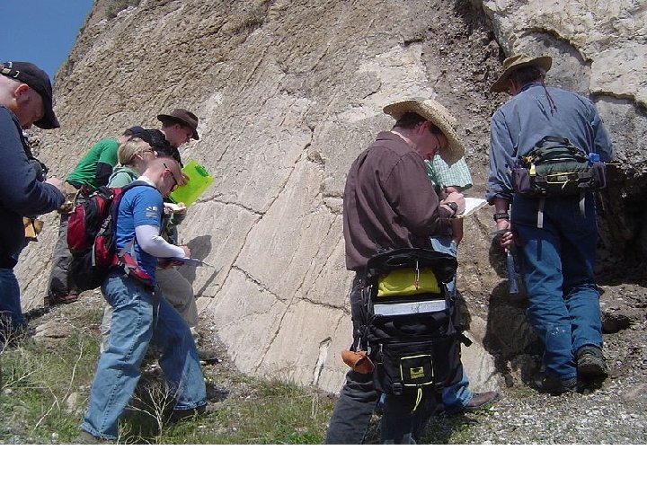


 Physical Geology: Physical geology")


 Petrology: It deals with the origin, structure, texture, and mineralogical composition etc. of")


 Historical Geology (Stratigraphy): It deals with the study of the strata of sedimentary")

 Design Following are the some of the geological characteristics that have direct or")
 Construction (i) Knowledge of geology is necessary for selection and proper use of")


- Slides: 41
Earth Science 1. Earth Science is the study of the Earth and its neighbors in space. 2. It is an exciting science with many interesting and practical applications. 3. Some Earth scientists use their knowledge of the Earth to locate and develop energy and mineral resources. 4. Others study the impact of human activity on Earth's environment and design methods to protect the planet. 5. Some use their knowledge about Earth processes such as volcanoes, earthquakes and hurricanes to plan communities that will not expose people to these dangerous events.
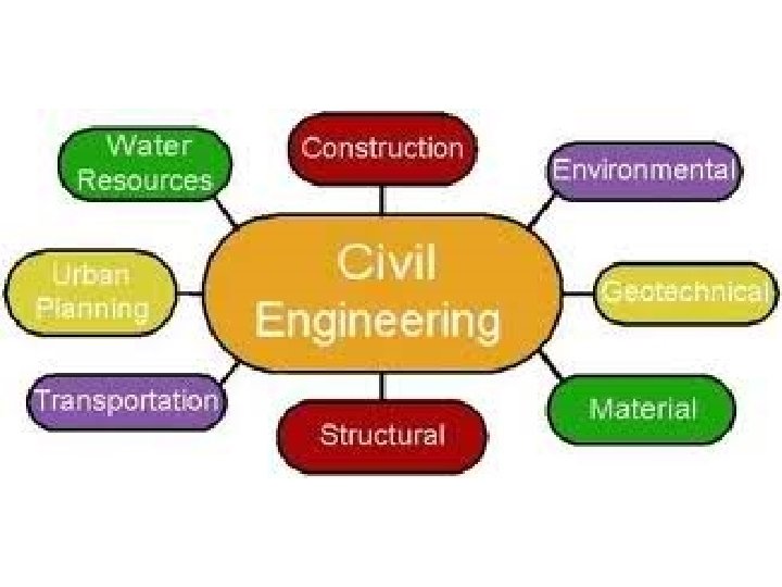
The Four Earth Sciences Many different sciences are used to learn about the earth, however, the four basic areas of Earth science study are: geology, meteorology, oceanography and astronomy.
Geology 1. Geology is the primary Earth science. The word means "study of the Earth". 2. Geology deals with the composition of Earth materials, Earth structures, and Earth processes. 3. It is also concerned with the organisms of the planet and how the planet has changed over time. 4. Geologists search for fuels and minerals, study natural hazards, and work to protect Earth's environment.
Soil Mechanics Soil mechanics is a discipline that applies principles of engineering mechanics, e. g. kinematics, dynamics, fluid mechanics, and mechanics of material, to predict the mechanical behavior of soils.
Branches of Geology applies primarily to Earth, but can be applied to any planet. Geology of Earth Sub-disciplines of Geology of Earth • Economic geology • Mining geology • Petroleum geology • Engineering geology • Environmental geology • Geochemistry • Geological modelling • Geomorphology • Geophysics • Historical geology • Hydrogeology • Mineralogy • Paleontology • Petrology • Sedimentology • Stratigraphy • Structural geology • Volcanology
BRANCHES OF GEOLOGY Geology is divided into following branches: (a) Physical Geology: Physical geology deals with the study of the effect of natural agencies which are in operation in moulding the surface of the globe. Volcanic eruptions and earthquake are internal agencies and wind, water, ice and atmosphere are external agencies that bring about the changes on the earth’s surface. (b) Geomorphology: It deals with the study of landforms. It includes detailed investigations regarding development and dispositions of mountains, plateaus, valleys and basins and various other land forms which are associated with them. (c) Mineralogy: It deals with the study of the formation, occurrence, aggregation, composition, properties and uses of minerals.
Physical Geology
Geomorphology
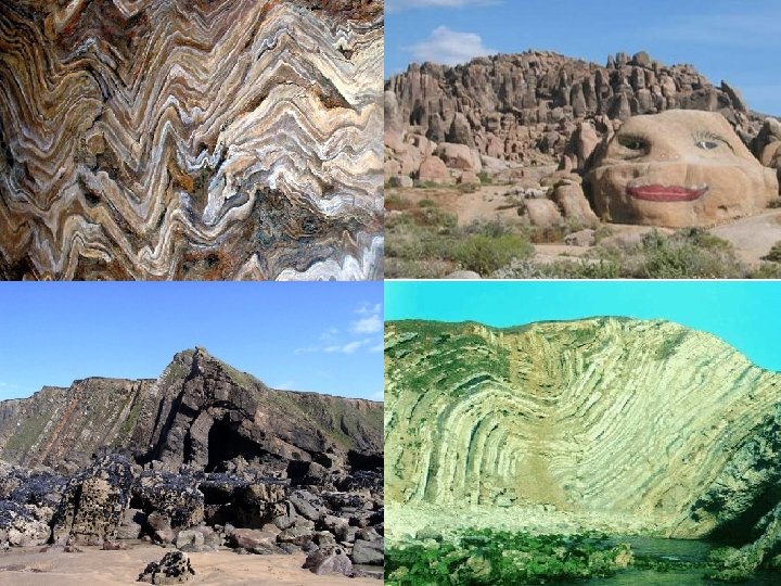
(d) Petrology: It deals with the origin, structure, texture, and mineralogical composition etc. of different types of rocks. (e) Structural Geology: It deals with the study of the configuration of the rocks in the Earth’s crust produced due to number of internal and external forces. (f) Palaeontology: It is the study of fossils of plants and animals that are found in the rocks. They indicate the climate, age and environment of deposition of rock unit in which they are found. Fossils are the remains of organisms, both plants and animals, which have been preserved with in the sedimentary rock beds under favourable geologic conditions.
Petrology
Palaeontology
(g) Historical Geology (Stratigraphy): It deals with the study of the strata of sedimentary rocks, their succession, thickness, age, variation and correlation to decipher the geological history of the earth from the rocks. (h) Economical Geology: This branch deals with the study of those minerals and rocks and other materials that can be exploited for the benefit of the society. It deals with the study of minerals, deposits, their modes of formation, modes of occurrence, distribution etc. (i) Engineering Geology: It deals with the application of geological knowledge in the field of engineering for construction of dams, bridges, tunnels, buildings, roads, stability of hill slopes etc. It gives description of structure and attributes of rocks connected with engineering works.
ROLE OF ENGG GEOLOGY IN CONSTRUCTION INDUSTRY In all type of heavy construction jobs the full geological information about the site of construction (excavation) and about the natural materials of construction is very important. This information has full relevance in the three important stages of a civil engineering construction project, i. e. planning, designing and execution. (a) Planning: Following geological information is greatly useful in proper planning of a civil engineering project: (i) Topographic Maps: Such maps give details of relief features and are essential to understand relative merits and demerits of all possible sites for the proposed project. (ii) Hydrological Maps: These maps give broad details about the distribution and geometry of the surface water channels and also the occurrence and depth contours of ground water below the surface of the earth. (iii) Geological Maps: Petrologic characters and structural deposition of rock types as developed in the proposed area are depicted in the geological maps.
(b) Design Following are the some of the geological characteristics that have direct or indirect bearing upon the design of a proposed project. (i) The existence of hard bed rocks, their depth and inclination with the surface. (ii) The mechanical properties: compressive strength, shear strength, transverse strength, modulus of elasticity, porosity, permeability, resistance to decay, and disintegration. (iii) Presence, nature and distribution pattern of planes of structural weakness (joints, faults, folds, cleavage etc. ) and seams and zones of weak materials (shear zones, fault zones and clay bands etc. ). (iv) Position of ground water table, recharge points, discharge points, and variation during different periods of the year. (v) Seismic characteristics of the area and prediction about future seismic activity.
(c) Construction (i) Knowledge of geology is necessary for selection and proper use of right type of material, quality control (sand, gravel, crushed rocks and soils). (ii) Knowledge of geological history is very important for construction in geologically sensitive areas like coastal belts, seismic zones and permafrost regions. (iii) Construction of under ground projects like construction of tunnels. The same type of rock may behave totally in a different way under different natural settings. Knowledge of behaviour of rocks under imposed loads and relieved loads.
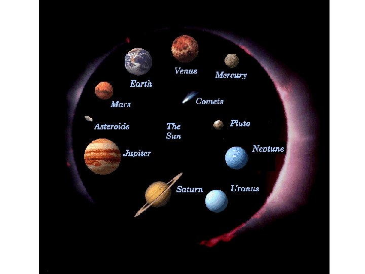
Planetary geology 1. Geology of Mercury 2. Geology of Venus 3. Geology of the Moon 4. Geology of Mars 5. Geology of Jupiter 6. Geology of Saturn 7. Geology of Uranus 8. Geology of Neptune
ORIGIN OF EARTH There are many theories about the origin of earth but the problem of origin of the earth is yet without a fixed solution. (i) The Nebular Hypothesis : The planetary system is believed to have evolved from an originally hot, rarefied gaseous cloud; the Nebula, which surrounded the primeval Sun. From this original nebular mass, the planets are assumed to have formed. (ii) The Planetesimal Hypothesis: Numerous small particles were thrown out by the sun during a large scale disturbance from the solar prominances. These solar particles formed the planetisimals and later on planets. (iii) The Tidal Hypothesis: The planets were formed from a gaseous filament that was torn out from the sun under the influence of another major star that happened to pass through at a certain time quite near to the parent sun of our solar system. (iv) The Gas-Dust Cloud Hypothesis: The fundamental assumption of these modern concepts is that “the planets have evolved out of a cold cloud of gas and dust.
The Nebular Hypothesis, an explanation of how the solar system was formed, proposed by Pierre Simon de Laplace in 1796. Laplace said that the material from which the solar system was formed was once a slowly rotating cloud, or nebula, of extremely hot gas. The gas cooled and the nebula began to shrink. As the nebula became smaller, it rotated more rapidly, becoming somewhat flattened at the poles. A combination of centrifugal force, produced by the nebula's rotation, and gravitational force, from the mass of the nebula, caused rings of gas to be left behind as the nebula shrank. These rings condensed into planets and their satellites, while the remaining part of the nebula formed the sun.
In the Nebular Hypothesis, a cloud of gas and dust collapsed by gravity begins to spin faster because of angular momentum conservation.
The collapsing, spinning nebula begins to flatten into a rotating pancake
As the nebula collapses further, local regions begin to contract gravitationally on their own because of instabilities in the collapsing, rotating cloud.
The Planetesimal Hypothesis, a theory of the origin of the solar system. It was proposed by Forrest R. Moulton and Thomas C. Chamberlin about 1900. The theory states that the planets were formed by the accumulation of extremely small bits of matter that revolved around the sun. This matter was produced when a passing star almost collided with the sun. During the near-collision, hot gases were pulled out of both stars and the gases then condensed. The planetesimal hypothesis was widely accepted for about 35 years.
The Tidal Hypothesis The Tidal or Gaseous Hypothesis of the earth involves an original sun that had a close encounter with a passing star. This near-collision between the sun and another star believed to have pulled material out of the sun and came out as a long spindle or cigar-shaped filament of solar gases. This gaseous filament later broke up into units which condensed to a molten and finally a solid stage, thus forming the planets. Astronomers have shown that a gaseous filament of this sort would not form solid bodies such as our planets; it would instead simply disappear in space. For this and many other reasons, this hypothesis is no longer acceptable to most scientists.
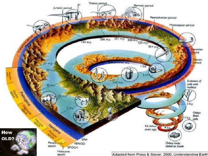
AGE OF THE EARTH 1. All methods except radioactive methods have been rejected. 2. Archbishop, Usshar, calculated from his interpretation of old testaments, the day of creation of the world as a day in 4004 B. C. 3. John Lightfoot calculated as 8 p. m. , Friday, October 22, 4004 B. C. 4. According to Hindu Mythology, total age of the earth is 4. 32 thousand million years, of which nearly half (about 2000 million years) is believed to have been over by now. 5. Based on the rate of sedimentation: The rate of sedimentation is one feet per one hundred years. The total thickness of sedimentary rocks is 265000 feet. The total age of the earth comes out to be 26. 5 million years. 6. Based on concentration of sodium in sea water, the age of the earth is estimated to be 90 million years. 7. Based on the radio activity dating, the age of the earth is estimated as 4. 6 × 10⁹ years.
Structure of the Earth The structure of Earth can be defined in two ways: by mechanical properties such as rheology, or chemically. 1. Mechanically, it can be divided into lithosphere, asthenosphere, mesosphere, outer core, and the inner core. The interior of the earth is divided into 5 important layers. 2. Chemically, Earth can be divided into the crust, upper mantle, lower mantle, outer core, and inner core.
Structure of the Earth
Core 1. The average density of Earth is 5, 515 kg/m 3. Since the average density of surface material is only around 3, 000 kg/m 3, it is conclude that denser materials exist within Earth's core. 2. Seismic measurements show that the core is divided into two parts, a solid inner core with a radius of ~1, 220 km and a liquid outer core extending beyond it to a radius of ~3, 400 km. 3. The solid inner core was discovered in 1936 by Inge Lehmann and is generally believed to be composed primarily of iron and some nickel.
Mantle 1. Earth's mantle extends to a depth of 2, 890 km, making it the thickest layer of the Earth. The pressure, at the bottom of the mantle, is ~140 GPa (1. 4 Matm). 2. The mantle is composed of silicate rocks that are rich in iron and magnesium relative to the overlying crust. Schematic view of the interior of Earth 1. continental crust 2. oceanic crust 3. upper mantle 4. lower mantle 5. outer core 6. inner core
Crust The crust ranges from 5– 70 km in depth and is the outermost layer. The thin parts are the oceanic crust, which underlie the ocean basins (5– 10 km) and are composed of dense (mafic) iron magnesium silicate rocks, like basalt. The thicker crust is continental crust, which is less dense and composed of (felsic) sodium potassium aluminium silicate rocks, like granite. Schematic view of the interior of Earth 1. continental crust 2. oceanic crust 3. upper mantle 4. lower mantle 5. outer core 6. inner core
Tectonic Plates Earth's outer shell, the lithosphere, long thought to be a continuous, unbroken, crust is actually a fluid mosaic of many irregular rigid segments, or plates. A tectonic plate (also called lithospheric plate) is a massive, irregularly shaped slab of solid rock, generally composed of both continental and oceanic lithosphere. Plate size can vary greatly, from a few hundred to thousands of kilometers across; the Pacific and Antarctic Plates are among the largest. Plate thickness also varies greatly, ranging from less than 15 km for young oceanic lithosphere to about 200 km or more for ancient continental lithosphere (for example, the interior parts of North and South America).
There are nine large plates and a number of smaller plates. While most plates are comprised of both continental and oceanic crust the giant Pacific Plate is almost entirely oceanic, and the tiny Turkish-Aegean Plate is entirely land. Of the nine major plates, six are named for the continents embedded in them: the North American, South American, Eurasian, African, Indo-Australian, and Antarctic. The other three are oceanic plates: the Pacific, Nazca, and Cocos.
Tectonic plates of the World