MAPS II ATLAS OF THE SAHARA SAHEL Chapters


- Slides: 59
MAPS II ATLAS OF THE SAHARA -SAHEL Chapters 2 -10 www. oecd. org/swac/maps
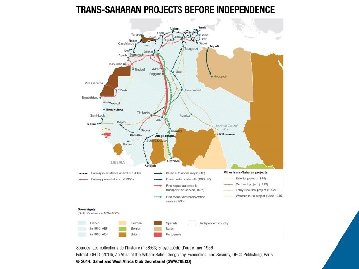
Atlas of the Sahara-Sahel # 1 2 3 4 5 6 7 8 9 10 11 12 13 14 15 16 17 18 19 20 21 22 23 24 25 26 27 28 29 30 Title of Map 0. 1 The geographic Sahel Map 0. 2 The diplomatic Sahel Map 0. 3 The Sahara-Sahel Map 1. 1 Relief and hydrography Map 1. 2 The arid area Map 1. 3 The partition into administrative subdivisions Map 1. 4 The partition into nation states Map 1. 5 Variability of isohyets Map 1. 6 The Sahel, zone of uncertainty Map 1. 7 Variation in isohyets between 1940– 1967 and 1968– 2000 Map 1. 8 Coefficient of variation for annual precipitation, 1901– 2006 Map 1. 9 The Paleo-Sahara Map 1. 10 The impossibility of choosing a limit Map 1. 11 Precolonial routes Map 1. 12 The road network Map 1. 13 City population Map 1. 14 Cities in West Africa, 2010 Map 1. 15 The weight of history Map 1. 16 Kanem Bornu Map 1. 17 Almoravid and Almohad Empires Map 1. 18 Ghana, Mali and Songhay Empires Map 1. 19 Hinges of the Saharan region Map 1. 20 Route empires Map 1. 21 Border negotiations Map 1. 22 Colonial empire limits in 1914 Map 1. 23 The process of independence Map 1. 24 Population distribution Map 1. 25 Population densities Map 1. 26 Linear density of population Map 1. 27 The impossible map (anamorphosis using inverse population density)
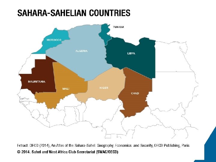
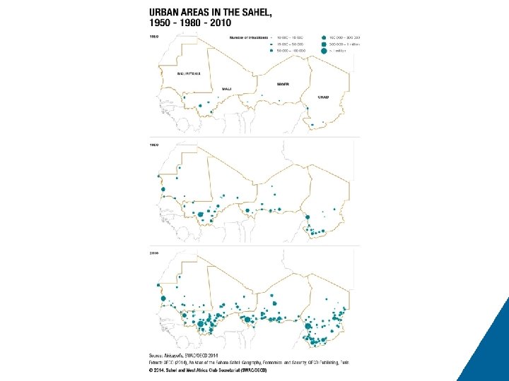
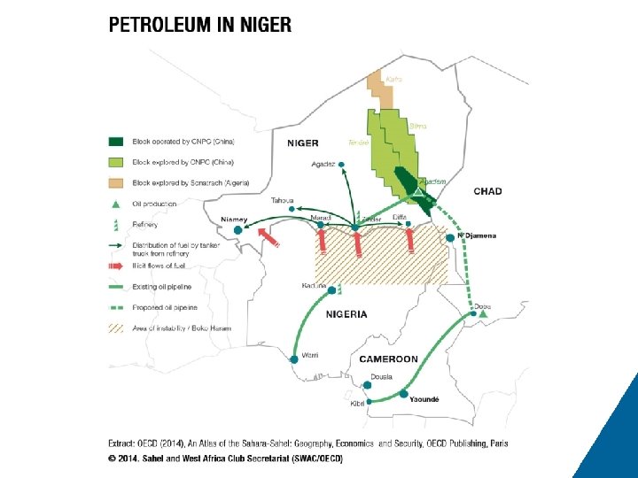
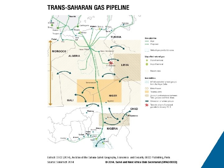
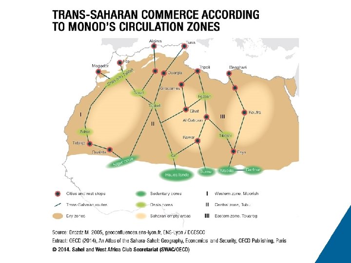
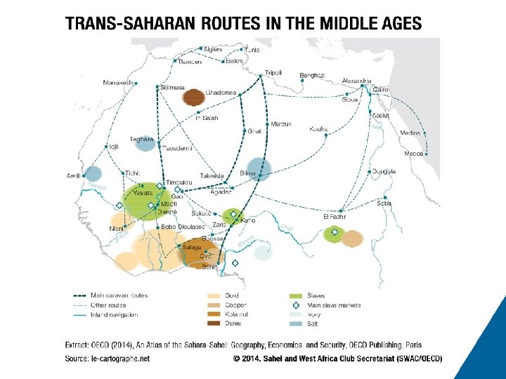
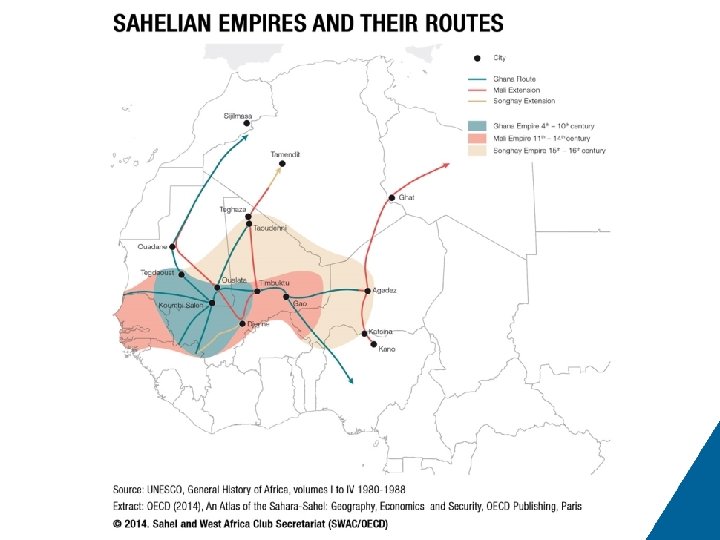
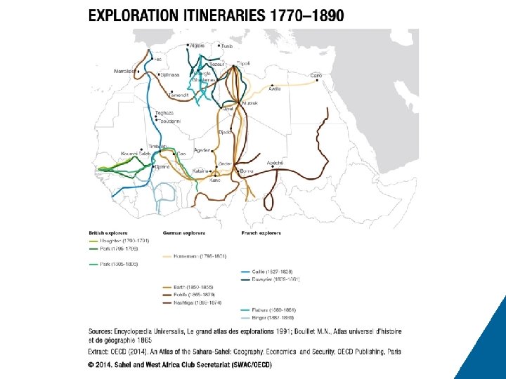
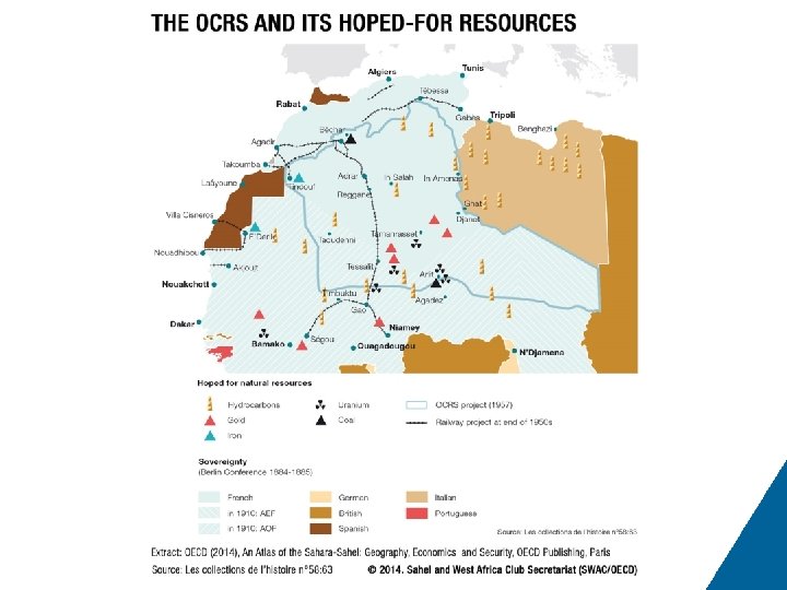
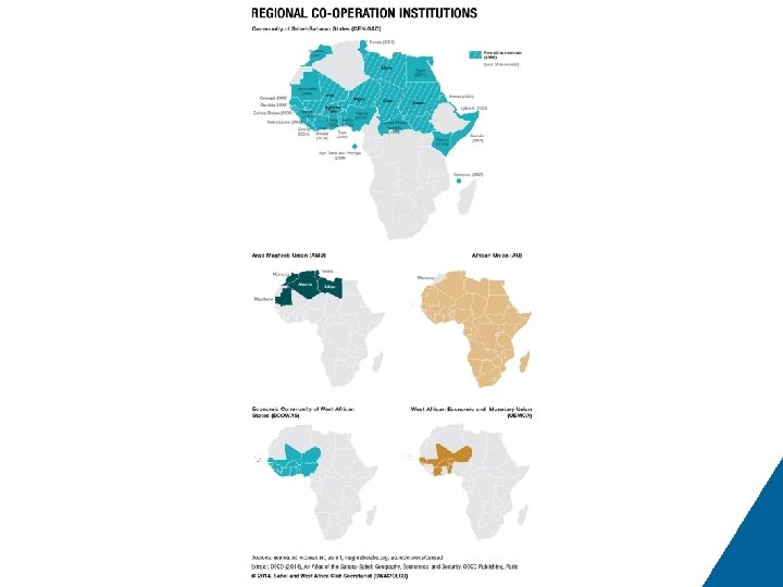
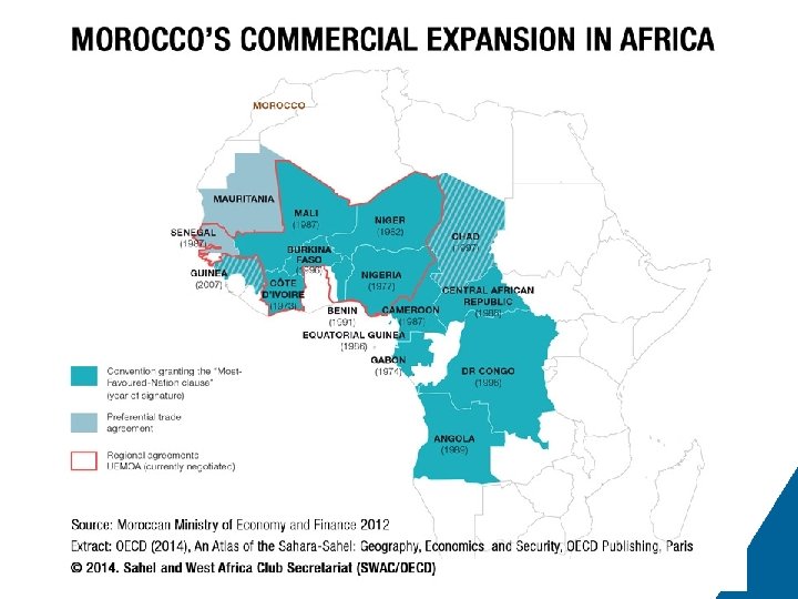
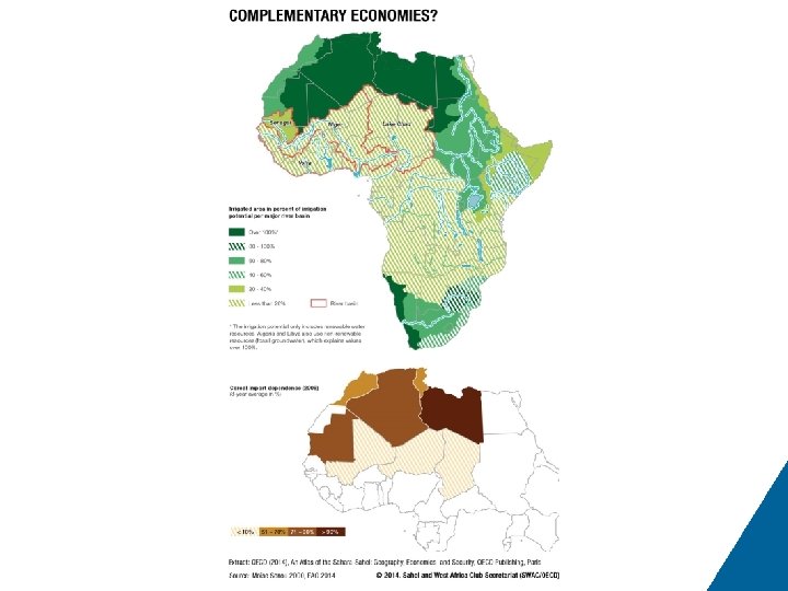
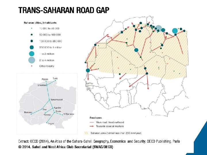
# 31 32 33 34 35 36 37 38 39 40 41 42 43 44 45 46 47 48 49 50 51 52 53 54 55 56 57 58 59 60 61 62 63 64 65 Title of Map 1. 28 Mines and industries Map 1. 29 Hydrocarbons Map 1. 30 Metals and minerals Map 1. 31 Petroleum license blocks Map 1. 32 Agricultural production systems Map 1. 33 Water, oases and breeding Map 1. 34 The evolution of migration Map 1. 35 Outsourcing of European migration policies Map 1. 36 Migrants in Tamanrasset Map 1. 37 The enclave of Ceuta Map 1. 38 Migratory movements Map 1. 39 Routes of the Paris-Dakar Rally Map 1. 40 Touristic attractions Map 1. 41 Touristic sites and routes Map 1. 42 Violent events by type between 1997 and 2012 Map 1. 43 Violent events between 1997 and 2012 Map 1. 44 Victims of violence between 1997 and 2012 Map 1. 45 The actors in conflicts in 2012 Map 1. 46 Violent events by type in 2012 Map 1. 47 Areas reported on by the French Ministry of Foreign and European Affairs Map 1. 48 Violent events in 2012 Map 2. 1 Sahara-Sahelian countries Map 2. 2 Urban areas in the Sahel, 1950 – 1980 – 2010 Map 3. 1 Petroleum in Niger Map 3. 2 The Trans-Saharan Gas Pipeline Map 4. 1 Trans-Saharan commerce according to Monod’s circulation zones Map 4. 2 Trans-Saharan routes in the Middle Ages Map 4. 3 Sahelian empires and their routes Map 4. 4 Exploration itineraries 1770– 1890 Map 4. 5 Trans-Saharan projects before independence Map 4. 6 The OCRS and its hoped-for resources Map 4. 7 Regional co-operation institutions Map 4. 8 Morocco’s commercial expansion in Africa Map 4. 9 Complementary economies? Map 4. 10 The trans-Saharan road gap
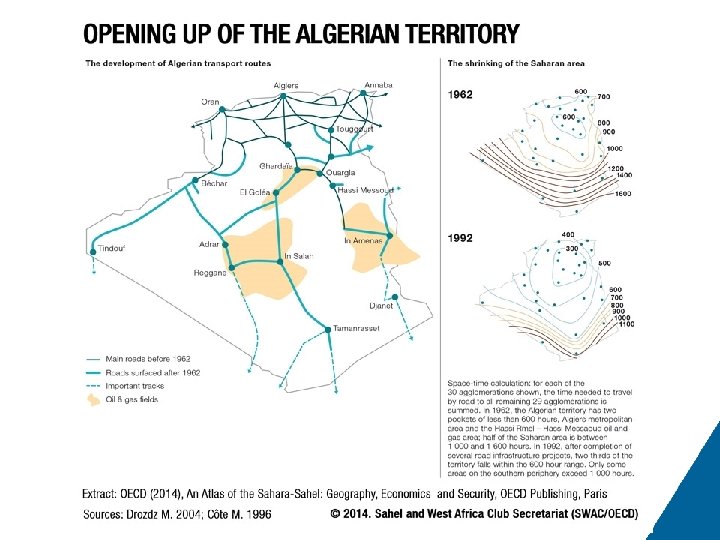
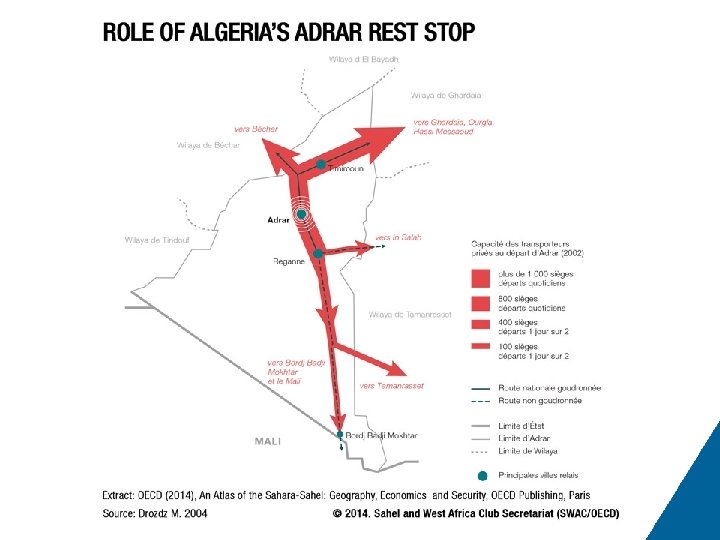
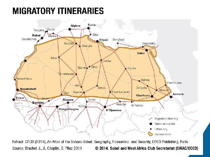
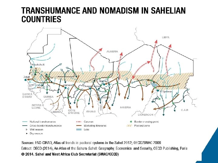
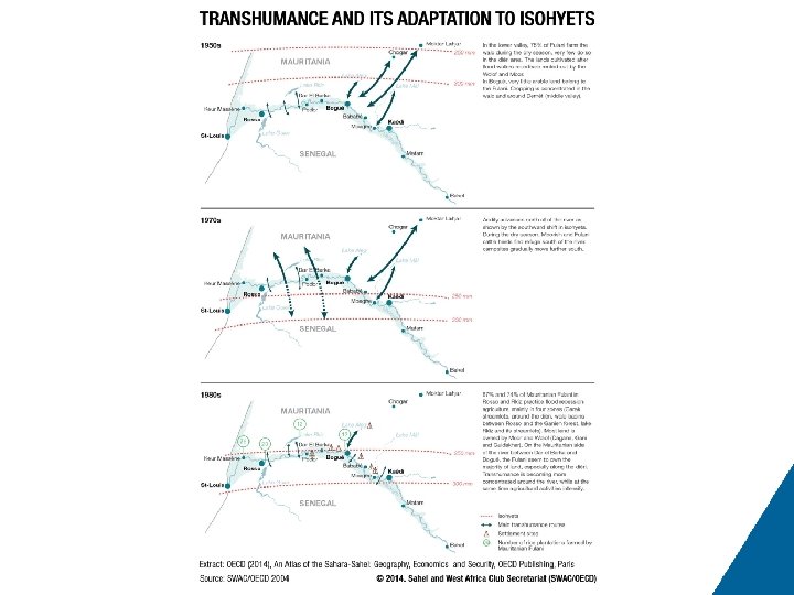
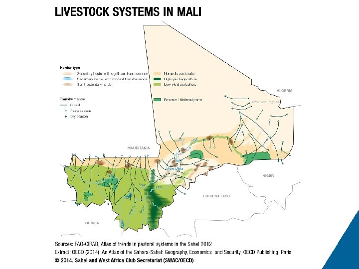
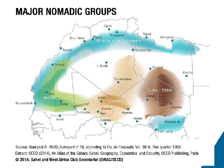
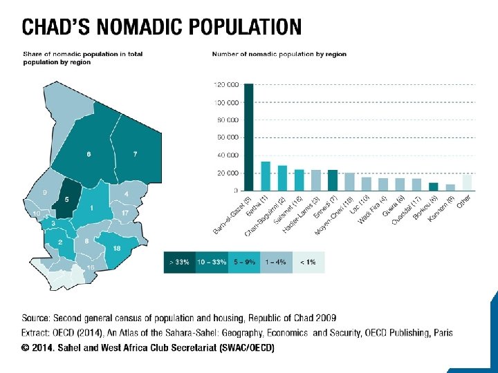
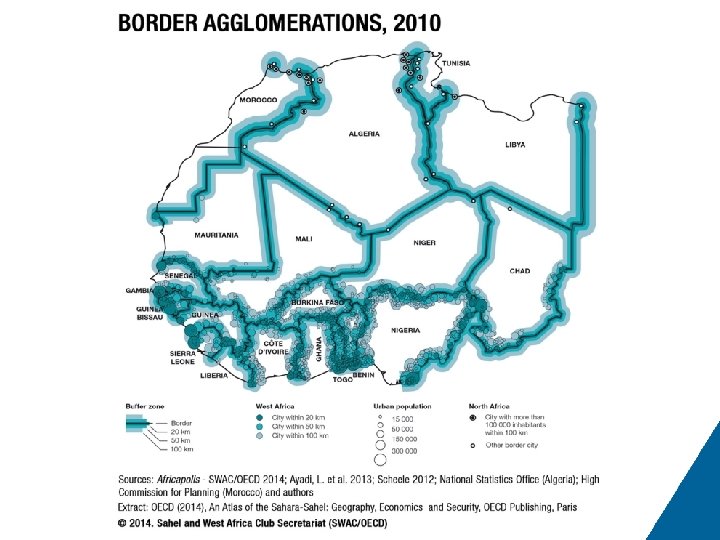
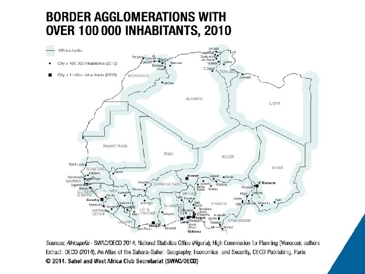
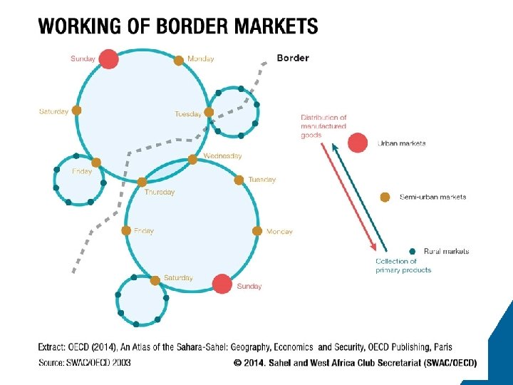
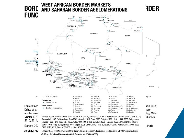
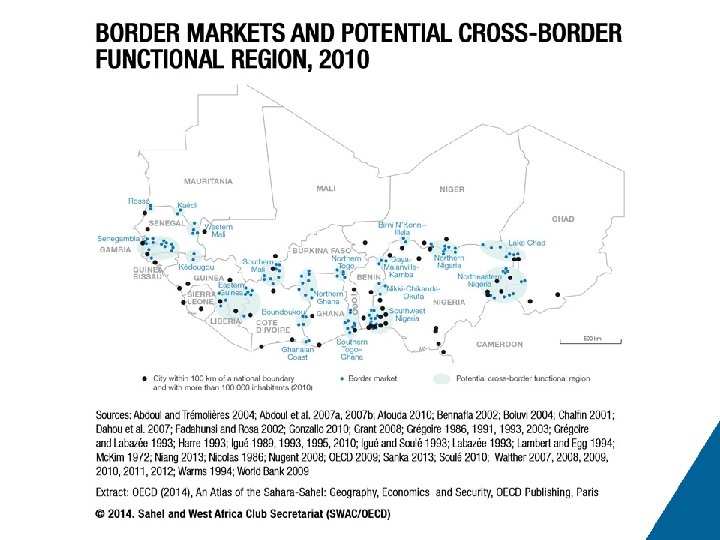
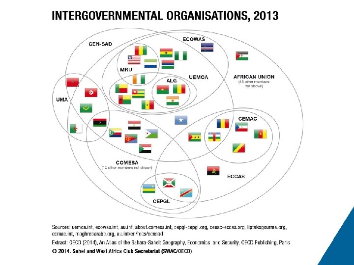
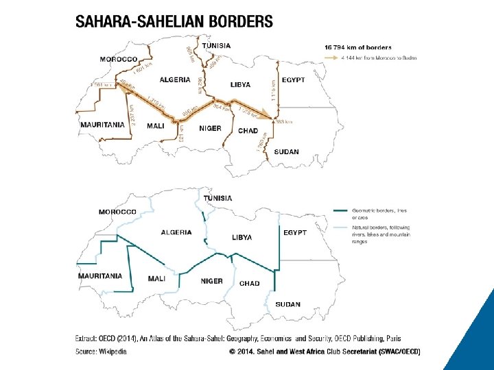
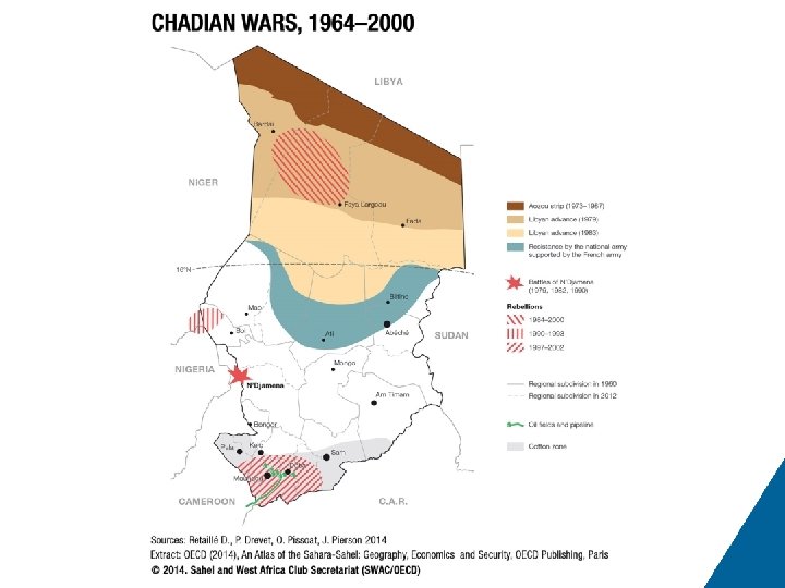
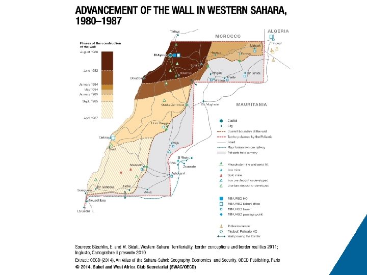
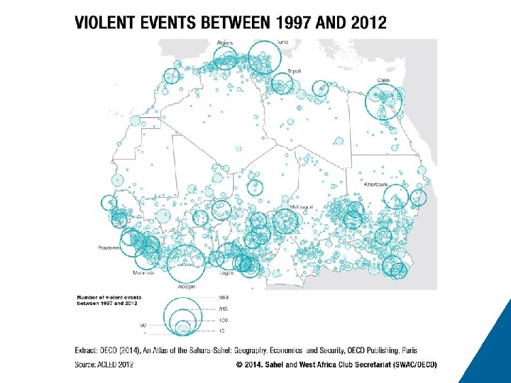
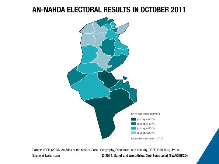
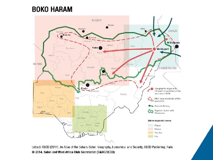
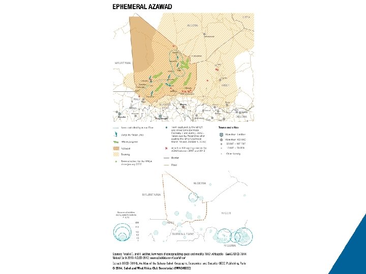
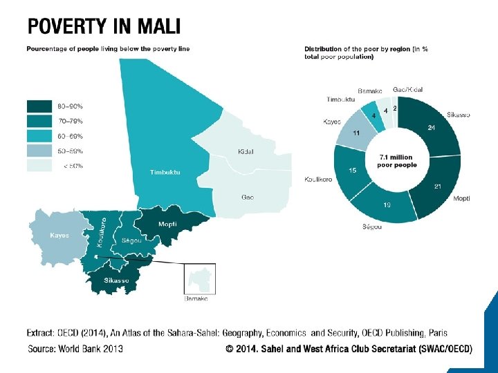
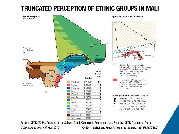
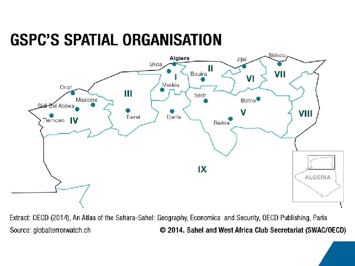
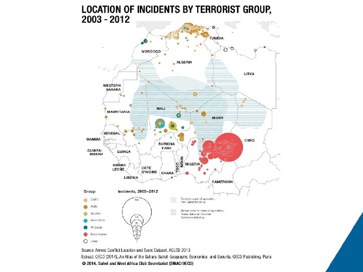
# 66 67 68 69 70 71 72 73 74 75 76 77 78 79 80 81 82 83 84 85 86 87 88 89 90 Title of Map 5. 1 The opening up of the Algerian territory Map 5. 2 The role of Algeria’s Adrar rest stop Map 5. 3 Migratory itineraries Map 6. 1 Transhumance and nomadism in Sahelian countries Map 6. 2 Transhumance and its adaptation to isohyets Map 6. 3 Livestock systems in Mali Map 6. 4 Major nomadic groups Map 6. 5 Chad’s nomadic population Map 7. 1 Border agglomerations, 2010 Map 7. 2 Border agglomerations with over 100 000 inhabitants, 2010 Map 7. 3 The working of border markets Map 7. 4 West African border markets and Saharan border agglomerations Map 7. 5 Border markets and potential cross-border functional region, 2010 Map 7. 6 Intergovernmental organisations, 2013 Map 7. 7 Sahara-Sahelian borders Map 8. 1 Chadian wars, 1964– 2000 Map 8. 2 The advancement of the wall in Western Sahara, 1980– 1987 Map 8. 3 Violent events between 1997 and 2012 Map 8. 4 An-Nahda electoral results in October 2011 Map 8. 5 Boko Haram Map 8. 6 The ephemeral Azawad Map 8. 7 Poverty in Mali Map 8. 8 The truncated perception of ethnic groups in Mali Map 8. 9 GSPC’s spatial organisation Map 8. 10 Location of incidents by terrorist group, 2003– 2012
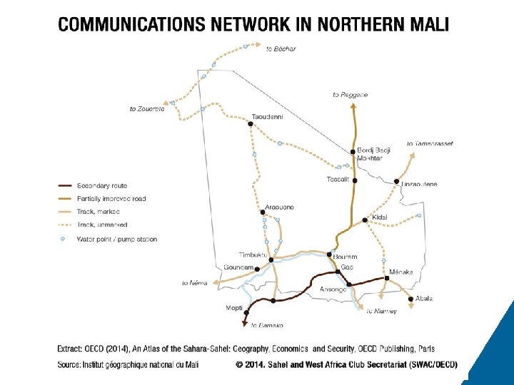
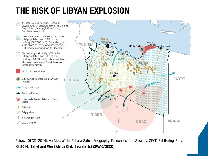
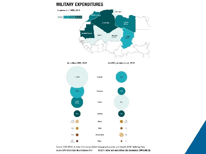
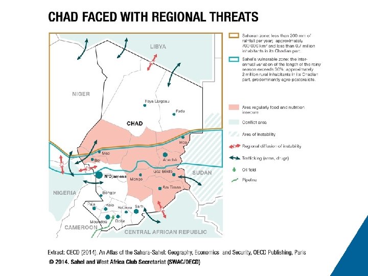
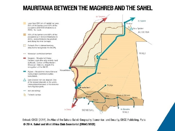
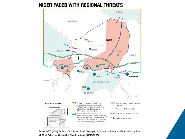
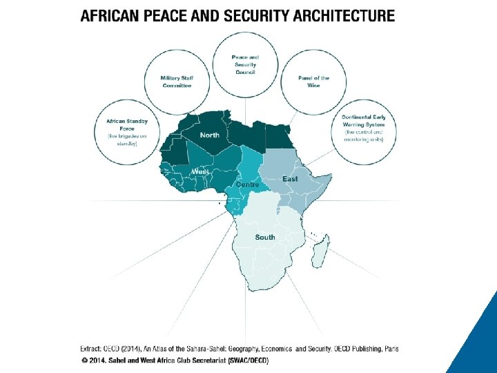
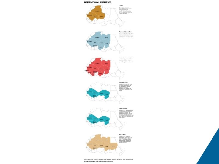
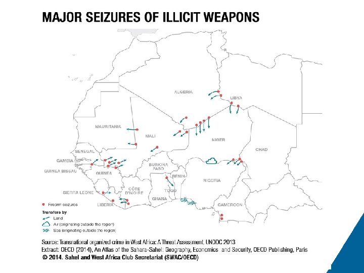
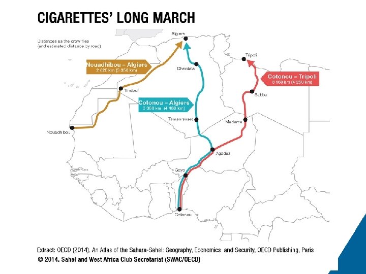
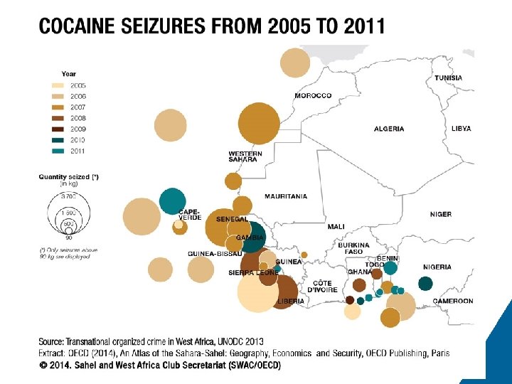
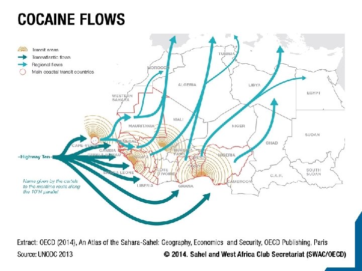
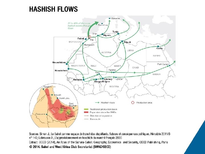
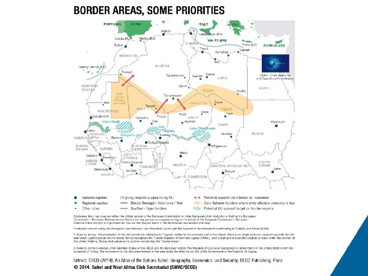
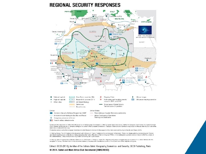
# 91 92 93 94 95 96 97 98 99 100 101 102 103 104 105 Title of Map 8. 11 Communications network in northern Mali Map 8. 12 The risk of Libyan explosion Map 8. 13 Military expenditures Map 8. 14 Chad faced with regional threats Map 8. 15 Mauritania between the Maghreb and the Sahel Map 8. 16 Niger faced with regional threats Map 8. 17 African peace and security architecture Map 8. 18 International initiatives Map 9. 1 Major seizures of illicit weapons Map 9. 2 Cigarettes’ long march Map 9. 3 Cocaine seizures from 2005 to 2011 Map 9. 4 Cocaine flows Map 9. 5 Hashish flows Map 10. 1 Border areas, some priorities Map 10. 2 Regional security responses