Agenda Tuesday 9616 TEKS 4 Geography The student
 Geography. The student understands the factors that influence")
 Geography. The student understands the factors that influence")

 Geography. The student understands the factors that influence")
 Geography. The student understands the factors that influence")
. On your sheet- Define")


- Slides: 45
Agenda Tuesday 9/6/16 • TEKS: (4) Geography. The student understands the factors that influence the locations and characteristics of locations of various contemporary societies on maps and globes and uses latitude and longitude to determine absolute locations. The student is expected to: • (D) identify and locate major physical and human geographic features such as landforms, water bodies, and urban centers of various places and regions; Supporting Standard • Language Objective: Students must be able to identify and locate physical features such as landforms, bodies of water and urban centers of various places and regions. • Absolute Location Battleship • HW: Coordinates Exercise Worksheet due tomorrow!
Agenda Wednesday 9/7/16 • TEKS: (4) Geography. The student understands the factors that influence the locations and characteristics of locations of various contemporary societies on maps and globes and uses latitude and longitude to determine absolute locations. The student is expected to: • (D) identify and locate major physical and human geographic features such as landforms, water bodies, and urban centers of various places and regions; Supporting Standard • Language Objective: Students must be able to identify and locate physical features such as landforms, bodies of water and urban centers of various places and regions. • Turn in Coordinates Exercise Worksheet • A Spatial Way of Thinking (Sections 1 – 2) • Geoterms • HW: Complete Geoterms (Pages 2 & 3 Only) • Test Friday Sept 16 th
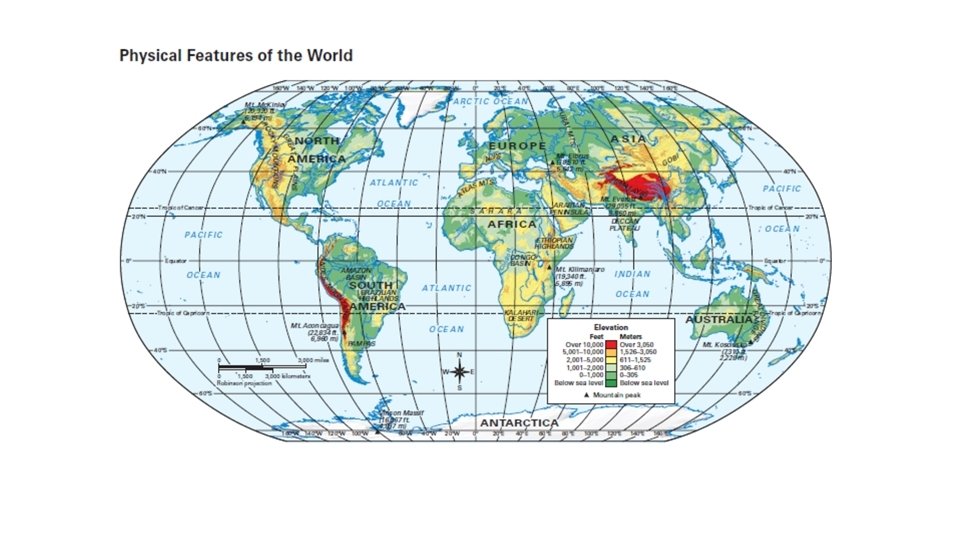
Types of Maps Political Map Physical Map Thematic Map
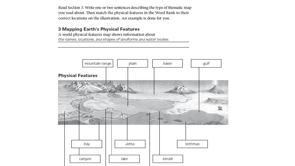
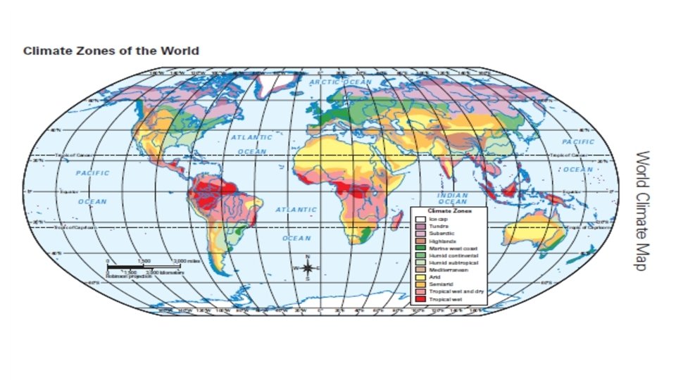
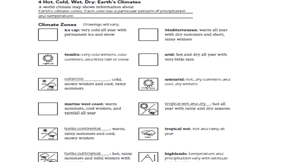
Agenda Thursday 9/8/16 • TEKS: (4) Geography. The student understands the factors that influence the locations and characteristics of locations of various contemporary societies on maps and globes and uses latitude and longitude to determine absolute locations. The student is expected to: • (D) identify and locate major physical and human geographic features such as landforms, water bodies, and urban centers of various places and regions; Supporting Standard • Language Objective: Students will understand how latitude, climate and elevation affect vegetation growth and population density. • Warm up: What water feature is used for transportation, agriculture and daily life? • Check Geoterms (Pages 2 & 3) • Read Sections 3 & 4 – A Spatial Way of Thinking • Earth’s Physical Features • Earth’s Climates (Hot, Cold, Wet, Dry) • Complete Pages 4 & 5 • HW: Test Thursday Sept 16 th
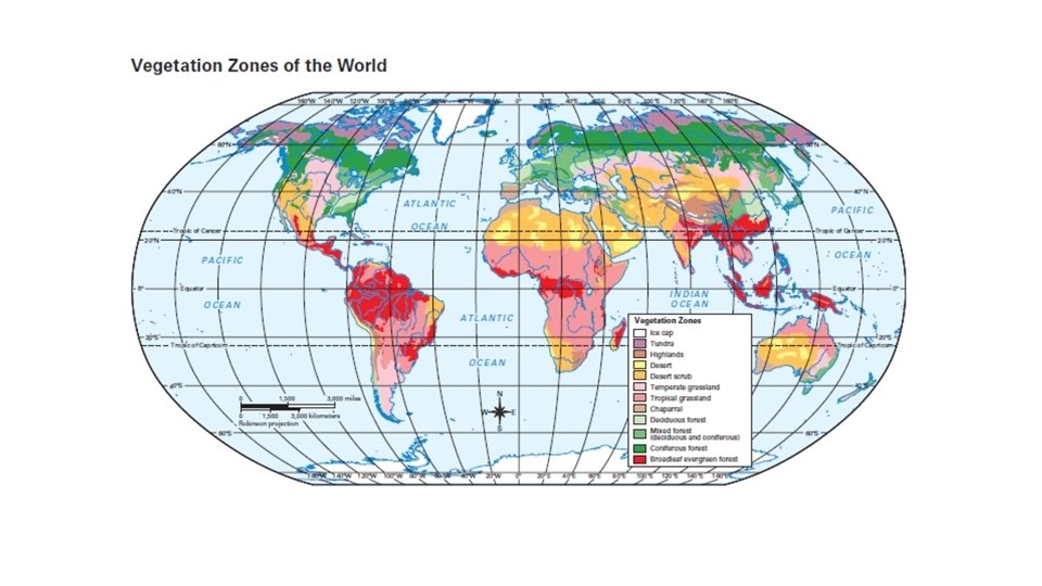
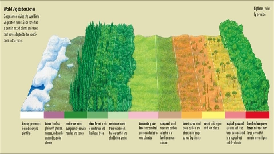
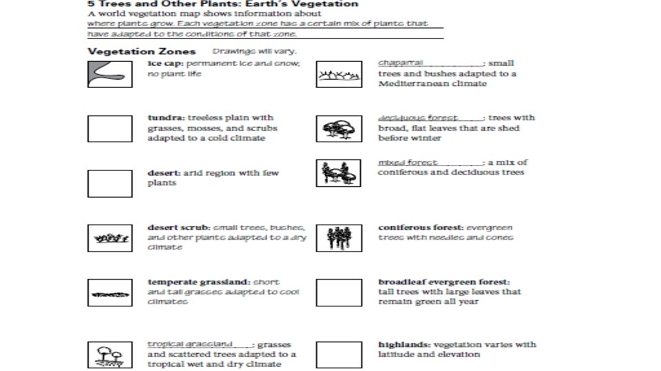
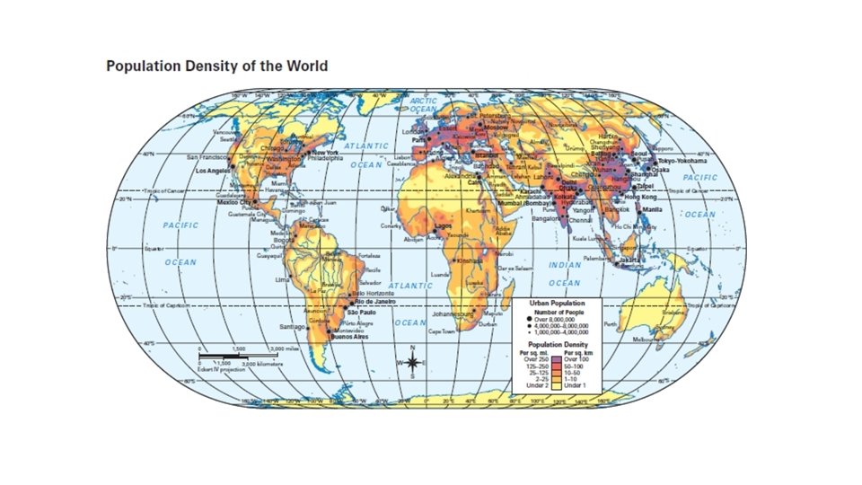
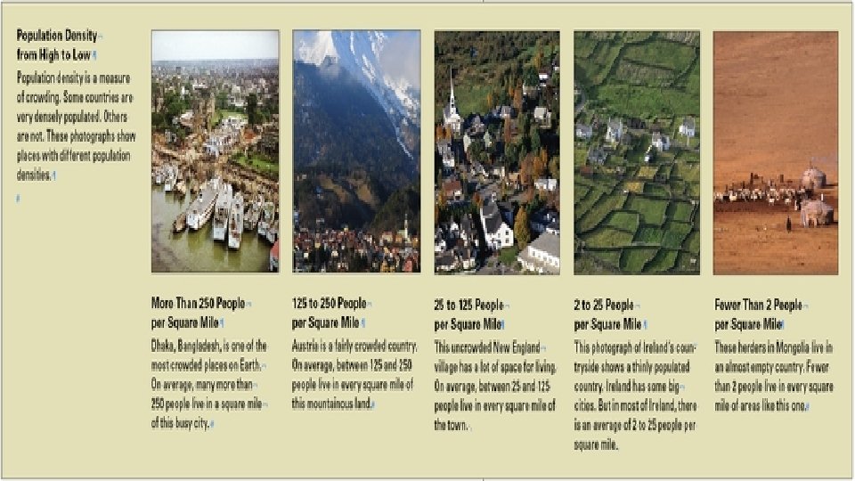
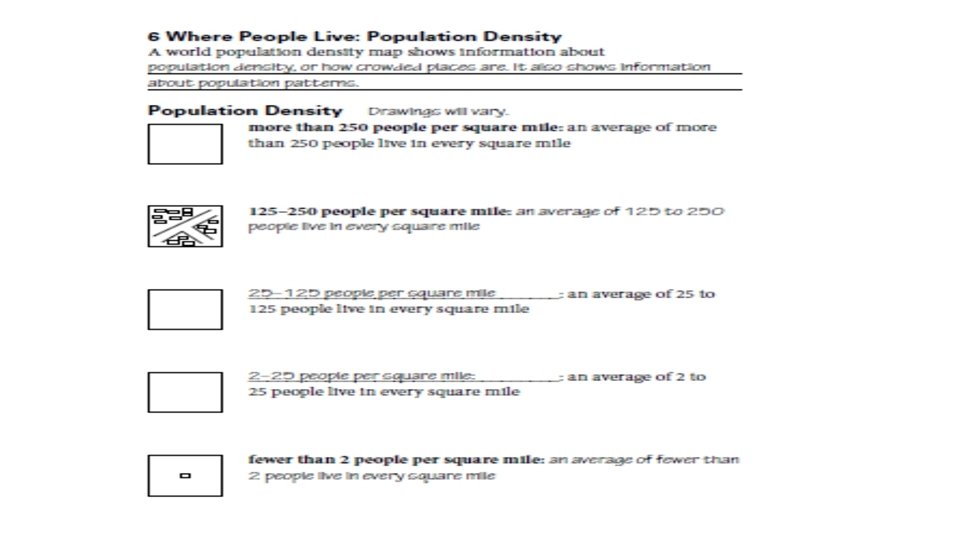
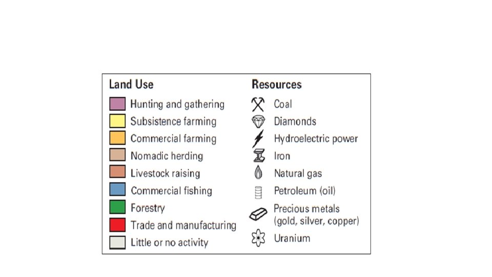
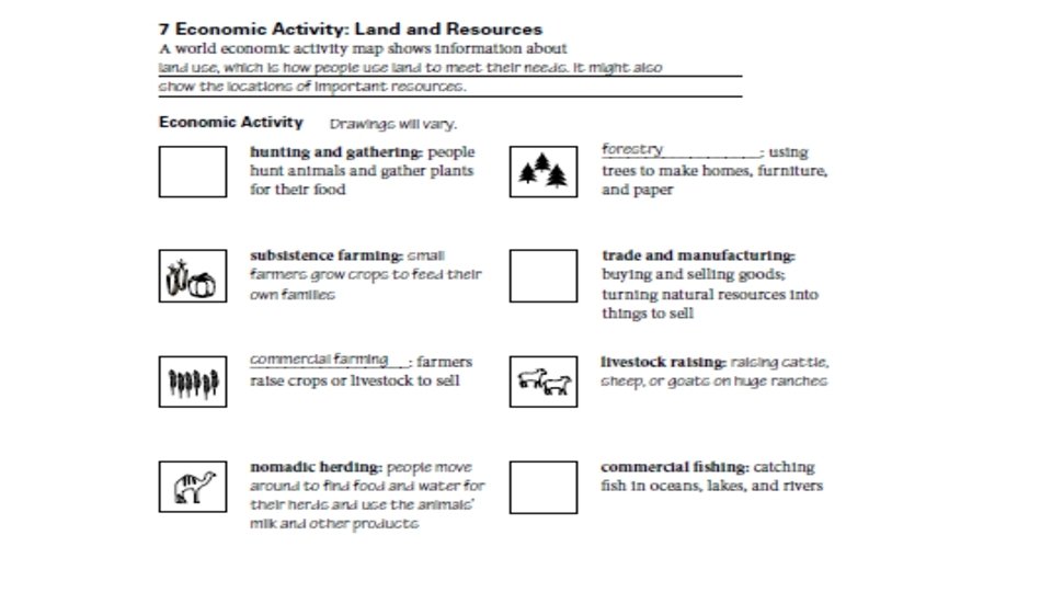
Agenda Friday 9/9/16 • TEKS: (4) Geography. The student understands the factors that influence the locations and characteristics of locations of various contemporary societies on maps and globes and uses latitude and longitude to determine absolute locations. The student is expected to: • (D) identify and locate major physical and human geographic features such as landforms, water bodies, and urban centers of various places and regions; Supporting Standard • Language Objective: Students will understand how natural resources affect a region’s economic activity and population patterns. • Read Sections 5 & 6 • Earth’s Vegetation • Population Density • A Spatial Way of Thinking – Complete Sections 5 & 6 • HW: Test Friday Sept 16 th
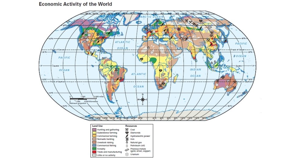
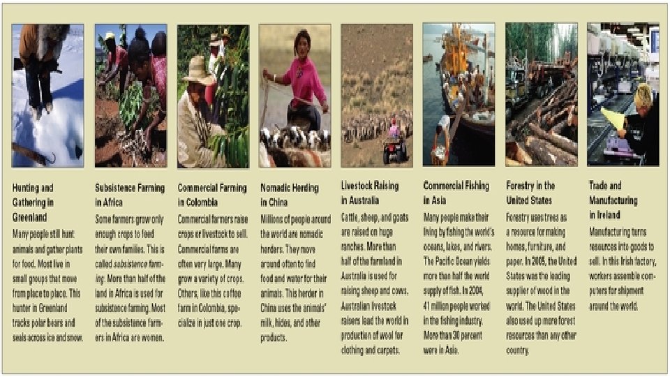
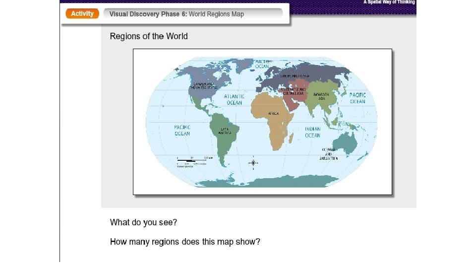
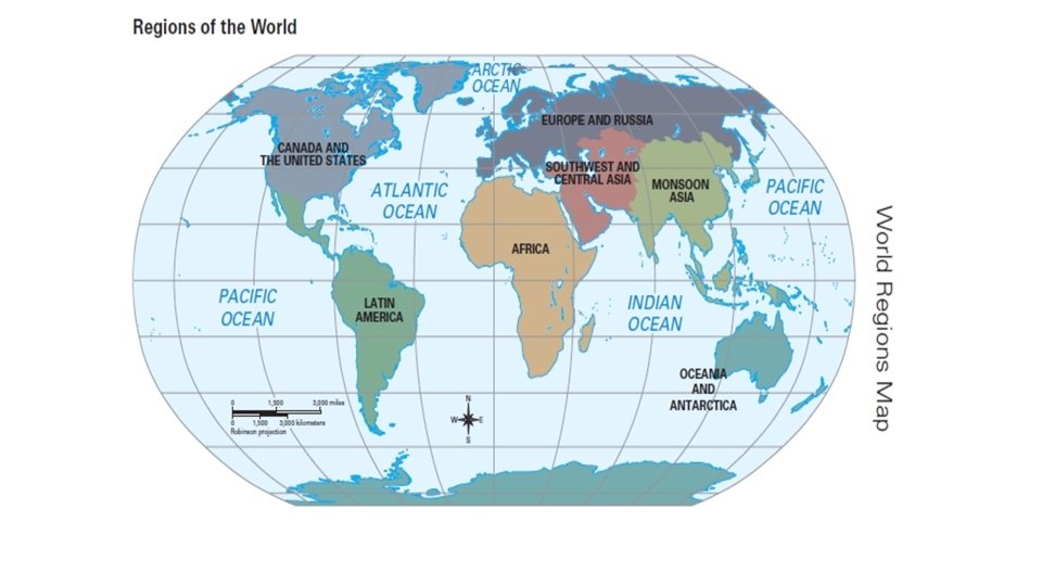
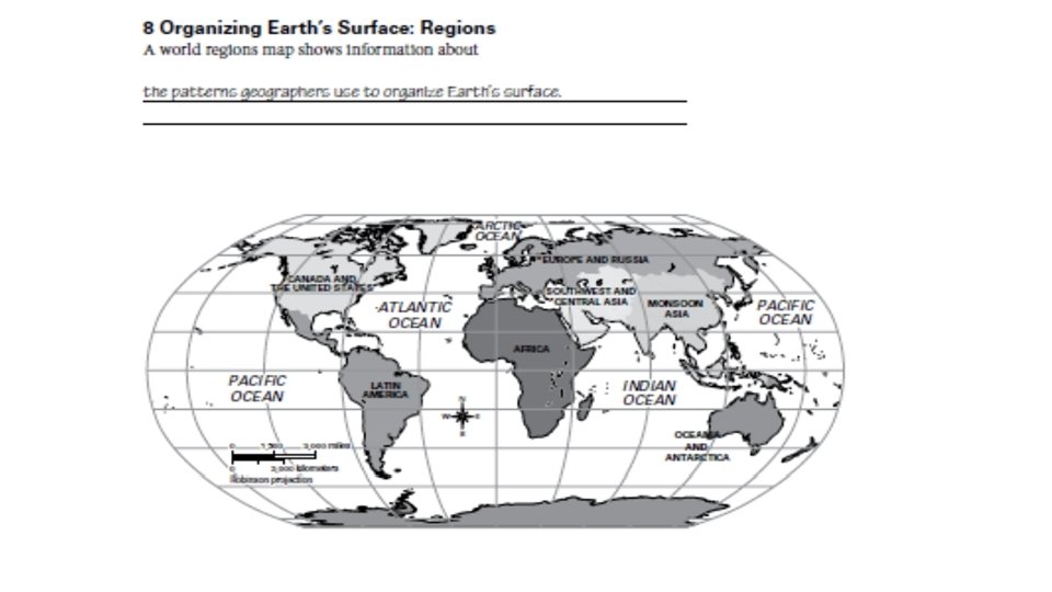
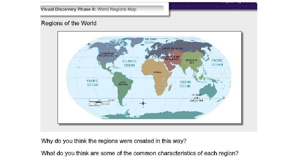
Monday 9/12/16 • Warm up: watch regions video (next slide). On your sheet- Define a REGION • A Spatial Way of Thinking – Sections 7 & 8 • Economic Activity: Land & Resources • Regions • Film – Geographical Features: Landforms • HW: Finish “A Spatial Way of Thinking” (if you have any missing sections) • Test Friday Sept 16 th
What is a region? • http: //www. youtube. com/watch? v=ch. UU-0 Ov. OEU&noredirect=1
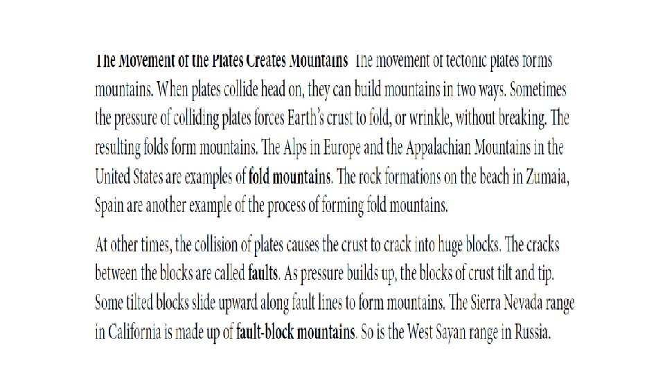
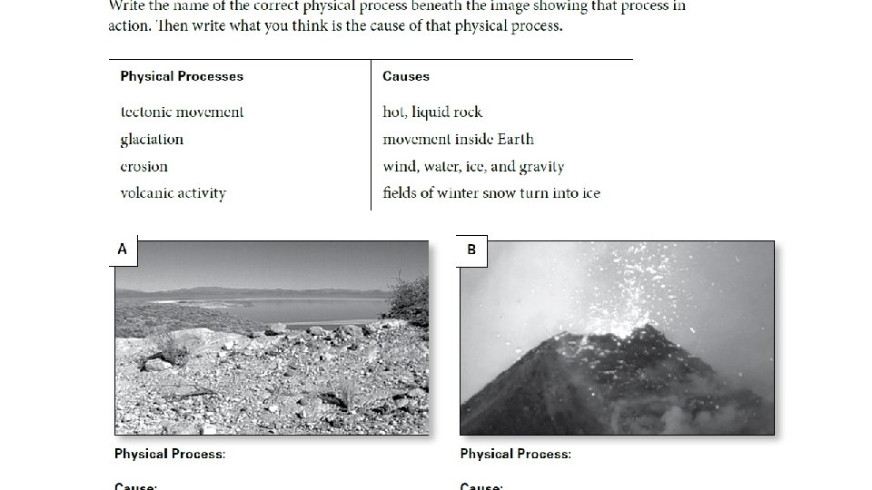
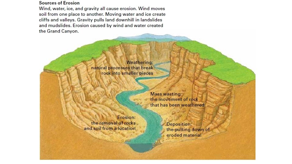
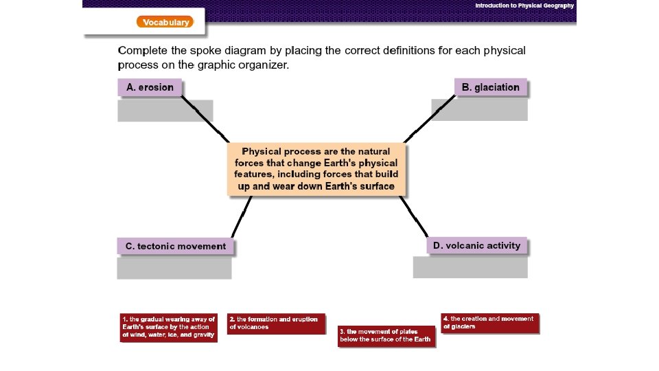
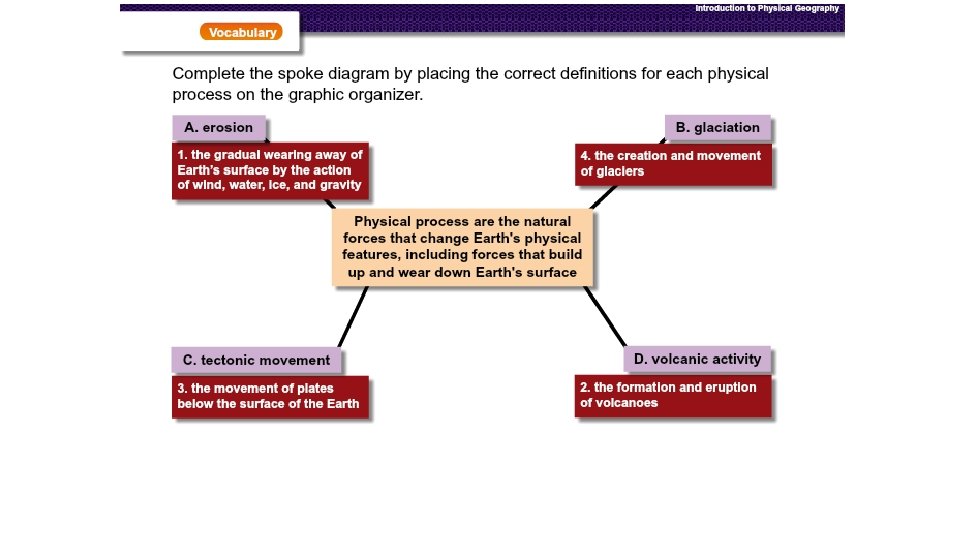
• Physical Process: Erosion Glaciations Tectonic Movement Volcanic Activity
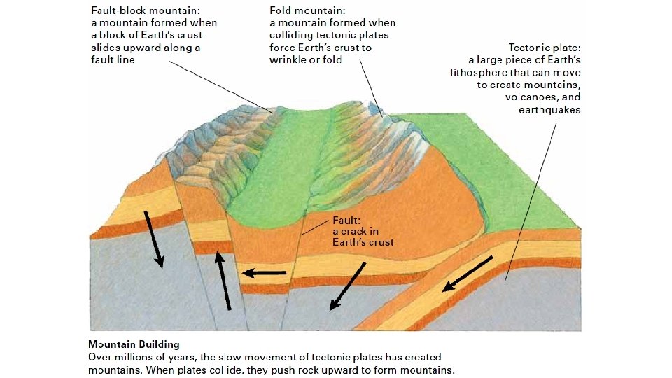
How Tectonic Movement Shapes Earth In 1906, a terrifying earthquake shook San Francisco, California. “Trolley lines snapped like threads” and buildings “crumbled like card houses, ” wrote one eyewitness. “The cobblestones danced like corn in a popper. ” No one at that time understood how or why earthquakes happen. Today we know that they are caused by tectonic movement. The Continents and Oceans Rest on Plates Scientists solved the mystery of earthquakes in the 1960 s. They discovered that the lithosphere is broken into huge pieces called tectonic plates. Earth’s lands and seas rest on these plates, which lie below the surface of our planet. The plates float like rafts on Earth’s liquid mantle. Tectonic plates move in three ways. 1. They can move away from each other. 2. They can move toward each other. 3 They can scrape sideways past each other. When two plates collide, one usually slides under the other. Tectonic plates are incredibly heavy. When they meet, friction can lock them into place for long periods. During this time, enormous pressure builds up below Earth’s crust. When the pressure gets too great, the plates come unstuck and move with tremendous energy. We feel this sudden movement as an earthquake.
A Crust of Moving Plates Earth’s solid crust is made up of tectonic plates. These plates float on the liquid rock that makes up the middle layer of Earth. There at least 14 plates, some very large in area, some smaller.
• Tectonic Movement- 3 minutes
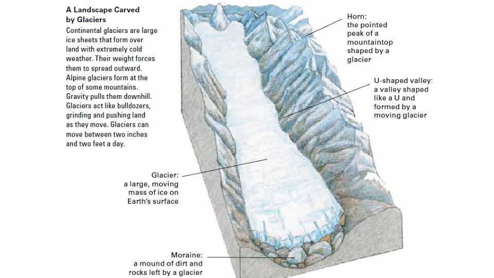
Glaciations Process • 2 min video- Yellowstone
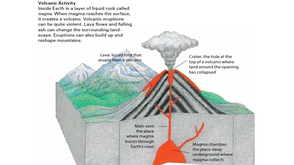
• Volcanic Activity- 3 minutes
• Erosion Video- 3 minutes
a physiographic feature is. • Physio means "physical, " graphic means "written down or recorded, " and feature means "a particular characteristic of something. " Thus, a physiographic feature is a physical characteristic of the land-a lake, a mountain, a river, a desert--that is recorded on a map.
• TED Blog • 13 October 2010 • Haiti’s disaster of engineering: Peter Haas on TED. com