Detection and nowcasting of convective cloud systems using


- Slides: 66

Detection and nowcasting of convective cloud systems using SEVIRI data. Silvia Puca Italian Civil Protection Department

Presidency of the Council of Ministers Department of Civil Protection THE NATIONAL EARLY WARNING SYSTEM AND THE REAL TIME MANAGEMENT OF NATURAL AND ANTHROPOGENIC RISK

outline n Meteosat Second Generation satellite; n Severe convective phenomena; n RGB combination: day time, night time; n NEFODINA: Convective cell automatic tool using 10. 8 mm, 6. 2 mm, 7. 3 mm – – – detection phase; forecasting phase; validation phase. n Rapid Detection thunderstorm (RDT) NWC-SAF; n Ancillary data.

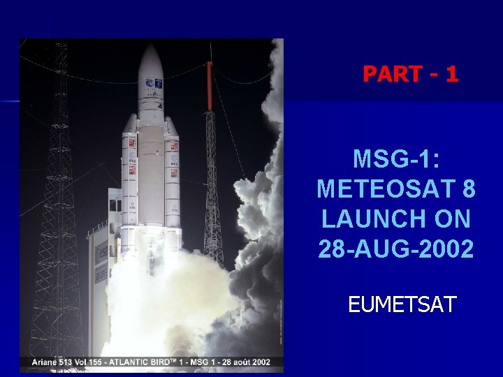
PART - 1 MSG-1: METEOSAT 8 LAUNCH ON 28 -AUG-2002 EUMETSAT

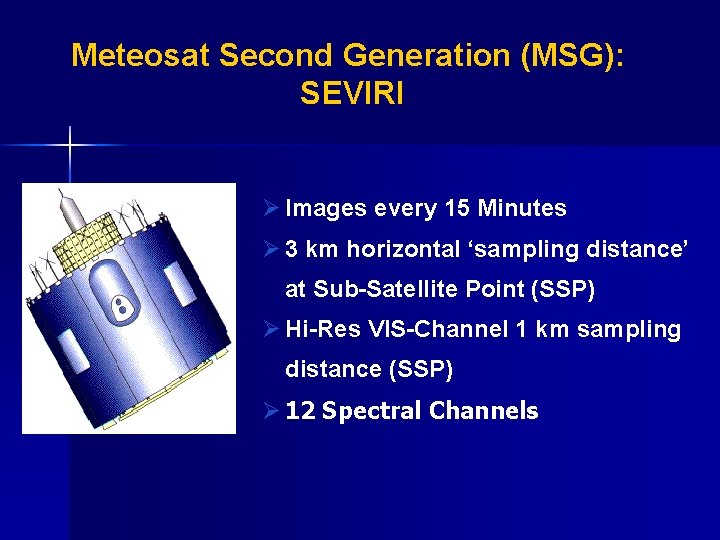
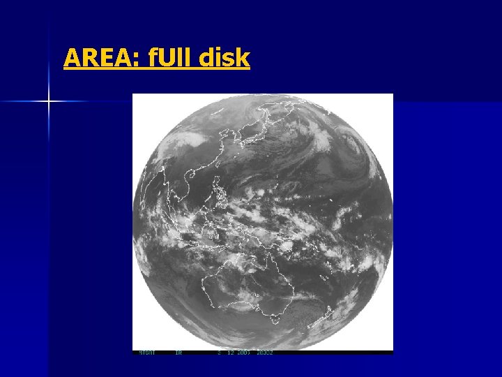
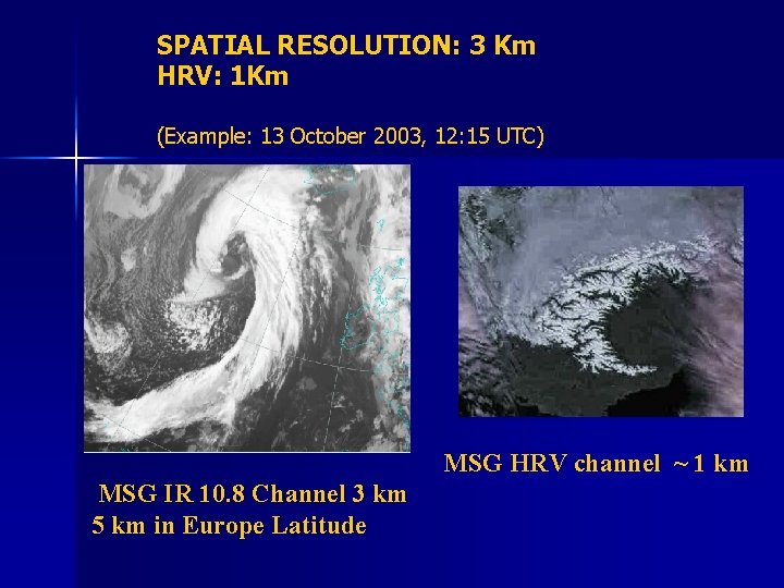
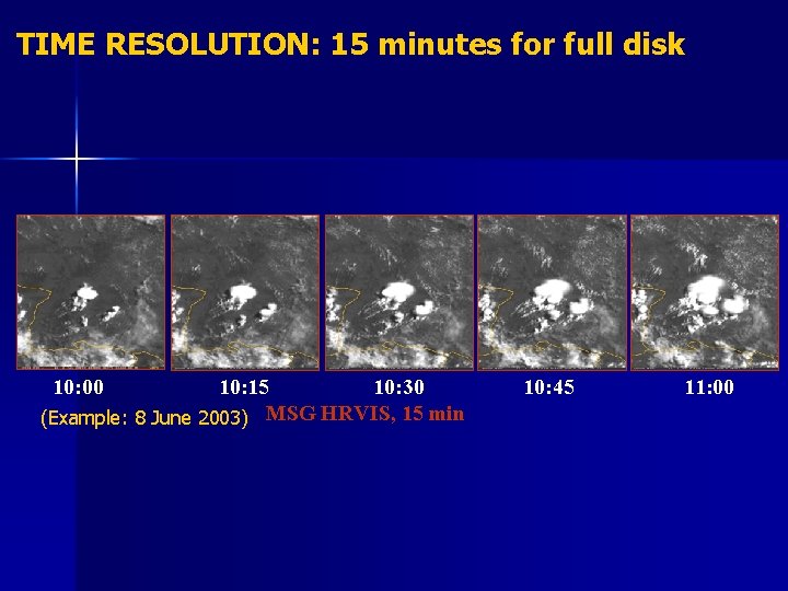
Meteosat Second Generation (MSG): SEVIRI Ø Images every 15 Minutes Ø 3 km horizontal ‘sampling distance’ at Sub-Satellite Point (SSP) Ø Hi-Res VIS-Channel 1 km sampling distance (SSP) Ø 12 Spectral Channels

AREA: f. Ull disk

SPATIAL RESOLUTION: 3 Km HRV: 1 Km (Example: 13 October 2003, 12: 15 UTC) MSG HRV channel ~ 1 km MSG IR 10. 8 Channel 3 km 5 km in Europe Latitude

TIME RESOLUTION: 15 minutes for full disk 10: 00 10: 15 10: 30 (Example: 8 June 2003) MSG HRVIS, 15 min 10: 45 11: 00

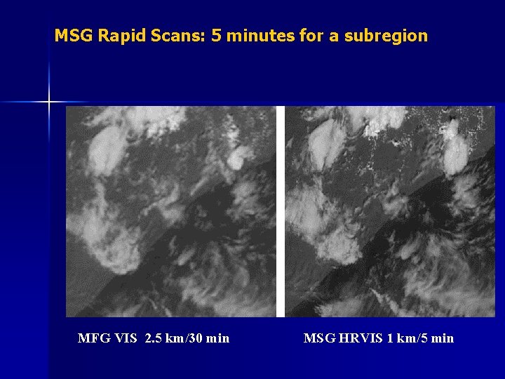
MSG Rapid Scans: 5 minutes for a subregion MFG VIS 2. 5 km/30 min MSG HRVIS 1 km/5 min

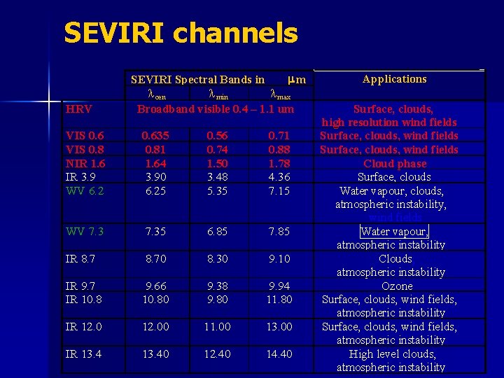
SEVIRI channels HRV mm SEVIRI Spectral Bands in l cen l min l max Broadband visible 0. 4 – 1. 1 um VIS 0. 6 VIS 0. 8 NIR 1. 6 IR 3. 9 WV 6. 2 0. 635 0. 81 1. 64 3. 90 6. 25 0. 56 0. 74 1. 50 3. 48 5. 35 0. 71 0. 88 1. 78 4. 36 7. 15 WV 7. 35 6. 85 7. 85 IR 8. 70 8. 30 9. 10 IR 9. 7 IR 10. 8 9. 66 10. 80 9. 38 9. 80 9. 94 11. 80 IR 12. 00 11. 00 13. 00 IR 13. 40 12. 40 14. 40 Applications Surface, clouds, high resolution wind fields Surface, clouds, wind fields Cloud phase Surface, clouds Water vapour, clouds, atmospheric instability, wind fields Water vapour, atmospheric instability Clouds, atmospheric instability Ozone Surface, clouds, wind fields, atmospheric instability High level clouds, atmospheric instability

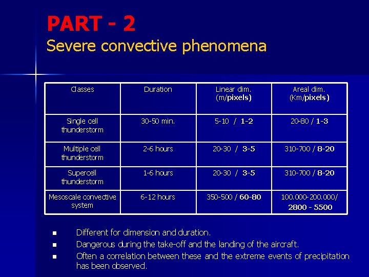
PART - 2 Severe convective phenomena Classes Duration Linear dim. (m/pixels) Areal dim. (Km/pixels) Single cell thunderstorm 30 -50 min. 5 -10 / 1 -2 20 -80 / 1 -3 Multiple cell thunderstorm 2 -6 hours 20 -30 / 3 -5 310 -700 / 8 -20 Supercell thunderstorm 1 -6 hours 20 -30 / 3 -5 310 -700 / 8 -20 Mesoscale convective system 6 -12 hours 350 -500 / 60 -80 100. 000 -200. 000/ 2800 - 5500 n n n Different for dimension and duration. Dangerous during the take-off and the landing of the aircraft. Often a correlation between these and the extreme events of precipitation has been observed.

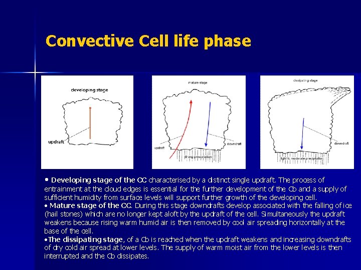
Convective Cell life phase • Developing stage of the CC characterised by a distinct single updraft. The process of entrainment at the cloud edges is essential for the further development of the Cb and a supply of sufficient humidity from surface levels will support further growth of the developing cell. • Mature stage of the CC. During this stage downdrafts develop associated with the falling of ice (hail stones) which are no longer kept aloft by the updraft of the cell. Simultaneously the updraft weakens because rising warm humid air is then removed by cool air spreading horizontally at the base of the cell. • The dissipating stage, of a Cb is reached when the updraft weakens and increasing downdrafts of dry cold air spread at lower levels. The supply of warm moist air from the lower levels is then interrupted and the Cb dissipates.

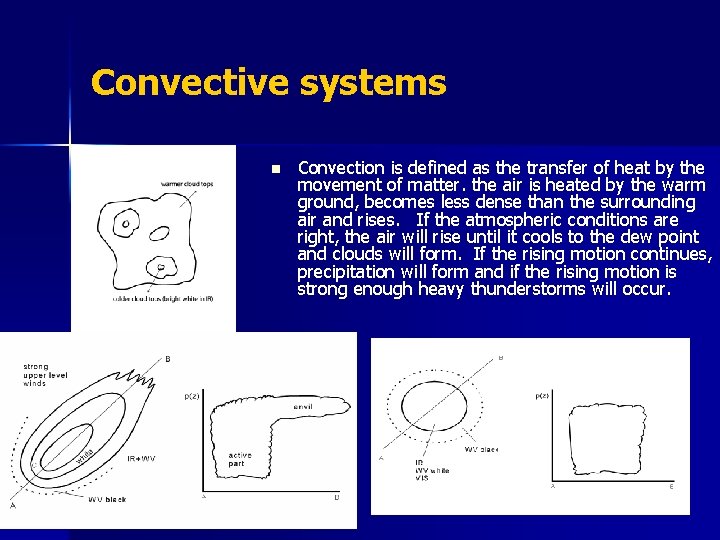
Convective systems n Convection is defined as the transfer of heat by the movement of matter. the air is heated by the warm ground, becomes less dense than the surrounding air and rises. If the atmospheric conditions are right, the air will rise until it cools to the dew point and clouds will form. If the rising motion continues, precipitation will form and if the rising motion is strong enough heavy thunderstorms will occur.

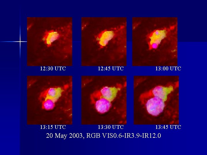
12: 30 UTC 12: 45 UTC 13: 00 UTC 13: 15 UTC 13: 30 UTC 13: 45 UTC 20 May 2003, RGB VIS 0. 6 -IR 3. 9 -IR 12. 0

Main Convective Object characteristics OVAL SHAPE; n LIMITEDED AREA; n SIZE 20 -80 KM 2; n COLD CLOUD TOP (BT < 236 K); n

PART -3 SEVIRI recommended channels for Convective object detection n VISIBLE: – HRV fine-scale structures – 0. 6 optical thickness of clouds n INFRARED: – WV 6. 2 upper-level moisture – WV 7. 3 mid-level moisture, early convection – IR 10. 8 top temperature

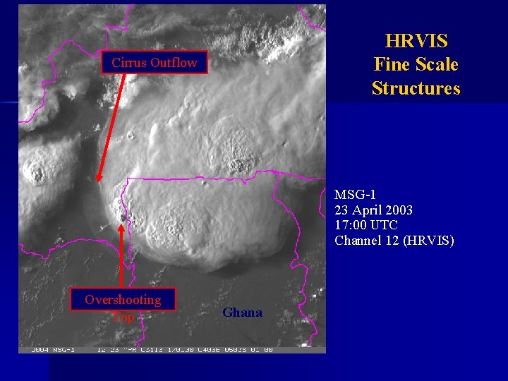
HRVIS Fine Scale Structures Cirrus Outflow MSG-1 23 April 2003 17: 00 UTC Channel 12 (HRVIS) Overshooting Top Ghana

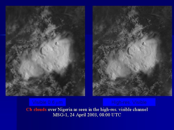
Visible 0. 6 m High-res. Visible Cb clouds over Nigeria as seen in the high-res. visible channel MSG-1, 24 April 2003, 08: 00 UTC

0. 6 channel characterization Ice cloud- water cloud n Particle size n

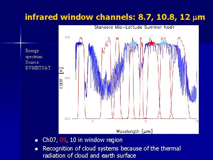
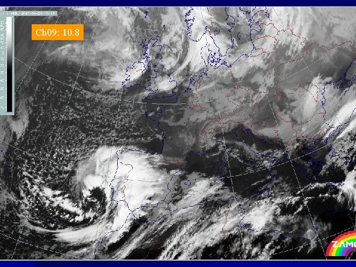
infrared window channels: 8. 7, 10. 8, 12 mm Energy spectrum Source: EUMETSAT Ch 07 n n Ch 09 Ch 10 Ch 07, 09, 10 in window region Recognition of cloud systems because of thermal radiation of cloud and earth surface

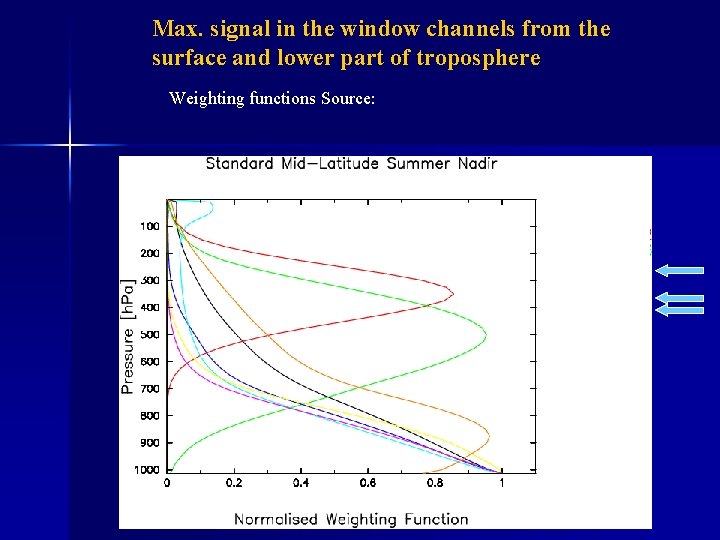
Max. signal in the window channels from the surface and lower part of troposphere Weighting functions Source:

Ch 09: 10. 8

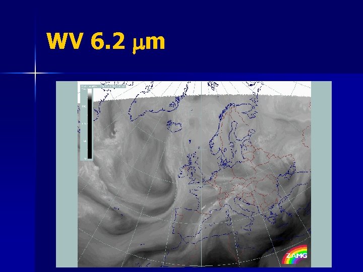
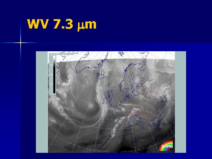
Watervapor channels Ch 05, Ch 06 n WV has an absorption band around 6 m – absorbs radiation from below n Greyshades in the WV are indicative of the WV content in the upper and middle part of the troposphere

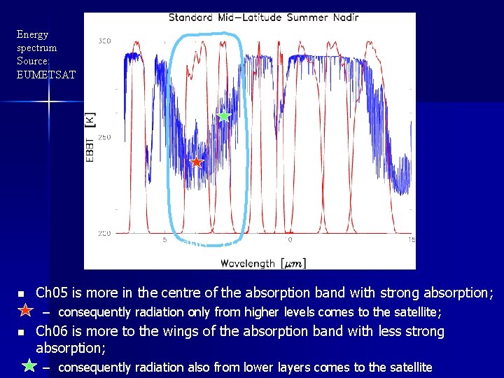
Energy spectrum Source: EUMETSAT Ch 05 n Ch 06 Ch 05 is more in the centre of the absorption band with strong absorption; – consequently radiation only from higher levels comes to the satellite; n Ch 06 is more to the wings of the absorption band with less strong absorption; – consequently radiation also from lower layers comes to the satellite

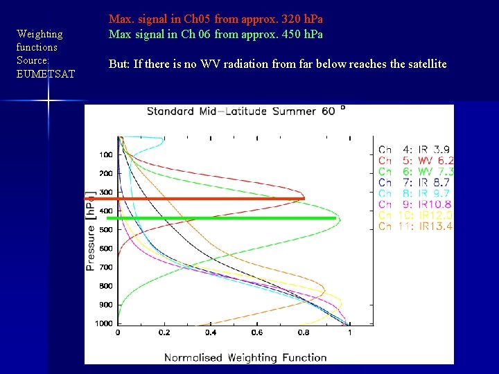
Weighting functions Source: EUMETSAT Max. signal in Ch 05 from approx. 320 h. Pa Max signal in Ch 06 from approx. 450 h. Pa But: If there is no WV radiation from far below reaches the satellite

WV 6. 2 mm

WV 7. 3 mm

PART 4: RECOMMENDED RED-GREEN-BLUE (RGB) COLOUR COMPOSITES FOR MONITORING CONVECTION DAY-TIME

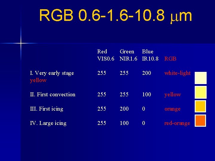
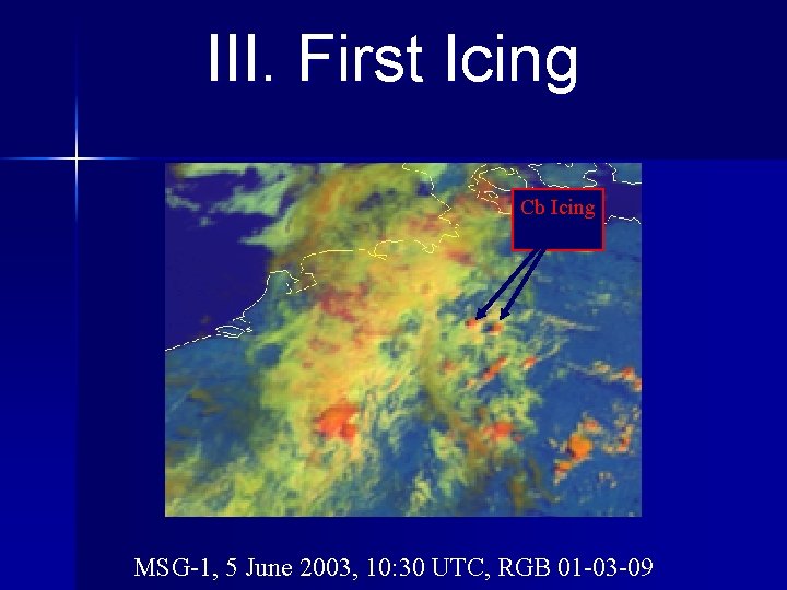
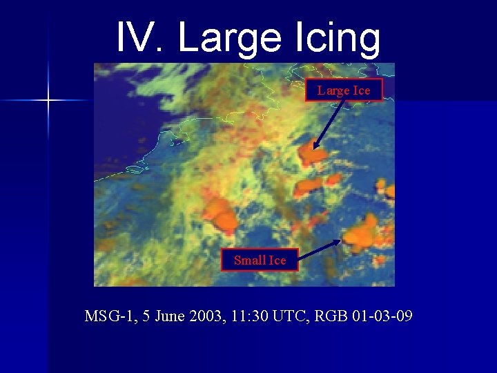
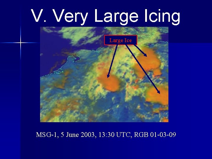
RGB 0. 6 -10. 8 m Red Green Blue VIS 0. 6 NIR 1. 6 IR 10. 8 RGB I. Very early stage yellow 255 200 white-light II. First convection 255 100 yellow III. First icing 255 200 0 orange IV. Large icing 255 100 0 red-orange

III. First Icing Cb Icing MSG-1, 5 June 2003, 10: 30 UTC, RGB 01 -03 -09

IV. Large Icing Large Ice Small Ice MSG-1, 5 June 2003, 11: 30 UTC, RGB 01 -03 -09

V. Very Large Icing Large Ice MSG-1, 5 June 2003, 13: 30 UTC, RGB 01 -03 -09

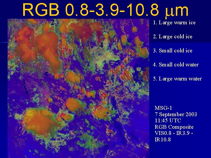
RGB 0. 8 -3. 9 -10. 8 m 1 2 1. Large warm ice 2. Large cold ice 4 3. Small cold ice 4. Small cold water 3 5 5. Large warm water MSG-1 7 September 2003 11: 45 UTC RGB Composite VIS 0. 8 - IR 3. 9 IR 10. 8

RECOMMENDED RED-GREEN-BLUE (RGB) COLOUR COMPOSITES FOR MONITORING CONVECTION NIGHT-TIME

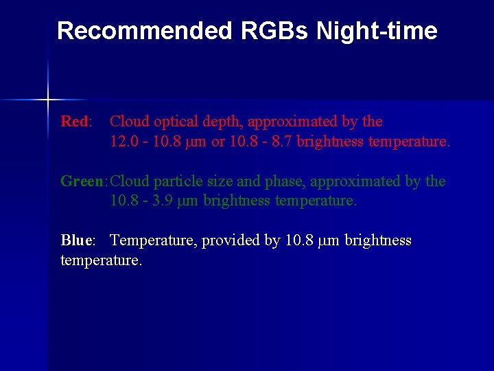
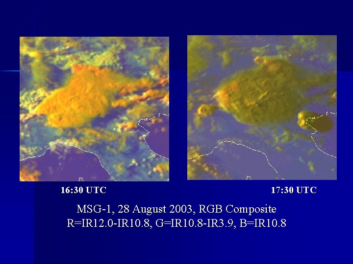
Recommended RGBs Night-time Red: Cloud optical depth, approximated by the 12. 0 - 10. 8 m or 10. 8 - 8. 7 brightness temperature. Green: Cloud particle size and phase, approximated by the 10. 8 - 3. 9 m brightness temperature. Blue: Temperature, provided by 10. 8 m brightness temperature.

16: 30 UTC 17: 30 UTC MSG-1, 28 August 2003, RGB Composite R=IR 12. 0 -IR 10. 8, G=IR 10. 8 -IR 3. 9, B=IR 10. 8

CONVECTIVE DETECTION n RGB: VISUALIZATION TOOL n AUTOMATIC TOOL

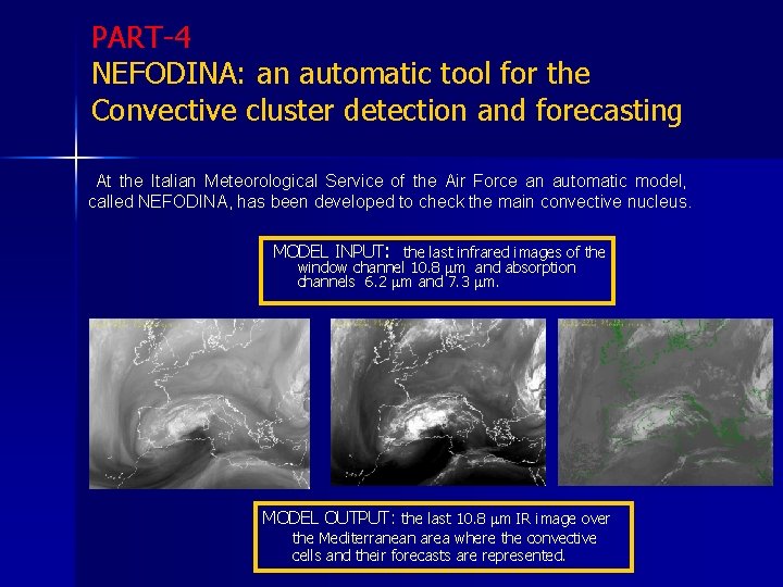
PART-4 NEFODINA: an automatic tool for the Convective cluster detection and forecasting At the Italian Meteorological Service of the Air Force an automatic model, called NEFODINA, has been developed to check the main convective nucleus. MODEL INPUT: the last infrared images of the window channel 10. 8 m and absorption channels 6. 2 m and 7. 3 m. MODEL OUTPUT: the last 10. 8 m IR image over the Mediterranean area where the convective cells and their forecasts are represented.

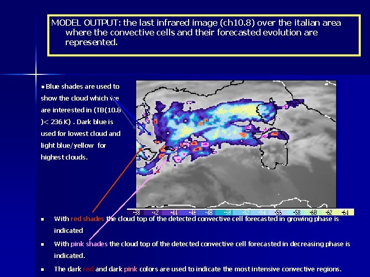
MODEL OUTPUT: the last infrared image (ch 10. 8) over the italian area where the convective cells and their forecasted evolution are represented. n Blue shades are used to show the cloud which we are interested in (TB(10. 8 )< 236 K). Dark blue is used for lowest cloud and light blue/yellow for highest clouds. n With red shades the cloud top of the detected convective cell forecasted in growing phase is indicated n With pink shades the cloud top of the detected convective cell forecasted in decreasing phase is indicated. n The dark red and dark pink colors are used to indicate the most intensive convective regions.

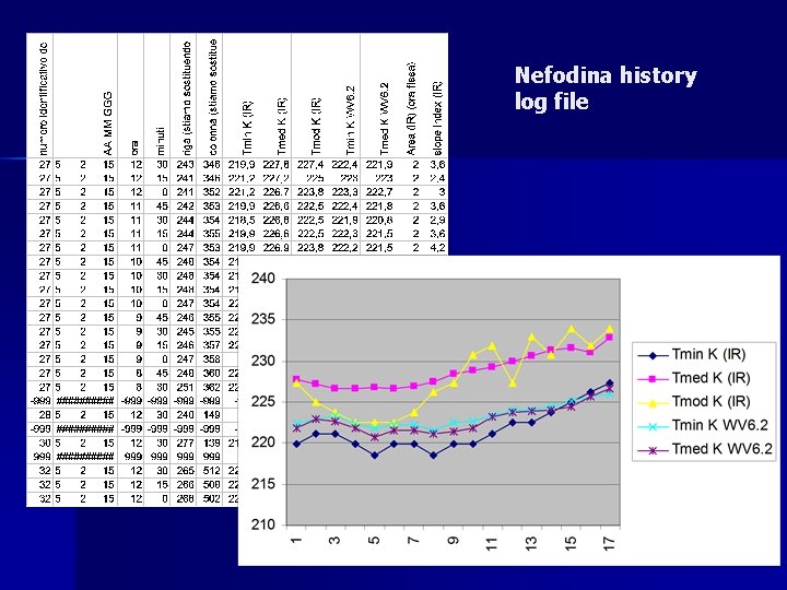
Nefodina history log file

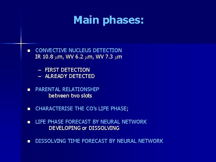
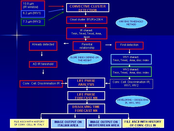
Main phases: n CONVECTIVE NUCLEUS DETECTION IR 10. 8 m, WV 6. 2 m, WV 7. 3 m – FIRST DETECTION – ALREADY DETECTED n PARENTAL RELATIONSHIP between two slots n CHARACTERISE THE CO’s LIFE PHASE; n LIFE PHASE FORECAST BY NEURAL NETWORK DEVELOPING or DISSOLVING n DISSOLVING TIME FORECAST BY NEURAL NETWORK

10. 8 m (IR window) CONVECTIVE CLUSTER DETECTION 6. 2 m (WV 1) Cloud cluster BT(IR)<236 K 7. 3 m (WV 2) VARYING TRHESHOLD METHOD IR charact. Tmin, Tmed, Tmod, Area, slope Already detected Parental relationship SLOPE INDEX DEPEND ON THE HEIGHT First detection WV 1 charact. Tmin, Tmed, Area, disc. index AD IR tereshold WV 2 charact. Tmin, Tmed, Area, disc. index Conv. Cell. Discrimination IR LIFE PHASE ANALYSIS LIFE PHASE FORECAST NN Conv. Cell. Discrimination IR, WV 1, WV 2 DEVELOPING – DISSOLVING IR, WV 1, WV 2 DISSOLVING TIME FORECAST NN FILE ASCII WITH HISTORY OF CONV. CELL IN ITALY IMAGE OUTPUT ON ITALIAN AREA IMAGE OUTPUT ON MEDITERREAN AREA FILE ASCII WITH HISTORY OF CONV. CELL IN MEDITERRANEAN AREA

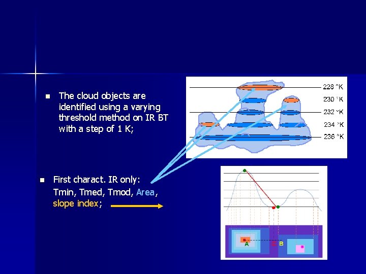
n n The cloud objects are identified using a varying threshold method on IR BT with a step of 1 K; First charact. IR only: Tmin, Tmed, Tmod, Area, slope index;

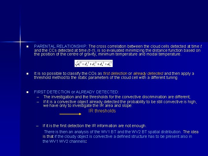
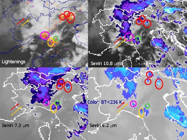
n PARENTAL RELATIONSHIP: The cross correlation between the cloud cells detected at time t and the CCs detected at time (t-1), is so evaluated minimizing the distance function based on the position of the centre of gravity, minimum temperature and modal temperature. n It is so possible to classify the COs as first detection or already detected and then apply a threshold method to the static parameters of the cloud cell with a different tuning n FIRST DETECTION or ALREADY DETECTED: – The investigation and the thresholds for the convective discrimination are different; – If it is a convective object already detected the probability to be still convective is high, we have only to investigate the IR area and slope: IR thresholds – If it is the first detection the IR information are not enough. There is then an analysis of the WV 1 BT and the WV 2 BT spatial distribution. The idea is that if the cloudy object is convective a defined structure has to be present also in the WV 1 WV 2 channels:

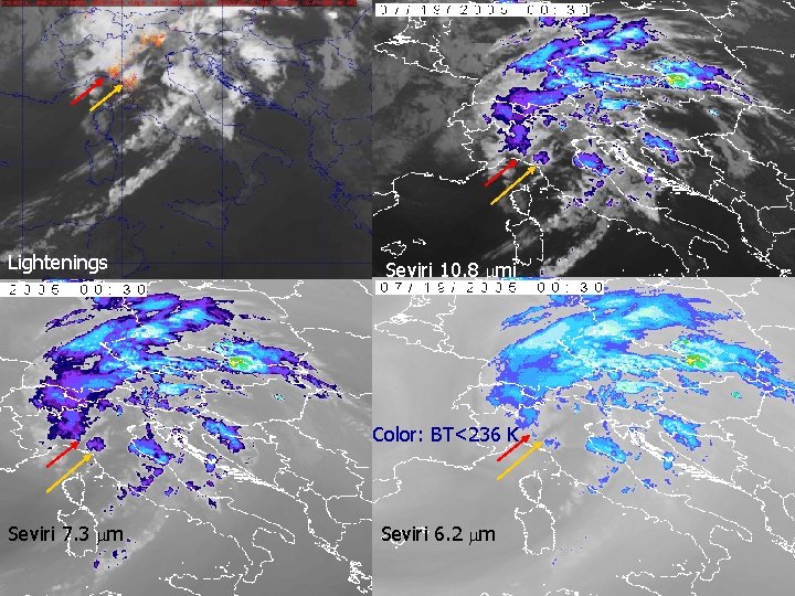
Lightenings Seviri 10. 8 mi Color: BT<236 K Seviri 7. 3 m Seviri 6. 2 m

Lightenings Seviri 10. 8 mi Color: BT<236 K Seviri 7. 3 m Seviri 6. 2 m

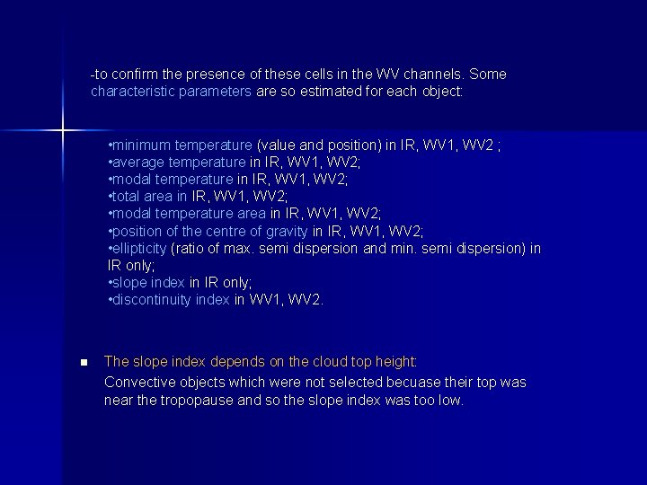
-to confirm the presence of these cells in the WV channels. Some characteristic parameters are so estimated for each object: • minimum temperature (value and position) in IR, WV 1, WV 2 ; • average temperature in IR, WV 1, WV 2; • modal temperature in IR, WV 1, WV 2; • total area in IR, WV 1, WV 2; • modal temperature area in IR, WV 1, WV 2; • position of the centre of gravity in IR, WV 1, WV 2; • ellipticity (ratio of max. semi dispersion and min. semi dispersion) in IR only; • slope index in IR only; • discontinuity index in WV 1, WV 2. n The slope index depends on the cloud top height: Convective objects which were not selected becuase their top was near the tropopause and so the slope index was too low.

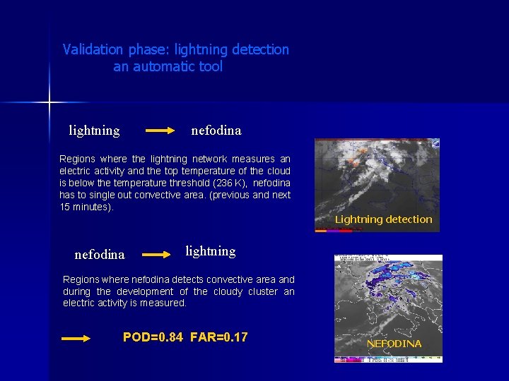
Validation phase: lightning detection an automatic tool lightning nefodina Regions where the lightning network measures an electric activity and the top temperature of the cloud is below the temperature threshold (236 K), nefodina has to single out convective area. (previous and next 15 minutes). Lightning detection nefodina lightning Regions where nefodina detects convective area and during the development of the cloudy cluster an electric activity is measured. POD=0. 84 FAR=0. 17 NEFODINA

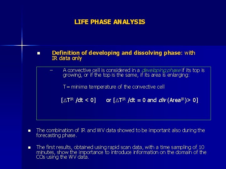
LIFE PHASE ANALYSIS Definition of developing and dissolving phase: with IR data only n A convective cell is considered in a developing phase if its top is growing, or if the top is the same, if its area is enlarging: – T= minima temperature of the convective cell [DTIR /dt < 0] or [DTIR /dt = 0 and div (Area. IR)> 0] n The combination of IR and WV data showed to be important also during the forecasting phase. n The first results, obtained using rapid scan data, with a time sampling of 10 minutes, show the importance to introduce information on the domain of the COs using the WV data.

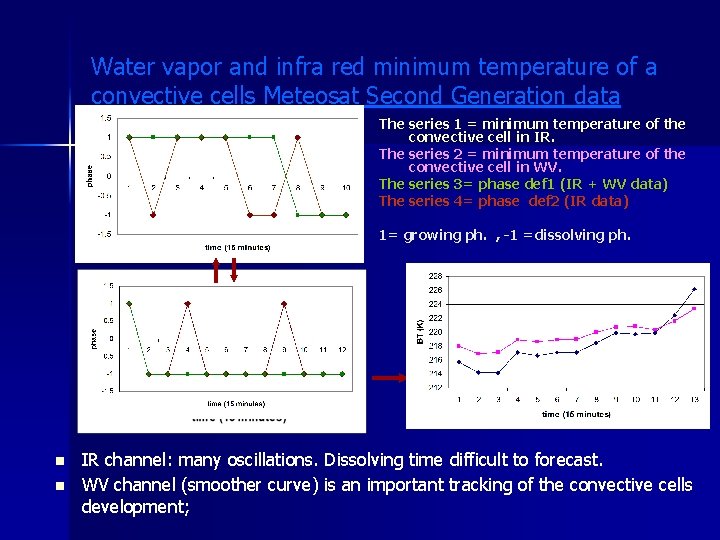
Water vapor and infra red minimum temperature of a convective cells Meteosat Second Generation data The series 1 = minimum temperature of the convective cell in IR. The series 2 = minimum temperature of the convective cell in WV. n The defination with IR and WV data is more representative of the real life evolution of a CO.

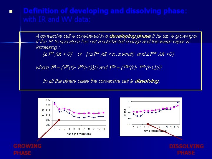
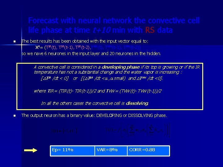
n Definition of developing and dissolving phase: with IR and WV data: A convective cell is considered in a developing phase if its top is growing or if the IR temperature has not a substantial change and the water vapor is increasing : [DTIR /dt < 0] or [(DTIR /dt <a , a small) and DTWV /dt <0]. where TIR= (TIR(t)- TIR(t-1))/2 and TWV= (TWV(t)- TWV(t-1))/2 In all the others cases the convective cell is dissolving. GROWING PHASE DISSOLVING PHASE

Water vapor and infra red minimum temperature of a convective cells Meteosat Second Generation data The series 1 = minimum temperature of the convective cell in IR. The series 2 = minimum temperature of the convective cell in WV. The series 3= phase def 1 (IR + WV data) The series 4= phase def 2 (IR data) 1= growing ph. , -1 =dissolving ph. n n IR channel: many oscillations. Dissolving time difficult to forecast. WV channel (smoother curve) is an important tracking of the convective cells development;

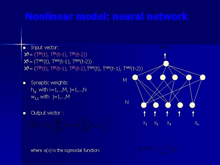
Nonlinear model: neural network Input vector: Xt= (TIR(t), TIR(t-1), TIR(t-2)) Xt= (TWV(t), TWV(t-1), TWV(t-2)) Xt= (TIR(t), TIR(t-1), TIR(t-2), TWV(t-1), TWV(t-2)) n n n Synaptic weights: hi, j with i=1, . . , M, j=1, . . , N w 1, j with j=1, . . , M M N Output vector : where s(x) is the sigmoidal function: X 1 X 2 X 3 Xn

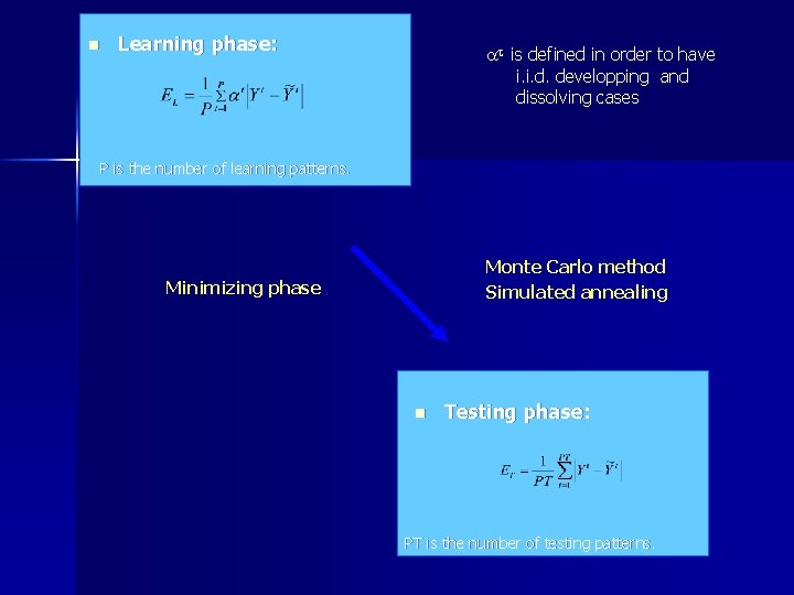
n Learning phase: at is defined in order to have i. i. d. developping and dissolving cases P is the number of learning patterns. Monte Carlo method Simulated annealing Minimizing phase n Testing phase: PT is the number of testing patterns.

Forecast with neural network the convective cell life phase at time t+10 min with RS data n The best results has been obtained with the input vector equal to: Xt= (TIR(t), TIR(t-1), TIR(t-2), TWV(t-1), TWV(t-2)) so we nave 6 neurones in the input layer and 20 neurones in the hidden. A convective cell is considered in a developing phase if its top is growing or if the IR temperature has not a substantial change and the water vapor is increasing : [DTIR /dt < 0] or [(DTIR /dt <a , a small) and DTWV /dt <0]. where TIR= (TIR(t)- TIR(t-1))/2 and TWV= (TWV(t)- TWV(t-1))/2 In all the others cases the convective cell is dissolving. n The output neuron has a binary value: DEVELOPING or DISSOLVING phase. Ep= 11% VAR=8% CORR=0. 88

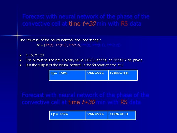
Forecast with neural network of the phase of the convective cell at time t+20 min with RS data The structure of the neural network does not change: Xt= (TIR(t), TIR(t-1), TIR(t-2), TWV(t-1), TWV(t-2)) n n n N=6, M=20 The output neuron has a binary value: DEVELOPPING or DISSOLVING phase. But the output of the neural network is the forecast at time t+2. Ep= 12% VAR=9% CORR=0. 8 Forecast with neural network of the phase of the convective cell at time t+30 min with RS data Ep= 15% VAR=9% CORR=0. 8

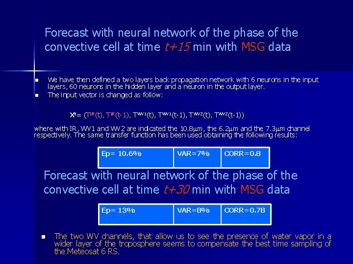
Forecast with neural network of the phase of the convective cell at time t+15 min with MSG data We have then defined a two layers back propagation network with 6 neurons in the input layers, 60 neurons in the hidden layer and a neuron in the output layer. The input vector is changed as follow: n n Xt= (TIR(t), TIR(t-1), TWV 1(t-1), TWV 2(t-1)) where with IR, WV 1 and WV 2 are indicated the 10. 8 m, the 6. 2 m and the 7. 3 m channel respectively. The same transfer function has been used obtaining the following results: Ep= 10. 6% VAR=7% CORR=0. 8 Forecast with neural network of the phase of the convective cell at time t+30 min with MSG data Ep= 13% n VAR=8% CORR=0. 78 The two WV channels, that allow us to see the presence of water vapor in a wider layer of the troposphere seems to compensate the best time sampling of the Meteosat 6 RS.

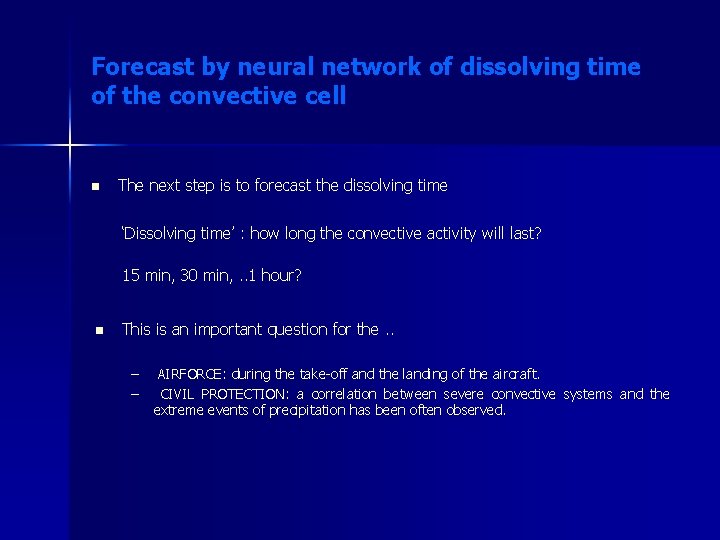
Forecast by neural network of dissolving time of the convective cell n The next step is to forecast the dissolving time ‘Dissolving time’ : how long the convective activity will last? 15 min, 30 min, . . 1 hour? n This is an important question for the. . – AIRFORCE: during the take-off and the landing of the aircraft. AIRFORCE: – CIVIL PROTECTION: a correlation between severe convective systems and the extreme events of precipitation has been often observed.

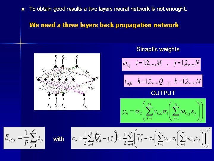
n To obtain good results a two layers neural network is not enought. We We need a three layers back propagation network Sinaptic weights OUTPUT with

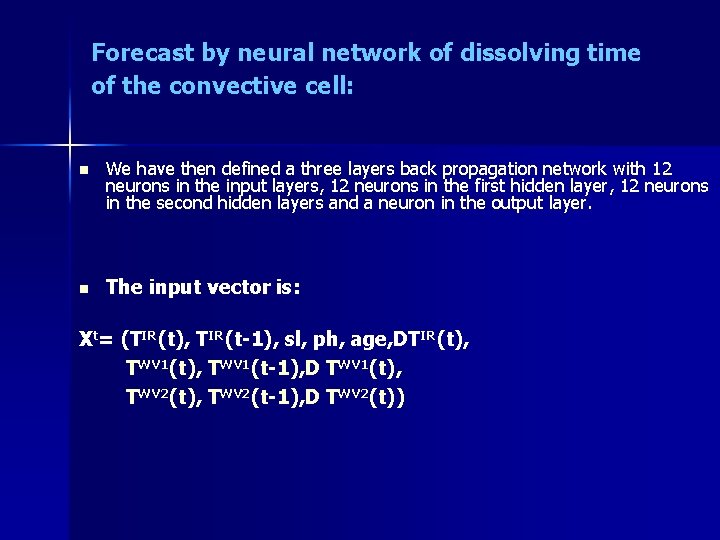
Forecast by neural network of dissolving time of the convective cell: n n We have then defined a three layers back propagation network with 12 neurons in the input layers, 12 neurons in the first hidden layer, 12 neurons in the second hidden layers and a neuron in the output layer. The input vector is: Xt= (TIR(t), TIR(t-1), sl, ph, age, DTIR(t), TWV 1(t-1), D TWV 1(t), TWV 2(t-1), D TWV 2(t))

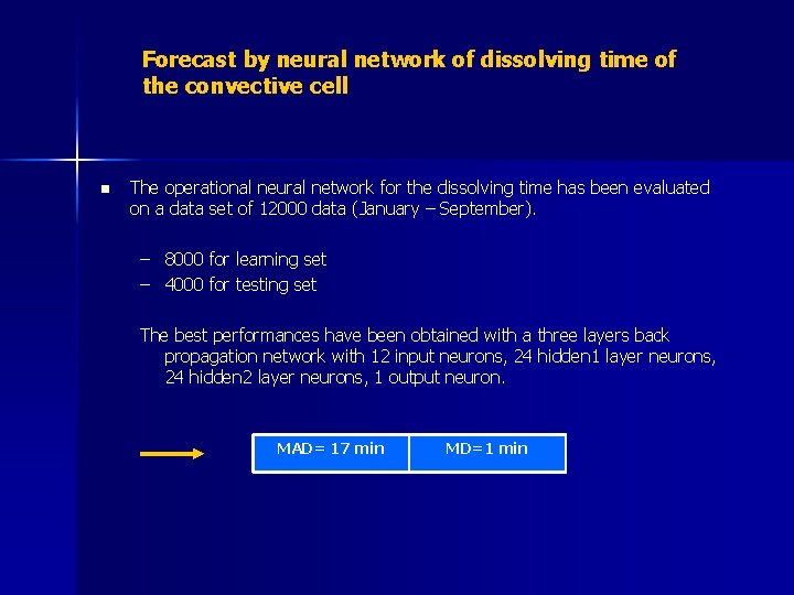
Forecast by neural network of dissolving time of the convective cell n The operational neural network for the dissolving time has been evaluated on a data set of 12000 data (January – September). – 8000 for learning set – 4000 for testing set The best performances have been obtained with a three layers back propagation network with 12 input neurons, 24 hidden 1 layer neurons, 24 hidden 2 layer neurons, 1 output neuron. MAD= 17 min MD=1 min

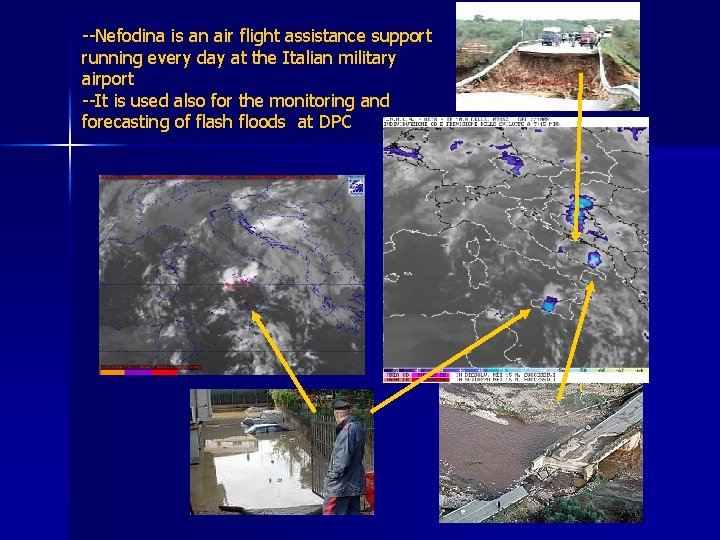
--Nefodina is an air flight assistance support running every day at the Italian military airport --It is used also for the monitoring and forecasting of flash floods at DPC

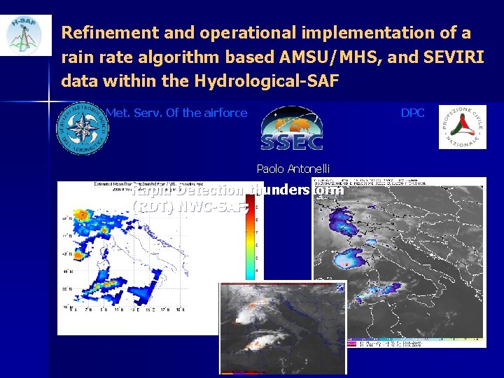
Refinement and operational implementation of a rain rate algorithm based AMSU/MHS, and SEVIRI data within the Hydrological-SAF Met. Serv. Of the airforce DPC Paolo Antonelli Rapid Detection thunderstorm (RDT) NWC-SAF;

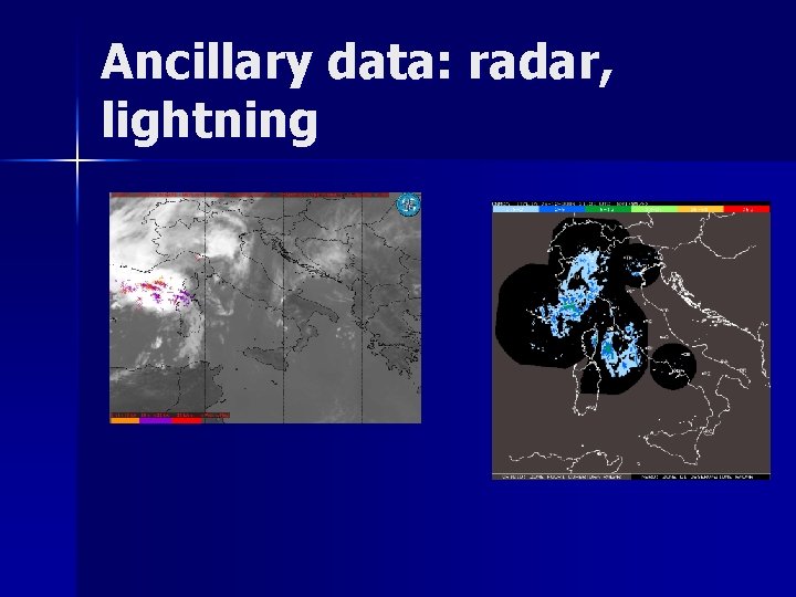
Ancillary data: radar, lightning

n Rapid Detection thunderstorm (RDT) NWC-SAF; Uses seviri and lightning data

Summary n SEVIRI: – Images every 15 Minutes – 3 km horizontal ‘sampling distance’ at Sub-Satellite Point (SSP) – Hi-Res VIS-Channel 1 km sampling distance (SSP) – 12 Spectral Channels n CONVECTION DETECTION with RGB (visual): – DAY TIME: 0. 6 -10. 8 mm or 0. 8 -3. 9 -10. 8 mm; – NIGHT TIME: 12. 0 -10. 8, 10. 8 -3. 9, 10. 8 mm; n NEFODINA: convective detection automatic tool. – developed to detect and forecast the severe convective systems present on the scene and main convective object inside these systems using Meteosat Second Generation data; – Based on a multi channel approach allows for detection and investigation of convective cloud structure – Uses the IR window channel and the two wv infrared absorption channels.