Supercell Storms METR 4433 Mesoscale Meteorology Spring 2016



- Slides: 126

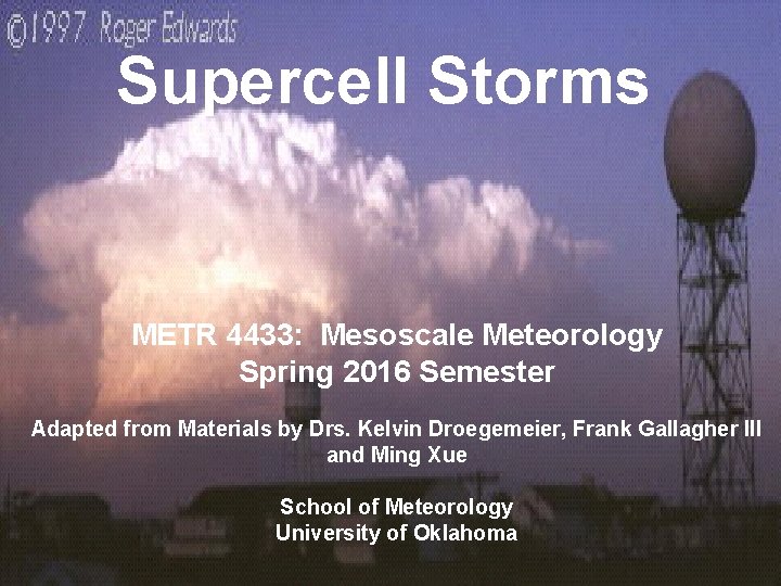
Supercell Storms METR 4433: Mesoscale Meteorology Spring 2016 Semester Adapted from Materials by Drs. Kelvin Droegemeier, Frank Gallagher III and Ming Xue School of Meteorology University of Oklahoma 1

2

3

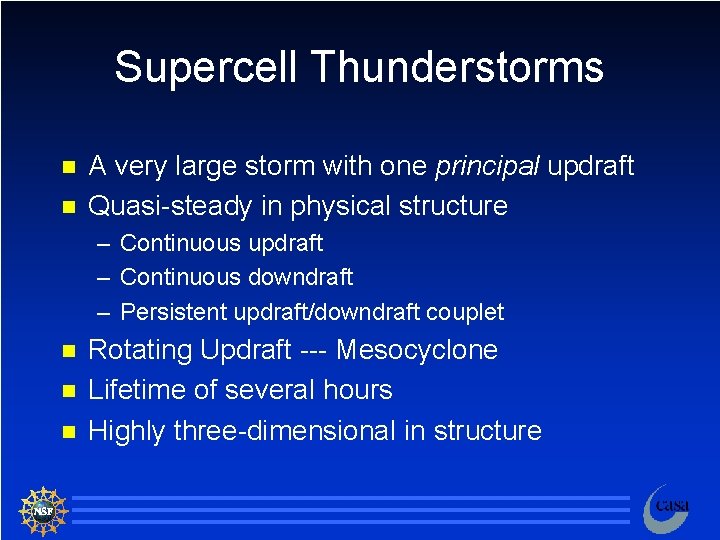
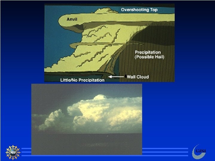
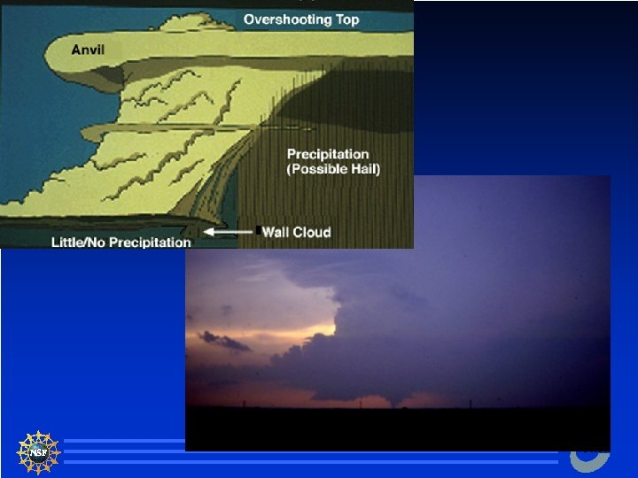
Supercell Thunderstorms n n A very large storm with one principal updraft Quasi-steady in physical structure – Continuous updraft – Continuous downdraft – Persistent updraft/downdraft couplet n n n Rotating Updraft --- Mesocyclone Lifetime of several hours Highly three-dimensional in structure 4

Supercell Thunderstorms Potentially the most dangerous of all the convective types of storms n Potpourri of severe and dangerous weather n – High winds – Large and damaging hail – Frequent lightning – Large and long-lived tornadoes 5

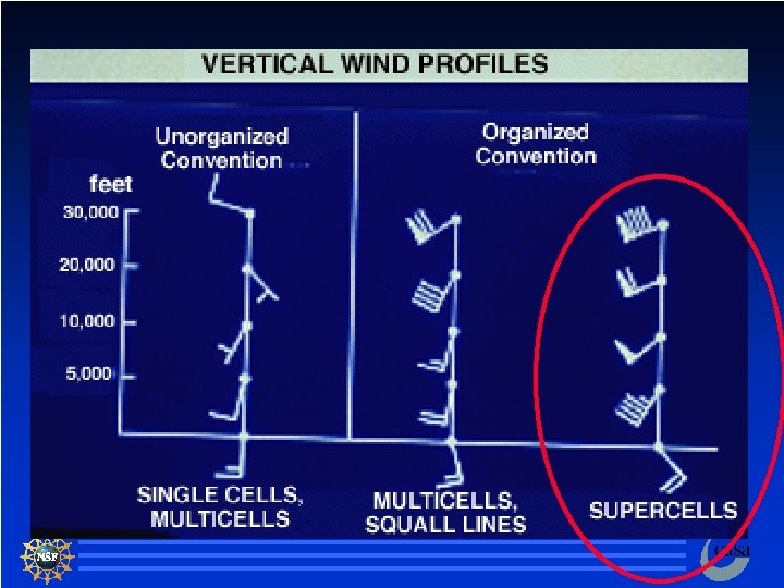
Supercell Thunderstorms n Form in an environment of strong winds and high shear – Provides a mechanism for separating the updraft and downdraft 6

7

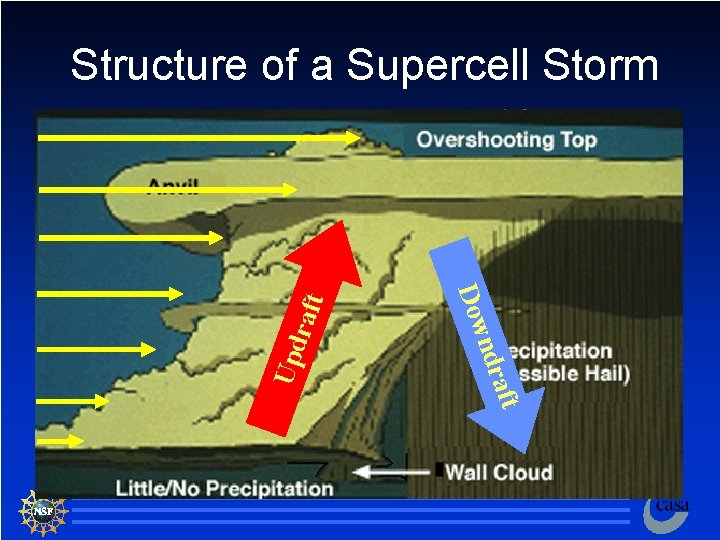
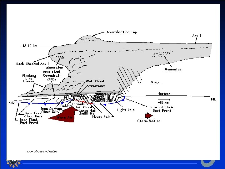
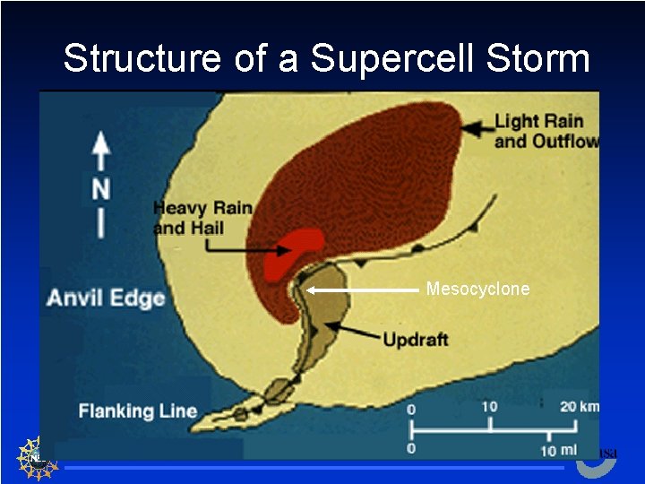
Upd aft ndr Dow raft Structure of a Supercell Storm 8

9

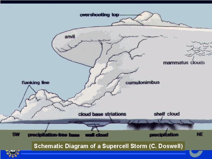
Schematic Diagram of a Supercell Storm (C. Doswell) 10

11

12

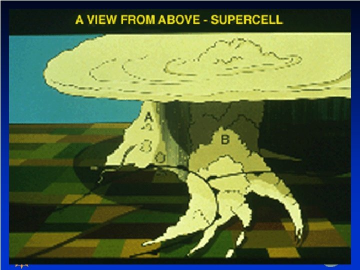
Structure of a Supercell Storm Mesocyclone 13

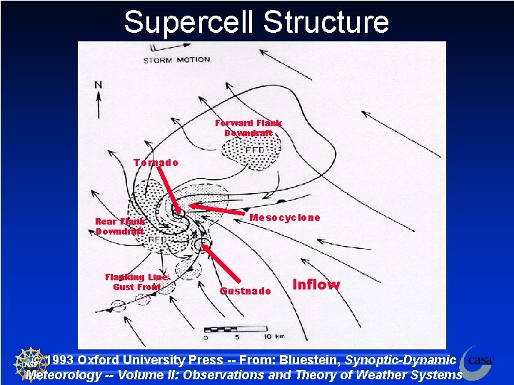
Supercell Structure Forward Flank Downdraft Tornado Rear Flank Downdraft Flanking Line/ Gust Front Mesocyclone Gustnado Inflow © 1993 Oxford University Press -- From: Bluestein, Synoptic-Dynamic Meteorology -- Volume II: Observations and Theory of Weather Systems 14

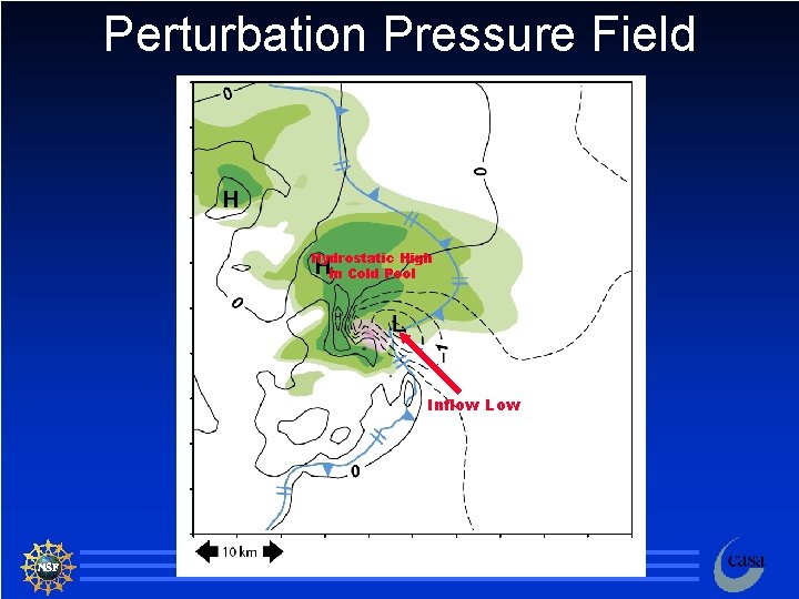
Perturbation Pressure Field Hydrostatic High In Cold Pool Inflow Low 15

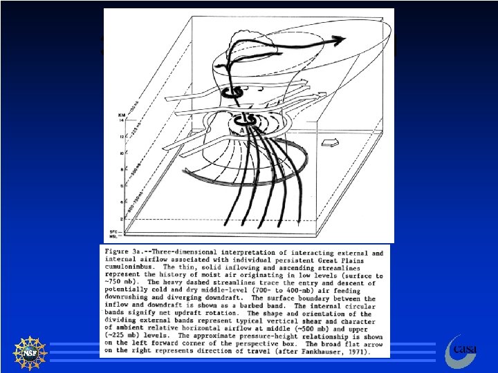
3 D Flow in a supercell 16

Animation of a Numerically Simulated Supercell Storm n https: //www. youtube. com/watch? v=Egu m. U 0 Ns 1 YI R. Wilhelmson, University of Illinois at Urbana-Champaign 17

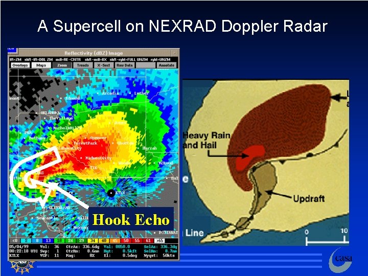
A Supercell on NEXRAD Doppler Radar Hook Echo 18

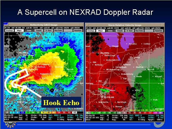
A Supercell on NEXRAD Doppler Radar Hook Echo 19

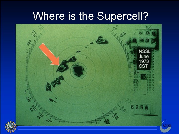
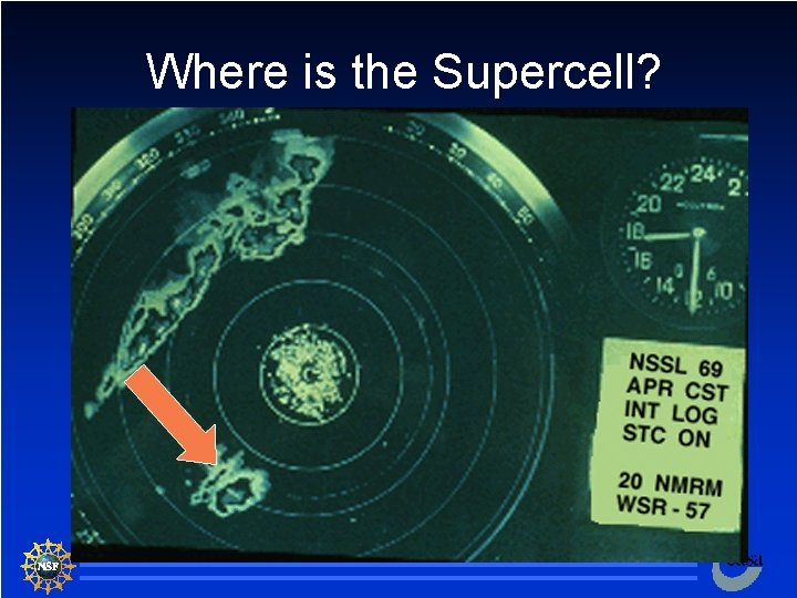
Where is the Supercell? 20

Where is the Supercell? 21

Supercell Types Classic n Low-precipitation n High-precipitation n 22

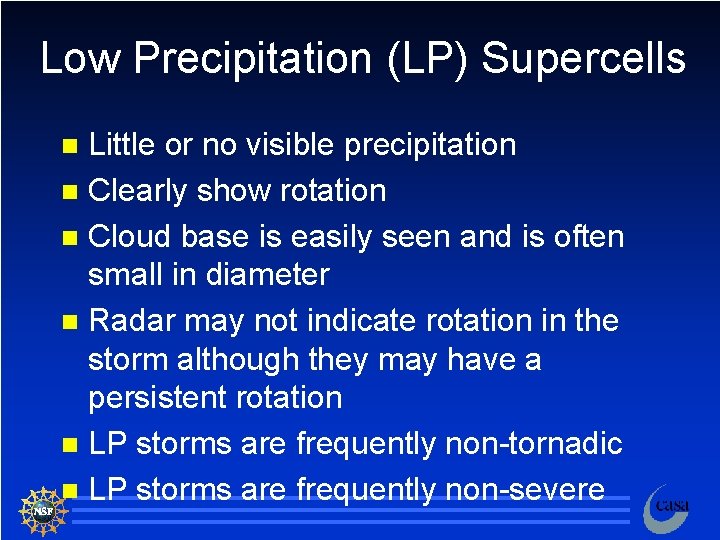
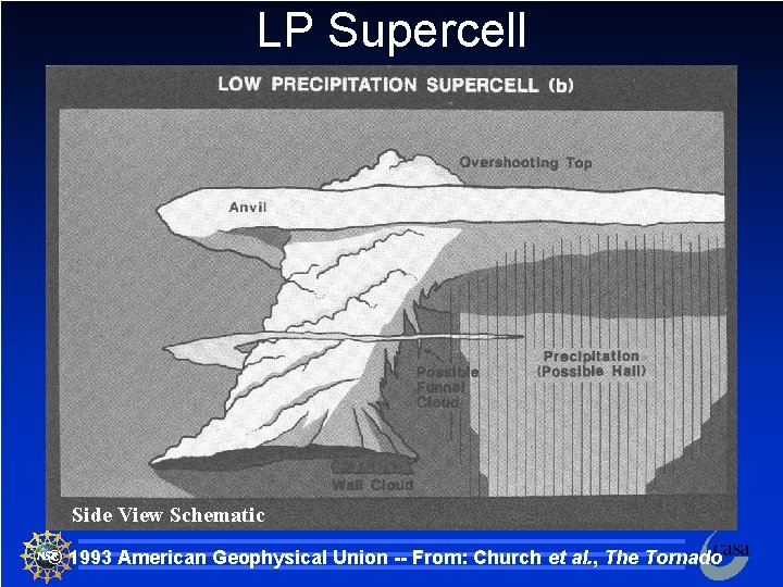
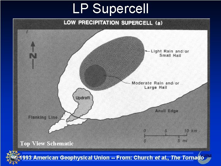
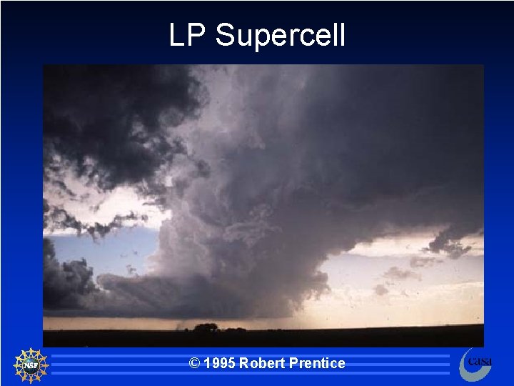
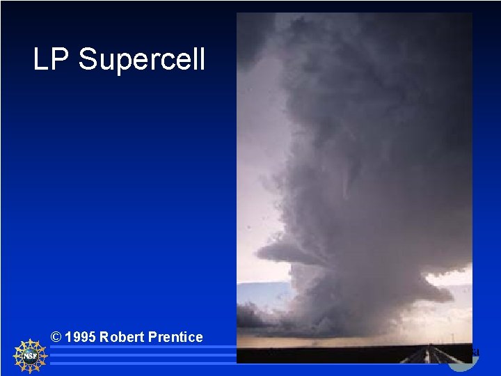
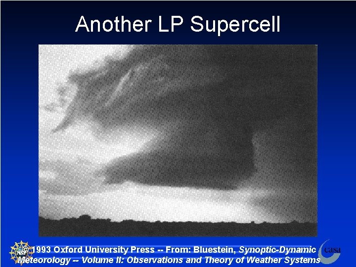
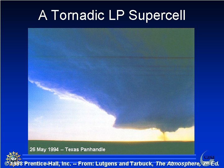
Low Precipitation (LP) Supercells Little or no visible precipitation n Clearly show rotation n Cloud base is easily seen and is often small in diameter n Radar may not indicate rotation in the storm although they may have a persistent rotation n LP storms are frequently non-tornadic n LP storms are frequently non-severe n 23

LP Supercell Side View Schematic © 1993 American Geophysical Union -- From: Church et al. , The Tornado 24

LP Supercell Top View Schematic © 1993 American Geophysical Union -- From: Church et al. , The Tornado 25

LP Supercell © 1995 Robert Prentice 26

LP Supercell © 1995 Robert Prentice 27

Another LP Supercell © 1993 Oxford University Press -- From: Bluestein, Synoptic-Dynamic Meteorology -- Volume II: Observations and Theory of Weather Systems 28

A Tornadic LP Supercell 26 May 1994 -- Texas Panhandle 29 © 1998 Prentice-Hall, Inc. -- From: Lutgens and Tarbuck, The Atmosphere, 7 th Ed.

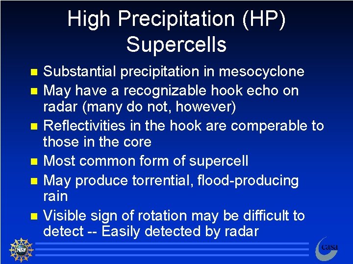
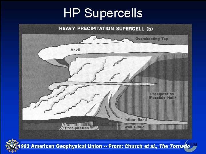
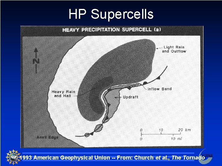
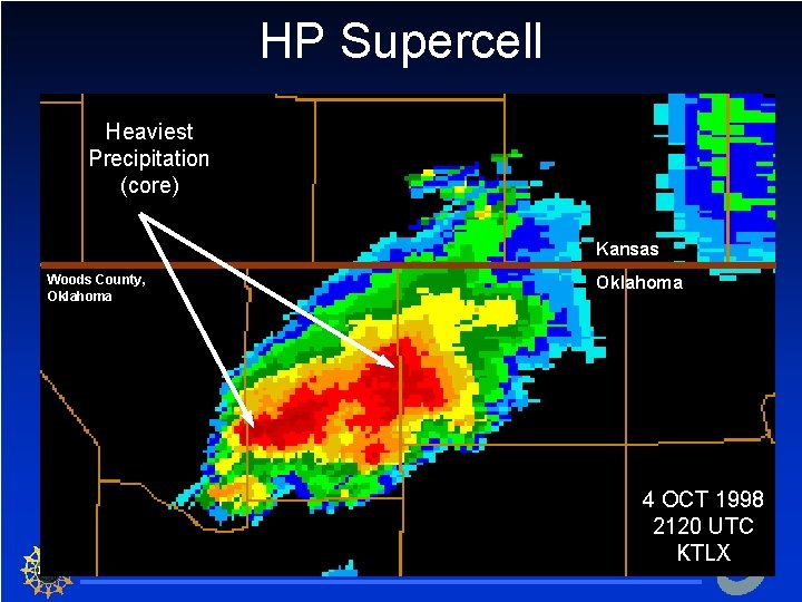
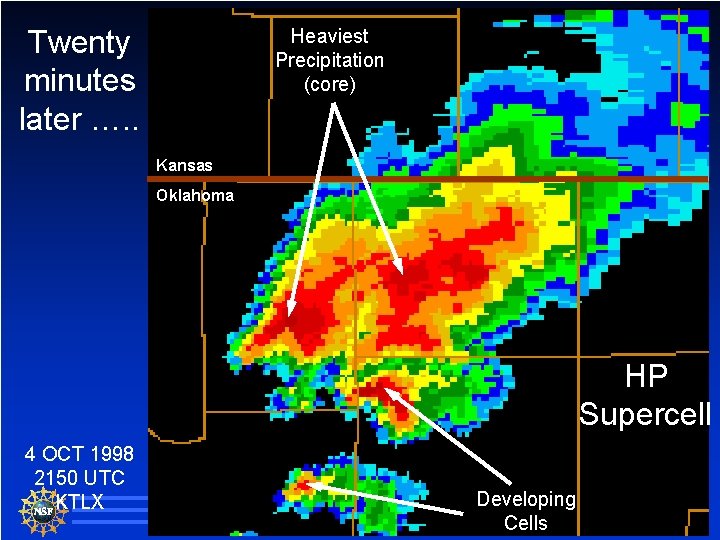
High Precipitation (HP) Supercells n n n Substantial precipitation in mesocyclone May have a recognizable hook echo on radar (many do not, however) Reflectivities in the hook are comperable to those in the core Most common form of supercell May produce torrential, flood-producing rain Visible sign of rotation may be difficult to detect -- Easily detected by radar 30

HP Supercells © 1993 American Geophysical Union -- From: Church et al. , The Tornado 31

HP Supercells © 1993 American Geophysical Union -- From: Church et al. , The Tornado 32

HP Supercell Heaviest Precipitation (core) Kansas Woods County, Oklahoma 4 OCT 1998 2120 UTC KTLX 33

Twenty minutes later …. . Heaviest Precipitation (core) Kansas Oklahoma HP Supercell 4 OCT 1998 2150 UTC KTLX Developing Cells 34

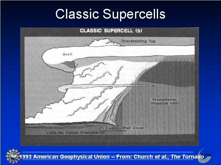
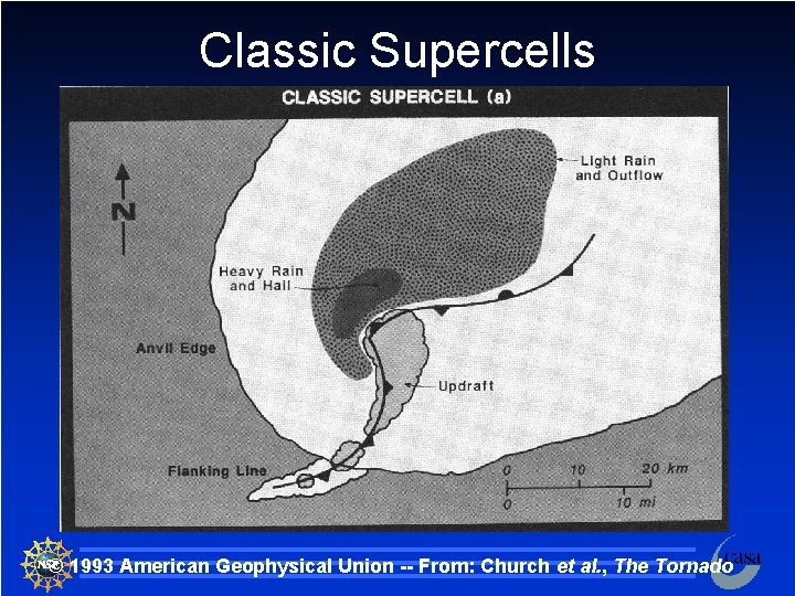
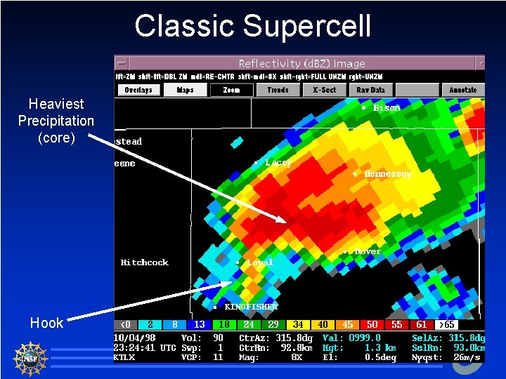
Classic Supercells Traditional conceptual model of supercells n Usually some precipitation but not usually torrential n n n Reflectivities in the hook are usually less than those in the core Rotation is usually seen both visually and on radar 35

Classic Supercells © 1993 American Geophysical Union -- From: Church et al. , The Tornado 36

Classic Supercells © 1993 American Geophysical Union -- From: Church et al. , The Tornado 37

Classic Supercell Heaviest Precipitation (core) Hook 38

Hybrids Class distinctions are much less obvious in the real world! n Visibly a storm may look different on radar than it does in person -- makes storms difficult to classify n Supercells often evolve from LP Classic HP. There is a continuous spectrum of storm types. n 39

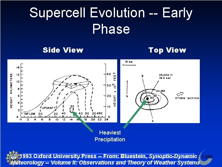
Supercell Evolution -- Early Phase Side View Top View Heaviest Precipitation © 1993 Oxford University Press -- From: Bluestein, Synoptic-Dynamic Meteorology -- Volume II: Observations and Theory of Weather Systems 40

Supercell Evolution n Early Phase – Initial cell development is essentially identical to that of a short-lived single cell storm. – Radar reflectivity is vertically stacked – Motion of the storm is generally in the direction of the mean wind – Storm shape is circular (from above) and symmetrical – Key ingredients » Conditional instability » Source of lift and vertical motion » Warm, moist air 41

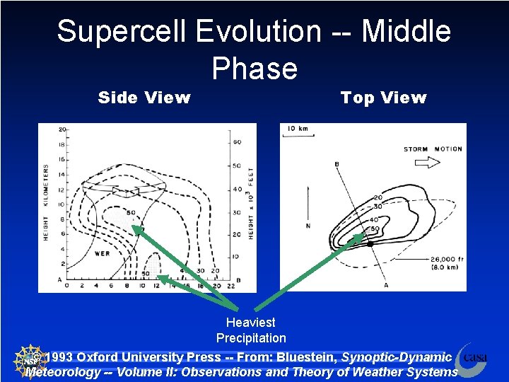
Supercell Evolution -- Middle Phase Side View Top View Heaviest Precipitation © 1993 Oxford University Press -- From: Bluestein, Synoptic-Dynamic Meteorology -- Volume II: Observations and Theory of Weather Systems 42

Supercell Evolution n Middle Phase – As the storm develops, the strong wind shear alters the storm characteristics from that of a single cell – The reflectivity pattern is elongated down wind -- the stronger winds aloft blow the precipitation – The strongest reflectivity gradient is usually along the SW corner of the storm – Instead of being vertical, the updraft and downdraft become separated 43

Supercell Evolution n Middle Phase – After about an hour, the radar pattern indicates a “weak echo region” (WER) – This tells us that the updraft is strong and scours out precipitation from the updraft – Precipitation aloft “overhangs” a rain free region at the bottom of the storm. – The storm starts to turn to the right of the mean wind into the supply of warm, moist air 44

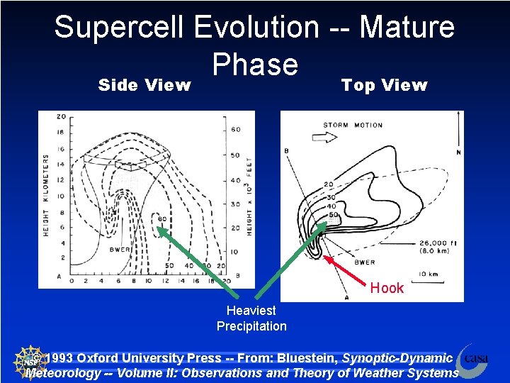
Supercell Evolution -- Mature Phase Side View Top View Hook Heaviest Precipitation © 1993 Oxford University Press -- From: Bluestein, Synoptic-Dynamic Meteorology -- Volume II: Observations and Theory of Weather Systems 45

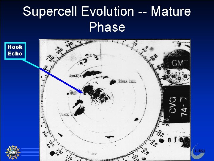
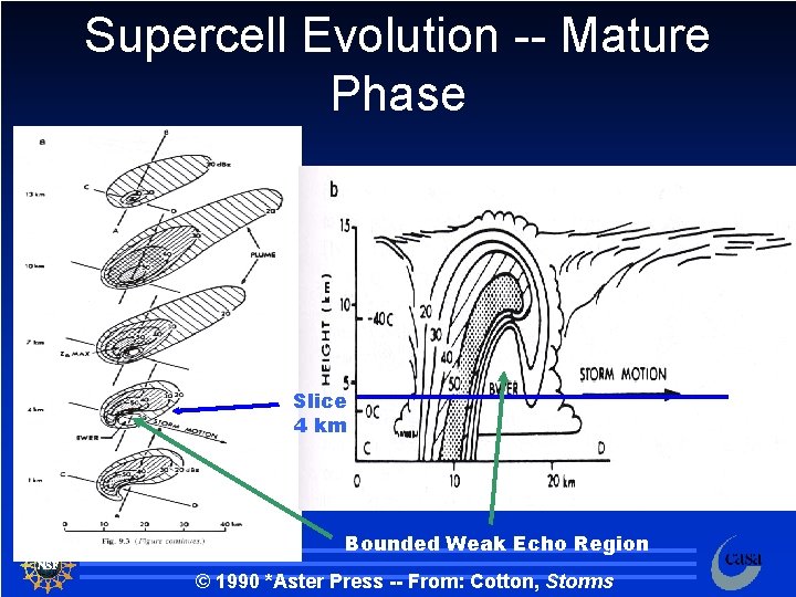
Supercell Evolution n Mature Phase – After about 90 minutes, the storm has reached a quasi-steady mature phase – Rotation is now evident and a mesocyclone (the rotating updraft) has started – This rotation (usually CCW) creates a hook -like appendage on the southwest flank of the storm 46

Supercell Evolution -- Mature Phase Hook Echo 47

Supercell Evolution n Mature Phase – The updraft increases in strength and more precipitation, including hail, is held aloft and scoured out of the updraft – As the storm produces more precipitation, the weak echo region, at some midlevels, becomes “bounded” – This bounded weak echo region (BWER), or “vault, ” resembles (on radar) a hole of no precipitation surrounded by a ring of precipitation 48

Supercell Evolution -- Mature Phase Slice 4 km Bounded Weak Echo Region © 1990 *Aster Press -- From: Cotton, Storms 49

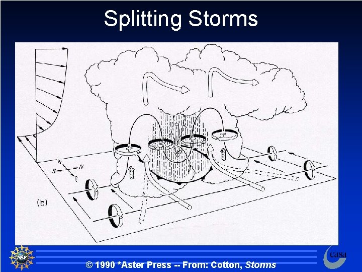
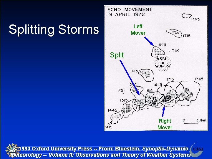
Splitting Storms If the shear is favorable, both circulations may continue to exist. n In this case the storm will split into two new storms. n We will look at this in greater detail later. n 50

Splitting Storms © 1990 *Aster Press -- From: Cotton, Storms 51

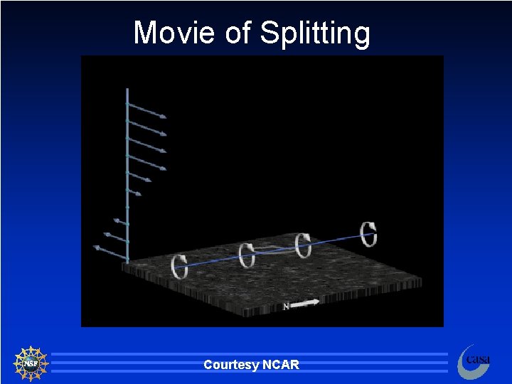
Movie of Splitting Courtesy NCAR 52

Splitting Storms Left Mover Split Right Mover © 1993 Oxford University Press -- From: Bluestein, Synoptic-Dynamic Meteorology -- Volume II: Observations and Theory of Weather Systems 53

Updraft The updraft is the rising column of air in the supercell n It generally is located on the front or right side of the storm n Entrainment is small in the core of the updraft n Updraft speeds may reach 50 m s-1!!! n Radar indicates that the strongest updrafts occur in the middle and upper parts of the storm n 54

Updraft n Factors affecting the updraft speed – Vertical pressure gradients » Small effect but locally important » Regions of local convergence can result in local areas of increased pressure gradients – Turbulence – Buoyancy » The more unstable the air, the larger the buoyancy of the parcel as they rise in the atmosphere » The larger the temperature difference between the parcel and the environment, the greater the buoyancy and the faster the updraft 55

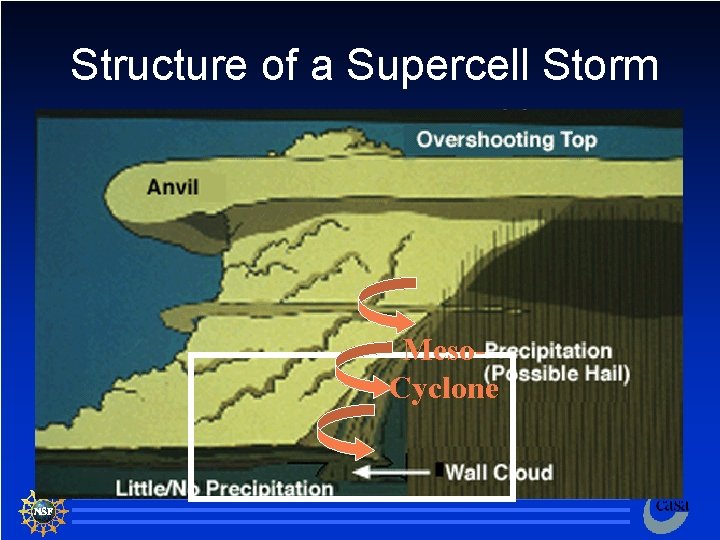
Structure of a Supercell Storm Meso. Cyclone 56

57

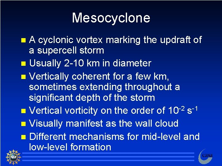
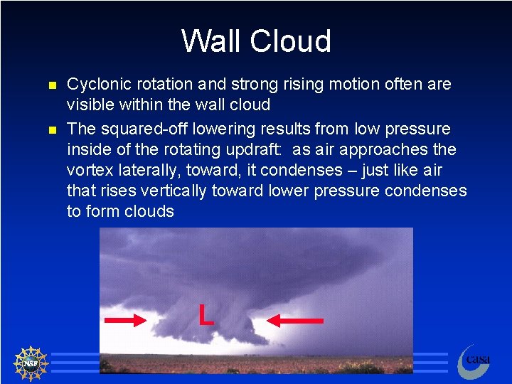
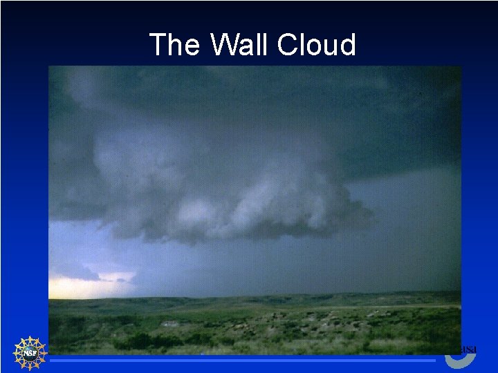
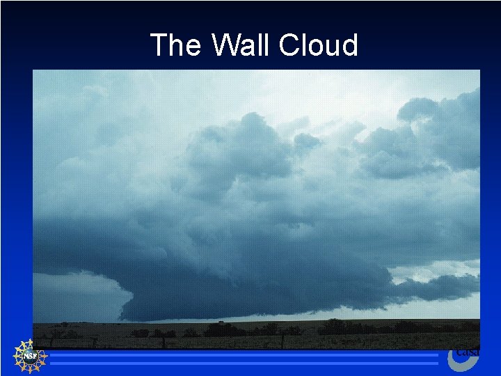
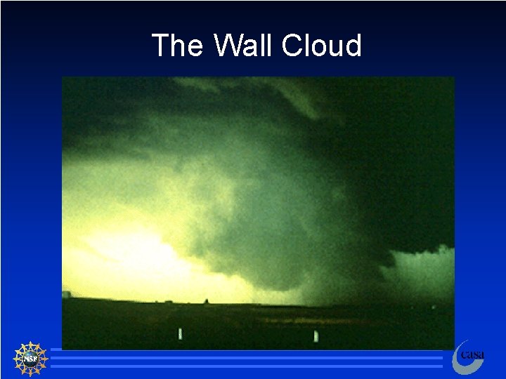
Mesocyclone A cyclonic vortex marking the updraft of a supercell storm n Usually 2 -10 km in diameter n Vertically coherent for a few km, sometimes extending throughout a significant depth of the storm n Vertical vorticity on the order of 10 -2 s-1 n Visually manifest as the wall cloud n Different mechanisms for mid-level and low-level formation n 58

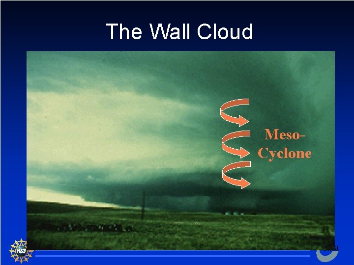
The Wall Cloud Meso. Cyclone 59

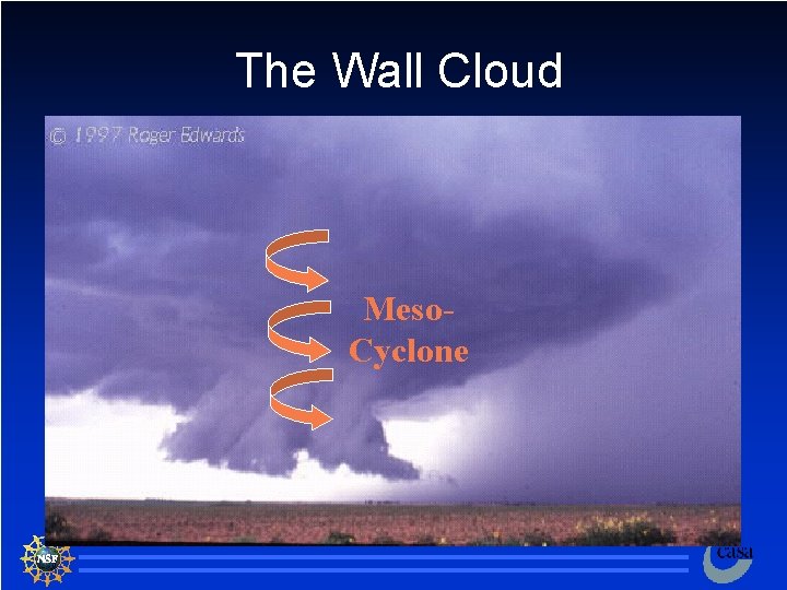
The Wall Cloud Meso. Cyclone 60

Wall Cloud n n Cyclonic rotation and strong rising motion often are visible within the wall cloud The squared-off lowering results from low pressure inside of the rotating updraft: as air approaches the vortex laterally, toward, it condenses – just like air that rises vertically toward lower pressure condenses to form clouds L 61

The Wall Cloud 62

The Wall Cloud 63

The Wall Cloud 64

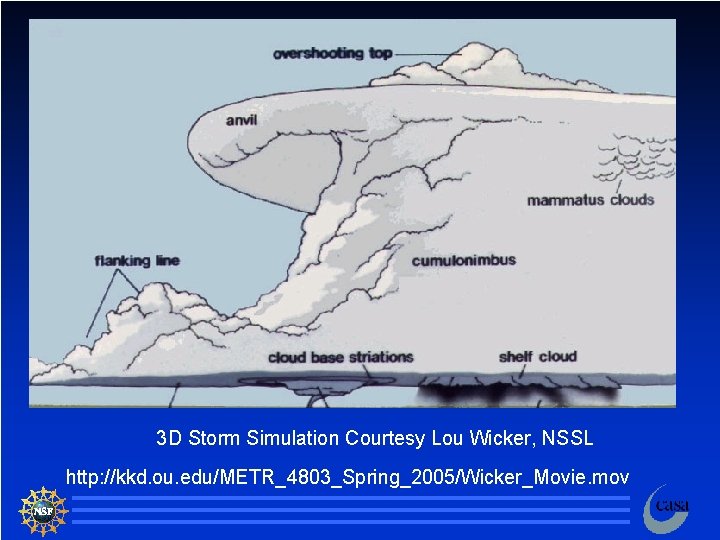
3 D Storm Simulation Courtesy Lou Wicker, NSSL http: //kkd. ou. edu/METR_4803_Spring_2005/Wicker_Movie. mov 65

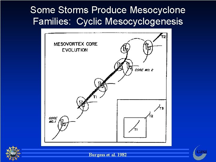
Some Storms Produce Mesocyclone Families: Cyclic Mesocyclogenesis Burgess et al. 1982 66

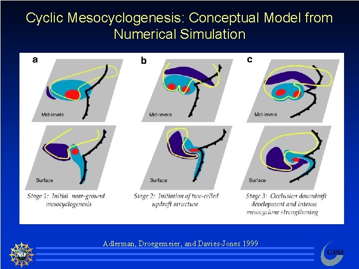
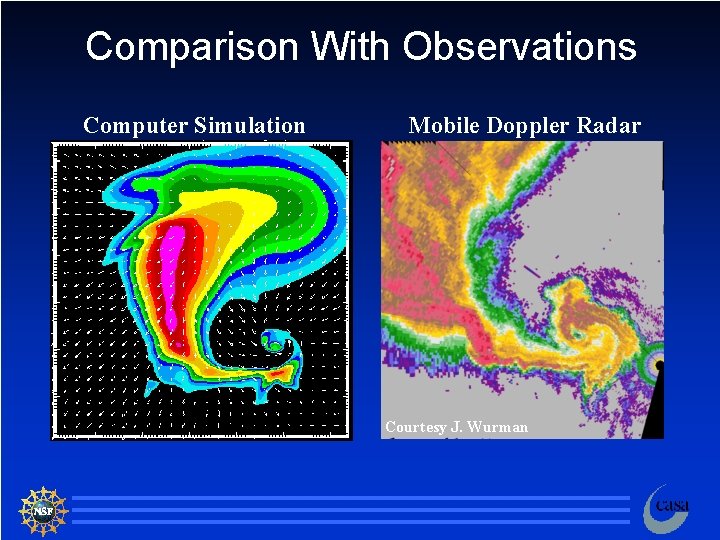
Cyclic Mesocyclogenesis: Conceptual Model from Numerical Simulation Adlerman, Droegemeier, and Davies-Jones 1999 67

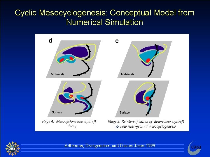
Cyclic Mesocyclogenesis: Conceptual Model from Numerical Simulation & Adlerman, Droegemeier, and Davies-Jones 1999 68

Comparison With Observations Computer Simulation Mobile Doppler Radar Courtesy J. Wurman 69

Supercell Downdrafts n The same forces that affect updrafts also help to initiate, maintain, or dissipate downdrafts: – Vertical PGF – Buoyancy (including precipitation loading) – Turbulence n Downdraft wind speeds may exceed 40 m s-1 70

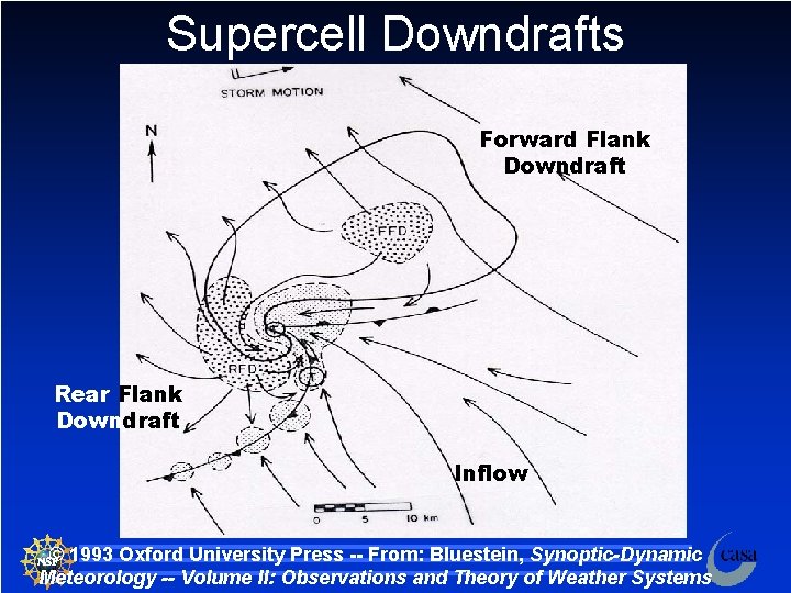
Supercell Downdrafts n We shall examine two distinct downdrafts associated with supercell thunderstorms: – Forward Flank Downdraft (FFD) – Rear Flank Downdraft (RFD) 71

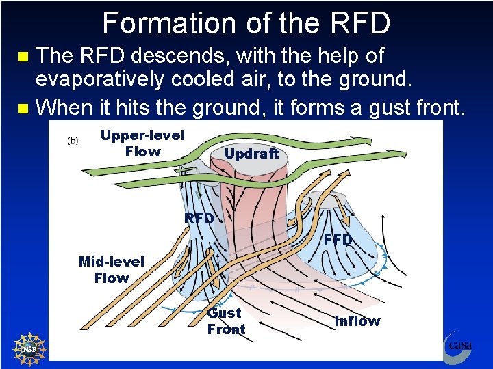
Forward Flank Downdraft Associated with the heavy precipitation core of supercells. n Air in the downdraft originates within the column of precipitation as well as below the cloud base where evaporational cooling is important. n Forms in the forward flank (with respect to storm motion) of the storm. n FFD air spreads out when it hits the ground and forms a gust front. n 72

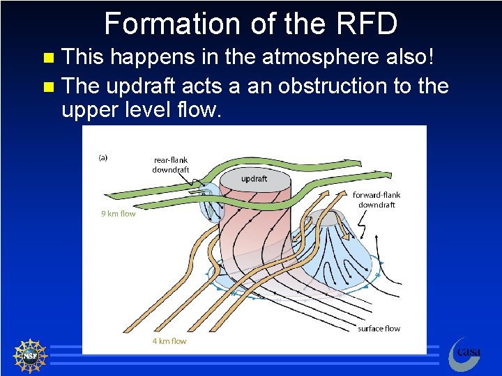
Rear Flank Downdraft Forms at the rear, or upshear, side of the storm. n Result of the storm “blocking” the flow of ambient air. n Maintained and enhanced by the evaporation of anvil precipitation. n Enhanced by mid-level dry air entrainment and associated evaporational cooling. n Located adjacent to the updraft. n 73

Supercell Downdrafts Forward Flank Downdraft Rear Flank Downdraft Inflow © 1993 Oxford University Press -- From: Bluestein, Synoptic-Dynamic Meteorology -- Volume II: Observations and Theory of Weather Systems 74

Rear Flank Downdraft Forms at the rear, or upshear, side of the storm. n Result of the storm “blocking” the flow of ambient air. n Maintained and enhanced by the evaporation of anvil precipitation. n Enhanced by mid-level dry air entrainment and associated evaporational cooling. n Located adjacent to the updraft. n 75

Supercell Downdrafts Forward Flank Downdraft Rear Flank Downdraft Inflow © 1993 Oxford University Press -- From: Bluestein, Synoptic-Dynamic Meteorology -- Volume II: Observations and Theory of Weather Systems 76

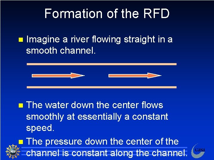
Formation of the RFD n Imagine a river flowing straight in a smooth channel. The water down the center flows smoothly at essentially a constant speed. n The pressure down the center of the channel is constant along the channel. n 77

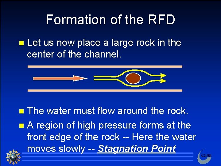
Formation of the RFD n Let us now place a large rock in the center of the channel. The water must flow around the rock. n A region of high pressure forms at the front edge of the rock -- Here the water moves slowly -- Stagnation Point n 78

Formation of the RFD This happens in the atmosphere also! n The updraft acts a an obstruction to the upper level flow. n 79

Formation of the RFD The RFD descends, with the help of evaporatively cooled air, to the ground. n When it hits the ground, it forms a gust front. n Upper-level Flow Updraft RFD FFD Mid-level Flow Gust Front Inflow 80

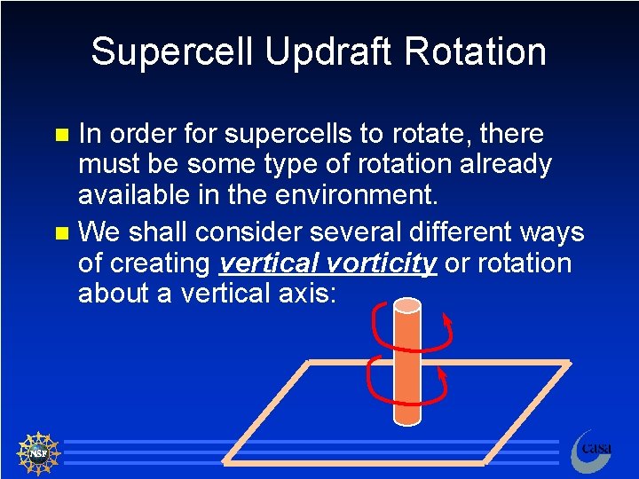
Supercell Updraft Rotation In order for supercells to rotate, there must be some type of rotation already available in the environment. n We shall consider several different ways of creating vertical vorticity or rotation about a vertical axis: n 81

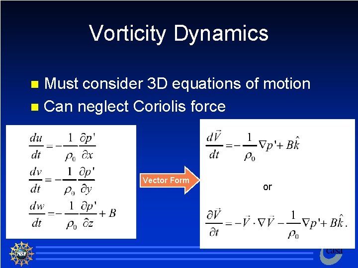
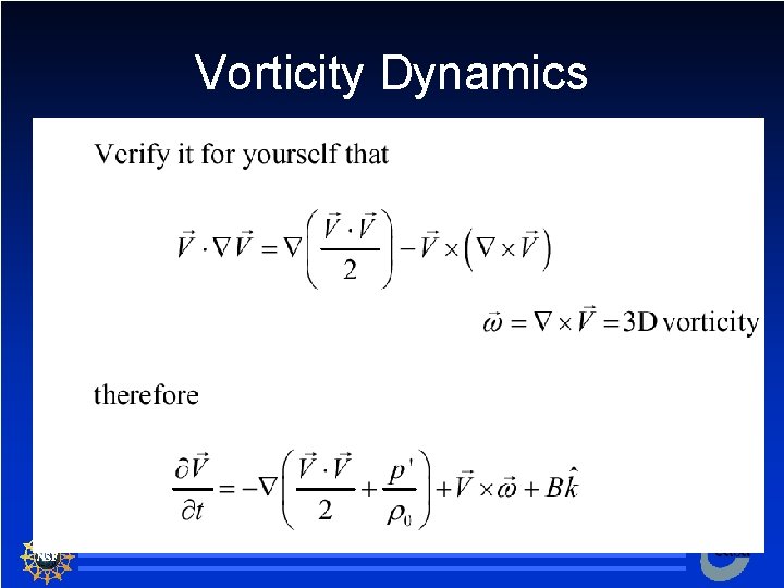
Vorticity Dynamics Must consider 3 D equations of motion n Can neglect Coriolis force n Vector Form or or 82

Vorticity Dynamics or 83

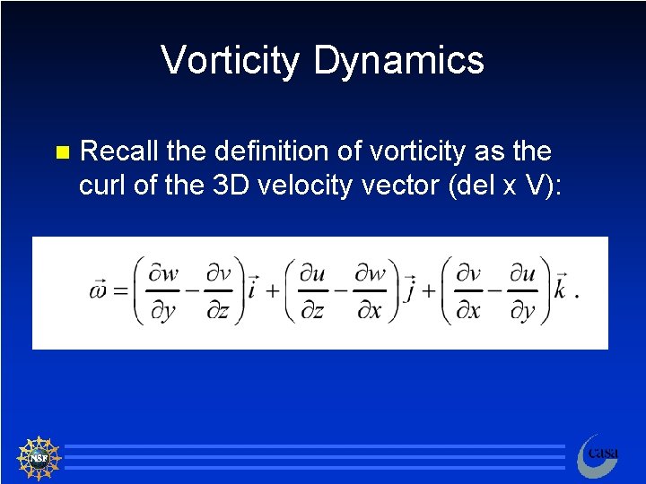
Vorticity Dynamics n Recall the definition of vorticity as the curl of the 3 D velocity vector (del x V): 84

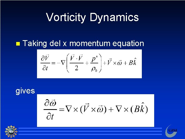
Vorticity Dynamics n Taking del x momentum equation gives 85

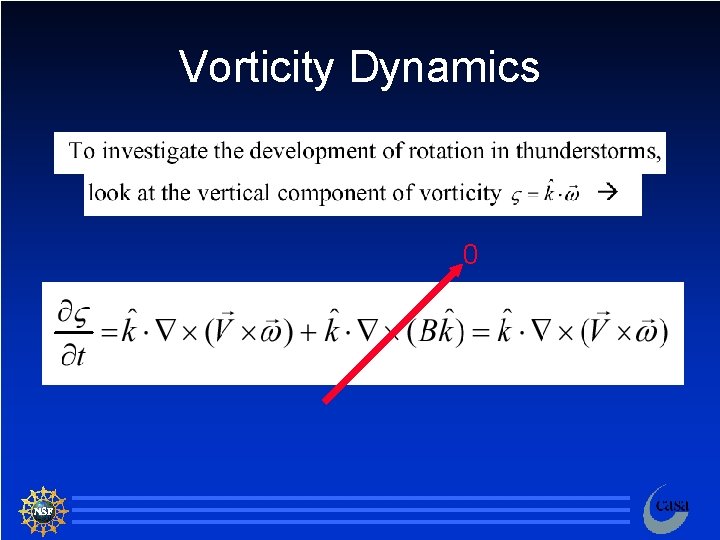
Vorticity Dynamics 0 86

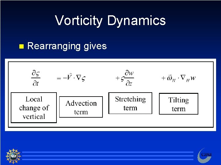
Vorticity Dynamics n Rearranging gives 87

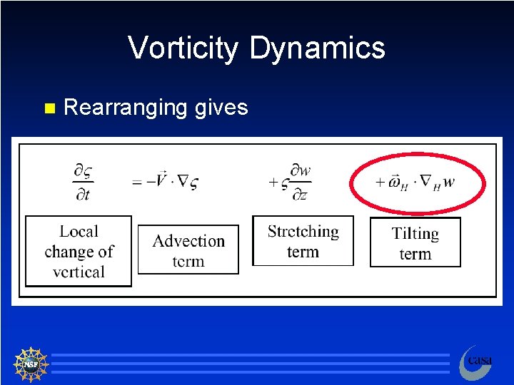
Vorticity Dynamics n Rearranging gives 88

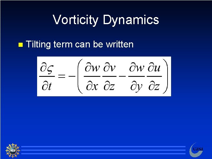
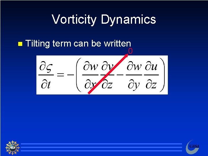
Vorticity Dynamics n Tilting term can be written 89

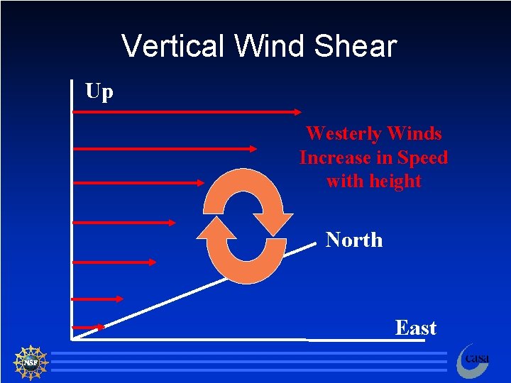
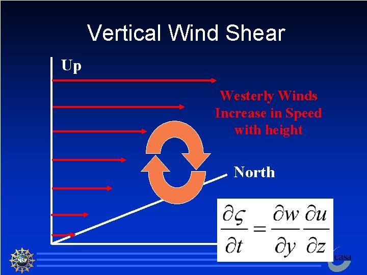
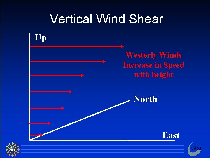
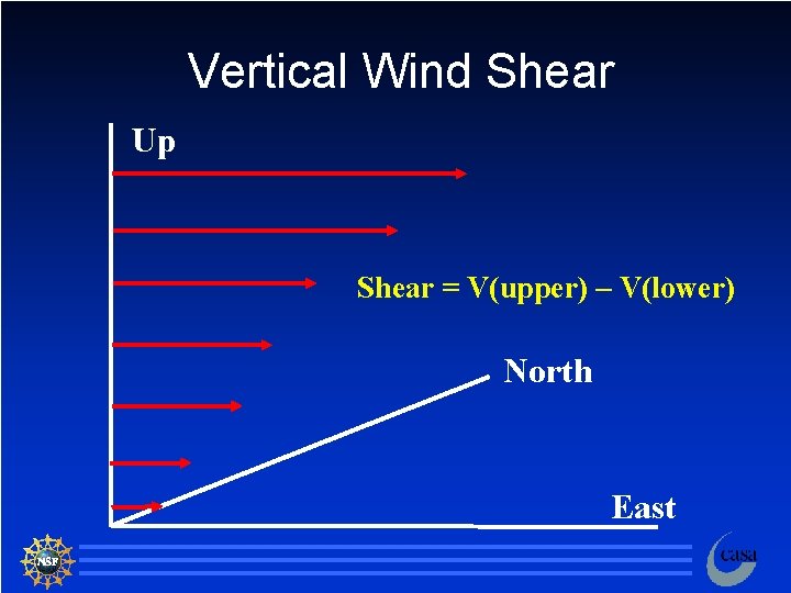
Vertical Wind Shear Up Westerly Winds Increase in Speed with height North East 90

Vorticity Dynamics n Tilting term can be written 0 91

Vertical Wind Shear Up Westerly Winds Increase in Speed with height North East 92

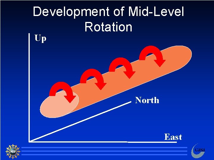
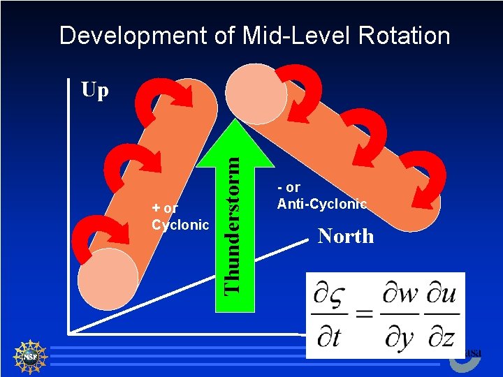
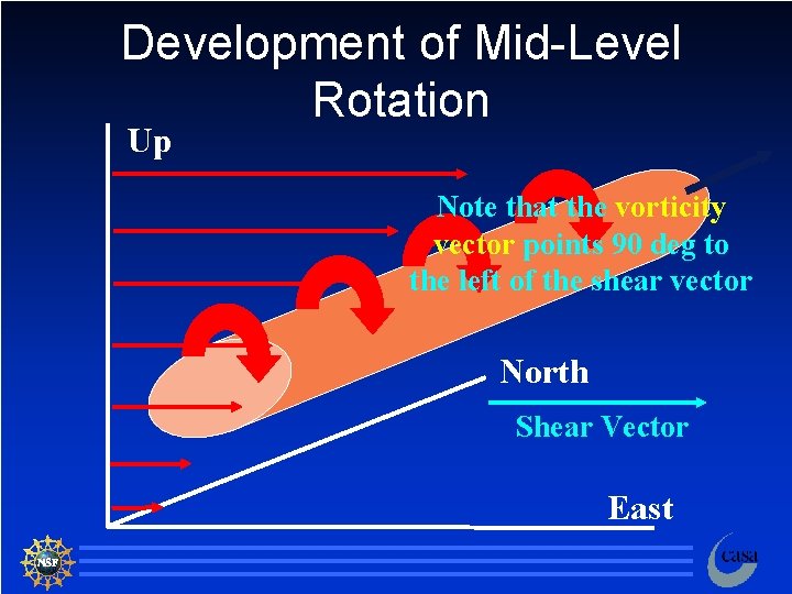
Development of Mid-Level Rotation Up North East 93

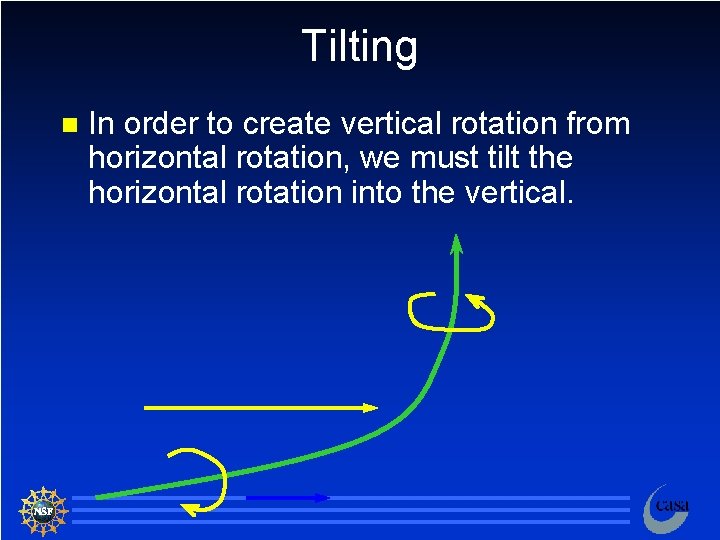
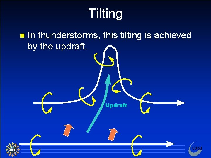
Tilting n In order to create vertical rotation from horizontal rotation, we must tilt the horizontal rotation into the vertical. 94

Tilting n In thunderstorms, this tilting is achieved by the updraft. Updraft 95

Development of Mid-Level Rotation + or Cyclonic Thunderstorm Up - or Anti-Cyclonic North East 96

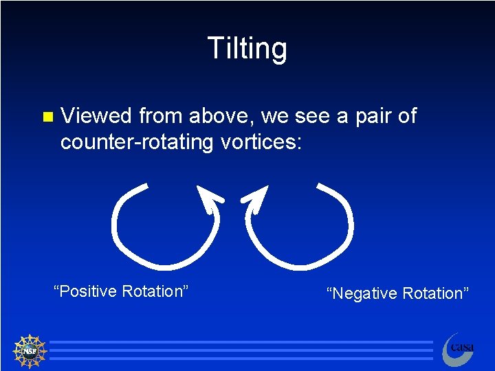
Tilting n Viewed from above, we see a pair of counter-rotating vortices: “Positive Rotation” “Negative Rotation” 97

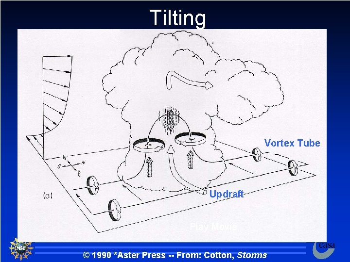
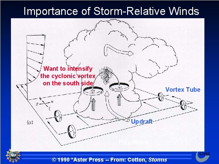
Tilting Vortex Tube Updraft Play Movie © 1990 *Aster Press -- From: Cotton, Storms 98

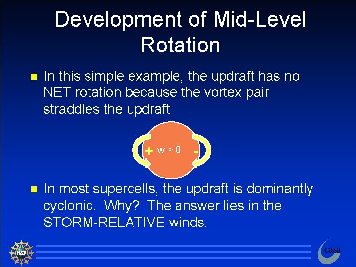
Development of Mid-Level Rotation n In this simple example, the updraft has no NET rotation because the vortex pair straddles the updraft +w>0 n In most supercells, the updraft is dominantly cyclonic. Why? The answer lies in the STORM-RELATIVE winds. 99

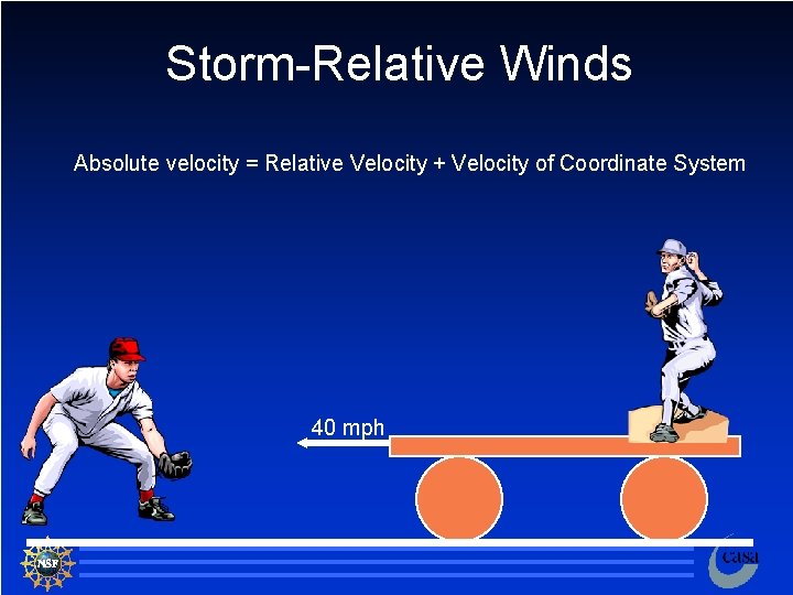
Storm-Relative Winds Absolute velocity = Relative Velocity + Velocity of Coordinate System 40 mph 100

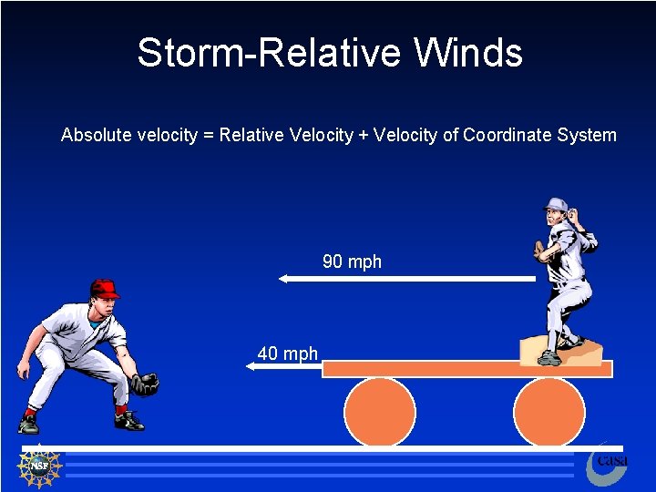
Storm-Relative Winds Absolute velocity = Relative Velocity + Velocity of Coordinate System 90 mph 40 mph 101

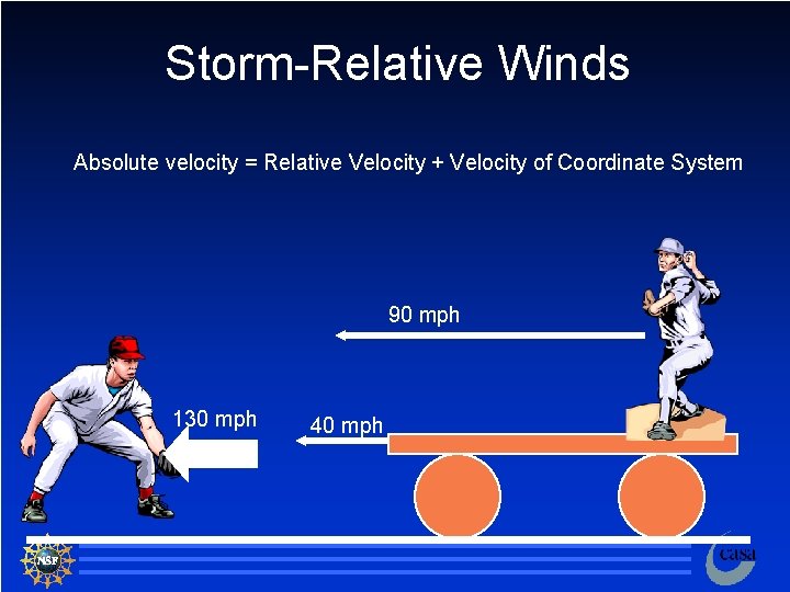
Storm-Relative Winds Absolute velocity = Relative Velocity + Velocity of Coordinate System 90 mph 130 mph 40 mph 102

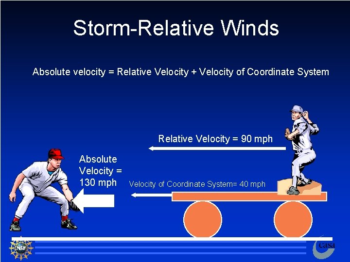
Storm-Relative Winds Absolute velocity = Relative Velocity + Velocity of Coordinate System Relative Velocity = 90 mph Absolute Velocity = 130 mph Velocity of Coordinate System= 40 mph 103

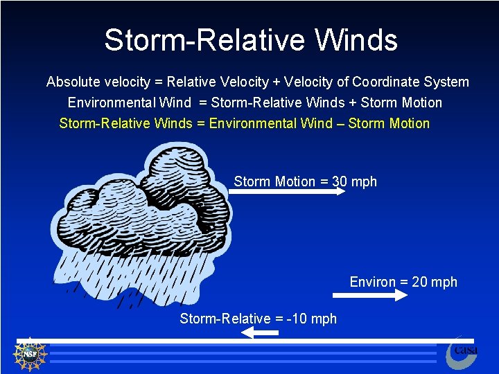
Storm-Relative Winds Absolute velocity = Relative Velocity + Velocity of Coordinate System Environmental Wind = Storm-Relative Winds + Storm Motion Storm-Relative Winds = Environmental Wind – Storm Motion = 30 mph Environ = 20 mph Storm-Relative = -10 mph 104

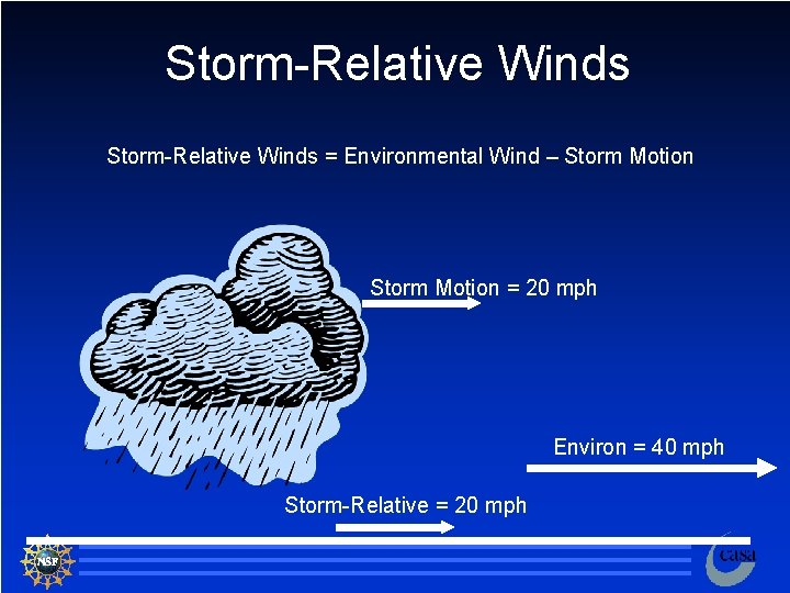
Storm-Relative Winds = Environmental Wind – Storm Motion = 20 mph Environ = 40 mph Storm-Relative = 20 mph 105

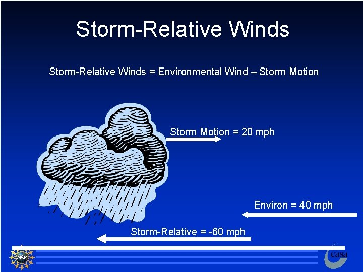
Storm-Relative Winds = Environmental Wind – Storm Motion = 20 mph Environ = 40 mph Storm-Relative = -60 mph 106

The Only Thing that EVER Matters is the Storm-Relative Wind 107

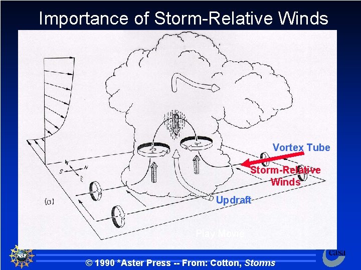
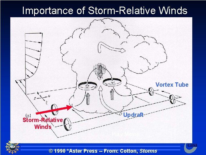
Importance of Storm-Relative Winds Want to intensify the cyclonic vortex on the south side Vortex Tube Updraft Play Movie © 1990 *Aster Press -- From: Cotton, Storms 108

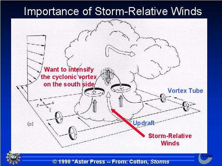
Importance of Storm-Relative Winds Want to intensify the cyclonic vortex on the south side Vortex Tube Updraft Storm-Relative Winds Play Movie © 1990 *Aster Press -- From: Cotton, Storms 109

Importance of Storm-Relative Winds Vortex Tube Updraft Play Movie © 1990 *Aster Press -- From: Cotton, Storms 110

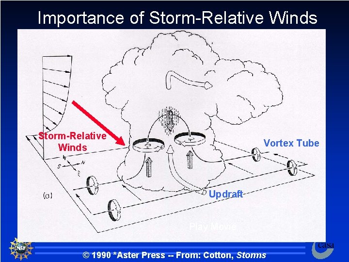
Importance of Storm-Relative Winds Vortex Tube Storm-Relative Winds Updraft Play Movie © 1990 *Aster Press -- From: Cotton, Storms 111

Importance of Storm-Relative Winds Vortex Tube Storm-Relative Winds Updraft Play Movie © 1990 *Aster Press -- From: Cotton, Storms 112

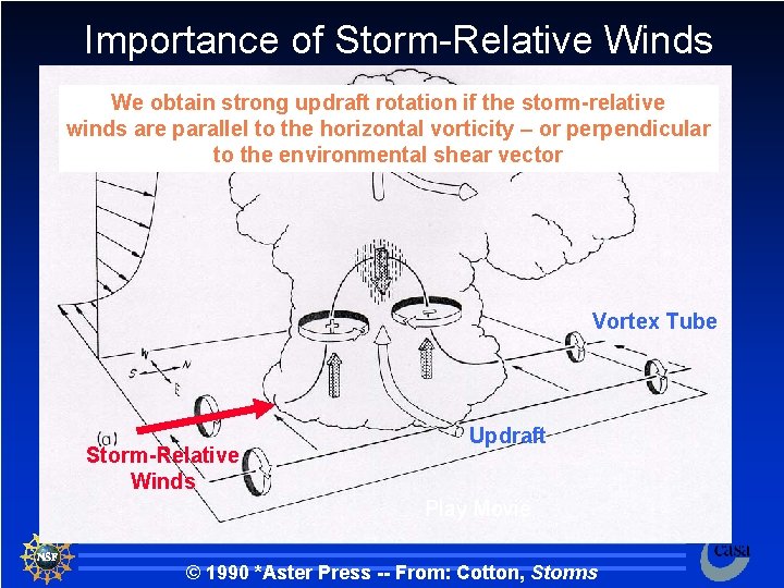
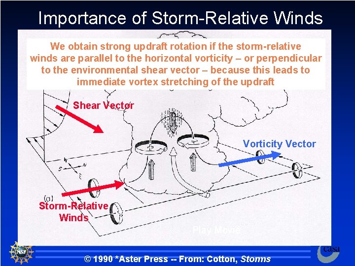
Importance of Storm-Relative Winds We obtain strong updraft rotation if the storm-relative winds are parallel to the horizontal vorticity – or perpendicular to the environmental shear vector Vortex Tube Storm-Relative Winds Updraft Play Movie © 1990 *Aster Press -- From: Cotton, Storms 113

Vertical Wind Shear Up Westerly Winds Increase in Speed with height North East 114

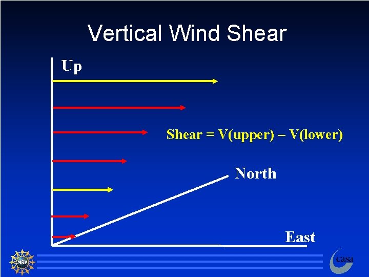
Vertical Wind Shear Up Shear = V(upper) – V(lower) North East 115

Vertical Wind Shear Up Shear = V(upper) – V(lower) North East 116

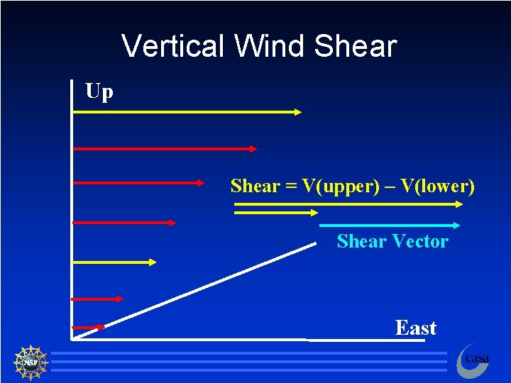
Vertical Wind Shear Up Shear = V(upper) – V(lower) Shear Vector East 117

Development of Mid-Level Rotation Up Note that the vorticity vector points 90 deg to the left of the shear vector North Shear Vector East 118

Importance of Storm-Relative Winds We obtain strong updraft rotation if the storm-relative winds are parallel to the horizontal vorticity – or perpendicular to the environmental shear vector – because this leads to immediate vortex stretching of the updraft Shear Vector Vorticity Vector Storm-Relative Winds Play Movie © 1990 *Aster Press -- From: Cotton, Storms 119

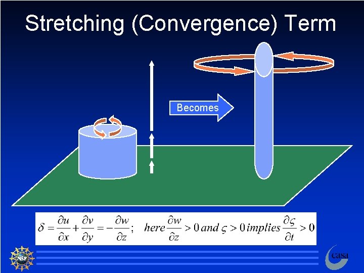
Stretching (Convergence) Term Becomes 120

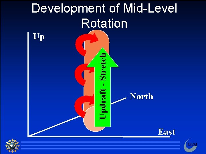
Development of Mid-Level Rotation Updraft - Stretch Up North East 121

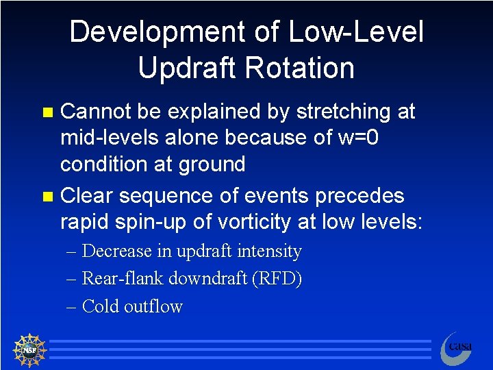
Development of Low-Level Updraft Rotation Cannot be explained by stretching at mid-levels alone because of w=0 condition at ground n Clear sequence of events precedes rapid spin-up of vorticity at low levels: n – Decrease in updraft intensity – Rear-flank downdraft (RFD) – Cold outflow 122

Supercell Structure Forward Flank Downdraft Tornado Rear Flank Downdraft Flanking Line/ Gust Front Mesocyclone Gustnado Inflow © 1993 Oxford University Press -- From: Bluestein, Synoptic-Dynamic Meteorology -- Volume II: Observations and Theory of Weather Systems 123

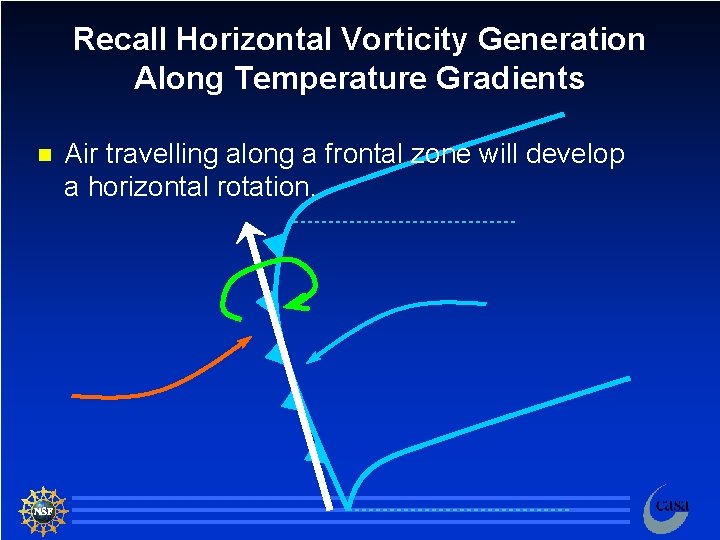
Recall Horizontal Vorticity Generation Along Temperature Gradients n Air travelling along a frontal zone will develop a horizontal rotation. 124

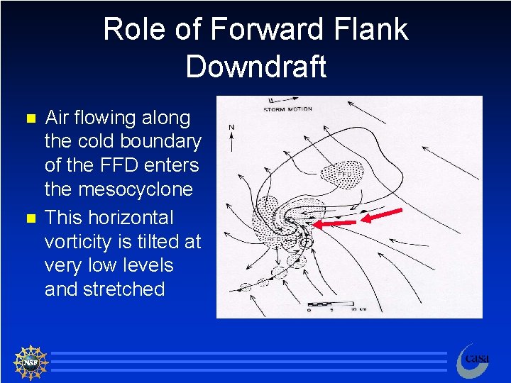
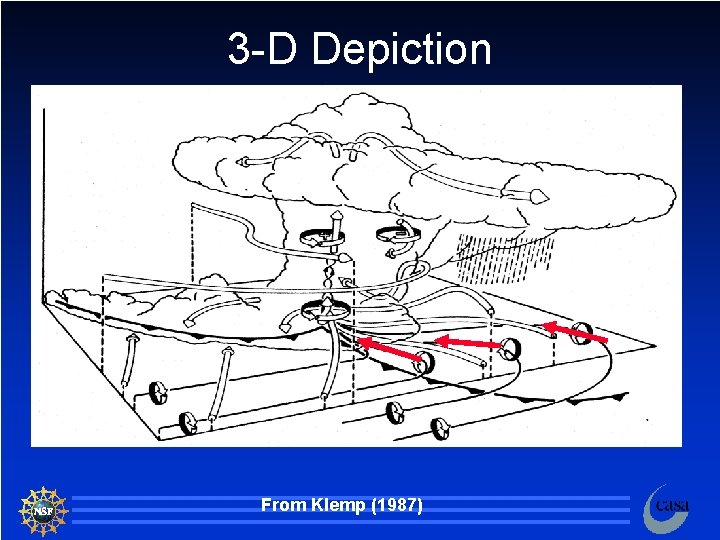
Role of Forward Flank Downdraft n n Air flowing along the cold boundary of the FFD enters the mesocyclone This horizontal vorticity is tilted at very low levels and stretched 125

3 -D Depiction From Klemp (1987) 126