Storms Storms Storms vary immensely depending on whether



- Slides: 27

Storms

Storms �Storms vary immensely depending on whether they’re: warm or cold, coming off the ocean or off a continent, occurring in summer or winter, and many other factors. �The effects of storms also vary depending on whether they strike a populated area or a natural landscape.

How do Thunderstorms Form? �Thunderstorms form when ground temperatures are high ordinarily in the late afternoon or early evening in spring and summer.

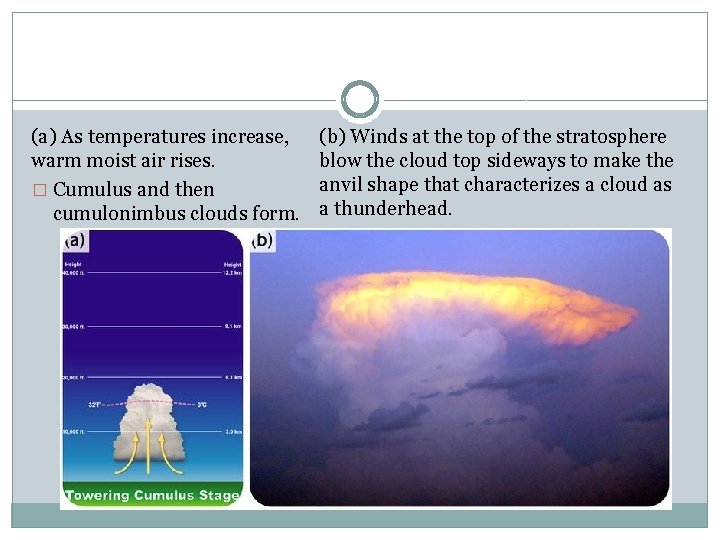
(a) As temperatures increase, warm moist air rises. � Cumulus and then cumulonimbus clouds form. (b) Winds at the top of the stratosphere blow the cloud top sideways to make the anvil shape that characterizes a cloud as a thunderhead.

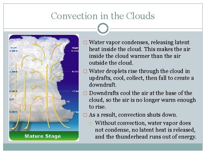
Convection in the Clouds � Water vapor condenses, releasing latent heat inside the cloud. This makes the air inside the cloud warmer than the air outside the cloud. � Water droplets rise through the cloud in updrafts, cool, collect, then fall to create a downdraft. � Downdrafts cool the air at the base of the cloud, so the air is no longer warm enough to rise. � As a result, convection shuts down. Without convection, water vapor does not condense, no latent heat is released, and the thunderhead runs out of energy.

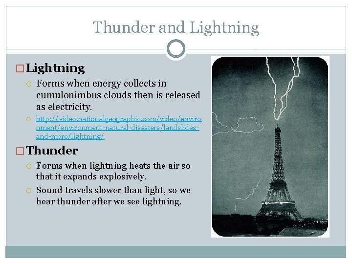
Thunder and Lightning � Lightning Forms when energy collects in cumulonimbus clouds then is released as electricity. http: //video. nationalgeographic. com/video/enviro nment/environment-natural-disasters/landslidesand-more/lightning/ � Thunder Forms when lightning heats the air so that it expands explosively. Sound travels slower than light, so we hear thunder after we see lightning.

Tornadoes �are violently rotating columns of air that descend from a thunderstorm to the ground. �form at the front of severe thunderstorms

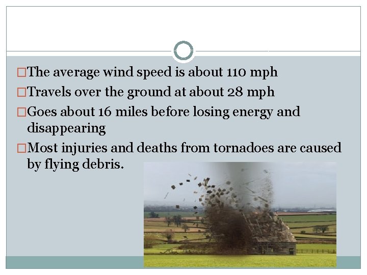
�The average wind speed is about 110 mph �Travels over the ground at about 28 mph �Goes about 16 miles before losing energy and disappearing �Most injuries and deaths from tornadoes are caused by flying debris.

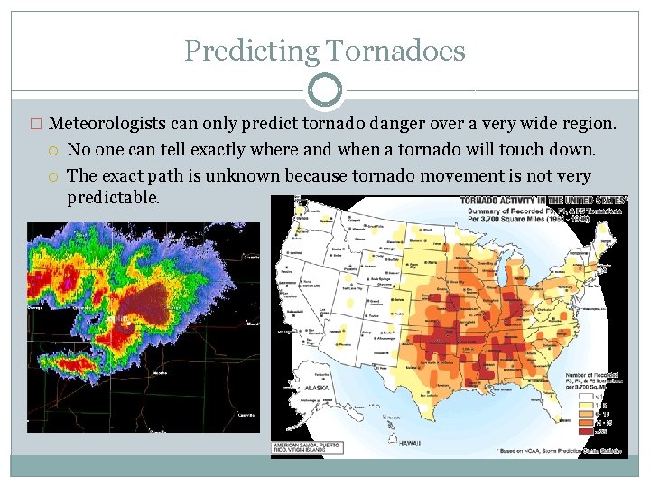
Predicting Tornadoes � Meteorologists can only predict tornado danger over a very wide region. No one can tell exactly where and when a tornado will touch down. The exact path is unknown because tornado movement is not very predictable.

Watch vs. Warning �Tornado Watch- conditions are favorable for severe thunderstorms to form; may be capable of producing a tornado �Tornado Warning- issued once a tornado is sighted on radar, its path is predicted and a warning is issued to people in that area. 3 D radar of the Moore, Okla. , tornado from May 2013

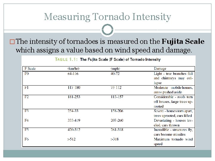
Measuring Tornado Intensity � The intensity of tornadoes is measured on the Fujita Scale which assigns a value based on wind speed and damage.

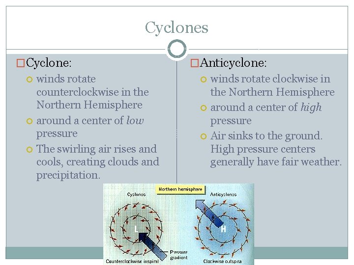
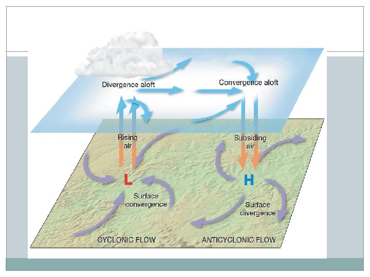
Cyclones �Cyclone: winds rotate counterclockwise in the Northern Hemisphere around a center of low pressure The swirling air rises and cools, creating clouds and precipitation. �Anticyclone: winds rotate clockwise in the Northern Hemisphere around a center of high pressure Air sinks to the ground. High pressure centers generally have fair weather.


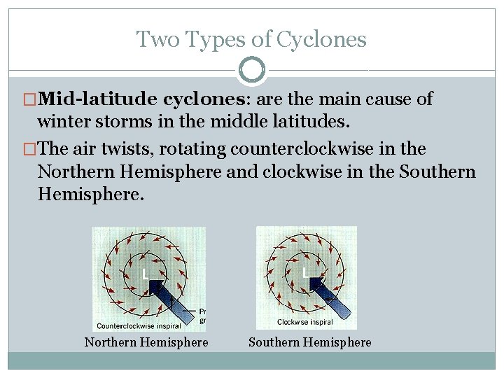
Two Types of Cyclones �Mid-latitude cyclones: are the main cause of winter storms in the middle latitudes. �The air twists, rotating counterclockwise in the Northern Hemisphere and clockwise in the Southern Hemisphere. Northern Hemisphere Southern Hemisphere

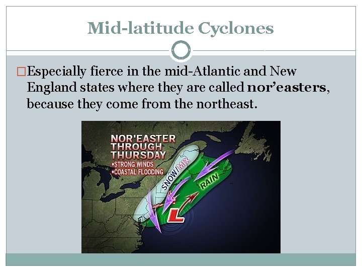
Mid-latitude Cyclones �Especially fierce in the mid-Atlantic and New England states where they are called nor’easters, because they come from the northeast.

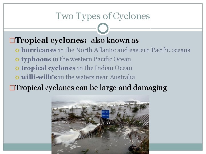
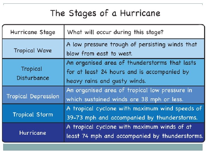
Two Types of Cyclones �Tropical cyclones: also known as hurricanes in the North Atlantic and eastern Pacific oceans typhoons in the western Pacific Ocean tropical cyclones in the Indian Ocean willi-willi's in the waters near Australia �Tropical cyclones can be large and damaging

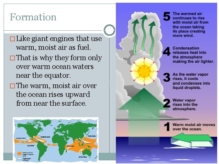
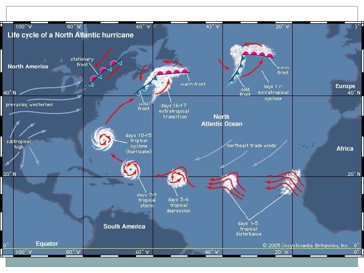
Formation � Like giant engines that use warm, moist air as fuel. � That is why they form only over warm ocean waters near the equator. � The warm, moist air over the ocean rises upward from near the surface.

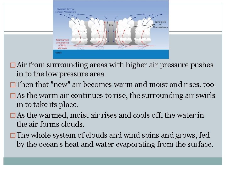
� Air from surrounding areas with higher air pressure pushes in to the low pressure area. � Then that "new" air becomes warm and moist and rises, too. � As the warm air continues to rise, the surrounding air swirls in to take its place. � As the warmed, moist air rises and cools off, the water in the air forms clouds. � The whole system of clouds and wind spins and grows, fed by the ocean's heat and water evaporating from the surface.

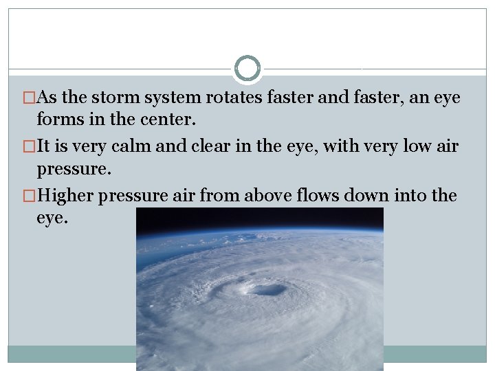
�As the storm system rotates faster and faster, an eye forms in the center. �It is very calm and clear in the eye, with very low air pressure. �Higher pressure air from above flows down into the eye.


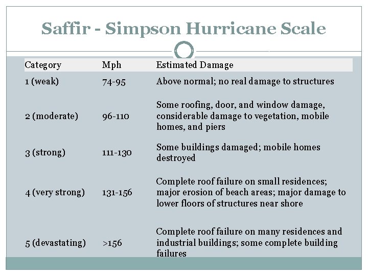
Saffir - Simpson Hurricane Scale Category Mph Estimated Damage 1 (weak) 74 -95 Above normal; no real damage to structures 2 (moderate) 96 -110 Some roofing, door, and window damage, considerable damage to vegetation, mobile homes, and piers 3 (strong) 111 -130 Some buildings damaged; mobile homes destroyed 131 -156 Complete roof failure on small residences; major erosion of beach areas; major damage to lower floors of structures near shore >156 Complete roof failure on many residences and industrial buildings; some complete building failures 4 (very strong) 5 (devastating)

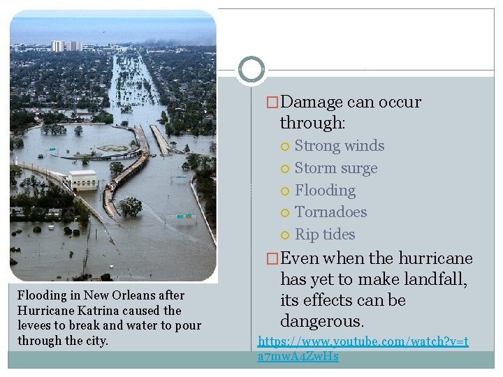
• NASA IN KATRINA'S WAKE �Damage can occur through: Strong winds Storm surge Flooding Tornadoes Rip tides �Even when the hurricane Flooding in New Orleans after Hurricane Katrina caused the levees to break and water to pour through the city. has yet to make landfall, its effects can be dangerous. https: //www. youtube. com/watch? v=t a 7 mw. A 4 Zw. Hs

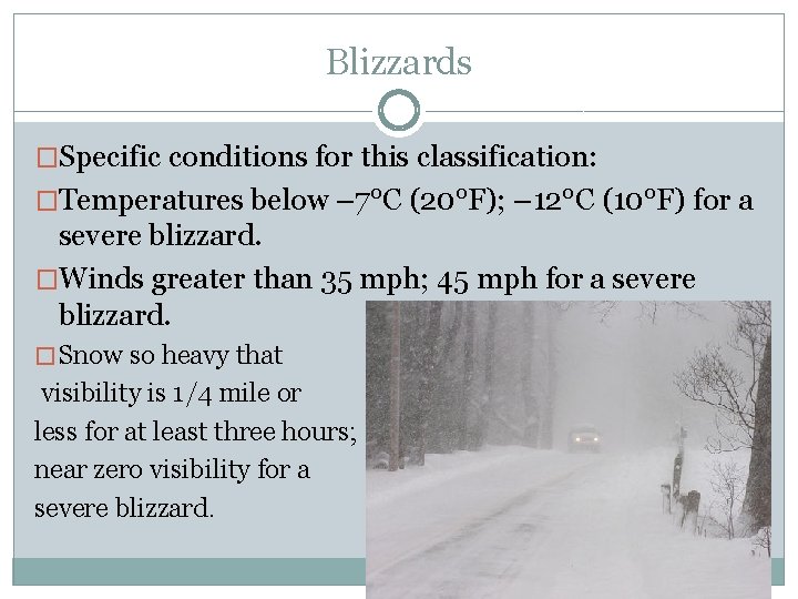
Blizzards �Specific conditions for this classification: �Temperatures below – 7°C (20°F); – 12°C (10°F) for a severe blizzard. �Winds greater than 35 mph; 45 mph for a severe blizzard. � Snow so heavy that visibility is 1/4 mile or less for at least three hours; near zero visibility for a severe blizzard.

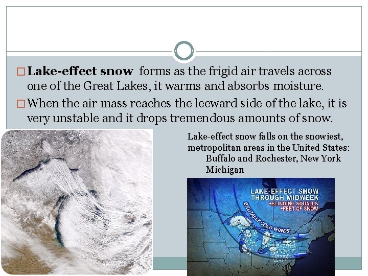
� Lake-effect snow forms as the frigid air travels across one of the Great Lakes, it warms and absorbs moisture. � When the air mass reaches the leeward side of the lake, it is very unstable and it drops tremendous amounts of snow. Lake-effect snow falls on the snowiest, metropolitan areas in the United States: Buffalo and Rochester, New York Michigan

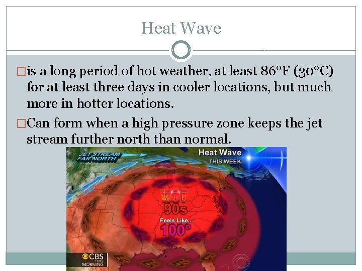
Heat Wave �is a long period of hot weather, at least 86°F (30°C) for at least three days in cooler locations, but much more in hotter locations. �Can form when a high pressure zone keeps the jet stream further north than normal.

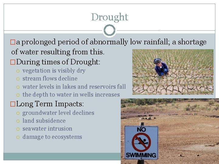
Drought �a prolonged period of abnormally low rainfall; a shortage of water resulting from this. �During times of Drought: vegetation is visibly dry stream flows decline water levels in lakes and reservoirs fall the depth to water in wells increases �Long Term Impacts: groundwater level declines land subsidence seawater intrusion damage to ecosystems