Latin America Geography Overview of Latin America Latin



- Slides: 79

Latin America Geography

Overview of Latin America

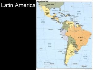
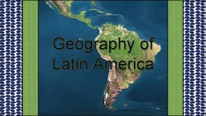
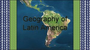
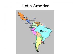
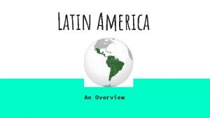
Latin America • Begins at the Rio Grande River on the southern border of the United States and extends to the southern tip of South America. • Covers 7, 900, 000 square miles or 16% of the earth’s surface

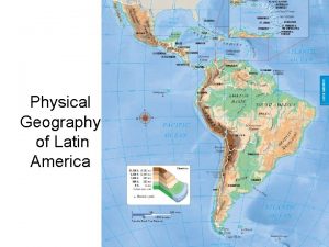
The Land • Mountains – Mexico has three mountain ranges – West Indies islands are the tops of volcanic mountains – The Andes Mountains stretches along the west coast of South America • Plains – Cover the coasts of Mexico and Central America – Two inland plains found inside South America • Pampas of Argentina and llanos of Colombia and Venezuela

The Land • Rivers – Contains five rivers including the Amazon – The Amazon stretches 4, 000 miles and is the longest river in the Western Hemisphere. • Natural Resources – Oil and natural gas are prevalent in Mexico and Venezuela – Other resources found are copper, iron ore, silver, and lead. – Rich soil allows farmers to grow grains, fruit, and coffee.

Climate and Vegetation • Elevation – Low elevation-hot and humid with green tropical vegetation – Higher elevation- the climate becomes milder and the temperature becomes cooler – Highest elevation- very little plant life (snow or frost) • Rainforests – Cover the lowland areas of Latin America – Largest is in Brazil in the Amazon basin – Found on the east coast of Central America and some of the Caribbean islands

Economy • Based mainly on agriculture • Farmers grow coffee, bananas, and sugarcane • Latin America is a top cattle raising region in the world • Service industry and manufacturing is growing

The People • Population- 500 million people (9%) • 70% live in cities and along the coastlines • Very diversified (many different groups of people) • Democratic governments have emerged and continue to emerge.


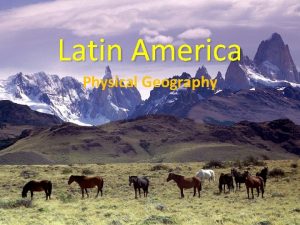
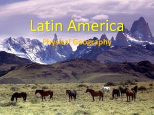
Latin America • Physical geography varies – Low-lying plains and vast water systems – Beauty and magnificence of the high rugged peaks of the Andes mountains

Location and Basic Facts • Located in the Western Hemisphere, south of the United States • 8 million square miles of land (16% of the world’s land surface) • Divided into three sub-regions: – Middle America – The Caribbean – South America

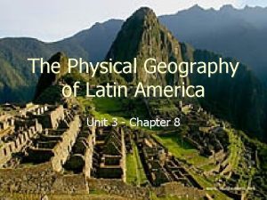
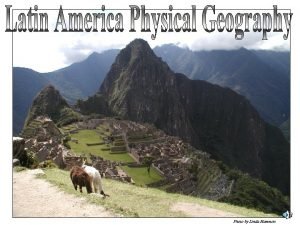
Mountains and Plateaus • The Andes mountains are the most distinctive landforms in this region • Located along the Pacific “Ring of Fire” • Plate movement still occurs causing earthquakes and volcanic eruptions • People have settled into the mountain region and mostly plateaus

Mountains and Plateaus • The cooler climate and rich resources drew settlers in • These regions were at one time very isolated • Technology (cell phones, tv, and internet are breaking down physical barriers

Mountains in Middle America and the Caribbean • Sierra Madre mountain ranges are surrounded by the Mexican plateau • Mild climate, fertile volcanic soil, and rainfall have attracted settlers for many years • The Central Highlands is a chain of volcanic peaks in which many islands in the Caribbean Sea are part of

Andes of South America • Stretch 4, 500 miles along the western edge of South America • The longest mountain chain and one of the tallest in the world

Highlands of Brazil • Mato Grosso Plateau- sparsely populated plateau of forests and grasslands – Brazil, Bolivia, Peru • Brazilian Highlands- spans several climate and vegetation zones – Key place to raise livestock

Figure 1

Figure 2

Figure 3

Figure 4

Figure 5

Figure 6

Chapter 9 Latin America Mr. Jeremy Rinkel

Mexico


Bridging Two Continents • Land bridge- a narrow strip of land that joins two larger landmasses • Connects North America and South America • Mexico is a peninsula or piece of land surrounded by water on three sides.

Mexico “Land of the Shaking Earth” • Very rugged landscape • Situated over various plates which caused the formation of mountains and volcanoes. • Earthquakes occur very frequently • Mount Popocatepetl “smoky mountain” – Famous volcano named by Aztec Indians

Mountains and Plateau • Mountain Ranges – Sierra Madre Occidentl (runs north and south along western Mexico near the Pacific Ocean) – Sierra Madre Oriental (runs along the eastern side of Mexico – Sierra Madre del Sur (southwestern Mexico) • Plateau of Mexico (covers 40% of Mexico) – Northern part is desert and grassy plains – Southern part rises in elevation with basins – Basins are broad, flat valleys.

Coastal Lowlands • Stretch along the Pacific Ocean and the Gulf of Mexico – Rivers flow through the coastal plains – The Rio Grande forms the border with the U. S. and drains in the Gulf of Mexico

Climate • Latitude is the location north or south of the equator • The Tropic of Cancer runs through the center of Mexico • Mexico is usually warm year around

Climate • Altitude zones • Hot Land • Temperate Land • Cold Land

The Economy • Economic Regions – Service industries- is a business that provides services to people instead of making goods. • Three economic regions – Central Mexico – The North – The South

Farming in Mexico • Only 11% of the land is fertile for farming because of the mountains, deserts, and rainforests • Farmers grow: coffee, corn, cotton, oranges, and sugarcane.

Central Mexico • The economic heart of the country • Home to half of Mexico’s population • Has favorable conditions for farming • Cities in Central Mexico – – Mexico City Guadalajara Leon Puebla

The North • Includes Baja California and the northern part of the plateau of Mexico • Too dry to farm, but farmers irrigate to grow – Cotton, fruits, cereals, and vegetables • Ranchers raise – Cattle, sheep, goats, and pigs – Vaqueros- cowhands developed the tools to herd, rope and brand cattle.

The North • Cities – Monterrey (steel, copper, lead, and zinc) • Maquiladoras- are factories that assemble parts shipped from other countries – Assemble automobiles, stereo systems, computers, and other electronic devices

The South • Stretches from Mexico City to the Yucatan Peninsula. • Poorest people of Mexico live in this area • Subsistence farm- is a farm that produces only enough to support a family’s needs • Plantations (in the valleys)- large farms that raise a single crop for money. – Rich farmers grow coffee and sugarcane • Tourism is very popular in the South

Economic Challenges • Mexico has become an industrialized country – Describes a country in which industry has replaced farming as the main economic activity • Challenges due to industrialization – – Conserving land Controlling pollution Creating new jobs Increasing trade with other countries

Pollution • Mountains surround Mexico City blocking the flow of air leaving smog. • Smog- is fog mixed with smoke and chemicals. • The city sometimes shuts down and people must stay indoors • Thousands of acres of forest are burned to make room for new fields for crops

Population Changes • Mexico’s population is growing twice as fast as the United States • Mexico cannot provide enough jobs • 98 million people live in the southern part of the Plateau of Mexico – Resources are strained with so many people living in this area • Many people move to the U. S. to seek employment

Free Trade • North American Free Trade Agreement – Joint agreement between the U. S. , Canada, and Mexico (1993) – Allows money to move freely among these three countries – Has created many new jobs in Mexico

Native Americans • The first people came from Asia • The Maya flourished in Yucatan – Lived during 250 A. D to 900 A. D. – Built cities around towering temples in the rainforest • The Aztecs built the city Tenochtitlan – Mexico City is located in this area – Were fierce warriors, builders and traders – Had marketplaces filled with pottery, baskets, cloth, gold, and silver

The Spanish Heritage • Hernan Cortes- arrived in Mexico in 1519. • Mexico remained a Spanish colony for nearly 300 years • The Spaniards enslaved the Native Americans and had them work the fields and the mines • Mestizo is a person with mixed Native American and European heritage • 60% are mestizos 30% Native American

Modern Mexico • Gained its freedom from Spain in 1821 • Revolution began in 1910 because people were discontent of the way of life especially poor farmers • 1920 - Mexico became a federal republic – 31 states share powers • 1990 s- people demanded reform – Other parties began to rule and win elections instead of just one political party

City Life • ¾ of the population in Mexico live in cities • Older homes are made of adobe (sundried or clay bricks) • Houses in poor areas are made of scrap wood, metal, or whatever material can be found • Most of these homes lack electricity and running water

Country Life • Most Mexican villages are very poor • Homes are built of cement blocks, with a red tiled roof, sheet metal, or clay • Most villages have a marketplace where clothes, food, baskets, and pottery are sold

The Arts and Recreation • Painters and Writers- have created many national treasures – Produced many murals or wall paintings • Music and Dance – Traditional music is played by a Mariachi band (a singer, 2 violinists, 2 guitarists, two horn players, and a bass player) • These musicians wear colorful outfits and sombreros

The Arts and Recreation • Celebrations- fiesta (feast day) – Independence Day (September 15 & 16) – Cinco de Mayo (May 5) – Mexicans also celebrate Christmas – Foods • Sports – Soccer is the most popular sport – Bullfighting is a popular sport for tourists

Sources • http: //go. hrw. com/atlas/norm_htm/mexico. htm

Central America


The Land • • • More than 1, 000 miles north to south 300 miles wide at widest point Pacific Ocean borders the west Caribbean Sea borders the east Volcanic eruptions are common

Climate • mostly tropical, but varies from country to country • Mountains and highlands are dry and cool year round • Pacific lowlands (tropical savanna) – May-Nov warm and rainy – Dec-April hot and dry • Eastern lowlands (tropical rainforest year round) – Hurricanes (fierce storms with winds of more than 74 m. p. h.

The Economy • Farming – Plantations- large farms that grow produce for sale or for export (coffee, bananas, sugar cane) – Substience farmer- raises small amount of crops to provide for family, extras are sold at the local market

The Economy • Rainforests (provide many great treasures) – Chicle- a substance used in making chewing gum. – Scientists use trees and plants used for medicine or medical research • Caribbean Lowlands – Farmers have cleared rainforest areas to raise crops, which erodes nutrients – Central American governments are trying to enforce laws from the destruction of rainforest.

Industry • Few small industries • Little manufacturing due to lack of fuels • Bauxite (mineral used to make aluminum) is found in Costa Rica and Guatemala

The People • Influence of the Past – Maya Indians settled in C. A. in 250 -400 B. C. – 1400 s- Spanish settled in Central America – 1500 s- Spanish claimed land forced Native Americans to work in plantations – 1600 s- British settled in Belize-enslaved Africans to work as slaves in the rainforest

Independence • Most countries gained in 1821 • In 1903, with U. S. help, Panama won independence from Colombia • Belize won independence from U. K. in 1981 • This area has been challenged by revolutions since the mid 1800 s.

The Population Today • 35 million people • Spanish is the official language except for English speaking Belize • 50% live on farms or small towns • People in urban areas work in manufacturing or service industry jobs • Those living on the coast harvest shrimp, lobster, and other seafood for export


Central America includes seven countries: • • Belize Guatemala Honduras El Salvador Nicaragua Costa Rica Panama

Landforms • • Many active volcanoes. Some are dormant. Dormant—Not likely to erupt. Chain of volcanic mountains, called the Central Highlands, stretch along most of the region. • Volcanic material has left rich, fertile soil. • Farmers grow coffee, bananas, sugarcane, & other crops.

Guatemala • Volcanoes • 40% live like their ancestors. • These people do not leave their country’s borders. • Guatemalans who speak Spanish & practice European ways are called ladinos. • Live in cities. • Civil War from 1960 -1996.

Costa Rica • Offers one of the highest standards of living in the world. • High literacy rates. • Most are of Spanish descent. • Few wars. • Lots of schools. • Major export is coffee.

Panama • 1903 –U. S. helped Panama gain independence. • U. S. built Panama Canal. (1914) • U. S. controlled the canal and the land of each side until 2000, when they gave it back to Panama. • 50% of population live & work near the canal. • Population is a mix of Spanish and Native American ancestry.

El Salvador • Main crops are coffee, sugarcane, corn, cotton, & shrimp. • Population of about six million. • Only 53% have access to safe water. • 1% are indigenous to the region. • Indigenous—native to the region.

Caribbean

The Caribbean • All Caribbean islands are located in the Caribbean Sea. • Geographers call a group of islands an archipelago. • Many of the islands are actually the tops of a mountain range that sit on the bottom of the sea.

The Caribbean • Some islands in the Caribbean are still active volcanoes. • Lava can help people as well as hurt. • When lava breaks down, it forms good soil for farming. • Some of the islands are not volcanic. • These nonvolcanic islands are called atolls. • Atoll---A chain of islands made up of coral.

Caribbean Islands • Bahamas are southeast of Florida. • Greater Antilles (northern Caribbean) include Jamaica, Cuba, Hispaniola (Haiti/Dominican Republic), and Puerto Rico. • Lesser Antilles (southern Caribbean) include a number of smaller islands.

Climate & Economy • Constant tropical savanna climate. • Temperatures between 70 degrees & 85 degrees year round. • Farming & tourism are the most important economic activities. • Many islands rely too heavily on just one crop.

The People • 1 st permanent European settlement in the Western Hemisphere was established in 1498 in the Dominican Republic. • Most people in the islands are descendents of Africans. • Europeans brought millions of Africans to the islands to work as slaves on sugarcane plantations.

Religion • Most of the people of the Caribbean are Christians. • Some people of African descent believe in voodoo. • Followers of voodoo believe that good & evil spirits affect daily life. • Voodoo is strongest in Haiti.

Independence • During the 20 th Century, most of the smaller Caribbean islands won their freedom from colonial rule. • Cuba is the only country in the Western Hemisphere with a communist government. • Communism---A government system in which there is no private property; the government owns & controls the land & goods

Cuba • • • 90 miles south of Florida. Large producer of sugar. Also grow coffee, tobacco, rice, & fruit. Most farmers work on cooperatives. Cooperatives—Farms owned & operated by the government.

Cuba • Leader is Fidel Castro. – Currently Raul Castro (Fidel’s brother is in power) • Most Cubans live in poverty.

Haiti • Shares the island of Hispaniola with the Dominican Republic. • More than 90% of population is of African descent. • People are poor & live in rural areas. • Coffee is a major crop. • Won independence in 1804 (2 nd in the Western Hemisphere after the U. S. )

Puerto Rico • Spanish colony from 1508 until 1898. • Under control of the U. S. since 1898 (Spanish-American War. ) • Has been a commonwealth since 1952. • Commonwealth—A partly self-governing territory. • More industry than any other island in the West Indies.

Puerto Rico • Agriculture & tourism make up the majority of Puerto Rico’s economy. • Factories make medicine, chemicals, clothing. • Capital is San Juan.
 Why is called latin america
 Physical features of south america
 Voluntary trade cloze notes 1
 South america highlands
 Chapter 9 cultural geography of latin america answers
 Traje tipico de soloma
 Chapter 8: the physical geography of latin america answers
 Amazon river
 How to write an frq for ap human geography
 5 themes of geography ap human geography
 Ap human geography political geography test
 Plateau facts
 Latin america webquest
 Lesson 1 physical geography of south america
 Rap of the map of the us
 America asia africa
 Whats an onomatopeia
 Happening body art
 Languages in china
 One minute sentence
 South american map
 What is the literacy rate in latin america
 Revolutions in europe and latin america section 2 quiz
 Physical features of pakistan
 Who created the griffin ford model
 What is the encomienda system
 Latin america physical features
 Largest economy in latin america
 Great leap forward communes
 Latin america physical features
 Chapter 25 lesson 4 imperialism in latin america
 Panama acrostic poem
 Caste system in latin america
 Peninsulares creoles mestizos
 Discontent in latin america worksheet answers
 Latin america physical map baja california
 Class system in latin america
 Landforms in latin america
 Latin america 1500 to 1800
 Chapter 11 today's issues in latin america
 Chapter 25 the consolidation of latin america
 How were nationalist revolts in latin america
 Mendel latin america 15m series infinity
 Latin american regions
 Bolivia christmas food
 Lad latin america
 Street children in latin america
 Revolutions in europe and latin america
 Religious syncretism in latin america
 Latin america map with capitals
 Social class pyramid of latin america
 Distance decay definition geography
 Urban model latin america
 Latin america model
 Dollarization in latin america
 Unit 3 latin america
 Argentina climate zones
 Linda hammon
 How were nationalist revolts in latin america
 Latin america dbq
 Subsistence farming in latin america
 The bather juan cordero
 Colonial empires in latin america
 Public relations latin america
 Www.overview
 Maximo overview
 Universal modeling language
 Uml overview
 Retail vertical
 Figure 12-1 provides an overview of the lymphatic vessels
 Major veins of the body
 Texas recapture districts
 Walmart operations
 Stylistic overview of architecture
 Difference between sa/sd and jsd
 Spring framework overview
 Nagios tactical overview
 Market overview managed file transfer solutions
 Nfv vs sdn
 Sbic program

