Physical Geography of Latin America Latin America covers


 Tropical Climate Zones -rainforests: dense forests made up on different species of")
 Dry Climate Zones -Only found in Mexico and South America -semiarid: generally")
 -Also in Southern")
 Mid-Latitude Climate Zones -mediterranean: hot, dry summers and cool, wet winters -Located")

- Slides: 21
Physical Geography of Latin America
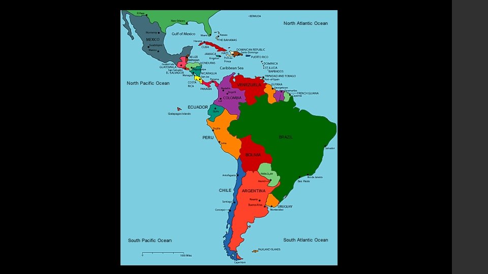
-Latin America covers 7, 000 miles -From the border of the U. S. and Mexico to Tierra del Fuego -Also includes the Caribbean Islands
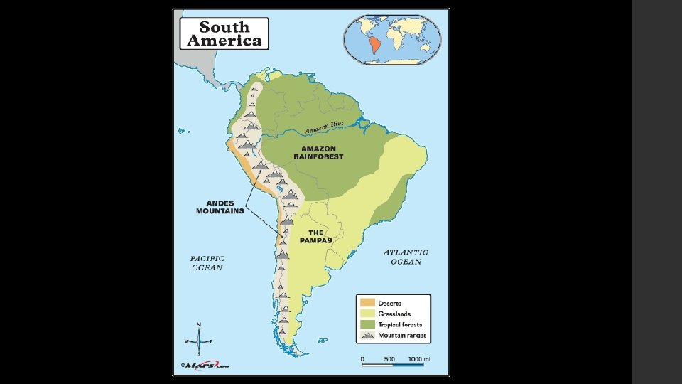
-Andes Mountains: part of mountain chain that includes the Rocky Mountains and the Sierra Madres -Barrier for movement into the interior of South America -More settlement has occurred along eastern and northern coasts
-Llanos: grassy, treeless areas used for farming and livestock grazing found in Colombia and Venezuela -Cerrado: flat plains found in the interior of Brazil -Moderate rainfall makes it suitable for farming -Pampas: grasslands with rich soil located in Northern Argentina and Uruguay -Main products are cattle and wheat grain
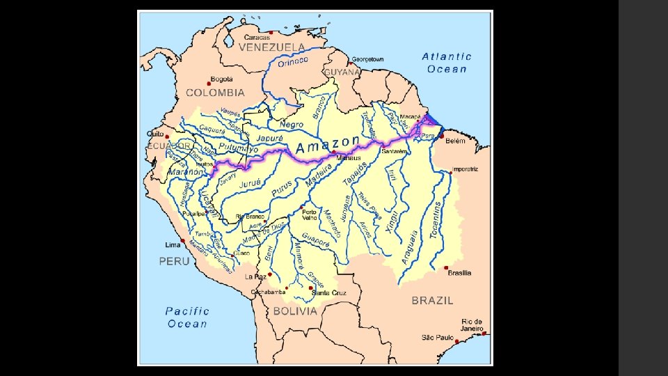
River Systems -Orinoco River: flows more than 1, 500 miles, partly along the Colombia/Venezuela border -Amazon River: flows about 4, 000 miles from west to east, empties into Atlantic Ocean -Flows across Brazil -Has over 1, 000 tributaries
Natural Resources -Mineral resources: gold, silver, iron, and copper -Many minerals are mined in Latin America and shipped to other areas of the world for production
Natural Resources -Energy resources: oil, coal, natural gas, and hydroelectric power -Venezuela and Mexico have major oil reserves -Brazil is rich in hydroelectric power because of its many rivers -Caribbean Islands: main resource=tourism
Climate and Vegetation of Latin America
-Climate is extremely varied -Ranges from hot and humid conditions of the Amazon Rainforest to the dry desert regions of Northern Mexico
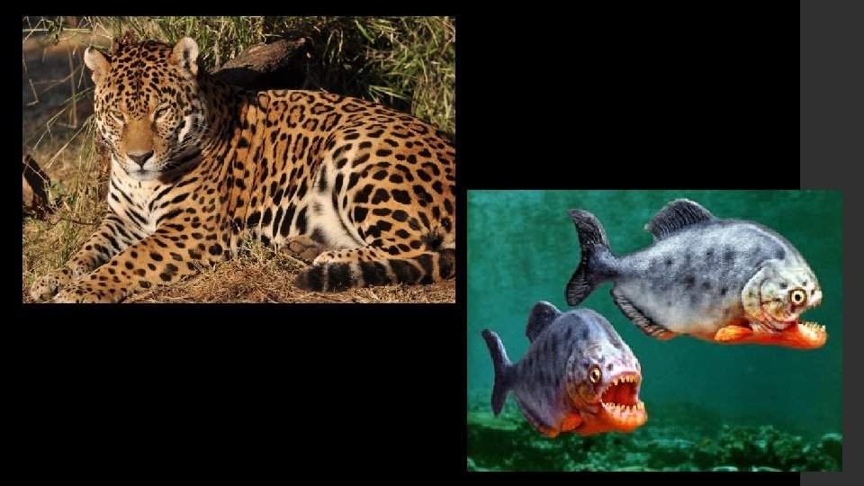
1. ) Tropical Climate Zones -rainforests: dense forests made up on different species of trees -Climate is hot and rainy yearround -Amazon rainforest covers more than 2, 000 square miles of South America -Contains many exotic plants and animals, such as jaguars and piranhas
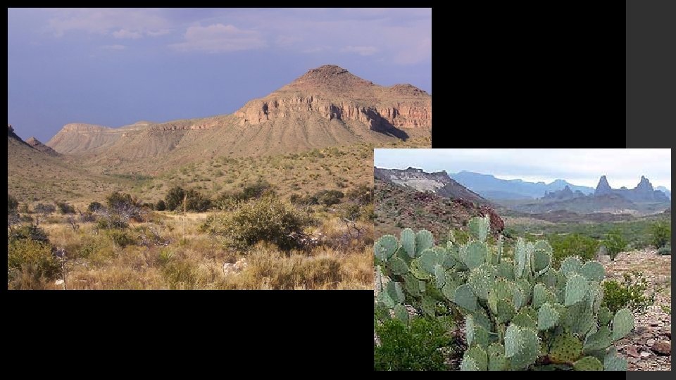
2. ) Dry Climate Zones -Only found in Mexico and South America -semiarid: generally dry, with some rain -Grass-covered plains found in this region -Found in Mexico, Brazil, Uruguay, and Argentina
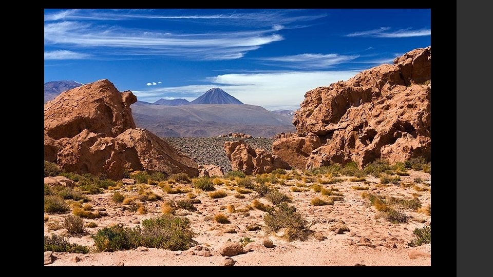
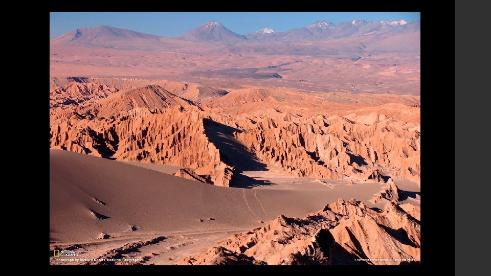
-desert: found in Northern Mexico as well as Chile (Atacama Desert) -Also in Southern Argentina (Patagonia) -Vegetation is mainly shrubs growing in gravel or sand
3. ) Mid-Latitude Climate Zones -mediterranean: hot, dry summers and cool, wet winters -Located along parts of the Western coast of Chile -similar to weather conditions in some parts of California
-marine west coast: cool, rainy winters and mild, rainy summers -Found in parts of Chile and Argentina Southern -Similar to weather conditions in Oregon and Washington in the U. S.