TOPAZ the Arctic TEP and the Arctic GOOS


 § Real-time data set (2 -3 days")


 20 km resolution TOPAZ 3 (800 x")


 Apr. 2007 § Ice")

 § Ice model § Biogeoch.")


 § Pacific Ocean /")

 2. Gulf of")

- Slides: 39
TOPAZ the Arctic TEP and the Arctic GOOS L. Bertino, G. Evensen, K. A. Lisæter, I. Keghouche Arctic GOOS opening, Bergen, 12 th Sept. 2006
Analysis 1 st Sept. 2006 Google Earth
TOPAZ System Description Model components Assimilation method Upgrades
Motivation § Objective: § Provide short-term forecasts of physical and biogeochemical parameters targeted to users needs (primarily the offshore oil and gas industry) § Strategy § Focus on advanced data assimilation techniques § Gradual increase of resolution § Nesting on regions of higher interest § Support § TOPAZ is the Arctic component of MERSEA IP § ESA, Industry, private donation (Frank Mohn AS, Bergen)
The TOPAZ model system § TOPAZ: Atlantic and Arctic § 18 -35 km resolution § 22 vertical layers § Assimilates § SLA (4 satellite altimeters), § SST (from AVHRR), § ice concentrations (SSM/I) § Run weekly, ECMWF forcing
Ice concentration data § Passive MW (NSIDC) § Real-time data set (2 -3 days delay) § NORSEX algorithm (Svendsen et al 1983) § 37 GHz, 19 GHz § ~25 km resolution
Ice extent and ice volume Solid black line - ensemble mean Dashed black line - free run Grey - individual ensemble members
Barents Sea
TOPAZ 2 (400 x 600 x 22) 20 km resolution TOPAZ 3 (800 x 880 x 22) 11 km resolution
TOPAZ Upgrade Stronger W. Spitzberg Current TOPAZ 2 TOPAZ 3
CERSAT - IFREMER
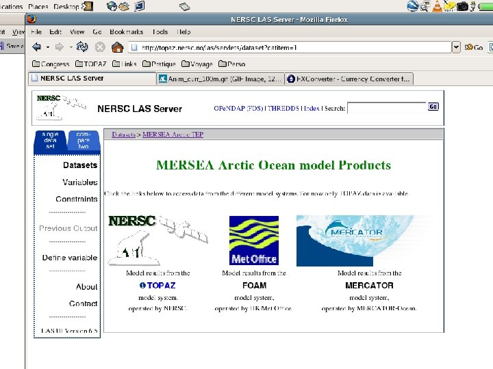
The Arctic TEP Thematic Portal Common Viewing Downloading Downscaling Validation Plan
Live Access Server
The MERSEA metrics
The MERSEA metrics § Class 1: 3 D daily averages § Class 2: Sections and moorings § Class 3: derived quantities (fluxes) § Class 4: validation to observations
Top 3 m layer
100 m depths
Validation procedures against in-situ measurements and climatology Station at the North Pole TOPAZ profiles In-situ data from CORIOLIS (Argo, XBT, …)
Status / Plan § TOPAZ: § next upgrade (TOPAZ 3) Apr. 2007 § Ice drift data assimilation § Arctic TEP § Started during the TOP 1 period (Oct. 2005) § Barents Sea model § Downscaling from TOPAZ. § Real-time since Sept. 2006. § MERSEA TOP 2 period (Apr. – Sept. 07) § Contributions from all Mersea V 2 systems § More validation metrics
Thank You
The ingredients § Models § HYCOM (U. Miami, USA) § Ice model § Biogeoch. model (AWI, D) § Observations § § Altimetry, SST (CLS, F) Sea Ice (NSIDC, USA) Sea Ice drift (Cersat, F) In-situ (CORIOLIS, F) § Data assimilation § Ensemble Kalman Filter [Evensen 1994, 2006]
Ensemble Kalman filtering a stochastic process Forecast 1 Analysis Member 1 Member 2 2 …… Member 99 1. Initial uncertainty 2. Model uncertainty 3. Measurement uncertainty 3 Observations Member 100
Assimilation update Summer Surface temperature update Ice concentration update Surface salinity update
Results from TOPAZ and nested models
Validation Salinity
Validation Temperature
Results from a nested model VOLUME TRANSPORTS BIC AW NCC How good are the boundary conditions ?
Norway-Bear Island Net transport AW: 1. 5 Sv/year (1. 7 Sv in winter and 1. 3 Sv in Summer) [Ingvaldsen et al. , 2004] Net transport NCC: 0. 5 Sv/year [Blindheim, 1989] Net transport BIC: -? ? ?
Bear Island Svalbard Recirculation within the Bear Island Trough is relatively stable at ~ 1. 0 Sv [Ingvaldsen et al. , 2002]
Svalbard – Franz Josef Land In => 0. 4 Sv Out => 0. 1 Sv [Loeng et al. , 1997] (used Russian literature)
Frans Josef Land – Novaya Zemlja In = 0 to 0. 3 Sv in Summer Out = 1. 5 Sv (between 0. 6 Sv in Summer and 2. 6 Sv in Winter) [Schauer et al. , 2002]
Kara Gate In = 0. 1 Sv Out = 0. 05 to 0. 7 Sv [Loeng et al. , 1997] (used Russian literature)
Planned upgrade TOPAZ 3
Expected improvements § Improved dynamics § Better resolution of shelf currents (esp. in the Nordic Seas) § Better fluxes in/out of the Arctic Ocean § More efficient assimilation of altimetry and hydrographic profiles. TOPAZ 2 Spitzberg Barents Sea opening TOPAZ 3 Norway
Future Perspectives § Geographical extension § Indian ocean (under development) § Pacific Ocean / South China Sea (Nansen-Zhu, Beijing) § Exhaustive model validation § In collaboration with the MERSEA gang § Real-time assimilation of more observations § § Temperature and salinity profiles (Argo program) Ice thicknesses (CRYOSAT) Sea surface salinity (SMOS / Aqua) New geoid and Mean Dynamic Topography (GOCE) § Progresses in data assimilation § Biases, non-linearity, parameter estimation § Coupling to a global system § Mercator
The end
System Applications Nested systems in 1. North Sea (N. Winther/C. Hansen) 2. Gulf of Mexico (F. Counillon) 3. Barents Sea (I. Keghouche)
Illustr. I. Kerghouche