Pilotage Things To Consider Altitude Mag Crs 0


 VFR Cruising Altitude Rules 8, 500 ft MSL 7, 500 ft")
 Flight Planning Check the Weather Process • • Select a Route")
 Magnetic Course / Cruising Altitude Magnetic Course: 008° WIND Magnetic Heading:")
 Flight Planning Check the Weather Process")
 Flight Planning Check the Weather Process • • Select a Route")
 Flight Planning Check the Weather Process • • Select a Route")

 fuel = The total fuel on board the aircraft before")

 = Fuel required to cover deviations during flight from")
")


 Flight Planning Check the Weather Process Select")


 NO Turning Radius NDB Visual Turning Point (Town) 1 ½ Turning Radius")
 100º Track NDB Change 2 ½ NM added 150 to distance 130")
 – ������������ Course Arrow • Aerodrome Control")
 • SET HEADING ขาตอไป • REPORT POSITION • CHECK ETA •")
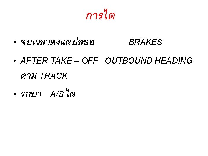
 • ขออนญาต ATC • ทำ BEFORE DESCENT CHECK")


× 60 Degrees of")


- Slides: 50
Pilotage Things To Consider • Altitude • Mag Crs 0 to 179 = Odd + 500 • Mag Crs 180 to 359 = Even + 500 B A
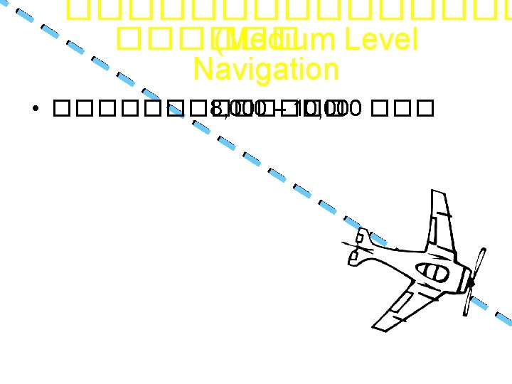
Dead Reckoning (DR) VFR Cruising Altitude Rules 8, 500 ft MSL 7, 500 ft MSL 180° - 359° Even Thousands + 500 ft Above 3, 000 ft AGL 0° - 179° Odd Thousands + 500 ft Magnetic Course Jeppesen Sanderson, Inc. 1998 All Rights Reserved Guided Flight Discovery Private Pilot Manual
Dead Reckoning (DR) Flight Planning Check the Weather Process • • Select a Route • Choose a VFR Cruising Altitude When flying course 175 and for wind correction, Flying heading 185. What is flight altitude?
Dead Reckoning (DR) Magnetic Course / Cruising Altitude Magnetic Course: 008° WIND Magnetic Heading: 355° Correct VFR Cruising Altitude: Odd Thousand Plus 500 Feet Jeppesen Sanderson, Inc. 1998 All Rights Reserved Guided Flight Discovery Private Pilot Manual
• Dead Reckoning (DR) Flight Planning Check the Weather Process
Dead Reckoning (DR) Flight Planning Check the Weather Process • • Select a Route Checkpoints - Performance - Airspace - Fuel
Dead Reckoning (DR) Flight Planning Check the Weather Process • • Select a Route • Choose a VFR Cruising Altitude • Consider Fuel Requirements
�������� Normal planning • When planning to an intended destination with alternate, the minimum amount of fuel to be on board the aircraft is the Minimum Ramp (Block) Fuel = Taxi Fuel + Trip Fuel + Contingency Fuel + Alternate Fuel + Final Reserve Fuel.
�������� • Ramp (block) fuel = The total fuel on board the aircraft before starting engines. • Taxi fuel = A standard quantity to cover APU consumption, engine start, and ground maneuvers until a start of takeoff. • Takeoff fuel = Ramp fuel minus taxi fuel.
�������� • Trip fuel = The fuel required to fly from the aerodrome of departure to the planned destination, based on planned operating conditions. This amount shall include fuel for takeoff, climb following a normally used SID giving longest distance, normal cruise, descent to initial approach fix, approach to the least favorable runway and landing.
�������� • Contingency Fuel (CF) = Fuel required to cover deviations during flight from the “Planned operating conditions” as well as to provide operational flexibility in case of inflight malfunction. When planning a flight, the CF shall be 5% of the planned trip fuel. Be reduced to a minimum of 3% of the planned trip fuel, provided an en route alternate is available
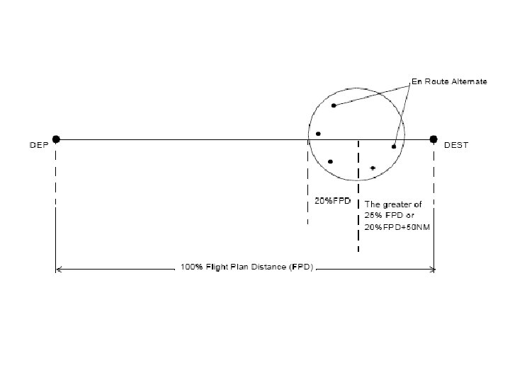
�������� • An en route alternate used for planning with reduced Contingency Fuel (CF) is an aerodrome which should be located within a circle with a radius equal to 20% of the total flight plan distance, the center of which lies on the planned route at a distance from destination 25% of the total flight plan distance, or 20% of the total flight plan distance plus 50 nm, whichever is greater.
�������� • Alternate fuel = The fuel required to fly from the planned destination to the respective alternate, based on the planned operating conditions. The alternate fuel will include fuel from the start of a missed approach following a normally used SID giving the longest distance, Climb, Long-Range Cruise, descent to main navaid, and approach to the least favorable runway and landing at alternate.
�������� • Final reserve fuel = Fuel required to fly for 30 min (Turbo Prop : 45 min) above the alternate aerodrome (or the destination when no alternate required) at: 1. Holding speed 2. 1500 ft ISA 3. Estimated weight.
ATC DETAIL • AIP: AERODROME INFORMATION PUBLISHCATION
• • • Dead Reckoning (DR) Flight Planning Check the Weather Process Select a Route Choose a VFR Cruising Altitude Consider Fuel Requirements Prepare the Nav Log v a N g o L
BC A D F G H I A. Route Column: Departure, Reporting Point, Turning Point, Check Point, Destination B. NAV Column: Freq & Code C. Report Column: RPT Call Sign D. MAG Heading Column: Magnetic Course & Drift E. Distance Section: Total Distance, LEG / Remain F. ETE/EST Total Column: Estimate Time En-Route G. ETA / ATA : Estimate Arrival / Actual Time Arrival H. Ground Speed Column: EST. GS I. Fuel Section: Total AMT Fuel, EST LEG/Remain, Actual Fuel Remain J. Position Report K. Destination Airport Information E J L.
A. Emergency Field Section B. GCI or UHF/DF Station Section: Location, Callsign C. Takeoff Data Section D. Miscellaneous Data Section
�������� ��� Flight plan • Heading • Speed • Time
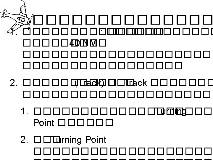
����� (Track) NO Turning Radius NDB Visual Turning Point (Town) 1 ½ Turning Radius
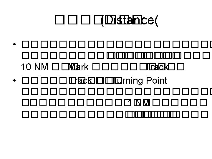
������� (Distance) 100º Track NDB Change 2 ½ NM added 150 to distance 130 120 110 160 100 Visual Turning Point (Town) 170 180 190 10 20 30 40 50 60 1 ½ Turning Radius
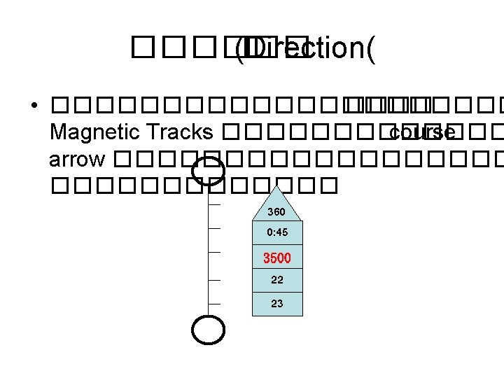
������� (Safety Heights( • ������� (Safety Heights) – ������������ Course Arrow • Aerodrome Control Boundaries • Check Points – ������������� Track
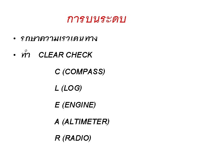
จดเลยว (TURNING POINT) • SET HEADING ขาตอไป • REPORT POSITION • CHECK ETA • เลยวถอ HEADING ใหม • แกไข ETA • ทำ CLEAR CHECK
การลดระยะสง (DESCENT PROCEDURE) • ขออนญาต ATC • ทำ BEFORE DESCENT CHECK
Lost Procedures
Lost Procedures CLIMB COMMUNICATE CONFESS COMPLY CONSERVE
One – In – Sixty Rule 60 NM A 1 ��� 60 NM 1 NM
������� Correction to parallel C Correction to converge Distance off A Distance flown Distance to fly B Correction angle to parallel X 1/60 = Distance off Distance flown Distance off Correction angle to converge X 1/60 = Distance to fly
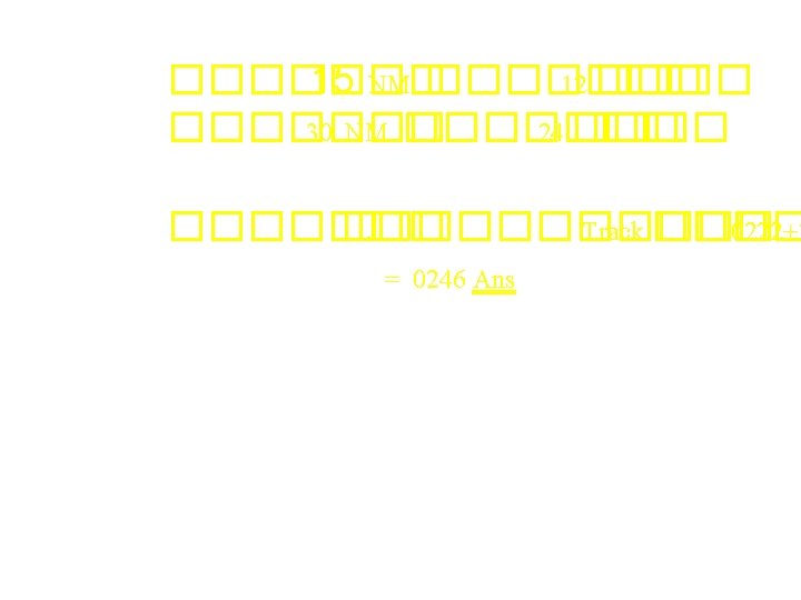
������ 02: 10 A 15 NM 8 3 1 2 NM G D H HDG 15 0 C ���� 02: 22 Correction angle to parallel X 1/60 = ���� =? B Correction to converge Correction to parallel Distance off Distance flown Distance off X 60 Distance flown Correction angle to parallel = = 2*60 15 = 8 ����
Correction angle to parallel = 8 ���� HDG ���� 150 HDG ���� 138 ������� 12 ���� Correction angle to converge = 12 -8 = 4 ������� Distance off Correction angle to converge X 1/60 = Distance to fly ��� Distance off X 60 Distance to fly = Correction angle to converge = 2*60 4 = 30 NM
• Time to Station = Time for Bearing Change (minutes)× 60 Degrees of Bearing Change • Distance to Station = Time for Bearing Change (minutes)× 60 Degrees of Bearing Change
• ���� TAS • Wind effect Effect on GS Effect on Drift
Question?
Map Reading • It is the identification of landmarks from their representation on a chart and therefore utilization of this information to fix the position of the aircraft or to establish lines of position.
Advantages and Limitation of Map Reading Advantages • The best means of checking dead reckoning • No fix is more precise than a positive identification of an accurately mapped landmark. Limitation • It cannot be used when the ground is obscured by clouds or when flying over water • Landmarks cannot always be readily identified on a chart such as at night or if the chart is incomplete or inaccurate.