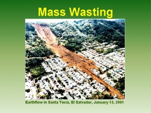
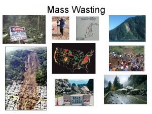
Mass Wasting Earthflow in Santa Tecia El Salvador


- Slides: 59

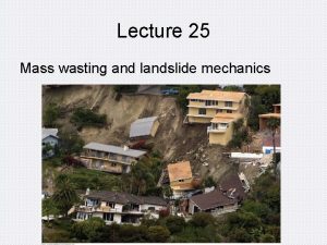
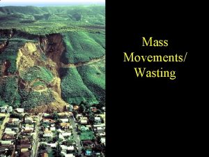
Mass Wasting Earthflow in Santa Tecia, El Salvador, January 13, 2001

Mass Wasting or Mass Movement is. . . • the movement in which – bedrock, – rock debris, – or soil – moves downslope in bulk, or as a mss, because of the pull of gravity.

Classification of Mass Wasting A. Rate of Movement : Varies from less that 1 cm/year to velocities greater than 4 km/hour Type of Material Mass wasting processes B. _________: distinguished on the basis of type of material. Debris Any unconsolidated material at Earth's 1. ____: surface. Amount of Water (or ice & snow) Influences type 2. ______________: and rate of movement.

C. Type of Movement Flow 1. _____: Mass is moving downslope as a viscous fluid.

Slide Mass remains relatively coherent, 2. _______: moving along a well-defined surface a) _______: Slump Movement along a curved surface. Also called a rotational slide. b) _______: Descending mass moves along a plane approximately parallel to the slope of the surface.

Slide Mass remains relatively coherent, 2. _______: moving along a well-defined surface a) _______: Slump Movement along a curved surface. Also called a rotational slide. b) _______: Translational Slide Descending mass moves along a plane approximately parallel to the slope of the surface.

3. _____ Fall Material free-falls or bounces down a cliff

Controlling Factors in Mass Wasting

Summary of Controls of Mass Wasting

Summary of Controls of Mass Wasting

Summary of Controls of Mass Wasting

Summary of Controls of Mass Wasting

Summary of Controls of Mass Wasting

Summary of Controls of Mass Wasting

California Mudslides Summary of Controls of Mass Wasting Even in New York State… April 2006 mudslide on the Northway in the Adirondacks (near Lake George)

Unstable Summary of Controls of Mass Wasting Stable

Summary of Controls of Mass Wasting

1970 Disaster in the Andes Debris Avalanche in Yungay, Peru Mt. Nevado Huascaràn

800 m Wide Slab of Glacier Dislodged by an Offshore Earthquake • • • Exceptionally Steep Slopes High Relief – The mass picked up speed and momentum Water and Ice – Added weight – Made it more fluid Abundant loose rock and debris in area At the slide’s origin there were no stabilizing plants with roots

Towns of Ranrahica and Yungay Buried by the Mass of Mud and Debris • Avalanche was as high as a 10 story building • More than 50 million m 3 of muddy debris – Fell 3. 7 km vertically – Traveled 14. 5 km – Speed was as fast as 435 km/hr (270 mi/hr) • Buried 1, 800 people in Ranrahica

Yungay Was Completely Buried 1970 1973 • Several meters of debris buried 17, 000 people. • Only a church steeple and the tops of palm trees were visible. • The only survivors ran to the cemetery which occupied higher ground

Gravity A. _______: The driving force for mass wasting The effect of gravity is resolvable into two component forces 1. Normal _______ Force: Perpendicular to the slope. Tends to hold the block in place 2. Shear _______ Force: Parallel to the slope. Indicates the block’s ability to move Resistance 3. Shear _______ a) The force needed to move a block of material b) It’s magnitude is a function of ❒ The size of the normal force ❒ Friction

Shear Strength Resistance to movement or deformation 4. _______ of that debris Controlled by factors such as: a) cohesiveness of the material; b)friction between particles; c) anchoring effect of plant roots. Forces acting at a point in debris Building heavy structures high on a slope requires special precautions Pilings may be sunk through debris into bedrock Developers may have to settle for fewer buildings to reduce weight to safe levels

Water A critical factor in mass wasting B. ____: Saturated Debris: From heavy rain or melting snow 1. ______ a) Added gravitational ________ weight shear force from increased b) Increased pore pressure Water forces grains of debris apart Reduces shear strength

Small Amount of Water 2. A ___________can prevent downslope movement a) b) Water forms a thin film around each grain in a soil. Surface tension created by the film of water increases shear strength.

Triggering Mechanisms for Mass Wasting Include: • Earthquakes • Heavy Rains • Construction

Construction Problems What’s Wrong Here?

Common Types of Mass Wasting

Creep (Soil Creep) A. _________ • Very slow, continuous downslope movement of soil or unconsolidated debris (Rate < 1 cm/yr)

Factors Contributing to Creep • Water in the soil • Daily Cycles of Freezing and Thawing

Indicators of Creep Lyme Regis, England Near Salt Lake City, UT

B. ____ Debris Flow The general term used for mass wasting in which motion is taking place throughout the moving mass

1. ______ Earthflow • • Debris moves downslope as a viscous fluid (slow or rapid. Flowing mass usually remains covered by a blanket of vegetation. – Hillsides with a thick cover of debris – A scarp or steep cut is left where the material has pulled away from remaining upper slope – A hummocky lobe usually forms at the front where debris has accumulated

La Conchita, CA Landslide January 2005 • 36 homes destroyed • 10 fatalities • http: //landslides. usgs. gov/recent/images/laconchita/La. Conchita 0105_sm. mov

Solifluction and Permafrost 2. ____________ Common in areas of permanently frozen ground a) b) _______: Solifluction Flow of water saturated debris over impermeable material _______: Permafrost Ground that remains frozen for many years Depths range from a few cm to a few meters Permafrost is a solid as concrete

Permafrost Railroad on permafrost in Alaska Solifluction in Newfoundland

3. Mudflows ____: A flowing mixture of debris and water, usually moving down a channel • Common in arid regions. • Occur on young volcanoes that are littered with ash. • Like a stream with the consistency of a thick milkshake. Toutle River, downstream from Mt. St. Helens

Mudflows in Death Valley

Debris Avalanche (landslide) 4. _________ Fastest type of debris flow A very rapidly moving, turbulent mass of debris, air, and water Air trapped underneath may create and air cushion, reducing friction Best example is the landslide that buried Yungay, Peru Himalayan Landslide

and Rockslides C. Rockfalls ____________ Rockfall When a block of bedrock breaks off 1. ______: and falls freely or bounces down a cliff • Common along river banks, highway and construction projects, wave-cut coastlines.

Rockfalls

Talus An apron of fallen rock fragments that accumulates at the base of a cliff.

Yosemite Valley Rockfall, 1999 • • • Two 80, 000 ton slabs of an overhang broke off Slid a short distance over steep rock and then flew 500 meters, launched as if from a ski jump They shattered upon impact and created a huge dust cloud.

2. Rockslide _____: Rapid sliding of a mass of bedrock along an inclined surface of weakness a) Also considered a kind of landslide. b) In regions with high topographic relief, it may travel hundreds or thousands of meters before coming to rest on a valley floor. c)If it breaks up it will become a rock avalanche.

Vaiont Dam Disaster Northern Italy, 1963 • A 1. 8 km x 1 km layer of limestone broke loose • A translational slide of 270 million cubic meters moved at speeds of up to 100 km/hr into the reservoir. • A 175 m high wave overtopped the dam, which wasn’t destroyed. • 3, 000 people were killed in the flooded villages

Vaiont Dam Disaster View looking upstream View looking downstream Remains of reservoir, still 200 m deep

Gros Ventre Slide, Wyoming (1925) • Heavy rains caused water to infiltrate into sandstone • The underlying shale got wet – Shear strength was reduced – Acted as a lubricant • Layers of inclined sedimentary rock, roughly parallel to the hillside, slide into the valley and blocked the river

Gros Ventre Slide

Debris Slide 3. _______ a) A coherent mass of debris moving along a surface Rotational debris slide (slump) if the movement is b) __________ along a curved surface. Debris in the upper part remained mostly intact as it moved in blocks. Debris in the lower portion flowed with rotational sliding. La Concita, CA (1995) Earthflow and Slumping

Underwater Landslides • Steeper parts of the ocean floor have landslides • Prehistoric submarine landslides are indicated by jumbled debris on the ocean floor. – Hawaiian Island: Nuuanu debris avalanche • Covers 5, 000 square kilometers • Larger than all of the present Hawaiian Islands combined. – Northeastern Canada in 1929 following an earthquake resulted in a turbidity current that traveled over 700 km and was up to 100 km wide. Stippled areas are locations of submarine landslides

Cape Verde Islands Submarine Landslide, 80, 000 years ago

Submarine Landslides – Central Part of U. S. East Coast Region of thick sediment is unstable and could become a giant submarine landslide A giant tsunami would be generated.

The Megatsunami • La Palma – The most active volcano in the Canary Islands – The western part of the island could separate and 500 billion tons of rock and debris would hit the ocean – A tsunami 2 x as high as the Empire State Building and traveling at 700 km/hr could be generated


Preventing Rockfalls and Rockslides on Highways

Rock Removal

“Stitching” a Slope A stabilized road cut near Valdez, Alaska

Rockfall Netting

Retaining Walls New York State Thruway in Orange County
 Mass wasting _____.
 Examples of mass movement
 Mass wasting
 Mass wasting
 Mass wasting processes
 Translational slide
 Mass wasting
 Fast movement
 Mass wasting occurs when____.
 Biological weathering
 Mass wasting video
 Mass wasting
 Santa apolonia santa rosa
 Sodium correction in hyponatremia
 The respiratory system just wasting away answer key
 Cerebral salt wasting
 Bitemporal wasting in copd
 Wasting sperm
 Propane
 A car of mass 1200kg pulls a trailer of mass 400kg
 Cold air mass overtakes warm air mass
 Mass to mass percent
 Mass/molar mass
 Mass to mass stoichiometry formula
 Atomic mass vs molar mass
 Whats the difference between atomic mass and atomic number
 Cl- molar mass
 Inertial mass vs gravitational mass
 Mass mole
 Inertial mass vs gravitational mass
 Mass and grams
 Oxygen electrons per shell
 Stoichiometry worksheet #2 (mole-mass mass-mole problems)
 Atomicity table
 How to do grams to moles
 Formula mass vs gram formula mass
 Formula mass vs molecular mass
 What are the units of molar mass
 Gravitational mass vs inertial mass
 Relative atomic mass of beryllium
 Does an iron nail gain mass or lose mass when it rusts
 Formula mass vs molar mass
 Formula mass vs molar mass
 Atomic weight of oxygen
 Mass/mass problems
 Molar mass table
 Iglesia de san salvador la monera
 Salvador dali leganes
 La llegada del salvador
 Christus hypercubus salvador dali
 Dali seven wonders of the world
 Derecho mercantil en el salvador
 Salvador late or early theme
 Salvador late or early theme
 Salvador dali domenech
 Salvador dali landscape near figueras
 Salvador perez camarena
 O grande eu sou harpa
 El salvador tamales
 El salvador major landforms
