State of the NAO Positive phase of the

- Slides: 20

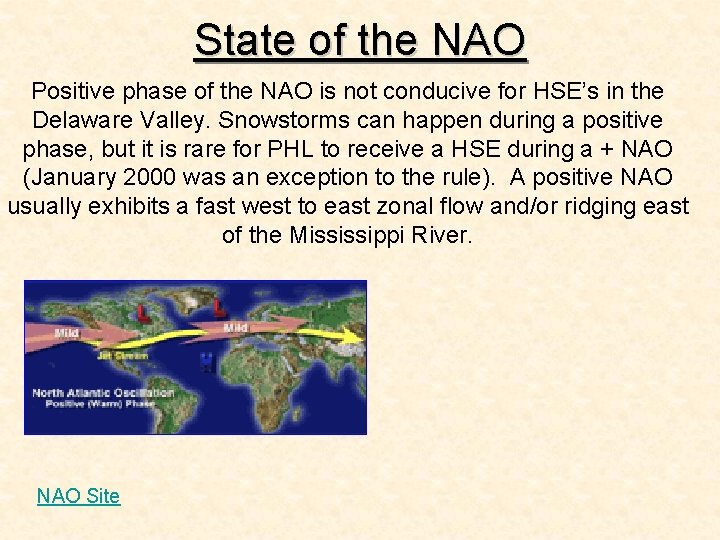
State of the NAO Positive phase of the NAO is not conducive for HSE’s in the Delaware Valley. Snowstorms can happen during a positive phase, but it is rare for PHL to receive a HSE during a + NAO (January 2000 was an exception to the rule). A positive NAO usually exhibits a fast west to east zonal flow and/or ridging east of the Mississippi River. NAO Site

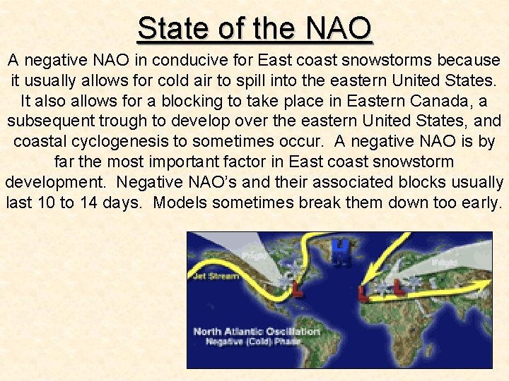
State of the NAO A negative NAO in conducive for East coast snowstorms because it usually allows for cold air to spill into the eastern United States. It also allows for a blocking to take place in Eastern Canada, a subsequent trough to develop over the eastern United States, and coastal cyclogenesis to sometimes occur. A negative NAO is by far the most important factor in East coast snowstorm development. Negative NAO’s and their associated blocks usually last 10 to 14 days. Models sometimes break them down too early.

Importance of High Latitude Blocking (-NAO) “Of course we are going to have to watch this very carefully as there is a window of opportunity for some sort of wave to develop warm front over the southeast JAN 16 -18. But notice what most of the models ate doing here. Without any High latitude blocking the trough becomes very deep and the strong High pressure area drops or falls into the trough. . . tracking from western Canada along the east side of the Rockies all the way into Texas and Oklahoma. This is a very bad sign for significant snowstorm activity for the East Coast and especially the Northeast. This is WHY the blocking pattern over Eastern Canada is SO important because it forces the arctic High pressure systems to stay to the North and track along the US Canada border. . instead of falling into the central and Lower Plains. The High to the north keeps temperatures cold over the East coast but also provides access to ocean moisture as well as being BIG player in the set up all of ageostrophic flow when East coast Low pressure development is underway…continued…

Importance of High Latitude Blocking (NAO) On the other hand when you do NOT have any high latitude blocking then you have got real problems in terms of getting a good winter pattern cooking. There is a tendency among weather hobbyists to really downplay the significance of high latitude blocking. . such as a sustained negative phase of the NAO. I know that there are some out there who say while you can still get big snow oin the Northeast without a Greenland block as long as you have lots of cold air. Often times the February 1995 noreaster is cited as a classic case of a good snow for the I-95 cities that and as rain and there was no high latitude blocking. Well that may be true but also proves the rule. You see the issue is not whether you can get a good snow in the Northeast without any high latitude blocking or negative phase of the NA O. You most certainly can BUT it won't stay all snow and that in my opinion is always the big issue. The February 95 system was such a rapid moving system that by the time the warm air got into the big cities of the Northeast most of precipitation had already fallen so we ended up with 85 - 90% of the precip fell as snow and then the rest as drizzle or freezing drizzle. If the 2/1995 had noreaster move at a more typical speed OR if the Noreaster had closed off in the upper levels the High latitiude blocking would of been far more important. Tthe warm air would have had more time to drive inland into the I-95 cities. . meaning less snow and more rain. – DT on January 11, 2007 -

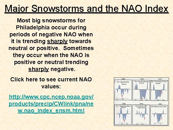
Major Snowstorms and the NAO Index Most big snowstorms for Philadelphia occur during periods of negative NAO when it is trending sharply towards neutral or positive. Sometimes they occur when the NAO is positive or neutral trending sharply negative. Click here to see current NAO values: http: //www. cpc. ncep. noaa. gov/ products/precip/CWlink/pna/ne w. nao_index_ensm. html

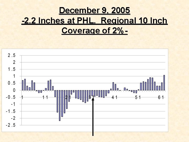
December 9, 2005 -2. 2 Inches at PHL. Regional 10 Inch Coverage of 2%-

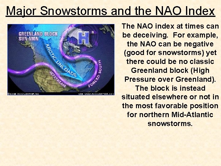
Major Snowstorms and the NAO Index The NAO index at times can be deceiving. For example, the NAO can be negative (good for snowstorms) yet there could be no classic Greenland block (High Pressure over Greenland). The block is instead situated elsewhere or not in the most favorable position for northern Mid-Atlantic snowstorms.

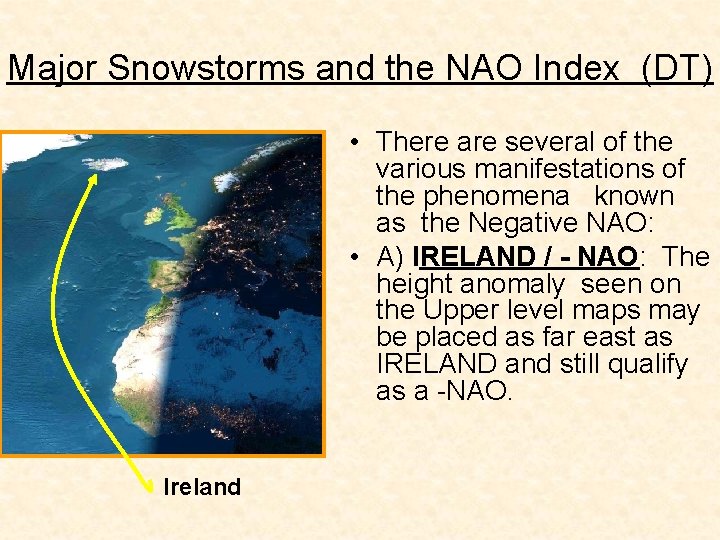
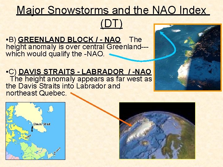
Major Snowstorms and the NAO Index (DT) • There are several of the various manifestations of the phenomena known as the Negative NAO: • A) IRELAND / - NAO: The height anomaly seen on the Upper level maps may be placed as far east as IRELAND and still qualify as a -NAO. Ireland

Major Snowstorms and the NAO Index (DT) • B) GREENLAND BLOCK / - NAO The height anomaly is over central Greenland--- which would qualify the -NAO. • C) DAVIS STRAITS - LABRADOR / -NAO The height anomaly appears as far west as the Davis Straits into Labrador and northeast Quebec.

Major Snowstorms and the NAO Index Also, the NAO index can be extreme negative which can prompt a suppression of storms. In this case, the lower Mid. Atlantic and/or southeastern states could receive the heaviest snow. Therefore, when it comes to the NAO, the following must be taken into consideration. 1. Negative or positive? 2. Trend? 3. How negative or positive? 4. What type of NAO? Where is the block?

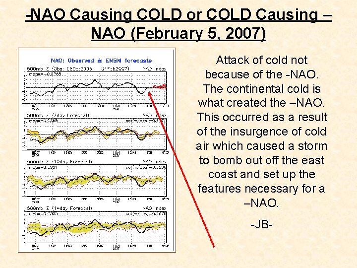
-NAO Causing COLD or COLD Causing – NAO (February 5, 2007) Attack of cold not because of the -NAO. The continental cold is what created the –NAO. This occurred as a result of the insurgence of cold air which caused a storm to bomb out off the east coast and set up the features necessary for a –NAO. -JB-

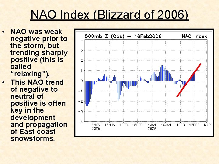
NAO Index (Blizzard of 2006) • NAO was weak negative prior to the storm, but trending sharply positive (this is called “relaxing”). • This NAO trend of negative to neutral of positive is often key in the development and propagation of East coast snowstorms.

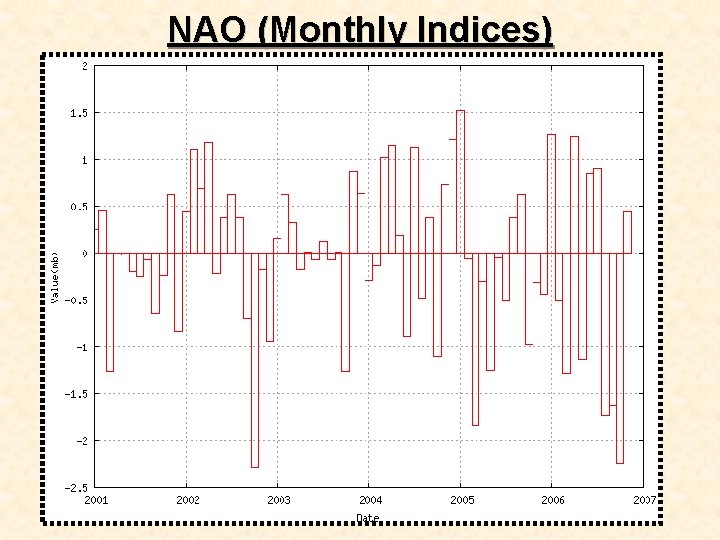
NAO (Monthly Indices)

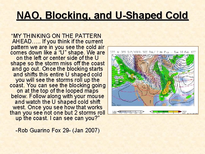
NAO, Blocking, and U-Shaped Cold “MY THINKING ON THE PATTERN AHEAD…. . If you think if the current pattern we are in you see the cold air comes down like a “U” shape. We are on the left or center side of the U shape so the storm miss off the coast and go out. Once the blocking starts and shifts this entire U shaped cold you will see the storms roll up the coast. You can see the blocking going on at the top of the looped maps below. Follow along with your mouse and watch the U shaped cold shift west. Once you see how that works than you see not one but 2 storms roll up the coast. I can see can you? ” -Rob Guarino Fox 29 - (Jan 2007)

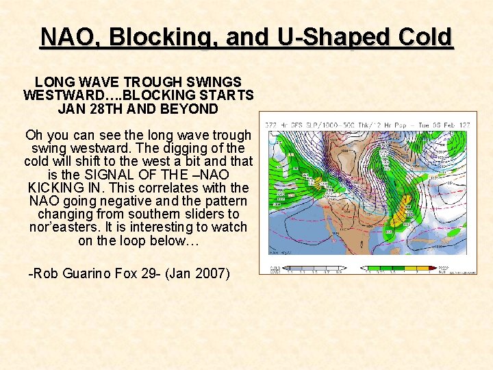
NAO, Blocking, and U-Shaped Cold LONG WAVE TROUGH SWINGS WESTWARD…. BLOCKING STARTS JAN 28 TH AND BEYOND Oh you can see the long wave trough swing westward. The digging of the cold will shift to the west a bit and that is the SIGNAL OF THE –NAO KICKING IN. This correlates with the NAO going negative and the pattern changing from southern sliders to nor’easters. It is interesting to watch on the loop below… -Rob Guarino Fox 29 - (Jan 2007)

NAO (U-Shaped Cold Swing to the West) “THURSDAY SYSTEM AND THE NAO. . . IS IT TOO SOON ! The NAO is on the negative side today but is the "U" shaped cold not fully in swing yet ? My previous blog I mentioned that "U" shaped cold has to swing back to the west to get a phasing going on or get a system up the coast. CLICK HERE THE NAO INDEX Maybe it is too soon and the GFS jumped the gun ? I also showed the comparison to the Jan 2000 NAO and the result on the UPSWING of the NAO as it came from negative to neutral after the dip. CLICK HERE NAO PATTERN WE ARE GOING INTO … -Rob Guarino Fox 29 (January 2007)-

NAO (U-Shaped Cold Swing to the West) …In January of 2000 the NAO dipped on the 13 th and we had snow by the 22 nd, which is 9 days after the dip. We are now negative today and 9 days from now it the 30 th. See my point here is the 30 th may be the real deal for snow and this is the transition snow. JANUARY 2000 DATA…LOOK HOW WARM 1 ST HALF, COLD SECOND HALF Notice how we got. 1” of snow the other and probably. 5 to. 8” in Philly for this one. Each system gets a little closer as the WHOLE PATTERN starts to swing –NAO. This is not a GUARANTEE be any means that it will follow this pattern but I do see so many similarities in the 2 months. Notice the last GFS run and all the snow is after the 30 th. Yeah, this is beyond or near 240 marker on the GFS but it is the pattern you must watch. This has been very frustrating for the snow lovers on here, including me. This as I noted is the tiny steps or STEP DOWN to winter that we have to deal with this season. ” -Rob Guarino Fox 29 (January 2007)-

February 6, 2007 (Cold Has Nothing To Do With NAO) “NAO neutral AND IS NOT, AND HAS NOT HAD ANYTHING TO DO WITH THIS COLD. It is one week of negative did not change the pattern as the seeds of this pattern change have been outlined and tracked since December, and formed the basis for the winter forecast of a harsher mid and late winter. However, if it pops negative again, and I think it will there are some very interesting repercussions, and later today I will explain that. I just don't buy the pat answers as to what is causing this or that change from "El Nino" to "negative NAO" since it is a combination of things that not only I, but others have talked about…”

February 6, 2007 (Cold Has Nothing To Do With NAO) “As far as this goes, if the snow can come in the areas still lacking, then this will go down with the great El Nino flip winters that we had looked at. Keep in mind that we were colder than normal when it was rising into the lower end of the scale and now that we are falling back we are there too. The big message here is that I don't believe simple answers from models, or labeling one feature as the reason is anything I would consider correct. I have taken great pains, right or wrong to make sure our subscribers knew how this can evolve, and again to be fair, I do think there are others that have seen it too. The weather occurs in the real world, not the virtual world and the only way to judge right and wrong is to look at the facts. One week of a negative NAO should not and cannot be the reason for this. In any case, later today I will explain how if it forced negative again it can keep this going into mid-March, which would be the normal course of the great arctic outbreaks we have seen before as they reluctantly pulse back out…” -JB-
