Quasigeostrophic Omega Equation diagnoses ascent and likely cloud






- Slides: 63

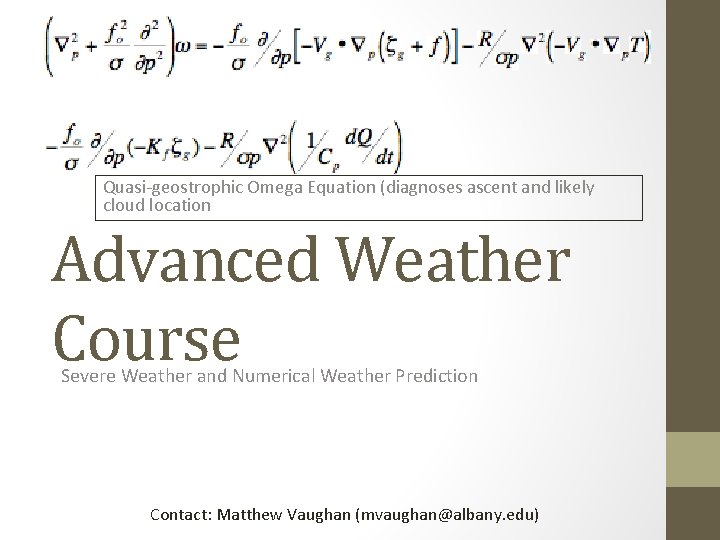
Quasi-geostrophic Omega Equation (diagnoses ascent and likely cloud location Advanced Weather Course Severe Weather and Numerical Weather Prediction Contact: Matthew Vaughan (mvaughan@albany. edu)

Outline • Severe Weather Principles • Vertical wind shear • Bow echoes and supercell signatures from radar • Recognizing severe weather threat in the field • Numerical Weather Prediction • Principles • Proper interpretation of ensembles • Common model biases/trouble spots • Questions and Audience-directed Topics

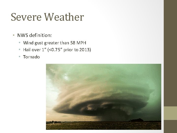
Severe Weather • NWS definition: • Wind gust greater than 58 MPH • Hail over 1” (<0. 75” prior to 2013) • Tornado

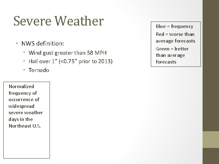
Severe Weather • NWS definition: • Wind gust greater than 58 MPH • Hail over 1” (<0. 75” prior to 2013) • Tornado Normalized frequency of occurrence of widespread severe weather days in the Northeast U. S. Blue = frequency Red = worse than average forecasts Green = better than average forecasts

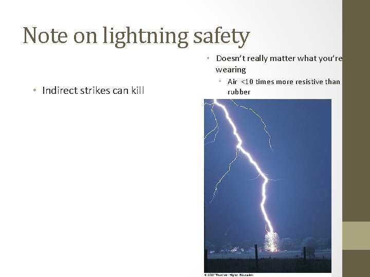
Note on lightning safety • Doesn’t really matter what you’re wearing • Indirect strikes can kill • Air <10 times more resistive than rubber

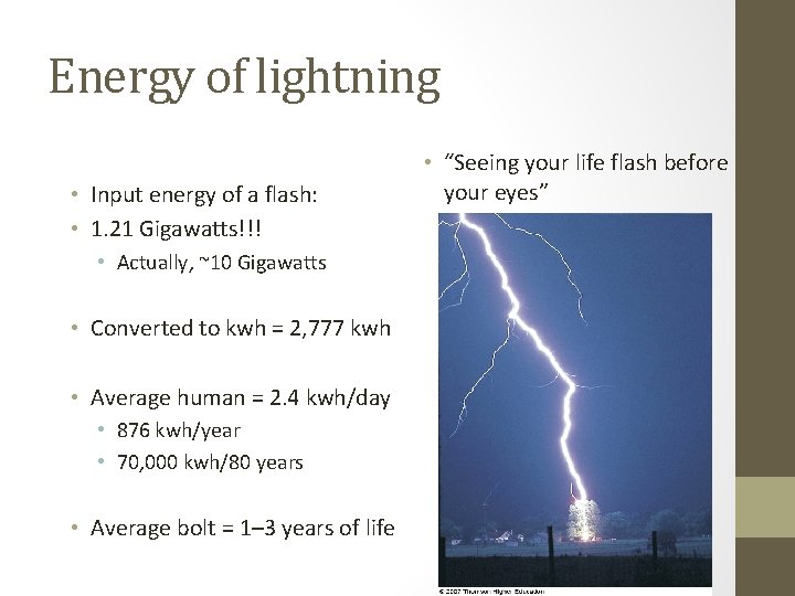
Energy of lightning • Input energy of a flash: • 1. 21 Gigawatts!!! • Actually, ~10 Gigawatts • Converted to kwh = 2, 777 kwh • Average human = 2. 4 kwh/day • 876 kwh/year • 70, 000 kwh/80 years • Average bolt = 1– 3 years of life • “Seeing your life flash before your eyes”

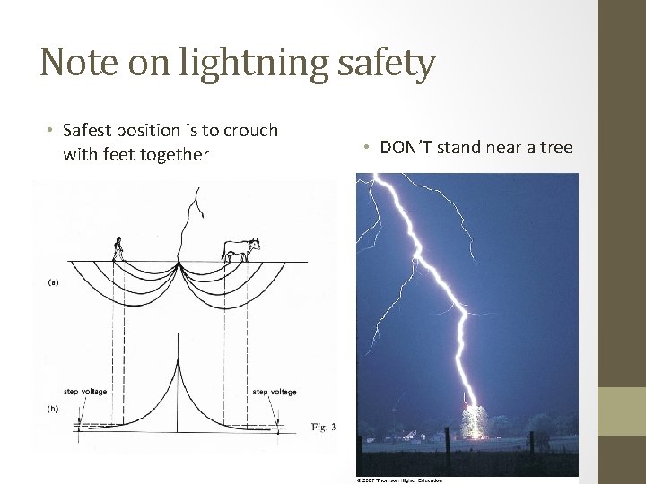
Note on lightning safety • Safest position is to crouch with feet together • DON’T stand near a tree

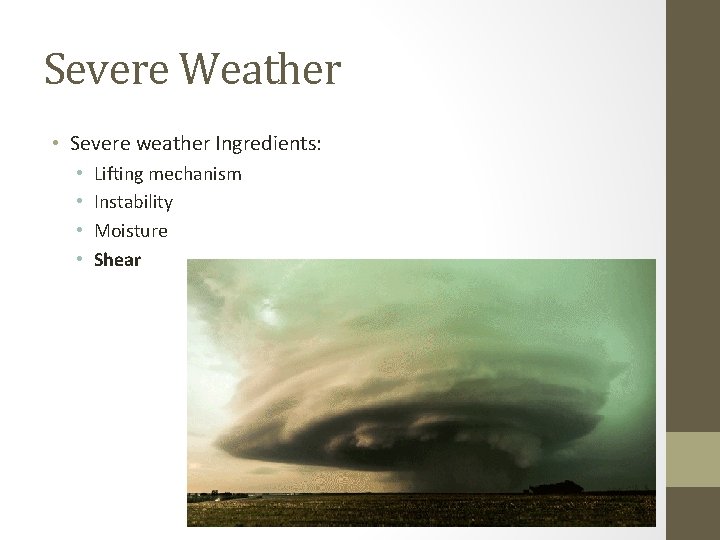
Severe Weather • Severe weather Ingredients: • • Lifting mechanism Instability Moisture Shear

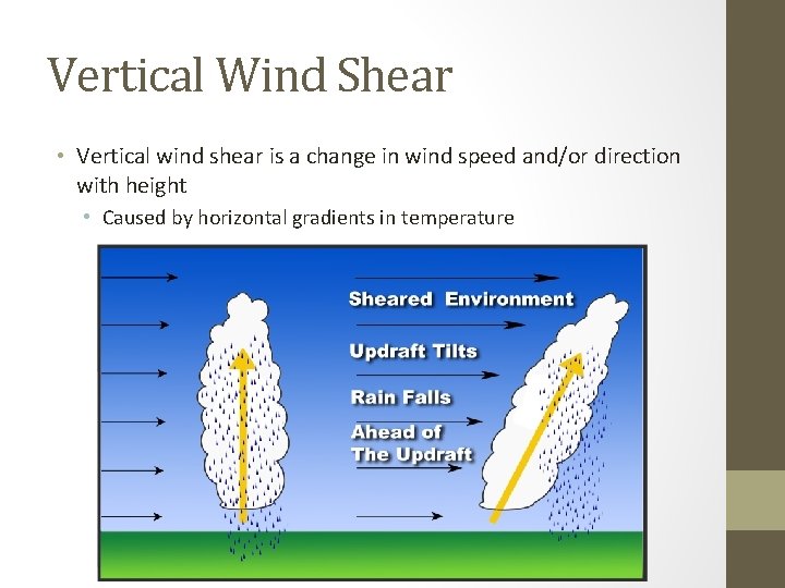
Vertical Wind Shear • Vertical wind shear is a change in wind speed and/or direction with height • Caused by horizontal gradients in temperature

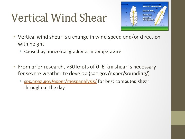
Vertical Wind Shear • Vertical wind shear is a change in wind speed and/or direction with height • Caused by horizontal gradients in temperature • From prior research, >30 knots of 0– 6 -km shear is necessary for severe weather to develop (spc. gov/exper/sounding/) • spc. noaa. gov/exper/mesoanalysis/ for best computed shear throughout the day

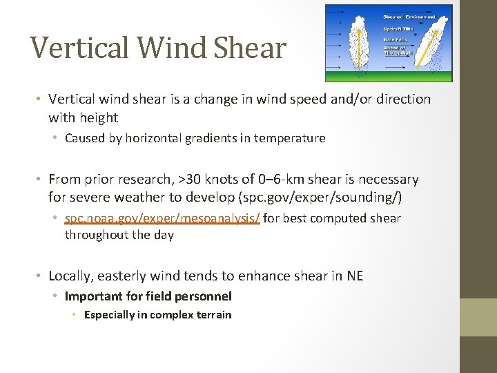
Vertical Wind Shear • Vertical wind shear is a change in wind speed and/or direction with height • Caused by horizontal gradients in temperature • From prior research, >30 knots of 0– 6 -km shear is necessary for severe weather to develop (spc. gov/exper/sounding/) • spc. noaa. gov/exper/mesoanalysis/ for best computed shear throughout the day • Locally, easterly wind tends to enhance shear in NE • Important for field personnel • Especially in complex terrain

Vertical Wind Shear • How does vertical wind shear lead to severe weather?

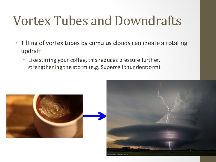
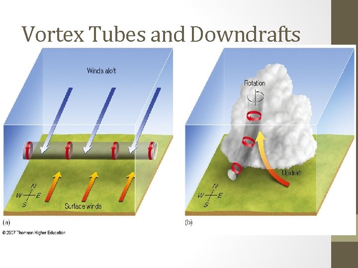
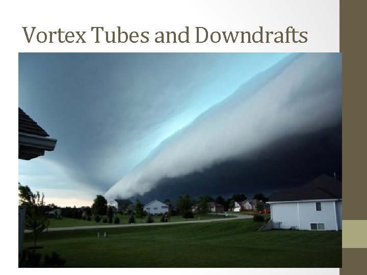
Vortex Tubes and Downdrafts • Tilting of vortex tubes by cumulus clouds can create a rotating updraft • Like stirring your coffee, this reduces pressure further, strengthening the storm (e. g. Supercell thunderstorm)

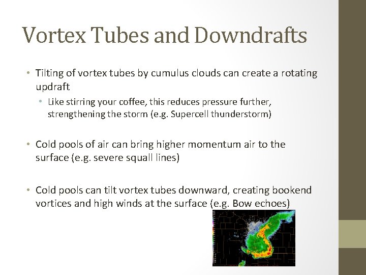
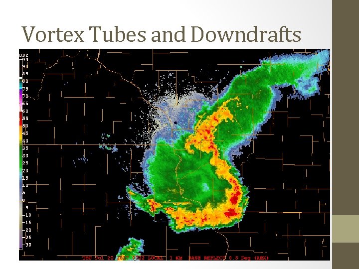
Vortex Tubes and Downdrafts • Tilting of vortex tubes by cumulus clouds can create a rotating updraft • Like stirring your coffee, this reduces pressure further, strengthening the storm (e. g. Supercell thunderstorm) • Cold pools of air can bring higher momentum air to the surface (e. g. severe squall lines) • Cold pools can tilt vortex tubes downward, creating bookend vortices and high winds at the surface (e. g. Bow echoes)

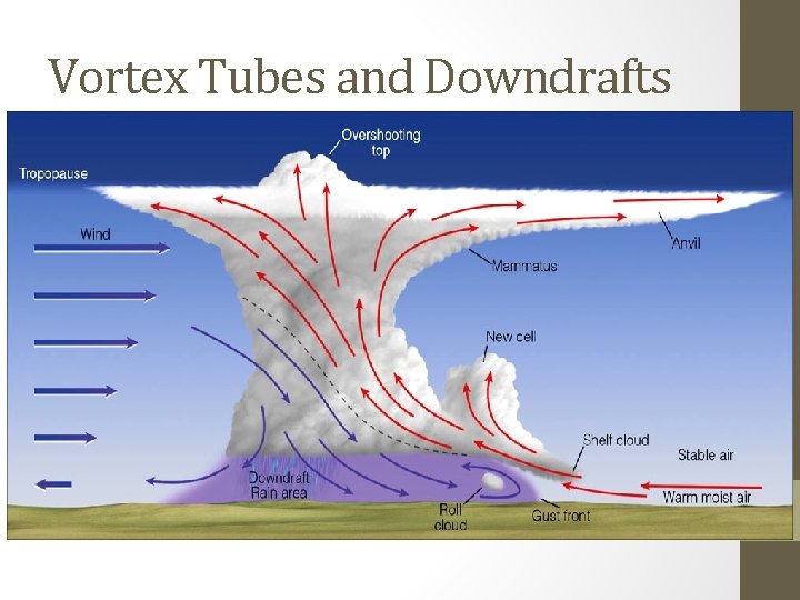
Vortex Tubes and Downdrafts • Tilting of vortex tubes by cumulus clouds can create a rotating updraft • Like stirring your coffee, this reduces pressure further, strengthening the storm (e. g. Supercell thunderstorm) • Cold pools of air can bring higher momentum air to the surface (e. g. severe squall lines)

Vortex Tubes and Downdrafts • Tilting of vortex tubes by cumulus clouds can create a rotating updraft • Like stirring your coffee, this reduces pressure further, strengthening the storm (e. g. Supercell thunderstorm) • Cold pools of air can bring higher momentum air to the surface (e. g. severe squall lines) • Cold pools can tilt vortex tubes downward, creating bookend vortices and high winds at the surface (e. g. Bow echoes)

Vortex Tubes and Downdrafts • Tilting of vortex tubes by cumulus clouds can create a rotating updraft • Like stirring your coffee, this reduces pressure further, strengthening the storm (e. g. Supercell thunderstorm) • Cold pools of air can bring higher momentum air to the surface (e. g. severe squall lines) • Cold pools can tilt vortex tubes downward, creating bookend vortices and high winds at the surface (e. g. Bow echoes)

Vortex Tubes and Downdrafts • Tilting of vortex tubes by cumulus clouds can create a rotating updraft • Like stirring your coffee, this reduces pressure further, strengthening the storm (e. g. Supercell thunderstorm) • Cold pools of air can bring higher momentum air to the surface (e. g. severe squall lines) • Cold pools can tilt vortex tubes downward, creating bookend vortices and high winds at the surface (e. g. Bow echoes)

Vortex Tubes and Downdrafts • Tilting of vortex tubes by cumulus clouds can create a rotating updraft • Like stirring your coffee, this reduces pressure further, strengthening the storm (e. g. Supercell thunderstorm) • Cold pools of air can bring higher momentum air to the surface (e. g. severe squall lines) • Cold pools can tilt vortex tubes downward, creating bookend vortices and high winds at the surface (e. g. Bow echoes)

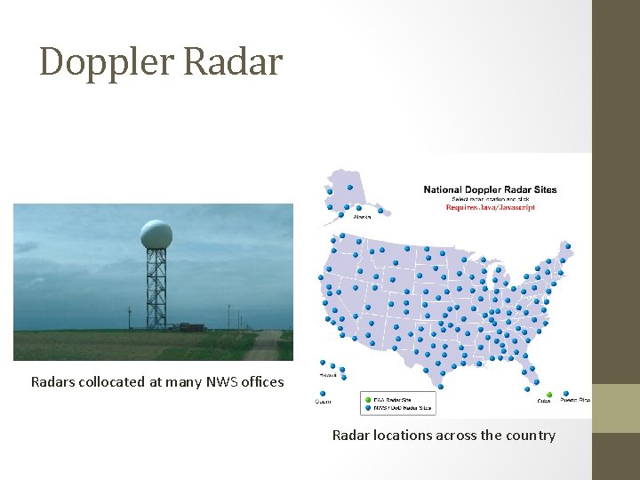
Doppler Radars collocated at many NWS offices Radar locations across the country

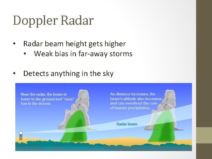
Doppler Radar • Radar beam height gets higher • Weak bias in far-away storms • Detects anything in the sky

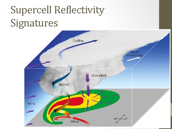
Supercell Reflectivity Signatures

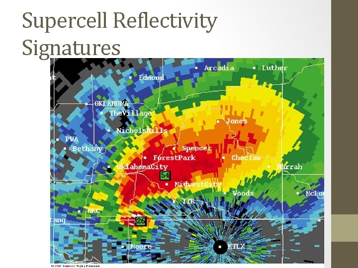
Supercell Reflectivity Signatures

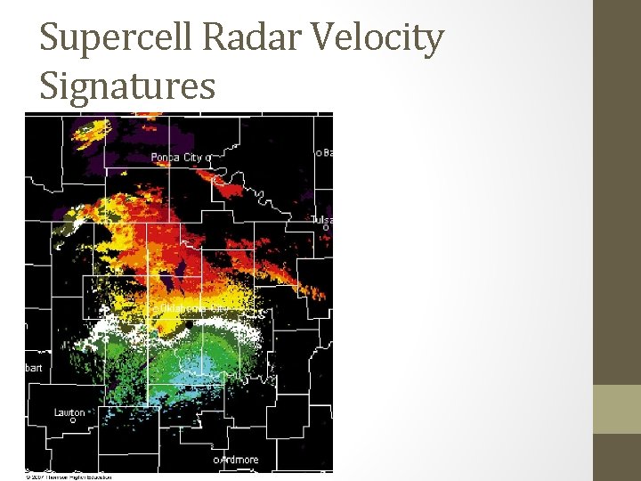
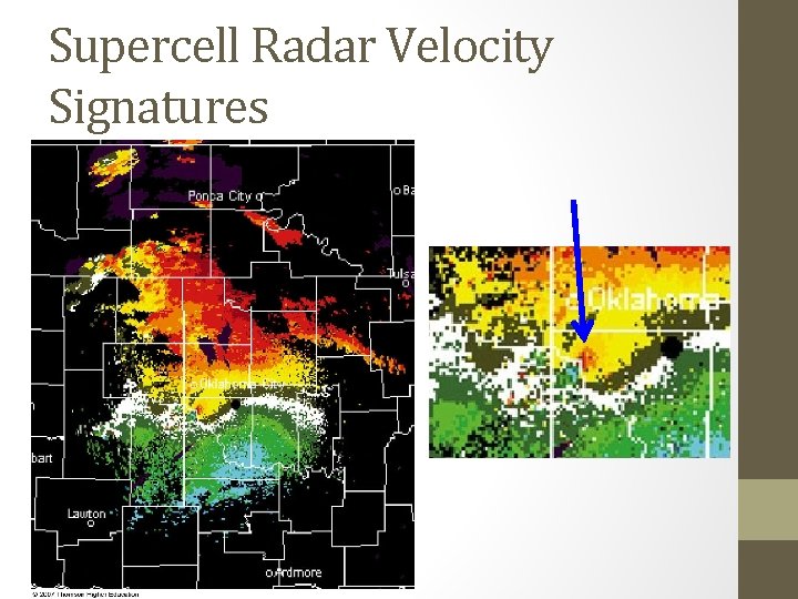
Supercell Radar Velocity Signatures

Supercell Radar Velocity Signatures

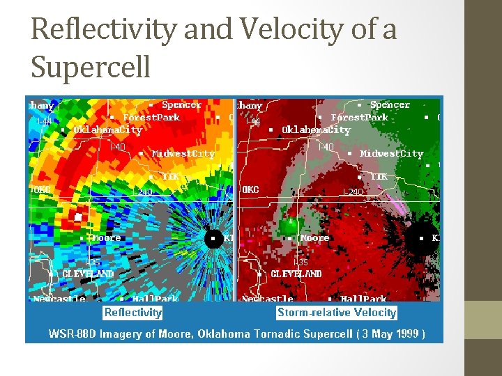
Reflectivity and Velocity of a Supercell

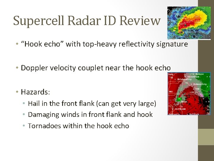
Supercell Radar ID Review • “Hook echo” with top-heavy reflectivity signature • Doppler velocity couplet near the hook echo • Hazards: • Hail in the front flank (can get very large) • Damaging winds in front flank and hook • Tornadoes within the hook echo

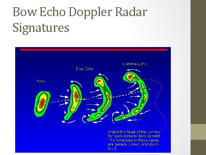
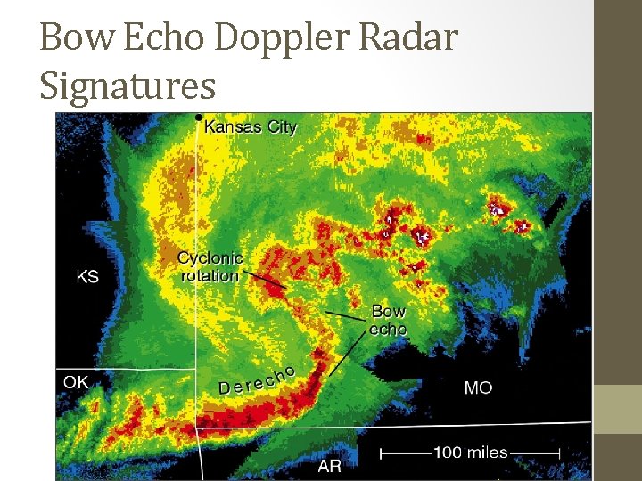
Bow Echo Doppler Radar Signatures

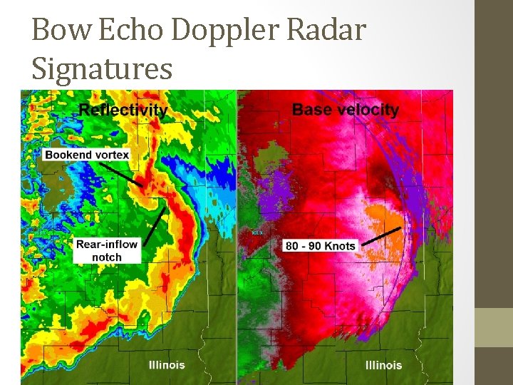
Bow Echo Doppler Radar Signatures

Bow Echo Doppler Radar Signatures

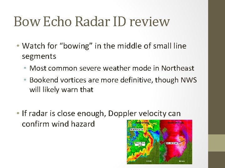
Bow Echo Radar ID review • Watch for “bowing” in the middle of small line segments • Most common severe weather mode in Northeast • Bookend vortices are more definitive, though NWS will likely warn that • If radar is close enough, Doppler velocity can confirm wind hazard

Numerical Weather Prediction

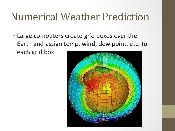
Numerical Weather Prediction • Large computers create grid boxes over the Earth and assign temp, wind, dew point, etc. to each grid box

Numerical Weather Prediction • Large computers create grid boxes over the Earth and assign temp, wind, dew point, terrain height, etc. to each grid box • Spatial resolution varies from ~50 mile to ~1. 6 mile “pixel density” • Correlated with observation density

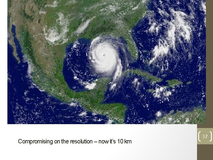
Hurricane Katrina satellite picture composed of 1 km pixels. High resolution model = possibly accurate, definitely expensive, and extremely time-consuming 35

As model resolution increases, we see more, but computers must be much bigger 36

Compromising on the resolution – now it’s 10 km 37

38 30 km resolution

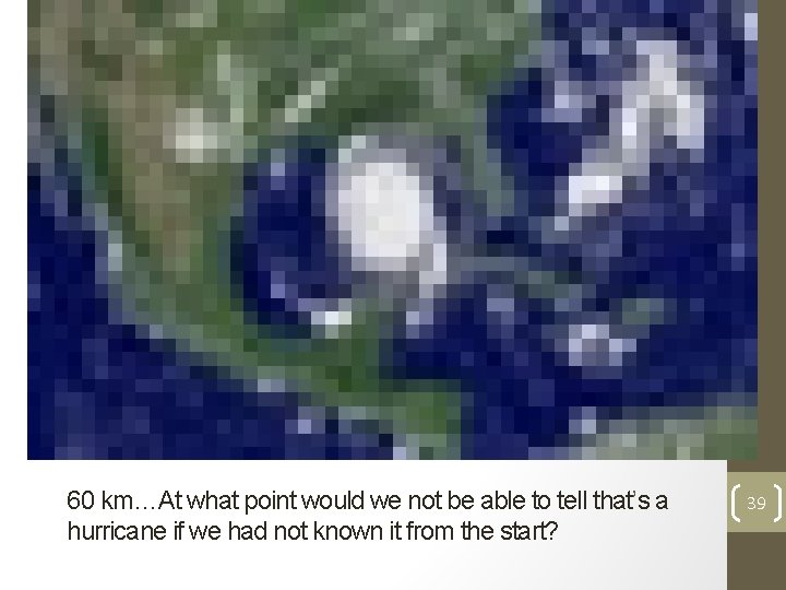
60 km…At what point would we not be able to tell that’s a hurricane if we had not known it from the start? 39

120 km…This is the world as seen by global weather models not so long ago, and still many climate models today. 40

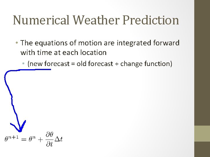
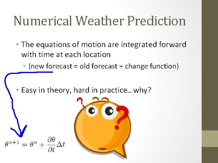
Numerical Weather Prediction • The equations of motion are integrated forward with time at each location • (new forecast = old forecast + change function)

Numerical Weather Prediction • The equations of motion are integrated forward with time at each location • (new forecast = old forecast + change function) • Easy in theory, hard in practice…why?

Why forecasting is tough… • Atmosphere is a “chaotic system” • Sensitive to initial conditions (ICs) • Our observing systems have errors • • Weather station error Weather balloon error Satellite error Observation location-derived error • Impossible to know ICs with perfect accuracy

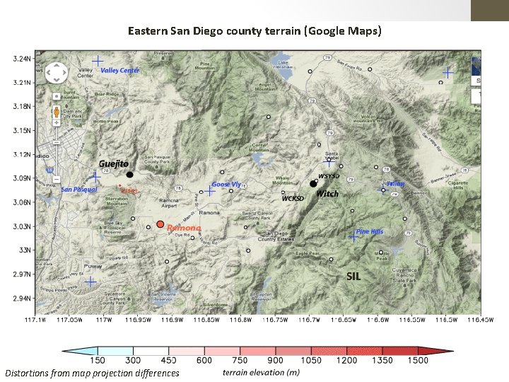
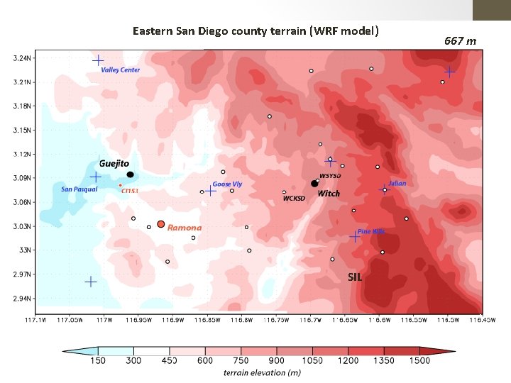
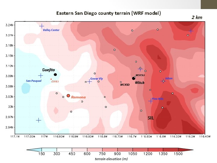
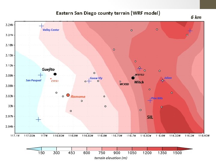
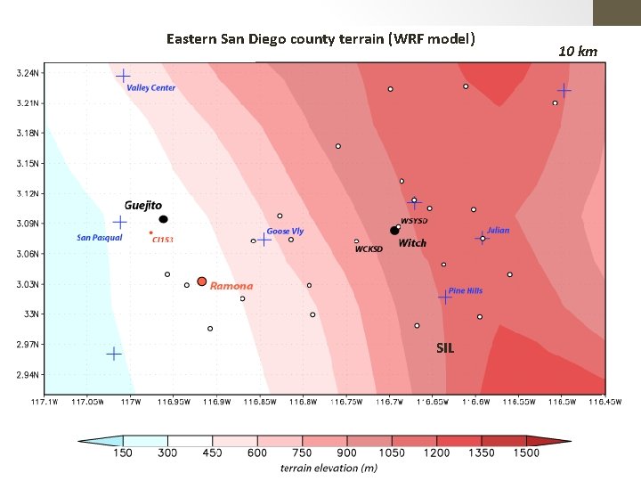
Why forecasting is tough…part deux • Model error • Time integration (now = earlier + (# seconds)) is not perfect • Sub-grid-scale processes (my dissertation work) • Small-scale turbulence, precipitation processes, etc. must be parameterized (educated guess) • We don’t have model resolution down to your back yard

Why forecasting is tough…part deux • Model error • Time integration (now = earlier + (# seconds)) is not perfect • Sub-grid-scale processes (my dissertation work) • Small-scale turbulence, precipitation processes, etc. must be parameterized (educated guess) • We don’t have model resolution down to your back yard

Eastern San Diego county terrain (Google Maps) SIL 46 Distortions from map projection differences

Eastern San Diego county terrain (WRF model) 667 m SIL 47

Eastern San Diego county terrain (WRF model) 2 km SIL 48

Eastern San Diego county terrain (WRF model) 6 km SIL 49

Eastern San Diego county terrain (WRF model) 10 km SIL 50

Why forecasting is tough…part trois • Model validation and verification is impossible everywhere • Can’t get better at predicting for your yard if there’s no sensor to verify against • Some variables, like model turbulent motions or radiative fluxes, are never verified • Data assimilation into a model is an inexact science • Non-trivial how you start the model

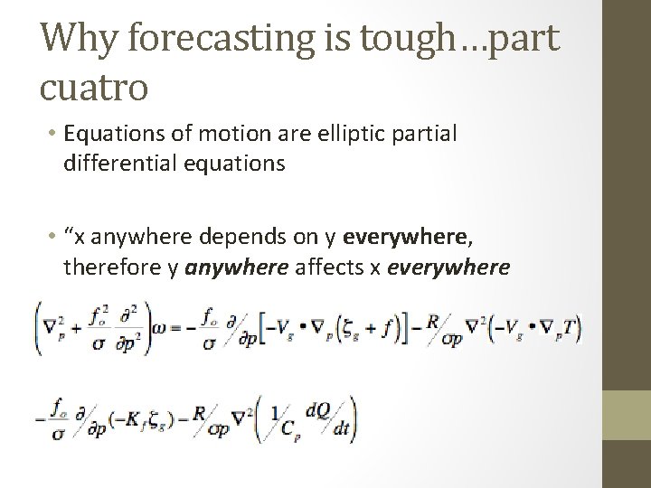
Why forecasting is tough…part cuatro • Equations of motion are elliptic partial differential equations • “x anywhere depends on y everywhere, therefore y anywhere affects x everywhere

SO, WHAT DO WE DO?

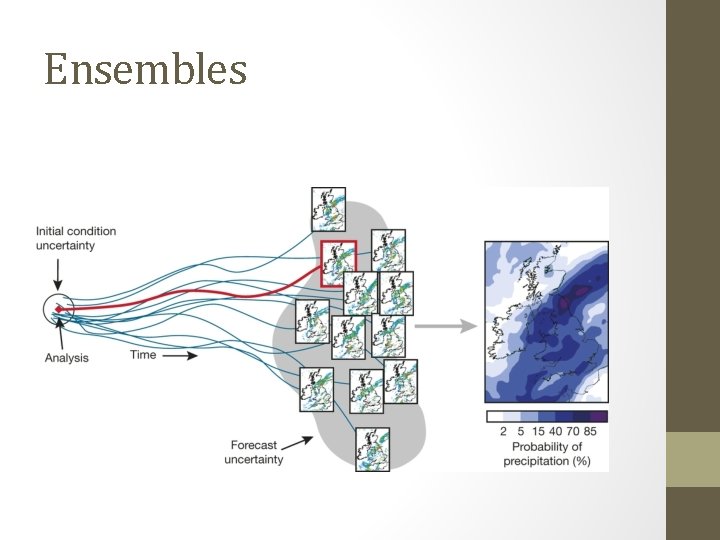
Ensembles

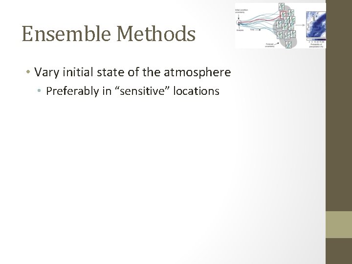
Ensemble Methods • Vary initial state of the atmosphere • Preferably in “sensitive” locations

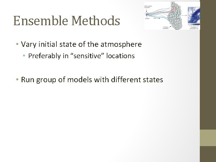
Ensemble Methods • Vary initial state of the atmosphere • Preferably in “sensitive” locations • Run group of models with different states

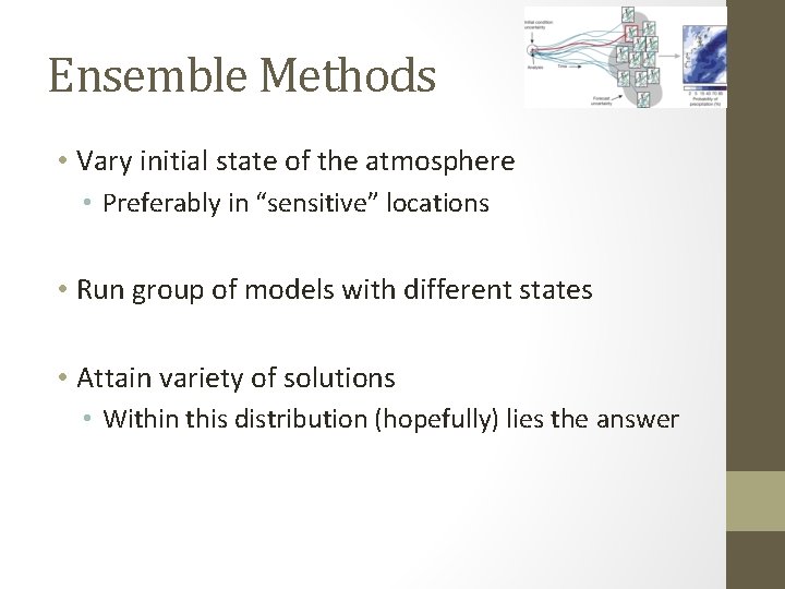
Ensemble Methods • Vary initial state of the atmosphere • Preferably in “sensitive” locations • Run group of models with different states • Attain variety of solutions • Within this distribution (hopefully) lies the answer

Ensemble Methods • This method, while infuriating to those wanting an exact answer, has revolutionized meteorology • For those needing exact answers, the ensemble mean (average) value has the highest skill over time • What do ensemble forecasts look like? (GEFS ensemble page) • emc. ncep. noaa. gov/gc_wmb/tdorian/gefs/EMCGE FSplumes. html

Known Model Difficulties

Known Model Difficulties • If cloud cover, add (subtract) a few degrees to the forecasted low (high) • If cloud free, do the opposite • Model Output Statistics causes this phenomenon • Under clear sky nighttime conditions and close temp/dew point spread, expect fog

Known Model Difficulties (cont. ) • Cold-season forecasts are better than warmseason forecasts • Higher confidence • Temperatures in the mountains will likely be more extreme than forecasted • Due to resolution issues • In complex terrain, cold air takes awhile to remove

Known Model Difficulties (cont. ) • Snowfall on the ground drastically effects temperatures at night • Fresh snowpack + clear sky = rock bottom nighttime low (lower than forecasted) • Soil moisture and soil temperature are poorly observed • Poorly resolved in models • Wet/warm ground may effect precipitation type and flooding beyond model solutions

Contact: Matthew Vaughan (mvaughan@albany. edu) AUDIENCE-DIRECTED SECTION (IF TIME ALLOWS) Thanks to the Department of Defense’s National Defense Science and Engineering Graduate Fellowship Program (funding) and the University at Albany - SUNY