Progress on Radar Data Assimilation at the NCEP

- Slides: 54

Progress on Radar Data Assimilation at the NCEP Environmental Modeling Center S. Lord, G. Di. Mego, D. Parrish, NSSL Staff With contributions by: J. Alpert, V. K. Kumar, R. Saffle, Q. Liu 1 NCEP: “where America’s climate, weather, and ocean services begin”

Overview • Introductory remarks – NEXRAD observations and Data Assimilation (DA) • History of NEXRAD data use in DA, including “precipitation assimilation” (Lin, Parrish) • CONUS impact study (Alpert) • Hurricane impact study (Liu) • Summary and outlook 2

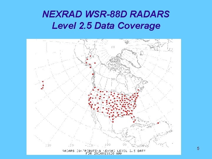
NEXRAD WSR-88 D RADARS • • 158 operational NEXRAD Doppler radar systems deployed throughout the United States Provide warnings on dangerous weather and its location – Potentially useful for mesoscale data assimilation • Data resolution of Level 2 radar radial wind – – – • Wind observation processing – – • 1/4 km radial resolution 1 degree of azimuth 16 vertical tilt angles 200 km range 8 minutes time resolution VAD: cartesian (u, v) wind from radial wind processing Level 3: dealiased radial wind at 4 lowest tilts Level 2. 5: on-site processing by NCEP “superob” algorithm Level 2. 0: raw radial wind Data volume – 100 Billion (1011) potential reports/day for radar radial winds – Typically 2 Billion radial wind reports/day – 0. 1 Tb/day computer storage 3

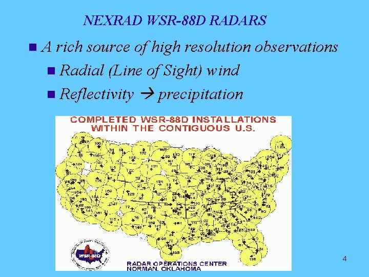
NEXRAD WSR-88 D RADARS A rich source of high resolution observations Radial (Line of Sight) wind Reflectivity precipitation 4

NEXRAD WSR-88 D RADARS Level 2. 5 Data Coverage 5

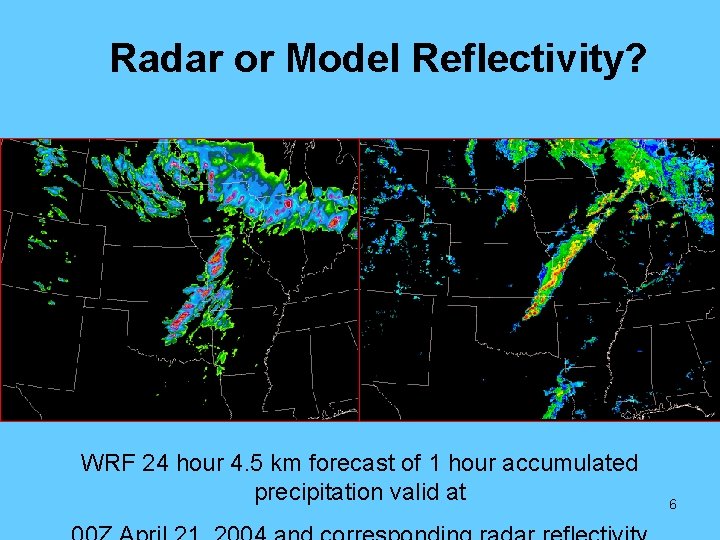
Radar or Model Reflectivity? WRF 24 hour 4. 5 km forecast of 1 hour accumulated precipitation valid at 6

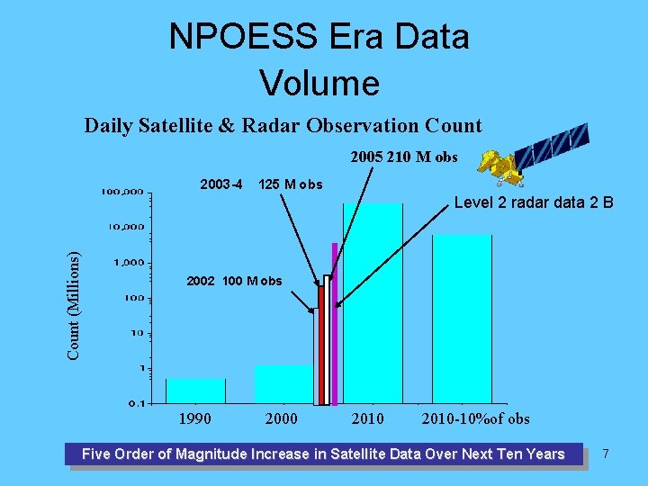
NPOESS Era Data Volume Daily Satellite & Radar Observation Count 2005 210 M obs 2003 -4 125 M obs Count (Millions) Level 2 radar data 2 B 2002 100 M obs 1990 2000 2010 -10%of obs Five Order of Magnitude Increase in Satellite Data Over Next Ten Years 7

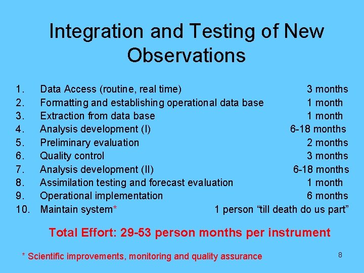
Integration and Testing of New Observations 1. 2. 3. 4. 5. 6. 7. 8. 9. 10. Data Access (routine, real time) 3 months Formatting and establishing operational data base 1 month Extraction from data base 1 month Analysis development (I) 6 -18 months Preliminary evaluation 2 months Quality control 3 months Analysis development (II) 6 -18 months Assimilation testing and forecast evaluation 1 month Operational implementation 6 months Maintain system* 1 person “till death do us part” Total Effort: 29 -53 person months per instrument * Scientific improvements, monitoring and quality assurance 8

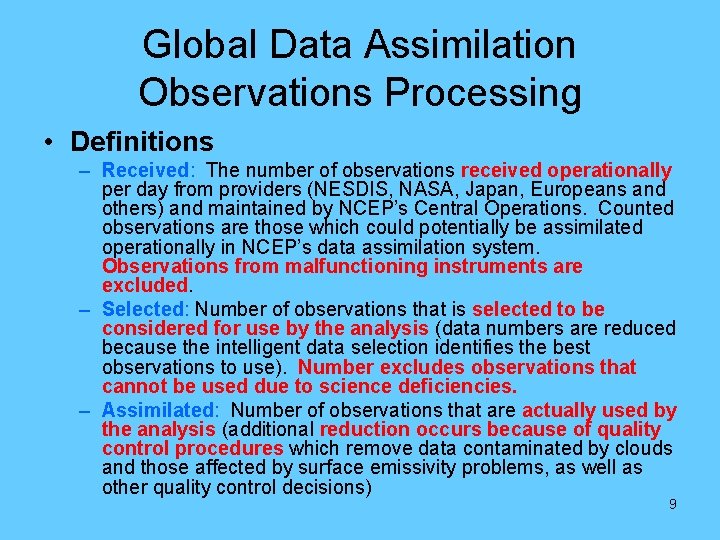
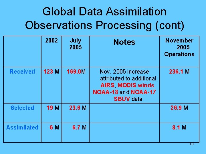
Global Data Assimilation Observations Processing • Definitions – Received: The number of observations received operationally per day from providers (NESDIS, NASA, Japan, Europeans and others) and maintained by NCEP’s Central Operations. Counted observations are those which could potentially be assimilated operationally in NCEP’s data assimilation system. Observations from malfunctioning instruments are excluded. – Selected: Number of observations that is selected to be considered for use by the analysis (data numbers are reduced because the intelligent data selection identifies the best observations to use). Number excludes observations that cannot be used due to science deficiencies. – Assimilated: Number of observations that are actually used by the analysis (additional reduction occurs because of quality control procedures which remove data contaminated by clouds and those affected by surface emissivity problems, as well as other quality control decisions) 9

Global Data Assimilation Observations Processing (cont) 2002 July 2005 Notes November 2005 Operations Received 123 M 169. 0 M Nov. 2005 increase attributed to additional AIRS, MODIS winds, NOAA-18 and NOAA-17 SBUV data 236. 1 M Selected 19 M 23. 6 M 26. 9 M Assimilated 6 M 6. 7 M 8. 1 M 10

Overview • Introductory remarks – Observations and Data Assimilation (DA) • History of NEXRAD data use in DA, including “precipitation assimilation” (Parrish, Lin) • CONUS impact study (Alpert) • Hurricane impact study (Liu) • Summary and outlook 11

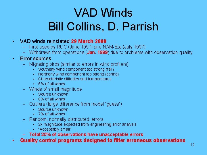
VAD Winds Bill Collins, D. Parrish • VAD winds reinstated 29 March 2000 – First used by RUC (June 1997) and NAM-Eta (July 1997) – Withdrawn from operations (Jan. 1999) due to problems with observation quality • Error sources – Migrating birds (similar to errors in wind profilers) • • Southerly wind component too strong (fall) Northerly wind component too strong (spring) Characteristic altitudes and temperatures 5% of all winds – Winds of small magnitude • Source unknown • 8% of all winds – Outliers (large difference from model “guess”) • Source unknown • 7% of all winds – Random, normally distributed, errors • 2 x magnitude expected from engineering error analysis • “Acceptably small” – Total 20% of observations have unacceptable errors • Quality control programs designed to filter erroneous observations 12

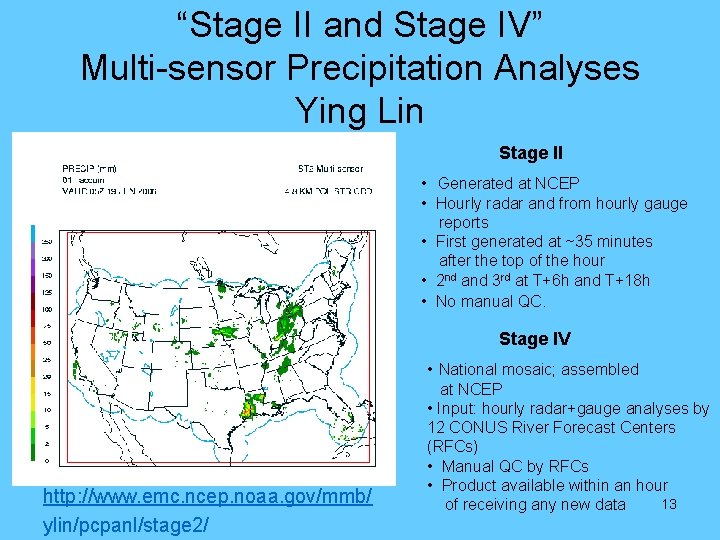
“Stage II and Stage IV” Multi-sensor Precipitation Analyses Ying Lin Stage II • Generated at NCEP • Hourly radar and from hourly gauge reports • First generated at ~35 minutes after the top of the hour • 2 nd and 3 rd at T+6 h and T+18 h • No manual QC. Stage IV • National mosaic; assembled http: //www. emc. ncep. noaa. gov/mmb/ ylin/pcpanl/stage 2/ at NCEP • Input: hourly radar+gauge analyses by 12 CONUS River Forecast Centers (RFCs) • Manual QC by RFCs • Product available within an hour 13 of receiving any new data

Assimilation of Precipitation Analyses 24 May 2001 – Ying Lin • Motivation – Direct model precipitation contains large biases • Impacts all aspects of hydrological cycle • Soil moisture and surface latent heat flux particularly impacted • Real-time Stage II precipitation analyses are available • Assimilation technique – Precipitation nudging technique • Comparison of model and observed precipitation • Change model precipitation, latent heating and moisture in consistent way dependent on ratio Pmodel/Pobs • Expected improvements in NAM-Eta – Short-term (0 -36 h) precipitation – Cycled soil moisture and surface fluxes – 2 meter temperature • No negative impact on other predicted fields 14

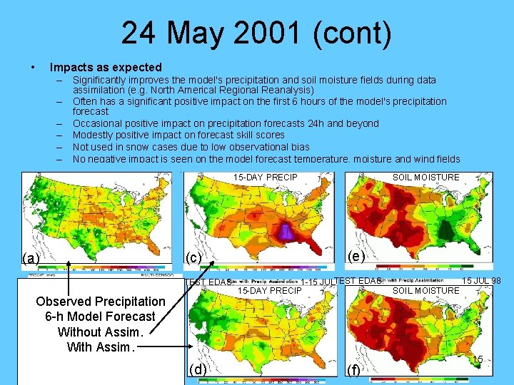
24 May 2001 (cont) • Impacts as expected – Significantly improves the model's precipitation and soil moisture fields during data assimilation (e. g. North Americal Regional Reanalysis) – Often has a significant positive impact on the first 6 hours of the model's precipitation forecast – Occasional positive impact on precipitation forecasts 24 h and beyond – Modestly positive impact on forecast skill scores – Not used in snow cases due to low observational bias – No negative impact is seen on the model forecast temperature, moisture and wind fields 15 -DAY OBS PRECIP (1 -15 JUL 98) OPS EDAS: (c) (a) 1 -HR STAGE IV PRECIP TEST EDAS: Observed Precipitation 6 -h Model Forecast Without Assim. With Assim. (b) 15 -DAY PRECIP (d) OPS EDAS: 1 -15 JUL 98 SOIL MOISTURE (e) 15 JUL 98 1 -15 JULTEST EDAS: 15 -DAY PRECIP SOIL MOISTURE (f) 15

8 July 2003 NAM-Eta Upgrade • Stage II and Stage IV hourly analyses merged precipitation assimilation – Analyses must arrive before data cutoff (H + 1: 15) – Quality control added to merged product • Assimilation of Level 3 NEXRAD 88 D radial wind data – Time and space averaged data (compression) • First 4 radar tilts (0. 5, 1. 5, 2. 5, and 3. 5 degrees) – the “NIDS” feed (1: 4) • Hourly (~1: 8) • Horizontal resolution of – 5 km radially (1: 20) – 6 degrees azimuthally (1: 6) • Overall compression: 1: 3840 – Quality control applied from VAD winds, including migrating bird contamination • “These radial wind runs show little positive or negative impact in the verification statistics, so it is certainly safe to include these winds treated this way in the 3 DVAR” • First implementation: do no harm 16

Overview • Introductory remarks – Observations and Data Assimilation (DA) • History of NEXRAD data use in DA, including “precipitation assimilation” (Lin, Parrish) • CONUS impact study (Alpert) • Hurricane impact study (Liu) • Summary and outlook 17

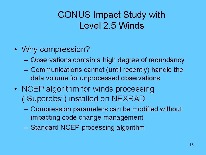
CONUS Impact Study with Level 2. 5 Winds • Why compression? – Observations contain a high degree of redundancy – Communications cannot (until recently) handle the data volume for unprocessed observations • NCEP algorithm for winds processing (“Superobs”) installed on NEXRAD – Compression parameters can be modified without impacting code change management – Standard NCEP processing algorithm 18

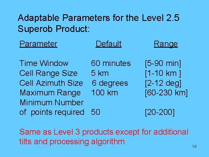
Adaptable Parameters for the Level 2. 5 Superob Product: Parameter Time Window Cell Range Size Cell Azimuth Size Maximum Range Minimum Number of points required Default Range 60 minutes 5 km 6 degrees 100 km [5 -90 min] [1 -10 km ] [2 -12 deg] [60 -230 km] 50 [20 -200] Same as Level 3 products except for additional tilts and processing algorithm 19

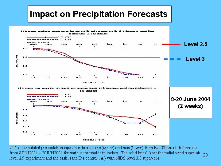
Impact on Precipitation Forecasts Level 2. 5 Level 3 8 -20 June 2004 (2 weeks) 24 -h accumulated precipitation equitable threat score (upper) and bias (lower) from Eta 32 -km 60 -h forecasts from 8 JUN 2004 – 20 JUN 2004 for various thresholds in inches. The solid line (+) are the radial wind super-ob 20 level 2. 5 experiment and the dash is the Eta control (▲) with NIDS level 3. 0 super-obs.

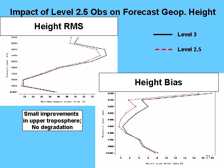
Impact of Level 2. 5 for. Obs Improved RMS scores heighton Forecast Geop. Height RMS Level 3 Level 2. 5 Height Bias Small improvements in upper troposphere; No degradation 21

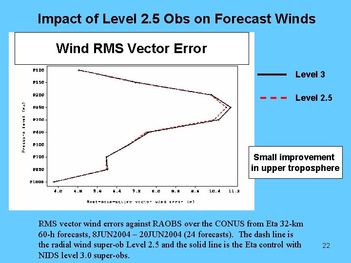
Impact of Level 2. 5 Obs on Forecast Winds No degradation in Vector wind – slightly better near jet levels. Wind RMS Vector Error Level 3 Level 2. 5 Small improvement in upper troposphere RMS vector wind errors against RAOBS over the CONUS from Eta 32 -km 60 -h forecasts, 8 JUN 2004 – 20 JUN 2004 (24 forecasts). The dash line is the radial wind super-ob Level 2. 5 and the solid line is the Eta control with NIDS level 3. 0 super-obs. 22

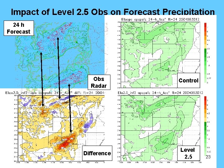
Impact of Level 2. 5 Obs on Forecast Precipitation 24 h Forecast Obs Radar Difference Control Level 2. 5 23

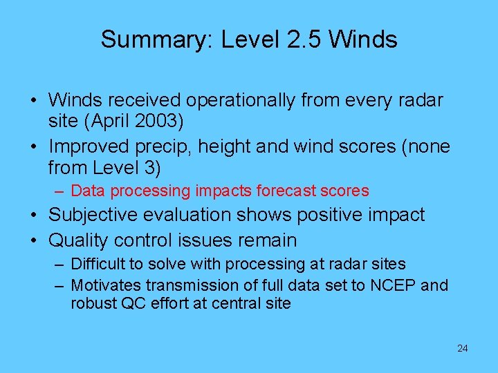
Summary: Level 2. 5 Winds • Winds received operationally from every radar site (April 2003) • Improved precip, height and wind scores (none from Level 3) – Data processing impacts forecast scores • Subjective evaluation shows positive impact • Quality control issues remain – Difficult to solve with processing at radar sites – Motivates transmission of full data set to NCEP and robust QC effort at central site 24

Overview • Introductory remarks – Observations and Data Assimilation (DA) • History of NEXRAD data use in DA, including “precipitation assimilation” (Lin, Parrish) • CONUS impact study (Alpert) • Hurricane impact study (Liu) • Summary and outlook 25

Airborne Doppler Radar Data Analysis in HWRF Model Q. Liu, N. Surgi, S. Lord W. -S. Wu, D. Parrish S. Gopal and J. Waldrop (NOAA/NCEP/EMC) John Gamache (AOML/HRD) 26

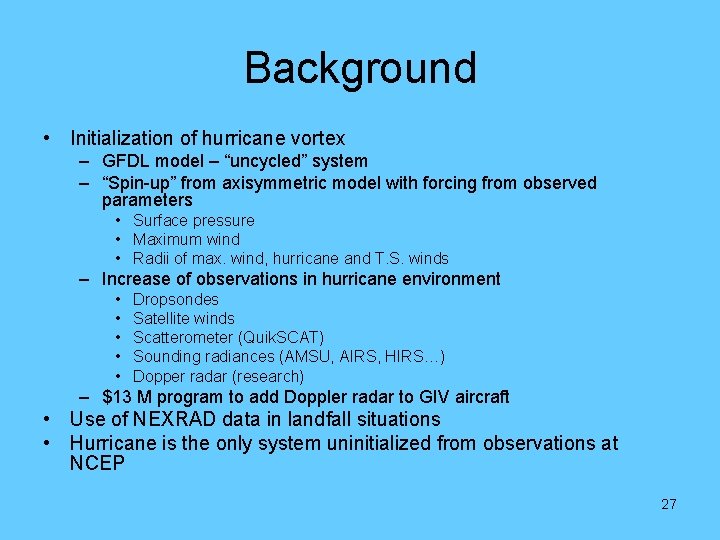
Background • Initialization of hurricane vortex – GFDL model – “uncycled” system – “Spin-up” from axisymmetric model with forcing from observed parameters • Surface pressure • Maximum wind • Radii of max. wind, hurricane and T. S. winds – Increase of observations in hurricane environment • • • Dropsondes Satellite winds Scatterometer (Quik. SCAT) Sounding radiances (AMSU, AIRS, HIRS…) Dopper radar (research) – $13 M program to add Doppler radar to GIV aircraft • Use of NEXRAD data in landfall situations • Hurricane is the only system uninitialized from observations at NCEP 27

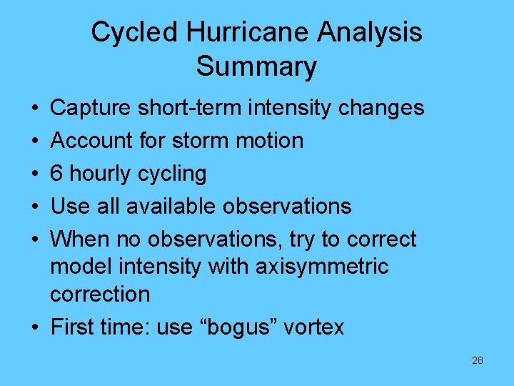
Cycled Hurricane Analysis Summary • • • Capture short-term intensity changes Account for storm motion 6 hourly cycling Use all available observations When no observations, try to correct model intensity with axisymmetric correction • First time: use “bogus” vortex 28

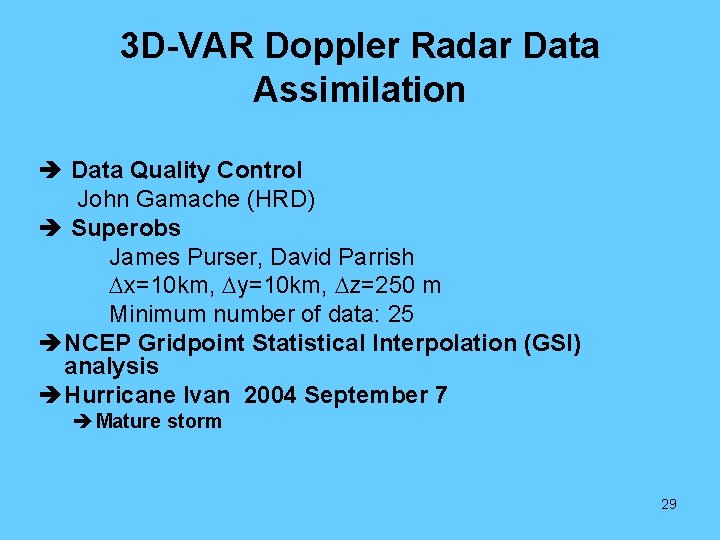
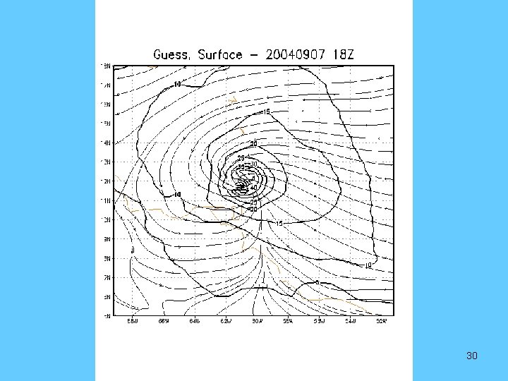
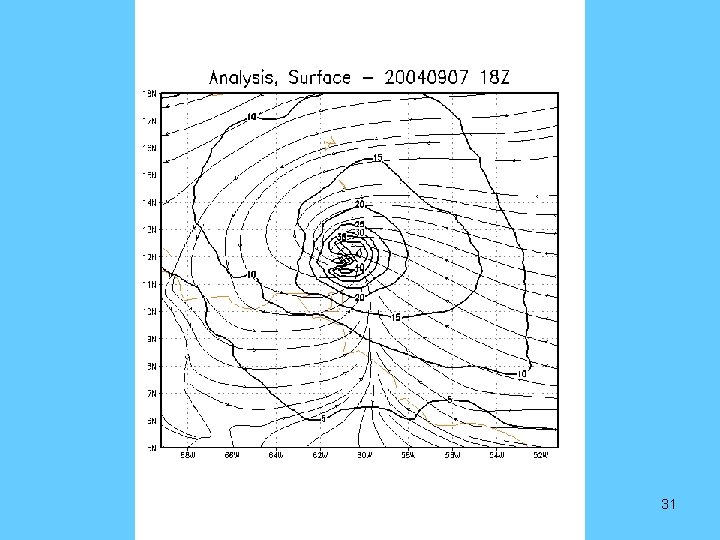
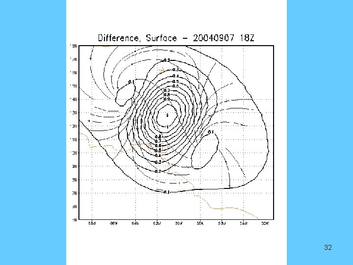
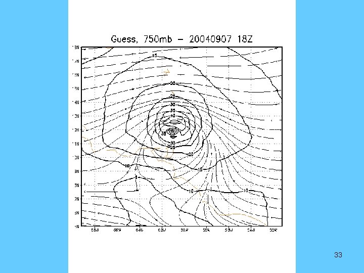
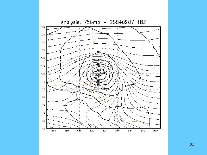
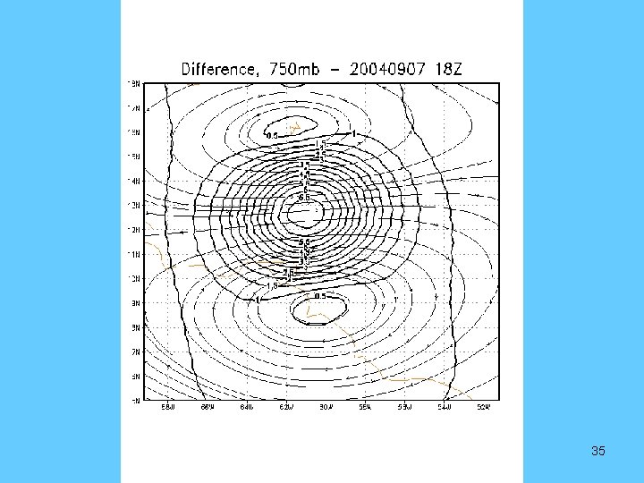
3 D-VAR Doppler Radar Data Assimilation è Data Quality Control John Gamache (HRD) è Superobs James Purser, David Parrish Dx=10 km, Dy=10 km, Dz=250 m Minimum number of data: 25 è NCEP Gridpoint Statistical Interpolation (GSI) analysis è Hurricane Ivan 2004 September 7 è Mature storm 29

Guess Field 30

31

32

33

34

35

Future Work • Run more model forecast using the new analysis for weak storms • Study the impact of the airborne radar data on hurricane track and intensity forecasts, particularly for weak storms • Run HWRF complete cycling system during 2006 hurricane season 36

Summary and Outlook • Use of NEXRAD wind data has proceeded in incremental steps over the past 9 years – Level 3 Level 2. 5 Level 2 • Use of reflectivity for – Precipitation analyses – Model initialization • Remaining issues – Quality control – Model initialization (increasing system complexity) 37

Summary and Outlook (cont) • June 2005 - Implemented Level 2. 5 (superobbed) data • June 2006 – Hierarchical radar data ingest for WRF-NAM – – Level 2. 0 (full resolution radial winds) Level 2. 5 (superobbed winds) Level 3 (“NIDS” feed) Precip. Assimilation impacts land surface only • Prototype data assimilation for hurricane initialization – – Airborne Doppler radar Coastal radar 2004 cases as prototype 2006 cases will be run as demonstration project • Integrating quality control codes into NCEP North American Model (NAM) run – Visiting scientist hired (on board at EMC 30 June, 2006) • Winds - expect steadily increasing impact • Reflectivity - long term project requiring advanced data assimilation techniques 38

Thanks Questions? 39

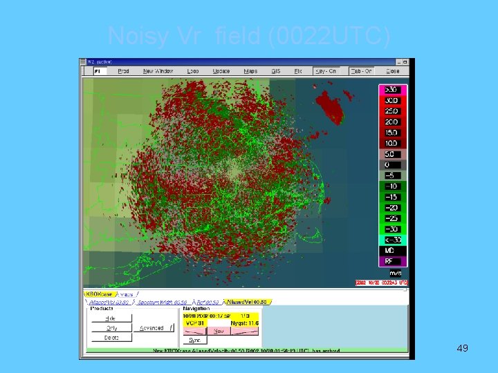
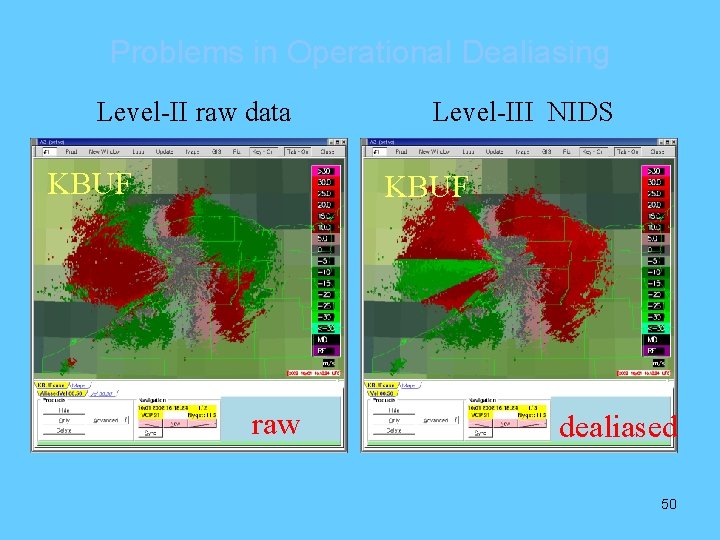
Doppler Velocity Data Quality Problems 1. Noisy fields (due to small Nyquist velocity) 2. Irregular variations due to scan mode switches 3. Unsuccessful dealiasing 4. Contamination by migrating birds 5. Ground clutters due to anomalous propagation (AP) 6. Large velocities caused by moving vehicles & AP 7. Sea Clutter EMC Working with NSSL and CIMMS to address all QC issues 40

Level 2 Radar Data Assimilation Strategy • NAM assimilates Level 2 data – 20 June • QC codes are being ported from NSSL & CIMMS – Address all QC issues • Visiting Scientist on board at NCEP (30 June) – Former NSSL scientist – Prior experience with codes – Tuning and case studies • Assimilating reflectivity will be a long-term project, dependent on advanced data assimilation techniques 41

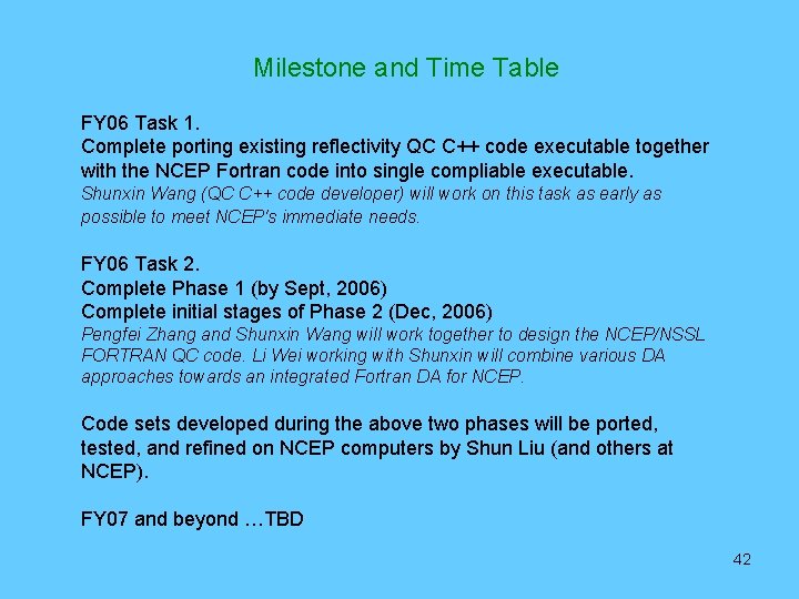
Milestone and Time Table FY 06 Task 1. Complete porting existing reflectivity QC C++ code executable together with the NCEP Fortran code into single compliable executable. Shunxin Wang (QC C++ code developer) will work on this task as early as possible to meet NCEP's immediate needs. FY 06 Task 2. Complete Phase 1 (by Sept, 2006) Complete initial stages of Phase 2 (Dec, 2006) Pengfei Zhang and Shunxin Wang will work together to design the NCEP/NSSL FORTRAN QC code. Li Wei working with Shunxin will combine various DA approaches towards an integrated Fortran DA for NCEP. Code sets developed during the above two phases will be ported, tested, and refined on NCEP computers by Shun Liu (and others at NCEP). FY 07 and beyond …TBD 42

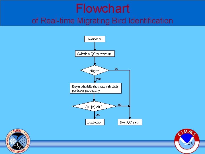
Flowchart of Real-time Migrating Bird Identification Raw data Calculate QC parameters Night? no yes Bayes identification and calculate posterior probability P(B |xi) >0. 5 no yes Bird echo Next QC step 43

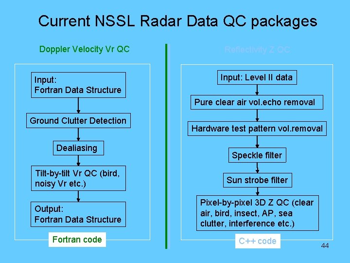
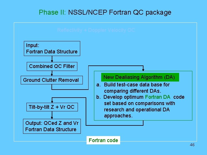
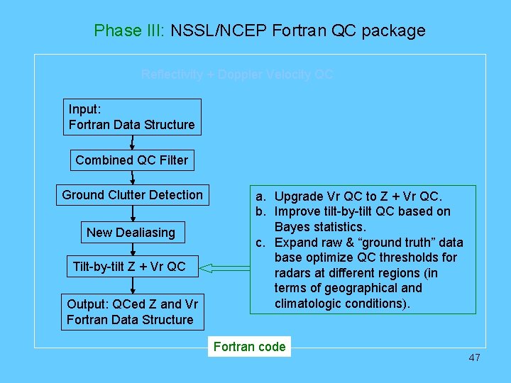
Current NSSL Radar Data QC packages Doppler Velocity Vr QC Input: Fortran Data Structure Reflectivity Z QC Input: Level II data Pure clear air vol. echo removal Ground Clutter Detection Dealiasing Hardware test pattern vol. removal Speckle filter Tilt-by-tilt Vr QC (bird, noisy Vr etc. ) Sun strobe filter Output: Fortran Data Structure Pixel-by-pixel 3 D Z QC (clear air, bird, insect, AP, sea clutter, interference etc. ) Fortran code C++ code 44

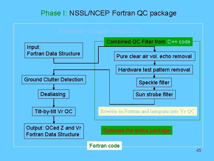
Phase I: NSSL/NCEP Fortran QC package Reflectivity + Doppler Velocity QC Input: Fortran Data Structure Combined QC Filter from C++ code Pure clear air vol. echo removal Hardware test pattern removal Ground Clutter Detection Speckle filter Dealiasing Tilt-by-tilt Vr QC Output: QCed Z and Vr Fortran Data Structure Sun strobe filter Rewrite in Fortran and integrate into Vr QC Optimize the entire package Fortran code 45

Phase II: NSSL/NCEP Fortran QC package Reflectivity + Doppler Velocity QC Input: Fortran Data Structure Combined QC Filter Ground Clutter Removal Tilt-by-tilt Z + Vr QC New Dealiasing Algorithm (DA) a. Build test-case data base for comparing different DAs. b. Develop optimum Fortran DA code set based on comparisons with research and operational DA approaches. Output: QCed Z and Vr Fortran Data Structure Fortran code 46

Phase III: NSSL/NCEP Fortran QC package Reflectivity + Doppler Velocity QC Input: Fortran Data Structure Combined QC Filter Ground Clutter Detection New Dealiasing Tilt-by-tilt Z + Vr QC Output: QCed Z and Vr Fortran Data Structure a. Upgrade Vr QC to Z + Vr QC. b. Improve tilt-by-tilt QC based on Bayes statistics. c. Expand raw & “ground truth” data base optimize QC thresholds for radars at different regions (in terms of geographical and climatologic conditions). Fortran code 47

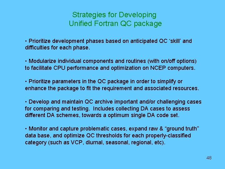
Strategies for Developing Unified Fortran QC package • Prioritize development phases based on anticipated QC ‘skill’ and difficulties for each phase. • Modularize individual components and routines (with on/off options) to facilitate CPU performance and optimization on NCEP computers. • Prioritize parameters in the QC package in order to simplify or enhance the package to fit the requirement and associated resources. • Develop and maintain QC archive important and/or challenging cases for comparing and testing. Includes collecting DA cases to assess different DA schemes, towards a optimum single DA code set. • Monitor and capture problematic cases, expand raw & “ground truth” data base, and optimize QC thresholds for each properly-classified category (such as VCP, diurnal, seasonal, regional, etc). 48

Noisy Vr field (0022 UTC) 49

Problems in Operational Dealiasing Level-II raw data KBUF Level-III NIDS KBUF raw dealiased 50

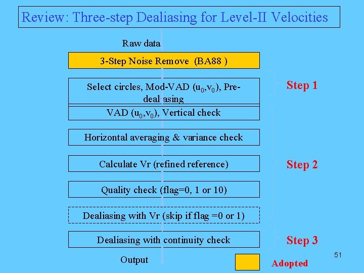
Review: Three-step Dealiasing for Level-II Velocities Raw data 3 -Step Noise Remove (BA 88 ) Select circles, Mod-VAD (u 0, v 0), Predealiasing VAD (u 0, v 0), Vertical check Step 1 Horizontal averaging & variance check Calculate Vr (refined reference) Step 2 Quality check (flag=0, 1 or 10) Dealiasing with Vr (skip if flag =0 or 1) Dealiasing with continuity check Output Step 3 Adopted 51

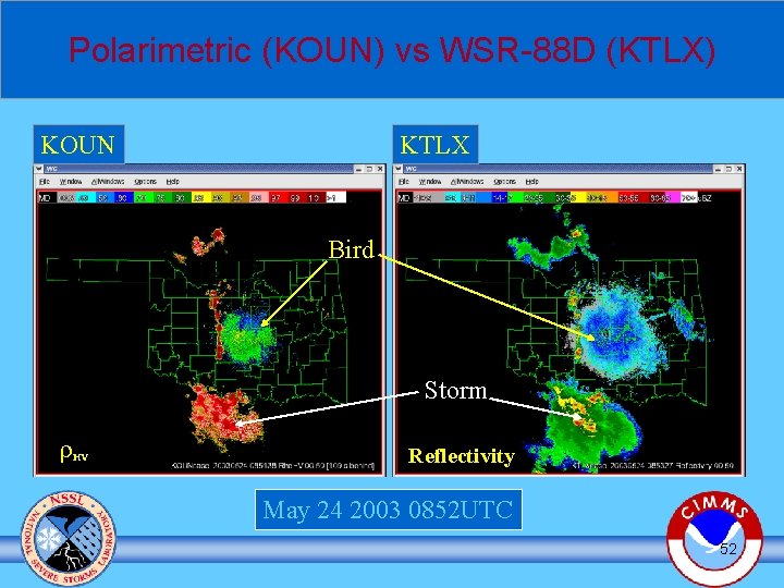
Polarimetric (KOUN) vs WSR-88 D (KTLX) KOUN KTLX Bird Storm r HV Reflectivity May 24 2003 0852 UTC 52

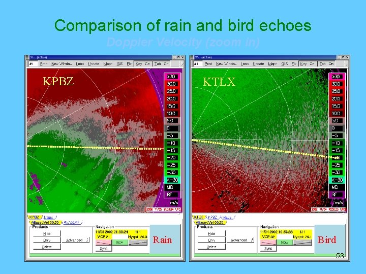
Comparison of rain and bird echoes Doppler Velocity (zoom in) KPBZ KTLX Rain Bird 53

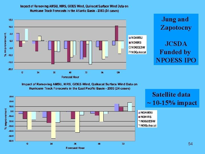
Jung and Zapotocny JCSDA Funded by NPOESS IPO Satellite data ~ 10 -15% impact 54