YEAR 7 GEOGRAPHY Miss Vidler Year 7 Geography










- Slides: 115

YEAR 7 GEOGRAPHY Miss Vidler

Year 7 Geography �Topic 1: The Nature of Geography �Topic 2: World Heritage Sites �Topic 3: Geographical Research and Fieldwork �Topic 3: Our World �Topic 5: Global Environments ◦ Case Study: Coral Reefs and Deserts Case study

THE NATURE OF GEOGRAPHY �What is Geography? �Our own understanding of Geography! ◦ In one short paragraph write in your notebook your own short definition of what Geography means to you. . . ◦ Geography to me is the study of the world. Geographers the culture, landmarks and people across the world!!!! ◦ Geography to me is the study of the world and the way it has come to be. Geographers are. . . . ◦ Geography to me is. . .


THE NATURE OF GEOGRAPHY �What is Geography? ◦ Geography and YOU: prior knowledge �Have you travelled before? �Have you ever read a map? �Have you been in a plane? �Are you curious? �Are you observant? ◦ Is Geography just knowledge? ◦ What does Geography help you do?

A definition Geography is the study of the natural world and how people interact with it.

Geography! What does this movie highlight about the importance of Geography? Why does Geography Matter?

YOUR GEOGRAPHY PASSPORT Fill out the GREEN Geography passport You will then share the answers to two questions with the class so decide which answers you would like to share! Why do we need passports?

THE NATURE OF GEOGRAPHY �What is Geography? �Not just knowledge but SKILLS �Read maps, developing spatial awareness, read synoptic charts, use a compass, identify physical and cultural features on a map �Geography helps you become an ACTIVE CITIZEN of the WORLD �“If you think you are too small to be effective, you have never been in bed with a mosquito” : Mahatma Ghandi �Geography allows us to see the world more clearly �Geography is NOW: what is happening today in the world? . . . �Geography is our future �Geography is POWER (what else is power? ) �Geography = Greek work ‘Ge’ meaning The Earth and ‘Graphein’ meaning to describe or to write

THE NATURE OF GEOGRAPHY �What is the role of Geography? ◦ Spatial subject concerned with WHERE people and places are located and the PATTERNS of features of the Earth’s surface �What work do Geographers do? ◦ Geographers learn to view things from different perspectives and to understand the natural and human processes that shape our world ◦ Geographers need to be curious to ask questions about the world around them

GEOGRAPHICAL QUESTIONS Questions to ask include: �What is it? �Where is it? �Why is it there? When investigating issues go on to ask: �What are the effects of it being there? �How is it changing? �Should it be like this? Then they consider citizenship �What groups are involved? �What do different groups think? �What action is appropriate

Homework from Friday Over the w-end if you try and read the “World” section of the Sydney Morning Herald or The Australian and find a story that interests you. You are then to write a short 1 paragraph summary if you have time! Please see the links below for online versions of the newspapers. I look forward to discussing on Monday. (TUESDAY!) Link to The Australian ‘World’ page http: //www. theaustralian. com. au/news/world Link to The Sydney Morning Herald ‘World’ page http: //www. smh. com. au/world

Why study Geography? �With a population on Earth of nearly seven billion people. . . ◦ Increasing competition for resources ◦ Many issues causing concern �By studying Geography we can become ACTIVE and INFORMED citizens and do something to protect our future

Famous and interesting. . . Geographers, maps and Geography! txt pg 5. �Geographers at Google Earth video ◦ What are some of the jobs that these Geographers do? ◦ What are some of the interesting things that Geography allows us to do today? ◦ What are the limits of Geography today? ◦ What can we do with maps today? ◦ What does Satellite imaging allow people to do? ◦ Who can be a map maker?

THE NATURE OF GEOGRAPHY Tips for success! �Glossary: What is a glossary? �Notebook �Geography is everywhere! ◦ News clippings ◦ Radio podcasts ◦ Your own experiences �SHARE OUR KNOWLEDGE

Our RULES for OUR GEOGRAPHY CLASS G E O G R A P H Y

RULES in the GEOGRAPHY CLASS G: enerosity E: verywhere: news, paper, movies O: rganisation G: lossary R: espect each others opinions A: ctive citizenship P: ower H: ope Y: our own interests

Key terms Physical Society Natural Reference Economy Grid Environment Reference Technology Area Global Politics Symbol Human Elements Processes Map Landforms Sketch Issues Photograph Resources Scale Key

Physical and human elements of environments: PHYSICAL elements BRAINSTORM �What are the physical elements of environments?

Physical and Human Geography �List the natural parts of this photograph the parts humans have changed in this photograph

The temples of Angkor, built by the Khmer civilization between 802 and 1220 AD, Investigating the World represent one of humankind's most astonishing and enduring architectural achievements. From Angkor the Khmer kings ruled over a vast domain that reached from Vietnam to China to the Bay of Bengal. The structures one sees at Definition Angkor today, more than 100 stone temples in all, are the surviving remains of a grand religious, social and administrative metropolis whose other buildings - palaces, public buildings, and houses - were built of wood and are long since decayed and gone.

GEOGRAPHY PRE- TEST you all did very well What we need to work on this term is MAPPING skills!! Also SPELLING AND HANDWRITING!! Take PRIDE in your work!

Physical Geography is the study of the landforms and processes in the natural environment.

Investigating the World Sun Air Definition Plants Rocks Sea List all the natural elements in this environment Fish

Physical elements of environments �Solar energy (heat and light) �Air �Water �Flora and fauna �Soil

Physical elements of environments ECOSYSTEMS: �Physical elements occur naturally. They are divided into 2 groups 1 -Biotic: living things such as plants and animals 2 - Abiotic: non-living things such as water, rocks and soil. What is an ecosystem?

ecosystsm. . is the way in which all these things interact in a particular environment is an ecosystem. The 3 main processes that connect all parts of an ecosystem are the: 1. Energy flow 2. Water cycling 3. Nutrient cycling

Ecosystem: creating our own ecosystem txt p. 14 -15 �Energy Flow: plants capture 1% of the solar energy that reaches the Earth and through photosynthesis plants convert this energy into carbohydrates that are a food source for their growth and the animals that eat them �Nutrient Cycle: plants gain the water and nutrients they need from the soil. Nutrients then pass along the food chain as plants are eaten by animals and they are then eaten by other animals. Eventually plans and animals die, and the nutrients are returned to the soil by the decomposers �Water Cycle: Water flows through all ecosystems. When heated by the sun water evaporates and turns into water vapour. If water vapour rises it cools and condenses forming clouds. Precipitation falls from the clouds and the water either soaks into the ground or flows over the surface into rivers. . .

Human elements of the environment What are the human elements of the environment?

Human Geography is the study of humans and how they change the natural world to satisfy their needs and wants.

Investigating the World Definition Industry Settlement Political List all the human elements in this environment Economic Socio-cultural

Human elements of the environment �Political �Economic �Settlements �Agriculture �Sociocultural �Industrial

Human elements of the environment Can you think of an area of the world that is completely natural and not affected at all from human influences on the landscape? Land cleared for agriculture, rivers dammed for water, industries developed to process raw material and people have created settlements to live in. . . � SETTLEMENTS: anywhere people live. . . isolated farmhouses to Tokyo. The buildings that people construct within settlements often reflect their culture as well as physical environment � AGRICULTURE: involves human activities that have been shaping the landscape for centuries. Often the natural environment has been significantly changed by farming practices. Patterns created very from patchworks of fields to featureless expanses by commercial farming. E. G. Bolivia. � INDUSTRY: industries used to be located close to raw materials they needed or to coalfields which provided power. Today, industries more concerned with access to their markets and reducing labour costs ◦ Old industrial areas in Europe and Nth America have declined replaced by modern business parks ◦ Factories have moved from richer to poorer countries. . why? POLITICAL ECONOMIC SOCIOCULTURAL

Using Geographical Tools �Geographers use photographs and sketches to describe an area. They can be also used to identify specific features such as human and physical elements. When a geographer labels features it is known as annotating.

Investigating the World Using Geographical Tools Oblique Close-up Aerial Panorama Satellite image Ground Level

Urban vs Rural living: human elements

TASK: Create a collage of Physical and human elements of the environment and include definitions of key terms OR Create a movie documenting the physical and human elements of the environment and include definitions �Could be a world map or a particular home, suburb, city. . .

Interaction of the pjhysical and human environments �Biosphere: zone of life on Earth. All ecosystems �Atmosphere: the air and gases, climate and water �Lithosphere: the Earth’s surface rocks, soils and landforms �Hydrosphere: water in oceans, seas, rivers and lakes

Worksheet! �Physical and human environments �Interaction of the physical and human elements!

New topic: Geographical Research and Fieldwork �In this topic we use geographical tools to investigate the physical and human environment! �What is fieldwork and why do geographers carry out fieldwork?

(sun, plants, decomposers, primary consumers, secondary consumers)

Geographical Research and Fieldwork �In order to understand the world it is essential to experience environments firsthand. . �Fieldwork allows geographers to gain a better understanding of physical processes and the interactions that take place between people and their environment �Conducting fieldwork teaches you how to use a variety of geographical tools. .

Geographical Research and Fieldwork �See FIELDWORK guide on p. 18 of text: 7 step process 1. Decide on the aim of your fieldwork 2. Generate key questions that relate to the aim 3. Decide what date you need to collect 4. Identify the techniques that you will use to collect your data 5. Go and collect your data 6. Process the data 7. Select a presentation method

Geographical Research Apply key geographical questions to any world environment ◦ ◦ ◦ ◦ What Where Why is What are the effects How is it changing Should it be like this What groups are involved Action needed

OBSERVATION � To collect information about an environment is to look at it carefully and keep a detailed record of observations � A field sketch is a useful tool for geographers and can be drawn to show the features of an individual plan or an entire area of study � Field sketch ◦ Only contains main features ◦ Features not important to your study can be left out ◦ You can zoom in or out as far as you choose. . what The eye sees ◦ You can make notes of your observation directly onto the Sketch as you draw it. E. g. Sand

Investigating the World Definition

Investigating the World Now try some colour to distinguish different features Definition

Investigating the World Definition

Investigating the World Definition

SAMPLES AND SURVEYS �An effective way to collect information is to conduct a survey �Survey: a collection of statistical data e. g. A count: how many students drive, catch bus, walk to school. . . ? � A poll: how many people in favour of a particular issue. Important that the people surveyed are fair representation of the broader population (old, young etc) More detailed form: questionnaire, which must be well planned and tested: see tips on p. 19 for what a good questionnaire includes � EG: Survey Monkey: www. surveymonkey. com/

A survey. .

Geographical Research �CONDUCT A SURVEY: ◦ Types of litter/origin of products purchased �Tally results �Compile tables and graphs �Make conclusions �Observation �Use digital photos taken at different times of the day or the playground �Observe changes to litter �Map the distribution of litter �Discuss possible reasons for the pattern �Student strategies to resolve these issues

School map �Walking around school we are to classify different elements we find �Construct a sketch map of the school. �BOLTS : Border, orientation, legend, title and scale

Fieldwork �STUDY A QUADRANT ◦ ◦ ◦ Describe what you can see Identify plan and animal species Compare to another area Use geographical questions Present findings using a range of written oral and graphic forms ◦ Create a brochure in publisher/word/pages

New topic: OUR WORLD The world! �Collect a series of images of places and cities from the internet and locate these places onto a blank map of the world (POSTER size)

OUR WORLD

The world You might already be an expert. . . ? During this topic we learn to. . . ◦ Learn how to recognise continents using different map projections ◦ Use latitude to describe the global pattern of climate, including the spatial and seasonal change in insolation ◦ Use longitude to explain world time zones ◦ Describe global patterns of physical and human features

The world �The Physical world: Main pieces of land on the Earth’s surface are called continents + Main saltwater areas on the Earth’s surface: the world’s oceans. How many continents are there? Is Australia a continent? How many oceans are there?

The world continents: 7 World oceans: 5 �Create your own map of the physical world: Australia centric. . . � Include guides relative size of world continents and oceans

World records What is the largest island? Longest coastline? Highest mountain Greatest mountain range? Longest river? Largest lake? . . see pg. 26 for answers. . Do you know any other world physical records? . . .

The world map Maps help people to understand the size, complexity and fragility of the planet Earth and the relationships that humans have with it. �Three features that are shown of every world map: ◦ Continents ◦ Oceans: ◦ A grid system: lines of latitude and longitude

MAP MAKING �http: //www. youtube. com/watch? v=co. R Et. R 0 T-x. A �Geographical knowledge �Did medieval Europe believe the world was flat?

Latitude and Longitude � Parallels of latitude: lines that run across the map from east to west; 5 main lines of latitude 1. 2. 3. 4. 5. Equator Tropic of Capricorn Tropic of Cancer Arctic Circle Antarctic Circle � Meridians of longitude: lines that run up and down the map from north to south; 2 main lines of longitude 1. 2. The Prime Meridian at O ° The International Date Line (IDL) which is around the 180 ° in the Pacific Ocean

NORTH OR SOUTH BEFORE EAST OR WEST �LATITUDE BEFORE LONGITUDE when locating a place �E. G. Latitude and longitude of Sydney is 33° 53'S, 151° 10'E

Latitude, longitude and hemispheres. . where is Australia?

Maps: Atlas, projections and types

Who was the first person to circumnavigate and map Australia? In the introduction to A voyage to Terra Australis, xxxxxx wrote: 'Had I permitted myself any innovation upon the original term, it would have been to convert it into Australia; as being more agreeable to the ear, and as an assimilation to the names of the other great portions of the earth. ' [ Vol. I, p. iii, facsim. ed. , 1966] What does Terra Australis mean?

� Matthew Flinders circumnavigation 1803 the exact outline were known and charted � Terra Australis ‘Southern land’ Reproduction of a copy of the Tasman Map on the floor of the State Library of NSW. The text (translated from old Dutch) reads: "State country, which has been sailed and discovered with the ships Hemskerck and Zeehaen under command of the captain Abel Tasman. In the year anno 1642 the 13 th December"

MATTHEW FLINDERS �Matthew Flinders was born in a village in Lincolnshire on the east coast of England. His Grandfather and father both busy doctors, it was expected that Matthew would follow family tradition. �However, at 15, Matthew preferred reading, secretly, Robinson Crusoe, than reading Medicine. So he wrote to his cousin, John Flinders who was in naval service in the West Indies for advice. �See more here

What is an Atlas? Wondering what an atlas is? �An atlas is a collection of maps. �They project both physical and human features. �They also contain world maps and regional maps which are linked to a particular theme or place. It is very likely that there is an atlas of your State. �In the library, there might even be an atlas of population, agriculture and history. �Atlases can either be viewed in print form or in electronic form.

Map making and map projections �Why are all world maps not the same? �Who are people who make maps? �What are the different ways of drawing the world called?

Map making and map projections �All maps are not the same as the Earth is a sphere(3 D) and a map is flat (2 D) �A Cartographer are people who make maps �Cartographers have different ways of showing the curved surface of an almost spherical lump of rock – our planet – on a flat piece of paper �The above different ways of drawing the world are called map projections

Map projections attempt to correctly show �The shape of continents and oceans �The area or size of continents and oceans �The distance between two points �Direction

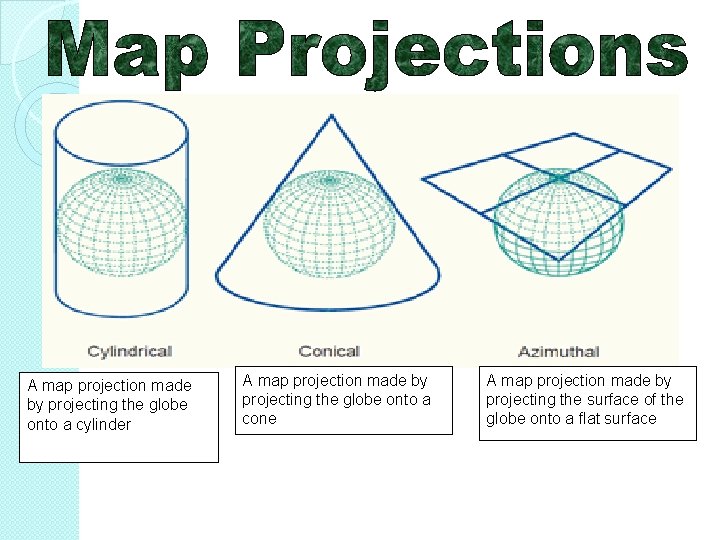
How are map projections made? By shining a light through part of a transparent globe so that the lines of latitude and longitude and the outlines of continents and oceans make a chart on the screen behind it. Areas near the centre will be about right but the poles will be distorted � Types of map projections � � 1. Cylindrical: by projecting the surface of the globe onto a cylinder that just touches the outside edges of the globe 2. Conical: by projecting the surface of the globe onto a cone that just touches the outside edges 3. Azimuthal: By projecting the surface of the globe onto a flat surface that just touches the outside edges Rectangular maps are prone to area and distance stretching while round ones distort the shape. Interrupted projections cut the world map along less important features – like oceans – to show size and shape correctly

ACTIVITIES: map projections Your homework is to create an information brochure highlighting all the different types of map projections with picture and a short summary of each type in your OWN WORDS!

A map projection made by projecting the globe onto a cylinder A map projection made by projecting the globe onto a cone A map projection made by projecting the surface of the globe onto a flat surface

Did you know? Australia is currently moving north-east at a rate of 73 millimetres per year. Geoscience Australia monitors regional earthquake risk by measuring the movement of tectonic plates.

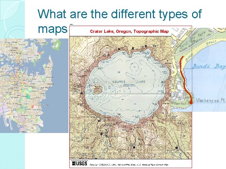
What are the different types of maps?

THE DIFFERENT TYPES OF MAPS Physical Political Topographic Thematic

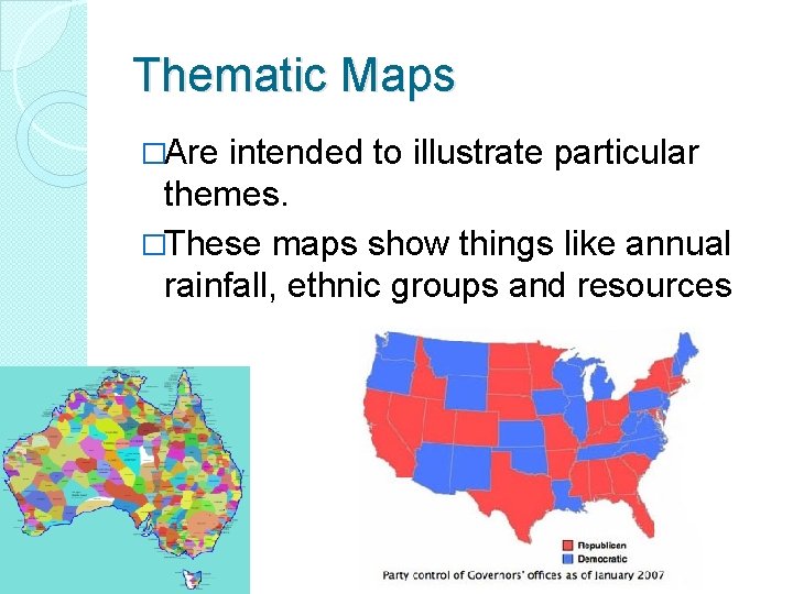
Thematic Maps �Are intended to illustrate particular themes. �These maps show things like annual rainfall, ethnic groups and resources

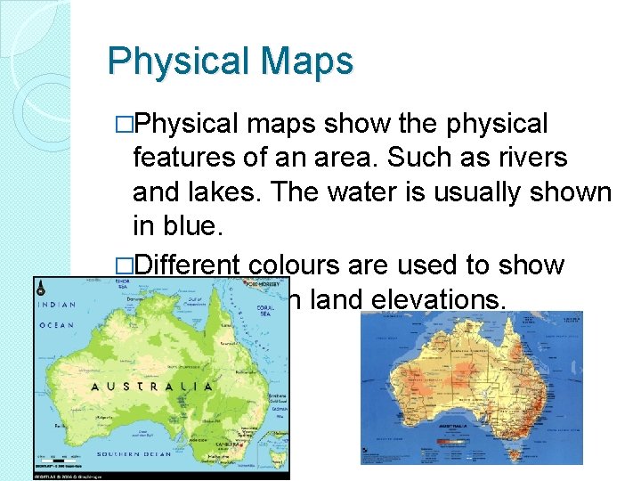
Physical Maps �Physical maps show the physical features of an area. Such as rivers and lakes. The water is usually shown in blue. �Different colours are used to show differences in land elevations. �

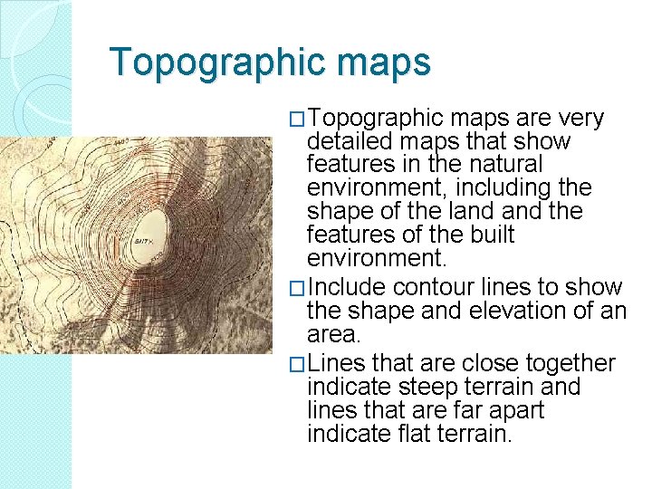
Topographic maps �Topographic maps are very detailed maps that show features in the natural environment, including the shape of the land the features of the built environment. �Include contour lines to show the shape and elevation of an area. �Lines that are close together indicate steep terrain and lines that are far apart indicate flat terrain.

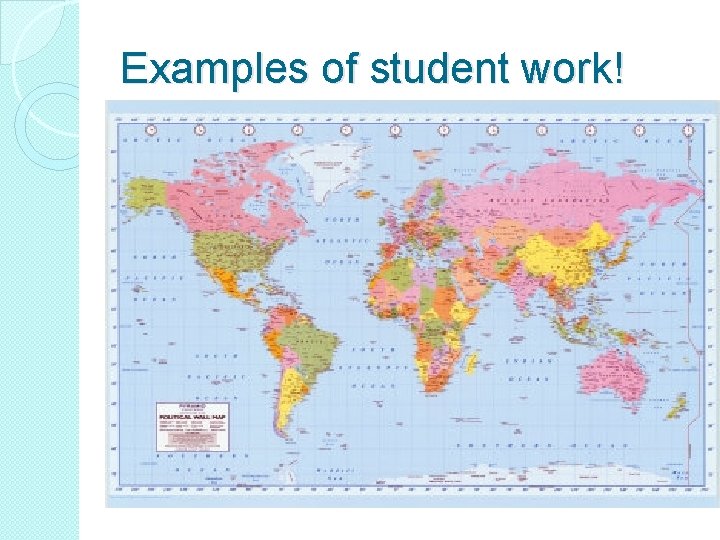
Political Maps �Political maps do not show physical features. �Instead, they show state and national boundaries, capital and major cities. A capital city is usually marked with a star within a circle � Political Maps are the most common maps of the world


Different types of maps! To help you create an information sheet on the different types of maps: physical, � Political � topographic � thematic. Visit the following websites! You should create your poster using Microsoft Publisher. It should be titled: “Types of maps: physical, political, topographic and thematic” http: //www. factmonster. com/world/geography/types-maps. html


Examples of student work!

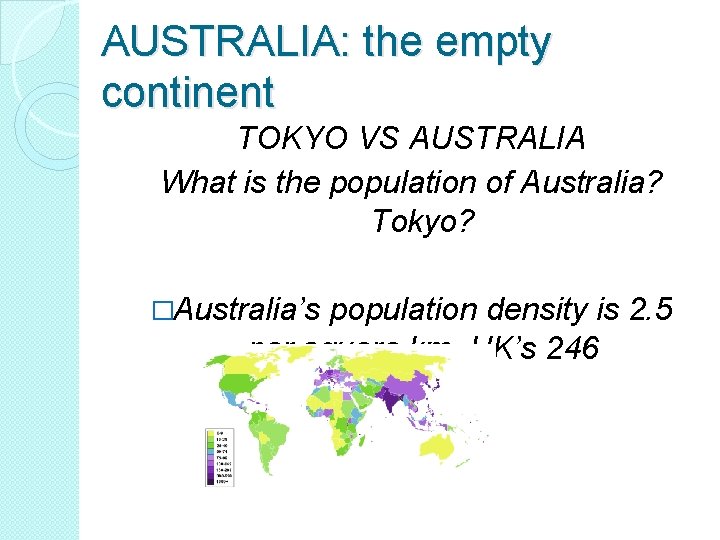
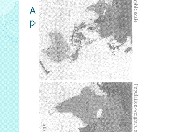
AUSTRALIA: the empty continent TOKYO VS AUSTRALIA What is the population of Australia? Tokyo? �Australia’s population density is 2. 5 per square km. UK’s 246

Australia by size and by population

HOW DO LATITUDE AND LONGITUDE INFLUENCE CLIMATE AND TIME?

Latitude and climate �Latitude measures how far north or south of the Equator a location is. . . What is the Equator and why does the equator and lines of latitude play a role in determining climate?

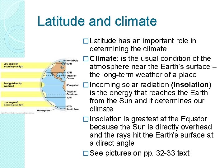
Latitude and climate � Latitude has an important role in determining the climate. � Climate: is the usual condition of the atmosphere near the Earth’s surface – the long-term weather of a place � Incoming solar radiation (insolation) is the energy that reaches the Earth from the Sun and it determines our climate � Insolation is greatest at the Equator because the Sun is directly overhead and the rays hit the Earth’s surface at a direct angle � See pictures on pp. 32 -33 text

Other influences on climate � Height above sea level – high elevations or altitudes experience colder conditions � Ocean currents – Warm ocean currents bring wet conditions, while cold currents bring dry conditions � Being close to the ocean –The ocean heats and cools more slowly than land, causing temperatures to be milder near the sea � Prevailing or usual wind patterns – winds over water may bring rain, but winds over land may bring dry conditions � Aspect – North-facing slopes in the Southern Hemisphere will be warmer than south-facing slopes

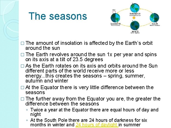
The seasons � The amount of insolation is affected by the Earth’s orbit around the sun � The Earth revolves around the sun 1 x per year and spins on its axis at a tilt of 23. 5 degrees � As the Earth rotates on its axis and orbits around the Sun different parts of the world receive more or less energy. . . this creates the seasons – spring, summer, autumn and winter � At the Equator there is very little difference between the seasons � The further away from the Equator you are, the greater the difference between the seasons ◦ Twice a year at the Equator there are equal hours of day and night ◦ At the South Pole there are 24 hours of darkness for six months in winter and 24 hours of daylight in summer

Longitude and time � North-south lines of longitude � They are NOT parallel to each other so all the lines meet at the North and South Poles � Called meridians of longitude � The Prime Meridian is an imaginary line at 0 degrees that runs from the North Pole to the South Pole passing through Greenwich, in London. The line separates Eastern Hemisphere from the Western Hemisphere � Meridian refers to the middle of the day or noon when the Sun is directly overhead. All places on the same meridian experience noon at the same time. � Morning a. m. Or ante meridian (before noon) and p. m. Or post meridian, afternoon

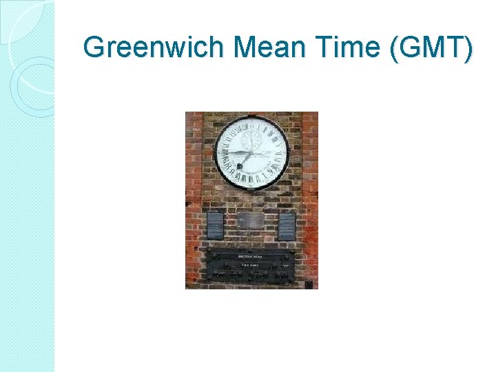
Greenwich Mean Time (GMT)

Longitude and time. . �What is the international date line? �What is daylight saving?

Time zones �http: //www. markstechnologynews. com /2009/12/geochron-world-clockmoving-map-displays-time-zonespentagon-style. html �http: //www. worldtimezone. com/

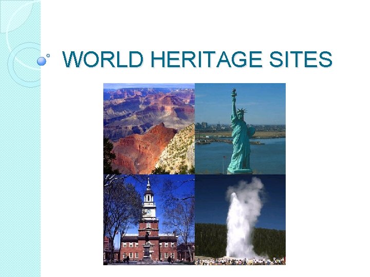
WORLD HERITAGE SITES


New topic: World Heritage Sites LEARN ABOUT �natural (physical) and cultural (human) sites �the criteria and process for World Heritage listing �international treaties and agreements related to World Heritage sites �organisations responsible for World Heritage sites

World Heritage sites LEARN TO �identify and locate natural and cultural World Heritage sites �use geographical questions to investigate a World Heritage site �explain the importance of World Heritage listing �legal obligations of governments to the preservation of World Heritage sites �outline the role of individuals, groups and governments in identifying and protecting World Heritage sites

The United Nations

The UN emblem shows the world held in the “olive branches of peace”.

“It is 'better to jaw-jaw than to war-war, '” http: //www. spartacus. schoolnet. co. uk/USA un. htm

A history of the UN The United Nations officially came into existence on 24 October 1945, when the UN Charter had been ratified by a majority of the original 51 Member States. The day is now celebrated each year around the world as United Nations Day. The purpose of the United Nations is to bring all nations of the world together to work for peace and development, based on the principles of justice, human dignity and the well-being of all people. It affords the opportunity for countries to balance global interdependence and national interests when addressing international problems. There are currently 192 Members of the United Nations. They meet in the General Assembly, which is the closest thing to a world parliament. Each country, large or small, rich or poor, has a single vote, however, none of the decisions taken by the Assembly are binding. Nevertheless, the Assembly's decisions become resolutions that carry the weight of world governmental opinion. http: //www. youtube. com/watch? v=d. Odo. Dxu 2 w. KY – historical alliance http: //www. youtube. com/watch? v=0 ba. Msmu. R 29 Q&feature=related

Development of UN declaration of human rights � Leading human rights lawyer Geoffrey Robertson gives a potted history of the development of human rights from the end of the monarchy's absolute power in Britain through to the Universal Declaration of Human Rights midway through last century. � He then calls for Australia to follow just about every other developed democratic nation and enact its own Bill of Rights. Far from being a banquet for greedy lawyers to feast on, Robertson says, such a bill protects the most vulnerable members of society. http: //www. abc. net. au/rn/foraradio/stories/2009/253 1484. htm

World Heritage Sites �Google’s world heritage sites: visit Versailles!

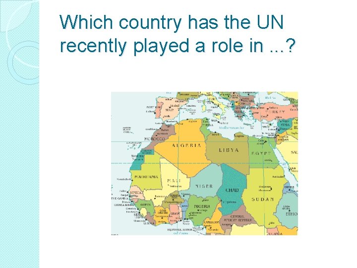
Which country has the UN recently played a role in. . . ?

World Heritage Sites. . . and the UNITED NATIONS http: //cyberschoolbus. un. org/unintro/unintro. asp http: //cyberschoolbus. un. org/infonation/in dex. asp? id=434 http: //www. un. org/cyberschoolbus/habitat/profil es/sydney. asp

Libya and the UN THEN �http: //news. bbc. co. uk/2/hi/africa/2672029. stm �And NOW �http: //www. bbc. co. uk/news/world-africa 12902450 �http: //www. bbc. co. uk/news/world-africa 12900706


Continental Drift and Plate tectonics
 Leavers acrostic poem
 Nsw geography syllabus
 5 themes of geography ap human geography
 Stateless nation
 Ap human geography frq format
 Miss goshko weebly
 Grace kelly 1947
 Irregular verbs drive
 Metamorphism definition
 Yiu are welcome
 Present simple miss
 Miss maudie atkinson quotes chapters 4-6
 Miss gimnazjum
 © jessica hall (miss señorita) 2014
 Miss cuba receives an invitation
 Diana rey xxx
 We aren't/we're not going to miss the train
 Miss arlene
 Miss angle
 © jessica hall (miss señorita) 2014
 Good morning miss in german
 Explain miss maudie's cake portions
 I hate everyone little miss sunshine
 Miss julie as a naturalistic tragedy
 The woman waited nervously in line
 Miss management 2
 Cinderella jump rope song
 Romance of a busy broker summary
 Miss zero conditional
 Lubang perempuan
 Who is miss gilby in the home and the world
 Curds and whey little miss muffet
 Near miss training ppt
 Identify mr dolphus raymond
 Billie holiday mugshots
 Miss trumbull
 Naturalism in drama
 Pride and prejudice miss lucas
 Miss status holding register
 Durian toeic
 Learn french with miss marie
 To kill a mockingbird chapter 1-5
 Ole miss diversity
 Good morning ms black
 Hit-or-miss transform
 Miss fatima husain
 Mitsl meaning
 I'm miss.bertha i'm your math
 Yonder come miss rosie
 Miss rivas
 Miss hughes teacher
 Description of scout in chapter 1
 Miss fenton
 Müge gördürür
 Can ct scan miss cirrhosis
 Miss america scoring
 Aprendo con miss lula
 Sally tennant orthopaedic
 Types of cache misses
 Miss ftn
 Southern gothic to kill a mockingbird
 Cook do
 Neulogismos
 Sentinel incident reporting
 Describing a dragon
 Domestic discipline contract
 Miss emma page
 How to calculate miss rate
 Urovnavat podu pred sejbou
 Canto de pin pon
 Jessica hall: libros
 Miss penalty della cache
 Miss malabares
 The ideal memory
 Miss b maths
 Aospine
 Little miss sunshine screenplay
 Jessica hall (miss señorita) 2014
 Character description of scout finch
 If it snows still drive to the coast
 Ilpc journalism
 Swiss miss mascot
 Is miss capitalized
 Did you miss it
 Scout's brother in to kill a mockingbird
 Mrs havisham poem
 Miss dig design ticket
 Please miss she just took my pencil and i need it lyrics
 Jason hale ole miss
 Jason hale ole miss
 Miss maudie quotes chapter 4-6
 Miss a integrantes
 Why would miss strangeworth be interested in whether linda
 The prime of miss jean brodie streaming
 Miss to send
 What is an incident
 Dark green pebbles for eyes
 I miss you allah
 Miss cooper teacher
 Miss martins
 Miss reeves
 To kill a mockingbird chapter 22
 Ymbryne miss peregrine
 Ms lawson a primary school teacher
 What does the narrator of “the wanderer” miss the most?
 Electrical near miss
 Near miss event
 Transforming moments summary
 Miss stem meaning
 Used to soru cümleleri
 Miss margarita
 Summary of nothing but the truth by avi
 Mince and tatties j k annand
 Miss emily sin
 Cache vs memory
 Jessica hall (miss senorita) 2014

