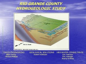
RIO GRANDE COUNTY HYDROGEOLOGIC STUDY DAVIS ENGINEERING Allen
- Slides: 73
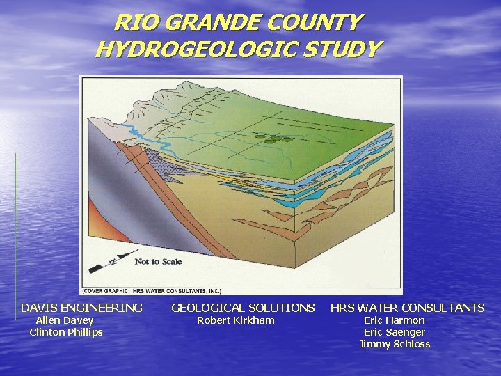
RIO GRANDE COUNTY HYDROGEOLOGIC STUDY DAVIS ENGINEERING Allen Davey Clinton Phillips GEOLOGICAL SOLUTIONS Robert Kirkham HRS WATER CONSULTANTS Eric Harmon Eric Saenger Jimmy Schloss
Rio Grande County Funding for project from State Water Supply Reserve Account through Rio Grande Basin Roundtable & Colorado Water Conservation Board Well and Spring Owners
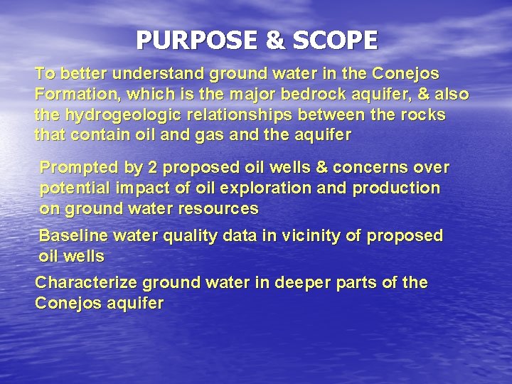
PURPOSE & SCOPE To better understand ground water in the Conejos Formation, which is the major bedrock aquifer, & also the hydrogeologic relationships between the rocks that contain oil and gas and the aquifer Prompted by 2 proposed oil wells & concerns over potential impact of oil exploration and production on ground water resources Baseline water quality data in vicinity of proposed oil wells Characterize ground water in deeper parts of the Conejos aquifer
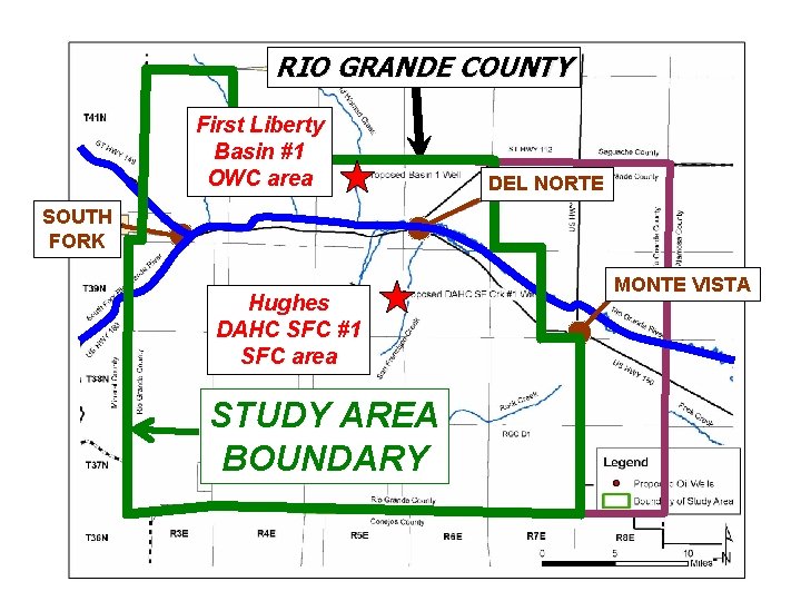
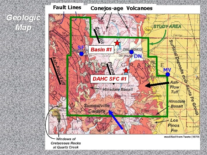
RIO GRANDE COUNTY First Liberty Basin #1 OWC area DEL NORTE SOUTH FORK Hughes DAHC SFC #1 SFC area STUDY AREA BOUNDARY MONTE VISTA
CONCLUSIONS DATA & INTERPRETATIONS SUPPORTING THE CONCLUSIONS RECOMMENDATIONS Study is based on limited data Interpretations & recommendations may evolve as new data becomes available & as other professionals provide feedback
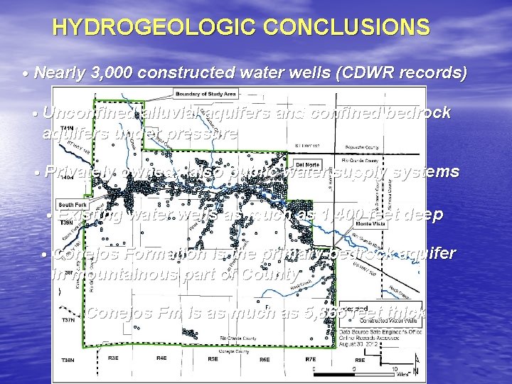
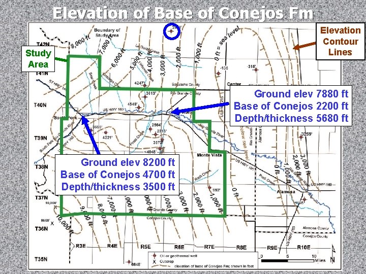
HYDROGEOLOGIC CONCLUSIONS • Nearly 3, 000 constructed water wells (CDWR records) • Unconfined alluvial aquifers and confined bedrock aquifers under pressure • Privately owned; also public water supply systems • Existing water wells as much as 1, 400 feet deep • Conejos Formation is the primary bedrock aquifer in mountainous part of County • Conejos Fm is as much as 5, 865 feet thick
Elevation of Base of Conejos Fm Elevation Contour Lines Study Area Ground elev 7880 ft Base of Conejos 2200 ft Depth/thickness 5680 ft Ground elev 8200 ft Base of Conejos 4700 ft Depth/thickness 3500 ft
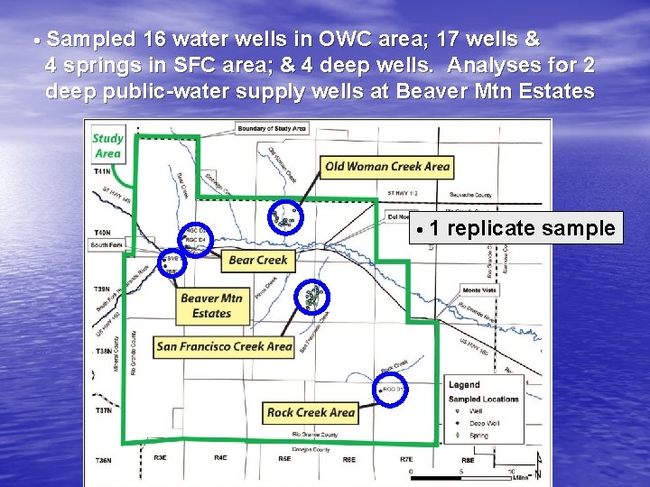
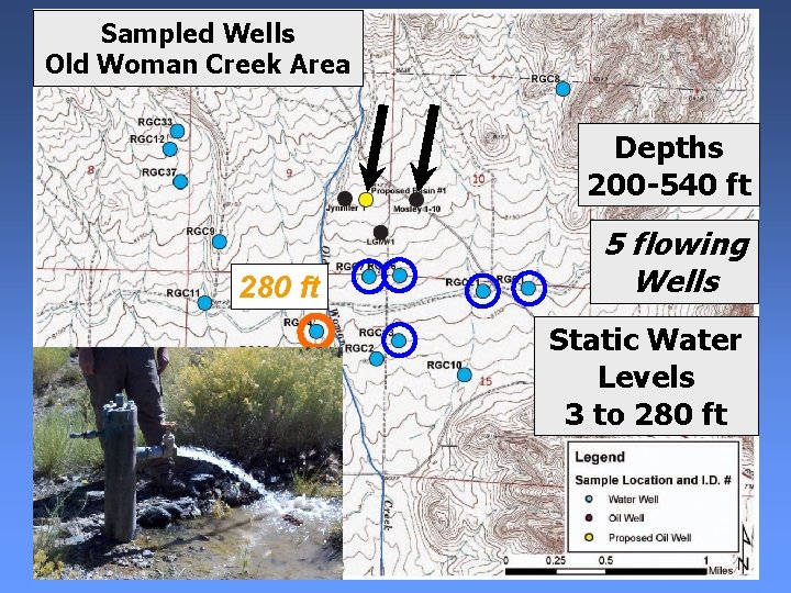
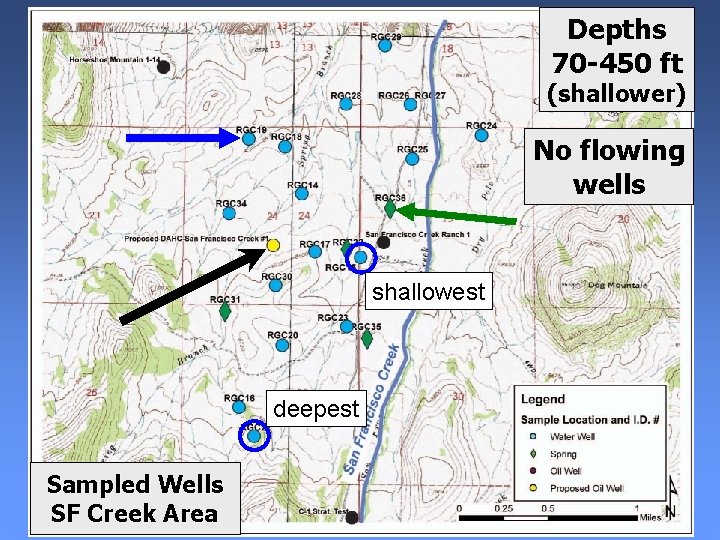
• Sampled 16 water wells in OWC area; 17 wells & 4 springs in SFC area; & 4 deep wells. Analyses for 2 deep public-water supply wells at Beaver Mtn Estates • 1 replicate sample
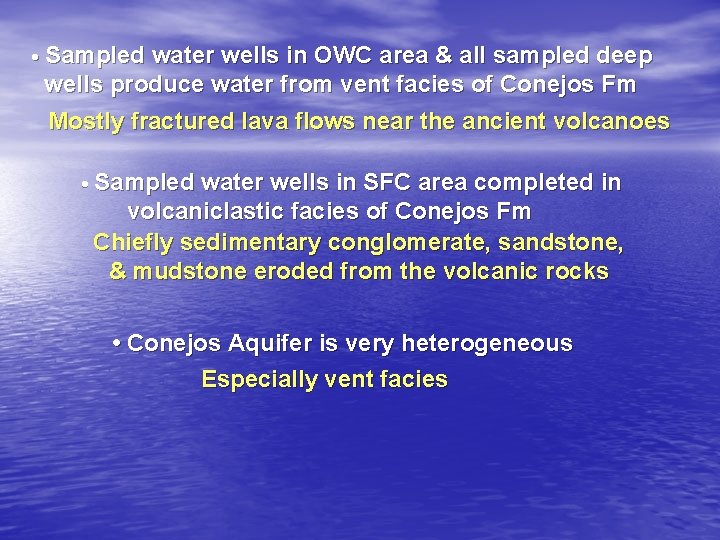
• Sampled water wells in OWC area & all sampled deep wells produce water from vent facies of Conejos Fm Mostly fractured lava flows near the ancient volcanoes • Sampled water wells in SFC area completed in volcaniclastic facies of Conejos Fm Chiefly sedimentary conglomerate, sandstone, & mudstone eroded from the volcanic rocks • Conejos Aquifer is very heterogeneous Especially vent facies
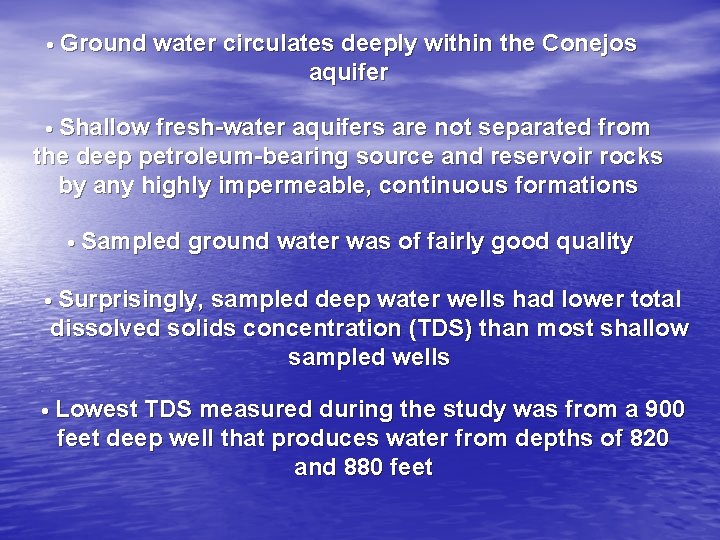
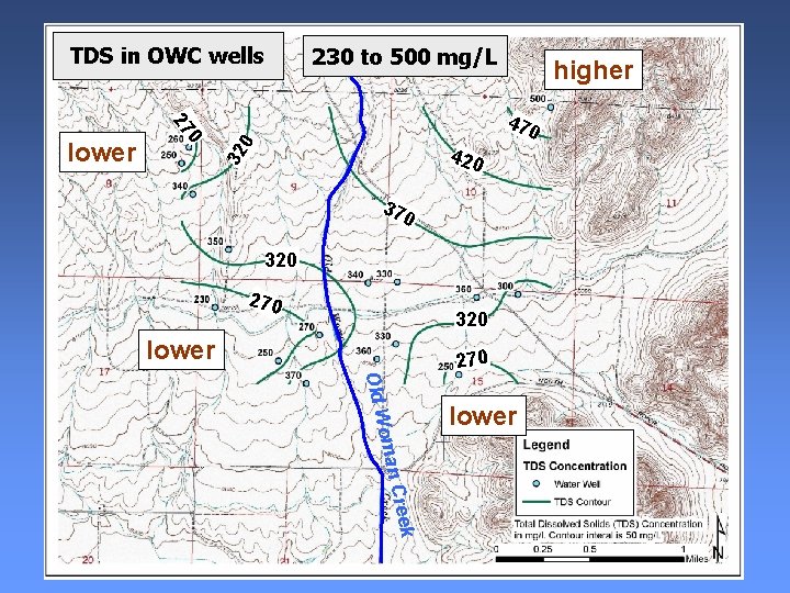
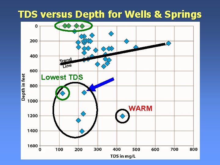
• Ground water circulates deeply within the Conejos aquifer • Shallow fresh-water aquifers are not separated from the deep petroleum-bearing source and reservoir rocks by any highly impermeable, continuous formations • Sampled ground water was of fairly good quality • Surprisingly, sampled deep water wells had lower total dissolved solids concentration (TDS) than most shallow sampled wells • Lowest TDS measured during the study was from a 900 feet deep well that produces water from depths of 820 and 880 feet
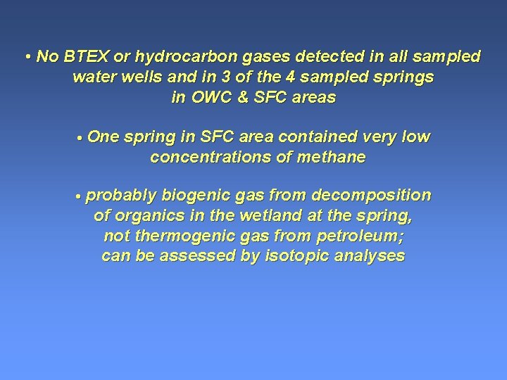
• None of the 33 sampled water wells and 3 of the 4 sampled springs within about 1 mile of the proposed oil wells contain detectable concentrations of the types of contaminants that might come from petroleum BTEX: benzene, ethylbenzene, xylene, and toluene HYDROCARBON GASES: methane, butane, ethylene, and propane • One sampled spring in SFC area contained very low concentrations of methane Biogenic gas from decomposition of organics in the wetland at the spring, not thermogenic gas; can be assessed by isotopic analyses
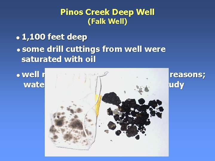
Oil and gas naturally exist locally within the Conejos aquifer • Natural • Oil oil seeps from bedrock formations in fractures in core from mineral exploration holes drilled into the Conejos • Oil found in drill cuttings from water wells • Natural gas was recovered from Conejos Fm in drillstem tests at some oil exploration drill holes Water wells in some areas may have potential for natural hydrocarbon contamination
Upper part of Conejos aquifer is an “underground source of drinking water” or aquifer as defined by U. S. Environmental Protection Agency. • The deeper part of the Conejos aquifer may NOT be an “exempted aquifer” and NOT be exempt from the EPA aquifer regulations—Need water chemistry to be sure And our last but not least important conclusion: • Casing requirements for the proposed oil wells may not be adequate to confidently protect the entire Conejos aquifer from potential impacts related to oil exploration and production
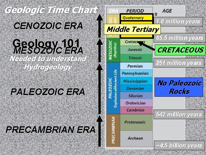
Geologic Time Chart CENOZOIC ERA Geology 101 MESOZOIC ERA Needed to understand Hydrogeology PALEOZOIC ERA 1. 8 million years Middle Tertiary 65. 5 million years CRETACEOUS 251 million years No Paleozoic Rocks 542 million years PRECAMBRIAN ERA ~4. 5 billion years
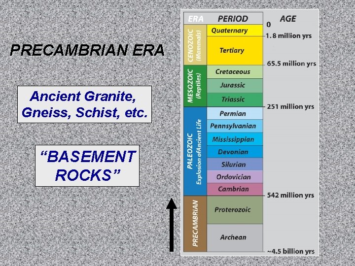
PRECAMBRIAN ERA Ancient Granite, Gneiss, Schist, etc. “BASEMENT ROCKS”
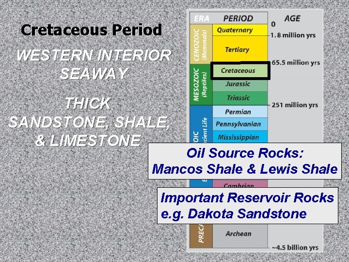
Cretaceous Period WESTERN INTERIOR SEAWAY THICK SANDSTONE, SHALE, & LIMESTONE Oil Source Rocks: Mancos Shale & Lewis Shale Important Reservoir Rocks e. g. Dakota Sandstone
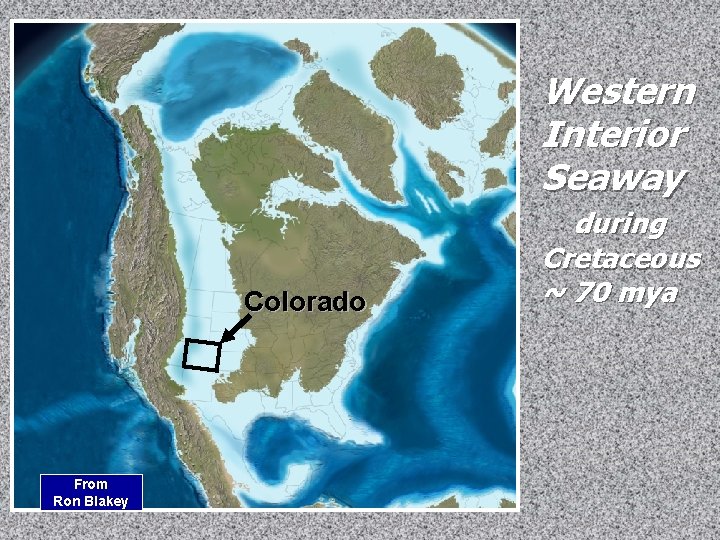
Western Interior Seaway Colorado From Ron Blakey during Cretaceous ~ 70 mya
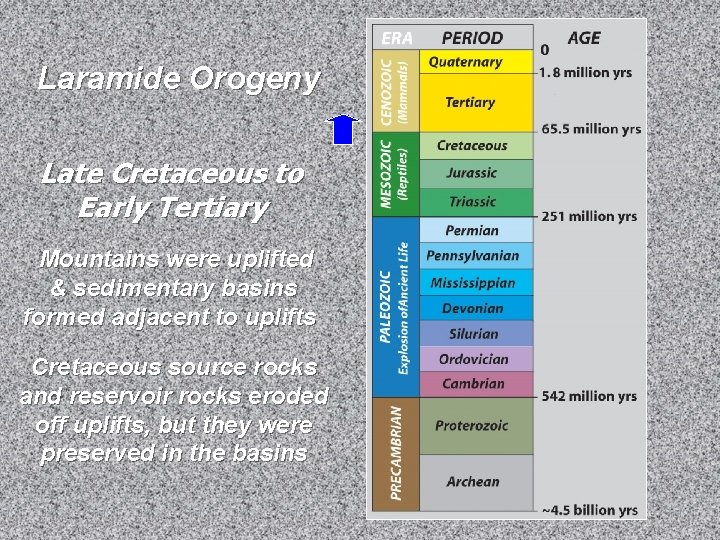
Laramide Orogeny Late Cretaceous to Early Tertiary Mountains were uplifted & sedimentary basins formed adjacent to uplifts Cretaceous source rocks and reservoir rocks eroded off uplifts, but they were preserved in the basins
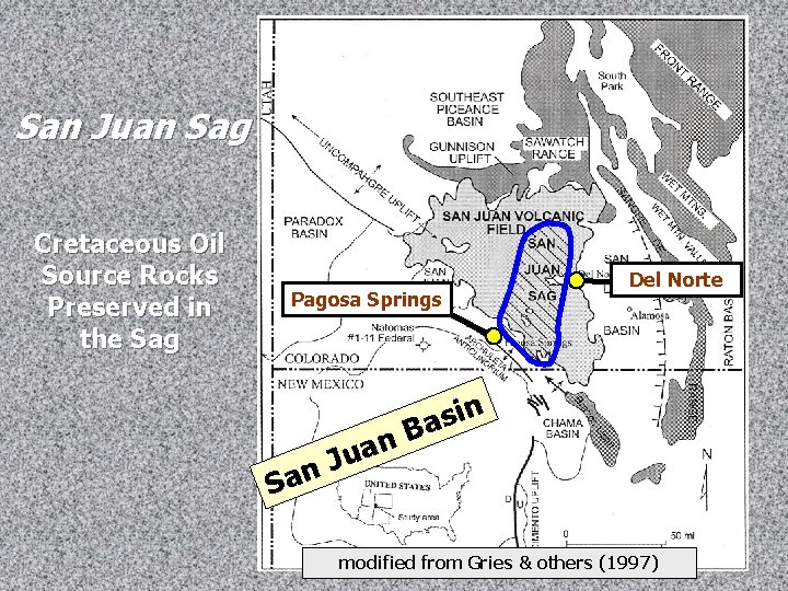
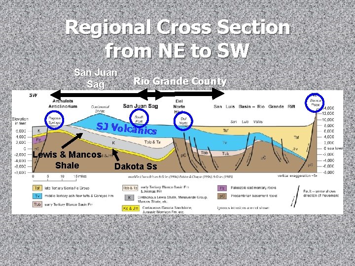
San Juan Sag Cretaceous Oil Source Rocks Preserved in the Sag Pagosa Springs San n a u J Del Norte n i s Ba modified from Gries & others (1997)
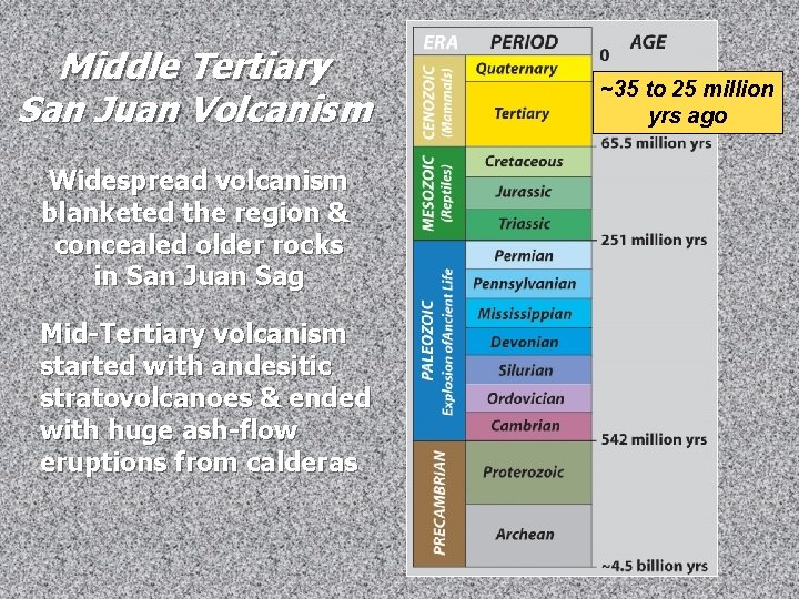
Middle Tertiary San Juan Volcanism Widespread volcanism blanketed the region & concealed older rocks in San Juan Sag Mid-Tertiary volcanism started with andesitic stratovolcanoes & ended with huge ash-flow eruptions from calderas ~35 to 25 million yrs ago
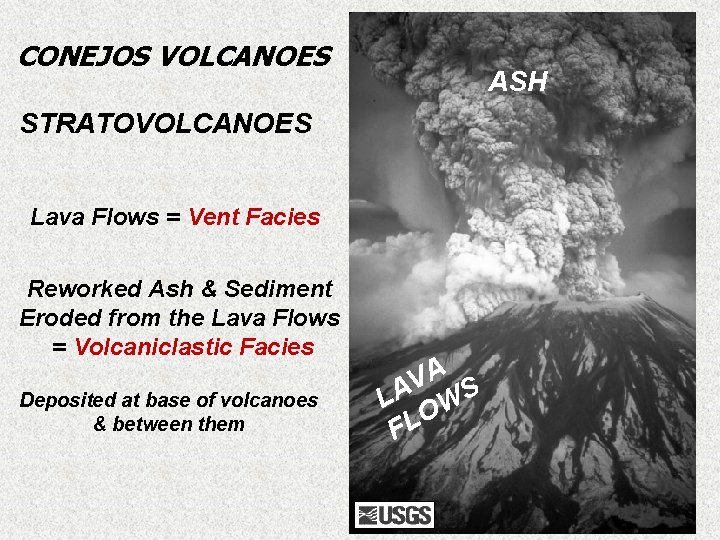
CONEJOS VOLCANOES ASH STRATOVOLCANOES Lava Flows = Vent Facies Reworked Ash & Sediment Eroded from the Lava Flows = Volcaniclastic Facies Deposited at base of volcanoes & between them A V LA WS O L F
Conejos Vent Facies Fractures
Conejos Volcaniclastic Facies conglomerate
Conejos Volcaniclastic Facies sandy mudstone
Fault Lines Conejos-age Volcanoes Geologic Map SF Basin #1 DN MV DAHC SFC #1
Regional Cross Section from NE to SW San Juan Sag Rio Grande County SJ Volcanic s Lewis & Mancos Shale Dakota Ss
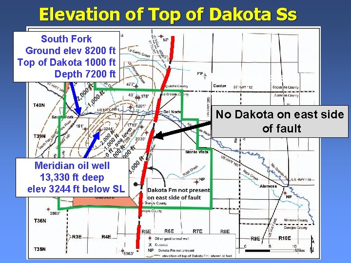
Elevation of Top of Dakota Ss South Fork Ground elev 8200 ft Top of Dakota 1000 ft Depth 7200 ft No Dakota on east side of fault Meridian oil well 13, 330 ft deep elev 3244 ft below SL
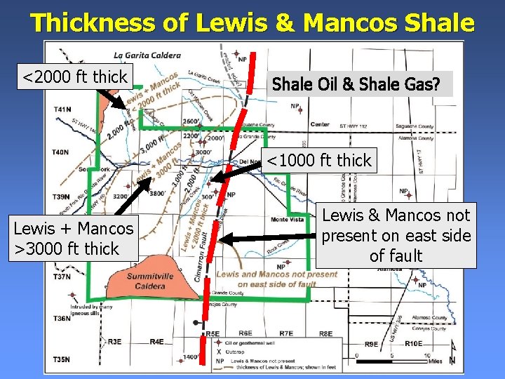
Thickness of Lewis & Mancos Shale <2000 ft thick Shale Oil & Shale Gas? <1000 ft thick Lewis + Mancos >3000 ft thick Lewis & Mancos not present on east side of fault
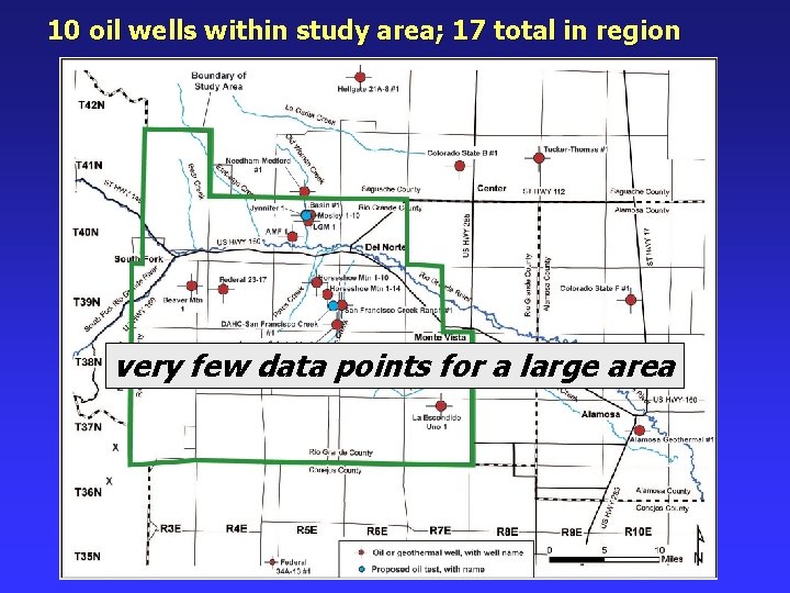
10 oil wells within study area; 17 total in region very few data points for a large area
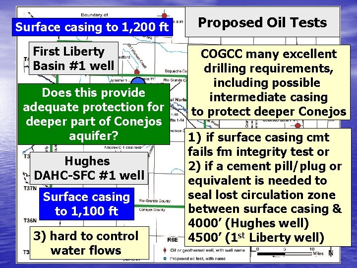
Surface casing to 1, 200 ft First Liberty Basin #1 well Does this provide adequate protection for deeper part of Conejos aquifer? Hughes DAHC-SFC #1 well Surface casing to 1, 100 ft 3) hard to control water flows Proposed Oil Tests COGCC many excellent drilling requirements, including possible intermediate casing to protect deeper Conejos 1) if surface casing cmt fails fm integrity test or 2) if a cement pill/plug or equivalent is needed to seal lost circulation zone between surface casing & 4000’ (Hughes well) 4500’ (1 st Liberty well)
Sampled Wells Old Woman Creek Area Depths 200 -540 ft 280 ft 5 flowing Wells Static Water Levels 3 to 280 ft
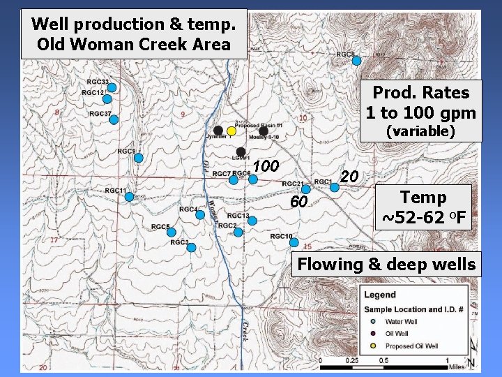
Well production & temp. Old Woman Creek Area Prod. Rates 1 to 100 gpm (variable) 100 20 60 Temp ~52 -62 o. F Flowing & deep wells
TDS in OWC wells 230 to 500 mg/L 470 0 420 32 0 27 lower higher 370 320 270 320 lower oman Old W 270 lower Creek
Depths 70 -450 ft (shallower) No flowing wells shallowest deepest Sampled Wells SF Creek Area
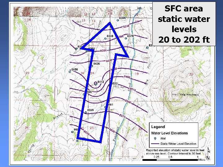
SFC area static water levels 20 to 202 ft
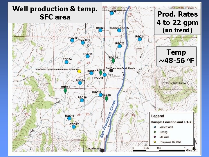
Well production & temp. SFC area Prod. Rates 4 to 22 gpm (no trend) Temp ~48 -56 o. F
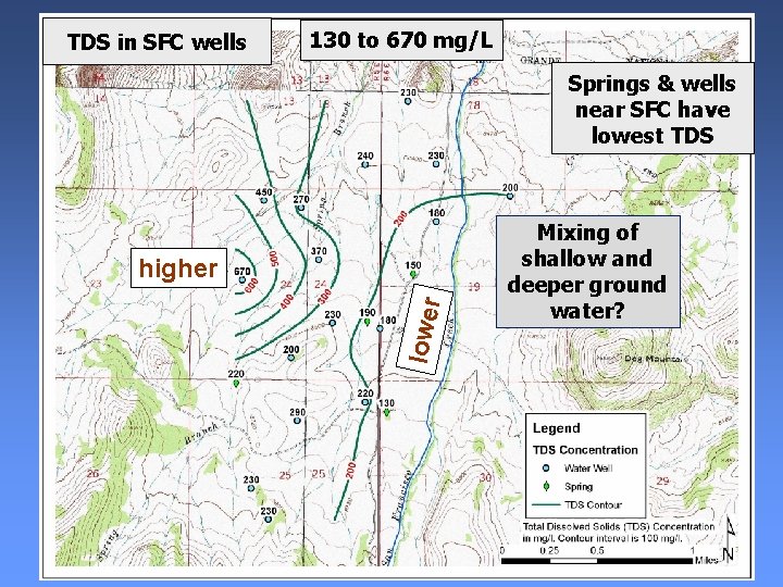
TDS in SFC wells 130 to 670 mg/L Springs & wells near SFC have lowest TDS lower higher Mixing of shallow and deeper ground water?
Colo. Oil & Gas Association (COGA) Baseline Water-Quality Analysis Includes Organic & Inorganic Parameters analyses performed by AZC Laboratory ORGANIC PARAMETERS: BTEX: benzene, ethylbenzene, xylene, and toluene HYDROCARBON GASES: methane, butane, ethylene, and propane types of contaminants that might come from petroleum
• No BTEX or hydrocarbon gases detected in all sampled water wells and in 3 of the 4 sampled springs in OWC & SFC areas • One spring in SFC area contained very low concentrations of methane • probably biogenic gas from decomposition of organics in the wetland at the spring, not thermogenic gas from petroleum; can be assessed by isotopic analyses
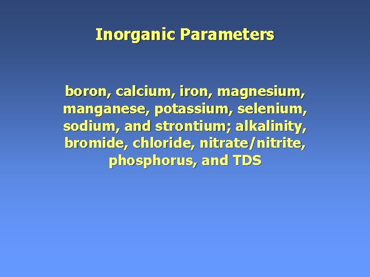
Inorganic Parameters boron, calcium, iron, magnesium, manganese, potassium, selenium, sodium, and strontium; alkalinity, bromide, chloride, nitrate/nitrite, phosphorus, and TDS
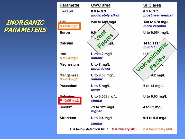
INORGANIC PARAMETERS t n s e e V ci Fa ic t s la c i s n e i a c lc a o F V
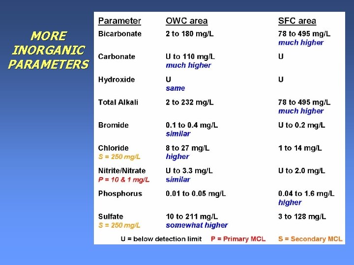
MORE INORGANIC PARAMETERS
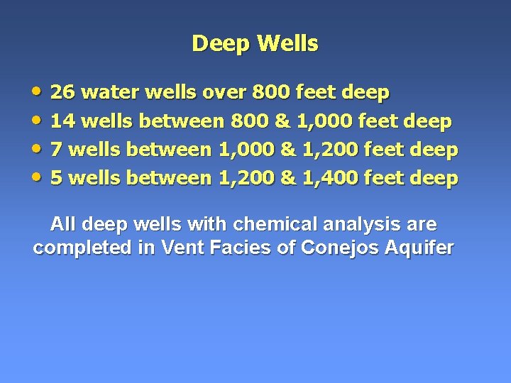
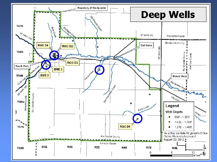
Deep Wells • 26 water wells over 800 feet deep • 14 wells between 800 & 1, 000 feet deep • 7 wells between 1, 000 & 1, 200 feet deep • 5 wells between 1, 200 & 1, 400 feet deep All deep wells with chemical analysis are completed in Vent Facies of Conejos Aquifer
Deep Wells
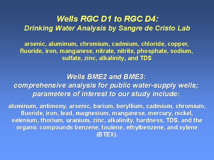
Wells RGC D 1 to RGC D 4: Drinking Water Analysis by Sangre de Cristo Lab arsenic, aluminum, chromium, cadmium, chloride, copper, fluoride, iron, manganese, nitrate, nitrite, phosphate, sodium, sulfate, zinc, alkalinity, and TDS Wells BME 2 and BME 3: comprehensive analysis for public water-supply wells; parameters of interest to our study include: aluminum, antimony, arsenic, barium, beryllium, cadmium, chromium, fluoride, iron, lead, magnesium, manganese, mercury, nickel, selenium, thorium, uranium, zinc, alkalinity, hardness, TDS, and the organic compounds benzene, toulene, ethylbenzene, and xylene (BTEX).
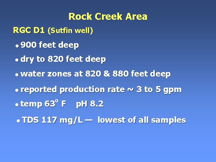
Rock Creek Area RGC D 1 (Sutfin well) • 900 • dry feet deep to 820 feet deep • water zones at 820 & 880 feet deep • reported • temp • TDS production rate ~ 3 to 5 gpm 63 o F p. H 8. 2 117 mg/L — lowest of all samples
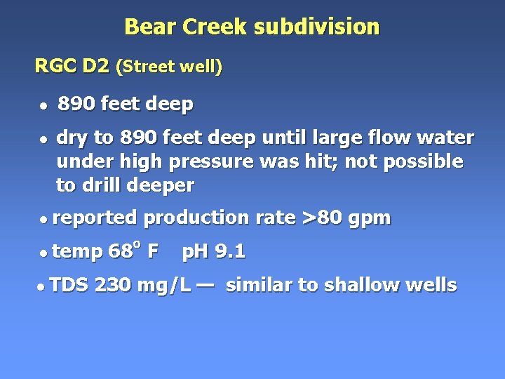
Bear Creek subdivision RGC D 2 (Street well) • 890 feet deep • dry to 890 feet deep until large flow water under high pressure was hit; not possible to drill deeper • reported • temp • TDS production rate >80 gpm 68 o F p. H 9. 1 230 mg/L — similar to shallow wells
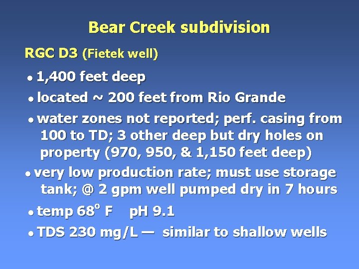
Bear Creek subdivision RGC D 3 (Fietek well) • 1, 400 feet deep • located ~ 200 feet from Rio Grande • water zones not reported; perf. casing from 100 to TD; 3 other deep but dry holes on property (970, 950, & 1, 150 feet deep) • very low production rate; must use storage tank; @ 2 gpm well pumped dry in 7 hours • temp o 68 F p. H 9. 1 • TDS 230 mg/L — similar to shallow wells
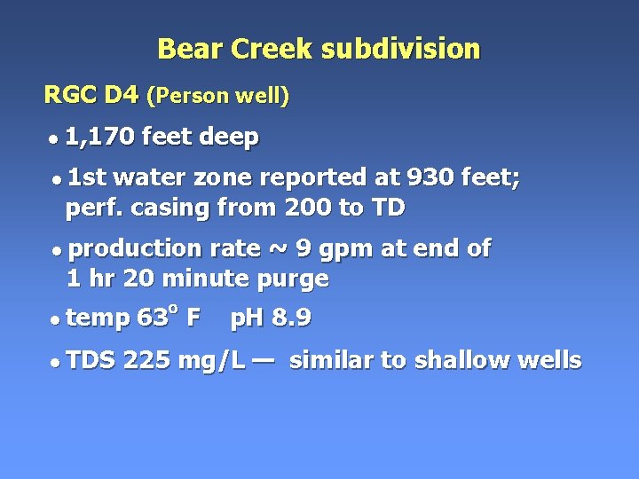
Bear Creek subdivision RGC D 4 (Person well) • 1, 170 feet deep • 1 st water zone reported at 930 feet; perf. casing from 200 to TD • production rate ~ 9 gpm at end of 1 hr 20 minute purge • temp • TDS o 63 o F p. H 8. 9 225 mg/L — similar to shallow wells
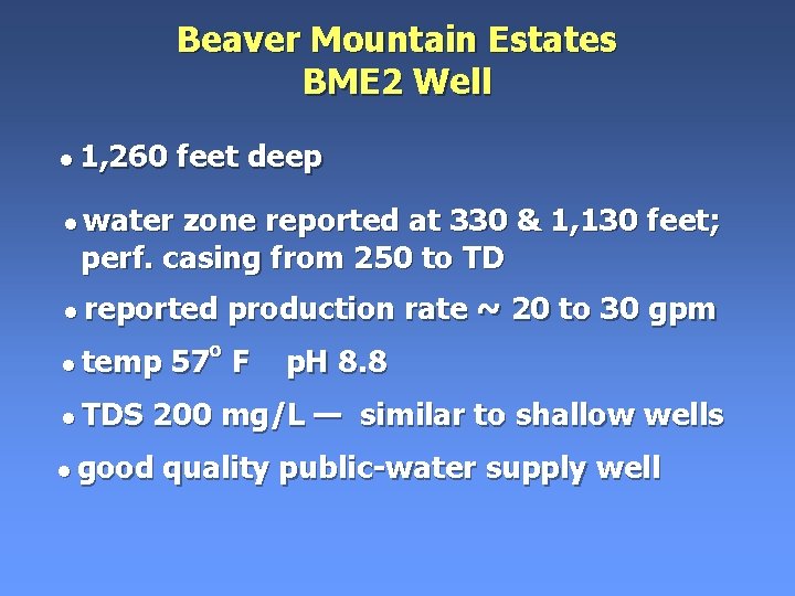
Beaver Mountain Estates BME 2 Well • 1, 260 feet deep • water zone reported at 330 & 1, 130 feet; perf. casing from 250 to TD • reported • temp • TDS o production rate ~ 20 to 30 gpm 57 F p. H 8. 8 200 mg/L — similar to shallow wells • good quality public-water supply well
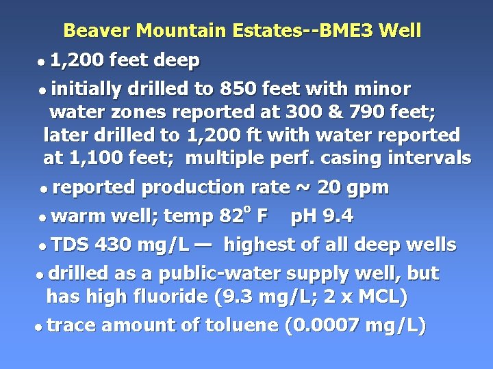
Beaver Mountain Estates--BME 3 Well • 1, 200 feet deep • initially drilled to 850 feet with minor water zones reported at 300 & 790 feet; later drilled to 1, 200 ft with water reported at 1, 100 feet; multiple perf. casing intervals • reported production rate ~ 20 gpm o • warm well; temp 82 F p. H 9. 4 • TDS 430 mg/L — highest of all deep wells • drilled as a public-water supply well, but has high fluoride (9. 3 mg/L; 2 x MCL) • trace amount of toluene (0. 0007 mg/L)
Pinos Creek Deep Well (Falk Well) • 1, 100 feet deep • some drill cuttings from well were saturated with oil • well never used for other logistical reasons; water should be tested in future study
TDS versus Depth for Wells & Springs Lowest TDS WARM
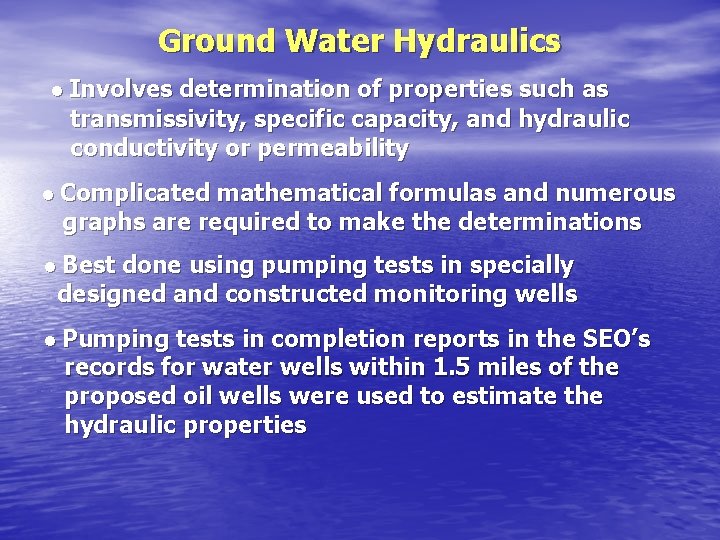
Ground Water Hydraulics • Involves determination of properties such as transmissivity, specific capacity, and hydraulic conductivity or permeability • Complicated mathematical formulas and numerous graphs are required to make the determinations • Best done using pumping tests in specially designed and constructed monitoring wells • Pumping tests in completion reports in the SEO’s records for water wells within 1. 5 miles of the proposed oil wells were used to estimate the hydraulic properties
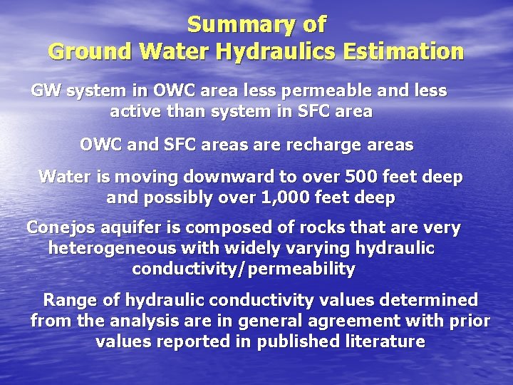
Summary of Ground Water Hydraulics Estimation GW system in OWC area less permeable and less active than system in SFC area OWC and SFC areas are recharge areas Water is moving downward to over 500 feet deep and possibly over 1, 000 feet deep Conejos aquifer is composed of rocks that are very heterogeneous with widely varying hydraulic conductivity/permeability Range of hydraulic conductivity values determined from the analysis are in general agreement with prior values reported in published literature
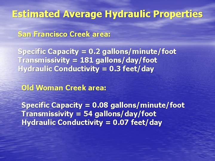
Estimated Average Hydraulic Properties San Francisco Creek area: Specific Capacity = 0. 2 gallons/minute/foot Transmissivity = 181 gallons/day/foot Hydraulic Conductivity = 0. 3 feet/day Old Woman Creek area: Specific Capacity = 0. 08 gallons/minute/foot Transmissivity = 54 gallons/day/foot Hydraulic Conductivity = 0. 07 feet/day
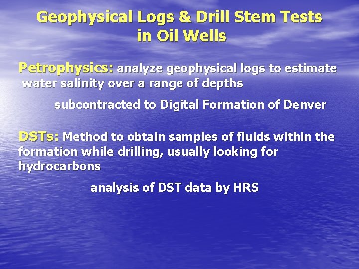
Geophysical Logs & Drill Stem Tests in Oil Wells Petrophysics: analyze geophysical logs to estimate water salinity over a range of depths subcontracted to Digital Formation of Denver DSTs: Method to obtain samples of fluids within the formation while drilling, usually looking for hydrocarbons analysis of DST data by HRS
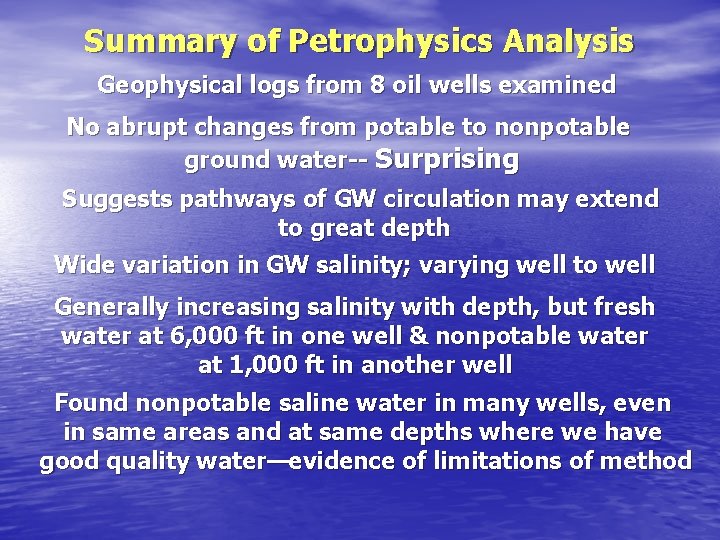
Summary of Petrophysics Analysis Geophysical logs from 8 oil wells examined No abrupt changes from potable to nonpotable ground water-- Surprising Suggests pathways of GW circulation may extend to great depth Wide variation in GW salinity; varying well to well Generally increasing salinity with depth, but fresh water at 6, 000 ft in one well & nonpotable water at 1, 000 ft in another well Found nonpotable saline water in many wells, even in same areas and at same depths where we have good quality water—evidence of limitations of method
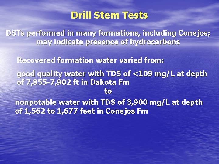
Drill Stem Tests DSTs performed in many formations, including Conejos; may indicate presence of hydrocarbons Recovered formation water varied from: good quality water with TDS of <109 mg/L at depth of 7, 855 -7, 902 ft in Dakota Fm to nonpotable water with TDS of 3, 900 mg/L at depth of 1, 562 to 1, 677 feet in Conejos Fm
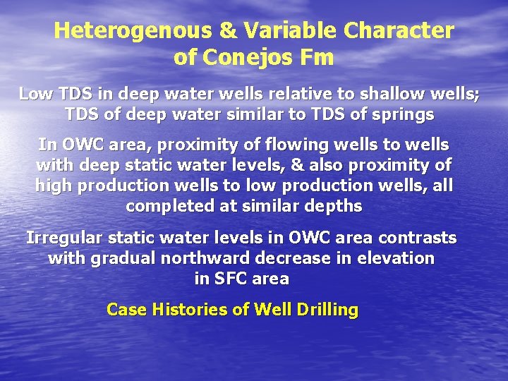
Heterogenous & Variable Character of Conejos Fm Low TDS in deep water wells relative to shallow wells; TDS of deep water similar to TDS of springs In OWC area, proximity of flowing wells to wells with deep static water levels, & also proximity of high production wells to low production wells, all completed at similar depths Irregular static water levels in OWC area contrasts with gradual northward decrease in elevation in SFC area Case Histories of Well Drilling
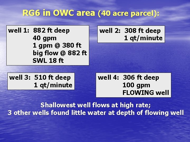
RG 6 in OWC area (40 acre parcel): well 1: 882 ft deep 40 gpm 1 gpm @ 380 ft big flow @ 882 ft SWL 18 ft well 2: 308 ft deep 1 qt/minute well 3: 510 ft deep 1 qt/minute well 4: 306 ft deep 100 gpm FLOWING well Shallowest well flows at high rate; 3 other wells found little water at depth of flowing well
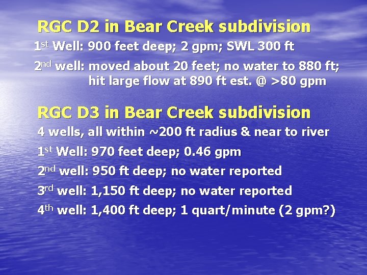
RGC D 2 in Bear Creek subdivision 1 st Well: 900 feet deep; 2 gpm; SWL 300 ft 2 nd well: moved about 20 feet; no water to 880 ft; hit large flow at 890 ft est. @ >80 gpm RGC D 3 in Bear Creek subdivision 4 wells, all within ~200 ft radius & near to river 1 st Well: 970 feet deep; 0. 46 gpm 2 nd well: 950 ft deep; no water reported 3 rd well: 1, 150 ft deep; no water reported 4 th well: 1, 400 ft deep; 1 quart/minute (2 gpm? )
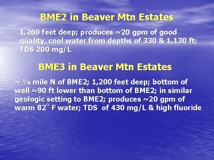
BME 2 in Beaver Mtn Estates 1, 260 feet deep; produces ~20 gpm of good quality, cool water from depths of 330 & 1, 130 ft; TDS 200 mg/L BME 3 in Beaver Mtn Estates ~ ½ mile N of BME 2; 1, 200 feet deep; bottom of well ~90 ft lower than bottom of BME 2; in similar geologic setting to BME 2; produces ~20 gpm of o warm 82 F water; TDS of 430 mg/L & high fluoride
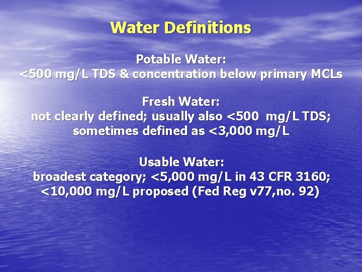
Water Definitions Potable Water: <500 mg/L TDS & concentration below primary MCLs Fresh Water: not clearly defined; usually also <500 mg/L TDS; sometimes defined as <3, 000 mg/L Usable Water: broadest category; <5, 000 mg/L in 43 CFR 3160; <10, 000 mg/L proposed (Fed Reg v 77, no. 92)
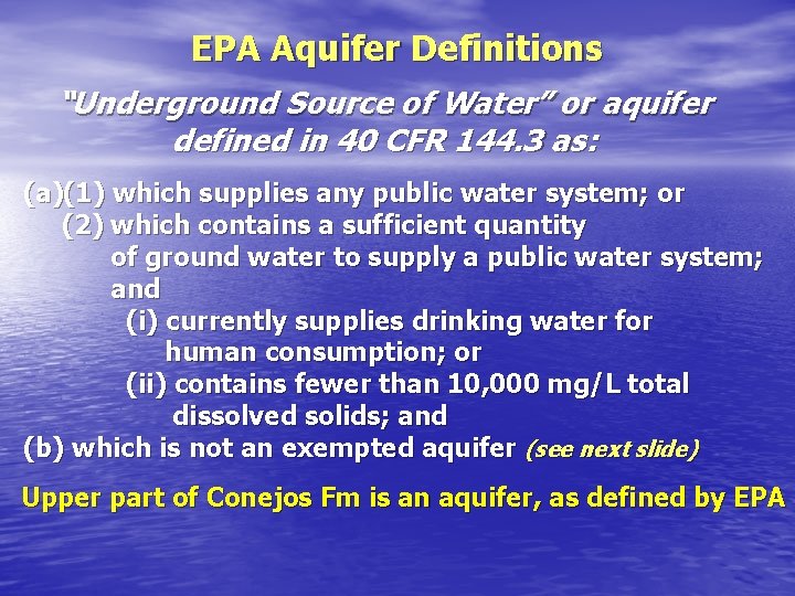
EPA Aquifer Definitions “Underground Source of Water” or aquifer defined in 40 CFR 144. 3 as: (a)(1) which supplies any public water system; or (2) which contains a sufficient quantity of ground water to supply a public water system; and (i) currently supplies drinking water for human consumption; or (ii) contains fewer than 10, 000 mg/L total dissolved solids; and (b) which is not an exempted aquifer (see next slide) Upper part of Conejos Fm is an aquifer, as defined by EPA
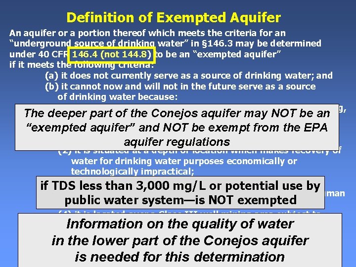
Definition of Exempted Aquifer An aquifer or a portion thereof which meets the criteria for an “underground source of drinking water” in § 146. 3 may be determined under 40 CFR 146. 4 (not 144. 8) to be an “exempted aquifer” if it meets the following criteria: (a) it does not currently serve as a source of drinking water; and (b) it cannot now and will not in the future serve as a source of drinking water because: (1) it is a mineral, hydrocarbon or geothermal energy producing, The deeper part of the Conejos may NOT beofan or can be demonstrated by a aquifer permit applicant as part a “exempted aquifer” andfor. NOT be. IIexempt from the EPA permit application a Class or III operation to contain minerals or hydrocarbons that considering their quantity aquifer regulations (2) it is situated at a depth or location which makes recovery of water for drinking water purposes economically or technologically impractical; (3) it is so contaminated that it would be economically or if TDS less than 3, 000 mg/L or potential use by technologically impractical to render that water fit for human public waterorsystem—is NOT exempted consumption; (4) it is located over a Class III well mining area subject to subsidence or catastrophic collapse; or Information on the quality of water (c) the total dissolved solids content of the ground water is more inthan the lower ofthan the 10, 000 Conejos aquifer 3, 000 mg/Lpart and less mg/L and it is not reasonably expected to this supplydetermination a public water system. is needed for
Recommendations offered to Commissioners & Citizens of RGC Well Drilling Grouted surface casing should be set from ground surface to base of Conejos Fm
Rationale for Surface Casing Recommendation • Existing water wells in Conejos aquifer are as much as 1, 400 ft deep • Aquifers at similar or greater depths may exist in OWC & SFC areas • Surface casing set at currently required depths of 1, 100 ft (Hughes) or 1, 200 ft (1 st Liberty) may not protect these slightly deeper aquifers
COGCC will require intermediate casing to be set, grouted, & tested to protect deeper part of Conejos aquifer if: 1) formation integrity test of surface casing cement fails 2) a cement pill/plug or equivalent is used to seal a zone of lost circulation between surface casing & depth of 4, 000 ft (Hughes) or & 4, 500 deep 1 st Liberty) (LC = drilling mud flows into formation) For Hughes well, hard to control water inflow from formation also triggers intermediate casing
Requirement for intermediate casing if formation integrity test fails is an excellent requirement, as is the hard to control water inflow (only Hughes well) Concern is with the lost circulation requirement Lost circulation will detect aquifers when drilling muds are overbalanced (drilling mud has higher hydrostatic pressure than formation water) But lost circulation may not detect all aquifers when drilling with underbalanced or balanced hydrostatic pressures Under these conditions lost circulation may not occur Also, lost circulation may not occur in aquifers with low hydraulic values; these aquifers locally may be important
Another Well Drilling Recommendation Avoid drilling within 1, 000 ft of alluvial floodplains or intermittent or ephemeral streams unless appropriate precautionary measures are employed Water Quality Baseline Studies Recommend baseline sampling of other water wells and springs identified in the report Repeated annual sampling of a selected subset of wells & springs in vicinity of petroleum wells Sampling should be performed on all available water wells & springs within 1 mile of a proposed petroleum well, not just two
Additional Hydrogeologic Investigations • Sampling & analysis of other deep water wells • Field investigations of mapped faults & lineaments that may affect ground water movement • Develop aquifer water level elevation maps • Develop water balance estimates • Perform properly instrumented pumping tests on selected existing water wells • Develop Piper trilinear diagrams of major cations & anions to understand GW pathways & chemical changes in subsurface • Consider water sampling for environmental isotopes • Consider installation of deep monitoring wells
Other Recommendations • Conduct geophysical logging before installation of surface casing (provides data for shallow aquifer) • Have drill cuttings from Conejos Fm collected & evaluated; allow County-selected geologist access to drilling location to periodically observe drilling • Work with State Legislators to develop regulations that would require disclosure of mineral rights ownership during real estate transactions • Encourage school districts to include water-quality education, especially ground water, in their curriculum