Introduction to Weather 7 Weather Forecasting predicting the
- Slides: 41

Introduction to Weather 7 Weather Forecasting predicting the weather over the coming days 1

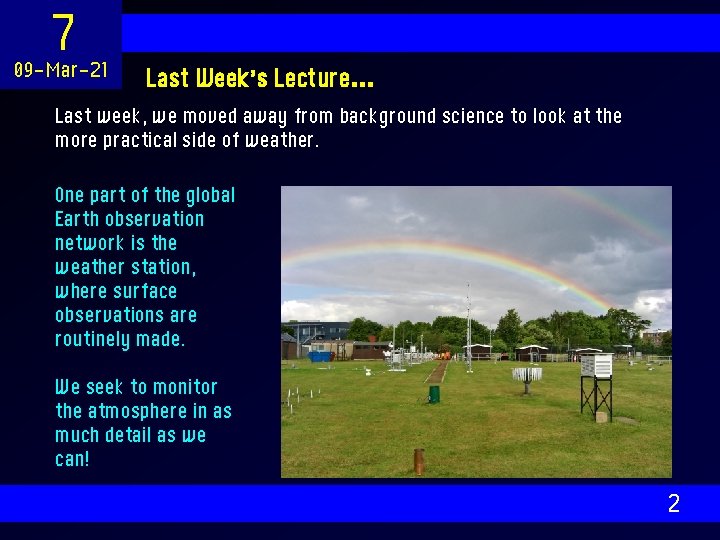
7 09 -Mar-21 Last Week’s Lecture… Last week, we moved away from background science to look at the more practical side of weather. One part of the global Earth observation network is the weather station, where surface observations are routinely made. We seek to monitor the atmosphere in as much detail as we can! 2

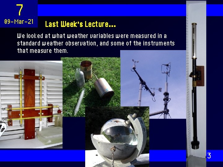
7 09 -Mar-21 Last Week’s Lecture… We looked at what weather variables were measured in a standard weather observation, and some of the instruments that measure them. 3

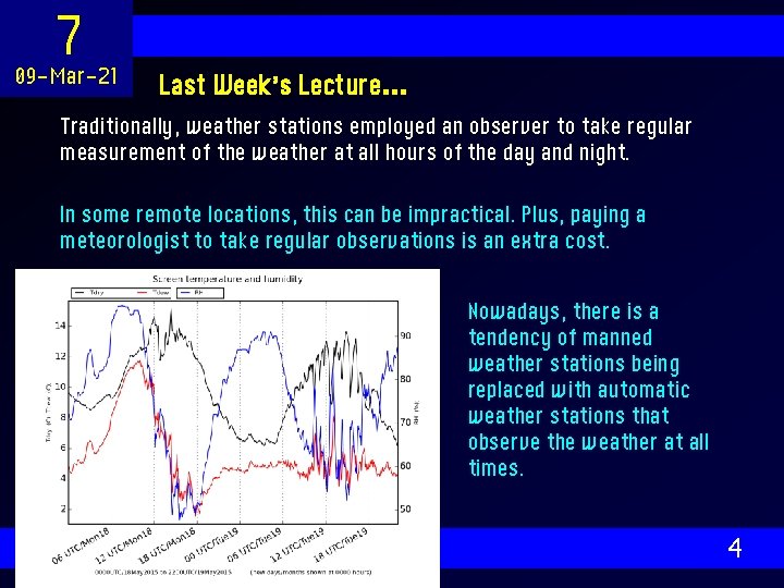
7 09 -Mar-21 Last Week’s Lecture… Traditionally, weather stations employed an observer to take regular measurement of the weather at all hours of the day and night. In some remote locations, this can be impractical. Plus, paying a meteorologist to take regular observations is an extra cost. Nowadays, there is a tendency of manned weather stations being replaced with automatic weather stations that observe the weather at all times. 4

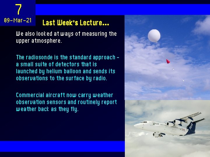
7 09 -Mar-21 Last Week’s Lecture… We also looked at ways of measuring the upper atmosphere. The radiosonde is the standard approach – a small suite of detectors that is launched by helium balloon and sends its observations to the surface by radio. Commercial aircraft now carry weather observation sensors and routinely report weather back as they fly. 5

7 09 -Mar-21 This Week’s Lecture We move on to the complicated matter of weather forecasting. We begin by looking at some traditional forecasting methods, including some that involve simply looking at the sky. We then introduce the weather model – a complex piece of code run routinely on a supercomputer to produce forecasts. We complete the global picture by looking at methods of remote sensing, which allow us to measure the weather over a large area from a single point. Finally, we look at how a forecast is run and interpreted. 6

7 09 -Mar-21 Layout of the Course 1. 2. 3. 4. 5. 6. 7. 8. 9. 10. Talking about the Weather Earth’s Weather Machine All About the Atmosphere Mid-Latitude Weather Clouds, Rain and Moisture Measuring the Weather Forecasting The Changing Climate Extreme Weather in the UK 7

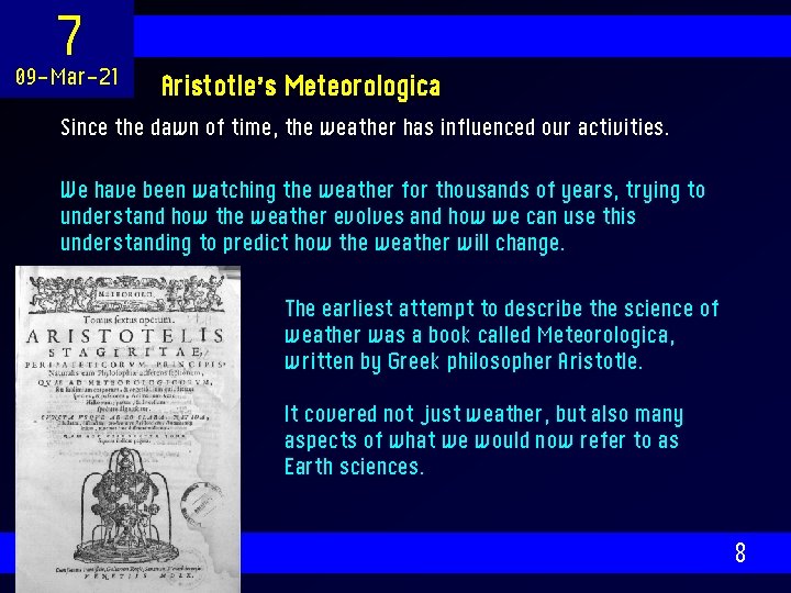
7 09 -Mar-21 Aristotle’s Meteorologica Since the dawn of time, the weather has influenced our activities. We have been watching the weather for thousands of years, trying to understand how the weather evolves and how we can use this understanding to predict how the weather will change. The earliest attempt to describe the science of weather was a book called Meteorologica, written by Greek philosopher Aristotle. It covered not just weather, but also many aspects of what we would now refer to as Earth sciences. 8

7 09 -Mar-21 Aristotle’s Meteorologica It was the accepted text on meteorology for over 1, 000 years – and had a few theories that were quite accurate. “Both dew and hoar-frost are found when the sky is clear and there is no wind. For the vapour could not be raised unless the sky were clear, and if a wind were blowing it could not condense. ” Others were perhaps less so, but showed great insight. “When there is a great quantity of exhalation and it is rare and is squeezed out in the cloud itself we get a thunderbolt. ” Aristotle also described a spherical Earth in his treatise. “The earth is surrounded by water, just as that is by the sphere of air, and that again by the sphere called that of fire. ” 9

7 09 -Mar-21 Weather Lore Ways of predicting the weather were passed down through the generations, describing how various elements of nature can be used to predict the coming weather. • Red sky at night, shepherd’s delight. Red sky in the morning, shepherd’s warning. • Oak before ash, we’ll have a splash; ash before oak, we’ll have a soak. • March comes in like a lion and goes out like a lamb. • Rain before seven, fine by eleven. These phrases are variable in their reliability at weather forecasting! 10

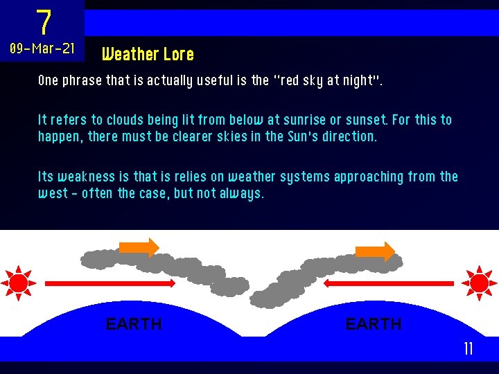
7 09 -Mar-21 Weather Lore One phrase that is actually useful is the “red sky at night”. It refers to clouds being lit from below at sunrise or sunset. For this to happen, there must be clearer skies in the Sun’s direction. Its weakness is that is relies on weather systems approaching from the west – often the case, but not always. EARTH 11

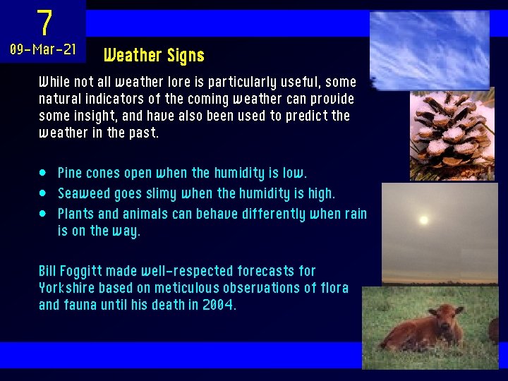
7 09 -Mar-21 Weather Signs While not all weather lore is particularly useful, some natural indicators of the coming weather can provide some insight, and have also been used to predict the weather in the past. • Pine cones open when the humidity is low. • Seaweed goes slimy when the humidity is high. • Plants and animals can behave differently when rain is on the way. Bill Foggitt made well-respected forecasts for Yorkshire based on meticulous observations of flora and fauna until his death in 2004. 12

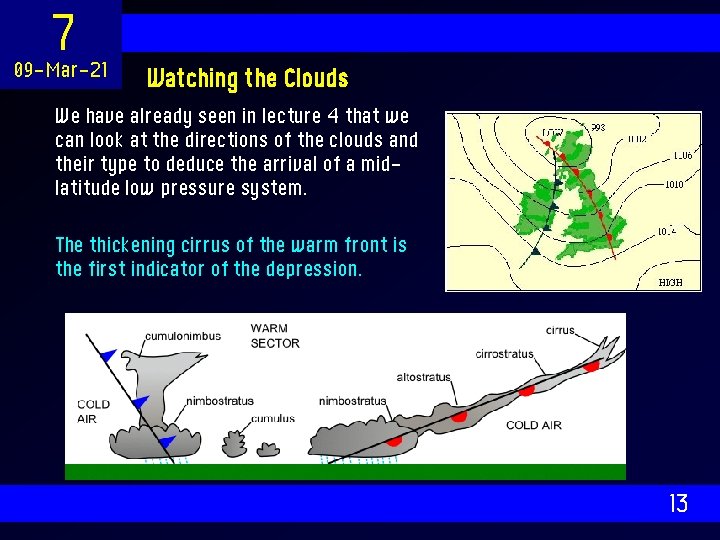
7 09 -Mar-21 Watching the Clouds We have already seen in lecture 4 that we can look at the directions of the clouds and their type to deduce the arrival of a midlatitude low pressure system. The thickening cirrus of the warm front is the first indicator of the depression. 13

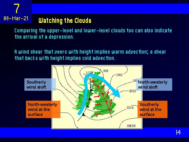
7 09 -Mar-21 Watching the Clouds Comparing the upper-level and lower-level clouds too can also indicate the arrival of a depression. A wind shear that veers with height implies warm advection; a shear that backs with height implies cold advection. Southerly wind aloft North-westerly wind at the surface North-westerly wind aloft Southerly wind at the surface 14

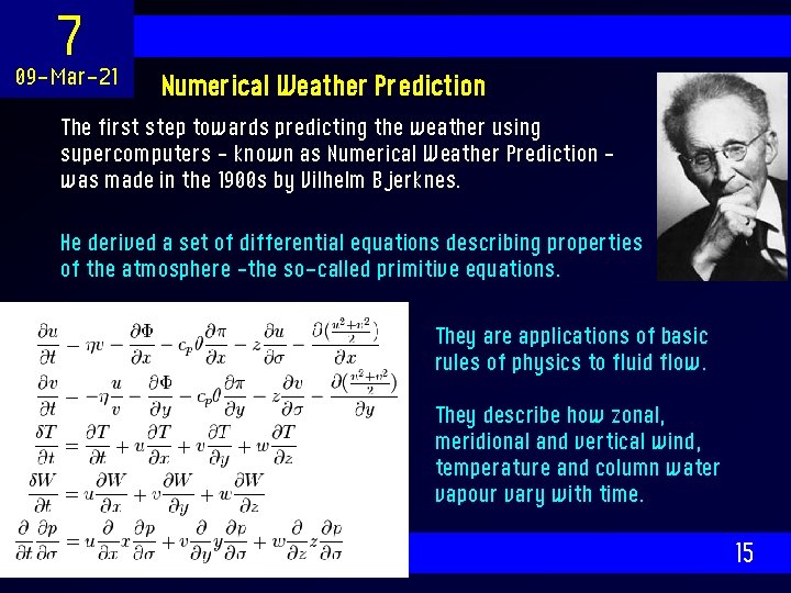
7 09 -Mar-21 Numerical Weather Prediction The first step towards predicting the weather using supercomputers – known as Numerical Weather Prediction – was made in the 1900 s by Vilhelm Bjerknes. He derived a set of differential equations describing properties of the atmosphere –the so-called primitive equations. They are applications of basic rules of physics to fluid flow. They describe how zonal, meridional and vertical wind, temperature and column water vapour vary with time. 15

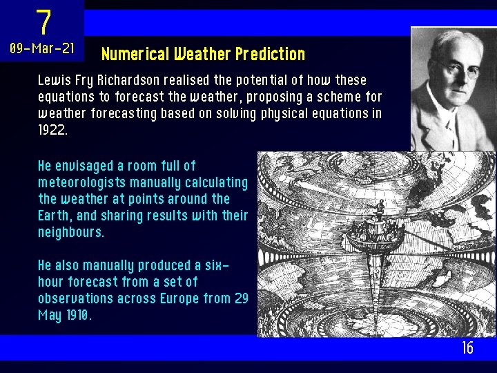
7 09 -Mar-21 Numerical Weather Prediction Lewis Fry Richardson realised the potential of how these equations to forecast the weather, proposing a scheme for weather forecasting based on solving physical equations in 1922. He envisaged a room full of meteorologists manually calculating the weather at points around the Earth, and sharing results with their neighbours. He also manually produced a sixhour forecast from a set of observations across Europe from 29 May 1910. 16

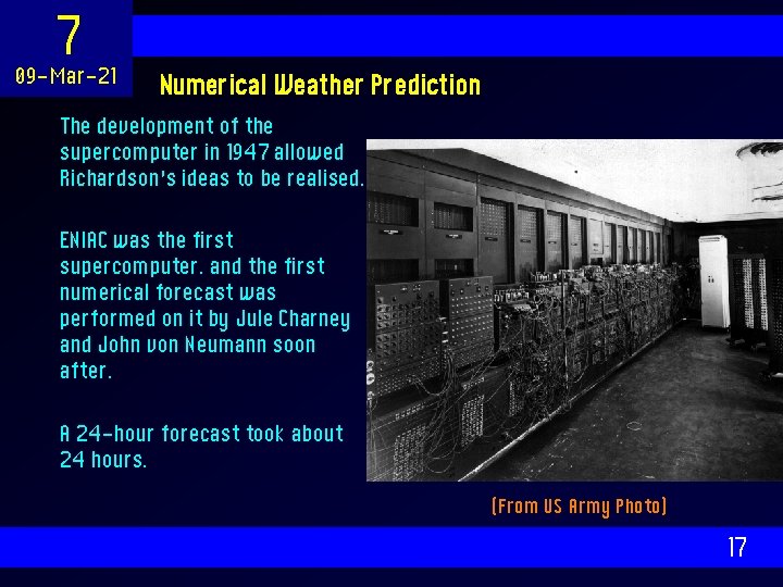
7 09 -Mar-21 Numerical Weather Prediction The development of the supercomputer in 1947 allowed Richardson’s ideas to be realised. ENIAC was the first supercomputer. and the first numerical forecast was performed on it by Jule Charney and John von Neumann soon after. A 24 -hour forecast took about 24 hours. (From US Army Photo) 17

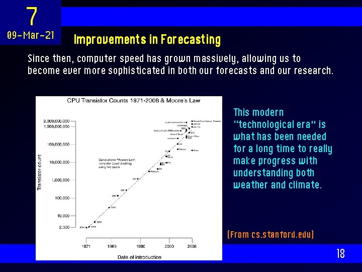
7 09 -Mar-21 Improvements in Forecasting Since then, computer speed has grown massively, allowing us to become ever more sophisticated in both our forecasts and our research. This modern “technological era” is what has been needed for a long time to really make progress with understanding both weather and climate. (From cs. stanford. edu) 18

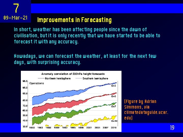
7 09 -Mar-21 Improvements in Forecasting In short, weather has been affecting people since the dawn of civilisation, but it is only recently that we have started to be able to forecast it with any accuracy. Nowadays, we can forecast the weather, at least for the next few days, with surprising accuracy. (Figure by Adrian Simmons, via climatedataguide. ucar. edu) 19

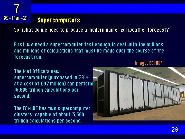
7 09 -Mar-21 Supercomputers So, what do we need to produce a modern numerical weather forecast? First, we need a supercomputer fast enough to deal with the millions and millions of calculations that must be made over the course of the forecast run. Image: ECMWF. The Met Office’s new supercomputer (purchased in 2014 at a cost of £ 97 million) can perform 16, 000 trillion calculations per second. The ECMWF has two supercomputer clusters, capable of about 3, 500 trillion calculations per second. 20

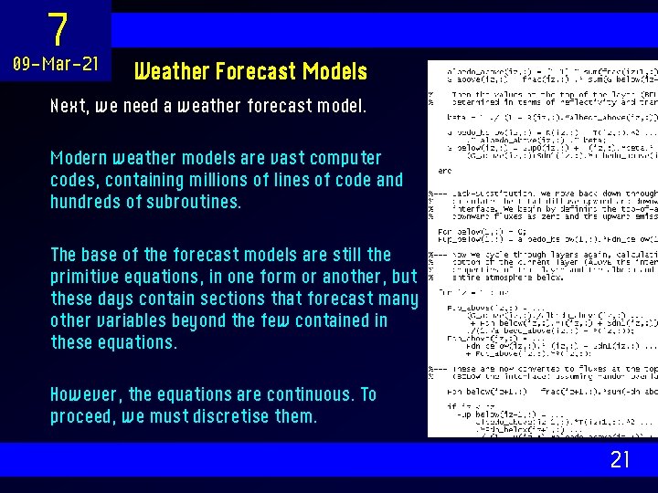
7 09 -Mar-21 Weather Forecast Models Next, we need a weather forecast model. Modern weather models are vast computer codes, containing millions of lines of code and hundreds of subroutines. The base of the forecast models are still the primitive equations, in one form or another, but these days contain sections that forecast many other variables beyond the few contained in these equations. However, the equations are continuous. To proceed, we must discretise them. 21

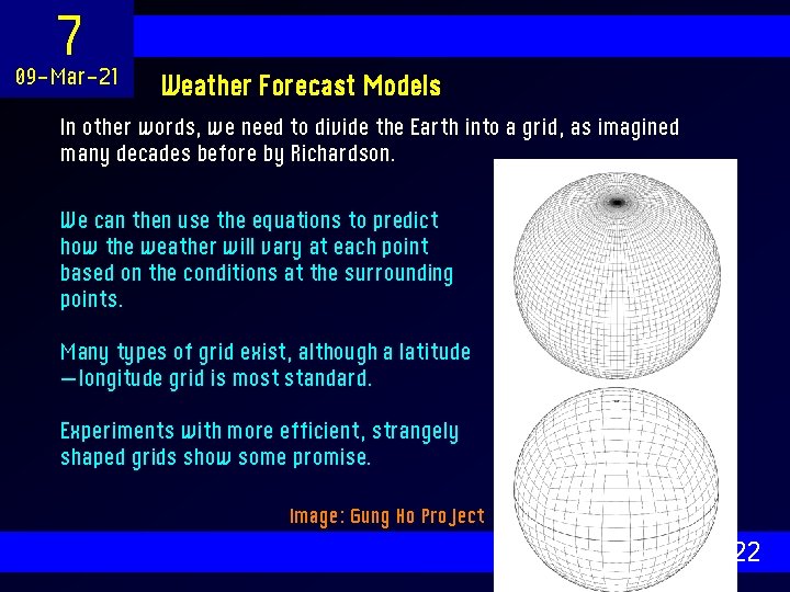
7 09 -Mar-21 Weather Forecast Models In other words, we need to divide the Earth into a grid, as imagined many decades before by Richardson. We can then use the equations to predict how the weather will vary at each point based on the conditions at the surrounding points. Many types of grid exist, although a latitude —longitude grid is most standard. Experiments with more efficient, strangely shaped grids show some promise. Image: Gung Ho Project 22

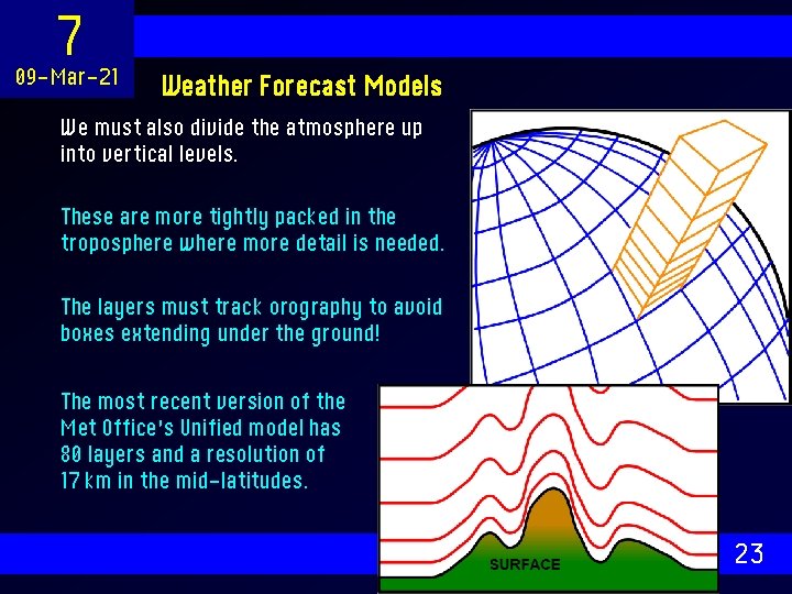
7 09 -Mar-21 Weather Forecast Models We must also divide the atmosphere up into vertical levels. These are more tightly packed in the troposphere where more detail is needed. The layers must track orography to avoid boxes extending under the ground! The most recent version of the Met Office’s Unified model has 80 layers and a resolution of 17 km in the mid-latitudes. 23

7 09 -Mar-21 Weather Forecast Models Bearing in mind that a typical modern numerical weather prediction model has a resolution of 20 km, there are some features that it will struggle to represent. Which of the following cannot be represented directly by a model of such resolution? • A mid-latitude depression. • A weather front. • A squall line, or cluster of convection. • An individual, isolated thunderstorm. • A single cumulus cloud. • The undulations in the jet stream. • Waves downstream of a mountain chain. 24

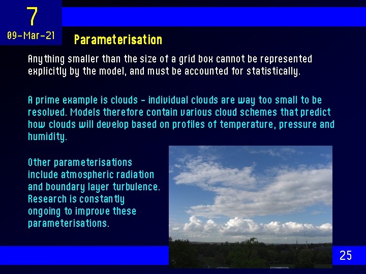
7 09 -Mar-21 Parameterisation Anything smaller than the size of a grid box cannot be represented explicitly by the model, and must be accounted for statistically. A prime example is clouds – individual clouds are way too small to be resolved. Models therefore contain various cloud schemes that predict how clouds will develop based on profiles of temperature, pressure and humidity. Other parameterisations include atmospheric radiation and boundary layer turbulence. Research is constantly ongoing to improve these parameterisations. 25

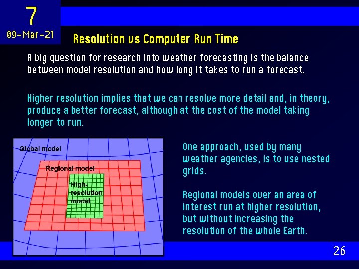
7 09 -Mar-21 Resolution vs Computer Run Time A big question for research into weather forecasting is the balance between model resolution and how long it takes to run a forecast. Higher resolution implies that we can resolve more detail and, in theory, produce a better forecast, although at the cost of the model taking longer to run. One approach, used by many weather agencies, is to use nested grids. Regional models over an area of interest run at higher resolution, but without increasing the resolution of the whole Earth. 26

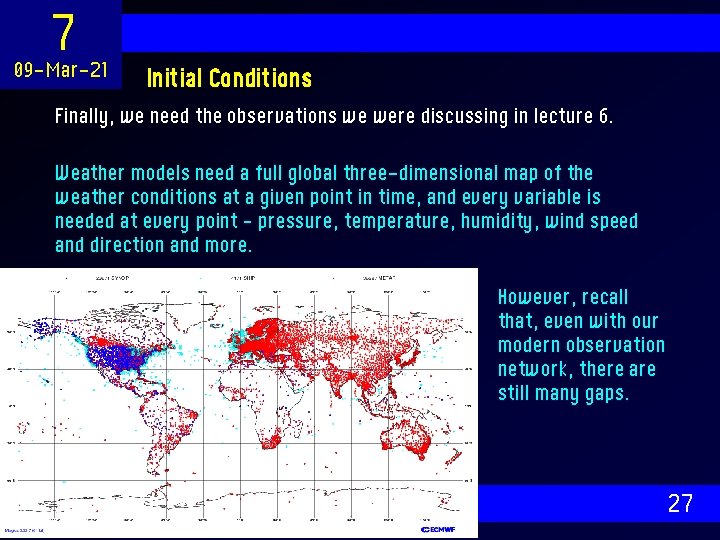
7 09 -Mar-21 Initial Conditions Finally, we need the observations we were discussing in lecture 6. Weather models need a full global three-dimensional map of the weather conditions at a given point in time, and every variable is needed at every point – pressure, temperature, humidity, wind speed and direction and more. However, recall that, even with our modern observation network, there are still many gaps. 27

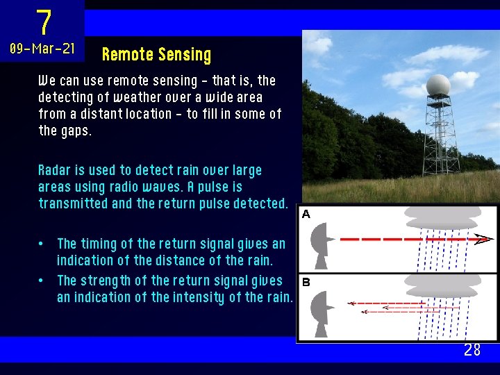
7 09 -Mar-21 Remote Sensing We can use remote sensing – that is, the detecting of weather over a wide area from a distant location – to fill in some of the gaps. Radar is used to detect rain over large areas using radio waves. A pulse is transmitted and the return pulse detected. • The timing of the return signal gives an indication of the distance of the rain. • The strength of the return signal gives an indication of the intensity of the rain. 28

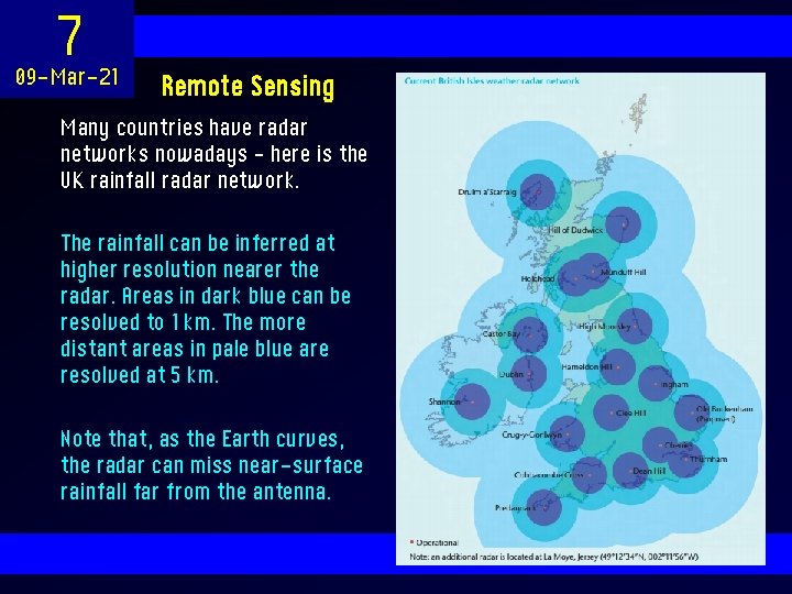
7 09 -Mar-21 Remote Sensing Many countries have radar networks nowadays – here is the UK rainfall radar network. The rainfall can be inferred at higher resolution nearer the radar. Areas in dark blue can be resolved to 1 km. The more distant areas in pale blue are resolved at 5 km. Note that, as the Earth curves, the radar can miss near-surface rainfall far from the antenna. 29

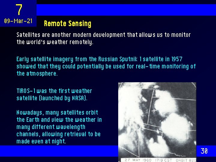
7 09 -Mar-21 Remote Sensing Satellites are another modern development that allows us to monitor the world’s weather remotely. Early satellite imagery from the Russian Sputnik 1 satellite in 1957 showed that they could potentially be used for real-time monitoring of the atmosphere. TIROS-1 was the first weather satellite (launched by NASA). Nowadays, many satellites orbit the Earth and view the weather in many different wavelength channels, allowing retrieval to be made even at night. 30

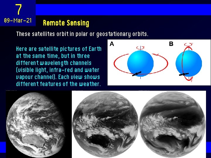
7 09 -Mar-21 Remote Sensing These satellites orbit in polar or geostationary orbits. Here are satellite pictures of Earth at the same time, but in three different wavelength channels (visible light, infra-red and water vapour channel). Each view shows different features of the weather. 31

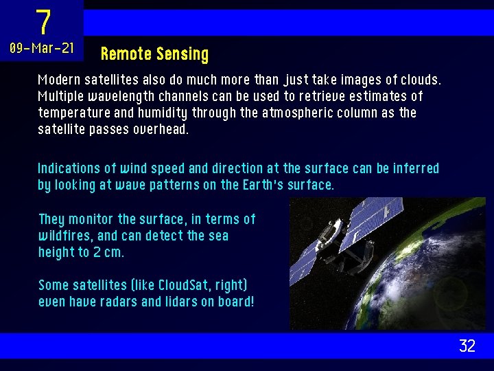
7 09 -Mar-21 Remote Sensing Modern satellites also do much more than just take images of clouds. Multiple wavelength channels can be used to retrieve estimates of temperature and humidity through the atmospheric column as the satellite passes overhead. Indications of wind speed and direction at the surface can be inferred by looking at wave patterns on the Earth’s surface. They monitor the surface, in terms of wildfires, and can detect the sea height to 2 cm. Some satellites (like Cloud. Sat, right) even have radars and lidars on board! 32

7 09 -Mar-21 Nowcasting Incidentally, the data received by satellites and radar allow forecasters to perform something called “nowcasting”. This involves looking at maps of cloud and rainfall and, based purely on observing the trends over the last few hours, predict what the weather might do in the next few hours. Here is a nowcasting challenge: look at the radar images provided and see if you can provide rainfall forecasts for the next few hours for the plotted places. 33

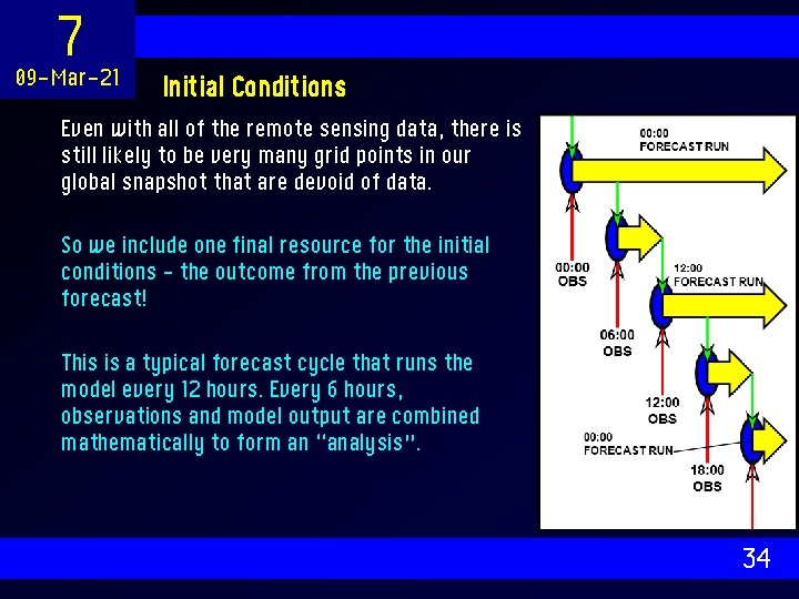
7 09 -Mar-21 Initial Conditions Even with all of the remote sensing data, there is still likely to be very many grid points in our global snapshot that are devoid of data. So we include one final resource for the initial conditions – the outcome from the previous forecast! This is a typical forecast cycle that runs the model every 12 hours. Every 6 hours, observations and model output are combined mathematically to form an “analysis”. 34

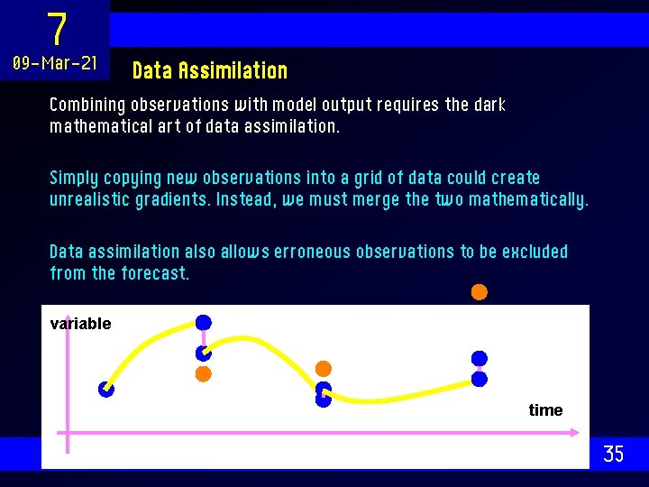
7 09 -Mar-21 Data Assimilation Combining observations with model output requires the dark mathematical art of data assimilation. Simply copying new observations into a grid of data could create unrealistic gradients. Instead, we must merge the two mathematically. Data assimilation also allows erroneous observations to be excluded from the forecast. variable time 35

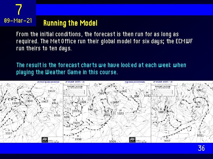
7 09 -Mar-21 Running the Model From the initial conditions, the forecast is then run for as long as required. The Met Office run their global model for six days; the ECMWF run theirs to ten days. The result is the forecast charts we have looked at each week when playing the Weather Game in this course. 36

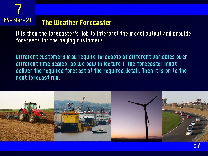
7 09 -Mar-21 The Weather Forecaster It is then the forecaster’s job to interpret the model output and provide forecasts for the paying customers. Different customers may require forecasts of different variables over different time scales, as we saw in lecture 1. The forecaster must deliver the required forecast at the required detail. Then it is on to the next forecast run. 37

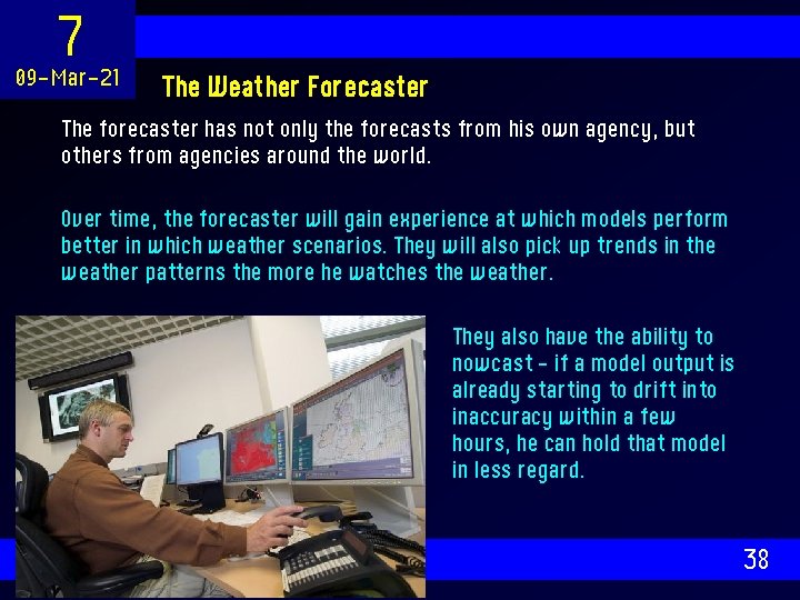
7 09 -Mar-21 The Weather Forecaster The forecaster has not only the forecasts from his own agency, but others from agencies around the world. Over time, the forecaster will gain experience at which models perform better in which weather scenarios. They will also pick up trends in the weather patterns the more he watches the weather. They also have the ability to nowcast – if a model output is already starting to drift into inaccuracy within a few hours, he can hold that model in less regard. 38

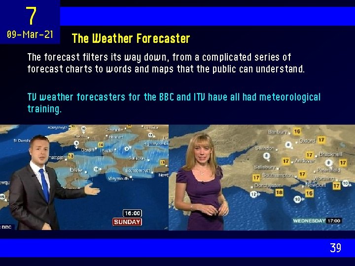
7 09 -Mar-21 The Weather Forecaster The forecast filters its way down, from a complicated series of forecast charts to words and maps that the public can understand. TV weather forecasters for the BBC and ITV have all had meteorological training. 39

7 09 -Mar-21 SUMMARY This week, we have covered the process of generating a forecast. There are ways of forecasting the weather by looking at the sky, although a numerical forecast using a computer can be much more insightful. Modern weather models are vast pieces of computer code, designed to be run on the world’s fastest supercomputers. To start them off, we need a full three-dimensional picture of the world weather at all gridpoints. We achieve this by combining observations with data rom previous forecast model output. It is then the forecaster’s job to interpret the forecast for the public. 40

7 09 -Mar-21 Next Week… Next week, we will look at why forecasts become less reliable with time, and how we can still use models to predict the weather further into the future. Then, we look at how the models can be used to simulate climate change. 41