Portraying the Earth GPS RS and GIS as


- Slides: 20

Portraying the Earth GPS, RS, and GIS as geographic tools Lab 3

Concepts n n Types of maps Categories of data on maps n n n Location data Attribute data 3 representations of data Global Positioning Systems Remote Sensing Geographic Information Systems

Types of Maps n “map”: representation of spatial distribution of selected phenomena n q Maps show what is where General Purpose/Reference maps q q q Display natural & man-made elements on the earth Ex: Landscape features, Political boundaries, etc. Special Purpose/Thematic/Statistical maps q q Illustrates characteristics of a geographical area Ex: Population, Unemployment, Ethnicity, etc.

Data on Maps Categories of Data n Location Data: coordinates, addresses n “Where is it located? ”

Data on Maps Categories of Data n Attribute Data: descriptive & informative n “What kind of item is there? ” and “How many items are there? ”

Data on Maps Where does it come from? n n n Scanned maps Field sampling Aerial photographs Satellite images Databases (location & attribute information)

Data on Maps Three representations n POINTS n n n LINES n n n single physical item Building, person, tree “arcs” Street, river, contours AREAS n n “polygons” Lakes, political units “Layers” of data

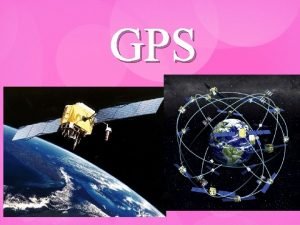
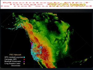
Global Positioning System (GPS) Satellite-based navigation n system, allows users to find their latitude/longitude location. n 24 satellites in orbit (U. S. Dept of Defense). n Originally for military application, but made available for civilian use in 1980 s. n Each satellite circles the Earth twice a day. n GPS works in any weather condition, anywhere in the world, 24 hours a day.

Global Positioning System (GPS) Three elements Space n Satellites in orbit Control n Ground stations around the world that upload data to the satellites and control their orbits User n Receiving end of the satellite transmission information

Global Positioning Systems (GPS) How do they work? n Use triangulation to provide user with location q q A GPS receiver must be locked on to the signal of at least 3 satellites to calculate latitude and longitude. With four or more satellites, the receiver can determine the user's 3 D position (latitude, longitude and altitude). You holding a GPS receiver

Remote Sensing n Collecting information about the Earth without direct contact n 2 examples n n Satellite Imagery Aerial Photographs

Remote Sensing Satellite Imagery Right: Pearl Harbor, Hawai’i Far Right: Italy and Greece Below: Light pollution at night

Remote Sensing Aerial Photography Below Left: Houston, TX Below Center: Chicago, IL Below Right: Turner Field

Geographic Information Systems (GIS) n A system of software, hardware, data, and user which allows us to visualize, manipulate, analyze, and display spatial data n n n Maps are a product of GIS – a way to spatially visualize the data Often called “smart maps” because they link databases to a map, with interactive capabilities GIS is a problem-solver n n n Ask a question Combine various forms of data in a program Interactive capabilities allow for analysis and final map

Geographic Information Systems (GIS) Think of it this way… n Data in a database: not easy to interpret

Geographic Information Systems (GIS) But… n Data represented analyzed in a spatial manner: easier interpretation

Geographic Information Systems (GIS) Example: Atlanta Area Schools

Geographic Information Systems (GIS) Example: Atlanta Area Schools

Geographic Information Systems (GIS) Helpful not just to Geographers n Emergency Services n n Environmental Agencies n n Transportation, communications, pipelines Government n n Marketing, store location analysis, customer data Industry n n Monitoring environmental quality standards, flooding Business n n Fire, police, 911 Census Bureau statistics, historical preservation Education

Geographic Information Systems (GIS) GIS on the Internet What is and what isn’t GIS? Think carefully and observe the tools you have available on each website. n Google Maps n n National Geographic Map Machine n n http: //publicgis. myclearwater. com/imsreports/Address. Reports. Picker. N. aspx The European Pollutant Emission Register n n http: //geomac. usgs. gov/viewer. html City of Clearwater, Florida n n http: //plasma. nationalgeographic. com/mapmachine GEOMAC Wildland Fire Support n n http: //maps. google. com http: //eper. cec. eu. int/eper/flashmap. asp Downtown Los Angeles Homeless Tracker n http: //homeless. cartifact. com/
 Gps gps gps
 How does gps work
 Hình ảnh bộ gõ cơ thể búng tay
 Ng-html
 Bổ thể
 Tỉ lệ cơ thể trẻ em
 Chó sói
 Glasgow thang điểm
 Chúa yêu trần thế alleluia
 Các môn thể thao bắt đầu bằng tiếng đua
 Thế nào là hệ số cao nhất
 Các châu lục và đại dương trên thế giới
 Công của trọng lực
 Trời xanh đây là của chúng ta thể thơ
 Mật thư anh em như thể tay chân
 Làm thế nào để 102-1=99
 độ dài liên kết
 Các châu lục và đại dương trên thế giới
 Thơ thất ngôn tứ tuyệt đường luật
 Quá trình desamine hóa có thể tạo ra
 Một số thể thơ truyền thống


