Gravity and the Geoid at NGS Dru A


- Slides: 41
Gravity and the Geoid at NGS Dru A. Smith National Geodetic Survey Presented at the 2000 Geodetic Advisor Convocation Silver Spring, MD April 11, 2000
Topics of Discussion n n Review of height systems Geoid modeling GEOID 99 Future Directions
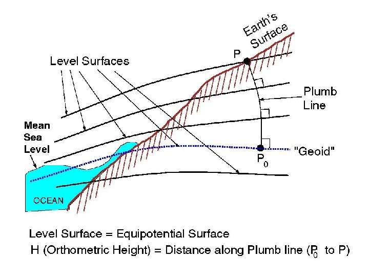
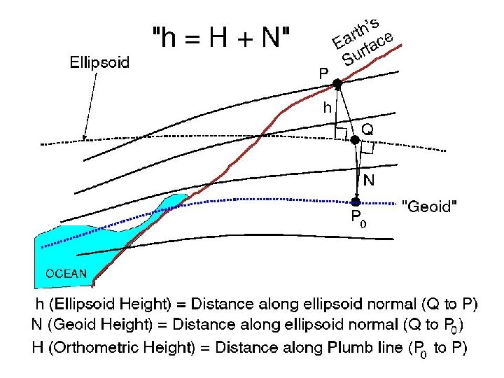
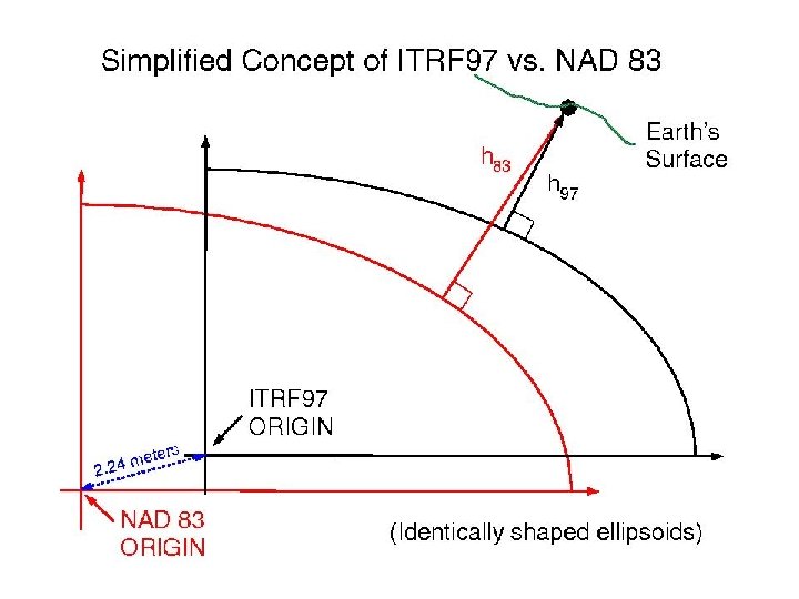
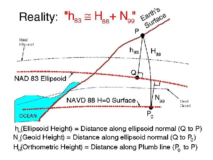
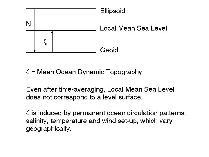
Review of Height Systems n n n (Helmert) Orthometric Heights Ellipsoid Heights Geoid undulations NAD 83 & NAVD 88 Mean Sea Level
Geoid Modeling n n Data Sets Methodology
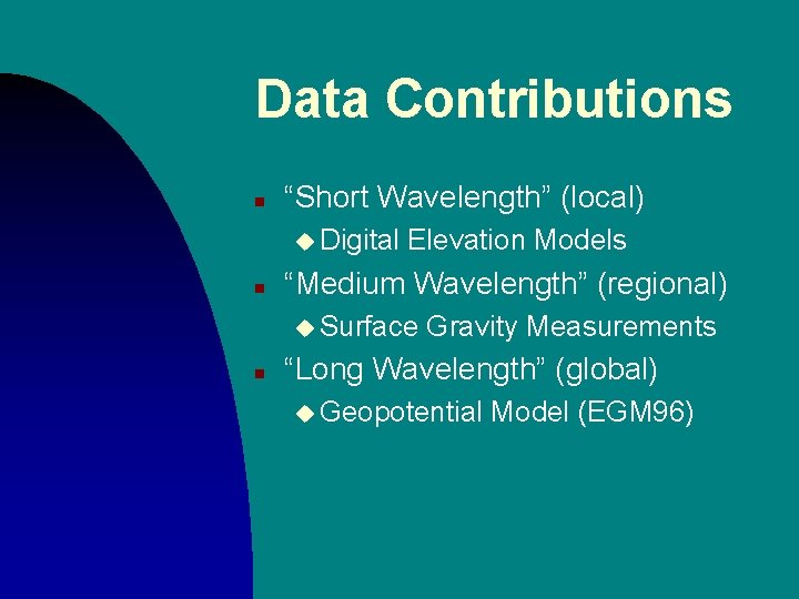
Data Contributions n “Short Wavelength” (local) u Digital n Elevation Models “Medium Wavelength” (regional) u Surface n Gravity Measurements “Long Wavelength” (global) u Geopotential Model (EGM 96)
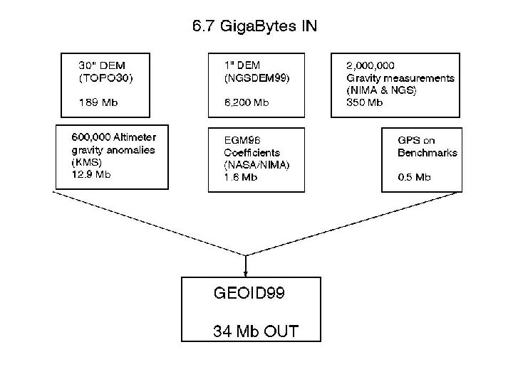
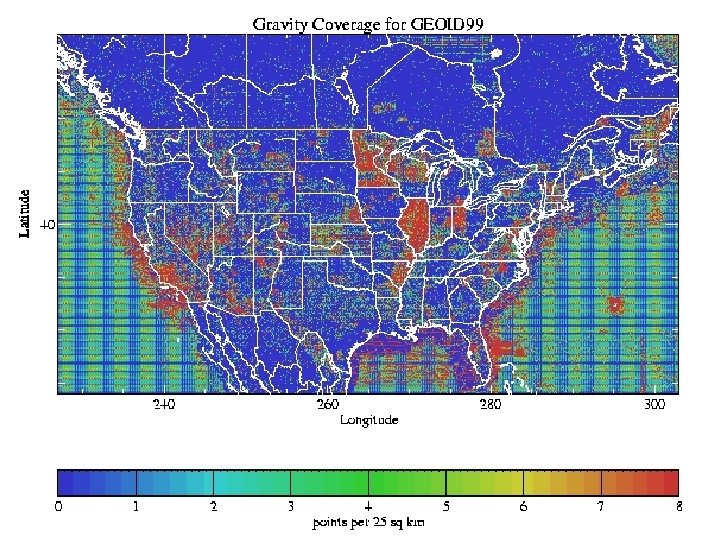
Need: Gravity Measurements n n n Terrestrial Ship-borne Altimetrically-derived
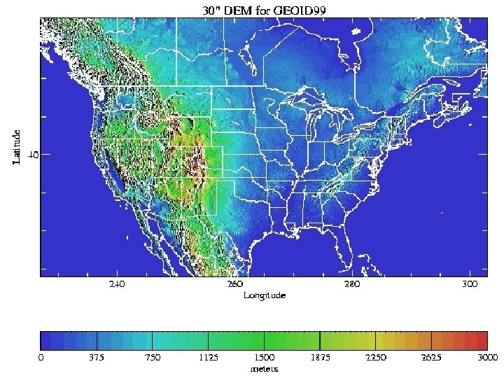
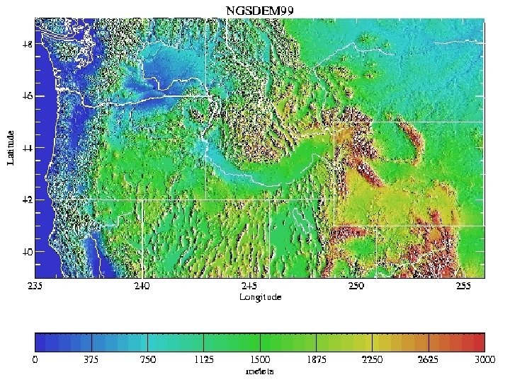
Need: Digital Elevation Models n n n TOPO 30 (30 arcsecond) for CONUS GTOPO 30 (30 arc second) for Canada NGSDEM 99 (1 arc second) for PNW
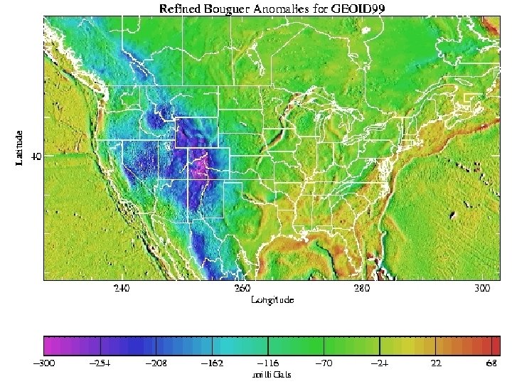
Step 1: Grid Bouguer Anomalies n n n Gravity measurements DEM for Bouguer plate DEM for Terrain Corrections
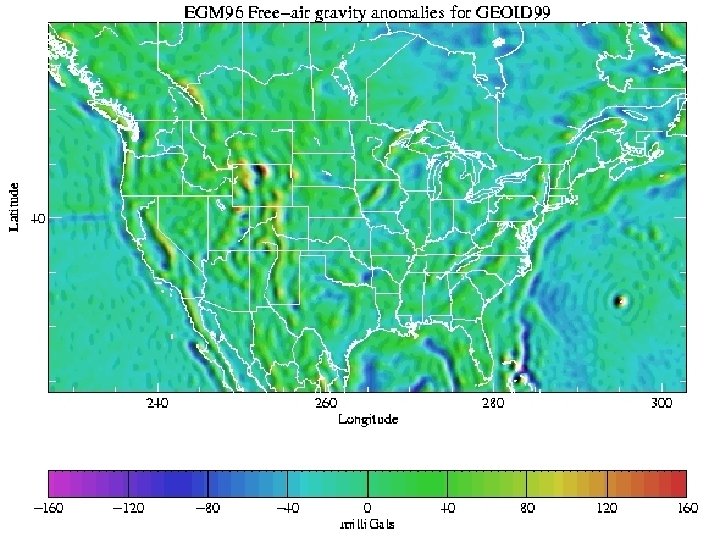
Step 2: Compute EGM 96 gravity anomalies
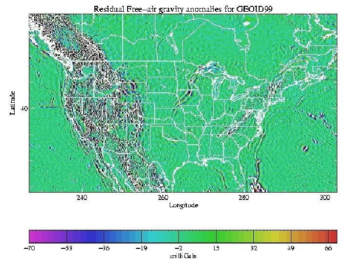
Step 3: Residual Free-air anomalies n n n Begin with Bouguer Restore Bouguer plate Remove EGM 96
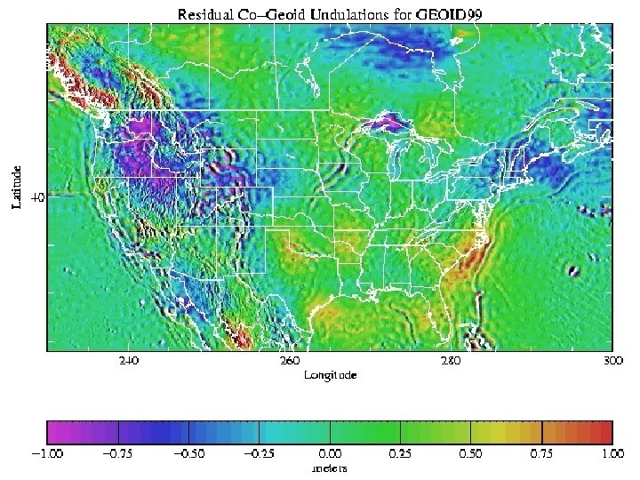
Step 4: The Stokes Integral n n n Input: residual free-air anomalies Output: residual co-geoid undulations 1 -D FFT method
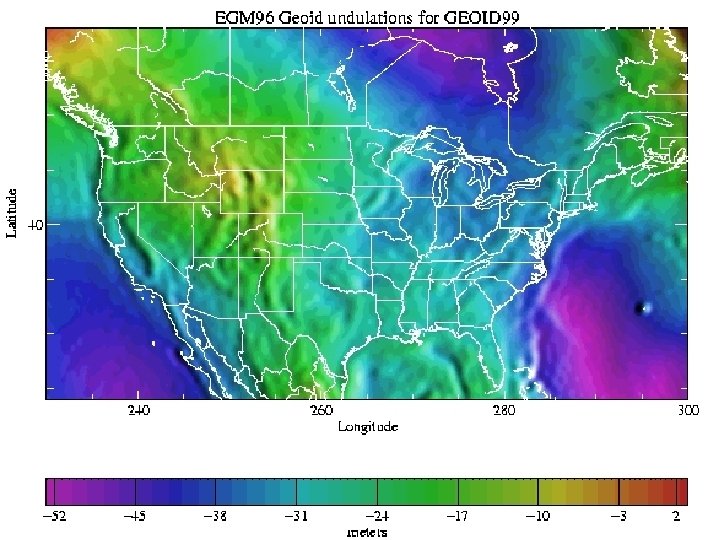
Step 5: Compute EGM 96 geoid undulations
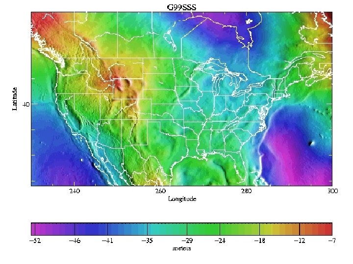
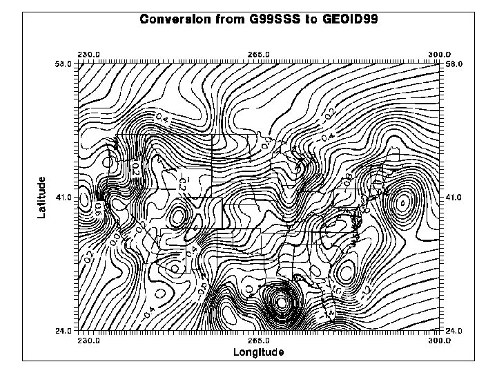
Step 6: G 99 SSS n n Begin with residual co-geoid undulations Add EGM 96 Add Indirect Effect G 99 SSS is u GEOCENTRIC u GRAVIMETRIC and
Need: GPS on Benchmarks n n NAD 83 ellipsoid heights NAVD 88 Helmert orthometric Heights
Step 7: Conversion Surface n Use Least Squares Collocation to combine: u ITRF 96 / NAD 83 transformation u NAVD 88 bias (-52 cm) u Tilt (0. 15 ppm, 327 azimuth) u Local GPS/Leveling/Geoid misfit n G 99 SSS - Conversion Surface = GEOID 99
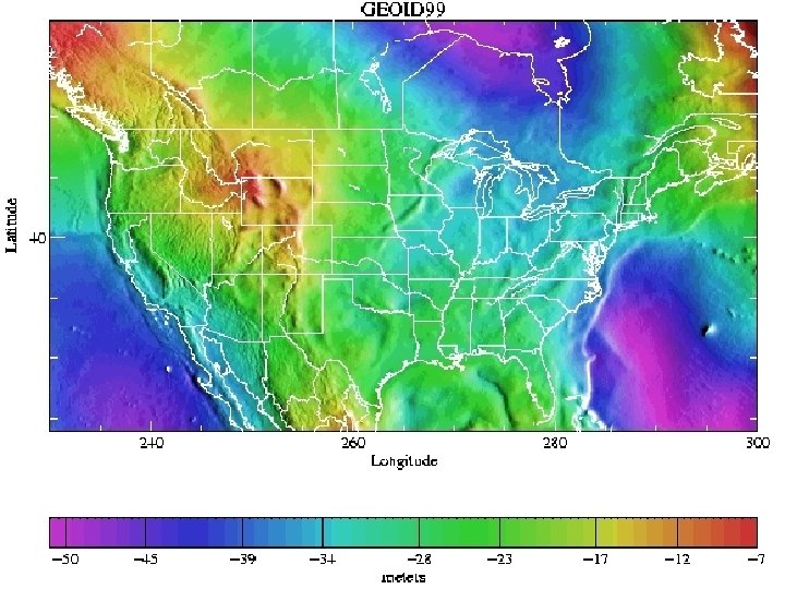
GEOID 99 n n n Comparison to GEOID 96 GPS-derived orthometric heights Accuracy
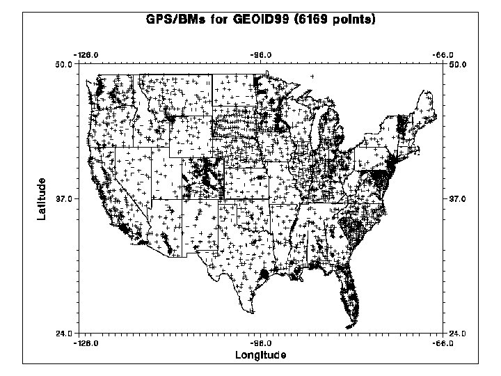
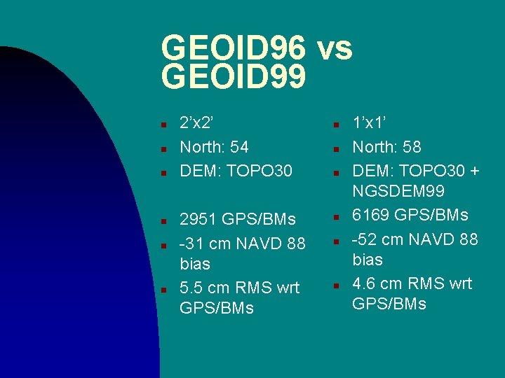
GEOID 96 vs GEOID 99 n n n 2’x 2’ North: 54 DEM: TOPO 30 2951 GPS/BMs -31 cm NAVD 88 bias 5. 5 cm RMS wrt GPS/BMs n n n 1’x 1’ North: 58 DEM: TOPO 30 + NGSDEM 99 6169 GPS/BMs -52 cm NAVD 88 bias 4. 6 cm RMS wrt GPS/BMs
GPS-derived Orthometric heights n n n Local accuracy is difficult to gauge Few GPSBMs near each other Depends on: u Quality of GPS u “Simplicity” of local geoid u Method of adjustment
Future Directions n Gravimetric u Improved gravimetric theory u GRACE/CHAMP u 1 arcsecond DEM over USA n Hybrid Geoid cm (1 s) GPS heights u Leveling near CORS u 1
Summary n n Gravity coverage is adequate to exceptional 1 arc second DEM needed for all USA territories GEOID 99 improved on the success of GEOID 96 GPS derived orthometric heights at the <1 to 8 cm level
ON-LINE NGS GEOID RESOURCES n Official NGS Geoid Page: u http: //www. ngs. noaa. gov/GEOID u Links to all geoid models u Links to all geoid papers from NGS u Lots of useful geoid information u Slideshows like this one (coming soon)