OPUS Online Positioning User Service http www ngs
- Slides: 23
OPUS: Online Positioning User Service http: //www. ngs. noaa. gov/OPUS/ ngs. opus@noaa. gov
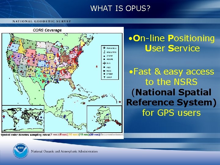
WHAT IS OPUS? • On-line Positioning User Service • Fast & easy access to the NSRS (National Spatial Reference System) for GPS users
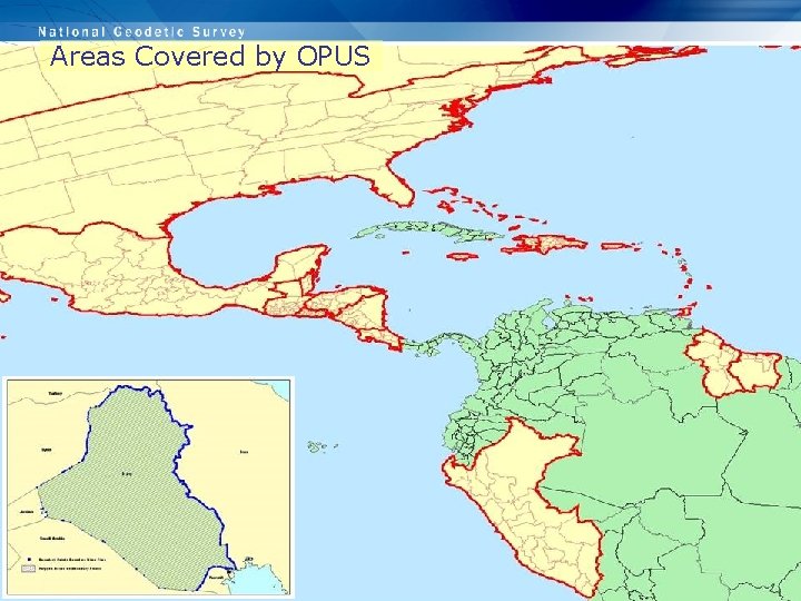
Areas Covered by OPUS
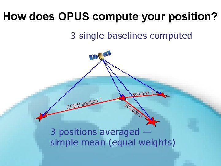
How Does OPUS Work? • Data submitted through NGS web page • Processed automatically with NGS computers & software • Position with respect to 3 suitable CORS (or IGS sites if 1) no NAD 83 positions are available and 2) the host country has an agreement with NGS. In these international cases, ITRF coordinates only are returned, and there are no state plane or US grid coordinates • Solution via email (usually in minutes)
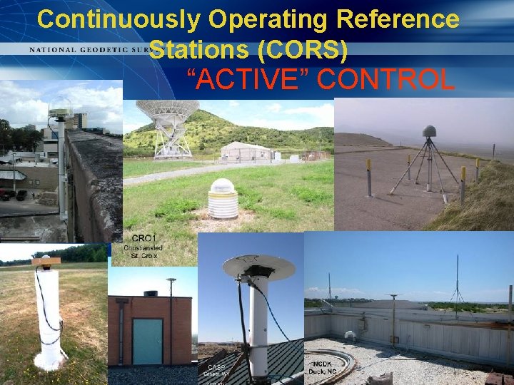
Continuously Operating Reference Stations (CORS) “ACTIVE” CONTROL
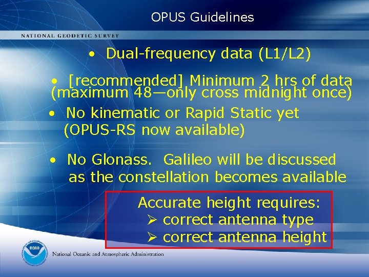
OPUS Guidelines • Dual-frequency data (L 1/L 2) • [recommended] Minimum 2 hrs of data (maximum 48—only cross midnight once) • No kinematic or Rapid Static yet (OPUS-RS now available) • No Glonass. Galileo will be discussed as the constellation becomes available Accurate height requires: Ø correct antenna type Ø correct antenna height
How does OPUS compute your position? 3 single baselines computed solution 2 n 1 lutio RS so CO so lut ion 3 3 positions averaged — simple mean (equal weights)
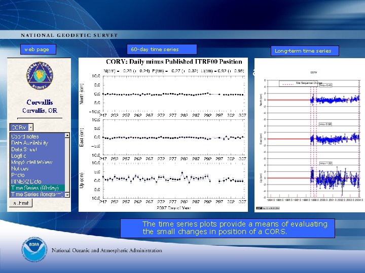
web page 60 -day time series Long-term time series Time-series plots, 60 -day and long-term The time series plots provide a means of evaluating the small changes in position of a CORS.
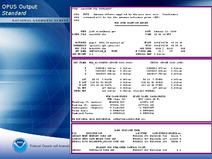
OPUS Output Standard FILE: corv 0590. 05 o 000416827 1008 NOTE: Antenna offsets supplied by the user were zero. Coordinates returned will be for the antenna reference point (ARP). NGS OPUS SOLUTION REPORT ============ USER: jeff. olsen@noaa. gov RINEX FILE: corv 059 f. 05 o SOFTWARE: EPHEMERIS: NAV FILE: ANT NAME: ARP HEIGHT: DATE: January 13, 2006 TIME: 19: 08: 14 UTC page 5 0601. 10 master 3. pl igs 13121. eph [precise] brdc 0590. 05 n ASH 700936 B_M NONE 0. 0 START: 2005/02/28 05: 00 STOP: 2005/02/28 06: 59: 30 OBS USED: 4228 / 4314 : 98% # FIXED AMB: 25 / 29 : 86% OVERALL RMS: 0. 013(m) REF FRAME: NAD_83(CORS 96)(EPOCH: 2002. 0000) E W EL ORTHO X: Y: Z: -2498423. 165(m) -3802822. 048(m) 4454737. 695(m) LAT: LON: HGT: 44 35 7. 91054 236 41 43. 48129 123 18 16. 51871 107. 485(m) 130. 010(m) Northing (Y) [meters] Easting (X) [meters] Convergence [degrees] Point Scale Combined Factor ITRF 00 (EPOCH: 2005. 1596) 0. 018(m) 0. 021(m) 0. 024(m) -2498423. 872(m) -3802820. 836(m) 4454737. 792(m) 0. 018(m) 0. 021(m) 0. 024(m) 0. 002(m) 44 35 7. 92698 0. 014(m) 236 41 43. 42434 0. 014(m) 123 18 16. 57566 0. 034(m) 107. 108(m) 0. 043(m) [Geoid 03 NAVD 88] 0. 002(m) 0. 014(m) 0. 034(m) UTM COORDINATES UTM (Zone 10) 4936954. 907 475821. 322 -0. 21381402 0. 99960719 0. 99959034 STATE PLANE COORDINATES SPC (3601 OR N) 105971. 557 2277335. 385 -1. 98897497 0. 99994603 0. 99992918 US NATIONAL GRID DESIGNATOR: 10 TDQ 7582136955(NAD 83) BASE STATIONS USED PID DESIGNATION LATITUDE LONGITUDE DISTANCE(m) AH 2489 NEWPORT CORS ARP N 443506. 072 W 1240342. 736 60138. 7 AJ 6959 CHZZ CAPE MEARS CORS ARP N 452911. 437 W 1235841. 187 113322. 4 DH 4503 P 376 EOLARESVR_OR 2004 CORS ARP N 445628. 313 W 1230608. 100 42648. 2 AH 2486 NEAREST NGS PUBLISHED CONTROL POINT CORVALLIS CORS ARP N 443507. 910 W 1231816. 519 0. 0
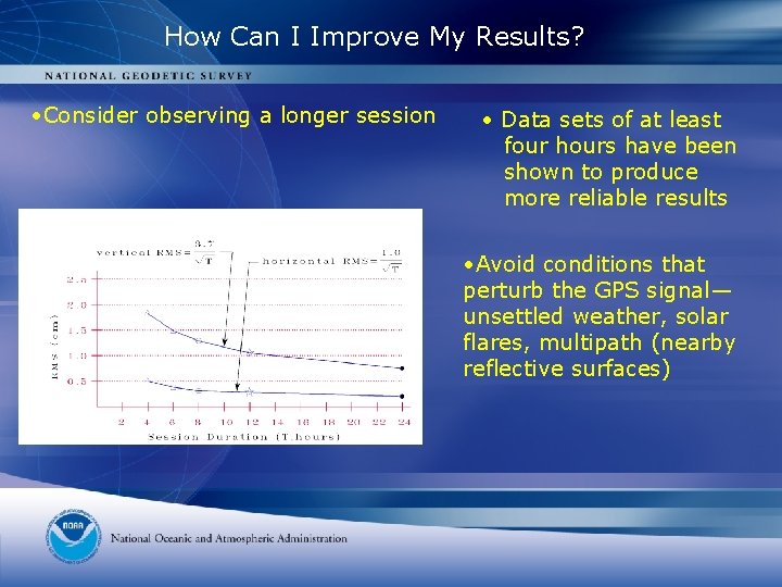
How Can I Improve My Results? • Consider observing a longer session • Data sets of at least four hours have been shown to produce more reliable results • Avoid conditions that perturb the GPS signal— unsettled weather, solar flares, multipath (nearby reflective surfaces)
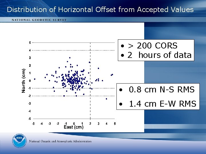
Distribution of Horizontal Offset from Accepted Values • > 200 CORS • 2 hours of data • 0. 8 cm N-S RMS • 1. 4 cm E-W RMS
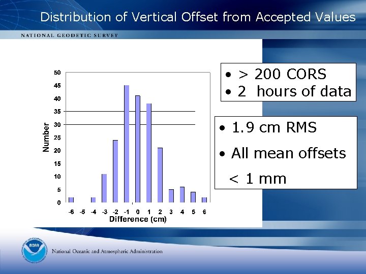
Distribution of Vertical Offset from Accepted Values • > 200 CORS • 2 hours of data • 1. 9 cm RMS • All mean offsets < 1 mm
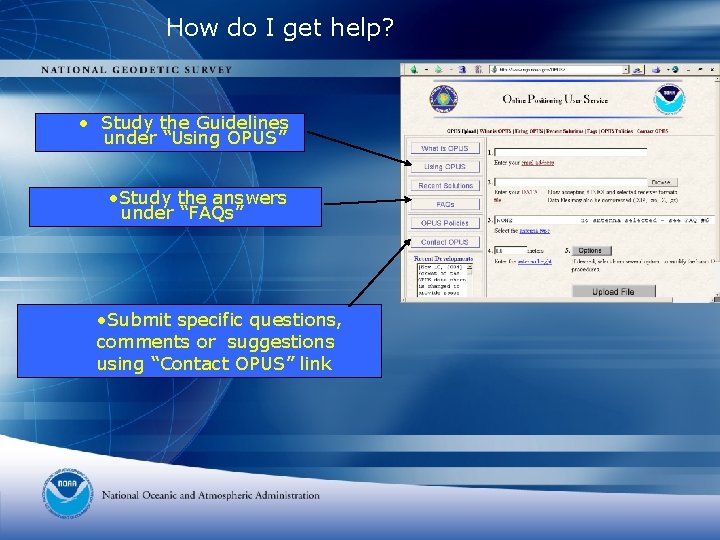
How do I get help? • Study the Guidelines under “Using OPUS” • Study the answers under “FAQs” • Submit specific questions, comments or suggestions using “Contact OPUS” link
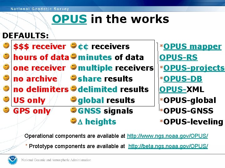
OPUS in the works DEFAULTS: $$$ receiver hours of data one receiver no archive no delimiters US only GPS only ¢¢ receivers minutes of data multiple receivers share results delimited results global results GNSS signals D heights *OPUS mapper OPUS-RS *OPUS-projects *OPUS-DB OPUS-XML *OPUS-global *OPUS-GNSS *OPUS-leveling Operational components are available at http: //www. ngs. noaa. gov/OPUS/ * Prototype components are available at http: //beta. ngs. noaa. gov/OPUS/
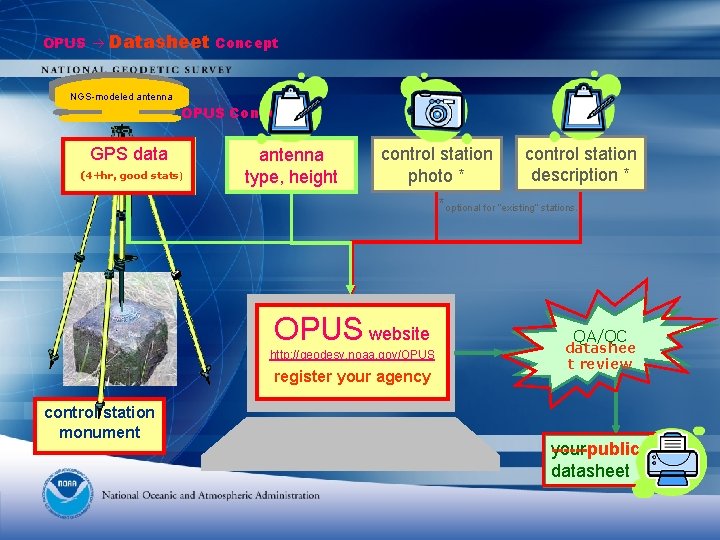
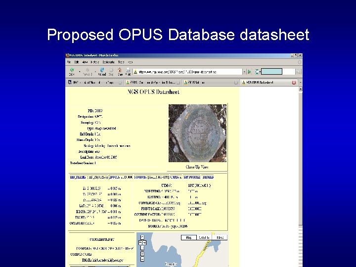
OPUS Datasheet Concept NGS-modeled antenna OPUS Concept GPS data (4+hr, good stats) antenna type, height control station photo * control station description * *optional for “existing” stations. OPUS website http: //geodesy. noaa. gov/OPUS register your agency control station monument QA/QC datashee t review ------public your datasheet
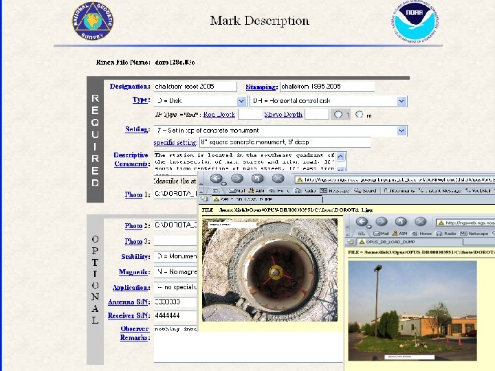
Proposed OPUS Database datasheet
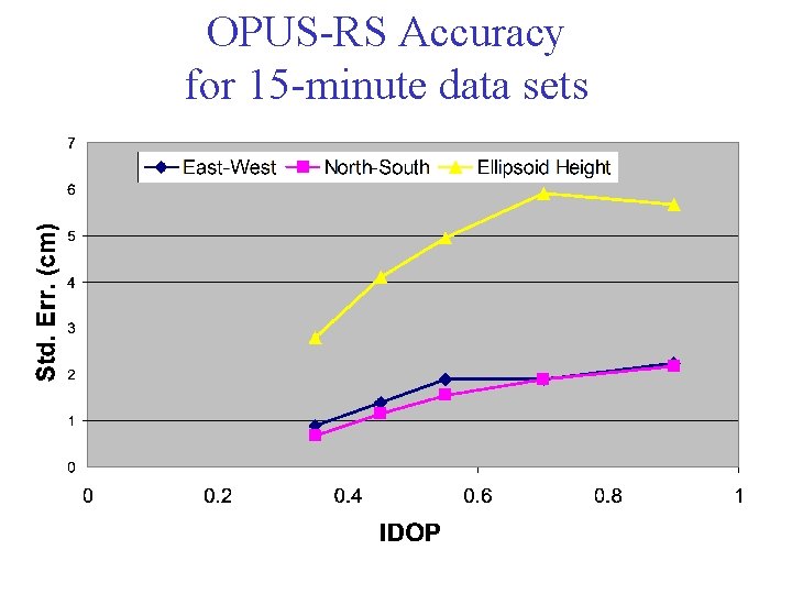
OPUS-RS Accuracy for 15 -minute data sets
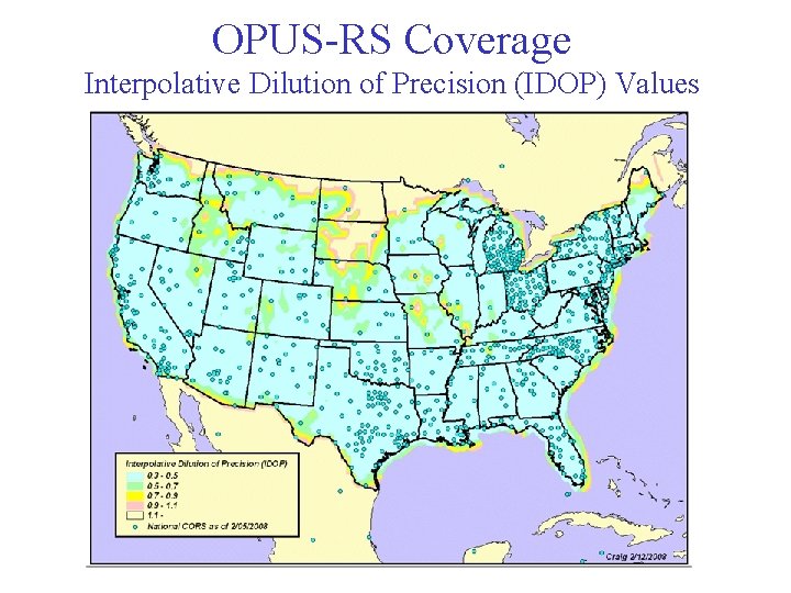
OPUS-RS Coverage Interpolative Dilution of Precision (IDOP) Values
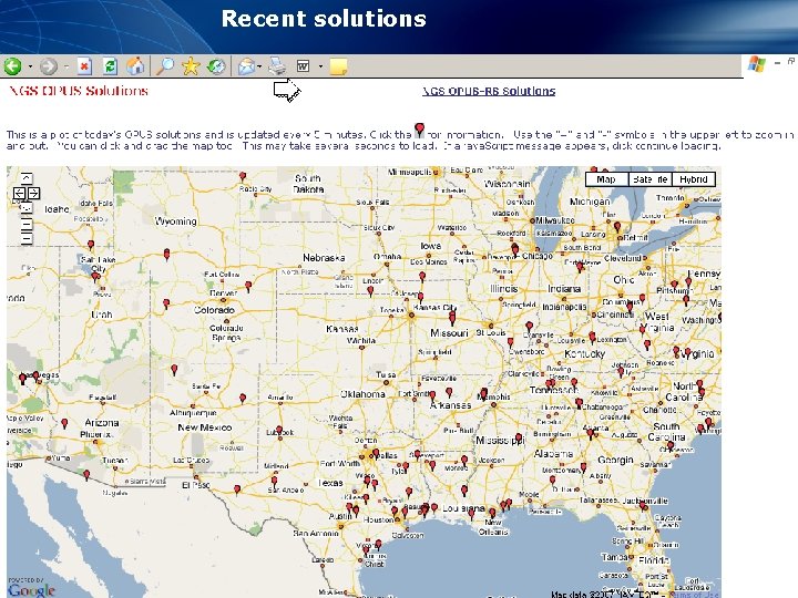
Recent solutions
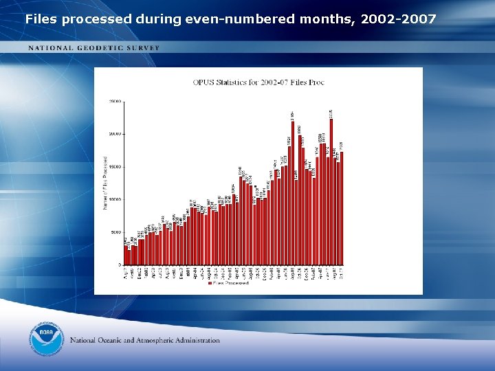
Files processed during even-numbered months, 2002 -2007
ONGOING CORS RESEARCH * Exploring the use of NTRIP to stream GPS data from selected CORS via the Internet. * Developing OPUS-GIS which will process a few minutes of GPS code range data (for sub-meter accuracy) * Improving OPUS-RS (rapid static) that will enable users to obtain positional coordinates with cm-level accuracy using only 15 minutes of GPS carrier phase data
Try it! • http: //beta. ngs. noaa. gov/OPUS/