Glaciers and Meltwater chapter 3 Glacier hydrology Why


 differences in peak and total runoff")


 down-ice n Water increases to the terminus n Debris")
 N (Nye) channels n")
 vs distributed (slow) flow Arborescent vs nonarborescent paths")


 Evolution n Q/Load n n Reheis (1987) n")
 Ritter (1972) Evolution n Q/Load n n")

 converges across")


- Slides: 62
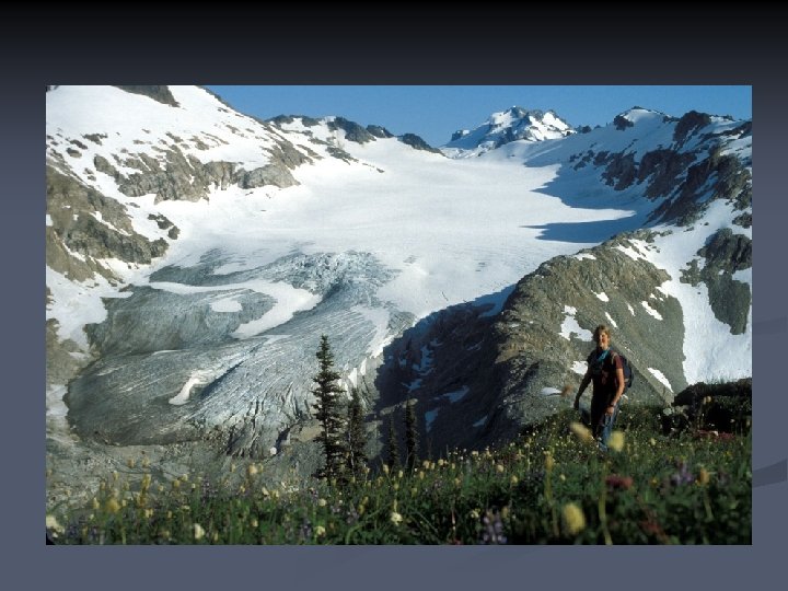
Glaciers and Meltwater chapter 3
Glacier hydrology Why should you care? Based on a lecture by Dr. J. S. Walder
Practical matters: glaciers in the hydrological system n n Glacier-fed rivers provide much of the water supply in some parts of the world. Run-off characteristics (daily and seasonal) differ from other types of stream flow. Run-off locally used for hydroelectric power generation. Flood hazards in alpine areas from morainedammed and ice-dammed lakes.
Glaciated vs. Unglaciated Basins n Minor (? ) differences in peak and total runoff n n in snow-dominated basins (not raindominated) Major difference is in timing of runoff
Characteristics of Glacial Q n During ablation season – strong daily peaks driven by energy inputs n f (cloudiness) n
Characteristics of Glacial Q n Ablation season – strong daily peaks driven by energy inputs n f (cloudiness) n n Anomalies – driven by internal/external drainage (re)organization of flow paths? n kinematic waves? n
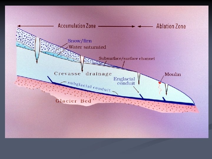
Glaciers and water n Sources of water surface n subsurface n n Water flow in glaciers open-channel, porous-media (Darcian) or conduit flow? n hydraulic potential n storage: lakes and ponds n n n Supraglacial, englacial, subglacial drainage Glacial-fluvial features n outburst floods
Glaciers and water n Explanation / discussion of hydraulic potential in glaciers n see text p 99 – 101
Glaciers and water n Sources of water surface n subsurface n n Water flow in glaciers open-channel, porous-media (Darcian) or conduit flow? n hydraulic potential n storage: lakes and ponds (classification) n n n Supraglacial, englacial, subglacial drainage Glacial-fluvial features n outburst floods
Glacier dammed lake ice flow This lake fills and drains every year. Lake basin after outburst Subglacial outflow
Glaciers and water n Sources of water surface n subsurface n n Water flow in glaciers open-channel, porous-media (Darcian) or conduit flow? n hydraulic potential n storage: lakes and ponds n n n Supraglacial, englacial, subglacial drainage Glacial-fluvial features n outburst floods
Supraglacial Drainage Melt occur because of albedo, air temperature n Snowpack becomes saturated, refreezes or n Water runs off n Channel morphology n Flow to margin or snout n
Supraglacial Drainage Melt occurs because of albedo, air temperature n Snowpack becomes saturated, refreezes or n Water runs off n Channel morphology n Flow to margin or snout n Moulins to interior/bed n
Ablation Zone
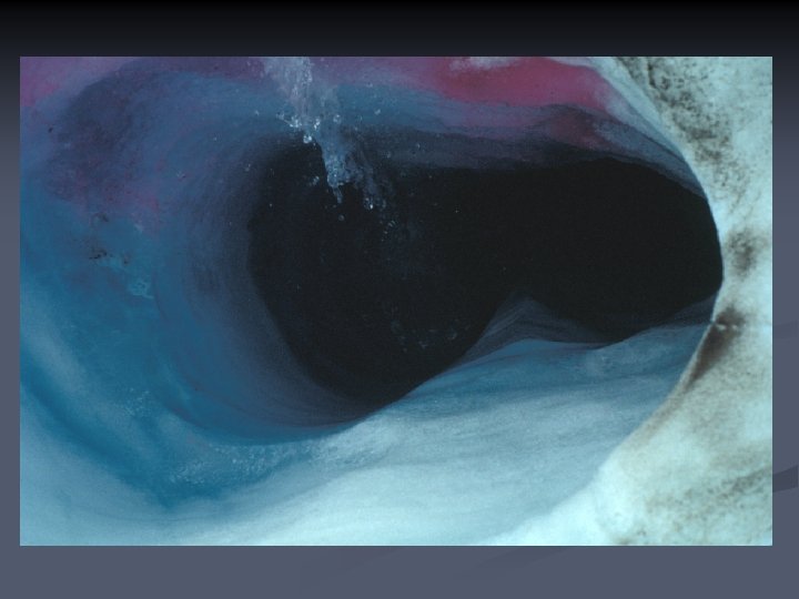
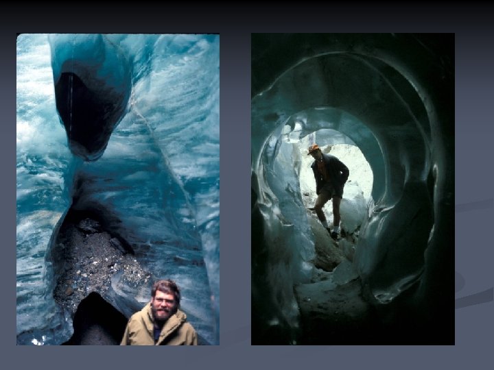
Englacial Drainage Positive feedbacks enlarge seeps to streams n Negative feedbacks close them n • See also http: //www. glaciers-online. net/morteratsch/ice_cave_2009/index-en. html
The Subglacial System f (distance) down-ice n Water increases to the terminus n Debris decreases below the terminus n
Subglacial Channels n Eroded into bedrock (e. g. , Antarctica) N (Nye) channels n Pressure n Tools n
Subglacial Drainage Channelized (fast) vs distributed (slow) flow Arborescent vs nonarborescent paths
Cavity network A cavity network has very different hydraulic properties than an arborescent channel network. N- or R- channels ?
Insight from geomorphology Features exposed on recently deglaciated carbonate bedrock provide insights into the geometry of a subglacial drainage network. ice flow
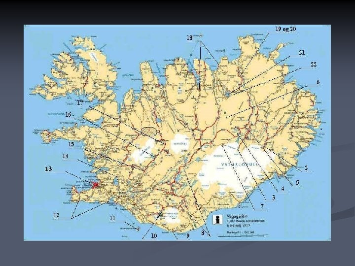
Vatnajökull Annes Hjemmeside
Dye tracing Dye is poured into moulin or borehole. Average properties of the drainage system can be inferred from dye return curves.
Boreholes
Dye concentration Character of the dye return curve commonly changes as the melt season progresses. June 20 July 4 June 19 June 17 Hours since injection
Subglacial Conduit
Subglacial Channels
Eskers Copyright © Daryl Dagesse 2002
Eskers II n n Impermeable bed Lane’s Balance? Gravity + hydrostatic pressure Typically flow down-ice
Eskers II n n Impermeable bed Lane’s Balance? Gravity + hydrostatic pressure Typically flow down-ice
Glaciers and water n Sources of water surface n subsurface n n Water flow in glaciers open-channel, porous-media (Darcian) or conduit flow? n hydraulic potential n storage: lakes and ponds n n n Supraglacial, englacial, subglacial drainage Glacial-fluvial features n outburst floods
Vatnajökull October 1, 1996 Magnús Tumi Guðmundsson Science Institute, University of Iceland
Vatnajökull October 3, 1996 Magnús Tumi Guðmundsson Science Institute, University of Iceland
Jökulhlaup, 5 November 1996 Magnús Tumi Guðmundsson Finnur Pálsson Science Institute, University of Iceland
380 m long bridge across Gýgja has disappeared Magnús Tumi Guðmundsson Finnur Pálsson Science Institute, University of Iceland
Lake Missoula n The largest of many icedammed lakes in Montana
Lake Missoula The largest of many icedammed lakes in Montana n Ice dam dynamics n
Lake Missoula The largest of many icedammed lakes in Montana n Ice dam dynamics n Reconstructe d discharges n
Glaciers and Meltwater II
Outwash Streams and Sediment n Sources of sediment and debris
Kames: Terraces/Moulins/Deltas “Ice-contact glacio-fluvial” n Normal faulting n
Proximal Outwash
Proximal Outwash
Outwash Sedimentology Facies n Distribution n
Outwash Sedimentology Facies n Distribution n Downstrea m evolution n
Outwash Sedimentology Facies n Distribution n Downstream evolution n
Pitted Outwash Copyright © Jeff Munro 2002
Outwash Terraces n Morphology Theoretical n Actual n
Rock Creek, Montana n Ritter (1972) Evolution n Q/Load n n Reheis (1987) n Sequence
Rock Creek, Montana n from Reheis (1987) Ritter (1972) Evolution n Q/Load n n Reheis (1987) n Sequence
Downstream Sequences n How far downstream can an outwash terrace persist?
Shoshone River terraces All surfaces fit quadratic models n Younger (last glacial) converges across 85 km n Older (Illinoisan? ) is asymptotic/”parallel”. n
Shoshone summary n Last glacial terraces Modern anabranching are finite/converge n require >14, 000 yr n Are still prograding n n Older terraces “parallel” the river n denudation and isostasy? n n Wisconsinan Illinoisan What about more complex river systems?
Yellowstone River terraces Last glacial = finite, older = river-parallel? n Show evidence of local sediment supply n Anomalous reaches require other data (provenance, age) to decipher n
Shreve’s Model Landscape n Model n 1 bar n 0. 5 bar n 0. 25 bar n