
GLACIERS CHAPTER 5 HONORS EARTH SCIENCE What is

- Slides: 74
GLACIERS CHAPTER 5 HONORS EARTH SCIENCE
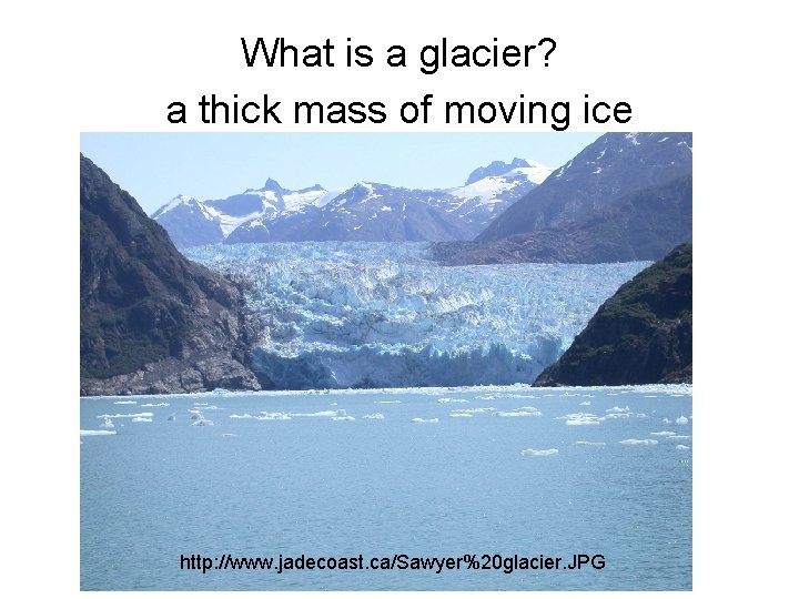
What is a glacier? a thick mass of moving ice http: //www. jadecoast. ca/Sawyer%20 glacier. JPG
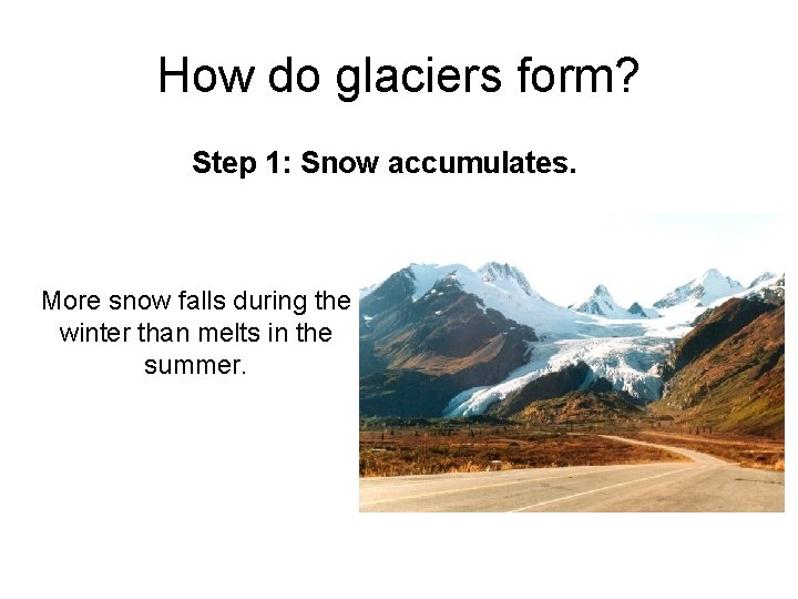
How do glaciers form? Step 1: Snow accumulates. More snow falls during the winter than melts in the summer.
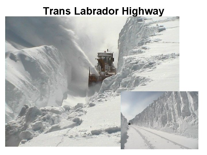
Trans Labrador Highway
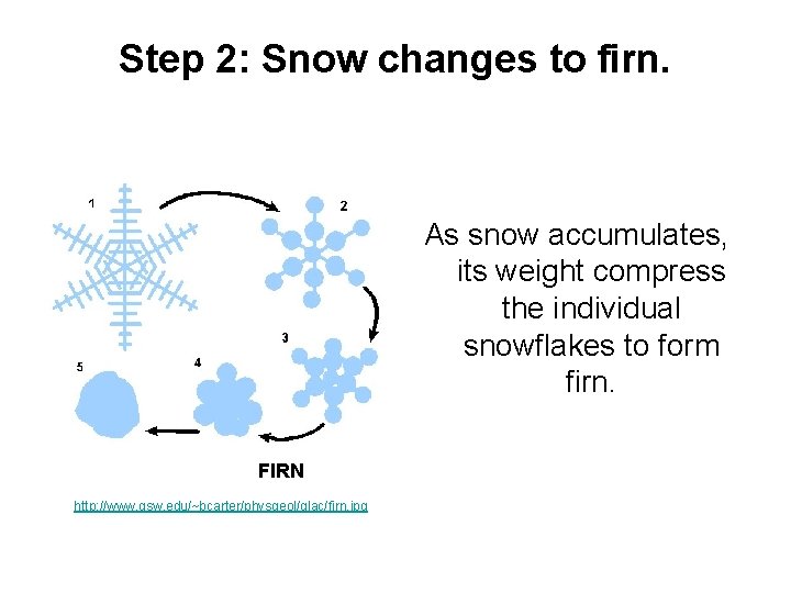
Step 2: Snow changes to firn. As snow accumulates, its weight compress the individual snowflakes to form firn. FIRN http: //www. gsw. edu/~bcarter/physgeol/glac/firn. jpg
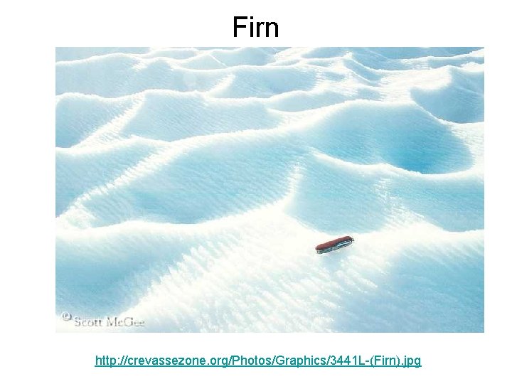
Firn http: //crevassezone. org/Photos/Graphics/3441 L-(Firn). jpg
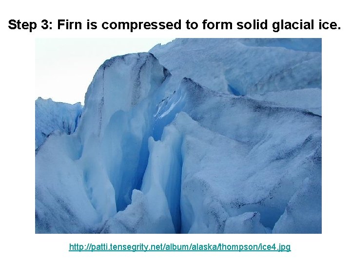
Step 3: Firn is compressed to form solid glacial ice. http: //patti. tensegrity. net/album/alaska/thompson/ice 4. jpg
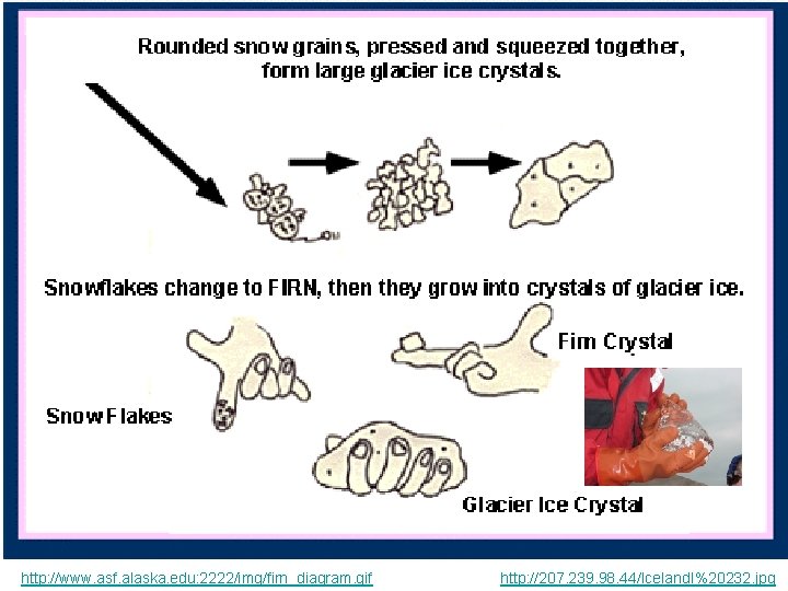
http: //www. asf. alaska. edu: 2222/img/firn_diagram. gif http: //207. 239. 98. 44/Iceland. I%20232. jpg
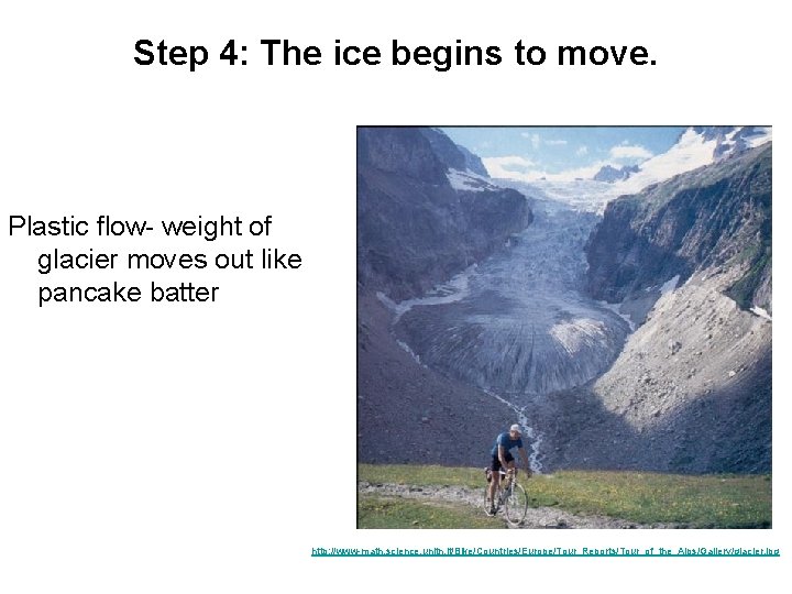
Step 4: The ice begins to move. Plastic flow- weight of glacier moves out like pancake batter http: //www-math. science. unitn. it/Bike/Countries/Europe/Tour_Reports/Tour_of_the_Alps/Gallery/glacier. jpg
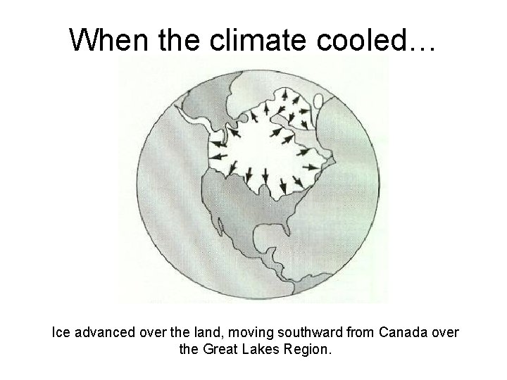
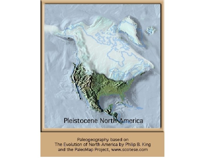
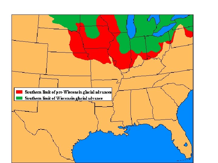
When the climate cooled… Ice advanced over the land, moving southward from Canada over the Great Lakes Region.
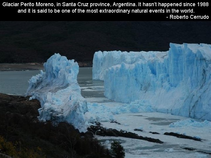
Glaciar Perito Moreno, in Santa Cruz province, Argentina. It hasn’t happened since 1988 and it is said to be one of the most extraordinary natural events in the world. - Roberto Cerrudo
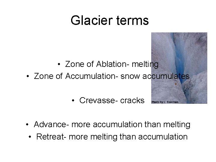
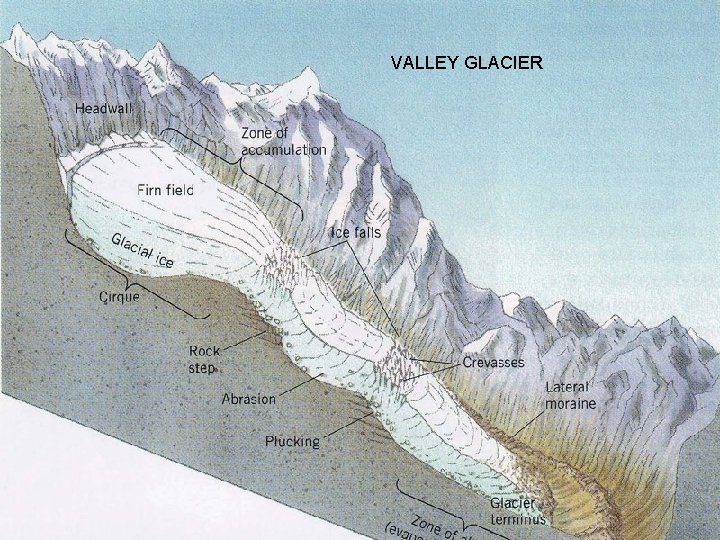
Glacier terms • Zone of Ablation- melting • Zone of Accumulation- snow accumulates • Crevasse- cracks • Advance- more accumulation than melting • Retreat- more melting than accumulation
VALLEY GLACIER
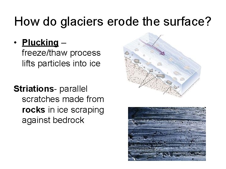
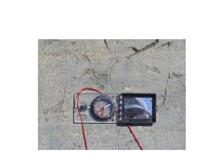
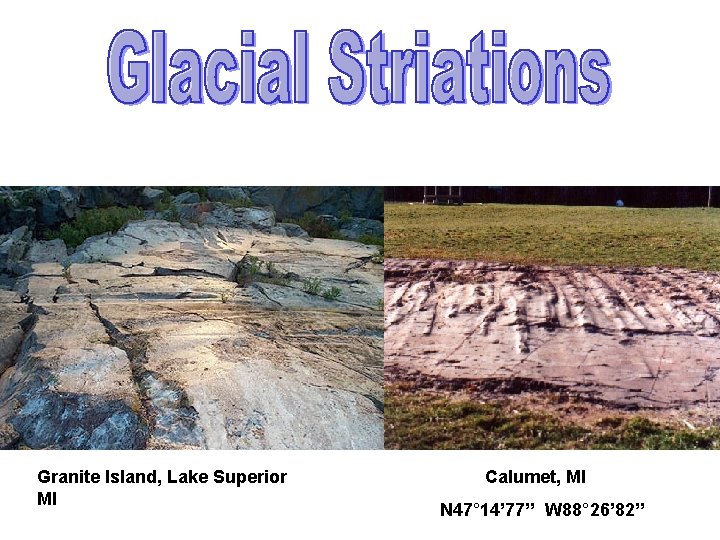
How do glaciers erode the surface? • Plucking – freeze/thaw process lifts particles into ice Striations- parallel scratches made from rocks in ice scraping against bedrock
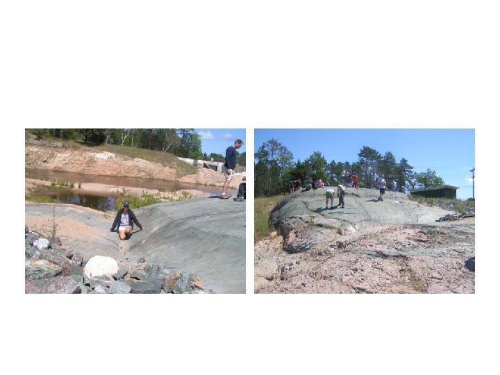
Granite Island, Lake Superior MI Calumet, MI N 47° 14’ 77’’ W 88° 26’ 82’’
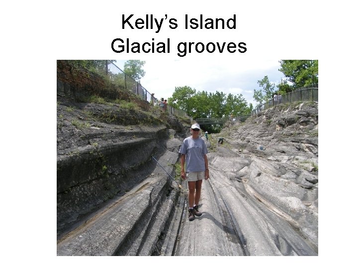
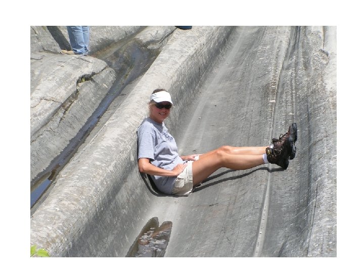
Kelly’s Island Glacial grooves
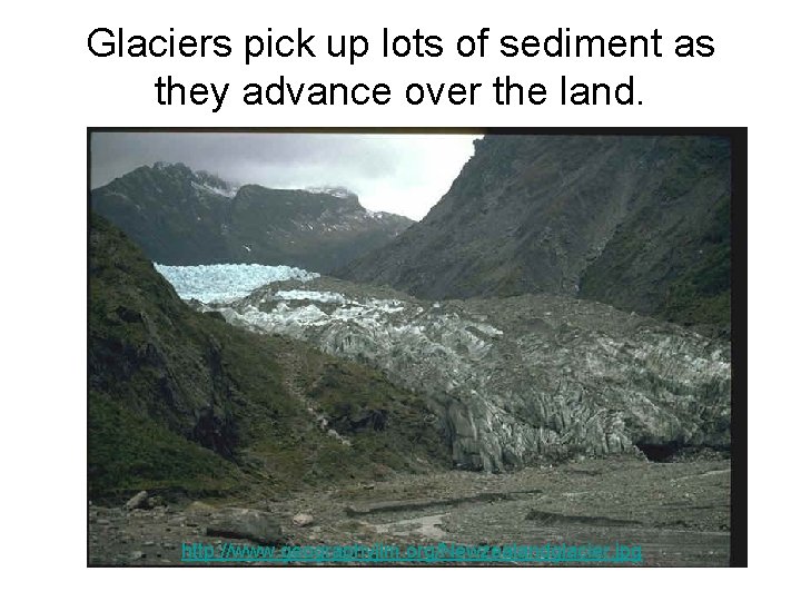
Glaciers pick up lots of sediment as they advance over the land. http: //www. geographyjim. org/Newzealandglacier. jpg
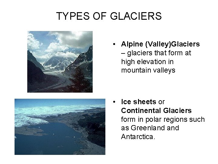
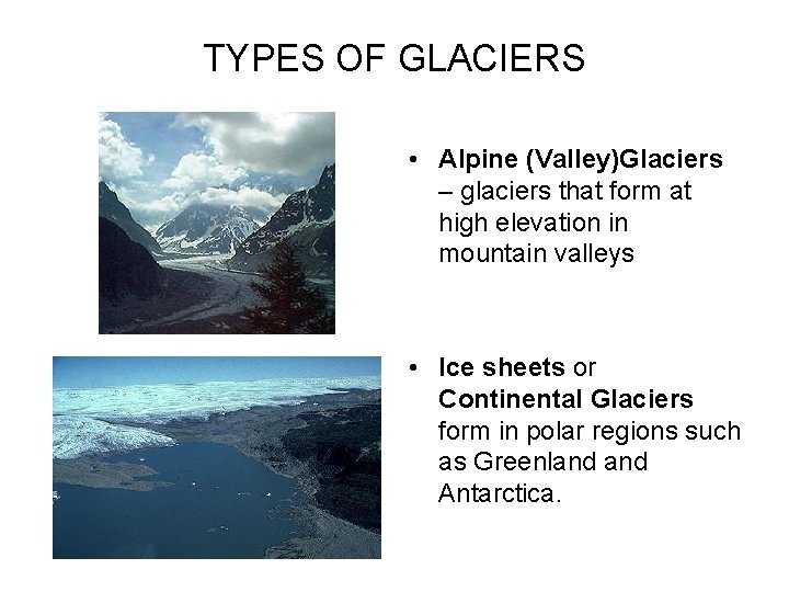
TYPES OF GLACIERS • Alpine (Valley)Glaciers – glaciers that form at high elevation in mountain valleys • Ice sheets or Continental Glaciers form in polar regions such as Greenland Antarctica.
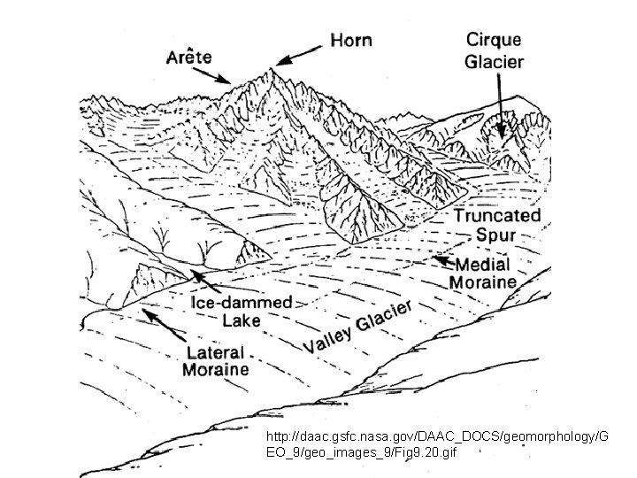
http: //daac. gsfc. nasa. gov/DAAC_DOCS/geomorphology/G EO_9/geo_images_9/Fig 9. 20. gif
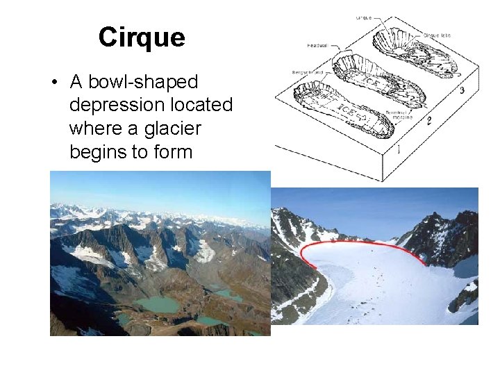
Cirque • A bowl-shaped depression located where a glacier begins to form
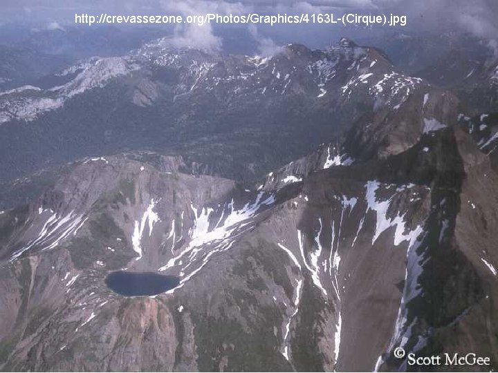
http: //crevassezone. org/Photos/Graphics/4163 L-(Cirque). jpg
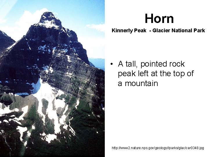
Horn Kinnerly Peak - Glacier National Park • A tall, pointed rock peak left at the top of a mountain http: //www 2. nature. nps. gov/geology//parks/glac/car 0348. jpg
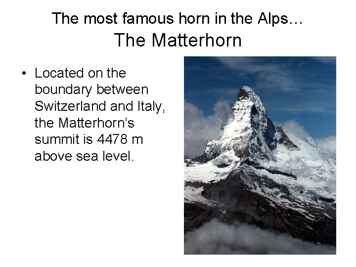
The most famous horn in the Alps… The Matterhorn • Located on the boundary between Switzerland Italy, the Matterhorn’s summit is 4478 m above sea level.
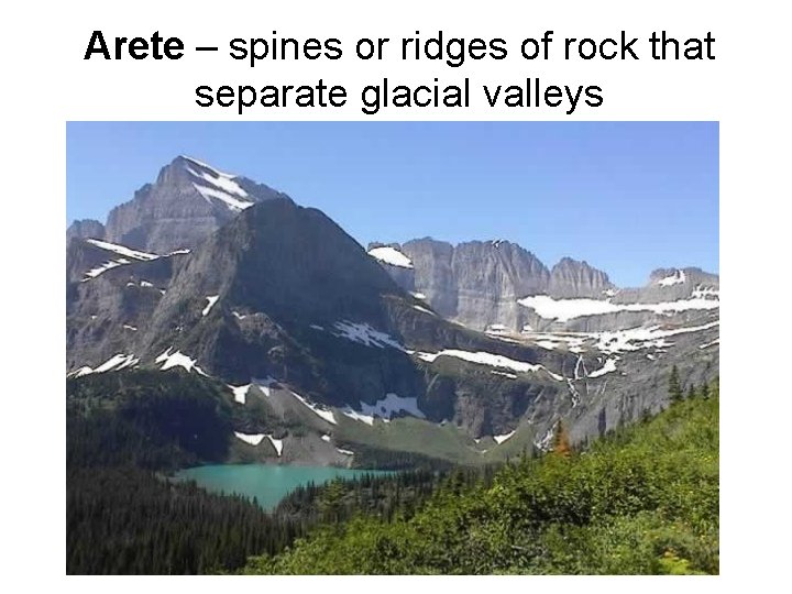
Arete – spines or ridges of rock that separate glacial valleys
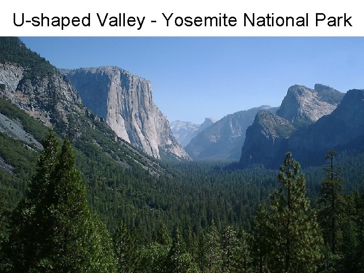
U-shaped Valley - Yosemite National Park
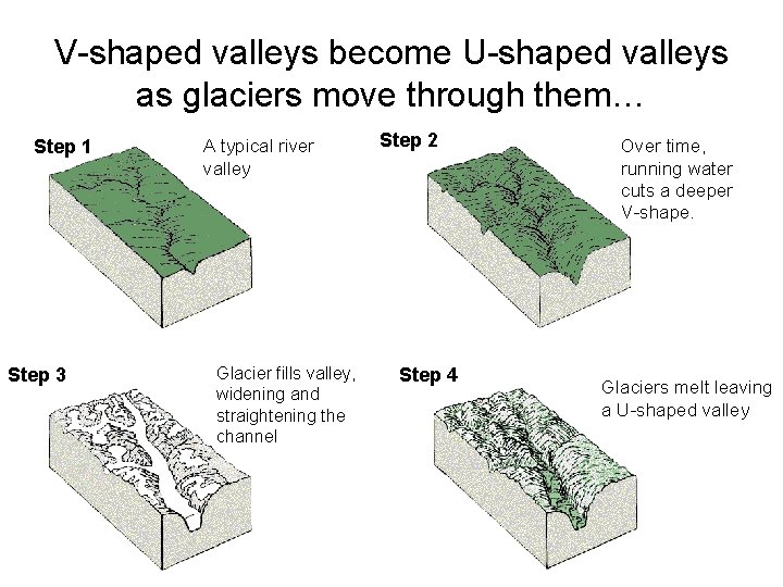
V-shaped valleys become U-shaped valleys as glaciers move through them… Step 1 Step 3 A typical river valley Glacier fills valley, widening and straightening the channel Step 2 Step 4 Over time, running water cuts a deeper V-shape. Glaciers melt leaving a U-shaped valley
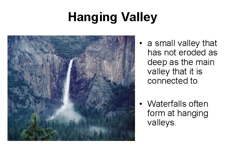
Hanging Valley • a small valley that has not eroded as deep as the main valley that it is connected to • Waterfalls often form at hanging valleys.
TYPES OF GLACIAL DRIFT (Sediments) • TILL- unsorted; deposited by ice • STRATIFIED DRIFT- layered; deposited by meltwater streams • OUTWASH- sorted sand; deposited by meltwater
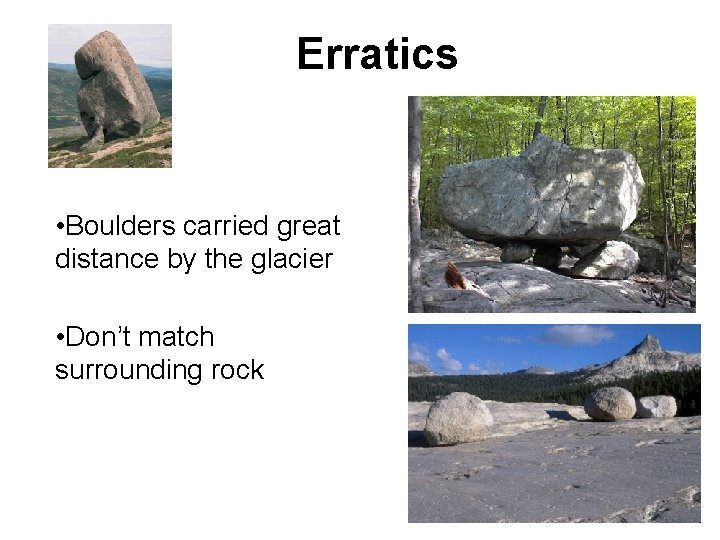
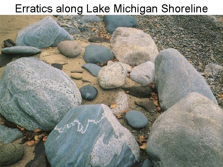
Erratics • Boulders carried great distance by the glacier • Don’t match surrounding rock
Erratics along Lake Michigan Shoreline
TYPES OF GLACIERS • Alpine (Valley)Glaciers – glaciers that form at high elevation in mountain valleys • Ice sheets or Continental Glaciers form in polar regions such as Greenland Antarctica.
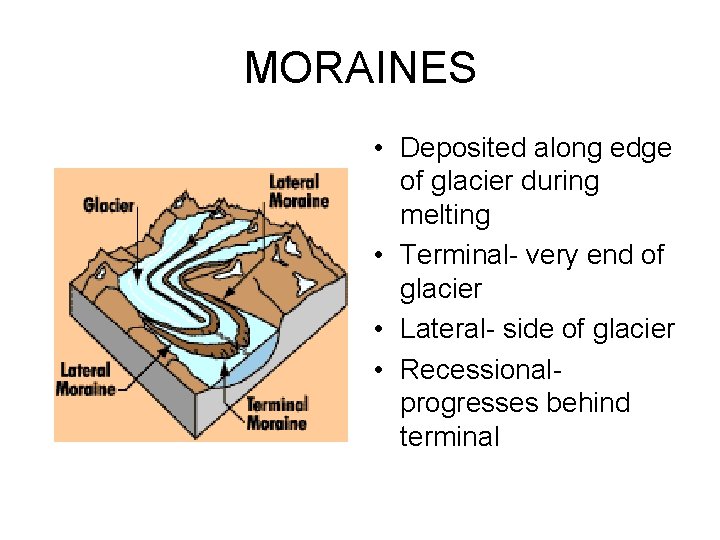
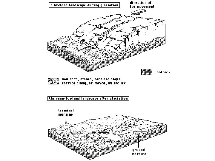
MORAINES • Deposited along edge of glacier during melting • Terminal- very end of glacier • Lateral- side of glacier • Recessionalprogresses behind terminal
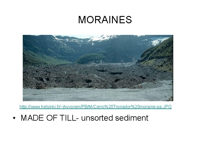
MORAINES http: //www. helsinki. fi/~jhyvonen/PB/M/Cerro%20 Tronador%20 moraine-pp. JPG • MADE OF TILL- unsorted sediment
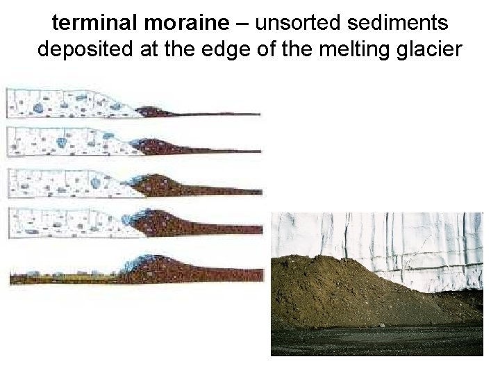
terminal moraine – unsorted sediments deposited at the edge of the melting glacier
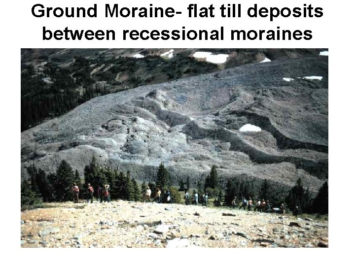
Ground Moraine- flat till deposits between recessional moraines
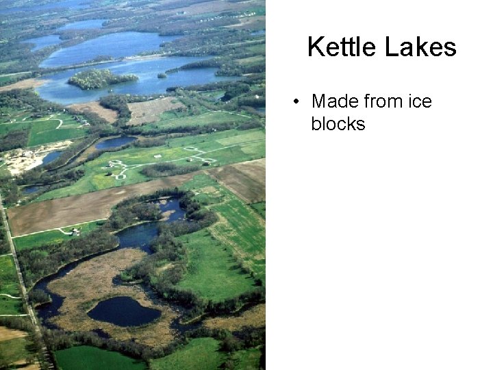
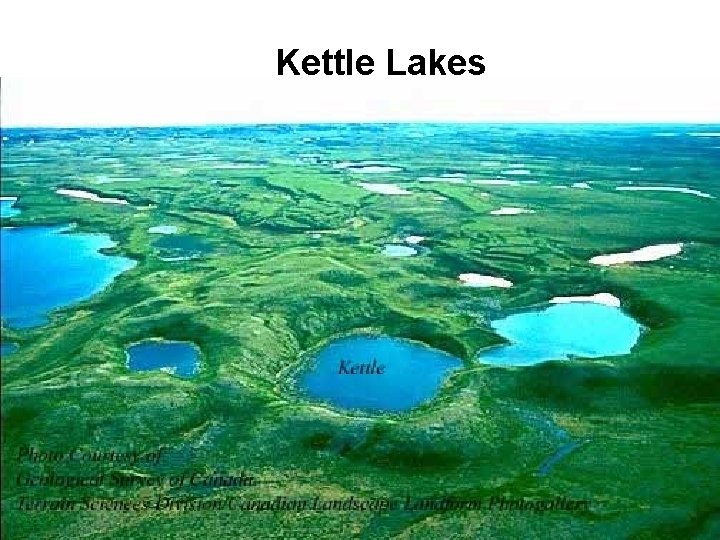
Kettle Lakes • Made from ice blocks
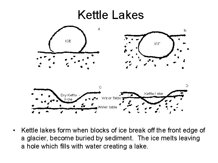
Kettle Lakes • Kettle lakes form when blocks of ice break off the front edge of a glacier, become buried by sediment. The ice melts leaving a hole which fills with water creating a lake.
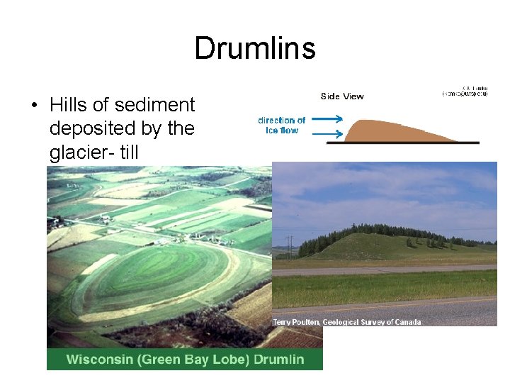
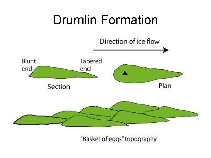
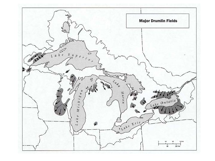
Drumlins • Hills of sediment deposited by the glacier- till
Drumlin Formation
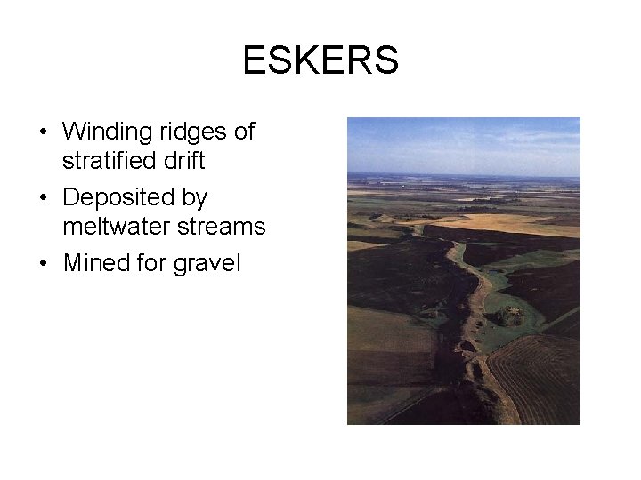
ESKERS • Winding ridges of stratified drift • Deposited by meltwater streams • Mined for gravel
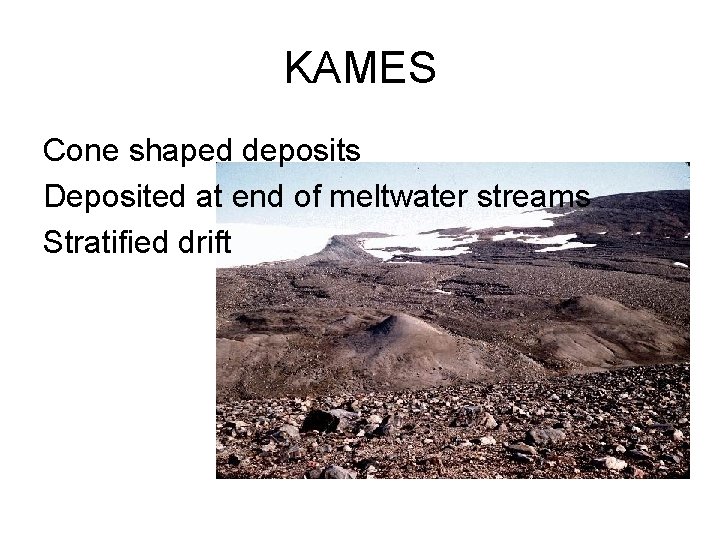
KAMES Cone shaped deposits Deposited at end of meltwater streams Stratified drift
Outwash plain
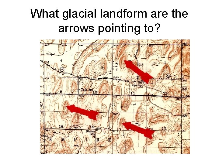
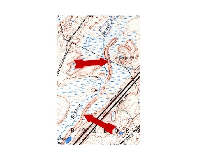
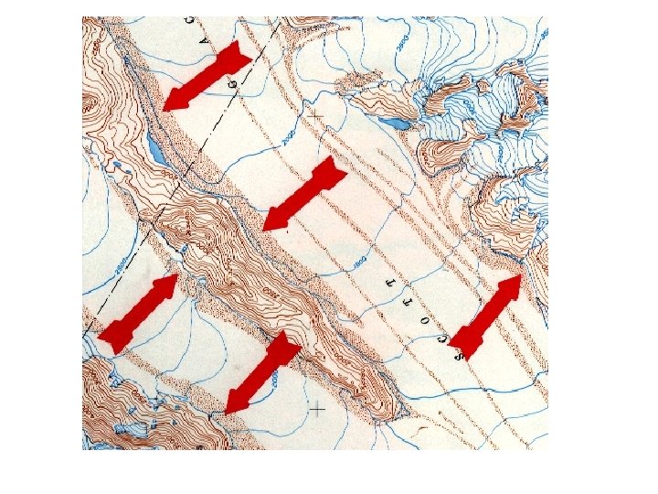
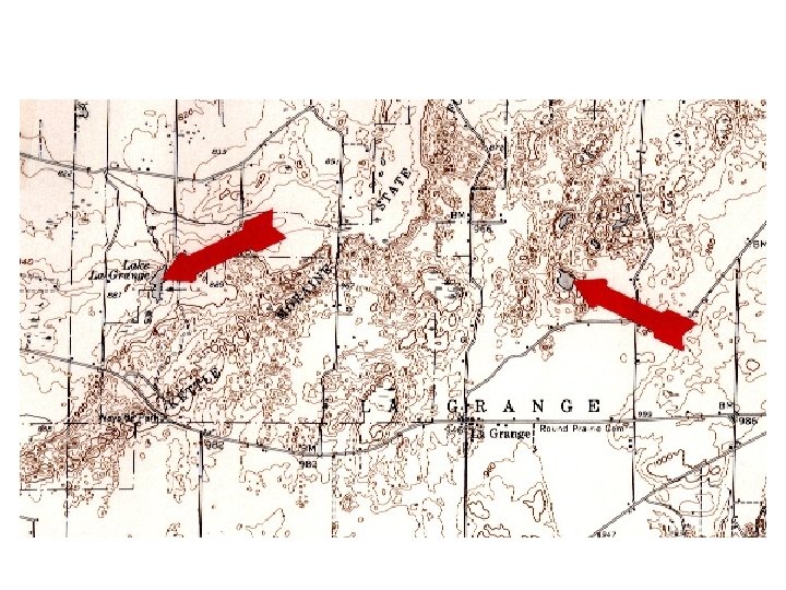
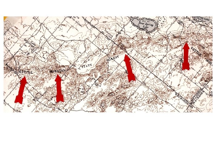
What glacial landform are the arrows pointing to?
Why do scientists believe that glaciers once covered Michigan?
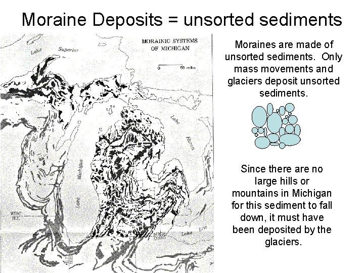
Moraine Deposits = unsorted sediments Moraines are made of unsorted sediments. Only mass movements and glaciers deposit unsorted sediments. Since there are no large hills or mountains in Michigan for this sediment to fall down, it must have been deposited by the glaciers.
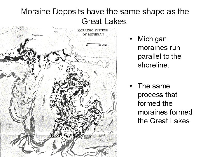
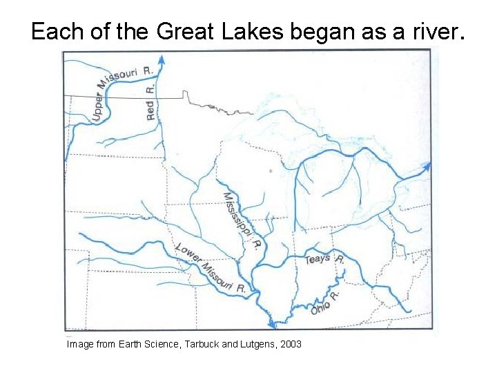
Moraine Deposits have the same shape as the Great Lakes. • Michigan moraines run parallel to the shoreline. • The same process that formed the moraines formed the Great Lakes.
Each of the Great Lakes began as a river. Image from Earth Science, Tarbuck and Lutgens, 2003
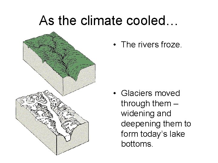
As the climate cooled… • The rivers froze. • Glaciers moved through them – widening and deepening them to form today’s lake bottoms.
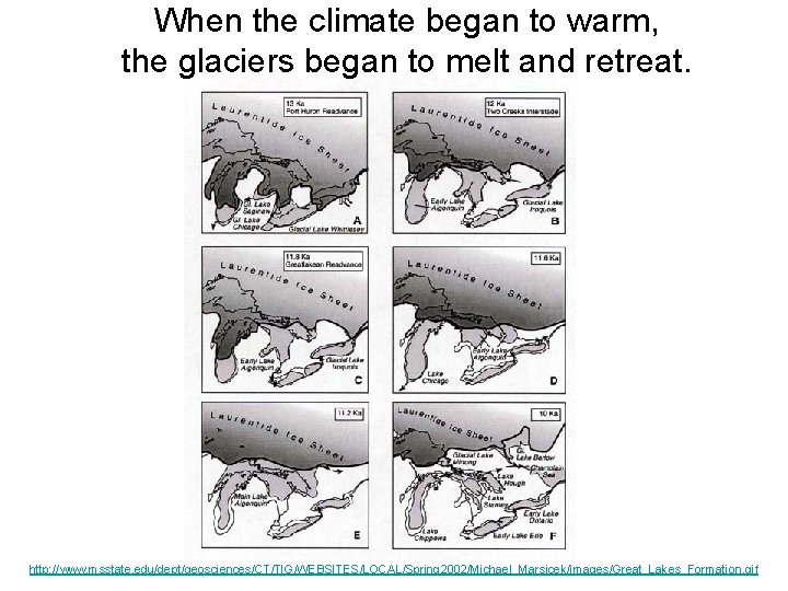
When the climate began to warm, the glaciers began to melt and retreat. http: //www. msstate. edu/dept/geosciences/CT/TIG/WEBSITES/LOCAL/Spring 2002/Michael_Marsicek/images/Great_Lakes_Formation. gif
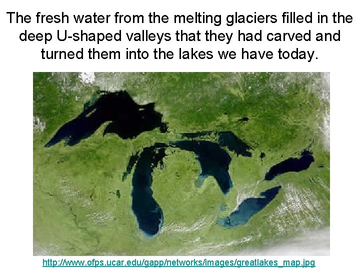
The fresh water from the melting glaciers filled in the deep U-shaped valleys that they had carved and turned them into the lakes we have today. http: //www. ofps. ucar. edu/gapp/networks/images/greatlakes_map. jpg
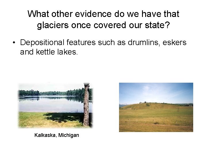
What other evidence do we have that glaciers once covered our state? • Depositional features such as drumlins, eskers and kettle lakes. Kalkaska, Michigan
Kettle Lakes
http: //homepage. tinet. ie/~jconsidi/BWS/karst 4. jpg
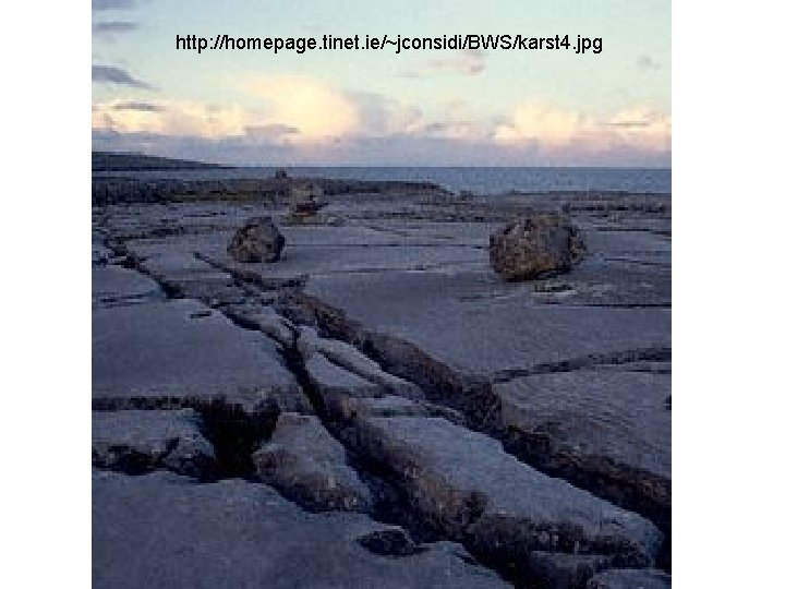
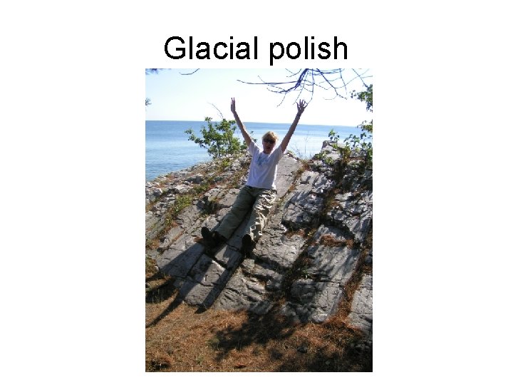
Glacial polish
Why do scientists believe that glaciers once covered Michigan? • Michigan is covered with unsorted moraine deposits. • The moraine deposits follow the outline of Great Lakes. . • Erratics/ glacial polish • striations • Other glacial landforms (kettles, drumlins, eskers, kames…. )
Isostatic rebound • The land is rebounding once the weight of the glacier left • 3 cm/year
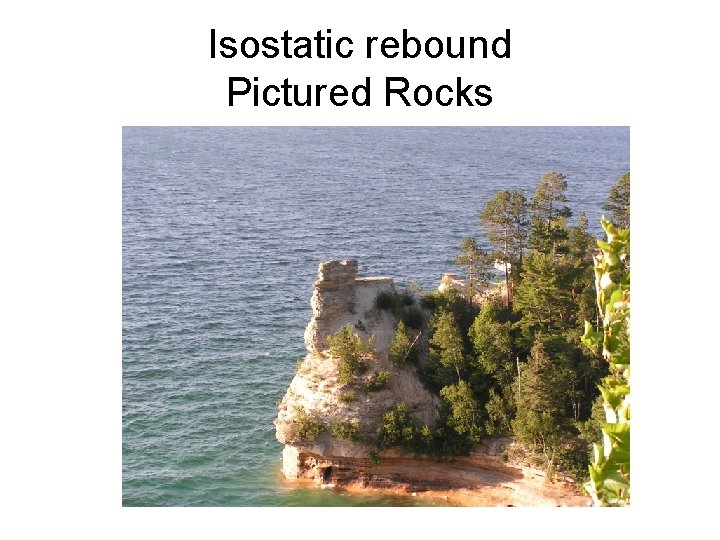
Isostatic rebound Pictured Rocks
Resources • • • • http: //cse. cosm. sc. edu/erth_sci/Erosion/plucking. jpg http: //www. skidmore. edu/academics/geo/courses/ge 101/Pictures/Glaciers/Glacial. St riations. jpg http: //www. go 2 moon. com/image/Valdez-Glacier. jpg http: //www. glaciers. pdx. edu/kennicott/photos 99/glacier. jpg http: //www. brownbearsw. com/photos/pws/moraine. jpg http: //www. homepage. montana. edu/~geol 445/hyperglac/depproc 1/moraine. JPG http: //www. ucalgary. ca/~dgsmit/MORAINE. jpg http: //mac 01. eps. pitt. edu/harbbook/c_viii/images/icefields/Hwb 0530. GIF http: //www. geographyhigh. connectfree. co. uk/s 3 glacgeoghigh 34 b. gif http: //www. uwsp. edu/geo/faculty/lemke/images/lithosphere/drumlin_diagram_small. gif http: //online. sd 43. bc. ca/della/images/drumlin. jpg http: //www. geology. wisc. edu/~qlab/g 420/drumlin. jpg http: //www. bbc. co. uk/scotland/education/bitesize/standard/img/geography/glaciation /g 98. gif http: //pbisotopes. ess. sunysb. edu/esp/Science_Walks/carmans/kettle-hole. gif
• • • • http: //perth. uwlax. edu/faculty/stoelting/Intro/Guides/Images 3/southern_Kettl e_Moraine_lakes_WI_800. jpg http: //images 3. vrbo. com/vrbo/images/18982 c. jpg http: //www. on. ec. gc. ca/greatlakeskids/images/g_lakes_form. gif http: //wrgis. wr. usgs. gov/docs/parks/glacier/Uvalley. B. gif http: //wrgis. wr. usgs. gov/docs/parks/glacier/Uvalley. C. gif http: //www. jchl. co. uk/photos/greenland/Valley. jpg http: //www. emporia. edu/earthsci/student/martel 1/ice. jpg http: //wrgis. wr. usgs. gov/docs/parks/glacier/gif. JPGdisplay. html http: //www. uwsp. edu/geo/faculty/lemke/alpine_glacial_glossary/images/mor e_examples/canada_cirque 01_dh. jpg http: //www. uoregon. edu/~millerm/Kluane 1. jpeg http: //people. surfaceeffect. com/pete/photos/folksholiday/yosemitevalley/vall ey 2. jpg http: //www. theotherpages. org/images/image 200. jpg http: //www. northforkmedia. com/spiveyscience/images/glacialerosion/pages/ grinnellcirqueareteetc_jpg. htm http: //www 3. uakron. edu/modlang/97 trip/d 16 f. jpg http: //tvl 1. geo. uc. edu/ice/Image/icland/Greenland. html http: //www. bougerolle. net/photos/matterhorn. jpg
• • • http: //perth. uwlax. edu/faculty/stoelting/Intro/Guides/Images 3/glacial_erratics _Lake_Michigan_WI_800. jpg http: //www. fettes. com/Cairngorms/images/Easter_Island. jpg http: //rt 23. com/Scenery/spring/images/tripod_rock. jpg http: //ic. ucsc. edu/~rocks/eart 109/Photo_Composition/Top_Pothole. jpg http: //perth. uwlax. edu/faculty/stoelting/Intro/Guides/Images 3/southern_Kettl e_Moraine_lakes_WI_800. jpg