How Glaciers Modify the Landscape Glacier Formation Glaciers


- Slides: 14

How Glaciers Modify the Landscape

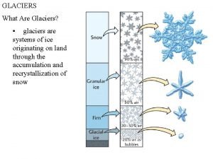
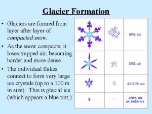
Glacier Formation • Glaciers form in areas where more snow falls in the winter than melts in the summer. Therefore, it isn’t necessary to have extremely cold winters, but rather cool summers. • Over time, snow will build up into thick layers, and the weight of the snow compacts the bottom layers into ice (Figure 1). • When this occurs the ice will slowly flow down hill or outwards and a glacier is formed. Figure 1. Each layer of snow in the glacier above represents one year of snowfall followed by the dark line which is due to summer melt.

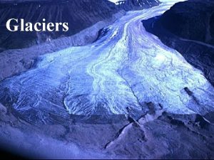
Different Types of Glaciers • There are two types of glaciers. • Valley glaciers, like the one in Figure 2, form at high elevations and flow down hill. • However, continental glaciers which can also be called ice sheets form near the poles and can grow to massive sizes. The two ice sheets that cover Antarctica (Figure 3), can be up to 2. 5 miles thick. Figure 2. Longest valley glacier in the world found in the Himalayan Mountains. Figure 3. Antarctica is larger than the United States and is covered by two ice sheets more than 2. 5 miles thick.

Glacial Erosion • • • As a glacier moves over the surface, the weight of all of the ice exerts a tremendous amount of pressure on the underlying bedrock. As a result cracks develop. Water can seep into these rocks, and through the process of frost wedging loose rock fragments can become frozen to the bottom of the glacier. This process of glacial plucking allows loose rock to become embedded into the ice (Figure 3). As a result of glacial plucking, an advancing glacier contains large rocks and sediment. This material acts as sandpaper and grinds into the underlying bedrock through a process called abrasion. This process can polish and leave scratches in the bedrock (Figure 4). Striations are important because they not only indicate that glaciers once covered a landscape but they can show the direction of glacial movement. Figure 3. Diagram showing the process of glacial plucking. A B Figure 4. (A) Rocks that are dragged on the bottom of the glacier can leave scratches or striations (B) on the underlying bedrock.

Glacial Erosion - Valleys • Rivers tend to cut downwards into the land creating v-shaped valleys (Figure 5 A). However, when glaciers advance down those river valleys, through glacial plucking and abrasion the river valleys are straightened, widened, and deepened. When the glaciers melt the valleys take on more of a U-shape as you can see in Figure 5 B. A B Figure 5. The V-shape valley (A) is the result of the Yellowstone river cutting down into the bedrock. The U-shape valley (B) is characteristic to glacial erosion.

Glacial Erosion – Finger Lakes • If the underlying bedrock is composed of weaker rock, the U -shaped valley can be very deep and later fill in with water. The Finger Lakes and Lake Champlain are Ushaped valleys (Figure 6). Figure 6. The diagram above shows how the last ice age changed preexisting V-shaped valleys into U-shaped valleys. These deep valleys later filled in with water creating the Finger Lakes.

Glacial Erosion – Finger Lakes The picture on the left is of central New York. It shows the Finger Lakes and to the north, the southern part of Lake Ontario. On the right is Cayuga Lake. This picture shows the southern end of the lake and the city of Ithaca.

Glacial Erosion - Kettle Lakes • Kettle lakes are round, usually shallow lakes. • These lakes form when pieces of ice break off a glacier in retreat. As the glacier melts, meltwater carrying sediment embedded in the glacier bury the dead ice. When that dead ice melts a hole is left, which can later be filled by rain, groundwater, or streams (Figure 7). Figure 7. Above is a diagram showing the formation of a kettle lake. Below is a series of kettle lakes located in Canada.

• The Great Lakes also formed as the result of the last ice age. Huge basins were created by the advancing ice sheet. When the ice melted these basins filled with water creating the Great Lakes.

Formation of a Hanging Valley • Hanging valleys form when a glacier deepens a main valley. When the glacier retreats the tributary valley now becomes cut off. Many of these side valleys become waterfalls. Figure 8. Above is a diagram showing the formation of a hanging valley. Below is a picture of a hanging valley in Yosemite National Park in California.

Glacial Deposits • When glaciers retreat (begin to melt) all of the sediment that they picked up as they advanced (grew) is dropped on the ground. This sediment that is deposited by a glacier is called glacial till. • • You can easily determine if a glacier deposited sediment, opposed to moving water or wind, because the sediment is unsorted, which is to say all of the big sediment is mixed together with the smaller sediment (Figure 9). Figure 9. The picture above was taken in New York. The fact that it is unsorted, not arranged by size, indicates that it was deposited by glaciers. The picture below is has sediment that was sorted by size, indicating that it was deposited by moving water.

Moraine • Glaciers are like a giant conveyor belts that transport sediment to the front of the glacier. • If a glacier is in equilibrium (isn’t advancing or retreating) large ridges or hills can form at the leading edge of the glacier. These ridges are called moraines (figure 10) and they can indicate the furthest extent of the glaciers advance. Figure 10. Moraine formed by Hotlum glacier in California.

Outwash Plains • Glacial melt water carries sediment embedded in the ice. This sediment is deposited in front of the glacier creating an outwash plain, as seen in figure 11. Figure 11. An outwash plain. Erratic • As glaciers melt they can also deposit boulders in random locations like in the middle of a field (figure 12). These deposited boulders are called a glacial erratic. Figure 12. A glacial erratic.

Drumlins • The tear-drop shaped hills seen in the two pictures to the right all called drumlins. • There are vast drumlin fields found been the cities of Rochester and Syracuse. • Like striations, drumlines indicate past glaciation in an area and the direction of glacial movement.
 Continetal glaciers
 Terminal moraines
 Glacial drift vs till
 Morraine glacier
 Glaciers cause erosion by abrasion and
 Examples of mass movement
 Nsidc glaciers
 Arrowhead region mn
 Metamorphic rock
 Bolivia glaciers
 Chapter 7 glaciers deserts and wind
 Formation initiale vs formation continue
 Glacier movement
 Glacier plastic flow
 Removebgh
