CI Valentine PO 403 References FTGU 29 th


 has developed a standard")


 � Bases from 16, 500 to 45, 000 feet � Composed")
 � Very high, thin delicate wisps � Generally no")
 � Thin, cotton ball-like clouds � Indicate high-level instability")
 � Thin, high sheet of cloud through which the")
 � Middle clouds have bases from 6, 500 to 23, 000")
 � Layers of rounded masses of cloud � Can")
 � Thick grey clouds that often cover entire sky")
 � Altocumulus with a turreted appearance � Instability,")
 � Low clouds have bases from the surface to 6, 500")
 � An uniform layer of cloud resembling fog but")
 � A thin layer of rounded masses of cloud")
 � A thick layer of dark, uniform gray cloud")

 during the warm part of")
 � Cumulus clouds that build up")
 �Pieces � Cloud of stratus cloud")
 � Heavy masses of cumulus � Anvil")


 Air is cooled to saturation point 2)")


 � Length of a column of")


 � 3. 0°C/1000’ � Saturated Adiabatic")


- Slides: 113
CI Valentine PO 403 References: FTGU 29 th Pages 123 - 140 METEOROLOGY
REVIEW 1. What are the 3 control surfaces on an aircraft? 2. What are the different types of aircraft stability? 3. Name the instruments in the aircraft
TOPICS TO BE COVERED TODAY � Properties of the Atmosphere � Clouds, Classifications and Families � Atmospheric Pressure and Density � Pressure Systems � Winds � Humidity, Temperature and Stability
THE ATMOSPHERE
COMPOSITION OF THE ATMOSPHERE The atmosphere is composed of several gasses. The most significant of these are: � From a weather standpoint, the most important gas is � 21% 1% Nitrogen Oxygen Other 78%
PROPERTIES OF THE ATMOSPHERE � Mobility � Expansion � Compression � Most important is EXPANSION
DIVISIONS OF THE ATMOSPHERE
TROPOSPHERE � � � The lowest layer of the atmosphere Most weather occurs here Temperature and pressure both decrease with height The top layer is known as the Tropopause Top always at -56°C DIVISIONS OF THE ATMOSPHERE
TROPOPAUSE • • Average height - 30, 000’ over the poles to 65, 000’ at the equator Higher in the Summer Its temperature remains steady at about -56°C It acts as a cap on weather DIVISIONS OF THE ATMOSPHERE
STRATOSPHERE � � Pressure continues to decrease with height Temperature slowly increases to 0°C Water vapour and air currents are almost nonexistent The top layer is called the Stratopause DIVISIONS OF THE ATMOSPHERE
MESOSPHERE � � � Temperature decreases with altitude The top layer is called the Mesopause Temperature decreases rapidly to -100°C at the mesopause DIVISIONS OF THE ATMOSPHERE
THERMOSPHERE � Temperature increases to 3000°C � Contains two layers: Ionosphere � � � Reflects low, medium, and high frequency radio waves Exosphere � Edge of space DIVISIONS OF THE ATMOSPHERE
THE STANDARD ATMOSPHERE � The International Civil Aviation Organization (ICAO) has developed a standard atmospheric reference for all aviation measurements The ICAO standard atmosphere characteristics are: � Sea-level Pressure - 29. 92” Hg � Sea-level Temperature - 15°C � Adiabatic Lapse Rate - 1. 98°C/1000 ft � The air is a perfectly dry gas �
REVIEW 1. What are the main components of the atmosphere? 2. In which layer of the atmosphere does weather occur? 3. What is the most important property of the atmosphere?
CLOUDS
CLASSIFICATION
CLOUD FORMATION � Cumulus clouds form in rising air currants and have a lumpy, cotton ball appearance � They are an indicator of Unstable air � Stratus � They clouds form in horizontal layers are an indicator of Stable air � Nimbus clouds create percipitation
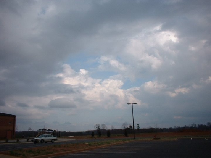
FAMILIES � Four families of clouds: � High clouds � Middle clouds � Low clouds � Clouds of vertical development
HIGH CLOUDS (CIRRO) � Bases from 16, 500 to 45, 000 feet � Composed mainly of ice crystals. � Little effect on flying � Possible moderate turbulence
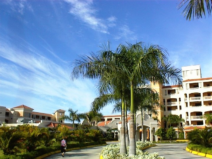
HIGH CLOUDS � Cirrus (CI) � Very high, thin delicate wisps � Generally no weather implications � “Cats’ whiskers” or “mares’ tails”
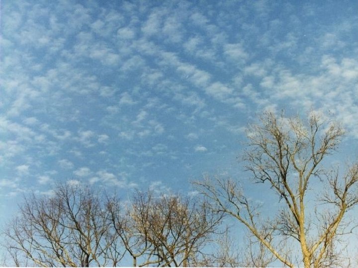
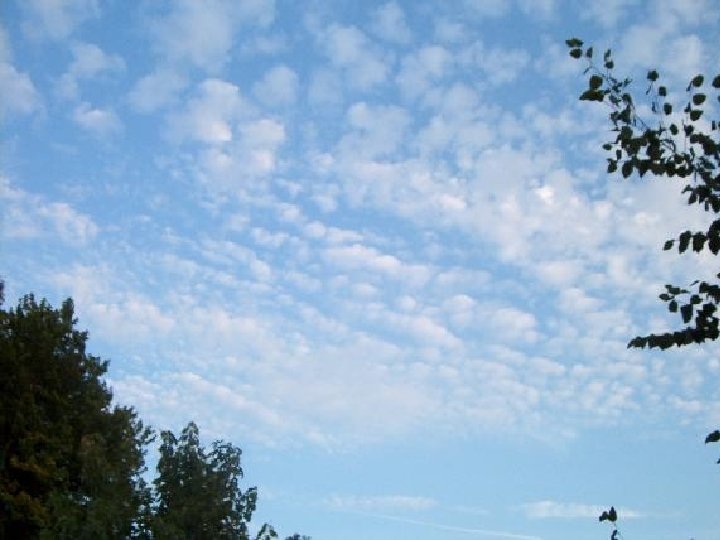
HIGH CLOUDS � Cirrocumulus (CC) � Thin, cotton ball-like clouds � Indicate high-level instability � Little indication of future weather conditions � “Mackerel sky”
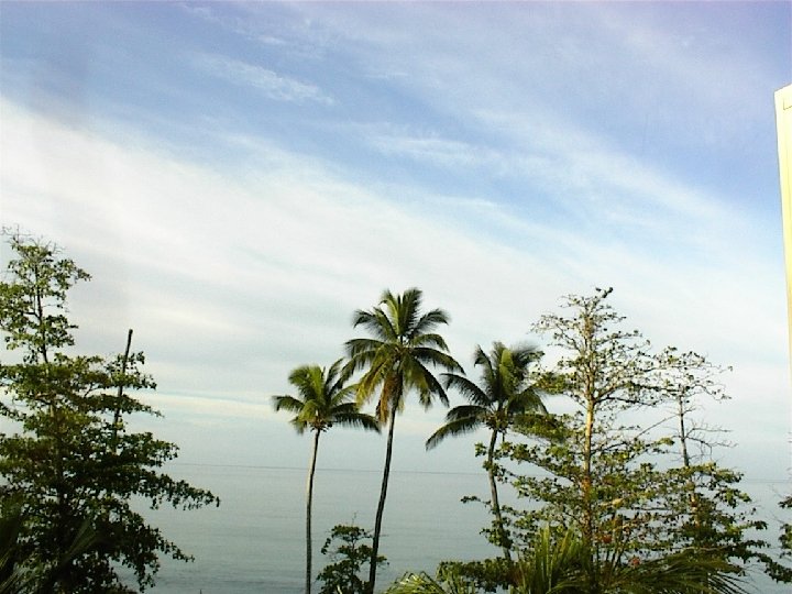
HIGH CLOUDS � Cirrostratus (CS) � Thin, high sheet of cloud through which the sun or moon is visible � Produces a halo effect � Often indicates an approaching warm front or occlusion (deteriorating weather)
MIDDLE CLOUDS (ALTO) � Middle clouds have bases from 6, 500 to 23, 000 feet � Composed of ice crystals or water droplets � Little turbulence associated unless cumulus clouds are embedded in them or altocumulus is forming
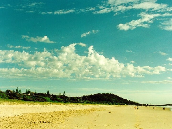
MIDDLE CLOUDS � Altocumulus (AC) � Layers of rounded masses of cloud � Can be in groups or lines � May indicate approaching front
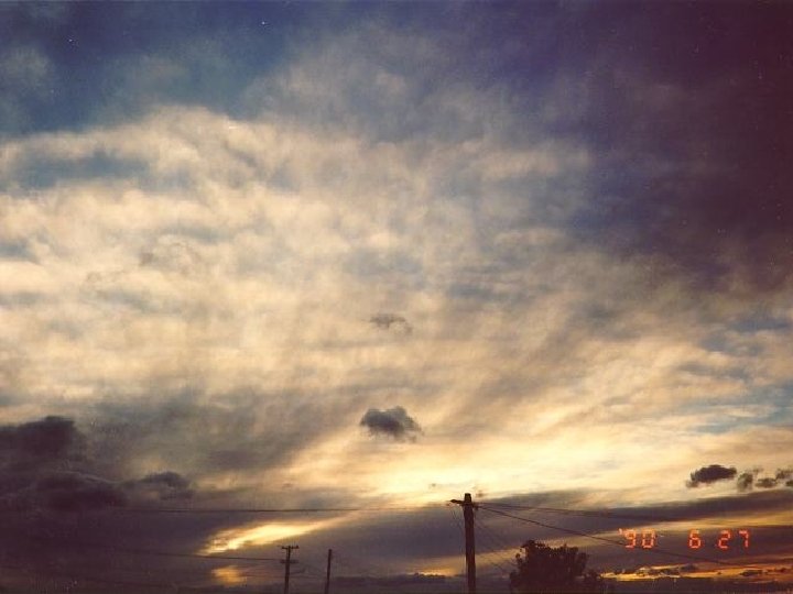
MIDDLE CLOUDS � Altostratus (AS) � Thick grey clouds that often cover entire sky � Often give light rain or snow � Near approach of warm front � Icing may occur
MIDDLE CLOUDS � Altocumulus Castellanus (ACC) � Altocumulus with a turreted appearance � Instability, turbulence, and showery precipitation � May develop into cumulonimbus
LOW CLOUDS (STRATO) � Low clouds have bases from the surface to 6, 500 feet � Composed of water droplets (can be supercooled) or sometimes ice crystals. � Light turbulence � Low cloud bases and poor visibility make VFR operations difficult to impossible
LOW CLOUDS � Stratus (ST) � An uniform layer of cloud resembling fog but not resting on the ground � Often produces drizzle
LOW CLOUDS � Stratocumulus (SC) � A thin layer of rounded masses of cloud � May produce light rain or snow showers
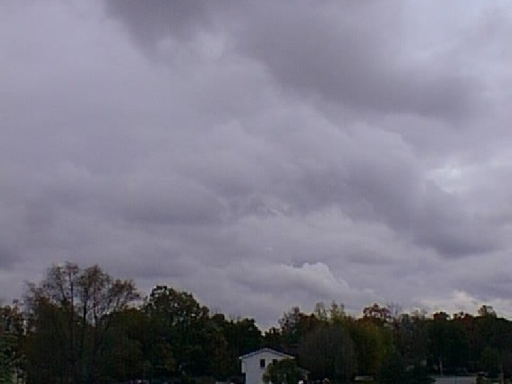
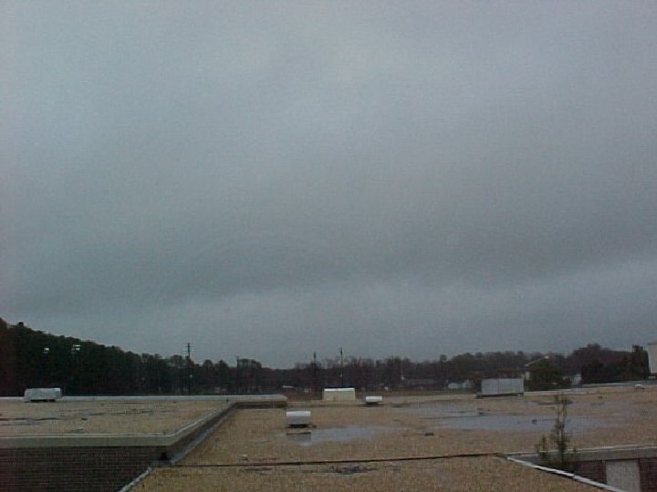
LOW CLOUDS � Nimbostratus (NS) � A thick layer of dark, uniform gray cloud � Usually associated with a warm front � Usually gives continuous precipitation which may be heavy at times
CLOUDS OF VERTICAL DEVELOPMENT � Bases as low as 1, 500 feet � Tops as high as 60, 000 feet � Composed of water droplets, supercooled water droplets and ice crystals � Isolated or embedded in layers
CLOUDS OF VERTICAL DEVELOPMENT � Cumulus � Form (CU) during the warm part of the day and dissipate during the evening � Thick, rounded and lumpy in appearance � Flat, dark bottoms and while rounded sides � Looks like cotton balls � Flight at base is usually bumpy
CLOUDS OF VERTICAL DEVELOPMENT � Towering Cumulus (TCU) � Cumulus clouds that build up into high towering masses � Can develop into cumulonimbus � Rough air underneath � Heavy icing in cloud
MORE CLOUDS � Low cloud: �Stratus Fractus (SF) �Pieces � Cloud of stratus cloud of Vertical Development: �Cumulus �Pieces Fractus (CF) of Cumulus
CLOUDS OF VERTICAL DEVELOPMENT � Cumulonimbus (CB) � Heavy masses of cumulus � Anvil top (thunderstorm and showery precip. ) � Violent vertical currents within cloud � Line indicates cold front � Heavy icing and hail within cloud � Electrical activity � May be embedded in stratiform clouds � Usually gives heavy showers with possible hail SEVERE HAZARD TO
CLOUD FORMATION
CHANGES OF STATE � All matter, including water, exists in three states � The processes by which matter changes states are: VAPOUR SUBLIMATION DEPOSITION EVAPORATION CONDENSATION SOLID FREEZING MELTING LIQUID
HOW DO CLOUDS FORM? � Clouds are formed by the condensation of water vapour � For clouds to form, three conditions must be present 1. Condensation Nuclei 2. High Relative Humidity 3. Cooling Process
FORMATIONS � Formed in two ways: 1) Air is cooled to saturation point 2) Water vapour is added to saturation point �Most common is through adiabatic expansion (lifting)
LIFTING AGENTS � The lifting agents involved in adiabatic expansion are: � Orographic � Frontal Lift � Convection � Convergence � Turbulence
LIFTING AGENTS � Orographic Lift � Occurs when air is forced upwards against the side of a hill or mountain � As the air rises, it expands and cools
LIFTING AGENTS � Frontal Lift � As the frontal surface forces warm air aloft, it expands and cools � This is responsible for most of the weather at fronts
LIFTING AGENTS � Convection � When air in contact with the earth is heated, it rises and eventually expands and cools � This is why good soaring thermals are under cumulus clouds � Produces condensation and cumuliform clouds at top of column of air; further ascent causes rain
LIFTING AGENTS � Convergence � This occurs when air flows into the centre of a low pressure area � The excess air is forced upwards to expand cool � This is why lows bring poor weather
LIFTING AGENTS � Turbulence � As air flows over a rough surface, vertical currents are created � If the air is unstable, these currents will continue upwards and eventually expand cool � Results in stratocumulus and possibly cumulus clouds if convection occurs at the same time
ATMOSPHERIC PRESSURE
ATMOSPHERIC PRESSURE � The surface of the earth is covered by a huge “sea of air” � The weight of this air exerts a force on the earth � There are three main units of pressure used to measure this force
UNITS OF MEASURE � Inches of Mercury (“Hg) � Length of a column of mercury the weight of which will balance a column of air extending from the ground to the top of the atmosphere � Millibar (mb) � Pressure exerted on an area of 1 square cm by a force of 1000 dynes � Kilopascal � Equals (k. Pa) 10 hectopascals (h. Pa) 1 h. Pa=1 mb
REVIEW 1. What are the classifications of cloud? 2. What are the ICAO standards for the atmosphere? 3. Name some clouds
METEOROLOGICAL ASPECTS OF THE ALTIMETER
ALTIMETER SETTING The altimeter setting is used to correct the altimeter for local pressure deviations from the standard � When the correct altimeter setting is used, the altimeter will indicate the altitude Above Sea Level (ASL) � The altimeter setting is expressed in inches of mercury (“Hg) � i. e. - GPHK, Toronto Radio, latest Muskoka altimeter is 29. 85”Hg �
METEOROLOGICAL ASPECTS OF THE ALTIMETER � When flying from areas of relatively high pressure to areas of relatively low pressure, the altimeter will indicate a higher altitude then the aircraft’s altitude � When flying from areas of relatively low pressure to areas of relatively high pressure, the altimeter will indicate a lower altitude then the aircraft’s altitude HIGH TO LOW, LOOK OUT BELOW TO HIGH, CLEAR BLUE SKY
PRESSURE SYSTEMS
PRESSURE SYSTEMS � Differences in pressure are responsible for all the weather that takes place on earth � There are two basic pressure systems that are the source of all weather � Low pressure area � High pressure area
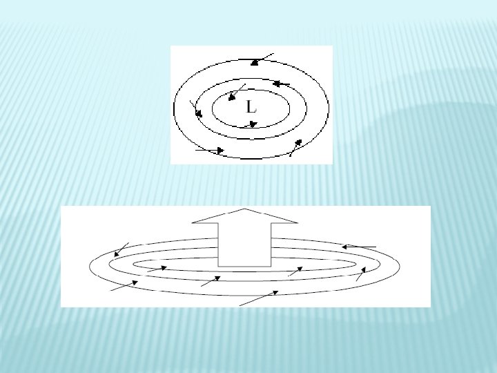
LOW PRESSURE � Also called a “cyclone” or “depression” � Relatively low pressure region � Pressure is lowest at the centre � Air flows in an anti-clockwise direction and inwards � Usually bring poor weather � Generally travel easterly � 500 -700 miles/day
LOW PRESSURE SYSTEM WINDS � Winds blow counter-clockwise and inwards in a low � Area of convergence � The flow of air into an area and is accompanied by rising air to permit the excess accumulation to escape
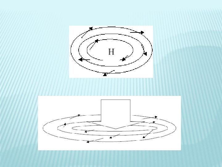
HIGH PRESSURE � Also known as an “anti-cyclone” � Relatively high pressure region � Pressure is highest at the centre � Winds flow clockwise and outwards � Fair, cool weather � Winds light and variable � Slow moving (sometimes stationary)
HIGH PRESSURE SYSTEM WINDS � Winds blow clockwise and outwards in a high � Area of divergence �A flow of air outwards from a region and is associated with highs � Sinking air compensates for the flow of air outward
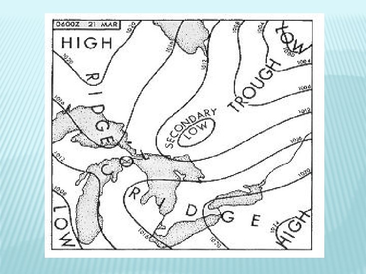
PRESSURE SYSTEMS � There also several different types of pressure regions that evolve from the main systems. These include: � Trough - An area of low pressure with higher pressure on either side � Secondary Low - An area of lower pressure that forms within a trough � Ridge - An area of high pressure with lower pressure on either side � Col - An area of neutral pressure between two highs and to lows
Winds always flow from an area of HIGH pressure to an area of LOW pressure
PRESSURE GRADIENT � The pressure gradient is the rate of change in pressure over a given distance when measured at right angles to the isobars � This determines the wind velocity (the steeper the gradient, the stronger the wind)
CORIOLIS FORCE � Coriolis force is caused by the rotation of the earth � Air moving over surface of earth continues to move in a straight line if no force acts on it. The Earth continues to move under this body of air. � This causes air to be apparently deflected to the right in the Northern Hemisphere, causing wind to flow more parallel to the isobars
BUY BALLOT’S LAW If, in the Northern Hemisphere, you stand with your back to the wind, the area of low pressure will be on your left
SURFACE FRICTION � Friction between the air and the ground slows the air down � This causes the air to flow at a greater angle to the isobars � Only extends to aproximately 2000 feet AGL
WINDS
WIND � The differences in pressure on the earth are responsible for the horizontal movement of air � This horizontal movement of air is known as wind
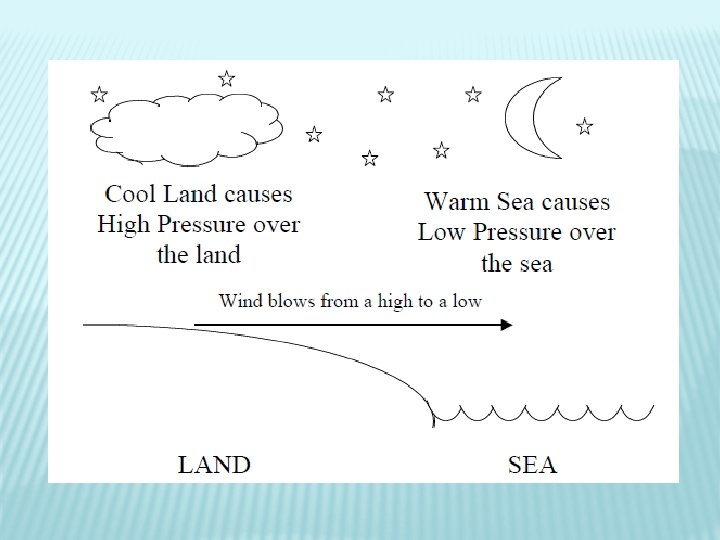
LAND BREEZE � Occurs at night � Land becomes cooler faster than water causing a high over the land � Wind blows from the land (high pressure area) to the warm water (low pressure)
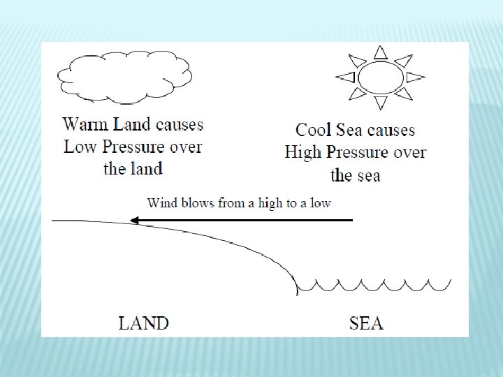
SEA BREEZE � Occurs during the day � Land heats faster than water causing a low over the land � Wind blows from the sea (high pressure) towards the warm land (low pressure)
MOUNTAIN WINDS � Anabatic winds: winds flowing up the slopes of bare mountain slopes during the day � Katabatic winds: winds flowing down the slopes of mountains during the night
GUST �A rapid and brief increase in the wind speed � Often associated with rapid fluctuations in the wind direction � Caused by mechanical turbulence and unequal heating of the Earth’s surface
SQUALL � Similar to a gust but of longer duration � Caused by passage of a fast moving cold front or thunderstorm � Like a gust, may be associated with rapid change of wind direction
DIURNAL VARIATION Daily variation in the wind � Caused by surface heating during day � Causes turbulence in lower levels, which transfers the stronger upper level winds to the surface � This causes surface winds to veer and increase during the day � Surface winds back and decrease during the evening when daytime heating stops �
MECHANICAL TURBULENCE � Friction between the air and surface features of the earth is responsible for the swirling vortices of air called “EDDIES” � Generally confined to below 3000 feet
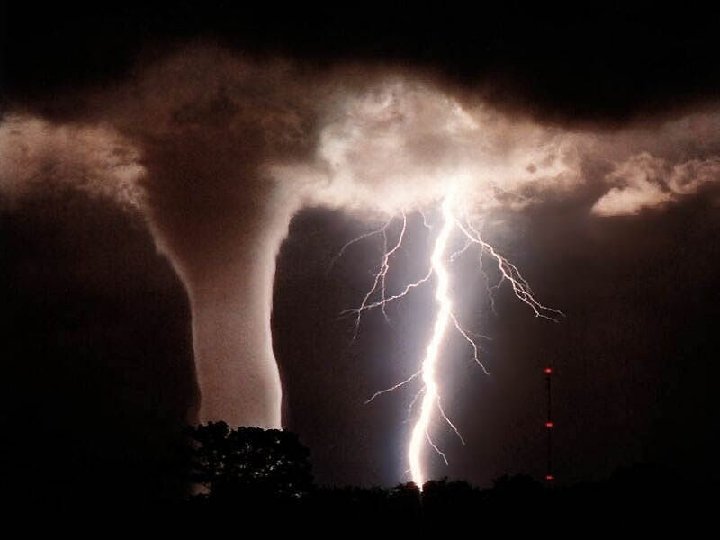
TORNADOES � Violent, circular whirlpools of air � Funnel shaped � Associated with severe thunderstorms (forms under cumulonimbus cloud) � Very deep concentrated LOWS
WIND SPEED AND DIRECTION � Wind speed is reported in knots (nautical miles per hour) � Direction is defined by the direction FROM which the wind blows
VEER � Wind � E. g. � Wind changes direction CLOCKWISE From 270° to 300° veers and increases speed during the day � Wind veers and increases in speed with increase in altitude
BACK � Wind changes direction COUNTERCLOCKWISE � E. g. � Wind From 90° to 60° backs and decreases speed at night � Wind backs and decreases with decrease in altitude
WIND SHEAR � Sudden ‘tearing’ or ‘shearing’ effect encountered when there is a sudden change in wind speed or direction � Can be very violent � Associated inversions with strong temperature
JET STREAM � Narrow band of exceeding high speed winds known to exist in higher levels of the troposphere at altitudes ranging from 20, 000 – 40, 000 feet � Wind speed is usually between 100 -125 knots but may get as high as 250 knots � Flow West to East and may encircle the globe
REVIEW 1. What is a cyclone? 2. What is Buy Ballot’s Law? 3. What is a sea breeze?
HUMIDITY, TEMPERATURE & STABILITY
HUMIDITY � Humidity � amount � Relative of water vapour present in the air Humidity � amount of water in the air compared to the maximum amount of water the air can hold at a the same temperature � Saturated �A parcel of air holding the maximum amount of water at a given temperature � Dew � the point temperature to which a given parcel of air must be cooled, at a constant pressure, to become saturated
� Supercooled water droplets � Water droplets that remain liquid at temperatures below freezing due to chemical composition of nuclei � Dew � Humidity which accumulates on objects through condensation on calm, clear nights � Frost (white and opaque) � Water � Frozen � Dew vapour sublimates into ice crystals dew (hard and transparent) that freezes after forming
TEMPERATURE � The sun heats the surface of the earth and the surface heats the air � Freezing � Point � Boiling � Point at which water freezes (0°C) Point at which water boils (100°C)
TEMPERATURE � Temperature has an effect on air density: � Cold air is more dense (heavier) � Warm air is less dense (lighter) � Isotherms are lines joining places of equal temperature drawn on weather maps
ATMOSPHERIC HEATING � The most important concept to understand when talking about atmospheric heating is: THE ATMOSPHERE IS HEATED FROM BELOW � The sun’s rays heat the earth, and the earth then heats the air � This is why the temperature decreases with altitude � This is called Radiation Heating
ATMOSPHERIC HEATING The atmosphere is also heated by two other methods: � Advection: cold air moves over a warm surface. The cold air is heated by coming into contact with the warm surface � Compression: air subsides (sinks), it is compressed, and as it is compressed, its temperature increases �
HEAT DISTRIBUTION � Heat is distributed throughout the atmosphere by several methods � Conduction: occurs when heat is transferred between two objects in contact with each other. This plays a very minor role in weather � Convection: As warm air rises, cold air moves in to take its place and is then heated by the earth � Turbulence: Friction between the moving air and the earth’s surface causes heat to be distributed aloft
ATMOSPHERIC COOLING � The cooling of the atmosphere also plays a large part in determining the weather. Air is cooled by: � Advection: As warm air moves over a cold surface, it is cooled by contact with that surface � Expansion: As air rises, it expands and therefore cools (most important) � Radiation: When the sun sets, the earth continues to radiate heat, but it is no longer replaced. The earth’s surface cools and so does the air in contact with it
VERTICAL DISTRIBUTION OF TEMPERATURE � Temperature decreases with altitude � Lapse rate: the rate of change of temperature with altitude � Inversion � An increase in temperature with altitude � Creates very stable air � Isothermal layer � temperature remains constant through layer
LAPSE RATES � Dry Adiabatic Lapse Rate (DALR) � 3. 0°C/1000’ � Saturated Adiabatic Lapse Rate (SALR) � 1. 5°C/1000’ � ICAO Standard Lapse Rate � 1. 98°C/1000’
AIR STABILITY � Stability � The tendency of air to return to its original horizontal level if disturbed � Instability � The tendency of air to move farther away from its original horizontal level if disturbed
SUMMARY OF WEATHER CONDITIONS Characteristics Stable Air Unstable Air Lapse Rate Weak Strong Clouds Stratus Cumulus Precipitation Steady Showers Visibility Poor Good Winds Steady Gusty Turbulence Light Moderate to Severe
LAPSE RATE � Steep lapse rate: indicates unstable air � � Shallow lapse rate: indicates stable air � � Cumuliform clouds, showery precipitation, good visibility, and turbulence Stratiform cloud, steady precipitation, poor visibility, and smooth air Generally speaking: Heating From Below produces Unstable Air � Cooling From Below produces Stable Air �
REVIEW 1. What is the ICAO standard lapse rate? 2. Name some changes of state of water 3. Which indicates stable air: steep lapse rate or shallow lapse rate?
MORE REVIEW 1. How is the atmosphere heated? 2. What direction do winds flow around a low? 3. Define relative humidity.
SUMMARY � Topics Covered Today: � Properties of the Atmosphere � Clouds, Classifications and Families � Atmospheric Pressure and Density � Pressure Systems � Winds � Humidity, Temperature and Stability � Next class we will continue Meteorology