Meteorology 5 09 METARs References FTGU pages 160

- Slides: 26

Meteorology 5. 09 METARs References: FTGU pages 160 -163 AWWS: www. flightplanning. navcanada. ca

5. 09 METARs • MTPs: – Weather Observing Stations – METARs

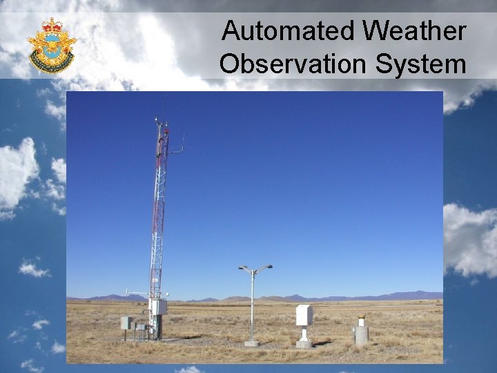
Weather Observing Stations • Weather observation are taken every hour at selected aerodromes throughout Canada and U. S. A. • These observations are taken by trained observers or by an automatic weather station; • The Automated Weather Observation System (AWOS) is designed to electronically collect weather data and to disseminate partial or full surface weather observations; • 2 types- METARs and TAFs

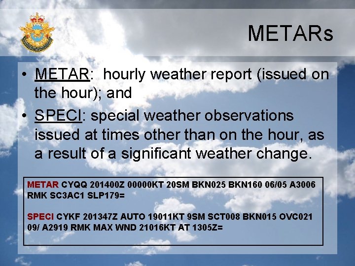
METARs • METAR: hourly weather report (issued on the hour); and • SPECI: special weather observations issued at times other than on the hour, as a result of a significant weather change. METAR CYQQ 201400 Z 00000 KT 20 SM BKN 025 BKN 160 06/05 A 3006 RMK SC 3 AC 1 SLP 179= SPECI CYKF 201347 Z AUTO 19011 KT 9 SM SCT 008 BKN 015 OVC 021 09/ A 2919 RMK MAX WND 21016 KT AT 1305 Z=

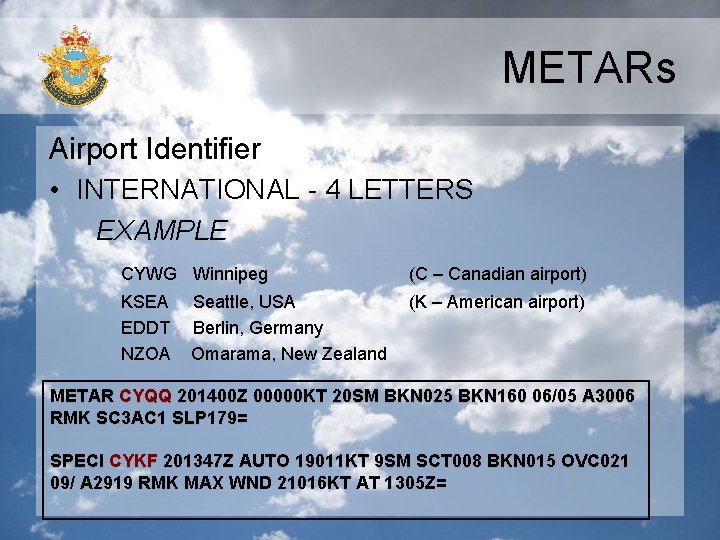
METARs Airport Identifier • INTERNATIONAL - 4 LETTERS EXAMPLE CYWG Winnipeg (C – Canadian airport) KSEA EDDT NZOA (K – American airport) Seattle, USA Berlin, Germany Omarama, New Zealand METAR CYQQ 201400 Z 00000 KT 20 SM BKN 025 BKN 160 06/05 A 3006 RMK SC 3 AC 1 SLP 179= SPECI CYKF 201347 Z AUTO 19011 KT 9 SM SCT 008 BKN 015 OVC 021 09/ A 2919 RMK MAX WND 21016 KT AT 1305 Z=

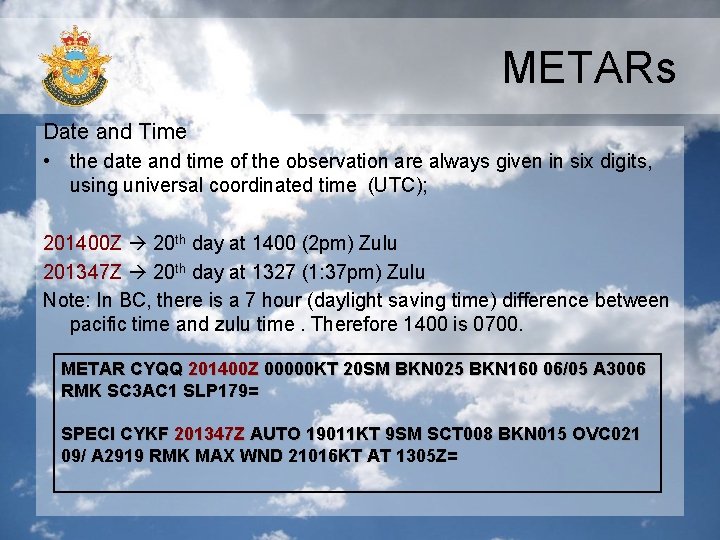
METARs Date and Time • the date and time of the observation are always given in six digits, using universal coordinated time (UTC); 201400 Z 20 th day at 1400 (2 pm) Zulu 201347 Z 20 th day at 1327 (1: 37 pm) Zulu Note: In BC, there is a 7 hour (daylight saving time) difference between pacific time and zulu time. Therefore 1400 is 0700. METAR CYQQ 201400 Z 00000 KT 20 SM BKN 025 BKN 160 06/05 A 3006 RMK SC 3 AC 1 SLP 179= SPECI CYKF 201347 Z AUTO 19011 KT 9 SM SCT 008 BKN 015 OVC 021 09/ A 2919 RMK MAX WND 21016 KT AT 1305 Z=

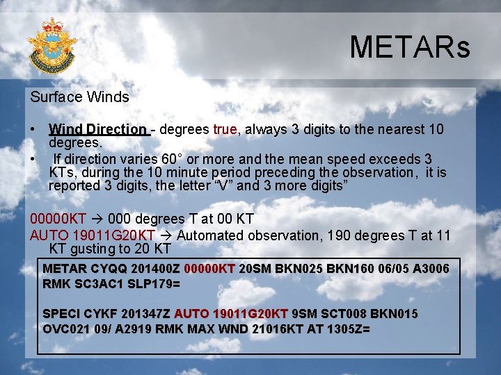
METARs Surface Winds • Wind Direction - degrees true, always 3 digits to the nearest 10 degrees. • If direction varies 60° or more and the mean speed exceeds 3 KTs, during the 10 minute period preceding the observation, it is reported 3 digits, the letter “V” and 3 more digits” 00000 KT 000 degrees T at 00 KT AUTO 19011 G 20 KT Automated observation, 190 degrees T at 11 KT gusting to 20 KT METAR CYQQ 201400 Z 00000 KT 20 SM BKN 025 BKN 160 06/05 A 3006 RMK SC 3 AC 1 SLP 179= SPECI CYKF 201347 Z AUTO 19011 G 20 KT 9 SM SCT 008 BKN 015 OVC 021 09/ A 2919 RMK MAX WND 21016 KT AT 1305 Z=

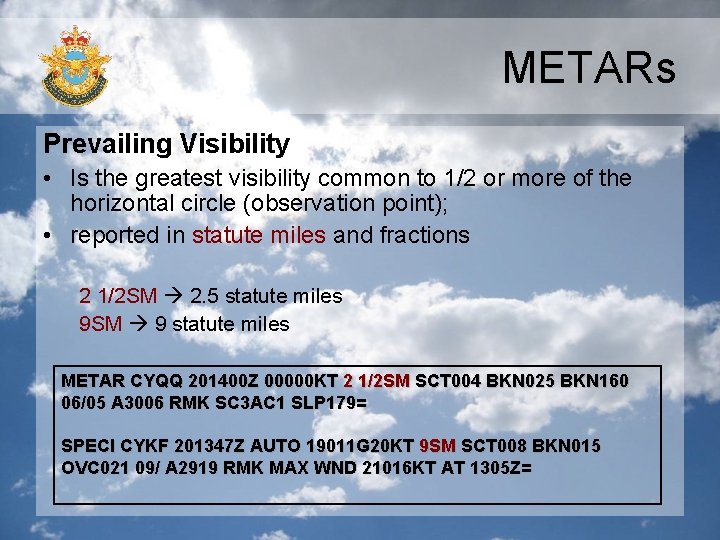
METARs Prevailing Visibility • Is the greatest visibility common to 1/2 or more of the horizontal circle (observation point); • reported in statute miles and fractions 2 1/2 SM 2. 5 statute miles 9 SM 9 statute miles METAR CYQQ 201400 Z 00000 KT 2 1/2 SM SCT 004 BKN 025 BKN 160 06/05 A 3006 RMK SC 3 AC 1 SLP 179= SPECI CYKF 201347 Z AUTO 19011 G 20 KT 9 SM SCT 008 BKN 015 OVC 021 09/ A 2919 RMK MAX WND 21016 KT AT 1305 Z=

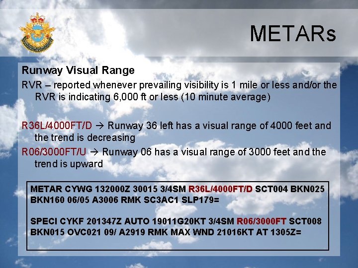
METARs Runway Visual Range RVR – reported whenever prevailing visibility is 1 mile or less and/or the RVR is indicating 6, 000 ft or less (10 minute average) R 36 L/4000 FT/D Runway 36 left has a visual range of 4000 feet and the trend is decreasing R 06/3000 FT/U Runway 06 has a visual range of 3000 feet and the trend is upward METAR CYWG 132000 Z 30015 3/4 SM R 36 L/4000 FT/D SCT 004 BKN 025 BKN 160 06/05 A 3006 RMK SC 3 AC 1 SLP 179= SPECI CYKF 201347 Z AUTO 19011 G 20 KT 3/4 SM R 06/3000 FT SCT 008 BKN 015 OVC 021 09/ A 2919 RMK MAX WND 21016 KT AT 1305 Z=

METARs Present Weather Present weather is comprised of weather phenomena (precipitation, obscuration, or other phenomena) preceded by one or two qualifiers (intensity or proximity to the station and descriptor) Intensity modifier “-” for “light” No modifier “moderate” “+” for “heavy” + Type of Weather SN (snow) RA (rain) FG (fog) METAR CYWG 132000 Z 30015 3/4 SM -RA SCT 004 BKN 025 BKN 160 06/05 A 3006 RMK SC 3 AC 1 SLP 179=

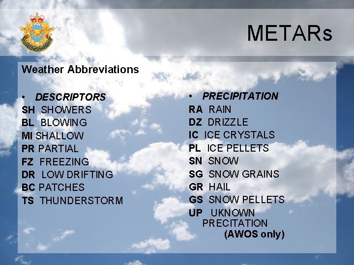
METARs Weather Abbreviations • DESCRIPTORS SH SHOWERS BL BLOWING MI SHALLOW PR PARTIAL FZ FREEZING DR LOW DRIFTING BC PATCHES TS THUNDERSTORM • PRECIPITATION RA RAIN DZ DRIZZLE IC ICE CRYSTALS PL ICE PELLETS SN SNOW SG SNOW GRAINS GR HAIL GS SNOW PELLETS UP UKNOWN PRECITATION (AWOS only)

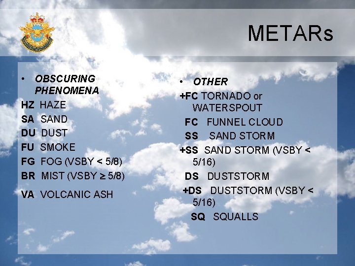
METARs • OBSCURING PHENOMENA HZ HAZE SA SAND DU DUST FU SMOKE FG FOG (VSBY < 5/8) BR MIST (VSBY 5/8) VA VOLCANIC ASH • OTHER +FC TORNADO or WATERSPOUT FC FUNNEL CLOUD SS SAND STORM +SS SAND STORM (VSBY < 5/16) DS DUSTSTORM +DS DUSTSTORM (VSBY < 5/16) SQ SQUALLS

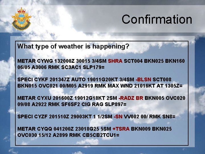
Confirmation What type of weather is happening? METAR CYWG 132000 Z 30015 3/4 SM SHRA SCT 004 BKN 025 BKN 160 06/05 A 3006 RMK SC 3 AC 1 SLP 179= SPECI CYKF 201347 Z AUTO 19011 G 20 KT 3/4 SM -BLSN SCT 008 BKN 015 OVC 021 00/M 05 A 2919 RMK MAX WND 21016 KT AT 1305 Z= METAR CYXU 201600 Z 19012 G 18 KT 2 SM -RADZ BR BKN 005 OVC 020 09/08 A 2922 RMK SF 6 SF 2 CIG RAG SLP 897= SPECI CYZF 201510 Z 29003 KT 1 1/2 SM -SN VV 002 00/ RMK SN 8= METAR CYQQ 041200 Z 23018 G 25 5 SM +TSRA BKN 009 BKN 025 OVC 030 15/12 A 2899 RMK CB 5 CB 2 TCU 1=

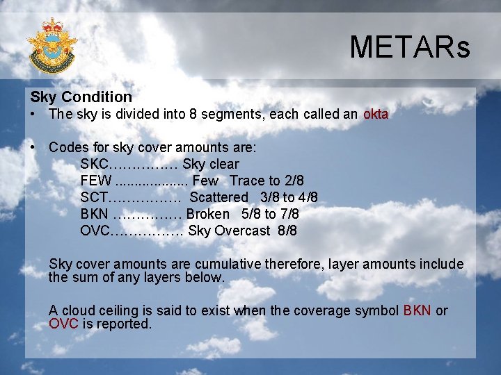
METARs Sky Condition • The sky is divided into 8 segments, each called an okta • Codes for sky cover amounts are: SKC…………… Sky clear FEW. . . . . Few Trace to 2/8 SCT……………. Scattered 3/8 to 4/8 BKN …………… Broken 5/8 to 7/8 OVC……………. Sky Overcast 8/8 Sky cover amounts are cumulative therefore, layer amounts include the sum of any layers below. A cloud ceiling is said to exist when the coverage symbol BKN or OVC is reported.

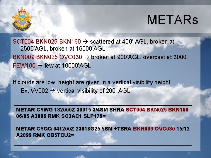
METARs SCT 004 BKN 025 BKN 160 scattered at 400’ AGL, broken at 2500’AGL, broken at 16000’AGL BKN 009 BKN 025 OVC 030 broken at 900’AGL, overcast at 3000’ FEW 100 few at 10000’AGL If clouds are low, height are given in a vertical visibility height Ex. VV 002 vertical visibility of 200’ AGL METAR CYWG 132000 Z 30015 3/4 SM SHRA SCT 004 BKN 025 BKN 160 06/05 A 3006 RMK SC 3 AC 1 SLP 179= METAR CYQQ 041200 Z 23018 G 25 5 SM +TSRA BKN 009 OVC 030 15/12 A 2899 RMK CB 5 TCU 2=

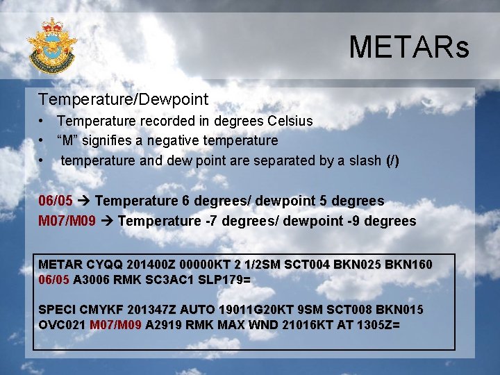
METARs Temperature/Dewpoint • Temperature recorded in degrees Celsius • “M” signifies a negative temperature • temperature and dew point are separated by a slash (/) 06/05 Temperature 6 degrees/ dewpoint 5 degrees M 07/M 09 Temperature -7 degrees/ dewpoint -9 degrees METAR CYQQ 201400 Z 00000 KT 2 1/2 SM SCT 004 BKN 025 BKN 160 06/05 A 3006 RMK SC 3 AC 1 SLP 179= SPECI CMYKF 201347 Z AUTO 19011 G 20 KT 9 SM SCT 008 BKN 015 OVC 021 M 07/M 09 A 2919 RMK MAX WND 21016 KT AT 1305 Z=

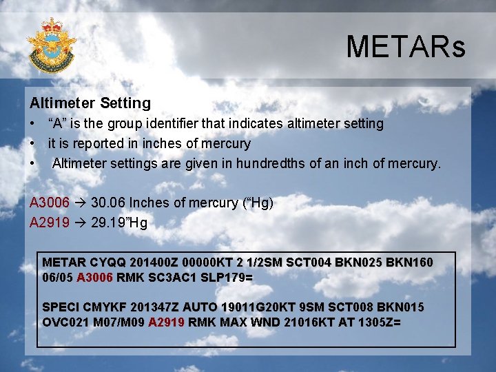
METARs Altimeter Setting • “A” is the group identifier that indicates altimeter setting • it is reported in inches of mercury • Altimeter settings are given in hundredths of an inch of mercury. A 3006 30. 06 Inches of mercury (“Hg) A 2919 29. 19”Hg METAR CYQQ 201400 Z 00000 KT 2 1/2 SM SCT 004 BKN 025 BKN 160 06/05 A 3006 RMK SC 3 AC 1 SLP 179= SPECI CMYKF 201347 Z AUTO 19011 G 20 KT 9 SM SCT 008 BKN 015 OVC 021 M 07/M 09 A 2919 RMK MAX WND 21016 KT AT 1305 Z=

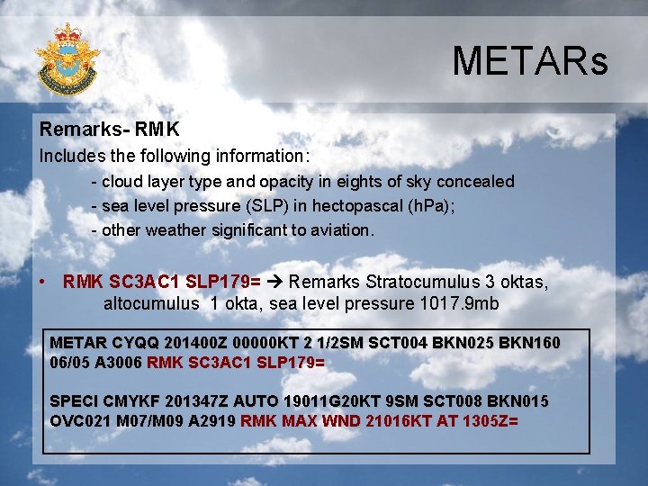
METARs Remarks- RMK Includes the following information: - cloud layer type and opacity in eights of sky concealed - sea level pressure (SLP) in hectopascal (h. Pa); - other weather significant to aviation. • RMK SC 3 AC 1 SLP 179= Remarks Stratocumulus 3 oktas, altocumulus 1 okta, sea level pressure 1017. 9 mb METAR CYQQ 201400 Z 00000 KT 2 1/2 SM SCT 004 BKN 025 BKN 160 06/05 A 3006 RMK SC 3 AC 1 SLP 179= SPECI CMYKF 201347 Z AUTO 19011 G 20 KT 9 SM SCT 008 BKN 015 OVC 021 M 07/M 09 A 2919 RMK MAX WND 21016 KT AT 1305 Z=

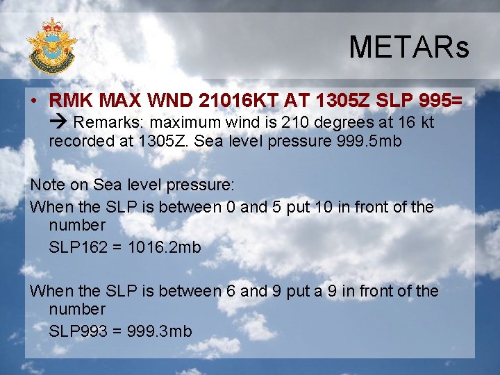
METARs • RMK MAX WND 21016 KT AT 1305 Z SLP 995= Remarks: maximum wind is 210 degrees at 16 kt recorded at 1305 Z. Sea level pressure 999. 5 mb Note on Sea level pressure: When the SLP is between 0 and 5 put 10 in front of the number SLP 162 = 1016. 2 mb When the SLP is between 6 and 9 put a 9 in front of the number SLP 993 = 999. 3 mb

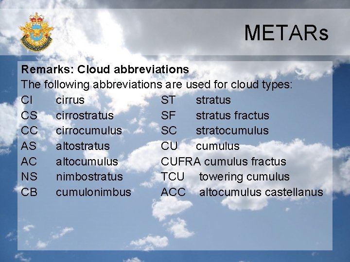
METARs Remarks: Cloud abbreviations The following abbreviations are used for cloud types: CI cirrus ST stratus CS cirrostratus SF stratus fractus CC cirrocumulus SC stratocumulus AS altostratus CU cumulus AC altocumulus CUFRA cumulus fractus NS nimbostratus TCU towering cumulus CB cumulonimbus ACC altocumulus castellanus

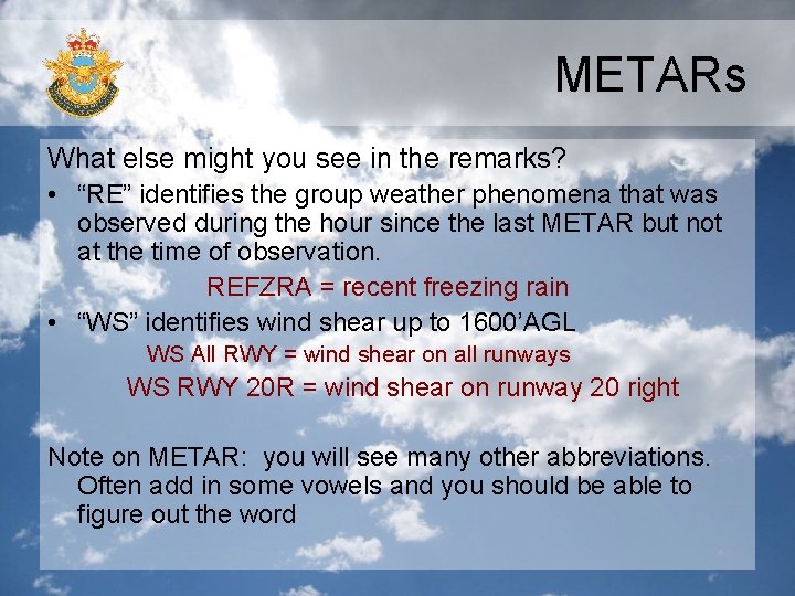
METARs What else might you see in the remarks? • “RE” identifies the group weather phenomena that was observed during the hour since the last METAR but not at the time of observation. REFZRA = recent freezing rain • “WS” identifies wind shear up to 1600’AGL WS All RWY = wind shear on all runways WS RWY 20 R = wind shear on runway 20 right Note on METAR: you will see many other abbreviations. Often add in some vowels and you should be able to figure out the word

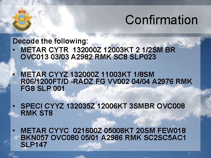
Confirmation Decode the following: • METAR CYTR 132000 Z 12003 KT 2 1/2 SM BR OVC 013 03/03 A 2982 RMK SC 8 SLP 023 • METAR CYYZ 132000 Z 11003 KT 1/8 SM R 06/1200 FT/D -RADZ FG VV 002 04/04 A 2976 RMK FG 8 SLP 001 • SPECI CYYZ 132035 Z 12006 KT 3 SMBR OVC 008 RMK ST 8 • METAR CYYC 021600 Z 05008 KT 20 SM FEW 018 BKN 057 OVC 080 05/01 A 2986 RMK SC 2 SC 5 AC 1 SLP 147

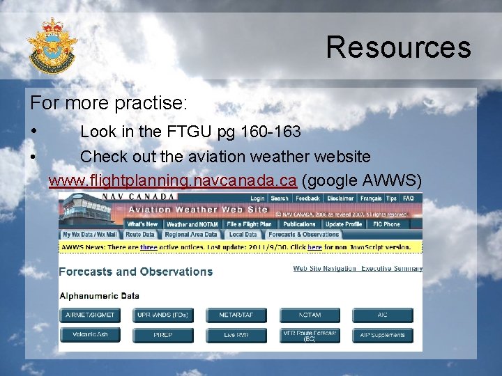
Resources For more practise: • Look in the FTGU pg 160 -163 • Check out the aviation weather website www. flightplanning. navcanada. ca (google AWWS)

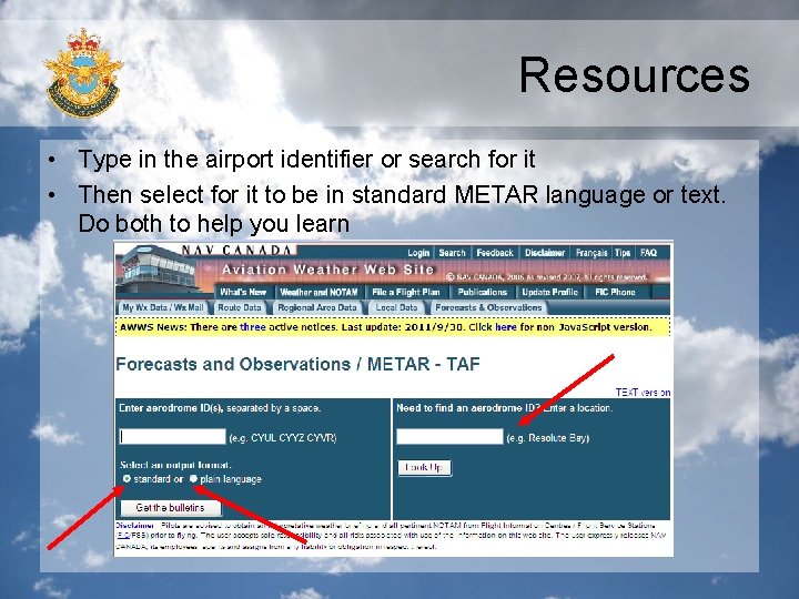
Resources • Type in the airport identifier or search for it • Then select for it to be in standard METAR language or text. Do both to help you learn

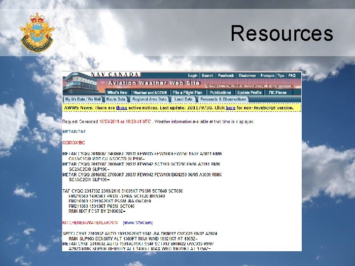
Resources

Automated Weather Observation System