CHAPTER 16 Oceans Shorelines and Shoreline Processes Introduction

- Slides: 90
CHAPTER 16 Oceans, Shorelines, and Shoreline Processes
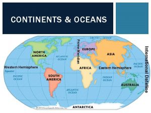
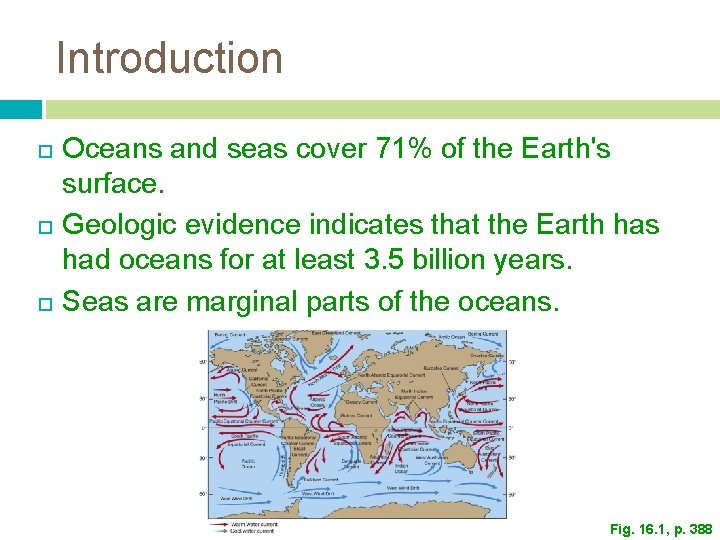
Introduction Oceans and seas cover 71% of the Earth's surface. Geologic evidence indicates that the Earth has had oceans for at least 3. 5 billion years. Seas are marginal parts of the oceans. Fig. 16. 1, p. 388
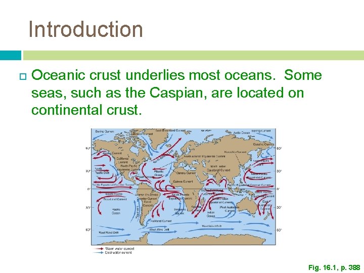
Introduction Oceanic crust underlies most oceans. Some seas, such as the Caspian, are located on continental crust. Fig. 16. 1, p. 388
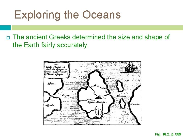
Exploring the Oceans The ancient Greeks determined the size and shape of the Earth fairly accurately. Fig. 16. 2, p. 389
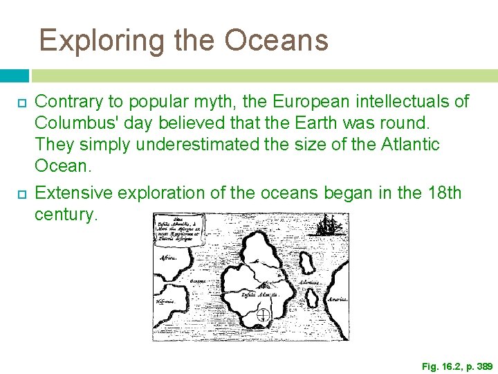
Exploring the Oceans Contrary to popular myth, the European intellectuals of Columbus' day believed that the Earth was round. They simply underestimated the size of the Atlantic Ocean. Extensive exploration of the oceans began in the 18 th century. Fig. 16. 2, p. 389
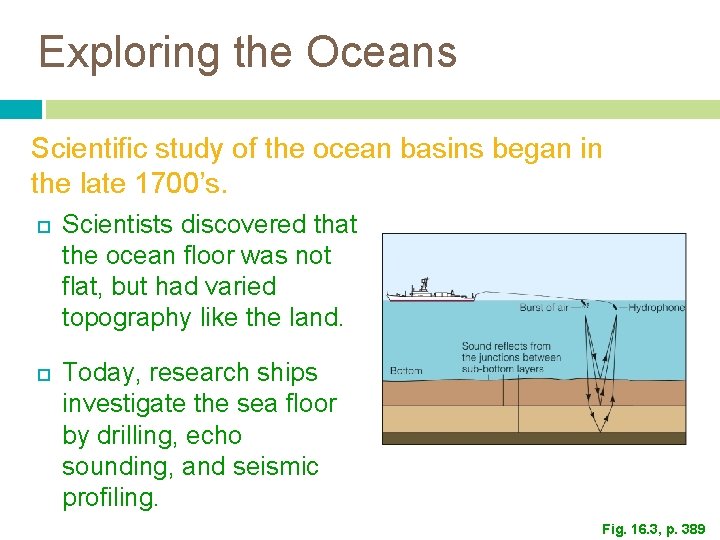
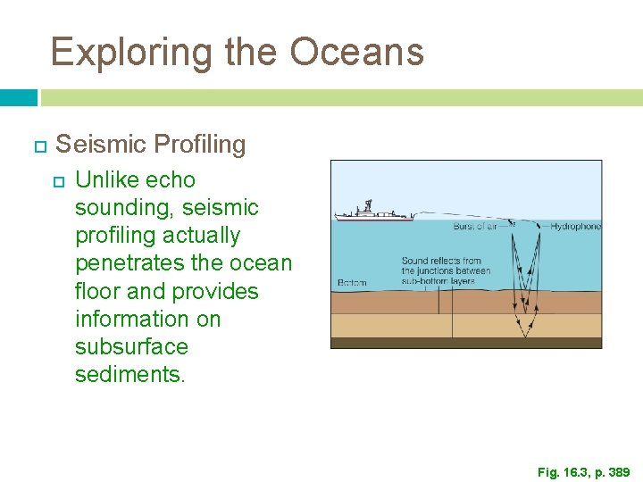
Exploring the Oceans Scientific study of the ocean basins began in the late 1700’s. Scientists discovered that the ocean floor was not flat, but had varied topography like the land. Today, research ships investigate the sea floor by drilling, echo sounding, and seismic profiling. Fig. 16. 3, p. 389
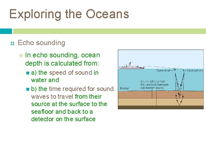
Exploring the Oceans Echo sounding In echo sounding, ocean depth is calculated from: a) the speed of sound in water and b) the time required for sound waves to travel from their source at the surface to the seafloor and back to a detector on the surface
Exploring the Oceans Seismic Profiling Unlike echo sounding, seismic profiling actually penetrates the ocean floor and provides information on subsurface sediments. Fig. 16. 3, p. 389
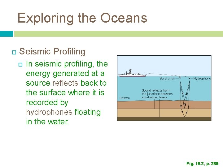
Exploring the Oceans Seismic Profiling In seismic profiling, the energy generated at a source reflects back to the surface where it is recorded by hydrophones floating in the water. Fig. 16. 3, p. 389
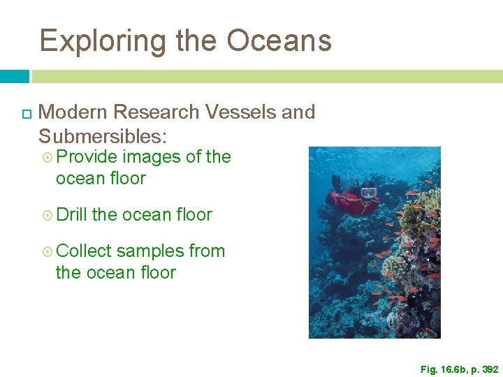
Exploring the Oceans Modern Research Vessels and Submersibles: Provide images of the ocean floor Drill the ocean floor Collect samples from the ocean floor Fig. 16. 6 b, p. 392
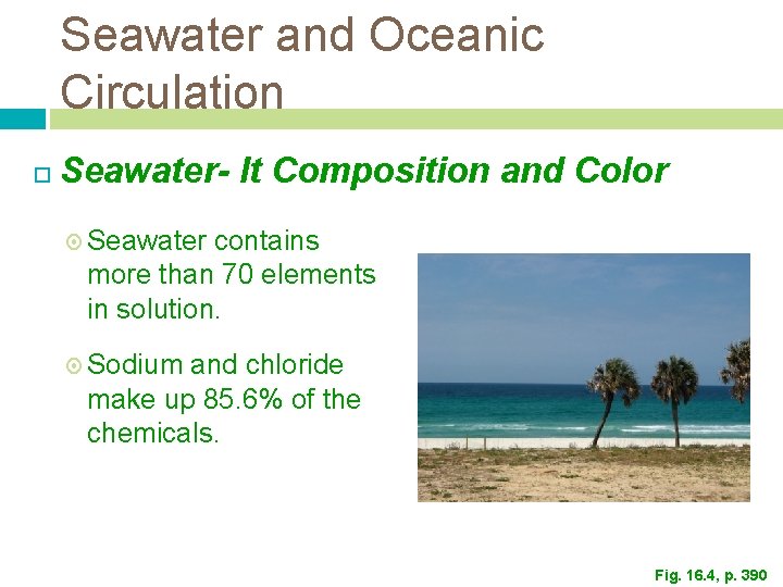
Seawater and Oceanic Circulation Seawater- It Composition and Color Seawater contains more than 70 elements in solution. Sodium and chloride make up 85. 6% of the chemicals. Fig. 16. 4, p. 390
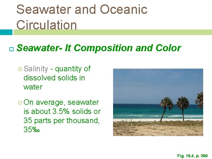
Seawater and Oceanic Circulation Seawater- It Composition and Color Salinity - quantity of dissolved solids in water On average, seawater is about 3. 5% solids or 35 parts per thousand, 35‰ Fig. 16. 4, p. 390
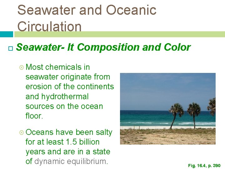
Seawater and Oceanic Circulation Seawater- It Composition and Color Most chemicals in seawater originate from erosion of the continents and hydrothermal sources on the ocean floor. Oceans have been salty for at least 1. 5 billion years and are in a state of dynamic equilibrium. Fig. 16. 4, p. 390
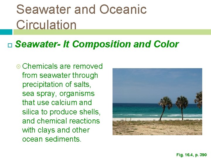
Seawater and Oceanic Circulation Seawater- It Composition and Color Chemicals are removed from seawater through precipitation of salts, sea spray, organisms that use calcium and silica to produce shells, and chemical reactions with clays and other ocean sediments. Fig. 16. 4, p. 390
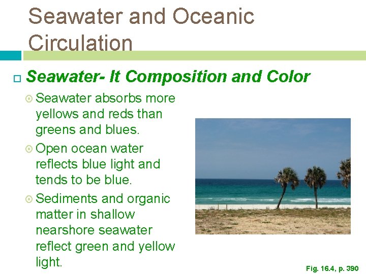
Seawater and Oceanic Circulation Seawater- It Composition and Color Seawater absorbs more yellows and reds than greens and blues. Open ocean water reflects blue light and tends to be blue. Sediments and organic matter in shallow nearshore seawater reflect green and yellow light. Fig. 16. 4, p. 390
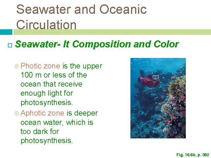
Seawater and Oceanic Circulation Seawater- It Composition and Color Photic zone is the upper 100 m or less of the ocean that receive enough light for photosynthesis. Aphotic zone is deeper ocean water, which is too dark for photosynthesis. Fig. 16. 6 b, p. 392
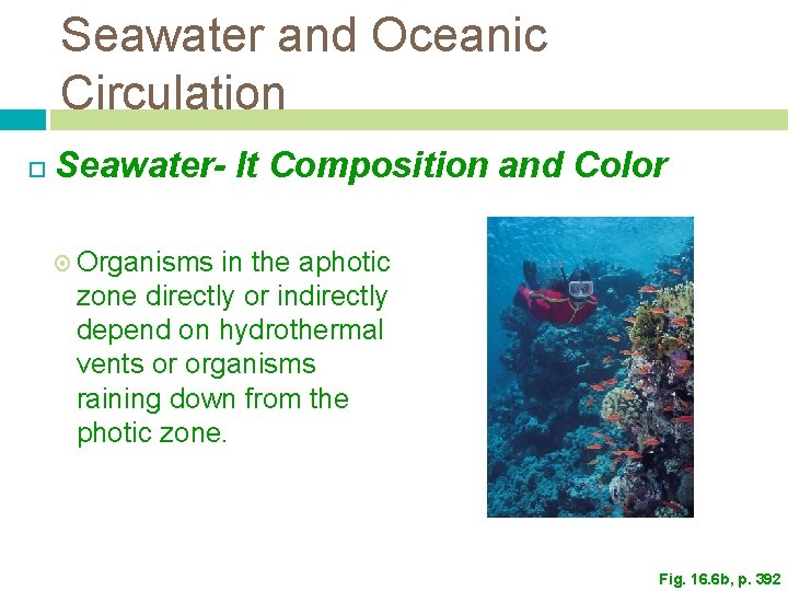
Seawater and Oceanic Circulation Seawater- It Composition and Color Organisms in the aphotic zone directly or indirectly depend on hydrothermal vents or organisms raining down from the photic zone. Fig. 16. 6 b, p. 392
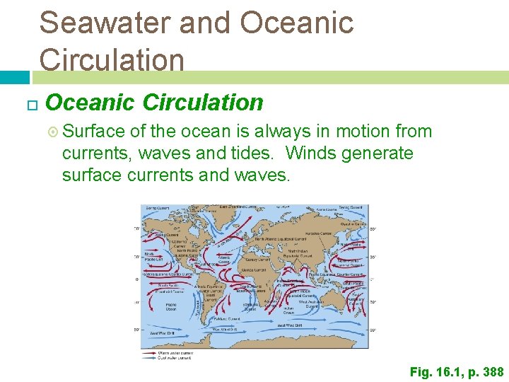
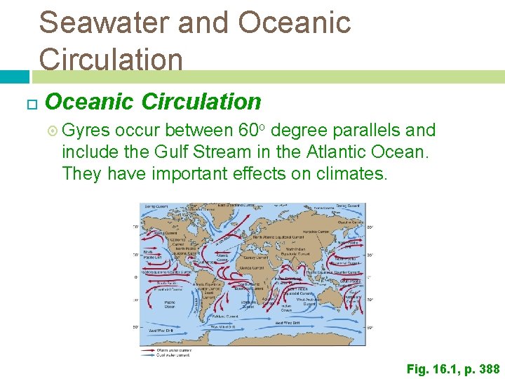
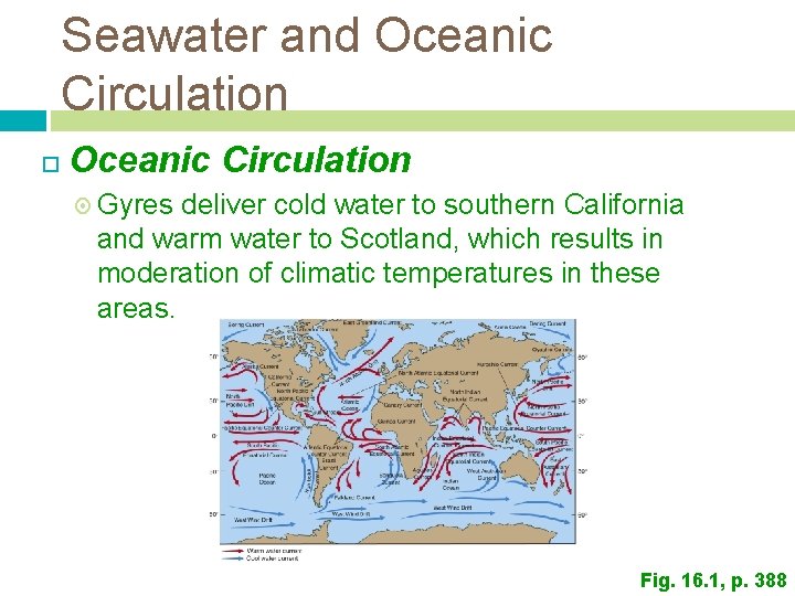
Seawater and Oceanic Circulation Surface of the ocean is always in motion from currents, waves and tides. Winds generate surface currents and waves. Fig. 16. 1, p. 388
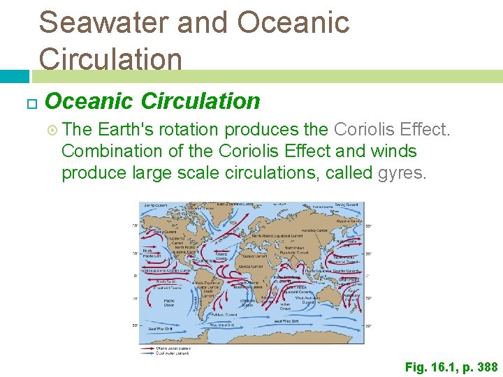
Seawater and Oceanic Circulation The Earth's rotation produces the Coriolis Effect. Combination of the Coriolis Effect and winds produce large scale circulations, called gyres. Fig. 16. 1, p. 388
Seawater and Oceanic Circulation Gyres occur between 60 o degree parallels and include the Gulf Stream in the Atlantic Ocean. They have important effects on climates. Fig. 16. 1, p. 388
Seawater and Oceanic Circulation Gyres deliver cold water to southern California and warm water to Scotland, which results in moderation of climatic temperatures in these areas. Fig. 16. 1, p. 388
Seawater and Oceanic Circulation Deep ocean circulation is mostly driven by density differences. Cold and saltier water is denser. Upwelling refers to circulation from the deep ocean to the surface. Deep cold water may be transferred to the surface. Downwelling refers to warm surface water sinking to greater depths.
Seawater and Oceanic Circulation Upwelling transfers cold nutrient-rich bottom waters to the surface. Important nutrients include phosphate and nitrate Once in the photic zones, the nutrients feed plankton, which provide food for other marine organisms. Less than 1% of the oceans are in areas of upwelling, but these areas support more than 50% by weight of the oceans' fish.
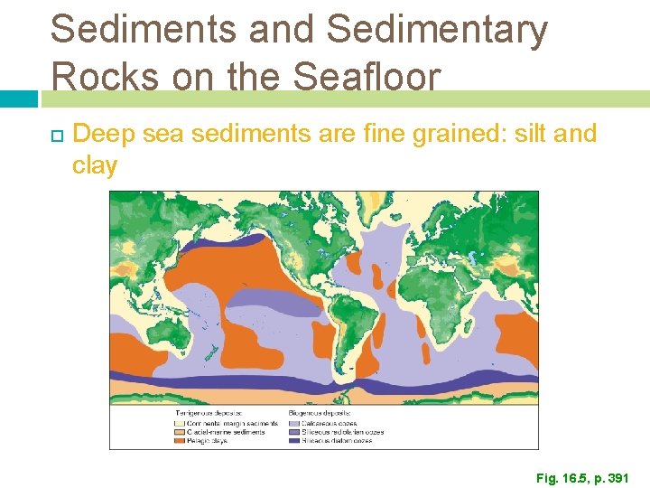
Sediments and Sedimentary Rocks on the Seafloor Deep sea sediments are fine grained: silt and clay Fig. 16. 5, p. 391
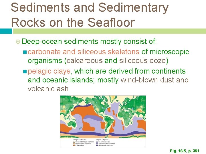
Sediments and Sedimentary Rocks on the Seafloor Deep-ocean sediments mostly consist of: carbonate and siliceous skeletons of microscopic organisms (calcareous and siliceous ooze) pelagic clays, which are derived from continents and oceanic islands; mostly wind-blown dust and volcanic ash Fig. 16. 5, p. 391
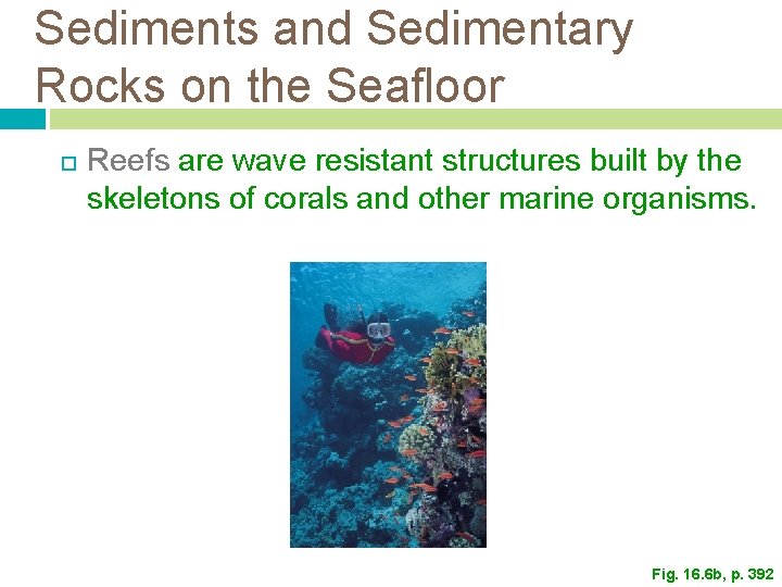
Sediments and Sedimentary Rocks on the Seafloor Reefs are wave resistant structures built by the skeletons of corals and other marine organisms. Fig. 16. 6 b, p. 392
Sediments and Sedimentary Rocks on the Seafloor Although commonly called coral reefs, they often contain clams, sponges and other marine organisms. Most coral reefs grow in shallow tropical waters, where temperatures do not drop below 20 o. C. Because corals depend on symbiotic algae that require photosynthesis, they rarely grow at depths greater than 50 m.
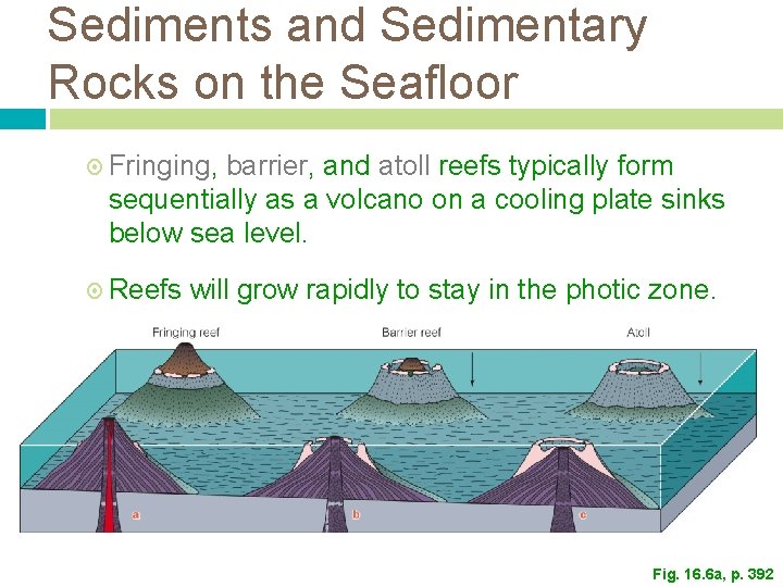
Sediments and Sedimentary Rocks on the Seafloor Three types of reefs: Fringing: up to 1 km wide, attached to a landmass, such as a volcanic island Barrier: Atoll: separated from the landmass by a lagoon. circular or oval reefs surrounding a lagoon
Sediments and Sedimentary Rocks on the Seafloor Fringing, barrier, and atoll reefs typically form sequentially as a volcano on a cooling plate sinks below sea level. Reefs will grow rapidly to stay in the photic zone. Fig. 16. 6 a, p. 392
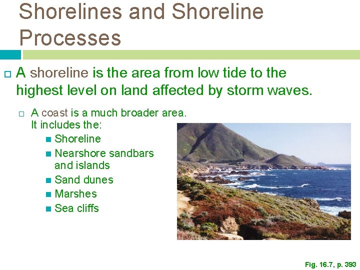
Shorelines and Shoreline Processes A shoreline is the area from low tide to the highest level on land affected by storm waves. A coast is a much broader area. It includes the: Shoreline Nearshore sandbars and islands Sand dunes Marshes Sea cliffs Fig. 16. 7, p. 393
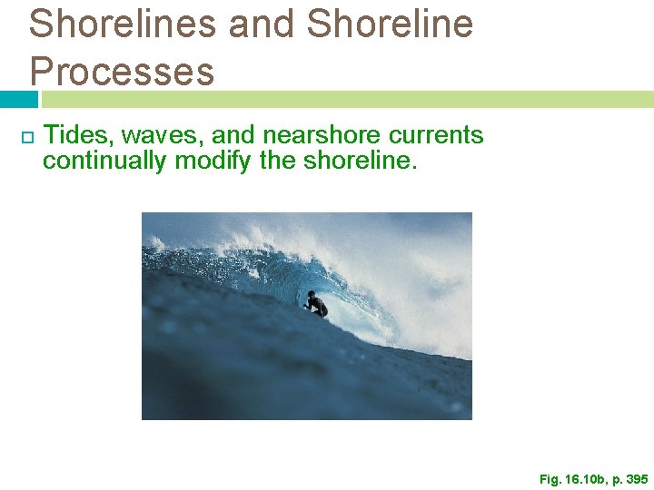
Shorelines and Shoreline Processes Tides, waves, and nearshore currents continually modify the shoreline. Fig. 16. 10 b, p. 395
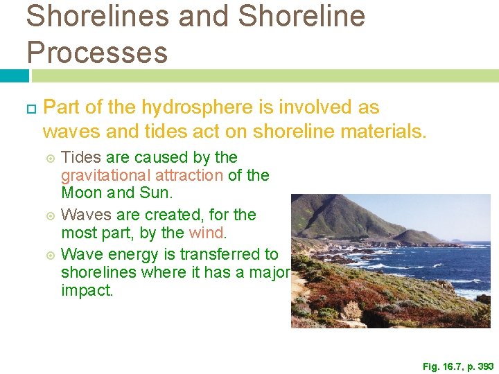
Shorelines and Shoreline Processes Part of the hydrosphere is involved as waves and tides act on shoreline materials. Tides are caused by the gravitational attraction of the Moon and Sun. Waves are created, for the most part, by the wind. Wave energy is transferred to shorelines where it has a major impact. Fig. 16. 7, p. 393
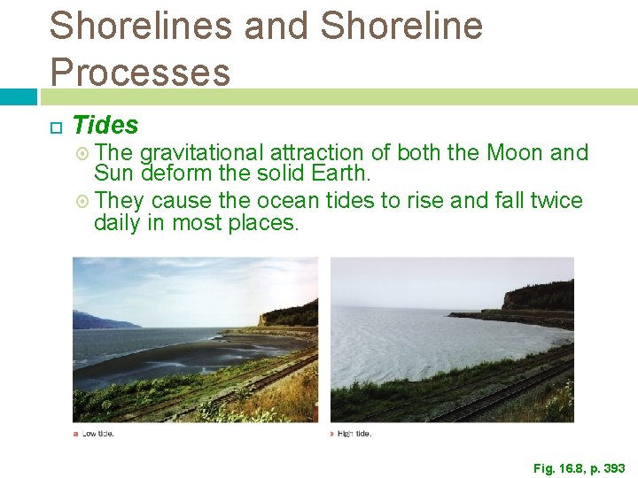
Shorelines and Shoreline Processes Tides The gravitational attraction of both the Moon and Sun deform the solid Earth. They cause the ocean tides to rise and fall twice daily in most places. Fig. 16. 8, p. 393
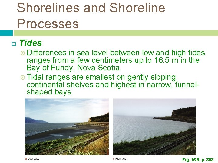
Shorelines and Shoreline Processes Tides Differences in sea level between low and high tides ranges from a few centimeters up to 16. 5 m in the Bay of Fundy, Nova Scotia. Tidal ranges are smallest on gently sloping continental shelves and highest in narrow, funnelshaped bays. Fig. 16. 8, p. 393
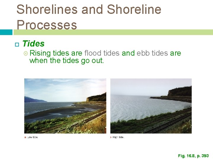
Shorelines and Shoreline Processes Tides Rising tides are flood tides and ebb tides are when the tides go out. Fig. 16. 8, p. 393
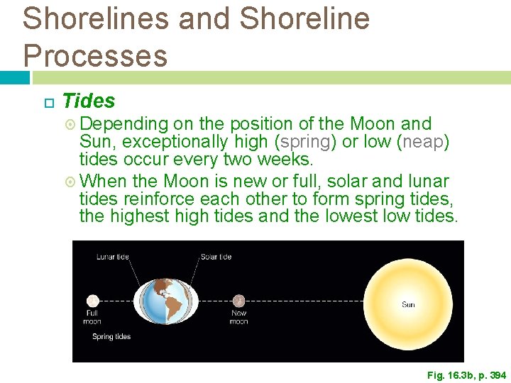
Shorelines and Shoreline Processes Tides Depending on the position of the Moon and Sun, exceptionally high (spring) or low (neap) tides occur every two weeks. When the Moon is new or full, solar and lunar tides reinforce each other to form spring tides, the highest high tides and the lowest low tides. Fig. 16. 3 b, p. 394
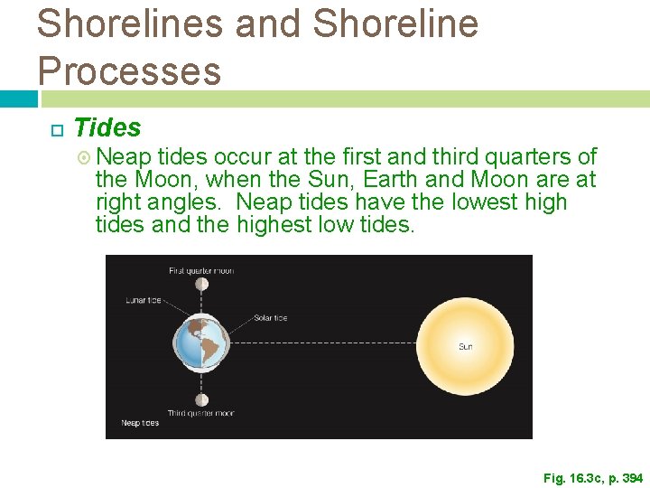
Shorelines and Shoreline Processes Tides Neap tides occur at the first and third quarters of the Moon, when the Sun, Earth and Moon are at right angles. Neap tides have the lowest high tides and the highest low tides. Fig. 16. 3 c, p. 394
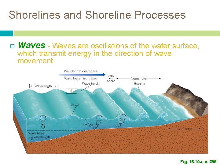
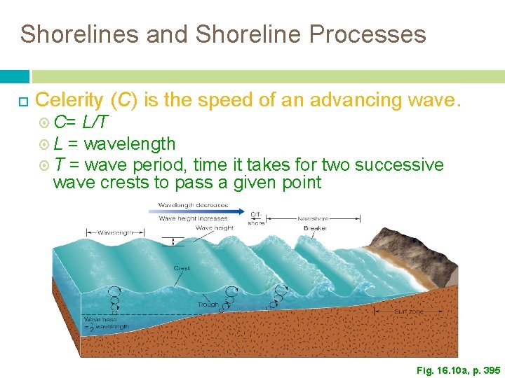
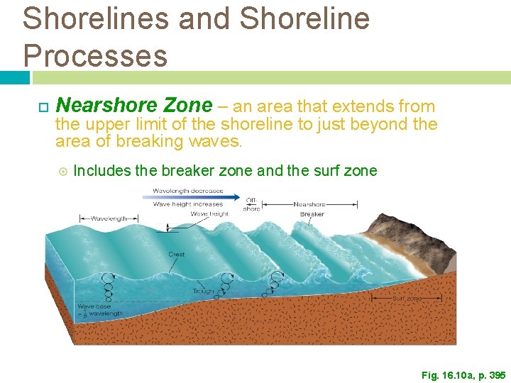
Shorelines and Shoreline Processes Waves - Waves are oscillations of the water surface, which transmit energy in the direction of wave movement. Fig. 16. 10 a, p. 395
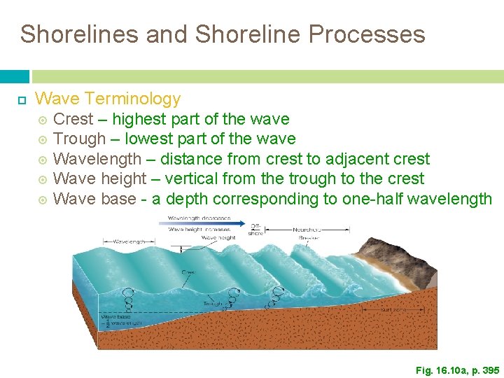
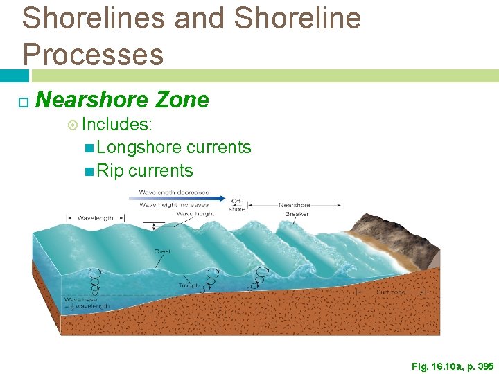
Shorelines and Shoreline Processes Wave Terminology Crest – highest part of the wave Trough – lowest part of the wave Wavelength – distance from crest to adjacent crest Wave height – vertical from the trough to the crest Wave base - a depth corresponding to one-half wavelength Fig. 16. 10 a, p. 395
Shorelines and Shoreline Processes Celerity (C) is the speed of an advancing wave. C= L/T L = wavelength T = wave period, time it takes for two successive wave crests to pass a given point Fig. 16. 10 a, p. 395
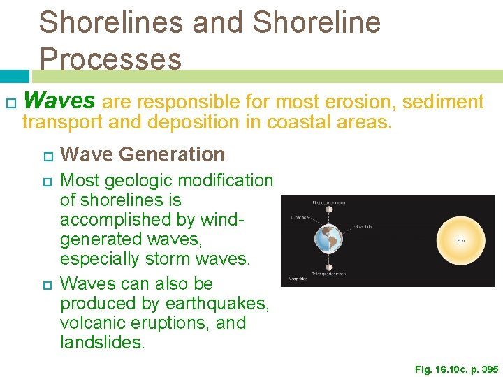
Shorelines and Shoreline Processes Waves are responsible for most erosion, sediment transport and deposition in coastal areas. Wave Generation Most geologic modification of shorelines is accomplished by windgenerated waves, especially storm waves. Waves can also be produced by earthquakes, volcanic eruptions, and landslides. Fig. 16. 10 c, p. 395
Shorelines and Shoreline Processes Wave Generation Wave size in wind-generated waves is controlled by fetch. Fetch is the distance the wind blows over a continuous water surface. Waves in the ocean have a larger fetch than waves in lakes and ponds.
Shorelines and Shoreline Processes Waves Shallow-Water Waves and Breakers As waves enter water shallower than their wave base (1/2 their wavelength), the waves hit the seafloor. The wave shape changes and water is displaced in the direction of wave advance. Broad, deep water waves become sharp crested. The waves then become oversteepened and plunge forward as breakers.
Shorelines and Shoreline Processes Nearshore Zone – an area that extends from the upper limit of the shoreline to just beyond the area of breaking waves. Includes the breaker zone and the surf zone Fig. 16. 10 a, p. 395
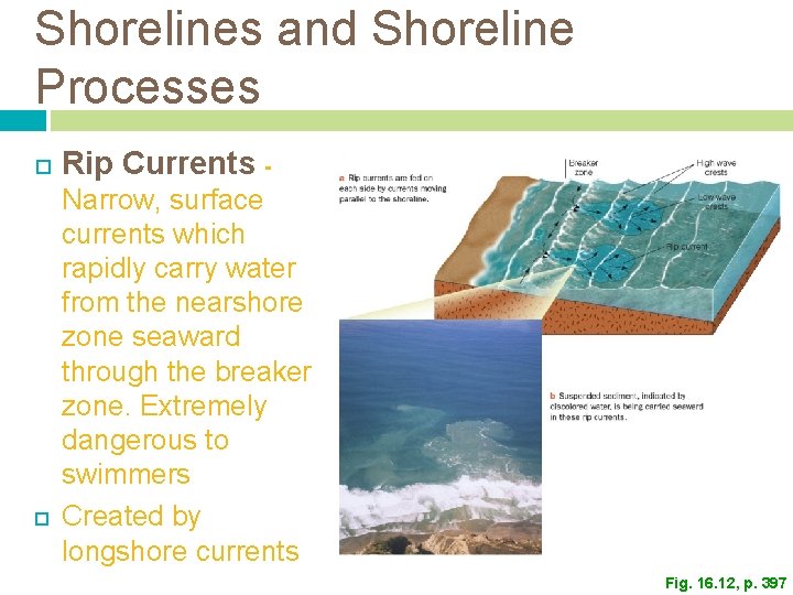
Shorelines and Shoreline Processes Nearshore Zone Includes: Longshore currents Rip currents Fig. 16. 10 a, p. 395
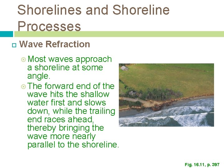
Shorelines and Shoreline Processes Wave Refraction Most waves approach a shoreline at some angle. The forward end of the wave hits the shallow water first and slows down, while the trailing end races ahead, thereby bringing the wave more nearly parallel to the shoreline. Fig. 16. 11, p. 397
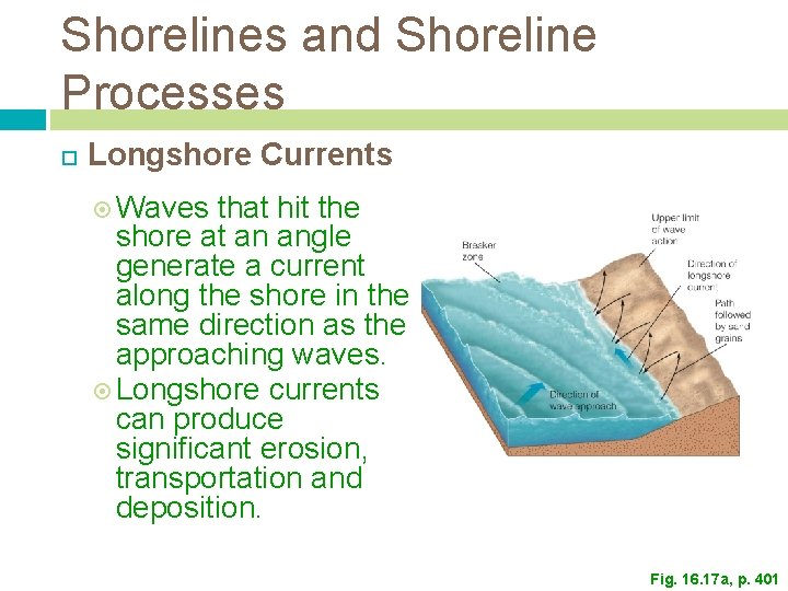
Shorelines and Shoreline Processes Longshore Currents Waves that hit the shore at an angle generate a current along the shore in the same direction as the approaching waves. Longshore currents can produce significant erosion, transportation and deposition. Fig. 16. 17 a, p. 401
Shorelines and Shoreline Processes Rip Currents Narrow, surface currents which rapidly carry water from the nearshore zone seaward through the breaker zone. Extremely dangerous to swimmers Created by longshore currents Fig. 16. 12, p. 397
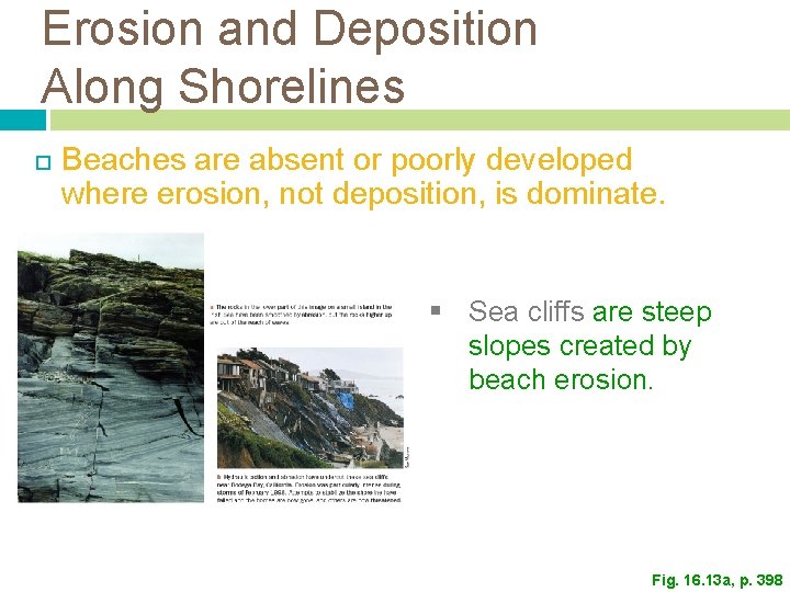
Erosion and Deposition Along Shorelines Beaches are absent or poorly developed where erosion, not deposition, is dominate. § Sea cliffs are steep slopes created by beach erosion. Fig. 16. 13 a, p. 398
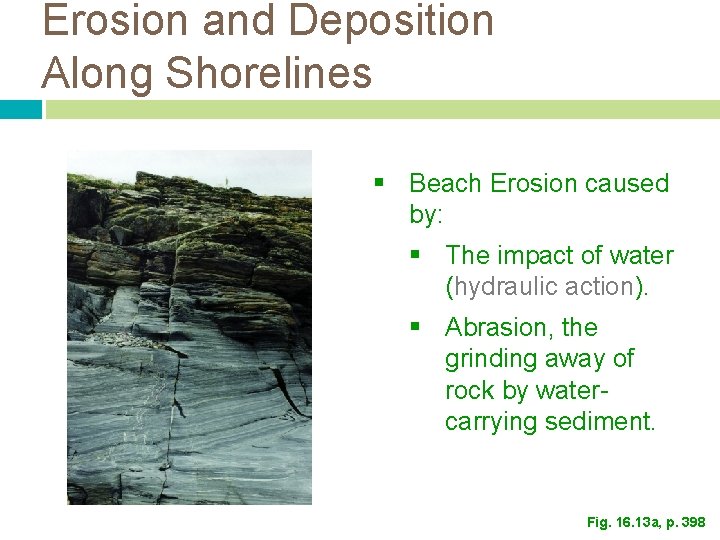
Erosion and Deposition Along Shorelines § Beach Erosion caused by: § The impact of water (hydraulic action). § Abrasion, the grinding away of rock by watercarrying sediment. Fig. 16. 13 a, p. 398
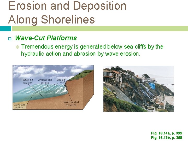
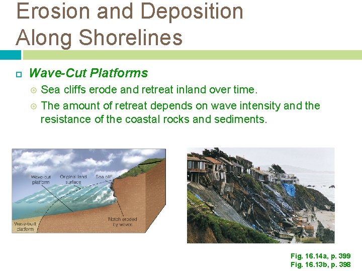
Erosion and Deposition Along Shorelines Wave-Cut Platforms Tremendous energy is generated below sea cliffs by the hydraulic action and abrasion by wave erosion. Fig. 16. 14 a, p. 399 Fig. 16. 13 b, p. 398
Erosion and Deposition Along Shorelines Wave-Cut Platforms Sea cliffs erode and retreat inland over time. The amount of retreat depends on wave intensity and the resistance of the coastal rocks and sediments. Fig. 16. 14 a, p. 399 Fig. 16. 13 b, p. 398
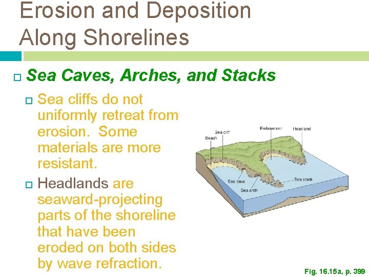
Erosion and Deposition Along Shorelines Sea Caves, Arches, and Stacks Sea cliffs do not uniformly retreat from erosion. Some materials are more resistant. Headlands are seaward-projecting parts of the shoreline that have been eroded on both sides by wave refraction. Fig. 16. 15 a, p. 399
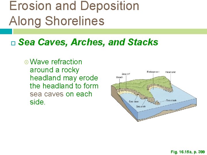
Erosion and Deposition Along Shorelines Sea Caves, Arches, and Stacks Wave refraction around a rocky headland may erode the headland to form sea caves on each side. Fig. 16. 15 a, p. 399
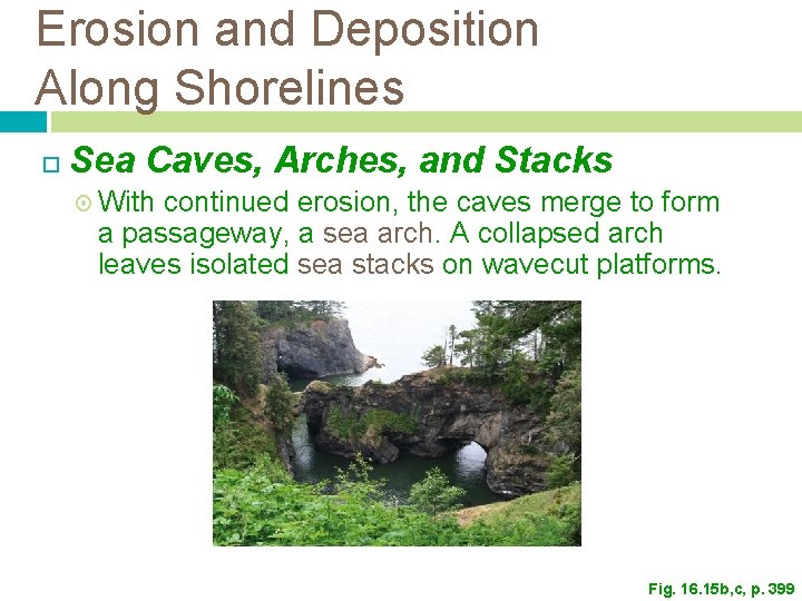
Erosion and Deposition Along Shorelines Sea Caves, Arches, and Stacks With continued erosion, the caves merge to form a passageway, a sea arch. A collapsed arch leaves isolated sea stacks on wavecut platforms. Fig. 16. 15 b, c, p. 399
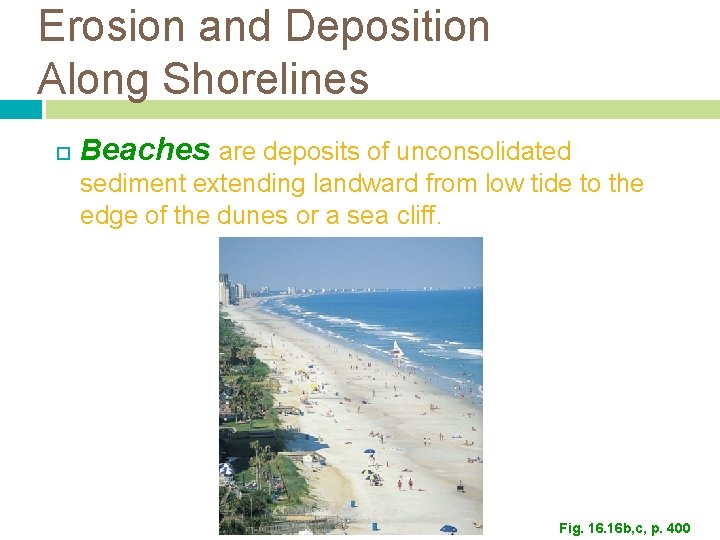
Erosion and Deposition Along Shorelines Beaches are deposits of unconsolidated sediment extending landward from low tide to the edge of the dunes or a sea cliff. Fig. 16 b, c, p. 400
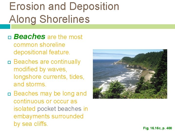
Erosion and Deposition Along Shorelines Beaches are the most common shoreline depositional feature. Beaches are continually modified by waves, longshore currents, tides, and storms. Beaches may be long and continuous or occur as isolated pocket beaches in embayments surrounded by sea cliffs. Fig. 16 c, p. 400
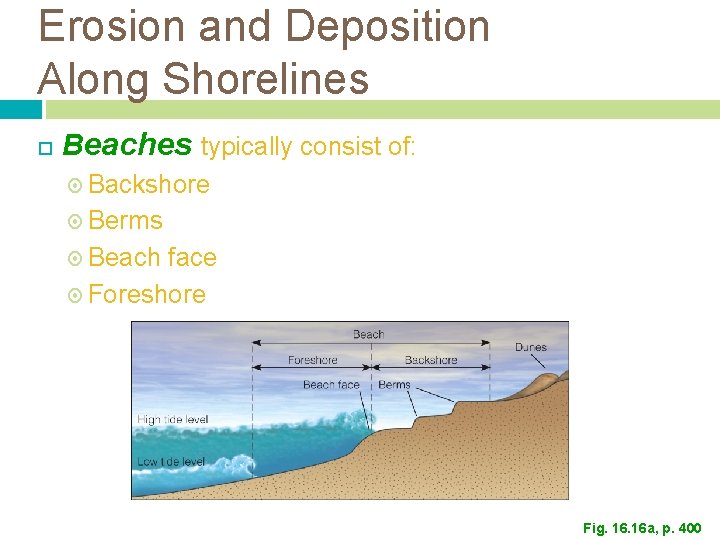
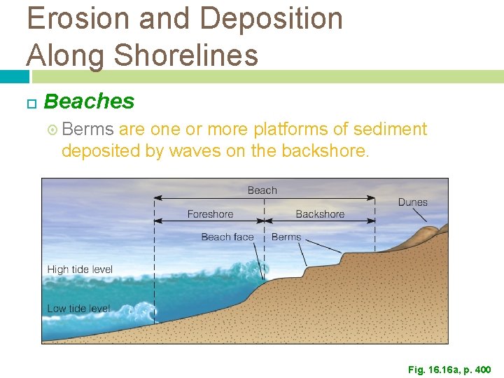
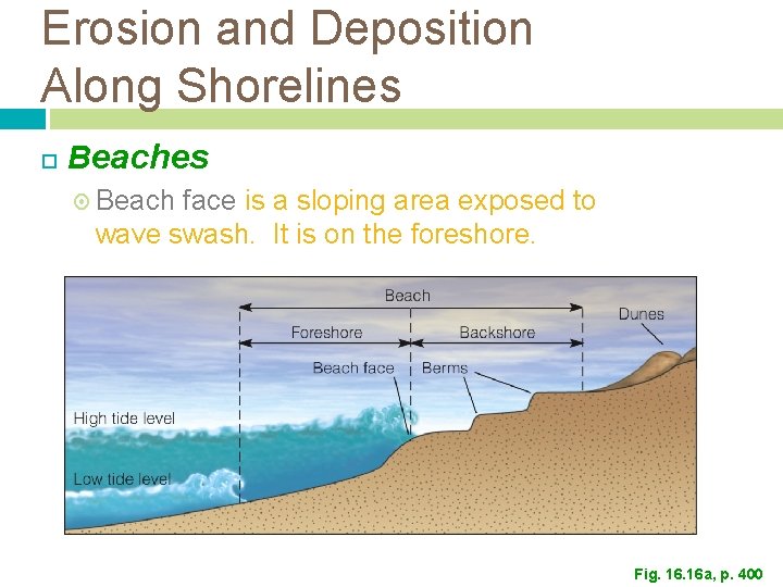
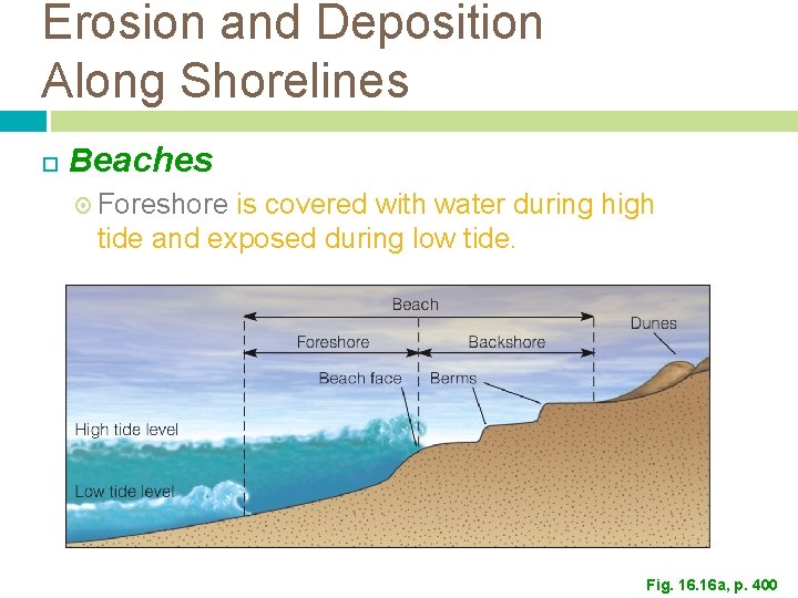
Erosion and Deposition Along Shorelines Beaches typically consist of: Backshore Berms Beach face Foreshore Fig. 16 a, p. 400
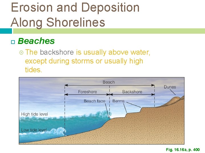
Erosion and Deposition Along Shorelines Beaches The backshore is usually above water, except during storms or usually high tides. Fig. 16 a, p. 400
Erosion and Deposition Along Shorelines Beaches Berms are one or more platforms of sediment deposited by waves on the backshore. Fig. 16 a, p. 400
Erosion and Deposition Along Shorelines Beach face is a sloping area exposed to wave swash. It is on the foreshore. Fig. 16 a, p. 400
Erosion and Deposition Along Shorelines Beaches Foreshore is covered with water during high tide and exposed during low tide. Fig. 16 a, p. 400
Erosion and Deposition Along Shorelines Seasonal Changes in Beaches Summer beaches usually have a wide berm, gently sloping beach face, and smooth offshore profile. Winter beaches tend to be steeper and made up of coarser materials than summer beaches because waves are more energetic during this season. Berms may be absent. The sand eroded from beaches during winter is stored in offshore bars until it is driven back shoreward by more gentle waves.
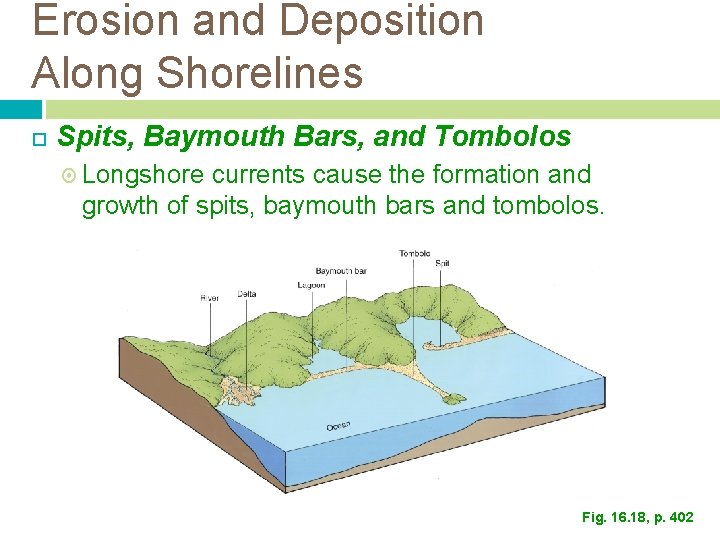
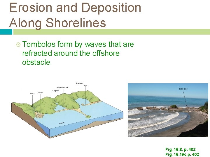
Erosion and Deposition Along Shorelines Spits, Baymouth Bars, and Tombolos Longshore currents cause the formation and growth of spits, baymouth bars and tombolos. Fig. 16. 18, p. 402
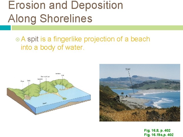
Erosion and Deposition Along Shorelines A spit is a fingerlike projection of a beach into a body of water. Fig. 16. 8, p. 402 Fig. 16. 19 a, p. 402
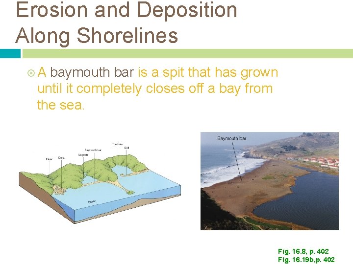
Erosion and Deposition Along Shorelines A baymouth bar is a spit that has grown until it completely closes off a bay from the sea. Fig. 16. 8, p. 402 Fig. 16. 19 b, p. 402
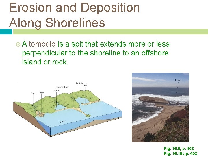
Erosion and Deposition Along Shorelines A tombolo is a spit that extends more or less perpendicular to the shoreline to an offshore island or rock. Fig. 16. 8, p. 402 Fig. 16. 19 c, p. 402
Erosion and Deposition Along Shorelines Tombolos form by waves that are refracted around the offshore obstacle. Fig. 16. 8, p. 402 Fig. 16. 19 c, p. 402
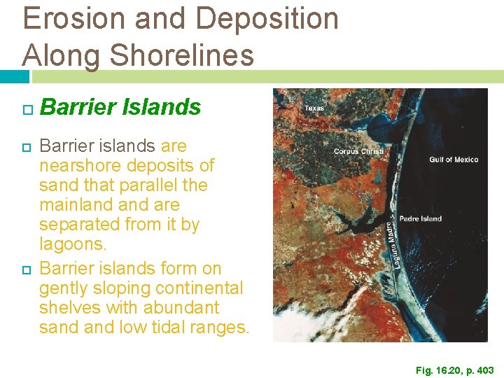
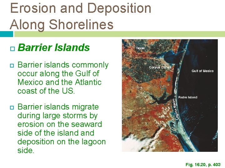
Erosion and Deposition Along Shorelines Barrier Islands Barrier islands are nearshore deposits of sand that parallel the mainland are separated from it by lagoons. Barrier islands form on gently sloping continental shelves with abundant sand low tidal ranges. Fig. 16. 20, p. 403
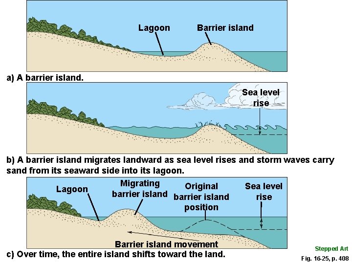
Erosion and Deposition Along Shorelines Barrier Islands Barrier islands commonly occur along the Gulf of Mexico and the Atlantic coast of the US. Barrier islands migrate during large storms by erosion on the seaward side of the island deposition on the lagoon side. Fig. 16. 20, p. 403
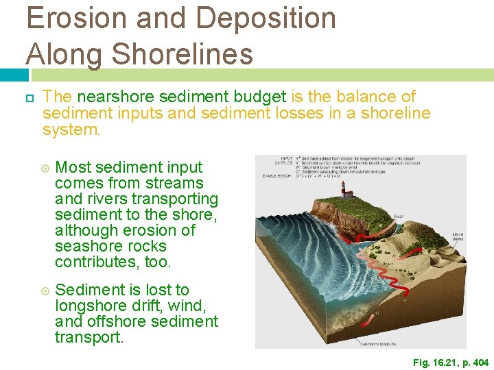
Erosion and Deposition Along Shorelines The nearshore sediment budget is the balance of sediment inputs and sediment losses in a shoreline system. Most sediment input comes from streams and rivers transporting sediment to the shore, although erosion of seashore rocks contributes, too. Sediment is lost to longshore drift, wind, and offshore sediment transport. Fig. 16. 21, p. 404
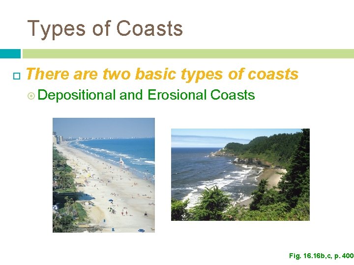
Types of Coasts There are two basic types of coasts Depositional and Erosional Coasts Fig. 16 b, c, p. 400
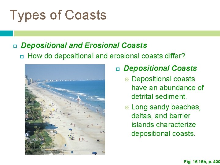
Types of Coasts Depositional and Erosional Coasts How do depositional and erosional coasts differ? Depositional Coasts Depositional coasts have an abundance of detrital sediment. Long sandy beaches, deltas, and barrier islands characterize depositional coasts. Fig. 16 b, p. 400
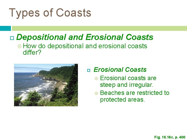
Types of Coasts Depositional and Erosional Coasts How do depositional and erosional coasts differ? Erosional Coasts Erosional coasts are steep and irregular. Beaches are restricted to protected areas. Fig. 16 c, p. 400
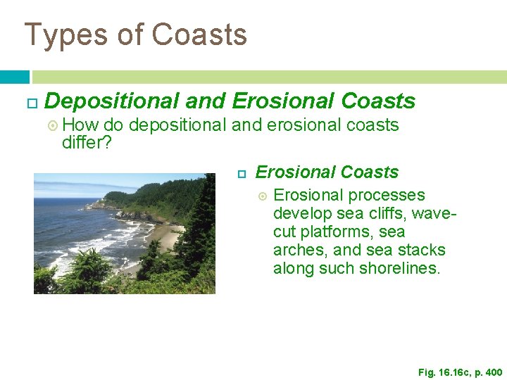
Types of Coasts Depositional and Erosional Coasts How do depositional and erosional coasts differ? Erosional Coasts Erosional processes develop sea cliffs, wavecut platforms, sea arches, and sea stacks along such shorelines. Fig. 16 c, p. 400
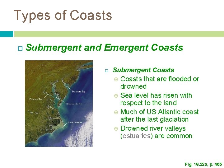
Types of Coasts Submergent and Emergent Coasts Submergent Coasts that are flooded or drowned Sea level has risen with respect to the land Much of US Atlantic coast after the last glaciation Drowned river valleys (estuaries) are common Fig. 16. 22 a, p. 405
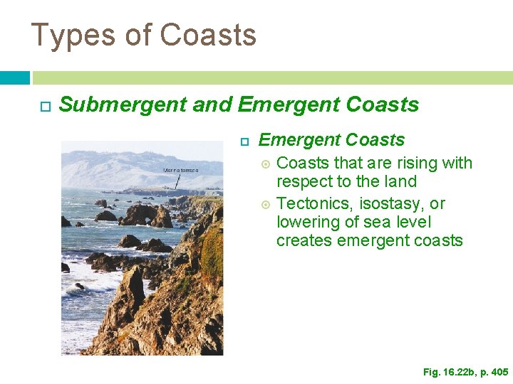
Types of Coasts Submergent and Emergent Coasts that are rising with respect to the land Tectonics, isostasy, or lowering of sea level creates emergent coasts Fig. 16. 22 b, p. 405
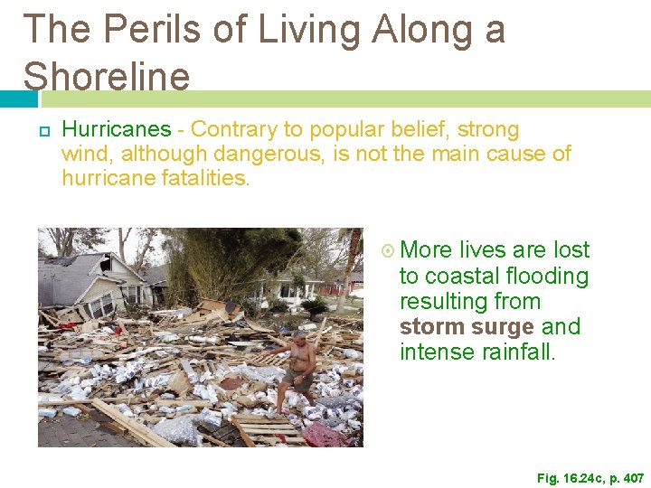
The Perils of Living Along a Shoreline Hurricanes - Contrary to popular belief, strong wind, although dangerous, is not the main cause of hurricane fatalities. More lives are lost to coastal flooding resulting from storm surge and intense rainfall. Fig. 16. 24 c, p. 407
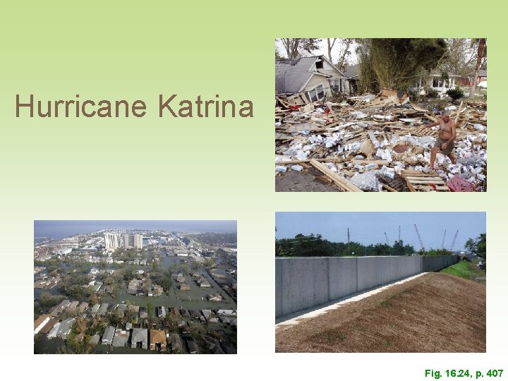
Hurricane Katrina Fig. 16. 24, p. 407
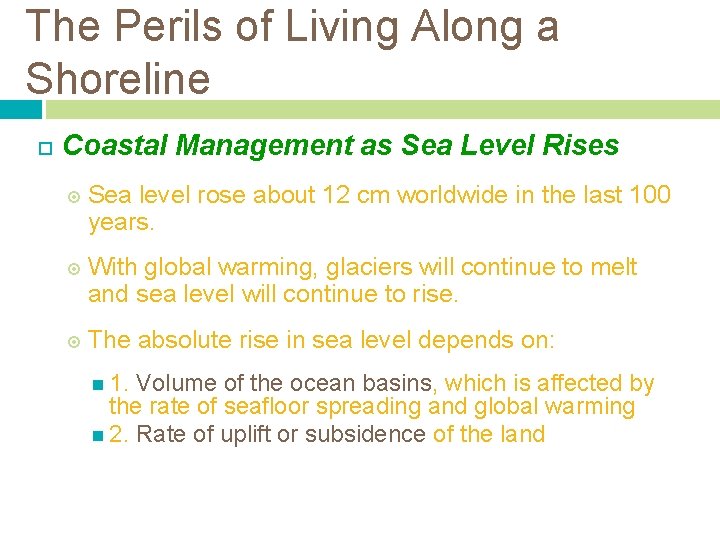
The Perils of Living Along a Shoreline Coastal Management as Sea Level Rises Sea level rose about 12 cm worldwide in the last 100 years. With global warming, glaciers will continue to melt and sea level will continue to rise. The absolute rise in sea level depends on: 1. Volume of the ocean basins, which is affected by the rate of seafloor spreading and global warming 2. Rate of uplift or subsidence of the land
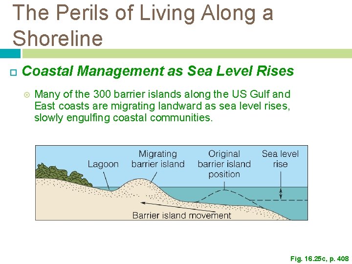
The Perils of Living Along a Shoreline Coastal Management as Sea Level Rises Many of the 300 barrier islands along the US Gulf and East coasts are migrating landward as sea level rises, slowly engulfing coastal communities. Fig. 16. 25 c, p. 408
Lagoon Barrier island a) A barrier island. Sea level rise b) A barrier island migrates landward as sea level rises and storm waves carry sand from its seaward side into its lagoon. Migrating Original Sea level Lagoon barrier island rise position Barrier island movement c) Over time, the entire island shifts toward the land. Stepped Art Fig. 16 -25, p. 408
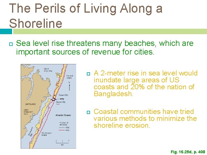
The Perils of Living Along a Shoreline Sea level rise threatens many beaches, which are important sources of revenue for cities. A 2 -meter rise in sea level would inundate large areas of US coasts and 20% of the nation of Bangladesh. Coastal communities have tried various methods to minimize the shoreline erosion. Fig. 16. 25 d, p. 408
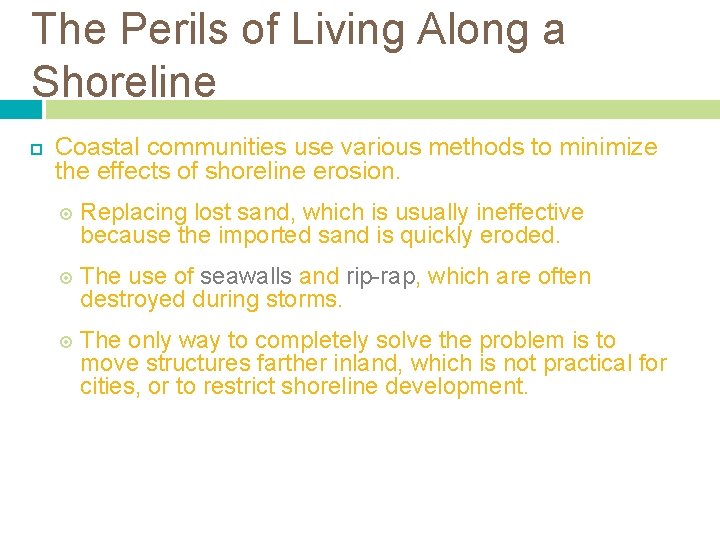
The Perils of Living Along a Shoreline Coastal communities use various methods to minimize the effects of shoreline erosion. Replacing lost sand, which is usually ineffective because the imported sand is quickly eroded. The use of seawalls and rip-rap, which are often destroyed during storms. The only way to completely solve the problem is to move structures farther inland, which is not practical for cities, or to restrict shoreline development.
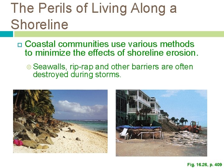
The Perils of Living Along a Shoreline Coastal communities use various methods to minimize the effects of shoreline erosion. Seawalls, rip-rap and other barriers are often destroyed during storms. Fig. 16. 26, p. 409
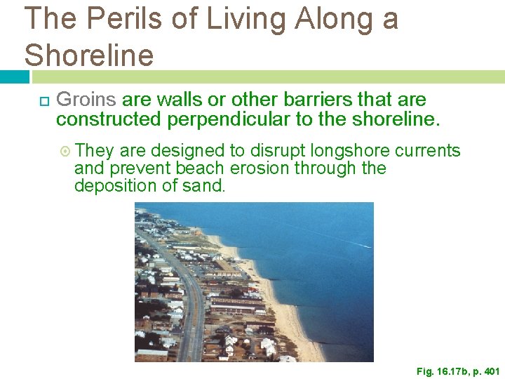
The Perils of Living Along a Shoreline Groins are walls or other barriers that are constructed perpendicular to the shoreline. They are designed to disrupt longshore currents and prevent beach erosion through the deposition of sand. Fig. 16. 17 b, p. 401
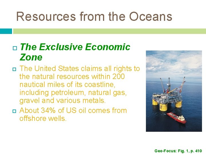
Resources from the Oceans The Exclusive Economic Zone The United States claims all rights to the natural resources within 200 nautical miles of its coastline, including petroleum, natural gas, gravel and various metals. About 34% of US oil comes from offshore wells. Geo-Focus: Fig. 1, p. 410
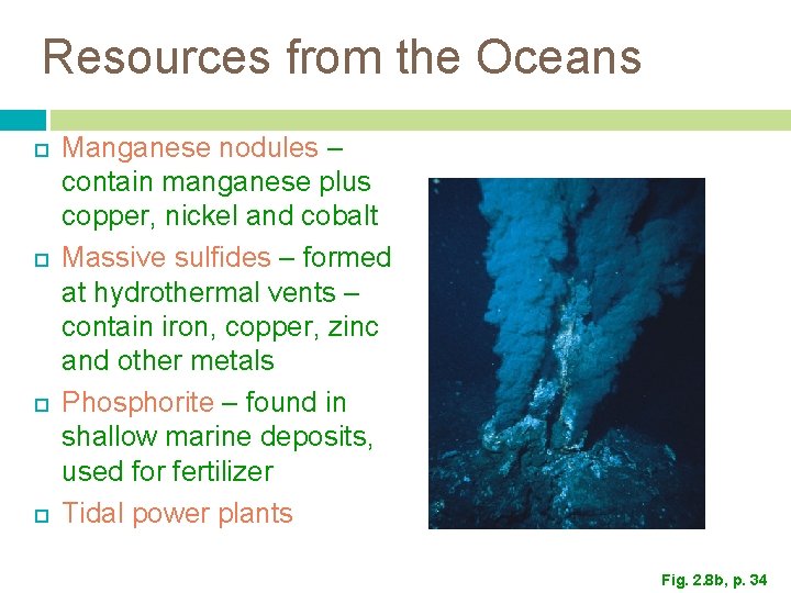
Resources from the Oceans Manganese nodules – contain manganese plus copper, nickel and cobalt Massive sulfides – formed at hydrothermal vents – contain iron, copper, zinc and other metals Phosphorite – found in shallow marine deposits, used for fertilizer Tidal power plants Fig. 2. 8 b, p. 34
Resources from the Oceans Methane hydrate - energy for the future? Single methane molecules bound up in ice crystals are found in huge quantities in sediments of the continental margins. The amount of carbon in methane hydrate exceeds that in all coal, oil, and natural gas, so if a technology is developed to recover it economically, it may become an energy source. Problem: may contribute to global warming
End of Chapter 16