Aircraft Icing Jim Vasilj Meteorologist Center Weather Service

- Slides: 49

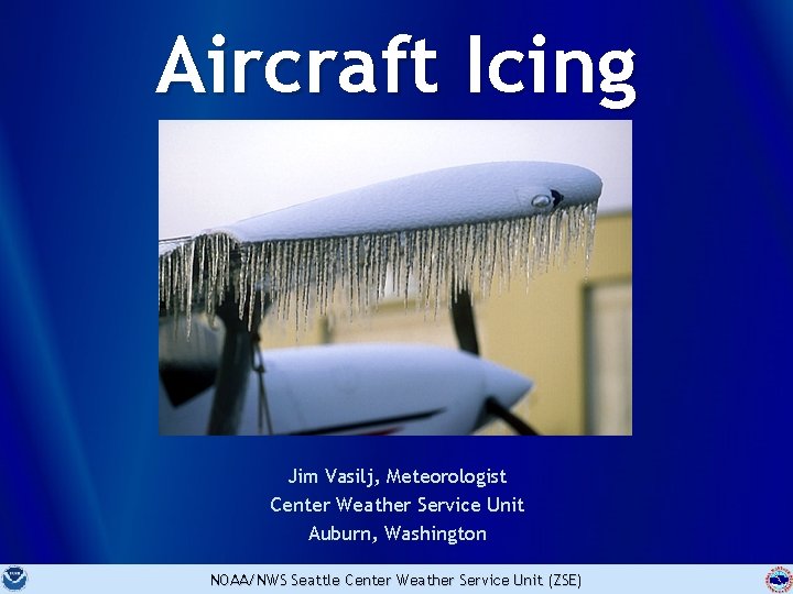
Aircraft Icing Jim Vasilj, Meteorologist Center Weather Service Unit Auburn, Washington NOAA/NWS Seattle Center Weather Service Unit (ZSE)

Objectives • Describe the effects of icing on aircraft performance • Explain what causes icing • Understand how ice forms and when and where it occurs • Define the 3 types of icing and their characteristics 2 NOAA/NWS Seattle Center Weather Service Unit (ZSE)

Objectives • Identify the potential type of icing based on cloud types • Explain how freezing precipitation produces aircraft icing • List strategies to maintain situational awareness for icing events 3 NOAA/NWS Seattle Center Weather Service Unit (ZSE)

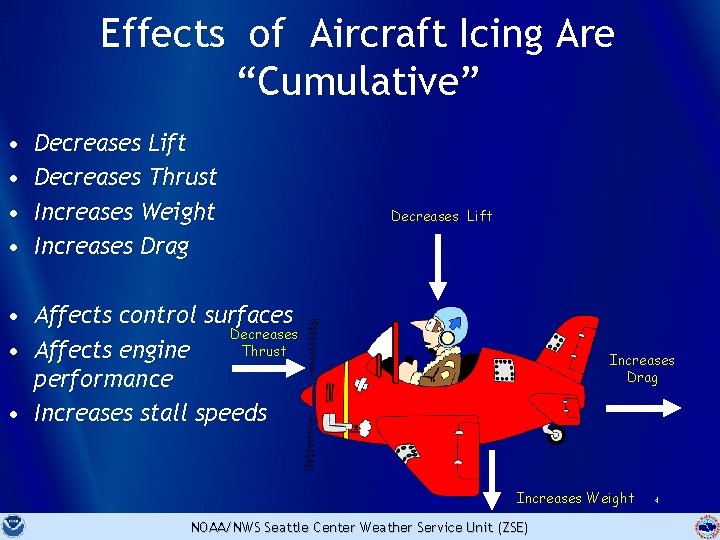
Effects of Aircraft Icing Are “Cumulative” • • Decreases Lift Decreases Thrust Increases Weight Increases Drag Decreases Lift • Affects control surfaces Decreases Thrust • Affects engine performance • Increases stall speeds Increases Drag Increases Weight NOAA/NWS Seattle Center Weather Service Unit (ZSE) 4

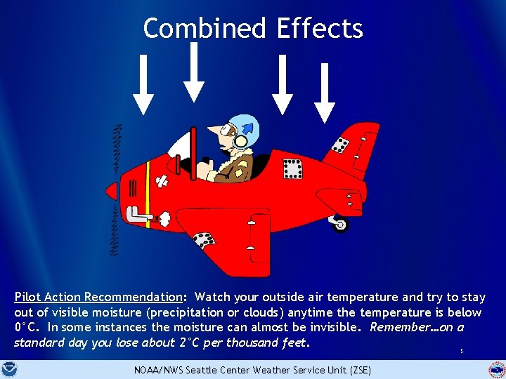
Combined Effects Pilot Action Recommendation: Watch your outside air temperature and try to stay out of visible moisture (precipitation or clouds) anytime the temperature is below 0°C. In some instances the moisture can almost be invisible. Remember…on a standard day you lose about 2°C per thousand feet. 5 NOAA/NWS Seattle Center Weather Service Unit (ZSE)

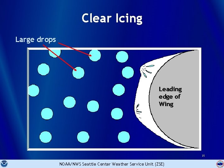
The Cause of Icing • NOT caused by ice in clouds. • Is caused by “super-cooled” liquid water droplets in clouds… – That strike the leading edge of an airfoil and – Freeze on impact • Aircraft must be in clouds or precipitation (visible water droplets) for icing to occur 6 NOAA/NWS Seattle Center Weather Service Unit (ZSE)

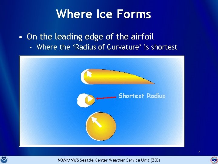
Where Ice Forms • On the leading edge of the airfoil – Where the ‘Radius of Curvature’ is shortest Shortest Radius 7 NOAA/NWS Seattle Center Weather Service Unit (ZSE)

Icing Severity Factors • Liquid water content (LWC) • Temperature • Droplet size • Cloud type 8 NOAA/NWS Seattle Center Weather Service Unit (ZSE)

Icing Severity Factors • Airfoil geometry • Airspeed • Duration of exposure 9 NOAA/NWS Seattle Center Weather Service Unit (ZSE)

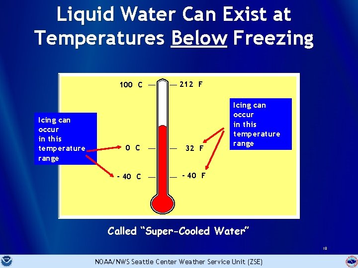
Liquid Water Can Exist at Temperatures Below Freezing 100 C Icing can occur in this temperature range 212 F 0 C 32 F - 40 C - 40 F Icing can occur in this temperature range Called “Super-Cooled Water” 10 NOAA/NWS Seattle Center Weather Service Unit (ZSE)

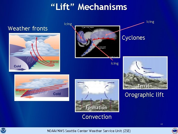
“Super-Cooled” Water Formation • Begins with water in liquid form • Initial water temp can be above freezing • Water is cooled rapidly, usually by “lifting” • Water remains in liquid state at temps well below freezing 11 NOAA/NWS Seattle Center Weather Service Unit (ZSE)

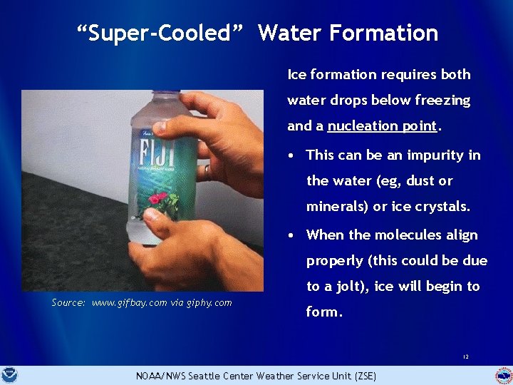
“Super-Cooled” Water Formation Ice formation requires both water drops below freezing and a nucleation point. • This can be an impurity in the water (eg, dust or minerals) or ice crystals. • When the molecules align properly (this could be due to a jolt), ice will begin to Source: www. gifbay. com via giphy. com form. 12 NOAA/NWS Seattle Center Weather Service Unit (ZSE)

“Lift” Mechanisms Weather fronts Icing Cyclones Icing Orographic lift Convection 13 NOAA/NWS Seattle Center Weather Service Unit (ZSE)

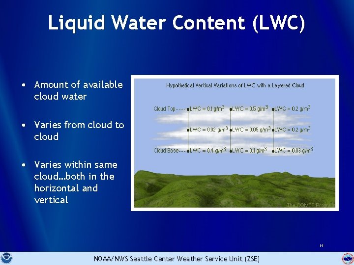
Liquid Water Content (LWC) • Amount of available cloud water • Varies from cloud to cloud • Varies within same cloud…both in the horizontal and vertical 14 NOAA/NWS Seattle Center Weather Service Unit (ZSE)

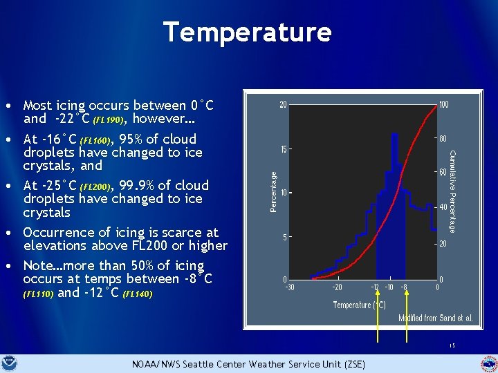
Temperature • Most icing occurs between 0°C and -22°C (FL 190), however… • At -16°C (FL 160), 95% of cloud droplets have changed to ice crystals, and • At -25°C (FL 200), 99. 9% of cloud droplets have changed to ice crystals • Occurrence of icing is scarce at elevations above FL 200 or higher • Note…more than 50% of icing occurs at temps between -8°C (FL 110) and -12°C (FL 140) 15 NOAA/NWS Seattle Center Weather Service Unit (ZSE)

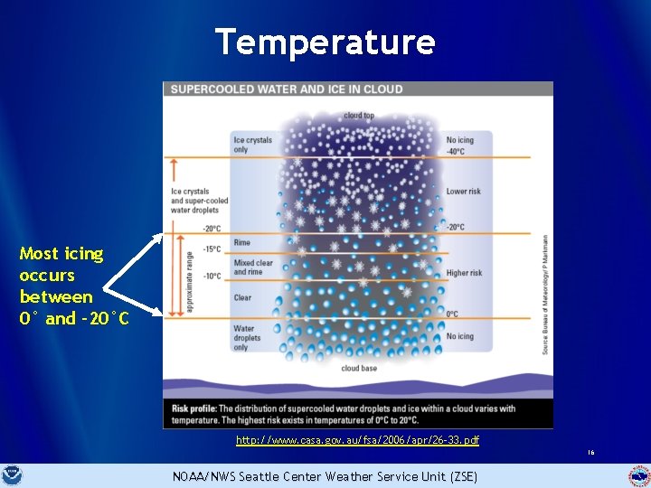
Temperature Most icing occurs between 0° and -20°C http: //www. casa. gov. au/fsa/2006/apr/26 -33. pdf 16 NOAA/NWS Seattle Center Weather Service Unit (ZSE)

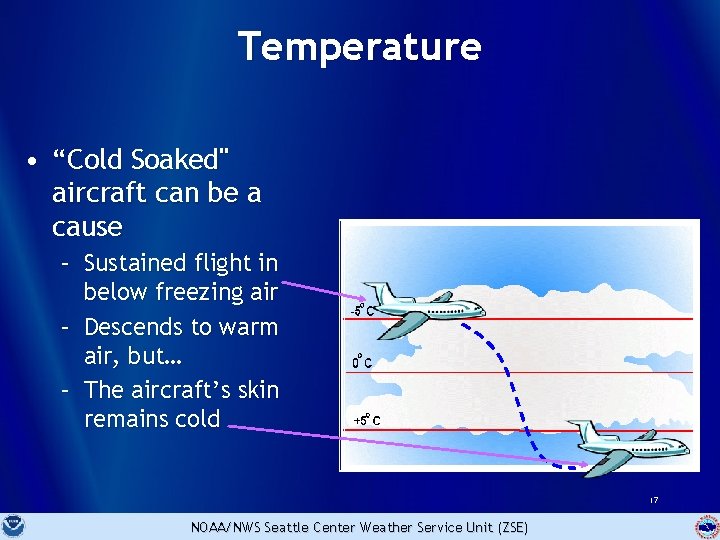
Temperature • “Cold Soaked" aircraft can be a cause – Sustained flight in below freezing air – Descends to warm air, but… – The aircraft’s skin remains cold 17 NOAA/NWS Seattle Center Weather Service Unit (ZSE)

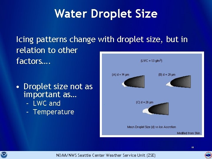
Water Droplet Size Icing patterns change with droplet size, but in relation to other factors…. • Droplet size not as important as… – – LWC and Temperature 18 NOAA/NWS Seattle Center Weather Service Unit (ZSE)

Cloud Type and Droplet Size • Cumulus - Large drops • Stratus - Small drops • High clouds - Ice crystals 19 NOAA/NWS Seattle Center Weather Service Unit (ZSE)

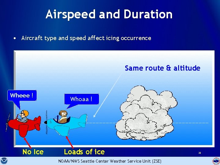
Airspeed and Duration • Aircraft type and speed affect icing occurrence Same route & altitude Wheee ! No Ice Whoaa ! Loads of ice NOAA/NWS Seattle Center Weather Service Unit (ZSE) 20

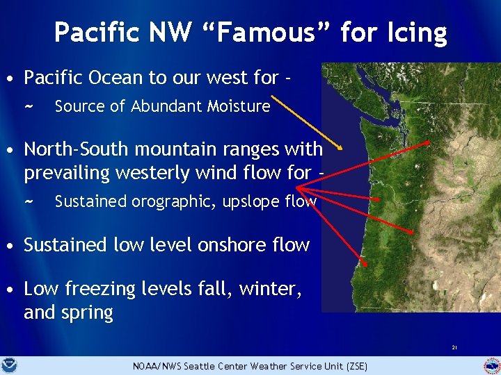
Pacific NW “Famous” for Icing • Pacific Ocean to our west for ~ Source of Abundant Moisture • North-South mountain ranges with prevailing westerly wind flow for ~ Sustained orographic, upslope flow • Sustained low level onshore flow • Low freezing levels fall, winter, and spring 21 NOAA/NWS Seattle Center Weather Service Unit (ZSE)

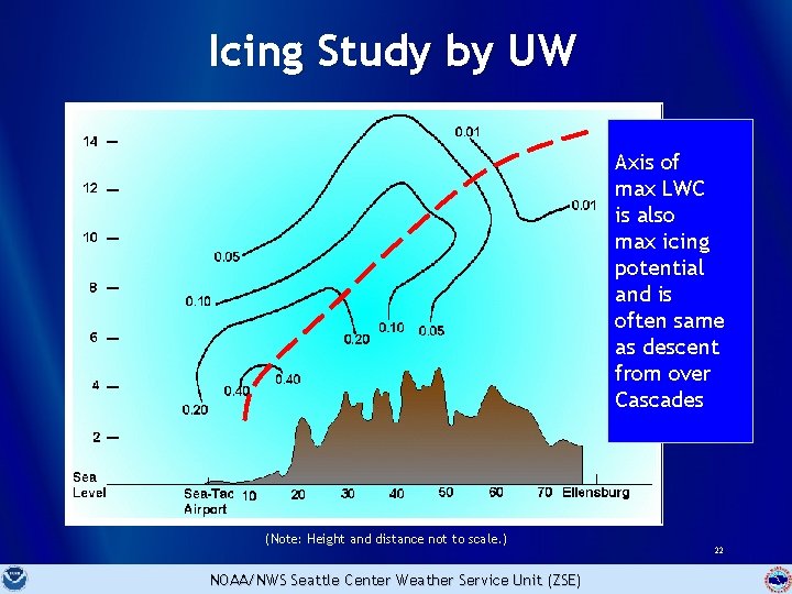
Icing Study by UW Axis of max LWC is also max icing potential and is often same as descent from over Cascades (Note: Height and distance not to scale. ) NOAA/NWS Seattle Center Weather Service Unit (ZSE) 22

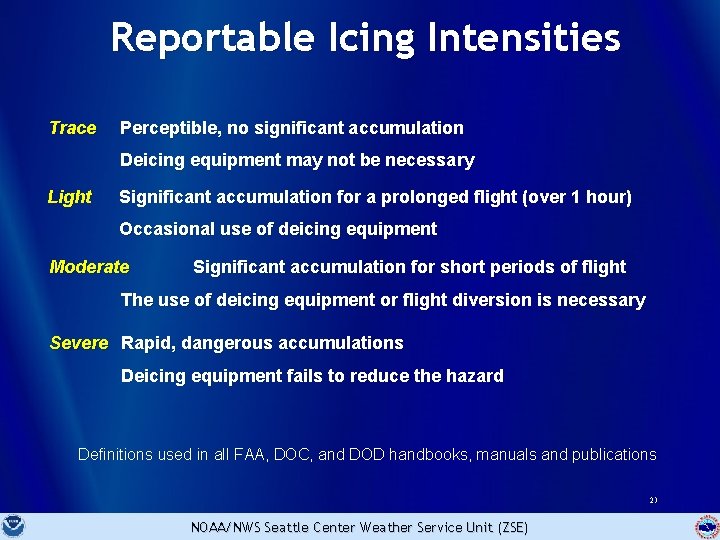
Reportable Icing Intensities Trace Perceptible, no significant accumulation Deicing equipment may not be necessary Light Significant accumulation for a prolonged flight (over 1 hour) Occasional use of deicing equipment Moderate Significant accumulation for short periods of flight The use of deicing equipment or flight diversion is necessary Severe Rapid, dangerous accumulations Deicing equipment fails to reduce the hazard Definitions used in all FAA, DOC, and DOD handbooks, manuals and publications 23 NOAA/NWS Seattle Center Weather Service Unit (ZSE)

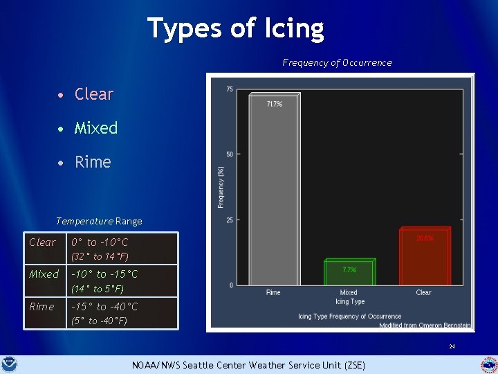
Types of Icing Frequency of Occurrence • Clear • Mixed • Rime Temperature Range Clear 0° to -10°C (32° to 14°F) Mixed -10° to -15°C (14° to 5°F) Rime -15° to -40°C (5° to -40°F) 24 NOAA/NWS Seattle Center Weather Service Unit (ZSE)

Clear Icing Large drops Leading edge of Wing 25 NOAA/NWS Seattle Center Weather Service Unit (ZSE)

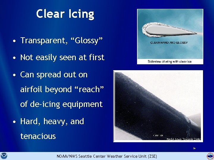
Clear Icing • Transparent, “Glossy” • Not easily seen at first • Can spread out on airfoil beyond “reach” of de-icing equipment • Hard, heavy, and tenacious 26 NOAA/NWS Seattle Center Weather Service Unit (ZSE)

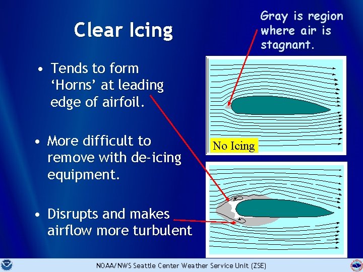
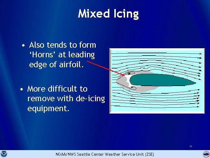
Gray is region where air is stagnant. Clear Icing • Tends to form ‘Horns’ at leading edge of airfoil. • More difficult to remove with de-icing equipment. No Icing • Disrupts and makes airflow more turbulent 27 NOAA/NWS Seattle Center Weather Service Unit (ZSE)

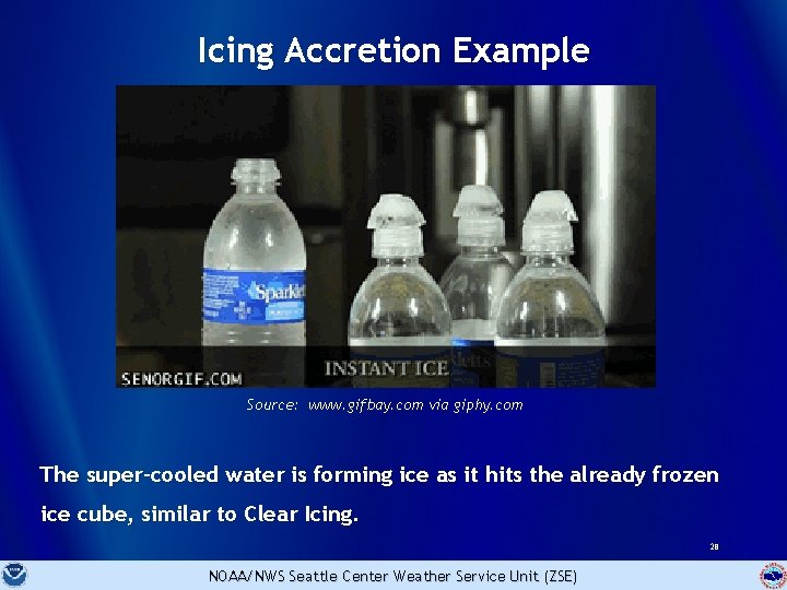
Icing Accretion Example Source: www. gifbay. com via giphy. com The super-cooled water is forming ice as it hits the already frozen ice cube, similar to Clear Icing. 28 NOAA/NWS Seattle Center Weather Service Unit (ZSE)

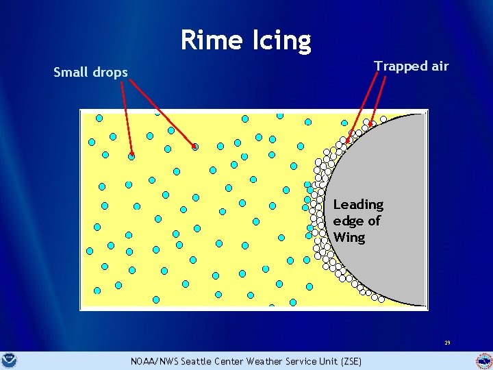
Rime Icing Trapped air Small drops Leading edge of Wing 29 NOAA/NWS Seattle Center Weather Service Unit (ZSE)

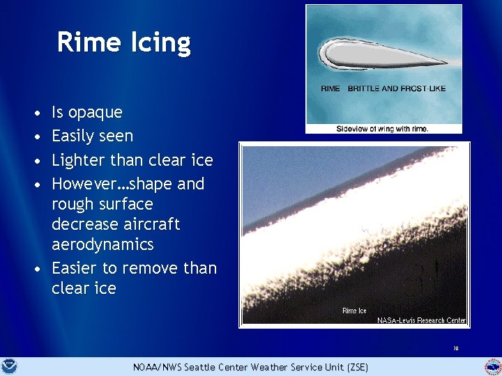
Rime Icing • • Is opaque Easily seen Lighter than clear ice However…shape and rough surface decrease aircraft aerodynamics • Easier to remove than clear ice 30 NOAA/NWS Seattle Center Weather Service Unit (ZSE)

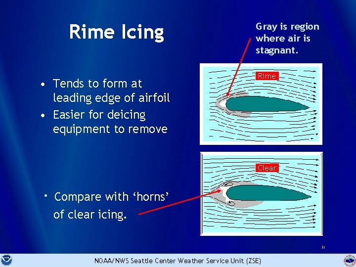
Rime Icing • Tends to form at leading edge of airfoil • Easier for deicing equipment to remove Gray is region where air is stagnant. Rime Clear • Compare with ‘horns’ of clear icing. 31 NOAA/NWS Seattle Center Weather Service Unit (ZSE)

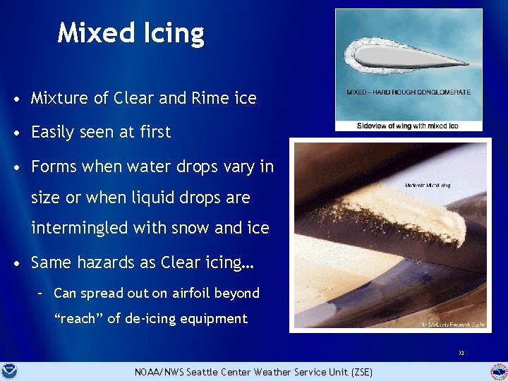
Mixed Icing • Mixture of Clear and Rime ice • Easily seen at first • Forms when water drops vary in size or when liquid drops are intermingled with snow and ice • Same hazards as Clear icing… – Can spread out on airfoil beyond “reach” of de-icing equipment 32 NOAA/NWS Seattle Center Weather Service Unit (ZSE)

Mixed Icing • Also tends to form ‘Horns’ at leading edge of airfoil. • More difficult to remove with de-icing equipment. 33 NOAA/NWS Seattle Center Weather Service Unit (ZSE)

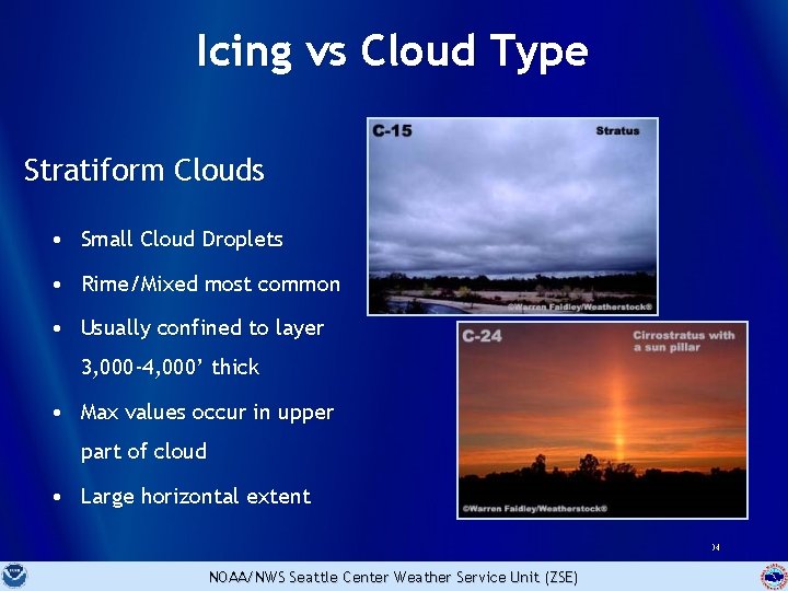
Icing vs Cloud Type Stratiform Clouds • Small Cloud Droplets • Rime/Mixed most common • Usually confined to layer 3, 000 -4, 000’ thick • Max values occur in upper part of cloud • Large horizontal extent 34 NOAA/NWS Seattle Center Weather Service Unit (ZSE)

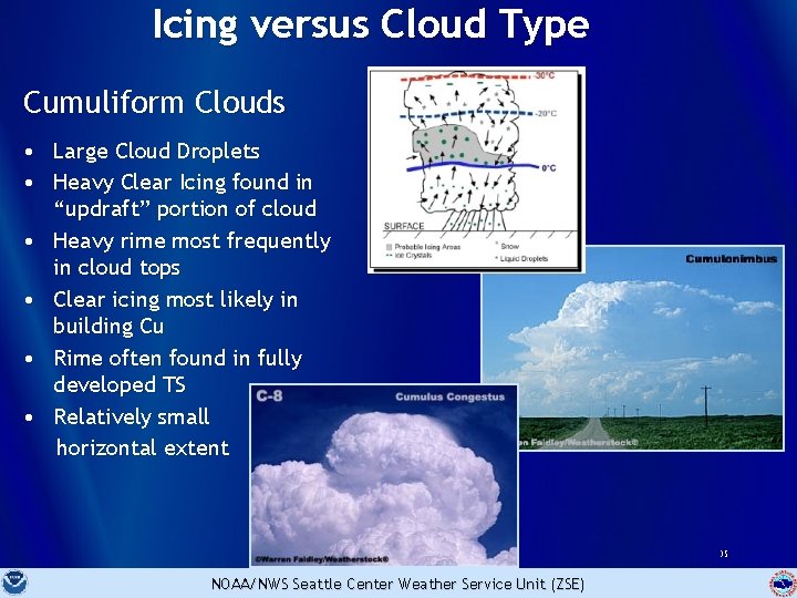
Icing versus Cloud Type Cumuliform Clouds • Large Cloud Droplets • Heavy Clear Icing found in “updraft” portion of cloud • Heavy rime most frequently in cloud tops • Clear icing most likely in building Cu • Rime often found in fully developed TS • Relatively small horizontal extent 35 NOAA/NWS Seattle Center Weather Service Unit (ZSE)

Icing versus Cloud Type • Previous statements “generally” true… • BUT research has found… – Mixed-phase clouds of all types may harbor sufficient amounts of Super-Cooled water. 36 NOAA/NWS Seattle Center Weather Service Unit (ZSE)

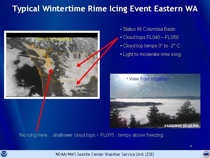
Typical Wintertime Rime Icing Event Eastern WA • Status fill Columbia Basin * View from satellite * • Cloud tops FL 040 – FL 050 • Cloud top temps 0° to -2° C • Light to moderate rime icing * View from ridgetop * No icing here …shallower cloud tops ~ FL 015…temps above freezing 37 NOAA/NWS Seattle Center Weather Service Unit (ZSE)

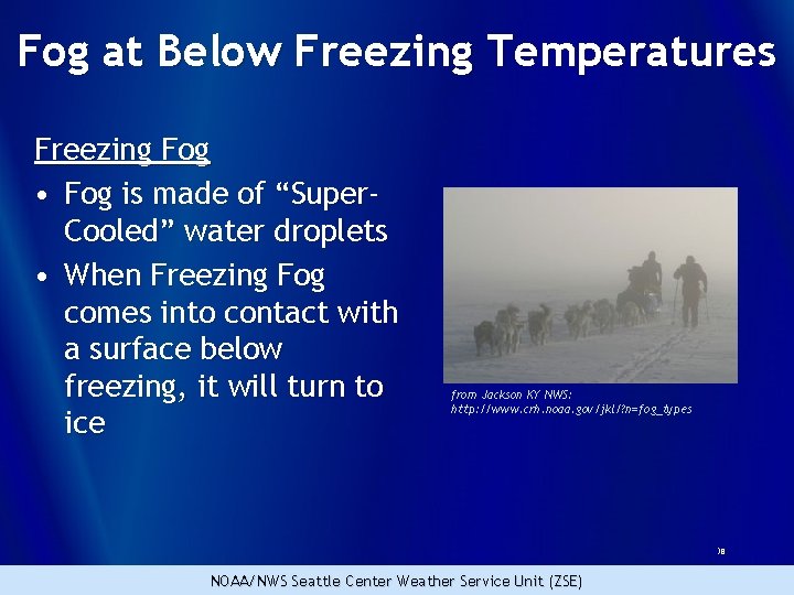
Fog at Below Freezing Temperatures Freezing Fog • Fog is made of “Super. Cooled” water droplets • When Freezing Fog comes into contact with a surface below freezing, it will turn to ice from Jackson KY NWS: http: //www. crh. noaa. gov/jkl/? n=fog_types 38 NOAA/NWS Seattle Center Weather Service Unit (ZSE)

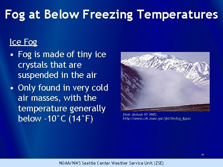
Fog at Below Freezing Temperatures Ice Fog • Fog is made of tiny ice crystals that are suspended in the air • Only found in very cold air masses, with the temperature generally below -10°C (14°F) from Jackson KY NWS: http: //www. crh. noaa. gov/jkl/? n=fog_types 39 NOAA/NWS Seattle Center Weather Service Unit (ZSE)

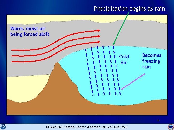
Freezing Rain • Occurs when warm, moist air is forced over cold (often dry) air. • Forcing can be done by – Terrain (Mountains) – Fronts – Cold air outflow (Columbia River Gorge) 40 NOAA/NWS Seattle Center Weather Service Unit (ZSE)

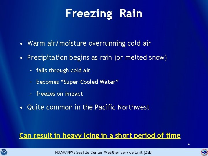
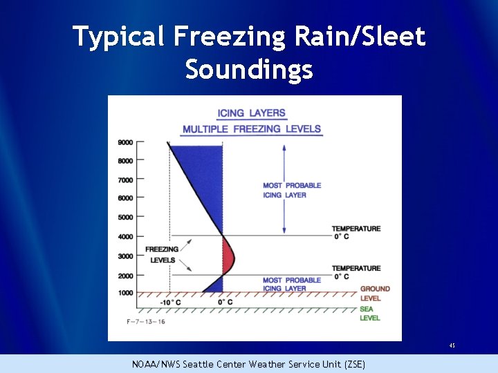
Freezing Rain • Warm air/moisture overrunning cold air • Precipitation begins as rain (or melted snow) – falls through cold air – becomes “Super-Cooled Water” – freezes on impact • Quite common in the Pacific Northwest Can result in heavy icing in a short period of time 41 NOAA/NWS Seattle Center Weather Service Unit (ZSE)

Precipitation begins as rain Warm, moist air being forced aloft Cold Air Becomes freezing rain 42 NOAA/NWS Seattle Center Weather Service Unit (ZSE)

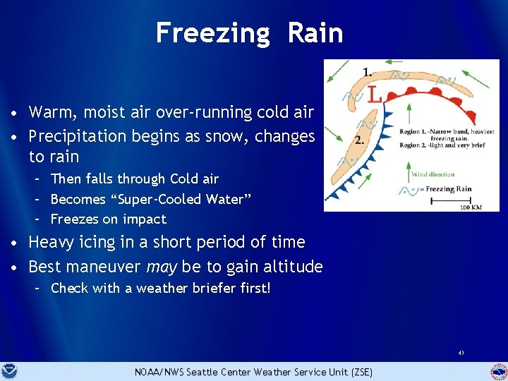
Freezing Rain • Warm, moist air over-running cold air • Precipitation begins as snow, changes to rain – – – Then falls through Cold air Becomes “Super-Cooled Water” Freezes on impact • Heavy icing in a short period of time • Best maneuver may be to gain altitude – Check with a weather briefer first! 43 NOAA/NWS Seattle Center Weather Service Unit (ZSE)

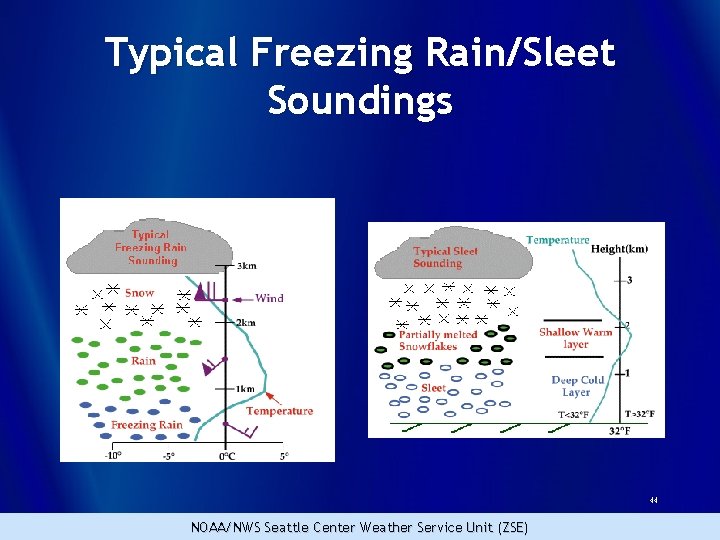
Typical Freezing Rain/Sleet Soundings 44 NOAA/NWS Seattle Center Weather Service Unit (ZSE)

Typical Freezing Rain/Sleet Soundings 45 NOAA/NWS Seattle Center Weather Service Unit (ZSE)

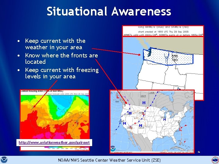
Situational Awareness • Keep current with the weather in your area • Know where the fronts are located • Keep current with freezing levels in your area http: //www. aviationweather. gov/gairmet 46 NOAA/NWS Seattle Center Weather Service Unit (ZSE)

Situational Awareness • Know the cloud bases • Know the cloud tops…light, non-turbo aircraft may not be able to climb above 8, 000 ft. Once on top…can they stay there? • Are clouds air mass or frontal? Frontal clouds cover larger areas…aircraft flying through frontal clouds may experience icing conditions for a longer period of time. • Are alternate routes available…around fronts or around mountains? • More about this in the next presentation…. NOAA/NWS Seattle Center Weather Service Unit (ZSE) 47

Thank you for your participation! Further questions can be directed to the Center Weather Service Unit in Auburn, Washington James. Vasilj@noaa. gov 48 NOAA/NWS Seattle Center Weather Service Unit (ZSE)

49