National Weather Service Weather Forecast Office Mobile Pensacola

National Weather Service Weather Forecast Office Mobile - Pensacola Special Briefing Update 1030 AM CDT Wednesday 10 April 2013

This outlook is intended for interests across interior southeast Mississippi, southwest and south central Alabama, the western Florida Panhandle, and the adjacent Gulf coastal waters of Alabama and northwest Florida

Current Situation Around 930 AM Wednesday • Strengthening southeast winds 15 to 25 mph. Periodic gusts to 30 mph. • Temperatures warming into the lower to middle 80 s. • Scattered thunderstorms will be mainly west of the Mississippi River.

Severe Storm Potential Thursday
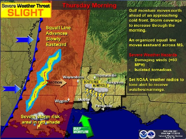
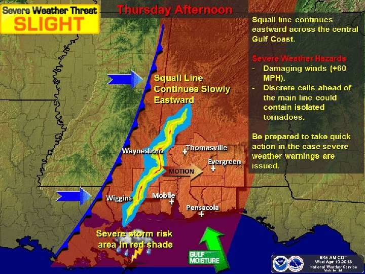
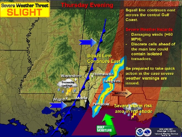

Projected Severe Weather Risk Southeast Mississippi, South Alabama, Northwest Florida for Thursday 11 April 2013 NOAA – NWS Forecast Office Mobile/Pensacola High Moderate Slight None Straight Line Wind Damage Tornadoes Hail Flash Flooding

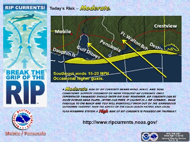
Coastal, Beach and Marine Impacts Coastal Alabama, Western Florida Panhandle for Thursday 11 April 2013 NOAA – NWS Forecast Office Mobile/Pensacola High Moderate Minor None Wind Waves Coastal Flood Rip Currents Rough Surf

Storm Total Rainfall Late Tonight into Thursday Evening • Rainfall rates will result in minor rises along rivers…none forecast to go to flood stage at this point. • We could see some localized flash flooding of poor drainage areas and small streams where localized higher amounts occur Thursday afternoon into Thursday evening.

weather. gov/mob Briefing Slides and Imagery
")
weather. gov/mob River Forecasts (Rivers / Lakes)
- Slides: 13