National Weather Service Weather Forecast Office Mobile Pensacola

National Weather Service Weather Forecast Office Mobile - Pensacola Special Briefing Update 10 AM CST Monday 25 February 2013

This outlook is intended for interests across interior southeast Mississippi, southwest and south central Alabama, the western Florida Panhandle, and the adjacent Gulf coastal waters of Alabama and northwest Florida

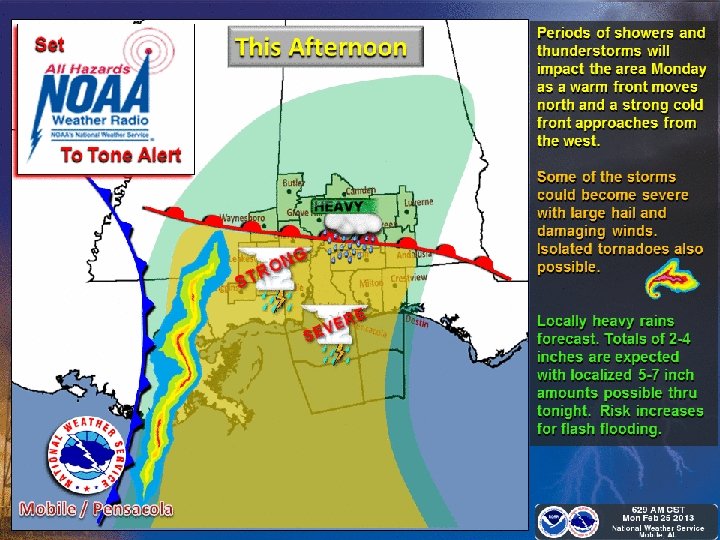
Current Situation Around 930 AM Monday • A warm front over the northern Gulf of Mexico is making slow progress north to the coastline through the morning. • Scattered thunderstorms will re-develop to the west and gradually become more numerous during the afternoon.

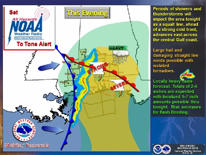
Today into This Evening Severe Storm Potential Just issued! Tornado Watch Likely. . .

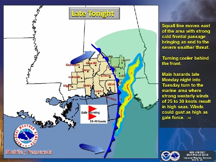
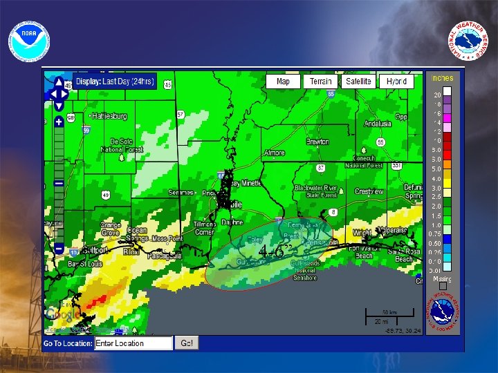
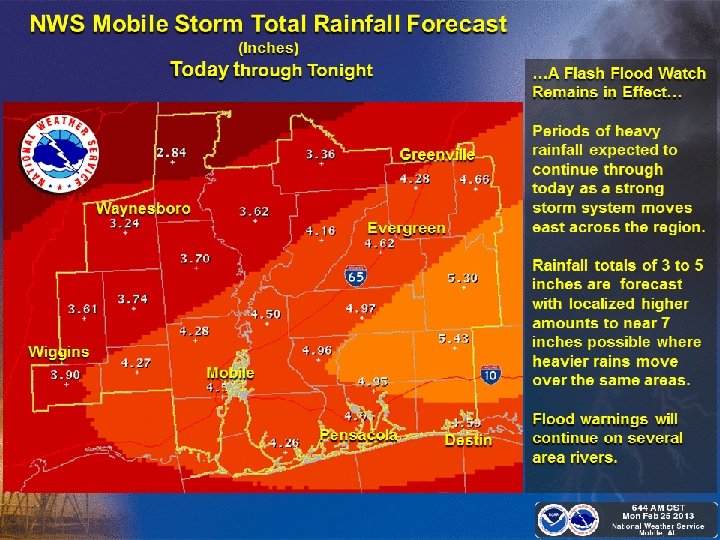
Event Summary • A slow moving warm front will slowly advance from the northern Gulf to central Mississippi and Alabama through the mid afternoon. Widespread showers with embedded scattered strong to isolated severe thunderstorms will re-develop this afternoon into tonight as the warm front moves to Highway 84. • There is a slight chance of severe storms with isolated downburst winds, large hail and tornadoes this afternoon into this evening. • 2 to 4 inches of rain on average is expected through tonight with locally higher amounts to near 7 inches possible over SE Mississippi, south Alabama and the western Florida panhandle. • This heavy rainfall will result in localized flash flooding of small streams and flood prone areas today into early Tuesday. These impacts could linger into midweek even though the rain by then will move east of the region. Mostly minor flooding will result on several larger rivers due to runoff.

Projected Severe Weather Risk Southeast Mississippi, South Alabama, Northwest Florida for Monday 23 February NOAA – NWS Forecast Office Mobile/Pensacola High Moderate Slight None Straight Line Wind Damage Tornadoes Hail Flash Flooding

weather. gov/mob Latest Timing and Impacts

weather. gov/mob Briefing Slides and Imagery
")
weather. gov/mob River Forecasts (Rivers / Lakes)

Chickasawhay River Forecast

Leaf and Pascagoula River Forecast

Tombigbee and Alabama River Forecast

Mobile River and Bayou Sara Forecast

Fish and Styx River Forecast

Murder and Burnt Corn Creek Forecast

Conecuh and Escambia River Forecast

Blackwater & Big Coldwater River Forecast

Yellow and Shoal River Forecast

No additional Webinar briefings scheduled for this event Email updates, watches, warnings and statements from NWS Mobile will follow as necessary to give additional information

• NWS Mobile Storm Reports Desk… – 800 -284 -9059 • NWS Mobile Website Direct… – www. weather. gov/mob • Facebook… – www. facebook. com/US. National. Weather. Service. Mobile. gov • Twitter… – Twitter. com/nwsmobile or @NWSMobile
- Slides: 25