AviationTurbulence Forecasting Aviation Weather Center AWC National Weather

Aviation/Turbulence Forecasting
 • National Weather Service office • Turbulence, flight rules, upper")
Aviation Weather Center (AWC) • National Weather Service office • Turbulence, flight rules, upper level progs
")
SIGWX Charts (High-level)
")
Streamlines at 36, 000 ft. (other levels available)

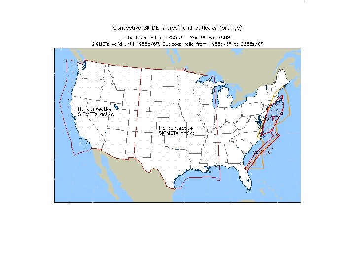
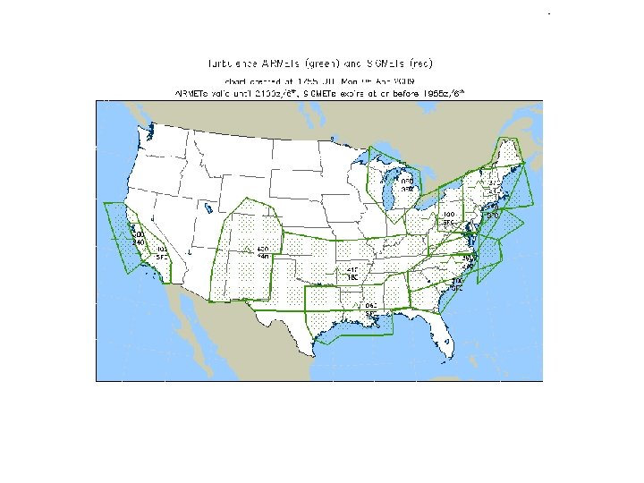
Convective SIGMETS
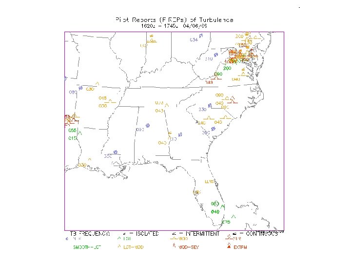

Forecasting Aviation Turbulence • Complicated – Topography – Convection – Mechanical forcing – Microscale • Cannot be resolved by NWP models • Approach: Analyze synoptic patterns that create or allow turbulence
 • Developed by National Center for Atmospheric Research (NCAR) •")
Graphical Turbulence Guidance (GTG) • Developed by National Center for Atmospheric Research (NCAR) • Uses RUC (Rapid Update Cycle) 20 km grids and observations of turbulence/lightning • Combines 11 different turbulence forecasting tools through a weighting function • Produces upper-level clear-air turbulence (CAT) prediction • Output is a number from 0 -1

This value is used in coordination with other observations to produce a 3, 6, 9, and 12 hour forecast of turbulence

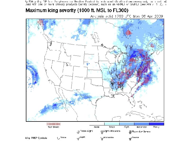
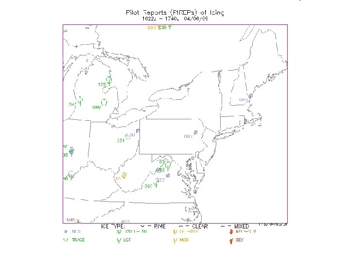
Turbulence Guidance

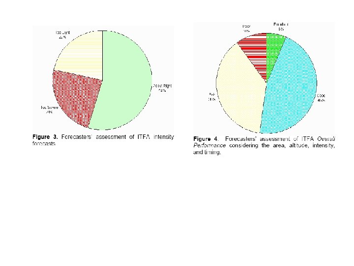
How Good is GTG? Kelsch et al. , 2004, AMS
 Forecasts (TAFs) • Surface forecast for hundreds of airport terminals around")
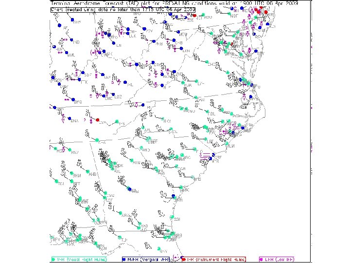
Terminal Aviation (Aerodrome) Forecasts (TAFs) • Surface forecast for hundreds of airport terminals around the country – Use METAR code – Produced by a human (not always at the reporting site) – Can be more accurate than NWP models • Local effects
 at 1120 Z")
Station Report issued 2 nd day of the month (April 2) at 1120 Z Forecast Wind at 12 Z today Valid for 12 Z today thru 12 Z tomorrow Sky Condition at 12 Z 6+ miles visibility TAF KAVL 021120 Z 021212 34010 G 20 KT P 6 SM SCT 025 BKN 250 FM 1500 35008 KT P 6 SM SCT 040 BKN 100 FM 0000 VRB 04 KT P 6 SM BKN 035 FM 0800 16005 KT P 6 SM BKN 025 15 Z forecast today 00 Z forecast tomorrow 08 Z forecast tomorrow Line that begins with “TEMPO” indicates temporary or occasional conditions (e. g. fog, visibility) within a time period specified TEMPO 0912 2 SM BR OVC 010

Flight Path Tool http: //adds. aviationweather. gov/flight_path/
- Slides: 21