
National Weather Service Weather Forecast Office Mobile Pensacola
National Weather Service Weather Forecast Office Mobile - Pensacola Special Update Tropical Storm Karen 11 AM CDT Thursday 3 October 2013
This outlook is intended for interests across interior southeast Mississippi, south Alabama, the western Florida Panhandle, and the adjacent Gulf coastal waters of Alabama and northwest Florida
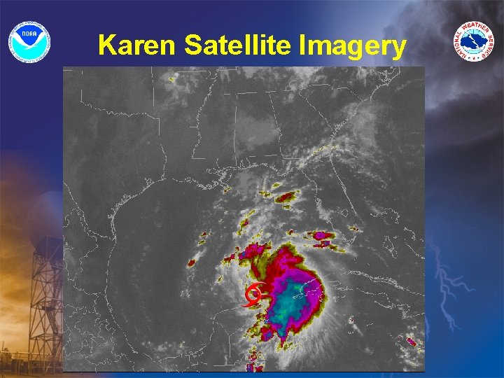
Karen Satellite Imagery
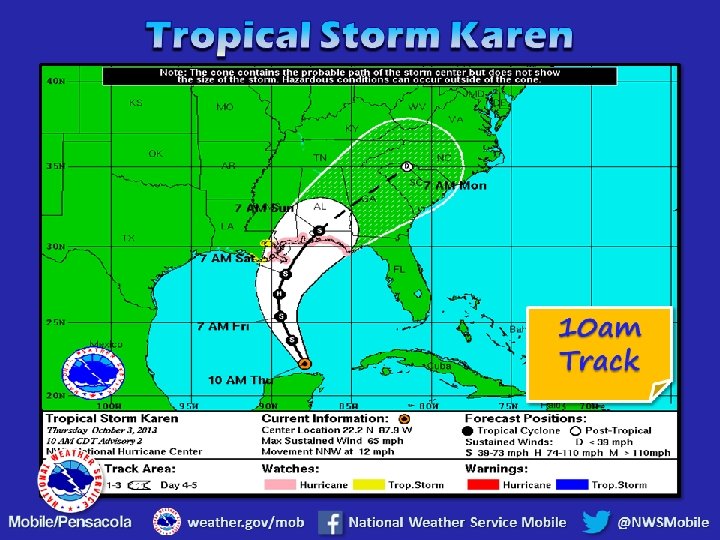
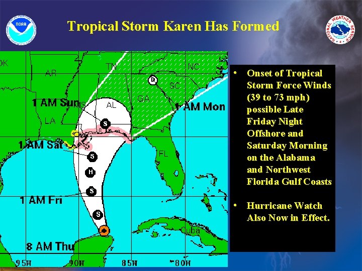
Tropical Storm Karen Has Formed • Onset of Tropical Storm Force Winds (39 to 73 mph) possible Late Friday Night Offshore and Saturday Morning on the Alabama and Northwest Florida Gulf Coasts • Hurricane Watch Also Now in Effect.
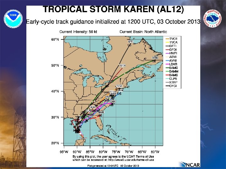
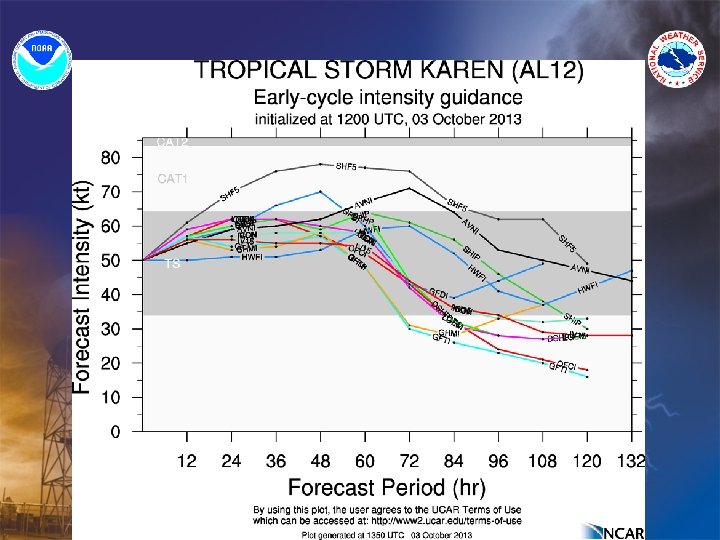
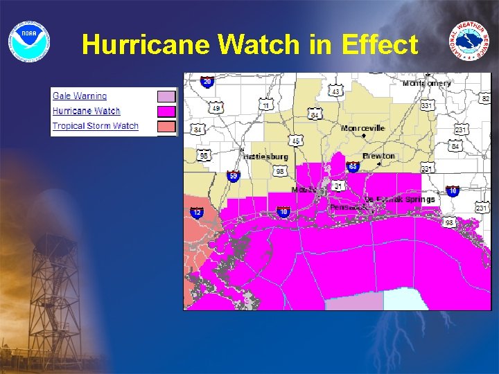
Hurricane Watch in Effect
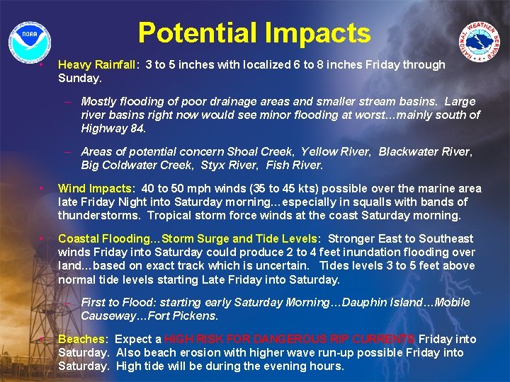
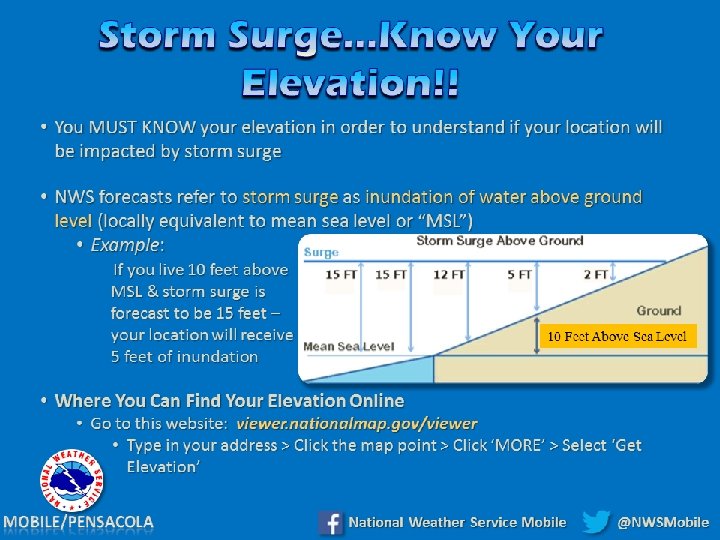
Potential Impacts • Heavy Rainfall: 3 to 5 inches with localized 6 to 8 inches Friday through Sunday. – Mostly flooding of poor drainage areas and smaller stream basins. Large river basins right now would see minor flooding at worst…mainly south of Highway 84. – Areas of potential concern Shoal Creek, Yellow River, Blackwater River, Big Coldwater Creek, Styx River, Fish River. • Wind Impacts: 40 to 50 mph winds (35 to 45 kts) possible over the marine area late Friday Night into Saturday morning…especially in squalls with bands of thunderstorms. Tropical storm force winds at the coast Saturday morning. • Coastal Flooding…Storm Surge and Tide Levels: Stronger East to Southeast winds Friday into Saturday could produce 2 to 4 feet inundation flooding over land…based on exact track which is uncertain. Tides levels 3 to 5 feet above normal tide levels starting Late Friday into Saturday. – First to Flood: starting early Saturday Morning…Dauphin Island…Mobile Causeway…Fort Pickens. • Beaches: Expect a HIGH RISK FOR DANGEROUS RIP CURRENTS Friday into Saturday. Also beach erosion with higher wave run-up possible Friday into Saturday. High tide will be during the evening hours.
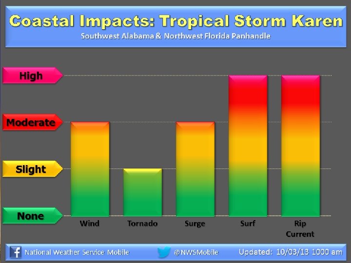
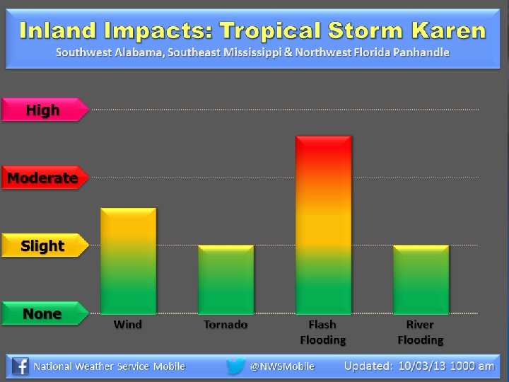
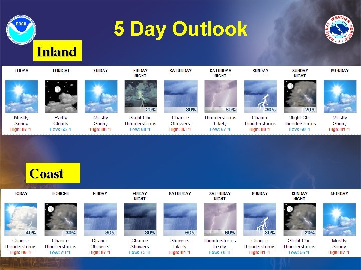
5 Day Outlook Inland Coast
- Slides: 13