Esri International User Conference San Diego CA Technical


 - Using HTTP GET / POST")


")


")
 • Serving pre-cached map tiles –")
 • Highlights • Cache creation and")


 • Geospatial processes over the web")
 - u. Dig")

- Slides: 56
Esri International User Conference | San Diego, CA Technical Workshops | Jul. 14 th 2011 Leveraging OGC Services in Arc. GIS Server Satish Sankaran <ssankaran@esri. com> Yingqi Tang <ytang@esri. com>
Agenda • Interoperability Enablers • OGC and esri • OGC Web Services • Arc. GIS and OGC Web Services - @ version 10. 0 - @ version 10. 1
Arc. GIS 10 — A Complete System Cloud Web Mobile • Discover • Create • Manage • Visualize • Analyze • Collaborate Enterprise Local Desktop A
Arc. GIS Server is Open & Interoperable Using Standards to Integrate with Any System Web • REST, SOAP XML, KML, . . . OGC • GML, WFS, WMS, WCS. . . Virtual Earth Enterprise Integration Google • SOAP, XML, EJB, SQL Application Content • CAD, Image, PDF Auto. CAD Any Client/Any Application SAP Imagine ENVI Ionic Geo. Media Standards Arc. GIS Server Map. Info
Interoperability Enablers • ETL Interoperability - • • DGN, DWG, MIF Interoperability through Open Standards - OGC Simple Features - SF-SQL, SF-OLE/COM - GML, OGC KML - OGC Web Services - WMS, WFS, WCS, CS-W, OGC KML, WPS, WMTS Interoperability through Open Specifications - Shapefiles, File Geodatabase API, Geoservices Specification - Geo. RSS, KML
De Facto Where does OGC fit in the ‘standards’ world? ISO & Other National Domains: o. Object/Abstract o. Models o. Content o. Vocabulary SLD OGC OASIS/IETF / W 3 C Infrastructure: o WSDL o UDDI o SOAP o XML Software Interfaces: Instantiate domain and de jure standards into infrastructure WMS De Jure CS-W KML WFS-T WFS Domain WCS GML SOS Infrastructure
ESRI’s OGC Participation Serving many roles within OGC – Principal member – Actively participates: • Technical Committee • Planning Committee • Board of Directors • All three OGC programs – Interoperability program – Standards program – Community Outreach and Adoption program – Architecture Board – Chair Standards and Domain Working Groups
I-295 I- I 8 95 OGC Web Services 7 Web Map Service Geospatial “picture” publishing/viewing service Web Feature Service Geospatial feature publishing/streaming service I 8 I 95 I-295 7 Web Coverage Service Imagery and gridded data publishing/processing service Keyhole Markup Language Service Geospatial feature publishing/streaming service
Arc. GIS Server - Supporting OGC Services Building open and interoperable Systems Arc. GIS Desktop Google Earth Arc. GIS Web ADF Arc. Explorer Imagine ENVI Gaia Auto. CAD gv. Sig Open. Layers OGC Services Geo. Media Ionic Standards QGIS u. Dig Arc. GIS Server Map. Info
Service Oriented Architecture Arc. GIS Supports Interoperability for: Service Client Requester Fi nd nd Bi t ac er Int - Spatial Data Infrastructures Service Broker Publish Service Provider - Service Enterprise Architectures Description - Neogeography, Mashup and WEB 2. 0 environments Service Description
OGC Service Encodings • Key Value Pair (KVP) - Using HTTP GET / POST • SOAP • RESTful
RESTful Encoding / Style Richardson Maturity Model http: //martinfowler. com/articles/richardson. Maturity. Model. html
9. 3 9. 2 WMS 10. 0 § WMS on Map. Service § 1. 0. 0, 1. 1. 1, 1. 3. 0 § Get. Capabilities § Get. Map § Get. Feature. Info § Arc. GIS Desktop client § Web. ADF client § Add WMS on Image. Service § Styled Layer Descriptors (SLD) § publish multiple styles at server side § send external styles through “SLD” § Filter Encoding (FE) in SLD § Security (inherits Arc. GIS Server Security Framework) § Add WMS on optimized map service § Support SLD_BODY § Support Get. Style § Support Get. Legend. Graphic § Support WMS-T (TIME) § KML on Map. Service § KML 2. 1 WMTS § Add WMTS on cached map service § KML on Image. Service and Geo. Data. Service § KML through Arc. GIS REST API § Bug fixes WCS § Bug fixes KML 10. 1 § KML 2. 2 (to OGC namespace) § Support TIME in KML § Bug fixes § WCS on Map. Service § WCS on Image. Service § WCS on Geo. Data. Service § 1. 0. 0, 1. 1. 1 § Get. Capabilities § Describe. Coverage § Get. Coverage § Bug fixes § Updated “Make WCS layer” GP tool § Add WCS on Optimized Map § Bug fixes Service § Ass TIME support § “Make WCS layer” GP tool § Arc. GIS Desktop client WFS § WFST on Map. Service § WFST on Geo. Data. Service § 1. 1. 0 OGC Services Support 9. 2 – 10. 1 § Get. Capabilities § Describe. Feature. Type § Get. Feature. With. Lock § Transaction § Add WFST 1. 0. 0 (9. 3 SP 1) § Add WFS on Optimized Map. Service § Add WFST on non-versioned § Performance enhancement § Bug fixes geodatabase § Bug fixes WPS § Add WPS on Geoprocessing § Data Interoperability Extension § WFS to Feature. Class GP tool Service
OGC Services in Arc. GIS Server - Architecture Implemented as capabilities of Arc. GIS Server services - Map Service - WMS, WCS, WFS, KML, WMTS (10. 1) - Image Service - WMS, WCS, KML - Geo. Data Service - WCS, WFS, KML - Geoprocessing Service - WPS (10. 1)
OGC Services in Arc. GIS Server - Architecture • Inherit from Arc. GIS Server services - Rich features from Arc. Objects - cartography, geodatabase, caching, geoprocessing etc. - Good authoring and publishing work flow - Scalability and Durability in distributed environment - Performance - Security mechanism
WMS in Arc. GIS Server • Serving map, legend, styles and limited feature data - Supported versions - 1. 0. 0, 1. 1. 1, 1. 3. 0 - Supported operations - Get. Capabilities - Get. Map - Get. Feature. Info - Get. Style - Get. Legend. Graphic
WMS in Arc. GIS Server – Cont. • Highlights - Styled Layer Descriptor (SLD) - Support both OGC Symbology and Filter encoding spec - Support SLD and SLD_BODY parameter - Get. Styles and Get. Legend. Graphic - TIME - XSLT template for Get. Feature. Info - Security (http basic, digest, token based)
SLD work flow Step 4: 4: Push SLD back to server using “SLD_BODY” Step 1: 1: Data and map document Arc. GIS Servers OGC WMS Internet WMS clients Step 3: 3: Get. Styles return SLD definition for Named-style Step 2: 2: publish additional “Named-Style” SLD XML
Customize Get. Feature. Info response using XSLT template to embed pictures Data and Map document XSLT template to embed videos Default response Arc. GIS Servers OGC WMS Internet WMS client Default XSLT template for Get. Feature. Info response XSLT template to embed JS code
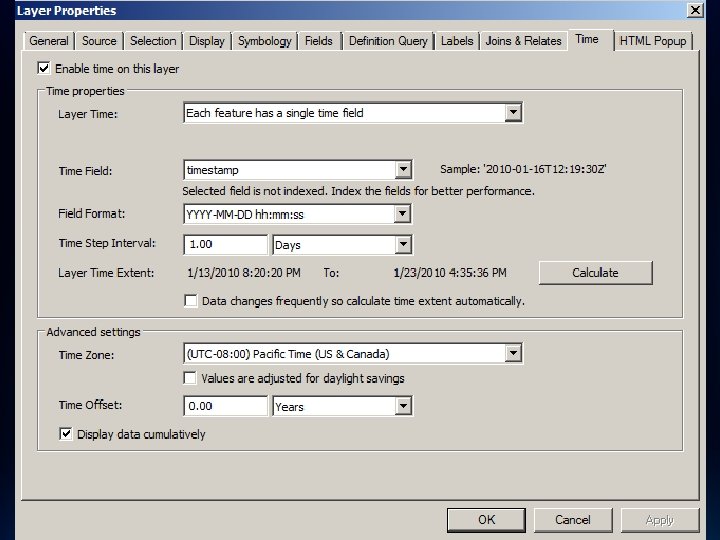
WMS TIME support
… http: //. . . request=Get. Map. . . &TIME=2010 -01 -13 T 00: 00 http: //. . . request=Get. Map. . . &TIME=2010 -01 -14 T 00: 00 http: //. . . request=Get. Map. . . &TIME=2010 -01 -15 T 00: 00 http: //. . . request=Get. Map. . . &TIME=2010 -01 -16 T 00: 00 …
KML in Arc. GIS Server • Serving dynamic/cached maps and imagery, 2 D/3 D vectors - Supported versions - 2. 2, no extensions - Supported operations - Generate. KML (Mapping: 2 D/3 D vectors and/or Ground. Overlays) - Query (Mapping: 2 D/3 D vectors) - Execute (GP only) - Reverse. Geocode (Geocode only) - Supported resources - map. Image. kmz (Mapping and Imaging: Region based Ground. Overlays) - Map. Server? f=kmz (footprint) - Image. Server? f=kmz (footprint)
KML in Arc. GIS Server – Cont. • Highlights - Regions for cached services - 2 D and 3 D vectors with extrusion expressions - Simple renderers (lines and polygons) with transparency - Labeling for point placemarks - HTML popups with xsl styling - Time - Legends
WMS and KML Demo • Leverage Arc. GIS Server WMS in QGIS • Leverage Arc. GIS Server WMS in Arc. GIS. com • Time Slider in Arc. Map with Time enabled WMS • Leverage KML in Google Earth
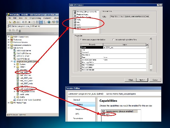
WFS in Arc. GIS Server • Data service, serving out geographic feature data – Version implemented • 1. 0. 0, 1. 1. 0 – WFS interfaces implemented • • Get. Capabilities Describe. Feature Get. Feature Transaction
WFS in Arc. GIS Server • Highlights - Simple Features GML - Transactions on versioned data - Transactions on non-versioned data - Field Aliases and Visibility Constraints - Default. Max. Features property - Security (http basic, digest and token based)
WFS/WFST work flow WFS viewer WFS service Default version No n- Reconcile ve r si on ed Ed Internet iti ng Arc. Map Versioned Editing WFS version Arc. SDE Geodatabase WFST service Arc. GIS Server Edits WFST editor
Arc. GIS as a WFS Client Data Interoperability Extension Internet Arc. GIS Desktop Data Interop Connection WFS services Arc. Map WFS to Feature Class GP tool Internet WFS services Geoprocessing tool Geodatabase Feature Class
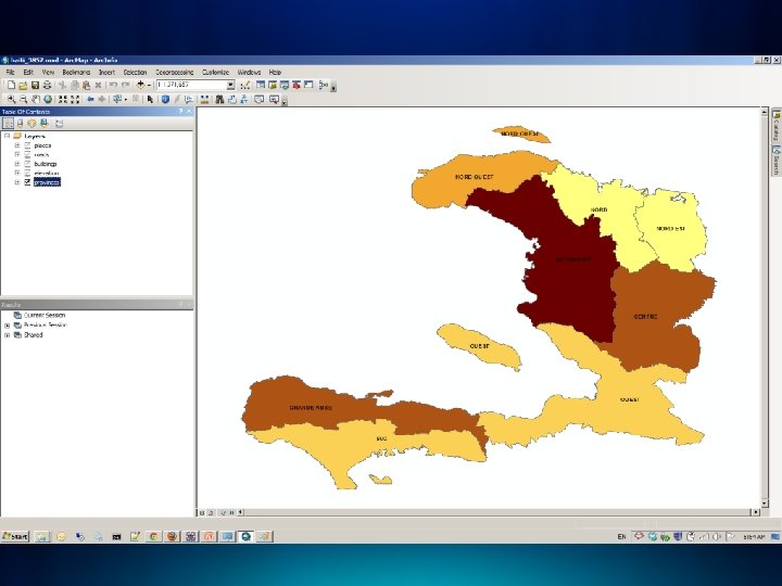
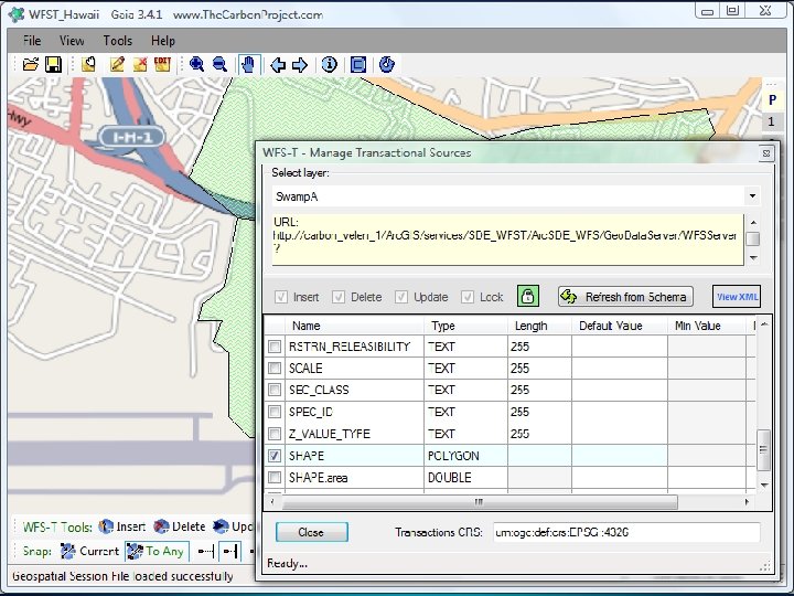
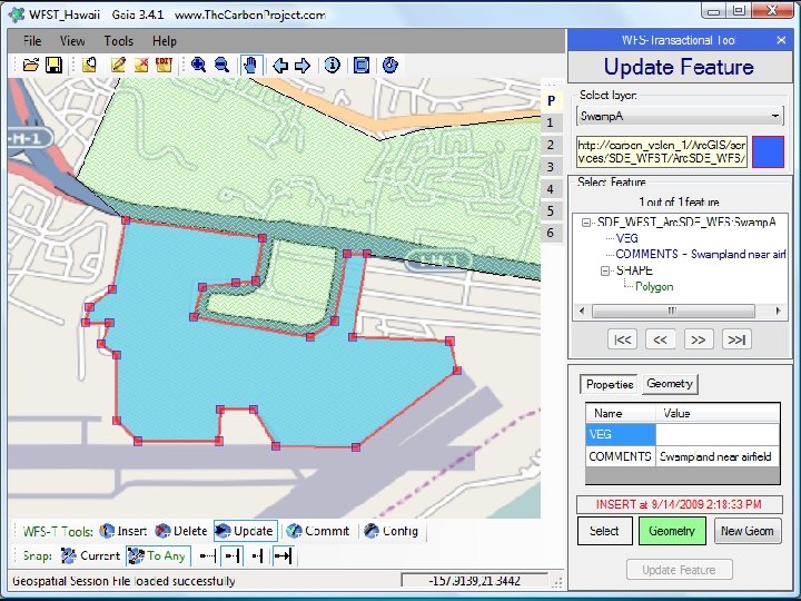
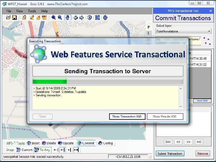
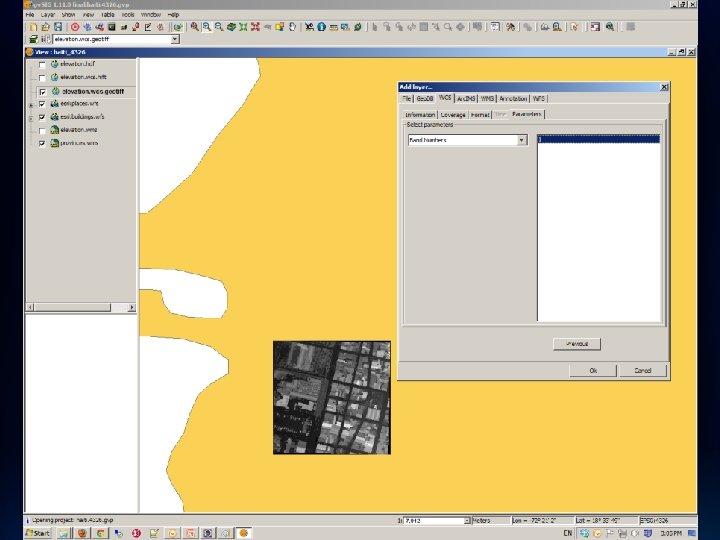
WFS Demo • Web editing through WFST in Open. Layers • Wed editing through Gaia (screenshots)
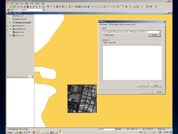
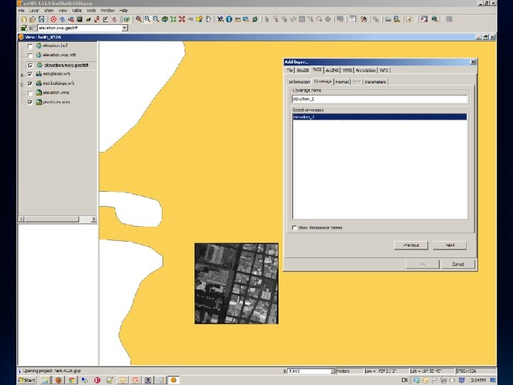
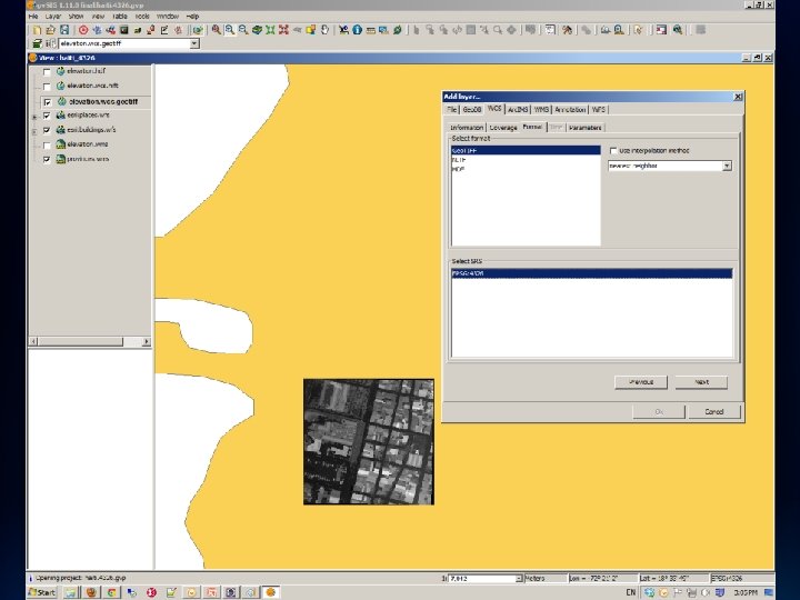
WCS in Arc. GIS Server • Data service, serving out geographic coverage data – Version implemented • 1. 0. 0, 1. 1. 0, and 1. 1. 1 – WCS interfaces implemented • Get. Capabilities • Describe. Coverage • Get. Coverage (coverage data) – Highlights • Supported formats: Geo. TIFF, NITF, HDF, JPEG 2000, PNG; • TIME • “IMAGE” (ESRI specific parameter to request an individual raster in a raster catalog) • Security (http basic, digest and token based)
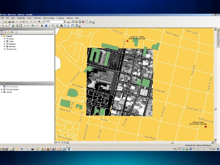
WCS Demo • Leverage Arc. GIS Server WCS in gv. SIG (screenshot)
WMTS in Arc. GIS Server (10. 1 Only) • Serving pre-cached map tiles – Version implemented • 1. 0. 0 – WMTS interfaces implemented • Get. Capabilities • Get. Tile
WMTS in Arc. GIS Server (10. 1 Only) • Highlights • Cache creation and management tools • Performance and scalability
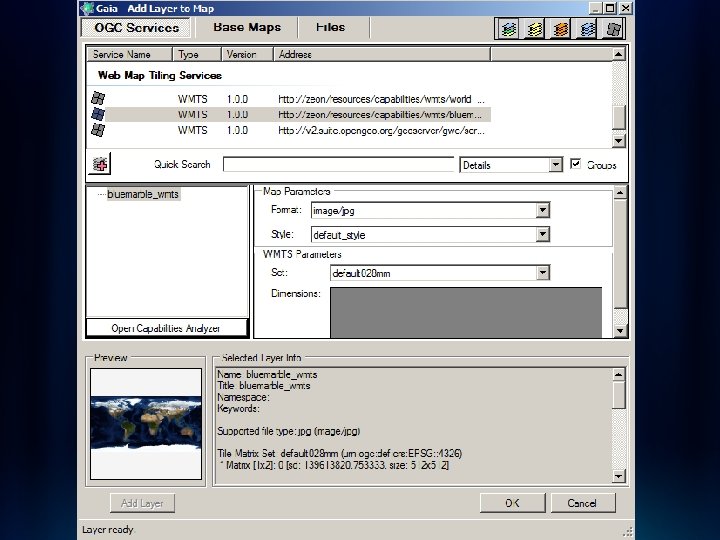
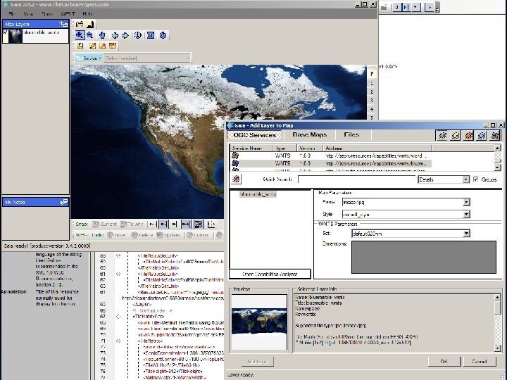
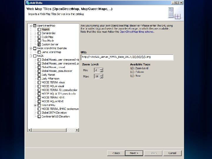
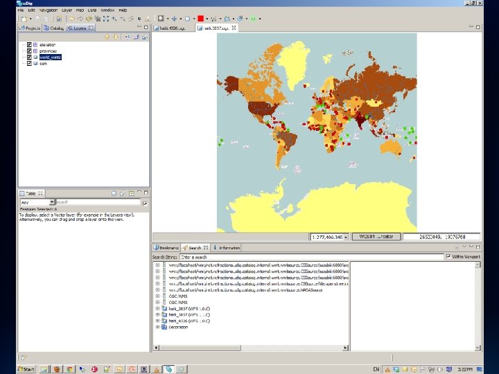
WMTS Clients • Open. Layers • Gaia • Arc. GIS Java. Script API • Other generic tile service client - u. Dig - Open. Scales - Deep. Earth
WMTS Demo • Leverage Arc. GIS Server WMTS in Open. Layers • Leverage Arc. GIS Server WMTS in Arc. GIS Script API • Leverage Arc. GIS Server WMTS in Gaia (screenshot) • Leverage Arc. GIS Server WMTS in u. Dig (screenshot)
WPS in Arc. GIS Server (10. 1 Only) • Geospatial processes over the web – Version implemented • 1. 0. 0 – WPS interfaces implemented • • • Get. Capabilities Describe. Process Execute – Highlights • • Out-of-the-box GP tools and scripts Python scripting environment and Model Builder Synchronous and Asynchronous execute mode Input and output features as GML
WPS Clients • 52 North - Open. Layers client (Java. Script) - u. Dig (Java) Open. Layers • QGIS • Py. WPS Open. Layers client (Java. Script) • ZOO API (server-side Java. Script) •
WPS Demo • WPS in Open. Layers