ECMWF Status Report NAEDEXAPSDEU 2015 Stephen English Marijana
- Slides: 32

ECMWF Status Report NAEDEX-APSDEU 2015 Stephen English, Marijana Crepulja, Erik Andersson ECMWF Stephen. English@ecmwf. int Erik. Andersson@ecmwf. int Marijana. Crepulja@ecmwf. int © ECMWF October 6 -8 th 2015

Outline Satellite observations for weather – Stephen English • Events September 2014 – September 2015 • IFS cycle updates in 2015, and planned for early 2016 • Status of ECMWF Data Assimilation • ECMWF observation monitoring Conventional observations for weather – Erik Andersson • Required data sets • Progress with BUFR migration Atmospheric composition observations – Marijana Crepulja • Satellite data usage and recent progress EUROPEAN CENTRE FOR MEDIUM-RANGE WEATHER FORECASTS 2

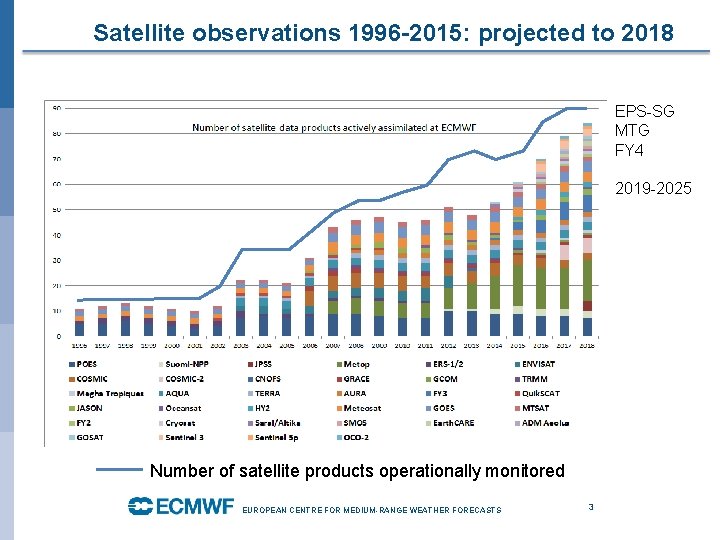
Satellite observations 1996 -2015: projected to 2018 EPS-SG MTG FY 4 2019 -2025 Number of satellite products operationally monitored EUROPEAN CENTRE FOR MEDIUM-RANGE WEATHER FORECASTS 3

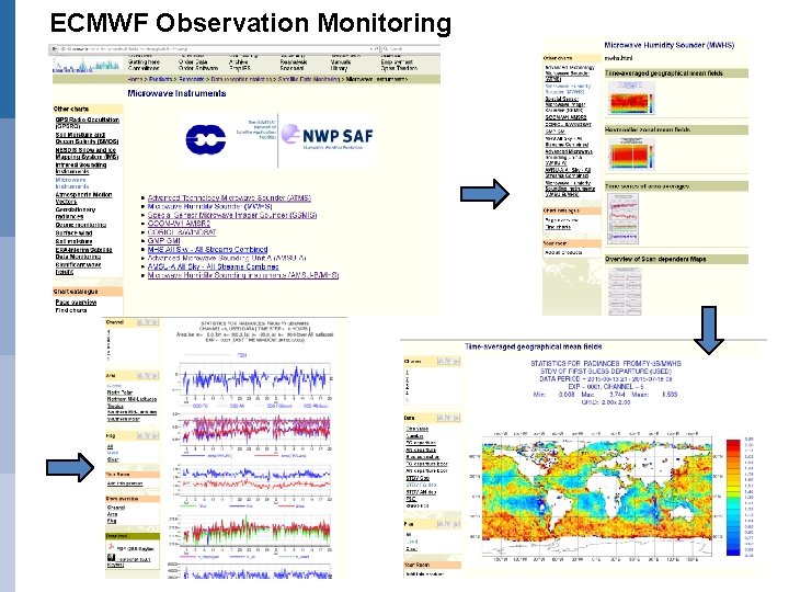
ECMWF Observation Monitoring

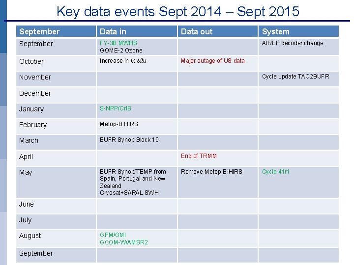
Key data events Sept 2014 – Sept 2015 September Data in September FY-3 B MWHS GOME-2 Ozone October Increase in in situ Data out System AIREP decoder change Major outage of US data Cycle update TAC 2 BUFR November December January S-NPP/Cr. IS February Metop-B HIRS March BUFR Synop Block 10 End of TRMM April May BUFR Synop/TEMP from Spain, Portugal and New Zealand Cryosat+SARAL SWH June July August September GPM/GMI GCOM-W/AMSR 2 Remove Metop-B HIRS Cycle 41 r 1

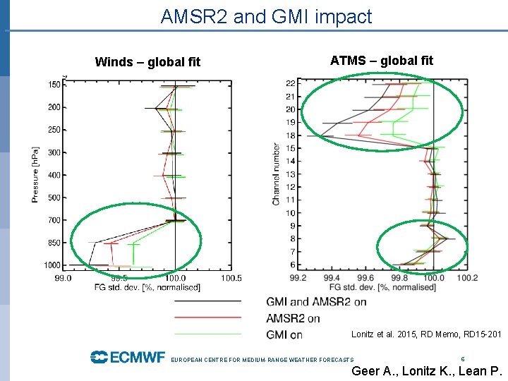
AMSR 2 and GMI impact Winds – global fit ATMS – global fit Lonitz et al. 2015, RD Memo, RD 15 -201 EUROPEAN CENTRE FOR MEDIUM-RANGE WEATHER FORECASTS 6 Geer A. , Lonitz K. , Lean P.

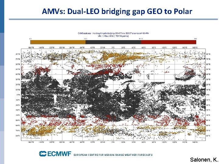
AMVs: Dual-LEO bridging gap GEO to Polar EUROPEAN CENTRE FOR MEDIUM-RANGE WEATHER FORECASTS Salonen, K.

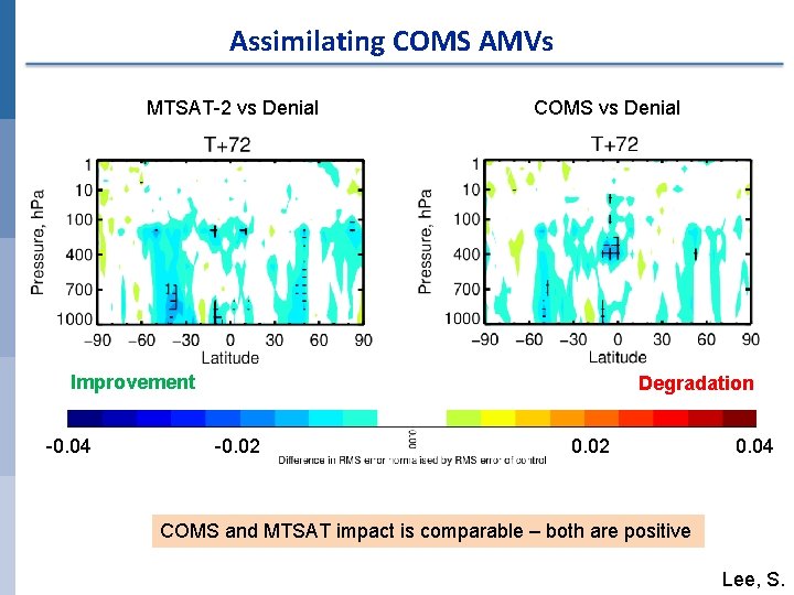
COMS Forecast impact. Assimilating over 6 months, wind. AMVs MTSAT-2 vs Denial COMS vs Denial Improvement -0. 04 Degradation -0. 02 0. 04 COMS and MTSAT impact is comparable – both are positive Lee, S.

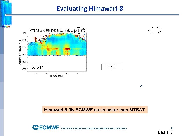
Evaluating Himawari-8 6. 75µm 6. 95µm > Himawari-8 fits ECMWF much better than MTSAT EUROPEAN CENTRE FOR MEDIUM-RANGE WEATHER FORECASTS 9 Lean K.

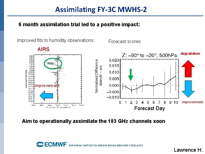
Assimilating FY-3 C MWHS-2 6 month assimilation trial led to a positive impact: Improved fits to humidity observations: Forecast scores: AIRS Normalised Difference stdev(fc – an) improvement degradation improvement Forecast Day Aim to operationally assimilate the 183 GHz channels soon EUROPEAN CENTRE FOR MEDIUM-RANGE WEATHER FORECASTS Lawrence H.

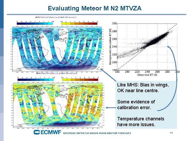
Evaluating Meteor M N 2 MTVZA Like MHS: Bias in wings, OK near line centre. Some evidence of calibration error. Temperature channels have more issues. EUROPEAN CENTRE FOR MEDIUM-RANGE WEATHER FORECASTS 11

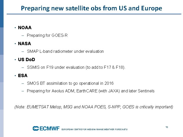
Preparing new satellite obs from US and Europe • NOAA – Preparing for GOES-R • NASA – SMAP L-band radiometer under evaluation • US Do. D – SSMIS on F 19 under evaluation (to add to F 17 & F 18). • ESA – SMOS BT assimilation to go operational in 2016 – Preparing for Aeolus ADM, Earth. CARE (with JAXA) and later Sentinels (Note: EUMETSAT Metop, MSG and NOAA POES, S-NPP, GOES is critically important) EUROPEAN CENTRE FOR MEDIUM-RANGE WEATHER FORECASTS 12

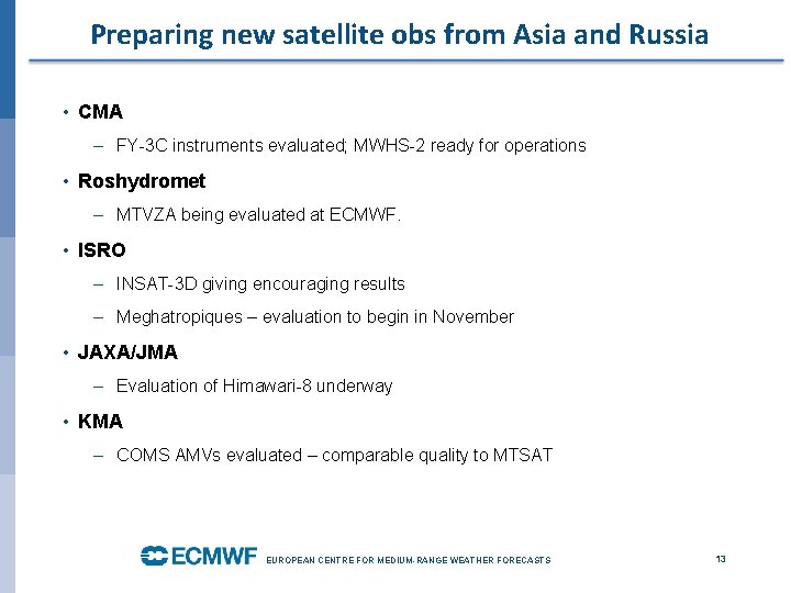
Preparing new satellite obs from Asia and Russia • CMA – FY-3 C instruments evaluated; MWHS-2 ready for operations • Roshydromet – MTVZA being evaluated at ECMWF. • ISRO – INSAT-3 D giving encouraging results – Meghatropiques – evaluation to begin in November • JAXA/JMA – Evaluation of Himawari-8 underway • KMA – COMS AMVs evaluated – comparable quality to MTSAT EUROPEAN CENTRE FOR MEDIUM-RANGE WEATHER FORECASTS 13

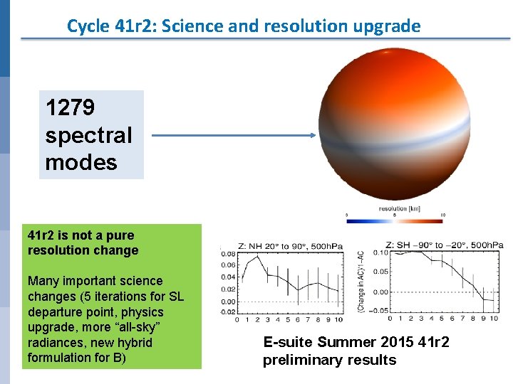
Cycle 41 r 2: Science and resolution upgrade 1279 spectral modes 41 r 2 is not a pure resolution change Many important science changes (5 iterations for SL departure point, physics upgrade, more “all-sky” radiances, new hybrid formulation for B) E-suite Summer 2015 41 r 2 preliminary results

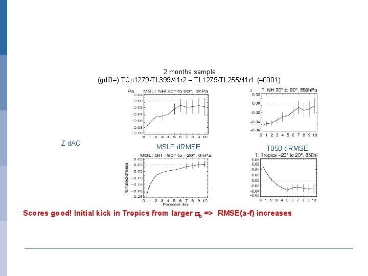
2 months sample (gdi 0=) TCo 1279/TL 399/41 r 2 – TL 1279/TL 255/41 r 1 (=0001) Z d. AC MSLP d. RMSE T 850 d. RMSE Scores good! Initial kick in Tropics from larger sb => RMSE(a-f) increases

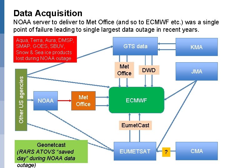
Data Acquisition NOAA server to deliver to Met Office (and so to ECMWF etc. ) was a single point of failure leading to single largest data outage in recent years. Other US agencies Aqua, Terra, Aura, DMSP, SMAP, GOES, SBUV, Snow & Sea ice products lost during NOAA outage GTS data Met Office NOAA Geonetcast (RARS ATOVS “saved day” during NOAA data outage) Met Office KMA DWD JMA ECMWF Eumet. Cast EUMETSAT ? CMA

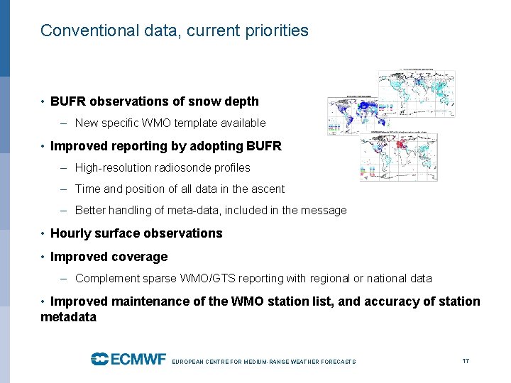
Conventional data, current priorities • BUFR observations of snow depth – New specific WMO template available • Improved reporting by adopting BUFR – High-resolution radiosonde profiles – Time and position of all data in the ascent – Better handling of meta-data, included in the message • Hourly surface observations • Improved coverage – Complement sparse WMO/GTS reporting with regional or national data • Improved maintenance of the WMO station list, and accuracy of station metadata EUROPEAN CENTRE FOR MEDIUM-RANGE WEATHER FORECASTS 17

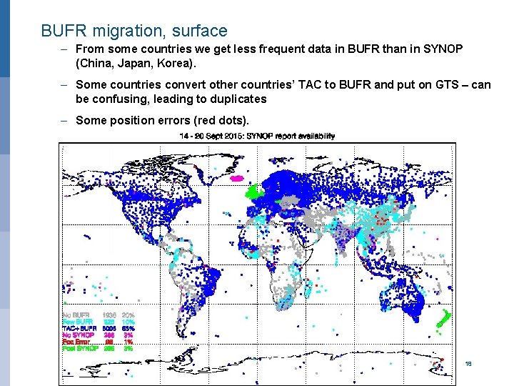
BUFR migration, surface – From some countries we get less frequent data in BUFR than in SYNOP (China, Japan, Korea). – Some countries convert other countries’ TAC to BUFR and put on GTS – can be confusing, leading to duplicates – Some position errors (red dots). EUROPEAN CENTRE FOR MEDIUM-RANGE WEATHER FORECASTS 18

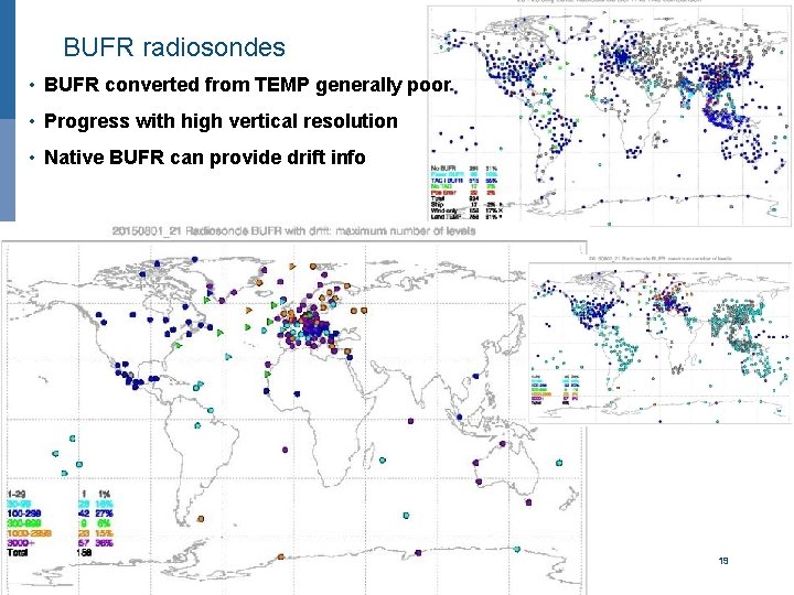
BUFR radiosondes • BUFR converted from TEMP generally poor • Progress with high vertical resolution • Native BUFR can provide drift info EUROPEAN CENTRE FOR MEDIUM-RANGE WEATHER FORECASTS 19

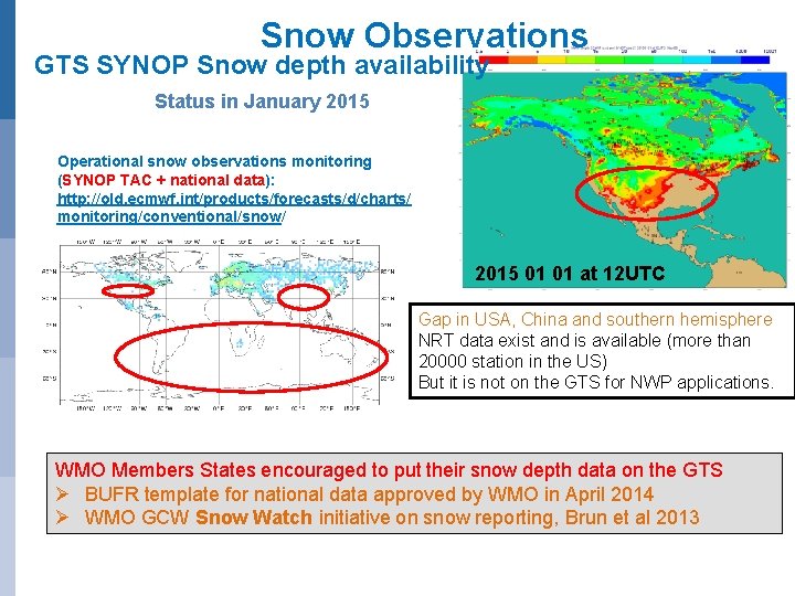
Snow Observations GTS SYNOP Snow depth availability Status in January 2015 Operational snow observations monitoring (SYNOP TAC + national data): http: //old. ecmwf. int/products/forecasts/d/charts/ monitoring/conventional/snow/ 2015 01 01 at 12 UTC Gap in USA, China and southern hemisphere NRT data exist and is available (more than 20000 station in the US) But it is not on the GTS for NWP applications. WMO Members States encouraged to put their snow depth data on the GTS Ø BUFR template for national data approved by WMO in April 2014 Ø WMO GCW Snow Watch initiative on snow reporting, Brun et al 2013

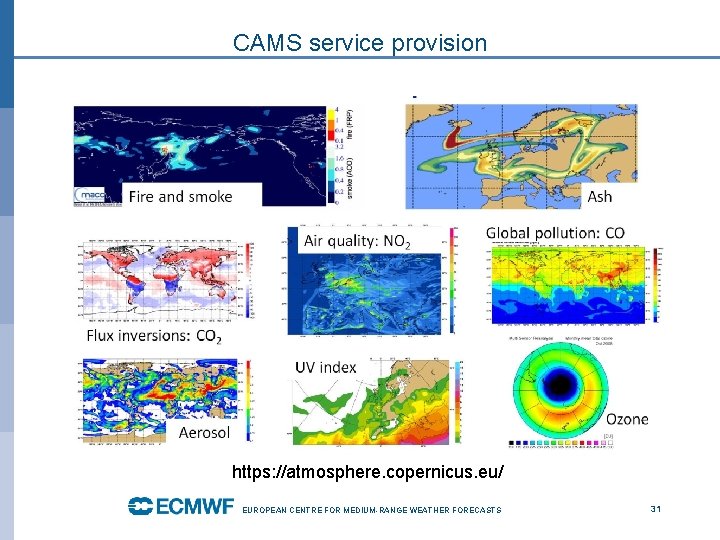
Copernicus Atmosphere Monitoring Service • ECMWF is operating CAMS on behalf of the European Union • Operational monitoring and forecasting of atmospheric composition data and aerosols • Build on ECMWF NWP system • Heritage from GEMS, MACC, -III, PROMOTE • Global and European regional scale EUROPEAN CENTRE FOR MEDIUM-RANGE WEATHER FORECASTS 21

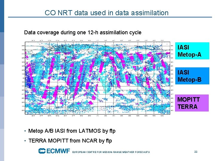
CO NRT data used in data assimilation Data coverage during one 12 -h assimilation cycle IASI Metop-A IASI Metop-B MOPITT TERRA • P • Metop A/B IASI from LATMOS by ftp • TERRA MOPITT from NCAR by ftp EUROPEAN CENTRE FOR MEDIUM-RANGE WEATHER FORECASTS 22

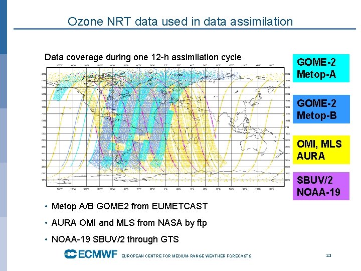
Ozone NRT data used in data assimilation Data coverage during one 12 -h assimilation cycle GOME-2 Metop-A GOME-2 Metop-B OMI, MLS AURA SBUV/2 NOAA-19 • Metop A/B GOME 2 from EUMETCAST • AURA OMI and MLS from NASA by ftp • NOAA-19 SBUV/2 through GTS EUROPEAN CENTRE FOR MEDIUM-RANGE WEATHER FORECASTS 23

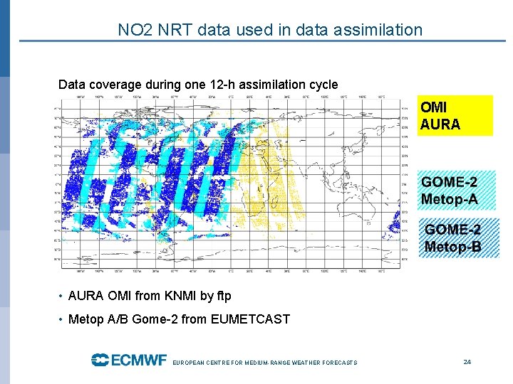
NO 2 NRT data used in data assimilation Data coverage during one 12 -h assimilation cycle OMI AURA • AURA OMI from KNMI by ftp • Metop A/B Gome-2 from EUMETCAST EUROPEAN CENTRE FOR MEDIUM-RANGE WEATHER FORECASTS 24

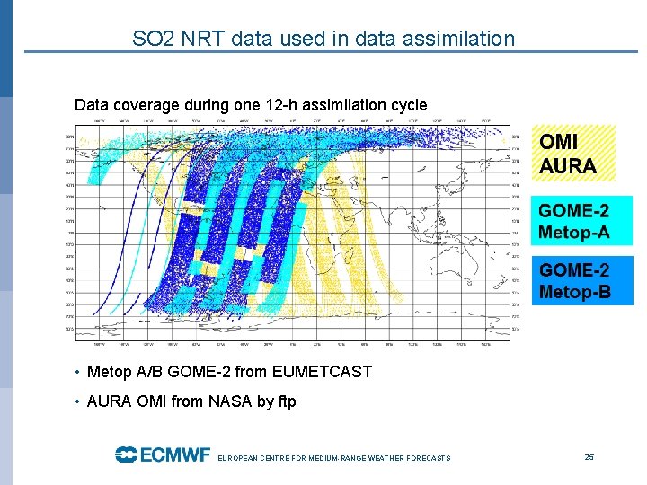
SO 2 NRT data used in data assimilation Data coverage during one 12 -h assimilation cycle • Metop A/B GOME-2 from EUMETCAST • AURA OMI from NASA by ftp EUROPEAN CENTRE FOR MEDIUM-RANGE WEATHER FORECASTS 25

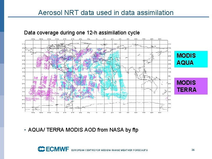
Aerosol NRT data used in data assimilation Data coverage during one 12 -h assimilation cycle MODIS AQUA MODIS TERRA • AQUA/ TERRA MODIS AOD from NASA by ftp EUROPEAN CENTRE FOR MEDIUM-RANGE WEATHER FORECASTS 26

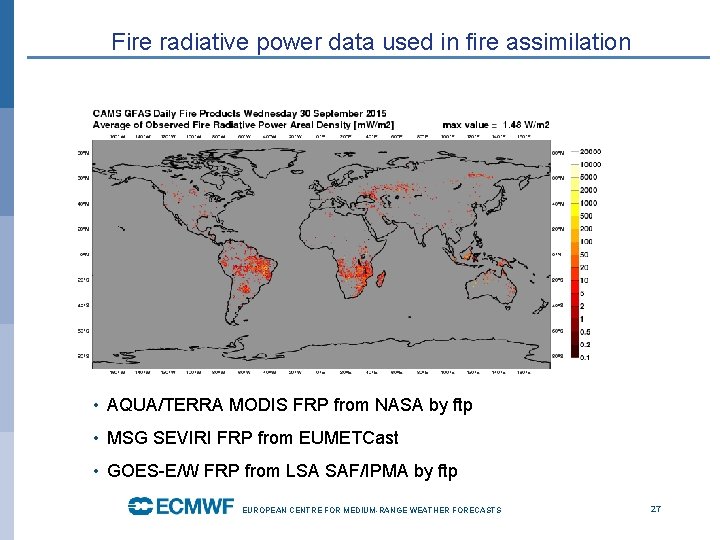
Fire radiative power data used in fire assimilation • AQUA/TERRA MODIS FRP from NASA by ftp • MSG SEVIRI FRP from EUMETCast • GOES-E/W FRP from LSA SAF/IPMA by ftp EUROPEAN CENTRE FOR MEDIUM-RANGE WEATHER FORECASTS 27

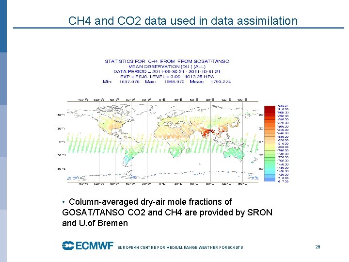
CH 4 and CO 2 data used in data assimilation • Column-averaged dry-air mole fractions of GOSAT/TANSO CO 2 and CH 4 are provided by SRON and U. of Bremen EUROPEAN CENTRE FOR MEDIUM-RANGE WEATHER FORECASTS 28

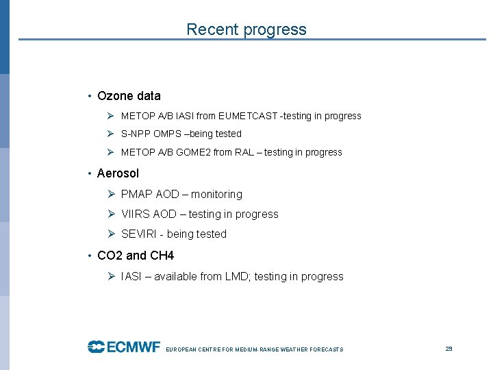
Recent progress • Ozone data Ø METOP A/B IASI from EUMETCAST -testing in progress Ø S-NPP OMPS –being tested Ø METOP A/B GOME 2 from RAL – testing in progress • Aerosol Ø PMAP AOD – monitoring Ø VIIRS AOD – testing in progress Ø SEVIRI - being tested • CO 2 and CH 4 Ø IASI – available from LMD; testing in progress EUROPEAN CENTRE FOR MEDIUM-RANGE WEATHER FORECASTS 29

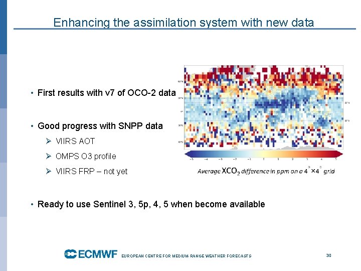
Enhancing the assimilation system with new data • First results with v 7 of OCO-2 data • Good progress with SNPP data Ø VIIRS AOT Ø OMPS O 3 profile Ø VIIRS FRP – not yet • Ready to use Sentinel 3, 5 p, 4, 5 when become available EUROPEAN CENTRE FOR MEDIUM-RANGE WEATHER FORECASTS 30

CAMS service provision https: //atmosphere. copernicus. eu/ EUROPEAN CENTRE FOR MEDIUM-RANGE WEATHER FORECASTS 31

Thank you Acknowledgments: V. H. Peuch, R. Engelen, M. Suttie, A. Benedetti, A. Inness, S. Massart, M. Parrington, J. Flemming, A. Agusti-Panareda and CAMS team EUROPEAN CENTRE FOR MEDIUM-RANGE WEATHER FORECASTS 32