Dual Polarization Technology Paul Schlatter The KICT Upgrade
- Slides: 48

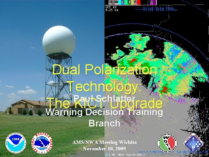
Dual Polarization Technology: Paul Schlatter The KICT Upgrade Warning Decision Training Branch AMS/NWA Meeting Wichita November 10, 2009

Outline • • • Explain dual-pol and the new products What dual-pol can/can’t do Current training and deployment plans

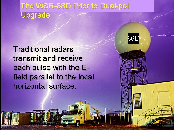
The WSR-88 D Prior to Dual-pol Upgrade 88 D Traditional radars transmit and receive each pulse with the Efield parallel to the local horizontal surface. _

WSR-88 D with the Upgrade to Dual-Pol • Transmitted at 45 o, received at both horizontal and vertical

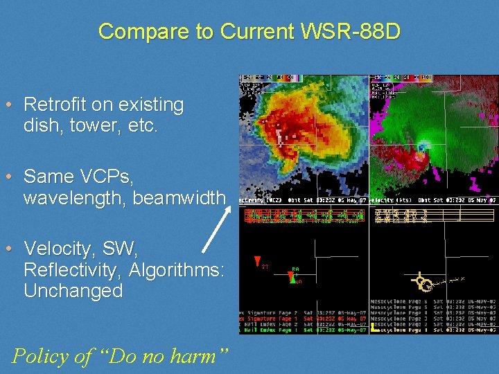
Compare to Current WSR-88 D • Retrofit on existing dish, tower, etc. • Same VCPs, wavelength, beamwidth • Velocity, SW, Reflectivity, Algorithms: Unchanged Policy of “Do no harm”

List of New Products via Dual-Pol • Correlation Coefficient (CC) • Differential Reflectivity (ZDR) • Specific Differential Phase (KDP) • 2 Algorithms – Melting Layer – Hydrometeor Classification • 9 NEW Precipitation Estimation Products

The Dual-Pol Base Products

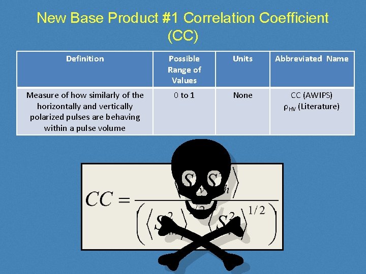
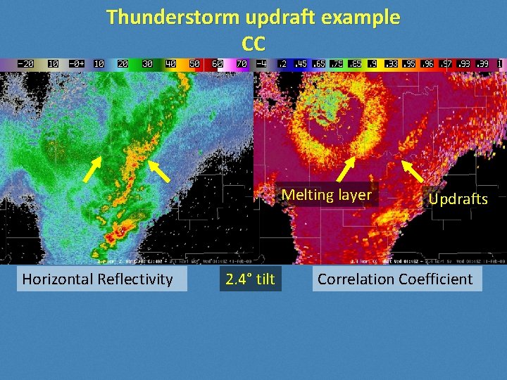
New Base Product #1 Correlation Coefficient (CC) Definition Possible Range of Values Units Abbreviated Name Measure of how similarly of the horizontally and vertically polarized pulses are behaving within a pulse volume 0 to 1 None CC (AWIPS) ρHV (Literature) N

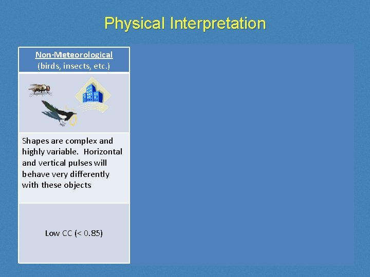
Physical Interpretation Non-Meteorological (birds, insects, etc. ) Metr (Uniform) (rain, snow, etc. ) Metr (Non-Uniform) (hail, melting snow, etc. ) Shapes are complex and highly variable. Horizontal and vertical pulses will behave very differently with these objects Shapes are fairly simple and do not vary much. Horizontal and vertical pulses behave very similarly with these objects Shapes can be complex and are mixed phase. Horizontal and vertical pulses behave somewhat differently with these objects Low CC (< 0. 85) High CC (> 0. 97) Moderate CC (0. 85 to 0. 95)

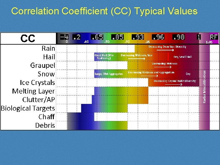
Correlation Coefficient (CC) Typical Values

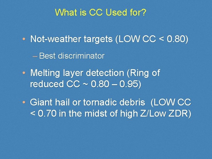
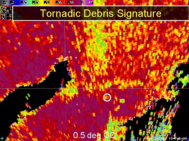
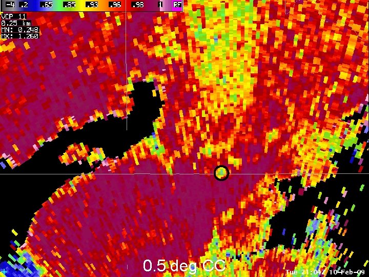
What is CC Used for? • Not-weather targets (LOW CC < 0. 80) – Best discriminator • Melting layer detection (Ring of reduced CC ~ 0. 80 – 0. 95) • Giant hail or tornadic debris (LOW CC < 0. 70 in the midst of high Z/Low ZDR)

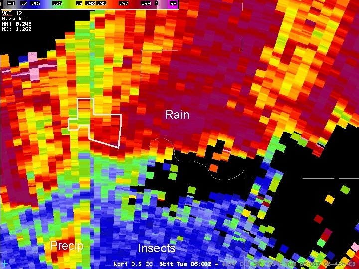
Marginally Severe Supercell Rain What about the rest? All > 0. 97 Precip Insects

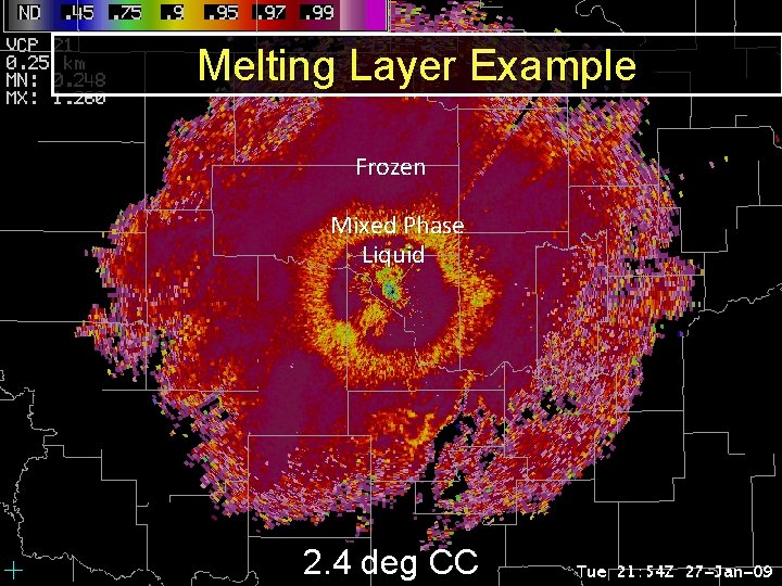
3. Melting Layer Detection Melting Example Frozen Mixed Phase Liquid 2. 4 deg CC

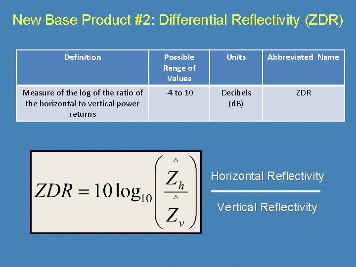
New Base Product #2: Differential Reflectivity (ZDR) Definition Possible Range of Values Units Abbreviated Name Measure of the log of the ratio of the horizontal to vertical power returns -4 to 10 Decibels (d. B) ZDR Horizontal Reflectivity Vertical Reflectivity

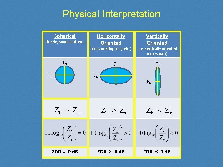
Physical Interpretation Spherical (drizzle, small hail, etc. ) Horizontally Oriented (rain, melting hail, etc. ) Pv Vertically Oriented (i. e. vertically oriented ice crystals) Pv Pv Ph Ph Ph Zh ~ Zv ZDR ~ 0 d. B Zh > Z v ZDR > 0 d. B Zh < Z v ZDR < 0 d. B

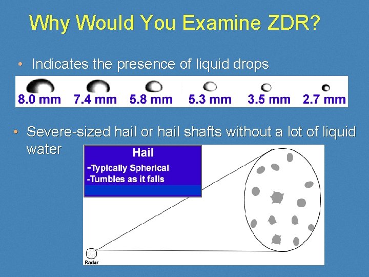
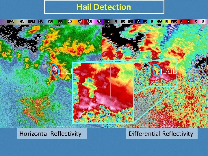
Why Would You Examine ZDR? • Indicates the presence of liquid drops • Severe-sized hail or hail shafts without a lot of liquid water

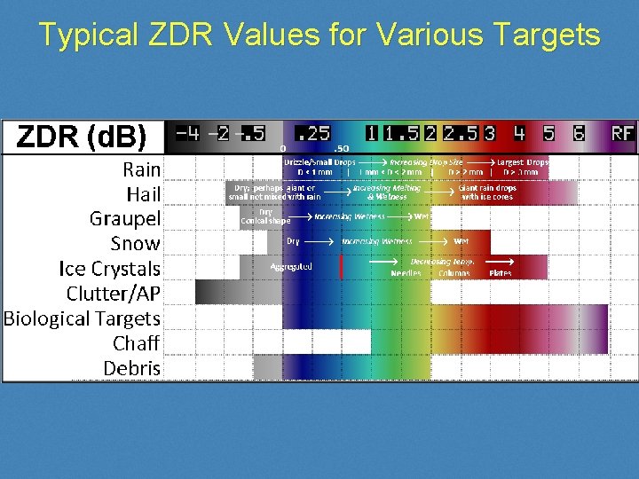
Typical ZDR Values for Various Targets

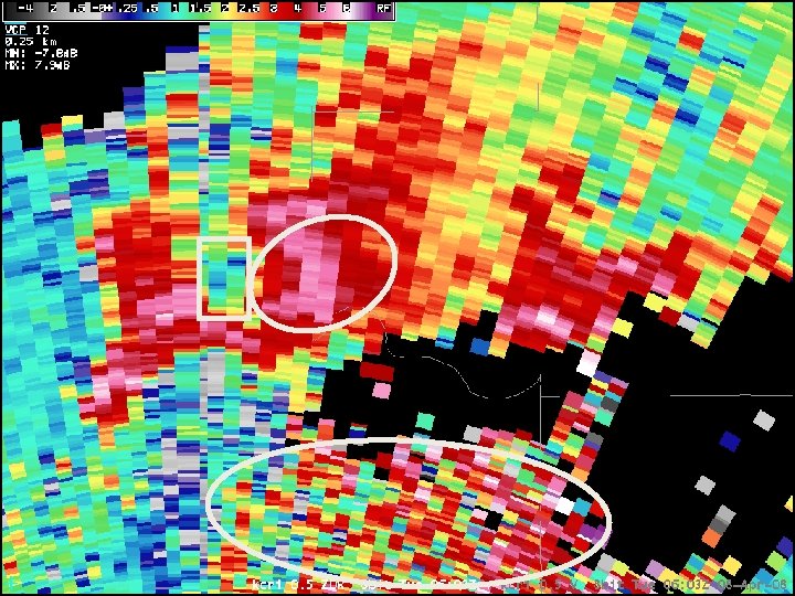
Marginally Severe Supercell

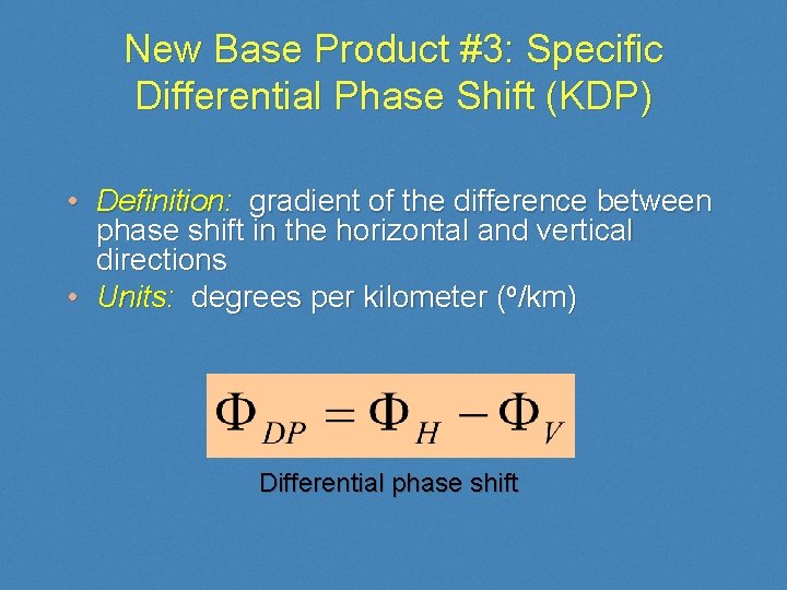
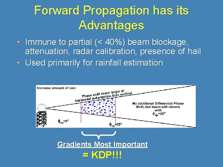
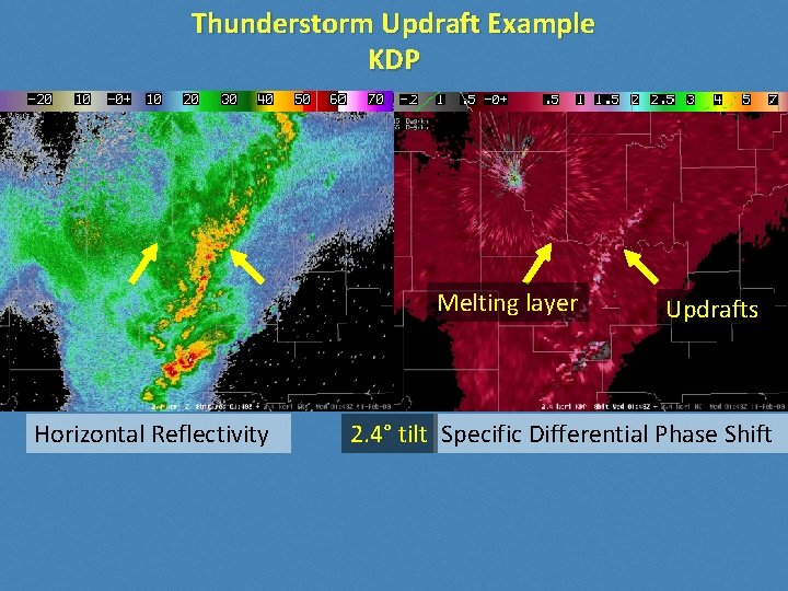
New Base Product #3: Specific Differential Phase Shift (KDP) • Definition: gradient of the difference between phase shift in the horizontal and vertical directions • Units: degrees per kilometer (o/km) Differential phase shift

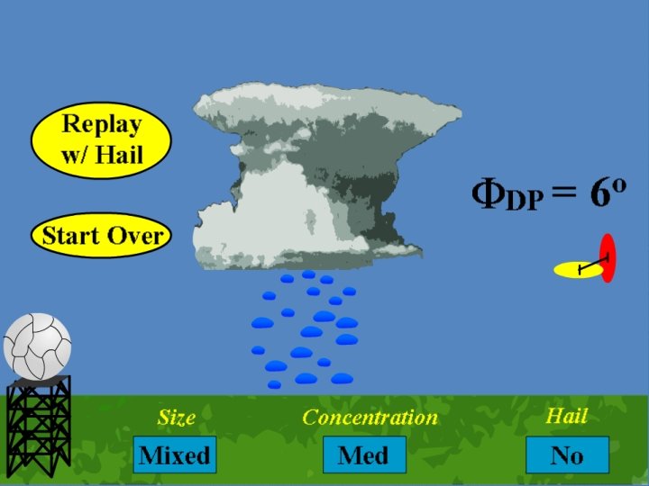
Differential Phase Ilustrated • blah

Forward Propagation has its Advantages • Immune to partial (< 40%) beam blockage, attenuation, radar calibration, presence of hail • Used primarily for rainfall estimation Gradients Most Important = KDP!!!

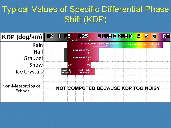
Typical Values of Specific Differential Phase Shift (KDP)

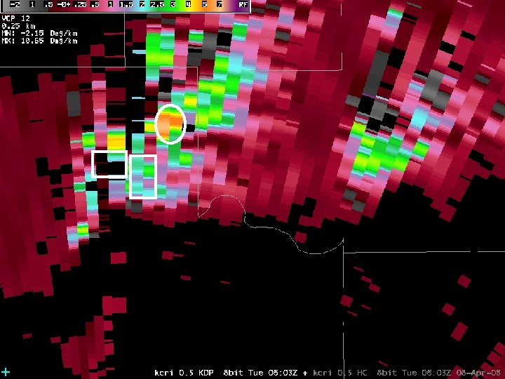
Marginally Severe Supercell

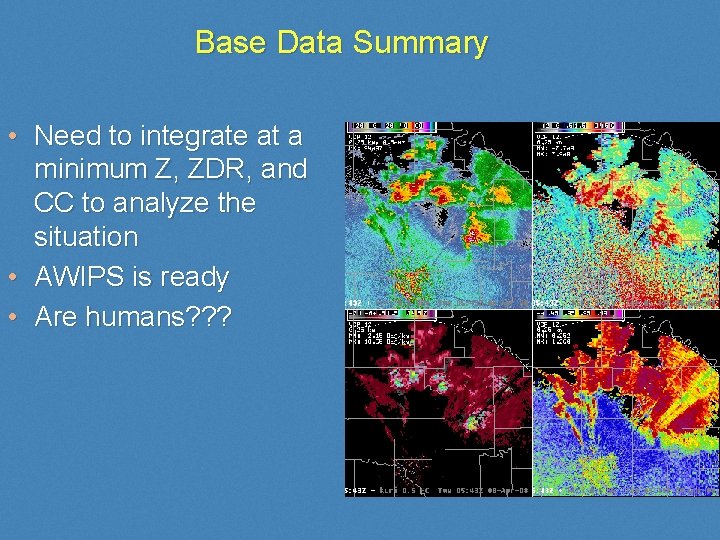
Base Data Summary • Need to integrate at a minimum Z, ZDR, and CC to analyze the situation • AWIPS is ready • Are humans? ? ?

The Dual-Pol Algorithms QPE, Hydrometeor Classification, and Melting Layer

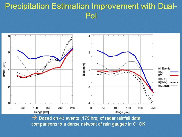
Precipitation Estimation Improvement with Dual. Pol Based on 43 events (179 hrs) of radar rainfall data comparisons to a dense network of rain gauges in C. OK

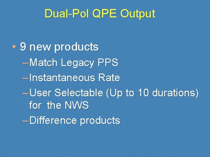
Dual-Pol QPE Output • 9 new products – Match Legacy PPS – Instantaneous Rate – User Selectable (Up to 10 durations) for the NWS – Difference products

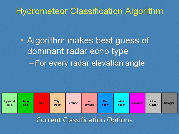
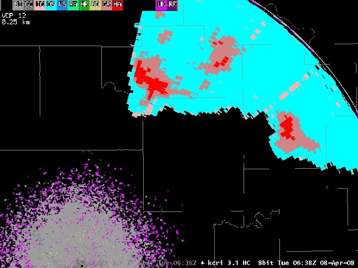
Hydrometeor Classification Algorithm • Algorithm makes best guess of dominant radar echo type – For every radar elevation angle Lgt/mod rain Heavy rain Hail “Big drops” Graupel Ice crystals Dry snow Wet snow Unknown Current Classification Options AP or Clutter Biological

• SOO-DOH 20000 ft MSL Imageskcri_0. 5_HC_20080408_0638. png

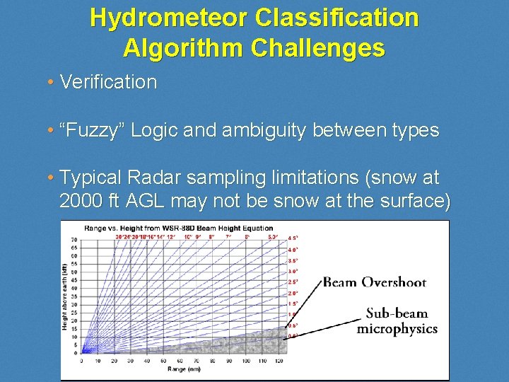
Hydrometeor Classification Algorithm Challenges • Verification • “Fuzzy” Logic and ambiguity between types • Typical Radar sampling limitations (snow at 2000 ft AGL may not be snow at the surface)

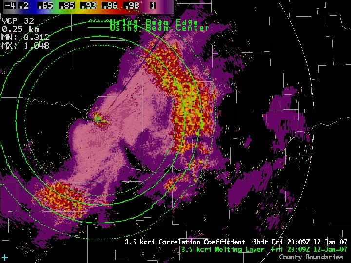
Melting Layer Detection Algorithm • Mixed phase hydrometeors: Easy detection for dual-pol! – Z typically increases (bright band) – ZDR and KDP definitely increase – Coexistence of ice and water will reduce the correlation coefficient (CC ~0. 950. 80) • Algorithm overlay product for top and bottom of melting layer

ML Product in AWIPS

Part 2: What Dual-Pol Can/Can’t Do

Highlights of How Dual-pol Data Will Aid Decision Makers 1. Better precipitation estimation P 2. Improved detection and mitigation of nonweather echoes P 3. Melting layer identification. P 4. Hydrometeor classification. P 5. New/improved storm signatures (NEXT)

Hail Detection HAIL Horizontal Reflectivity HAIL Differential Reflectivity

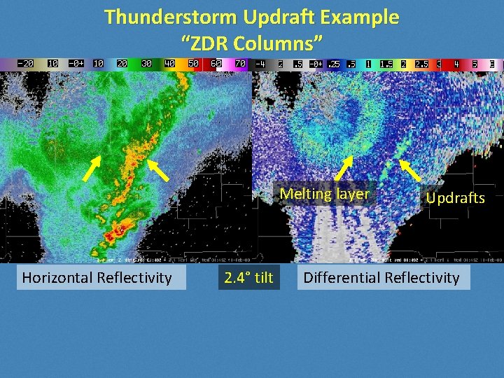
Thunderstorm Updraft Example “ZDR Columns” Melting layer Horizontal Reflectivity 2. 4° tilt Updrafts Differential Reflectivity

Thunderstorm Updraft Example KDP Melting layer Horizontal Reflectivity Updrafts 2. 4° tilt Specific Differential Phase Shift

Thunderstorm updraft example CC Melting layer Horizontal Reflectivity 2. 4° tilt Updrafts Correlation Coefficient

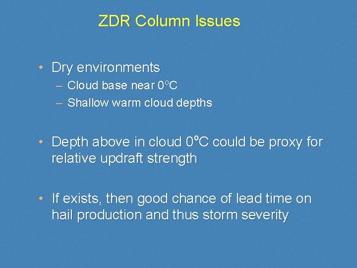
ZDR Column Issues • Dry environments – Cloud base near 0 o. C – Shallow warm cloud depths • Depth above in cloud 0 o. C could be proxy for relative updraft strength • If exists, then good chance of lead time on hail production and thus storm severity

Tornadic Debris Signature Reflectivity Lowest Cut Storm-Relative 0. 5 deg CC Velocity

0. 5 Reflectivity deg CC

What Dual-Pol Can do • Vastly improve precip estimation • Detect hail aloft, infer presence of giant hail • Detect melting layer and improve winter weather nowcasting • Improve identification of non-weather echoes • Offer best guess at P-type aloft • Improve confidence in damaging tornado close to the radar

What Dual-pol Can’t do • Overcome the laws of physics • Perfect rainfall estimation at each gate • Exact hail sizes • Identify surface precipitation type • Detect every tornado • Predict any tornado

Part 3: Deployment and Training Plans

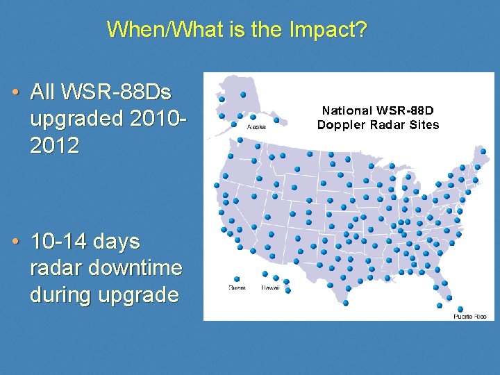
When/What is the Impact? • All WSR-88 Ds upgraded 20102012 • 10 -14 days radar downtime during upgrade

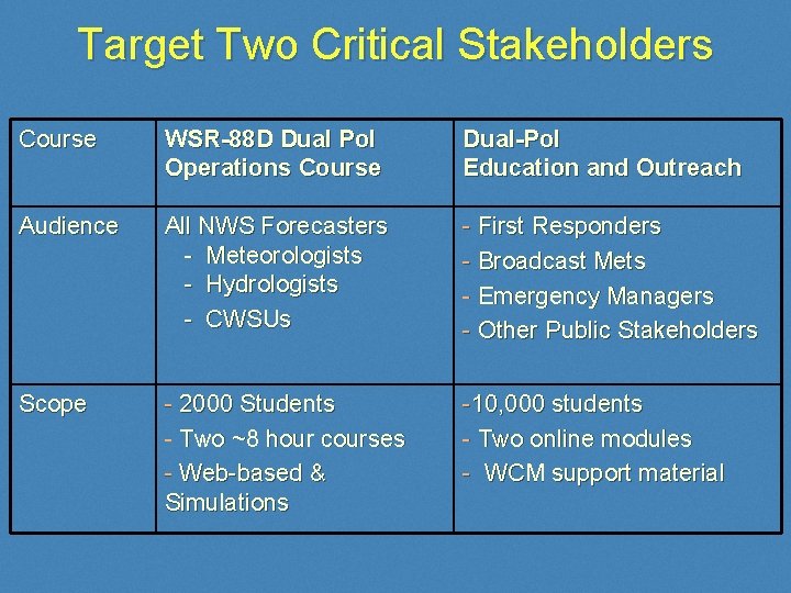
Target Two Critical Stakeholders Course WSR-88 D Dual Pol Operations Course Dual-Pol Education and Outreach Audience All NWS Forecasters - Meteorologists - Hydrologists - CWSUs - First Responders - Broadcast Mets - Emergency Managers - Other Public Stakeholders Scope - 2000 Students - Two ~8 hour courses - Web-based & Simulations -10, 000 students - Two online modules - WCM support material

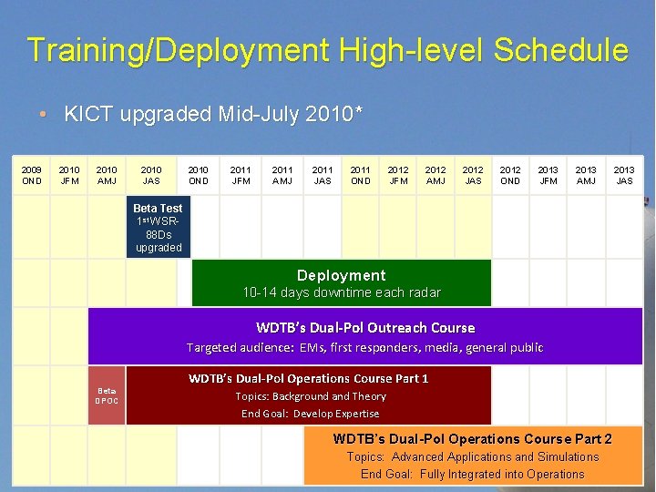
Training/Deployment High-level Schedule • KICT upgraded Mid-July 2010* 2009 OND 2010 JFM 2010 AMJ 2010 JAS 2010 OND 2011 JFM 2011 AMJ 2011 JAS 2011 OND 2012 JFM 2012 AMJ 2012 JAS 2012 OND 2013 JFM 2013 AMJ Beta Test 1 st WSR 88 Ds upgraded Deployment 10 -14 days downtime each radar WDTB’s Dual-Pol Outreach Course Targeted audience: EMs, first responders, media, general public Beta DPOC WDTB’s Dual-Pol Operations Course Part 1 Topics: Background and Theory End Goal: Develop Expertise WDTB’s Dual-Pol Operations Course Part 2 Topics: Advanced Applications and Simulations End Goal: Fully Integrated into Operations 2013 JAS

Questions? Tel: 405 -325 -1091 Email: Paul. T. Schlatter@noaa. gov