Aviation Weather WFO Indianapolis Sally Pavlow Aviation Weather


- Slides: 51

Aviation Weather WFO Indianapolis Sally Pavlow

Aviation Weather • TAF directives • TWEBs • Climatology • Aviation Verification • Stats • Goals • Recommendations • Forecast Scenarios • 10/16/2021 What’s Coming Up Sally Pavlow

TAF Directives • Newly certified Feb. 7, 2005 • Critical TAF Period Philosophy • 2 to 6 hrs from current valid time 10/16/2021 Sally Pavlow

TAF Directives • The Critical TAF Period is the most important time frame for operationally significant weather. • Detail level • Be aware of amendment criteria 10/16/2021 Sally Pavlow

TAF Directives • Severe thunderstorms (TSTM) are difficult to describe in the significant weather (SIGWX) portion of the TAF. • A severe TSTM may be indicated by the forecast winds (GTE 50 knots with TSTMs in significant weather). 10/16/2021 Sally Pavlow

TAF Directives • Suspend or Delay a TAF • Forecaster Discretion • No ob in AWIPS • Can’t call the ASOS • Limited TAF • NIL AMD • Suspended TAF • NIL 10/16/2021 Sally Pavlow

TAF Directives • If you suspend a TAF • Note it in the shift log • To restart a suspended TAF • 2 consecutive observations of at least 30 minutes but not longer than 1 hour apart should be received • This establishes a trend • Can be an ASOS ob and a satellite ob 10/16/2021 Sally Pavlow

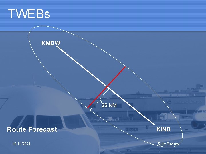
TWEBs KMDW 25 NM Route Forecast 10/16/2021 KIND Sally Pavlow

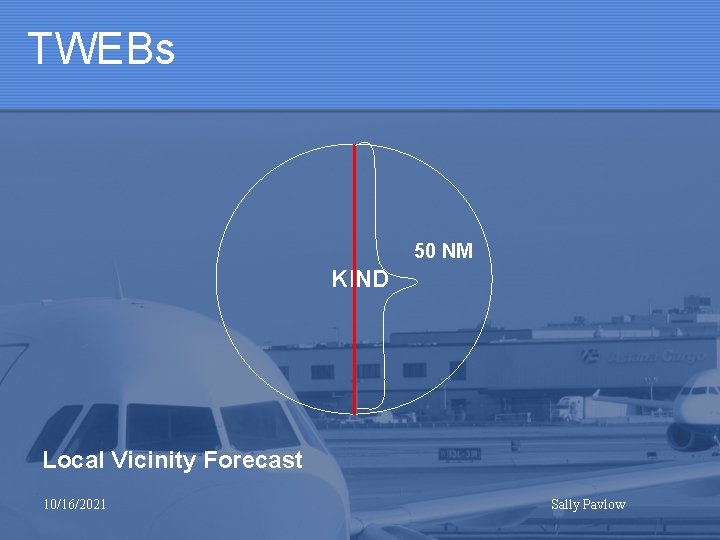
TWEBs 50 NM KIND Local Vicinity Forecast 10/16/2021 Sally Pavlow

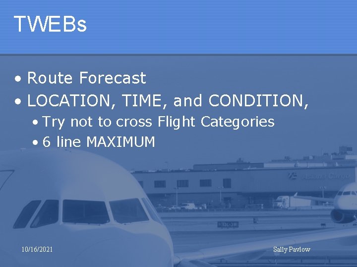
TWEBs • Route Forecast • LOCATION, TIME, and CONDITION, • Try not to cross Flight Categories • 6 line MAXIMUM 10/16/2021 Sally Pavlow

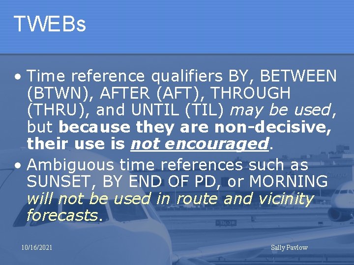
TWEBs • Time reference qualifiers BY, BETWEEN (BTWN), AFTER (AFT), THROUGH (THRU), and UNTIL (TIL) may be used, but because they are non-decisive, their use is not encouraged. • Ambiguous time references such as SUNSET, BY END OF PD, or MORNING will not be used in route and vicinity forecasts. 10/16/2021 Sally Pavlow

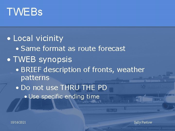
TWEBs • Local vicinity • Same format as route forecast • TWEB synopsis • BRIEF description of fronts, weather patterns • Do not use THRU THE PD • Use specific ending time 10/16/2021 Sally Pavlow

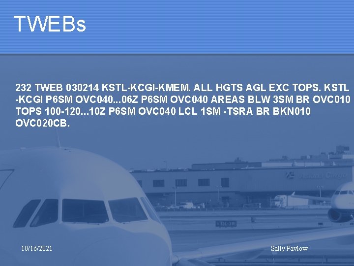
TWEBs 232 TWEB 030214 KSTL-KCGI-KMEM. ALL HGTS AGL EXC TOPS. KSTL -KCGI P 6 SM OVC 040. . . 06 Z P 6 SM OVC 040 AREAS BLW 3 SM BR OVC 010 TOPS 100 -120. . . 10 Z P 6 SM OVC 040 LCL 1 SM -TSRA BR BKN 010 OVC 020 CB. 10/16/2021 Sally Pavlow

Climatology • KIND • Aviation Climate Assessment Report • Charlie A. Lies, WFO Albuquerque Air Traffic Weather Support Team • June 2004 10/16/2021 Sally Pavlow

Climatology • Defined a list of critical weather elements • Surveyed 21 CWSU MIC’s • Most MIC’s coordinated with FAA sources including TMU, ARTCC, TRACON and Tower Chiefs 10/16/2021 Sally Pavlow

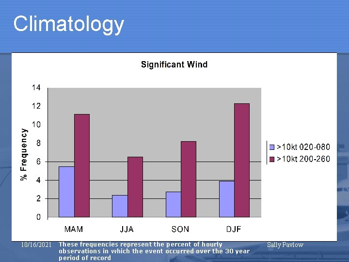
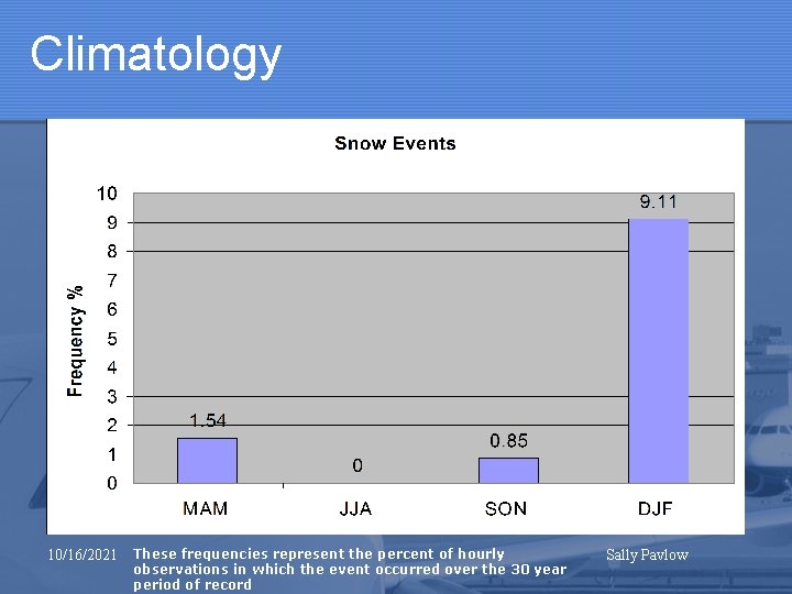
Climatology • Significant Wind • Significant Ceilings • Significant Visibility • Thunderstorms • Snow Events • Freezing Precipitation (including IP) • Turbulence • Icing 10/16/2021 Sally Pavlow

Climatology • Airports divided into 2 categories • Indianapolis International • Medium Hub 10/16/2021 Sally Pavlow

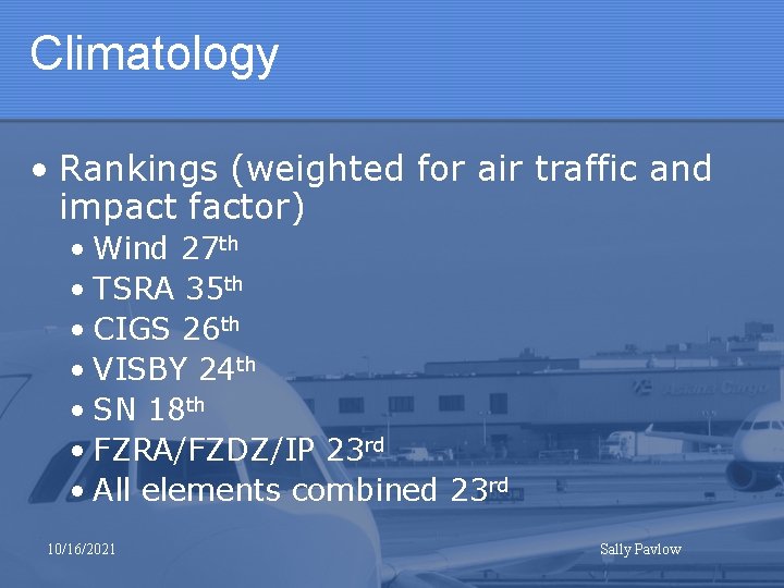
Climatology • Rankings (weighted for air traffic and impact factor) • Wind 27 th • TSRA 35 th • CIGS 26 th • VISBY 24 th • SN 18 th • FZRA/FZDZ/IP 23 rd • All elements combined 23 rd 10/16/2021 Sally Pavlow

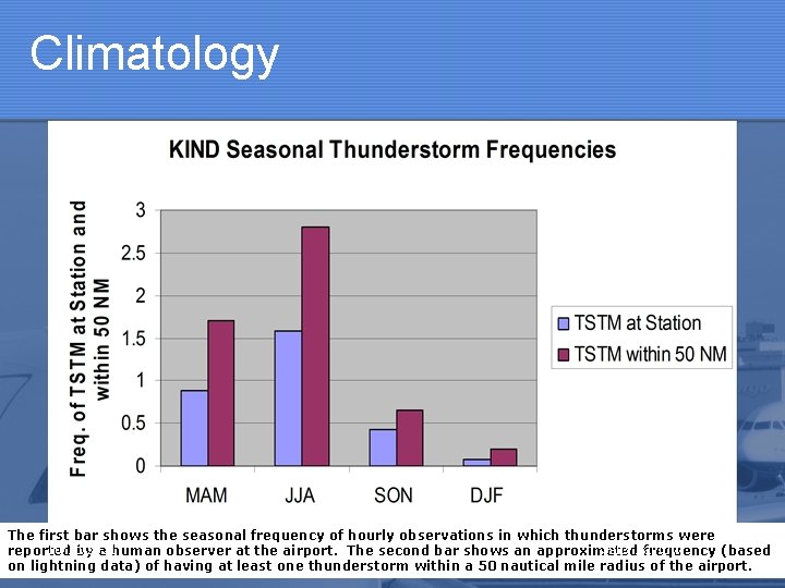
Climatology The first bar shows the seasonal frequency of hourly observations in which thunderstorms were 10/16/2021 Sally Pavlow reported by a human observer at the airport. The second bar shows an approximated frequency (based on lightning data) of having at least one thunderstorm within a 50 nautical mile radius of the airport.

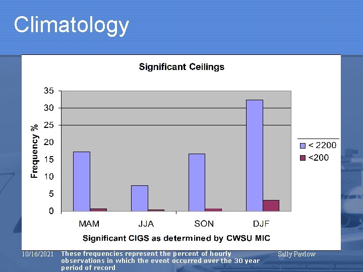
Climatology 10/16/2021 These frequencies represent the percent of hourly observations in which the event occurred over the 30 year period of record Sally Pavlow

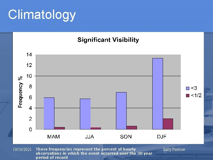
Climatology 10/16/2021 These frequencies represent the percent of hourly observations in which the event occurred over the 30 year period of record Sally Pavlow

Climatology 10/16/2021 These frequencies represent the percent of hourly observations in which the event occurred over the 30 year period of record Sally Pavlow

Climatology 10/16/2021 These frequencies represent the percent of hourly observations in which the event occurred over the 30 year period of record Sally Pavlow

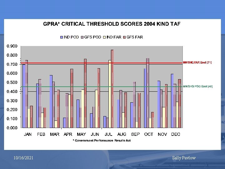
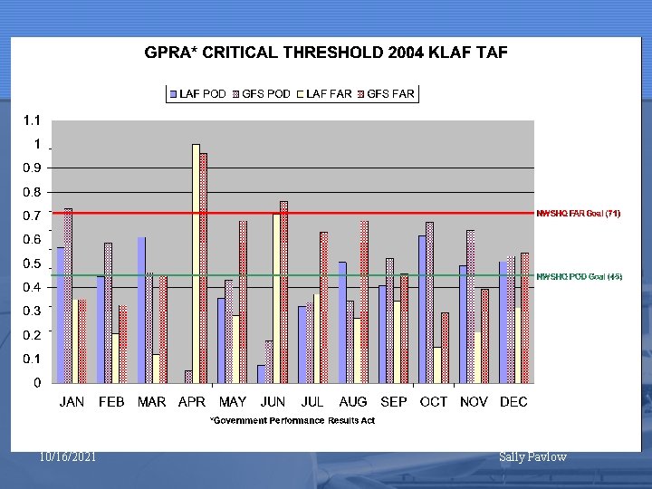
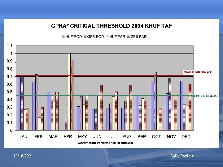
Aviation Verification • Stats on Demand • Awaiting Regional verification requirements • Government Performance Results Act 10/16/2021 Sally Pavlow

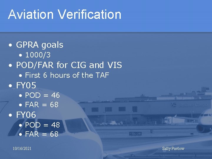
Aviation Verification • GPRA goals • 1000/3 • POD/FAR for CIG and VIS • First 6 hours of the TAF • FY 05 • POD = 46 • FAR = 68 • FY 06 • POD = 48 • FAR = 68 10/16/2021 Sally Pavlow

10/16/2021 Sally Pavlow

10/16/2021 Sally Pavlow

10/16/2021 Sally Pavlow

10/16/2021 Sally Pavlow

10/16/2021 Sally Pavlow

10/16/2021 Sally Pavlow

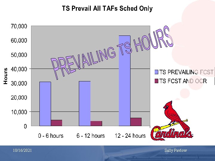
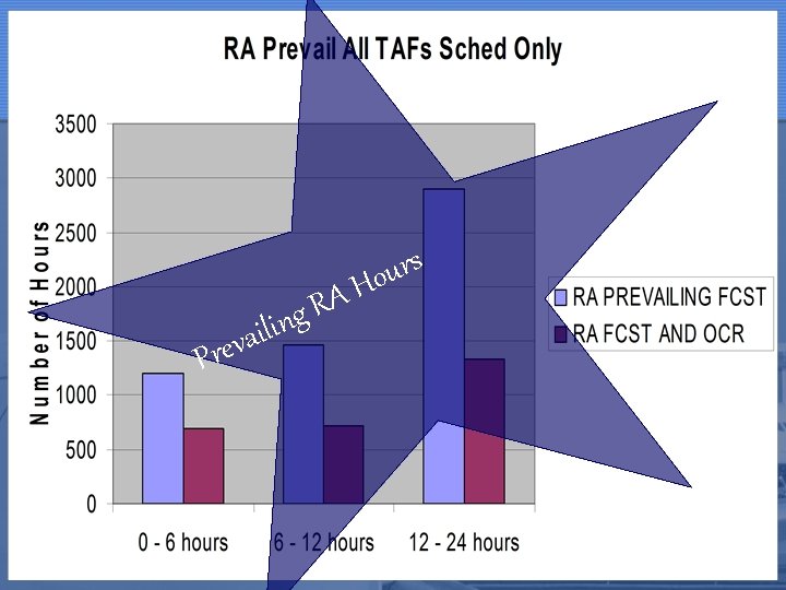
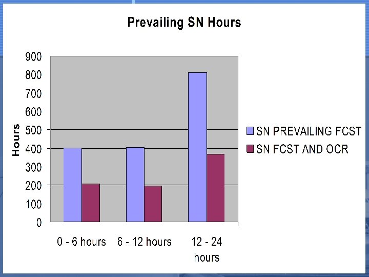
A R ing s r u Ho l i a v Pre 10/16/2021 Sally Pavlow

10/16/2021 Sally Pavlow

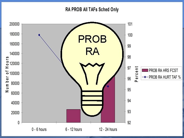
PROB RA 10/16/2021 Sally Pavlow

10/16/2021 Sally Pavlow

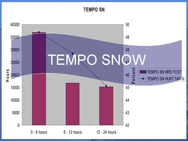
TEMPO SNOW 10/16/2021 Sally Pavlow

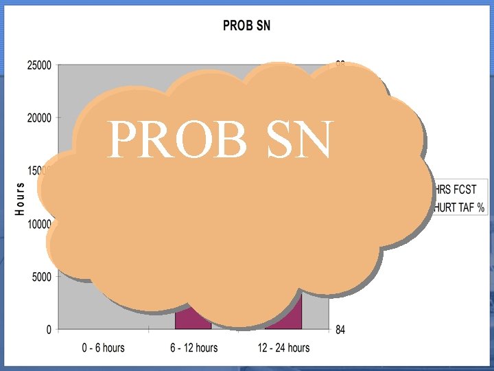
PROB SN 10/16/2021 Sally Pavlow

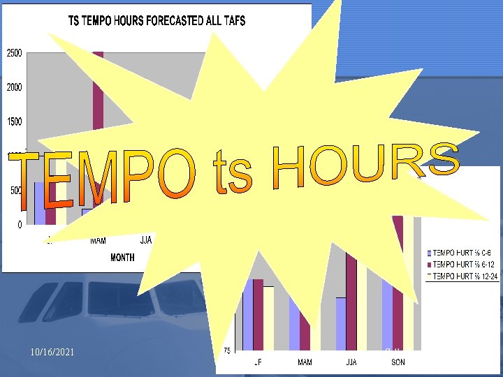
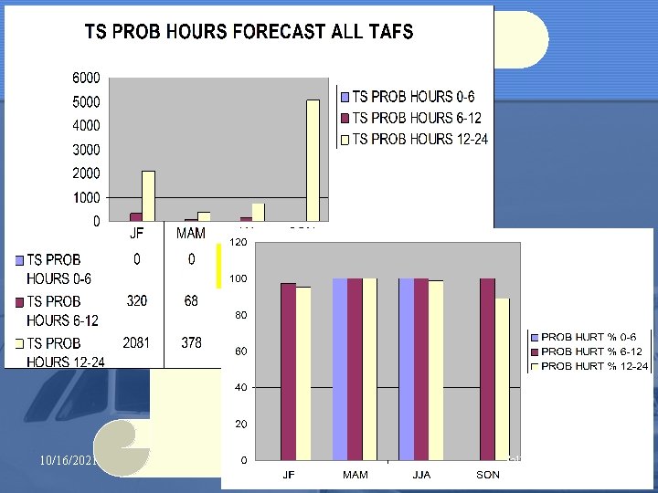
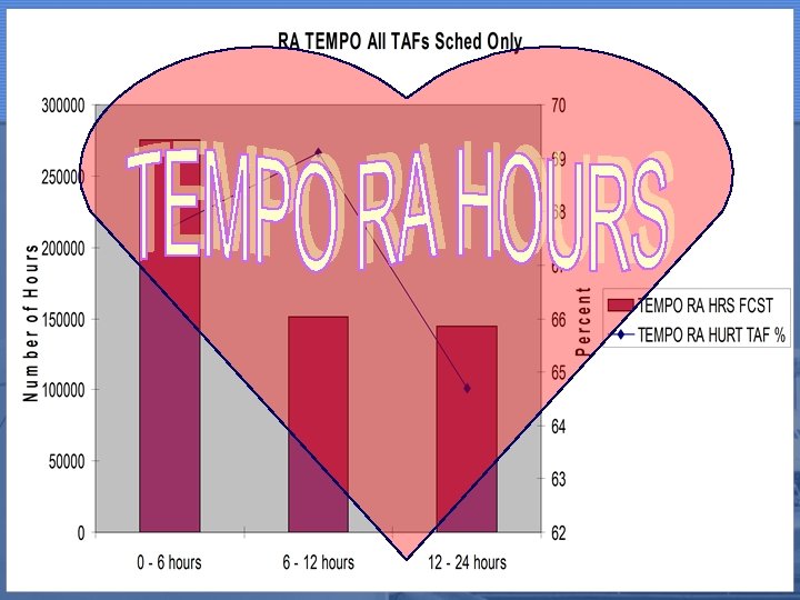
Goals • Reduce TS False Alarm Hours • Improve use of TEMPO and PROB • Improve TAF especially after 12 hours 10/16/2021 Sally Pavlow

Recommendations • General TAF writing • Focus on the critical 2 -6 hour time period • Forecast for flight categories • Use the CCFP • QC will eliminate PROB errors • Keep it simple! 10/16/2021 Sally Pavlow

Recommendations • Thunderstorms • Limit use of PROB and TEMPO groups • Especially after 12 hours • After 12 hours, eliminate TS • Use VCTS or CB instead • Limit length of PROB and TEMPO • <= 2 hours • Focus on organized vs. scattered convection • Keep climatology in mind 10/16/2021 Sally Pavlow

Forecast Scenarios • 4 Scenarios 10/16/2021 Sally Pavlow

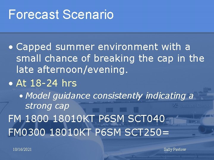
Forecast Scenario • Capped summer environment with a small chance of breaking the cap in the late afternoon/evening. • At 18 -24 hrs • Model guidance consistently indicating a strong cap FM 1800 18010 KT P 6 SM SCT 040 FM 0300 18010 KT P 6 SM SCT 250= 10/16/2021 Sally Pavlow

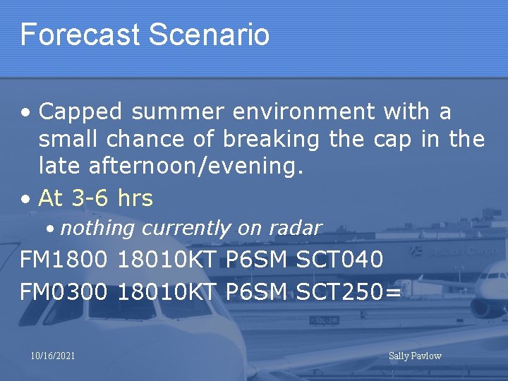
Forecast Scenario • Capped summer environment with a small chance of breaking the cap in the late afternoon/evening. • At 3 -6 hrs • nothing currently on radar FM 1800 18010 KT P 6 SM SCT 040 FM 0300 18010 KT P 6 SM SCT 250= 10/16/2021 Sally Pavlow

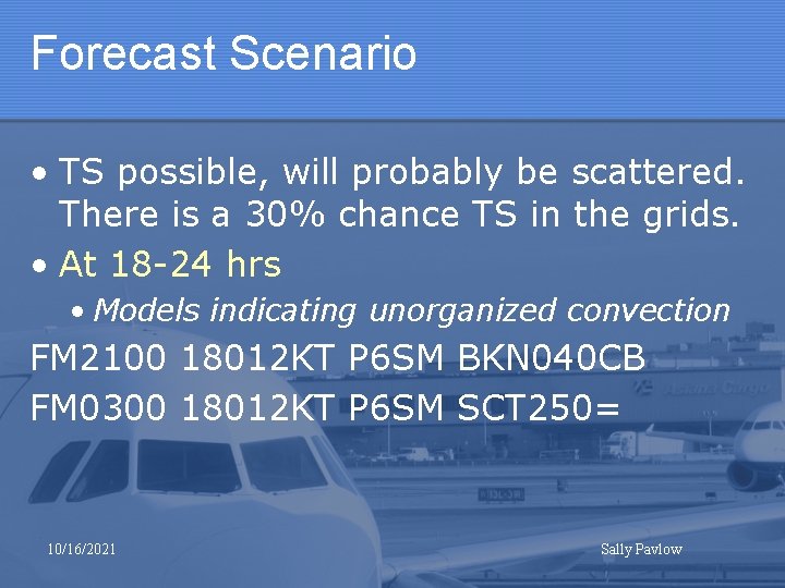
Forecast Scenario • TS possible, will probably be scattered. There is a 30% chance TS in the grids. • At 18 -24 hrs • Models indicating unorganized convection FM 2100 18012 KT P 6 SM BKN 040 CB FM 0300 18012 KT P 6 SM SCT 250= 10/16/2021 Sally Pavlow

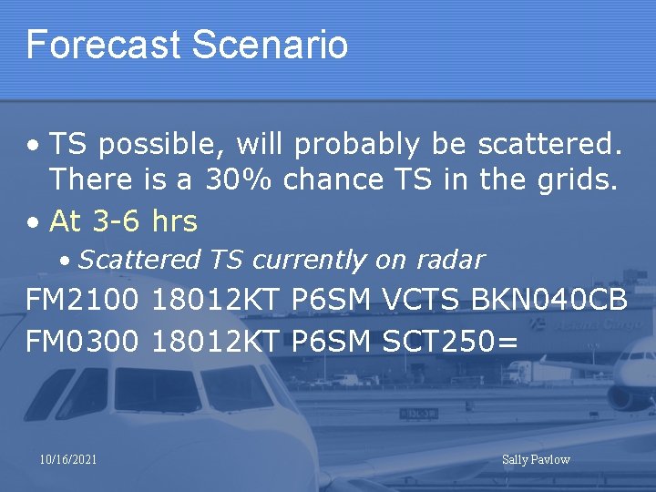
Forecast Scenario • TS possible, will probably be scattered. There is a 30% chance TS in the grids. • At 3 -6 hrs • Scattered TS currently on radar FM 2100 18012 KT P 6 SM VCTS BKN 040 CB FM 0300 18012 KT P 6 SM SCT 250= 10/16/2021 Sally Pavlow

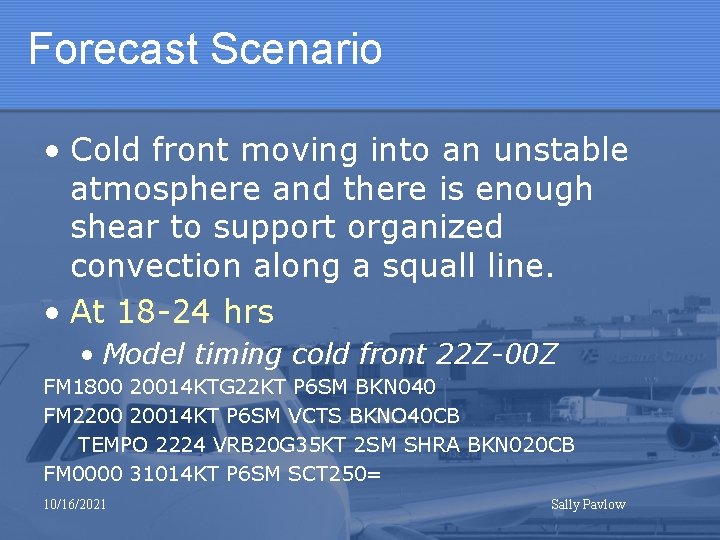
Forecast Scenario • Cold front moving into an unstable atmosphere and there is enough shear to support organized convection along a squall line. • At 18 -24 hrs • Model timing cold front 22 Z-00 Z FM 1800 20014 KTG 22 KT P 6 SM BKN 040 FM 2200 20014 KT P 6 SM VCTS BKNO 40 CB TEMPO 2224 VRB 20 G 35 KT 2 SM SHRA BKN 020 CB FM 0000 31014 KT P 6 SM SCT 250= 10/16/2021 Sally Pavlow

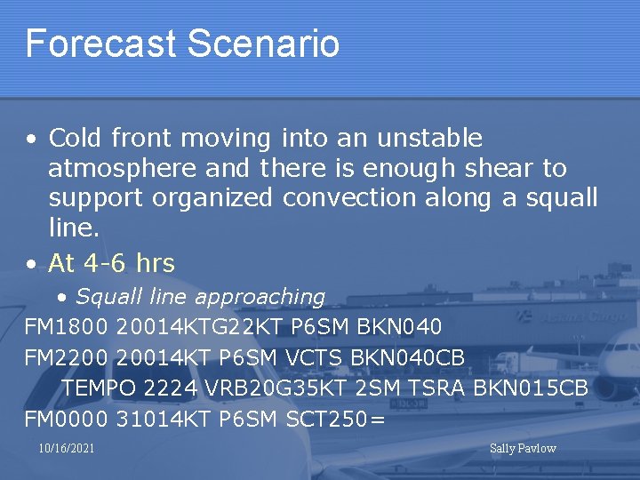
Forecast Scenario • Cold front moving into an unstable atmosphere and there is enough shear to support organized convection along a squall line. • At 4 -6 hrs • Squall line approaching FM 1800 20014 KTG 22 KT P 6 SM BKN 040 FM 2200 20014 KT P 6 SM VCTS BKN 040 CB TEMPO 2224 VRB 20 G 35 KT 2 SM TSRA BKN 015 CB FM 0000 31014 KT P 6 SM SCT 250= 10/16/2021 Sally Pavlow

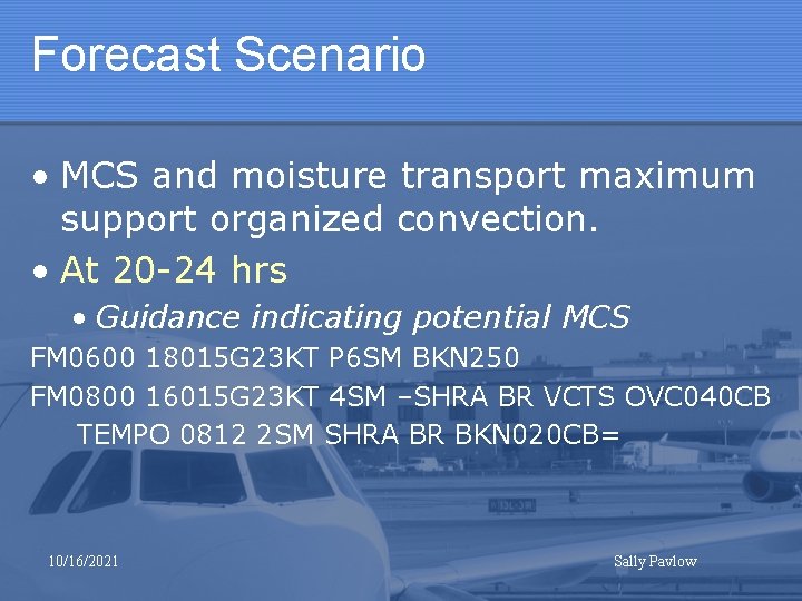
Forecast Scenario • MCS and moisture transport maximum support organized convection. • At 20 -24 hrs • Guidance indicating potential MCS FM 0600 18015 G 23 KT P 6 SM BKN 250 FM 0800 16015 G 23 KT 4 SM –SHRA BR VCTS OVC 040 CB TEMPO 0812 2 SM SHRA BR BKN 020 CB= 10/16/2021 Sally Pavlow

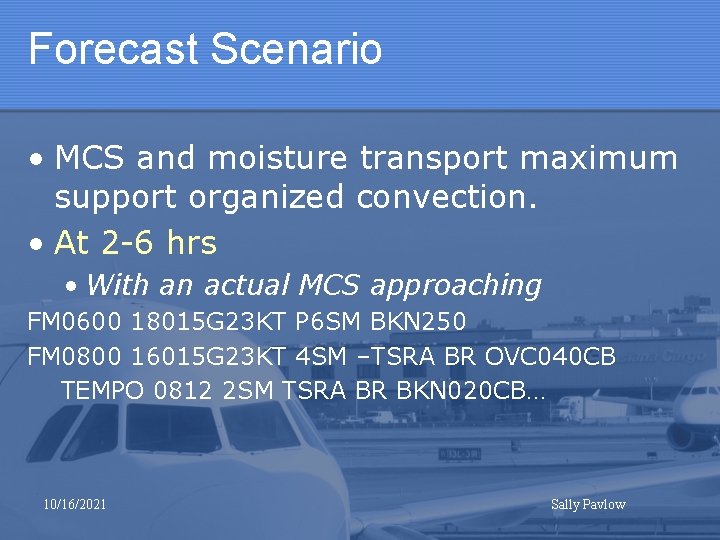
Forecast Scenario • MCS and moisture transport maximum support organized convection. • At 2 -6 hrs • With an actual MCS approaching FM 0600 18015 G 23 KT P 6 SM BKN 250 FM 0800 16015 G 23 KT 4 SM –TSRA BR OVC 040 CB TEMPO 0812 2 SM TSRA BR BKN 020 CB… 10/16/2021 Sally Pavlow

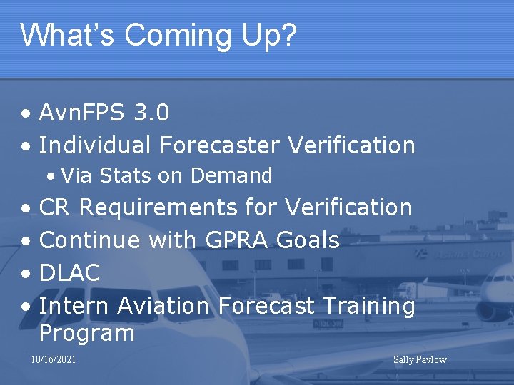
What’s Coming Up? • Avn. FPS 3. 0 • Individual Forecaster Verification • Via Stats on Demand • CR Requirements for Verification • Continue with GPRA Goals • DLAC • Intern Aviation Forecast Training Program 10/16/2021 Sally Pavlow

THE END!! • Questions? 10/16/2021 Sally Pavlow