Graphical Area Forecasts Friends and Partners of Aviation
- Slides: 38

Graphical Area Forecasts Friends and Partners of Aviation Weather Jack May Aviation Weather Center October 22, 2002 Friends & Partners of Aviation Weather 1

Briefing Outline i Current Product Suite i Why the Change to a Graphical Aviation Forecast? i New Product Recommendations Suite i Examples i Differences i Production and Development Issues October 22, 2002 Friends & Partners of Aviation Weather 2

Current U. S. Product Suite Text i Free Text Area Forecast > Forecast of Visual Flight Rules (VFR) clouds and Weather > Location referenced by states and portions of states > Do not include low ceilings and visibility. User referred to AIRMET Sierra. > May differ from details of latest Low Level Chart. October 22, 2002 Friends & Partners of Aviation Weather 3

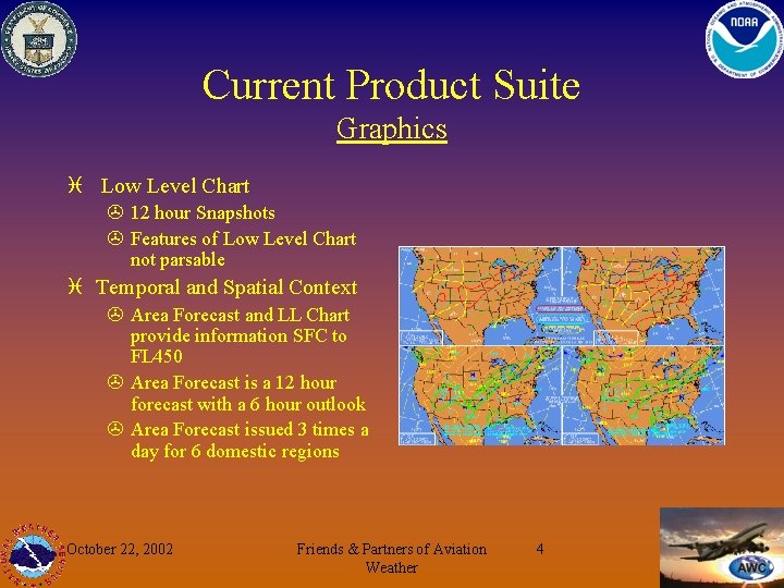
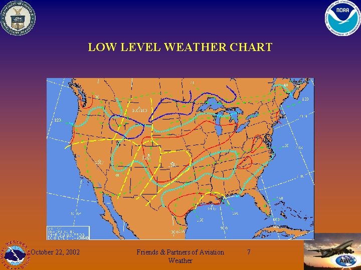
Current Product Suite Graphics i Low Level Chart > 12 hour Snapshots > Features of Low Level Chart not parsable i Temporal and Spatial Context > Area Forecast and LL Chart provide information SFC to FL 450 > Area Forecast is a 12 hour forecast with a 6 hour outlook > Area Forecast issued 3 times a day for 6 domestic regions October 22, 2002 Friends & Partners of Aviation Weather 4

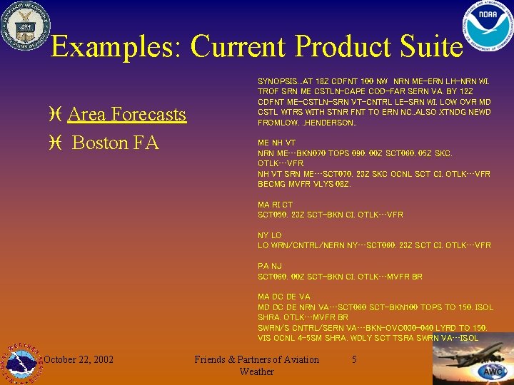
Examples: Current Product Suite i Area Forecasts i Boston FA SYNOPSIS. . . AT 18 Z CDFNT 100 NW NRN ME-ERN LH-NRN WI. TROF SRN ME CSTLN-CAPE COD-FAR SERN VA. BY 12 Z CDFNT ME-CSTLN-SRN VT-CNTRL LE-SRN WI. LOW OVR MD CSTL WTRS WITH STNR FNT TO ERN NC. . ALSO XTNDG NEWD FROMLOW. . . HENDERSON. . ME NH VT NRN ME…BKN 070 TOPS 090. 00 Z SCT 060. 05 Z SKC. OTLK…VFR. NH VT SRN ME…SCT 070. 23 Z SKC OCNL SCT CI. OTLK…VFR BECMG MVFR VLYS 08 Z. MA RI CT SCT 050. 23 Z SCT-BKN CI. OTLK…VFR NY LO LO WRN/CNTRL/NERN NY…SCT 060. 23 Z SCT CI. OTLK…VFR PA NJ SCT 060. 00 Z SCT-BKN CI. OTLK…MVFR BR MA DC DE VA MD DC DE NRN VA…SCT 060 SCT-BKN 100 TOPS TO 150. ISOL SHRA. OTLK…MVFR BR SWRN/S CNTRL/SERN VA…BKN-OVC 030 -040 LYRD TO 150. VIS OCNL 4 -5 SM SHRA. WDLY SCT TSRA SWRN VA…ISOL October 22, 2002 Friends & Partners of Aviation Weather 5

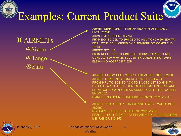
Examples: Current Product Suite i AIRMETs >Sierra >Tango >Zulu AIRMET SIERRA UPDT 4 FOR IFR AND MTN OBSN VALID UNTIL 262000 AIRMET MTN OBSCN…WV VA FROM EKN TO CSN TO 30 N GSO TO HMV TO 40 WSW BKW TO EKN…MTNS OCNL OBSCD BY CLDS/PCPN BR. CONDS END 16 -18 Z. AIRMET IFR…VA FROM RIC TO ORF TO 40 NE RDU TO HMV TO PSK TO RIC OCNL CIG BLW 010/VIS BLS 3 SM BR. CONDS ENDG 15 -16 Z. ELSW… NO WDSPRD IFR EXP. AIRMET TANGO UPDT 2 FOR TURB VALID UNTIL 262000 AIRMET TURB…NH VT MA RI CT NY LE LO PA OH FROM MPV TO BOS TO ACK TO SAX TO JST TO HNN TO CVG TO FWA TO DXO…OCNL MOD TURB BTN FL 280 AND FL 350 DUE TO WIND SHEAR ASSOCD WITH JTST. CONDS ENDG 20 Z. RMNDR…NO SGFNT TURB EXP EX INVOF CNVTV ACT. AIRMET ZULU UPDT 2 FOR ICE AND FRZLVL VALID UNTIL 262000. NO SGFNT ICE EXP OUTSIDE OF CNVTV ACT. FRZLVL… 120 -130 E OF YYZ-ERI-AIR-GSO LN. . 110 -130 NRN ME. . RMNDR 130 -150. October 22, 2002 Friends & Partners of Aviation Weather 6

LOW LEVEL WEATHER CHART October 22, 2002 Friends & Partners of Aviation Weather 7

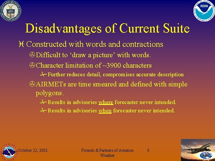
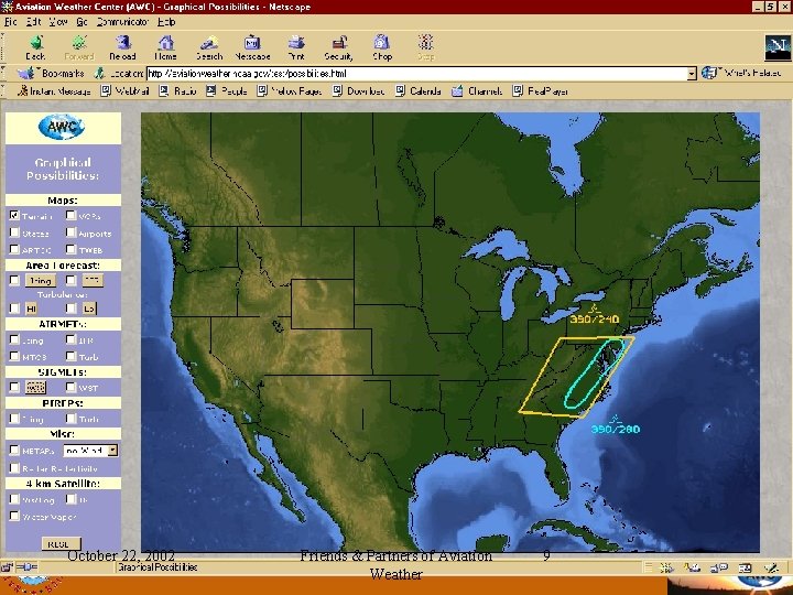
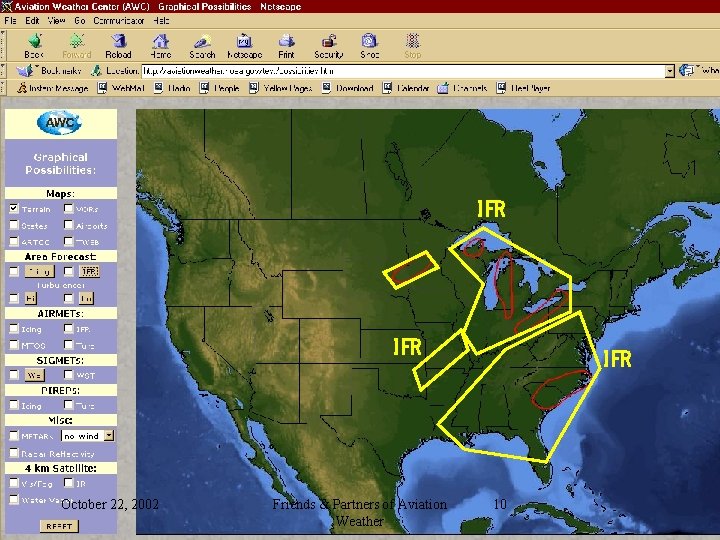
Disadvantages of Current Suite i Constructed with words and contractions >Difficult to ‘draw a picture’ with words. >Character limitation of ~3900 characters #Further reduces detail, compromises accurate description >AIRMETs are time smeared and defined with simple polygons. #Results in advisories where forecaster never intended. #Results in advisories when forecaster never intended. October 22, 2002 Friends & Partners of Aviation Weather 8

October 22, 2002 Friends & Partners of Aviation Weather 9

IFR October 22, 2002 Friends & Partners of Aviation Weather IFR 10

Comparisons with AIRMET October 22, 2002 Friends & Partners of Aviation Weather 11

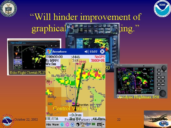
Disadvantages of Current Suite i Different rules from Annex 3 description for SWL. >Text based. Graphics are simple pictorial representations of official text product. >Hinder use of forecast information systems across international boundaries. >Will hinder improvement of graphical forecast imaging. >U. S. is style is alone in the world. October 22, 2002 Friends & Partners of Aviation Weather 12

Why Change? i Graphical Forecasts contain more information. >“A picture is worth a thousand words… a graphical FA is worth a thousand contractions pilots don’t understand. ” >Features and their spatial variability are pictured, not articulated. #Can be selectable. #Can be zoomed #Can be detailed >Weather evolution better communicated through higher time resolution of graphical information. i Graphical Forecasts are more accurate over time and space. October 22, 2002 Friends & Partners of Aviation Weather 13

Why Change? i The time is right. >Producers have capability to create graphical products (latest changes in NMAP production capability). #Alaska interested in NMAP #Canada interested in NMAP >Users have capability to view: #Honeywell WINN system #Experimental Aircraft Association Oshkosh #Aviation Digital Data Service #OASIS #COBOR, Morcom, etc. >Break Ground for new graphical products October 22, 2002 Friends & Partners of Aviation Weather 14

Change to What? i ICAO Annex 3 Prescription: BUFR >BUFR (Binary Universal Form for the Representation of Meteorological Data) #Object Oriented #Rules are international #NOT a picture, but a coded, earth-oriented description of weather info that can be made into a graphic! >International Description of Weather Information. A single system is needed. #Important in weather in the cockpit era. #The prescription already exists in Annex 3. October 22, 2002 Friends & Partners of Aviation Weather 15

Change to What? i AWC recommends international standards be followed as international communication and graphic display systems evolve: >AWC producing High Level Significant Weather Charts SWH in BUFR in next few months, matching the UK. >BUFR code for SIGMETs under development now. >WAFS SWM products and charts produced in BUFR. >SWL is next logical step for the US. October 22, 2002 Friends & Partners of Aviation Weather 16

Demo Site http: //aviationweather. gov/demo October 22, 2002 Friends & Partners of Aviation Weather 17

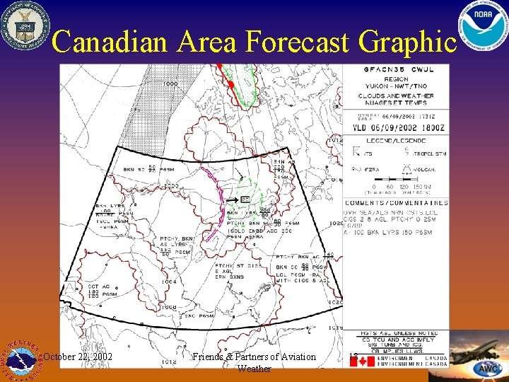
Canadian Area Forecast Graphic October 22, 2002 Friends & Partners of Aviation Weather 18

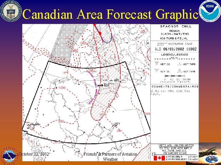
Canadian Area Forecast Graphic October 22, 2002 Friends & Partners of Aviation Weather 19

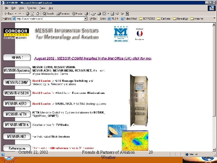
The World is Getting Ready… Corobor i Automatic generation of wind-temperature charts focusing on a specific flight route i Instant access to different areas, levels and validity times, for various meteorological parameters i Multi-windowing, data overlay, various projections i Vertical cross section, zooming, movie loop i Local production of Significant Weather Charts i User-defined flight routes. i Data retrieval by airport, area, route i Automatic print-out of comprehensive flight documentation i Triggering by flight plans / AFTN i Easy menu-driven set-up October 22, 2002 Friends & Partners of Aviation Weather 20

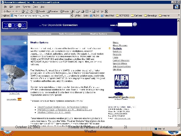
The World is Getting Ready… Morcom i i i Collection of meteorological and NOTAM data from the GTS, AFTN and SADIS. Storage of data in a RDB for ease of retrieval. Constructs relevant PIB tailored to the flight route. Allows the operator to select and refine specific geographical areas of interest. Graphically displays meteorological and NOTAM information for aerodromes, FIRs and Areas of Operation. Uses triggers to include updated information pertaining to distributed PIBs. Stores legal records of distributed PIBs. Uses decoders to verify input data before the data is stored. Non-conforming data can be returned to the originator for correction or edited by qualified personnel. PIBs can be distributed via faxes, printers, fax-on-demand LANs. Scheduled PIBs are distributed by day of operation, date and time for specific flights. October 22, 2002 Friends & Partners of Aviation Weather 21

“Will hinder improvement of graphical forecast imaging. ” Echo Flight Cheetah FL 270 Garmin GNS 530 Avidyne Flightmax 850 Control Vision Corp. October 22, 2002 Friends & Partners of Aviation Weather 22

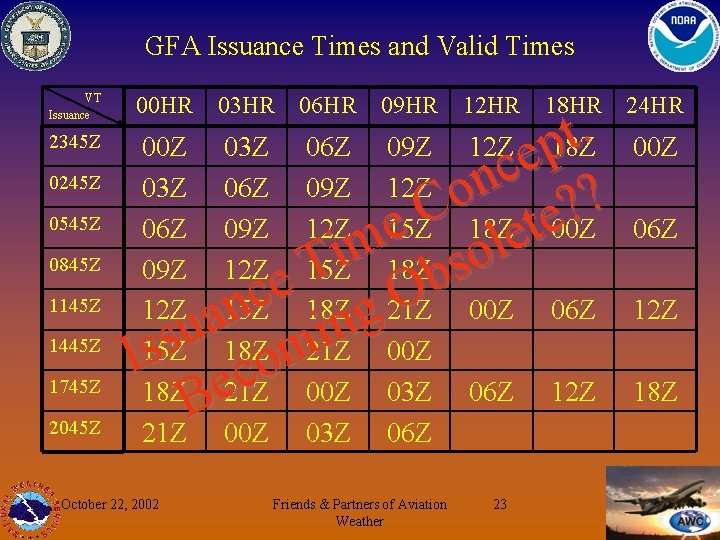
GFA Issuance Times and Valid Times VT Issuance 2345 Z 0245 Z 0545 Z 0845 Z 1145 Z 1445 Z 1745 Z 2045 Z 00 HR 03 HR 06 HR 09 HR 12 HR 18 HR . t 00 Z 03 Z 06 Z 09 Z 12 Z p 18 Z e c 03 Z 06 Z 09 Z 12 Z on ? ? C 06 Z 09 Z 12 Z 15 Z 18 Z te 00 Z e e l m i 09 Z 12 Z 15 Z 18 Z so T b e c O 12 Z 15 Z 18 Z g 21 Z 00 Z 06 Z n a n u i s 21 Z 00 Z s 18 Z m I 15 Z o c 18 Z e 21 Z 00 Z 03 Z 06 Z 12 Z B 21 Z 00 Z 03 Z 06 Z October 22, 2002 Friends & Partners of Aviation Weather 23 24 HR 00 Z 06 Z 12 Z 18 Z

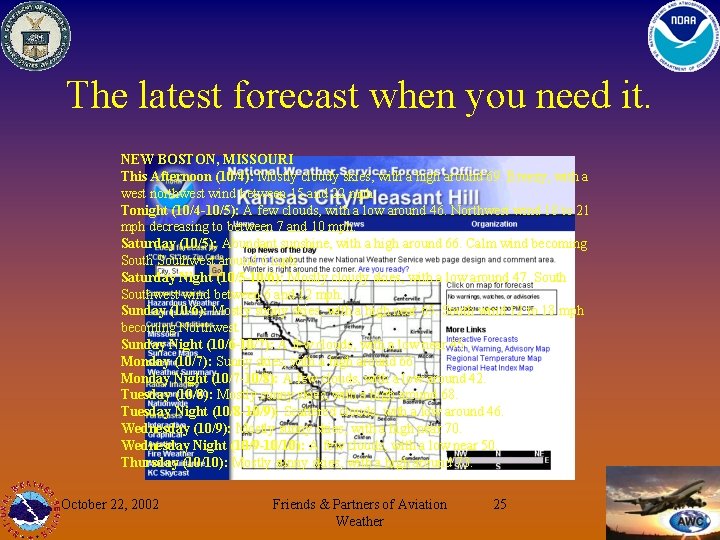
“What if…” Is happening now. i What if products were continually updated to ensure users got the latest when they asked? i NWS Office in Pleasant Hill Example October 22, 2002 Friends & Partners of Aviation Weather 24

The latest forecast when you need it. NEW BOSTON, MISSOURI This Afternoon (10/4): Mostly cloudy skies, with a high around 69. Breezy, with a west northwest wind between 15 and 22 mph. Tonight (10/4 -10/5): A few clouds, with a low around 46. Northwest wind 18 to 21 mph decreasing to between 7 and 10 mph. Saturday (10/5): Abundant sunshine, with a high around 66. Calm wind becoming Southwest around 6 mph. Saturday Night (10/5 -10/6): Mostly cloudy skies, with a low around 47. Southwest wind between 6 and 12 mph. Sunday (10/6): Mostly sunny skies, with a high near 65. South wind 12 to 18 mph becoming Northwest. Sunday Night (10/6 -10/7): A few clouds, with a low near 45. Monday (10/7): Sunny skies, with a high around 66. Monday Night (10/7 -10/8): A few clouds, with a low around 42. Tuesday (10/8): Mostly sunny skies, with a high around 68. Tuesday Night (10/8 -10/9): Scattered clouds, with a low around 46. Wednesday (10/9): Mostly sunny skies, with a high near 70. Wednesday Night (10/9 -10/10): A few clouds, with a low near 50. Thursday (10/10): Mostly sunny skies, with a high around 73. October 22, 2002 Friends & Partners of Aviation Weather 25

Need for Text i There are not enough resources at AWC to prepare both SWL graphics and area forecast text. i If text is necessary, produced through automated means. >Automating text, if necessary, will take 12 to 18 months to develop, depending on format of text. October 22, 2002 Friends & Partners of Aviation Weather 26

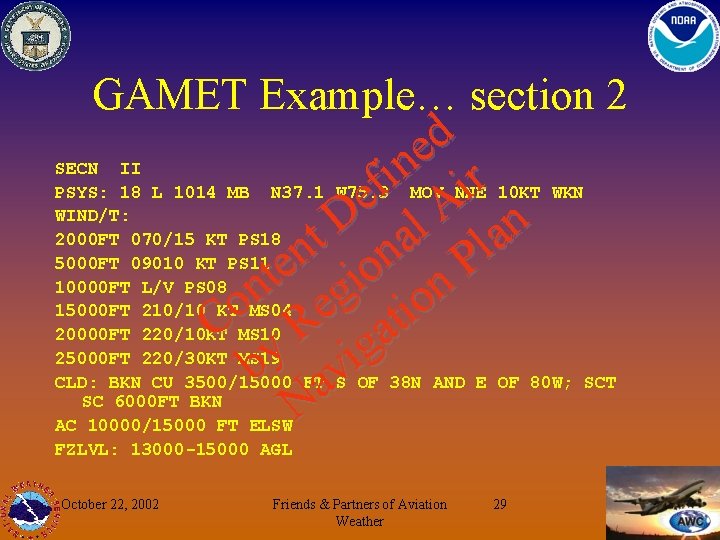
Need for Text i Text Format Choices >Current Format #Very Descriptive, segmented by states or portions of states. Six sections in the CONUS. #Character limit continues to exist. >GAMET (General Aviation Meteorology) #ICAO Annex 3, Section 6. 6 #Very structured. #Abbreviated, contractions, issued by FIR. #Two parts: Hazards & Other Weather #AIRMET definition changes. ^An update to scheduled forecast >Modified GAMET as defined by Met Authority (FAA). October 22, 2002 Friends & Partners of Aviation Weather 27

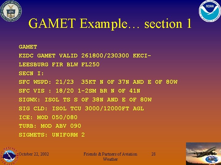
GAMET Example… section 1 GAMET KZDC GAMET VALID 261800/230300 KKCILEESBURG FIR BLW FL 250 SECN I: SFC WSPD: 21/23 35 KT N OF 37 N AND E OF 80 W SFC VIS : 18/20 1 -2 SM BR N OF 41 N SIGWX: ISOL TS S OF 38 N AND E OF 80 W SIG CLD: ISOL TCU 3000/12000 FT AGL ICE: MOD 050/080 TURB: MOD ABV 090 SIGMETS: UNIFORM 2 October 22, 2002 Friends & Partners of Aviation Weather 28

GAMET Example… section 2 d e n i r f i e A D n l t a a l n n P e o t i on n g o e i t C R ga y b avi N SECN II PSYS: 18 L 1014 MB N 37. 1 W 75. 3 MOV NNE 10 KT WKN WIND/T: 2000 FT 070/15 KT PS 18 5000 FT 09010 KT PS 11 10000 FT L/V PS 08 15000 FT 210/10 KT MS 04 20000 FT 220/10 KT MS 10 25000 FT 220/30 KT MS 19 CLD: BKN CU 3500/15000 FT S OF 38 N AND E OF 80 W; SCT SC 6000 FT BKN AC 10000/15000 FT ELSW FZLVL: 13000 -15000 AGL October 22, 2002 Friends & Partners of Aviation Weather 29

Need for Text i If graphical area forecast, who needs text? >Can AFSS briefers brief directly off graphics? >Can HIWAS be prepared directly from graphics? >Can DUATs print applicable graphics (as Corobor and Morcom do today? ) >What text products are required by ICAO Annex 3? >Is text necessary to get us “over the hump”? October 22, 2002 Friends & Partners of Aviation Weather 30

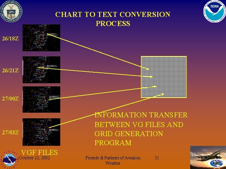
CHART TO TEXT CONVERSION PROCESS 26/18 Z 26/21 Z 27/00 Z INFORMATION TRANSFER BETWEEN VG FILES AND GRID GENERATION PROGRAM 27/03 Z VGF FILES October 22, 2002 Friends & Partners of Aviation Weather 31

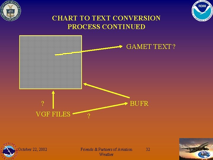
CHART TO TEXT CONVERSION PROCESS CONTINUED GAMET TEXT ? ? VGF FILES October 22, 2002 BUFR ? Friends & Partners of Aviation Weather 32

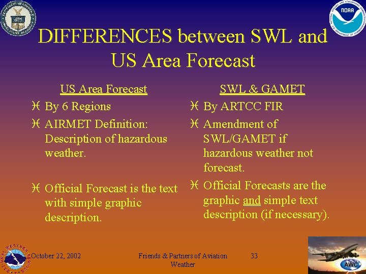
DIFFERENCES between SWL and US Area Forecast i By 6 Regions i AIRMET Definition: Description of hazardous weather. SWL & GAMET i By ARTCC FIR i Amendment of SWL/GAMET if hazardous weather not forecast. i Official Forecast is the text i Official Forecasts are the graphic and simple text with simple graphic description (if necessary). description. October 22, 2002 Friends & Partners of Aviation Weather 33

Graphical Forecast Experiment GFAX i January 15 -February 14 i Determine if AWC can produce 3 -hourly GFA charts for the CONUS. i Refine BUFR production/output requirements for NCEP Computer Development. i Refine GAMET production requirements for Meteorological Development Laboratory. i Collect BUFR forecasts to use for auto-text software development. October 22, 2002 Friends & Partners of Aviation Weather 34

GFAX Development Issues i i i Confident we can provide internet accessible charts similar to http: //aviationweather. gov/demo/ Test if we can provide 3 hour updates. Measure difficulty issuing text AIRMETs for updates. Develop requirements to produce efficiency tools. Looking for user comments on utility of product from internet display. Test GFA tool under development > > > i ASOS Observations in MSL MOS Ceilings in MSL Mountain Obscuration Tool Retool creation of BUFR files to meet developing standards October 22, 2002 Friends & Partners of Aviation Weather 35

GFAX Development Issues i Questionable: >Ability to create and distribute “user-ready” BUFR files. >Ability to create GAMET from VG Files and/or BUFR files. #What can Meteorological Development Laboratory do before mid-November? (Nothing, according to Bob Glahn, given current resources and priorities. ) #Can HPC provide 3 hourly fronts? (No. Requirement for 3 hourly forecast fronts will be put on resource list. ) October 22, 2002 Friends & Partners of Aviation Weather 36

After the GFAX i Refining Text Requirements i User Feedback >Pilots, Dispatchers, FSS i Refine BUFR Requirements >WSI provides FSS workstation displays. >WSI already into BUFR. #Hmmmm……. i ICAO Approval October 22, 2002 Friends & Partners of Aviation Weather 37

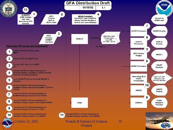
October 22, 2002 Friends & Partners of Aviation Weather 38