
Anticipating Aviation Weather Hazards in the Southwest Dr

- Slides: 22
Anticipating Aviation Weather Hazards in the Southwest Dr. Curtis N. James Department of Meteorology Prescott, Arizona
Overview • What are some general characteristics of the climate of the Southwest? • How is aviation affected by this climate? • How can the aviation weather hazards be anticipated and avoided? • Why is an understanding of the vertical structure of the atmosphere necessary?
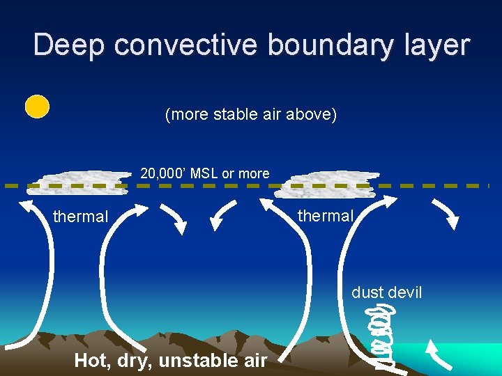
General Climate of the Southwest • Located in a latitude belt (~30°) where air generally sinks and warms (usually clear & dry; 300+ flying days / year) • Rugged terrain (clouds/precip usually more frequent over windward slopes w/ lee rain shadowing & waves) • Continental climate, isolated from oceans by terrain (generally dry air w/ high temperature variability) • Prevailing surface wind generally southwesterly (except where terrain generates local winds) • Prevailing wind aloft westerly in cold season, southerly in summer (associated with the SW monsoon) • In warm season, deep convective layer near the ground
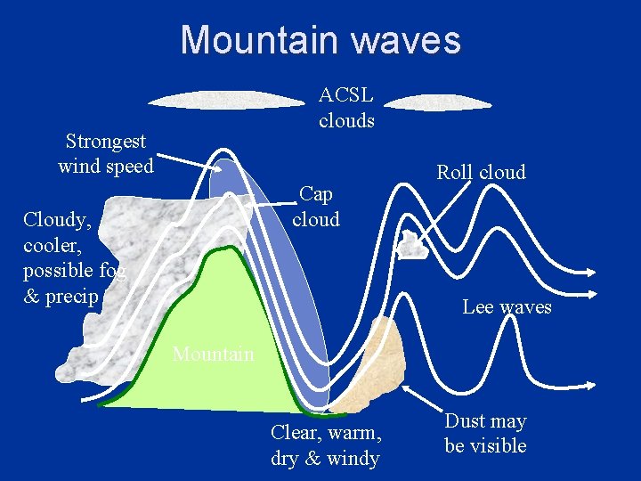
Aviation Hazards of the Southwest • Deep convective boundary layer – Low-level turbulence and dust devils • Thunderstorms (esp. July – September) – Downbursts (especially dry microbursts) – Hail, lightning, turbulence near thunderstorms • Mountain waves / shears & lee turbulence • Other (icing, low clouds, IMC, LLWS, etc. ) Related to the vertical structure of atmosphere
Deep convective boundary layer (more stable air above) 20, 000’ MSL or more thermal dust devil Hot, dry, unstable air
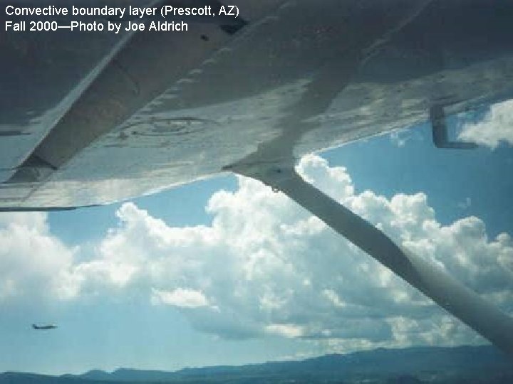
Convective boundary layer (Prescott, AZ) Fall 2000—Photo by Joe Aldrich
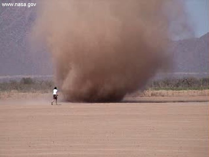
Dust Devil in Arizona www. nasa. gov
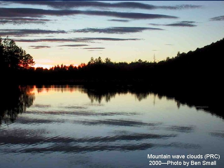
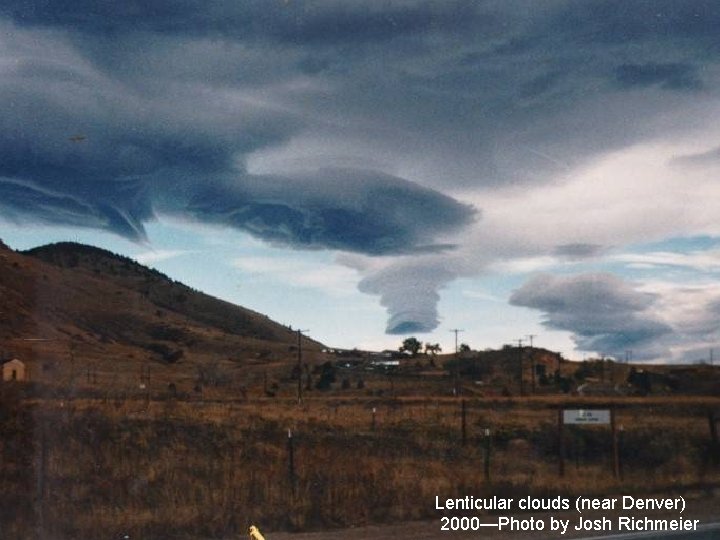
Mountain waves ACSL clouds Strongest wind speed Cap cloud Cloudy, cooler, possible fog & precip Roll cloud Lee waves Mountain Clear, warm, dry & windy Dust may be visible
Mountain wave clouds (PRC) 2000—Photo by Ben Small
Lenticular clouds (near Denver) 2000—Photo by Josh Richmeier
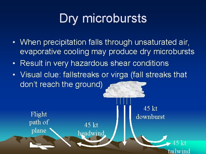
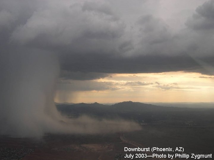
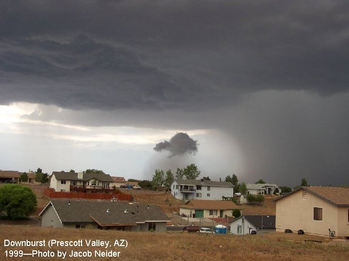
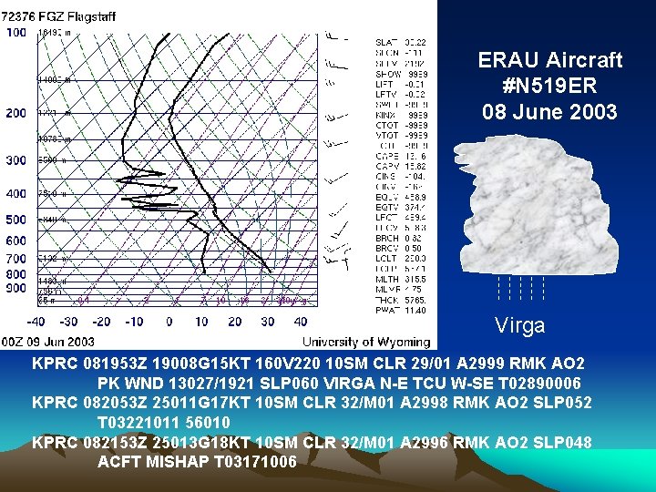
Dry microbursts • When precipitation falls through unsaturated air, evaporative cooling may produce dry microbursts • Result in very hazardous shear conditions • Visual clue: fallstreaks or virga (fall streaks that don’t reach the ground) Flight path of plane 45 kt downburst 45 kt headwind 45 kt tailwind
Downburst (Phoenix, AZ) July 2003—Photo by Phillip Zygmunt
Downburst (Prescott Valley, AZ) 1999—Photo by Jacob Neider
ERAU Aircraft #N 519 ER 08 June 2003 Virga KPRC 081953 Z 19008 G 15 KT 160 V 220 10 SM CLR 29/01 A 2999 RMK AO 2 PK WND 13027/1921 SLP 060 VIRGA N-E TCU W-SE T 02890006 KPRC 082053 Z 25011 G 17 KT 10 SM CLR 32/M 01 A 2998 RMK AO 2 SLP 052 T 03221011 56010 KPRC 082153 Z 25013 G 18 KT 10 SM CLR 32/M 01 A 2996 RMK AO 2 SLP 048 ACFT MISHAP T 03171006
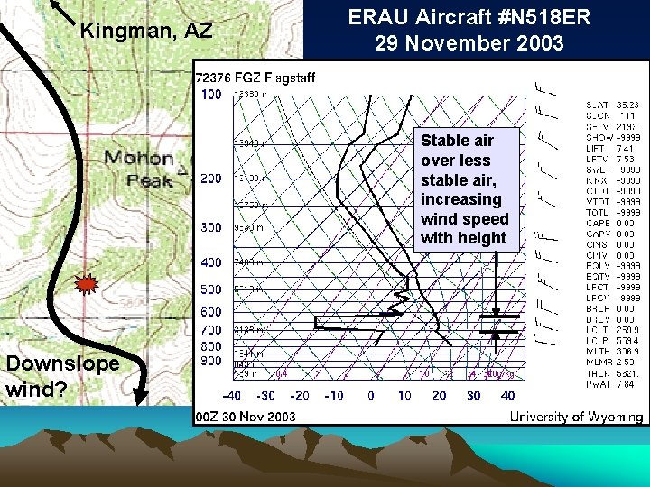
Kingman, AZ ERAU Aircraft #N 518 ER 29 November 2003 Stable air over less stable air, increasing wind speed with height Downslope wind?
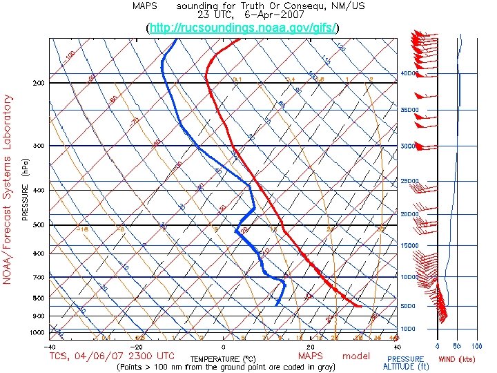
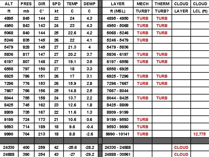
Vertical structure of atmosphere The following three parameters can be used to anticipate most of the hazards in a forecast vertical sounding: (Analysis Tool: http: //meteo. pr. erau. edu/links. php)
(http: //rucsoundings. noaa. gov/gifs/)
ALT PRES DIR SPD TEMP DEWP LAYER MECH THERM CLOUD ft mb C° kt C C ft (MSL) TURB? LAYER LCL (ft) 4895 845 144 22 24 4. 3 4895 - 4950 TURB 4950 843 143 24 23 4. 3 4950 - 5068 TURB 5068 840 144 25 22. 6 4. 2 5068 - 5246 TURB 5246 835 145 26 22 4. 1 5246 - 5479 TURB 5479 828 145 27 21. 3 4 5479 - 5836 817 147 27 20. 2 3. 7 5836 - 6197 TURB 6197 807 148 27 19. 1 3. 5 6197 - 6558 TURB 6558 797 150 27 18 3. 3 6558 - 6925 786 151 26 17 3. 1 6925 - 7296 TURB 7296 776 153 26 15. 9 2. 8 7296 - 7667 TURB 7667 766 156 25 14. 8 2. 5 7667 - 8044 755 158 24 13. 7 2. 2 8044 - 8425 TURB 8425 745 162 23 12. 6 1. 8 8425 - 8809 735 167 22 11. 6 1. 3 8809 - 9199 724 173 21 10. 6 9199 - 9593 TURB 9593 714 189 18 9. 6 -0. 4 9593 - 9990 TURB 9990 704 213 18 8. 8 -2. 6 9990 - 10141 TURB 12, 775 24330 400 259 42 -25. 6 -28. 2 24330 - 24888 CLOUD 24888 390 254 43 -27 -29. 2 24888 - 30561 CLOUD
Convectively unstable layer Dry thermals
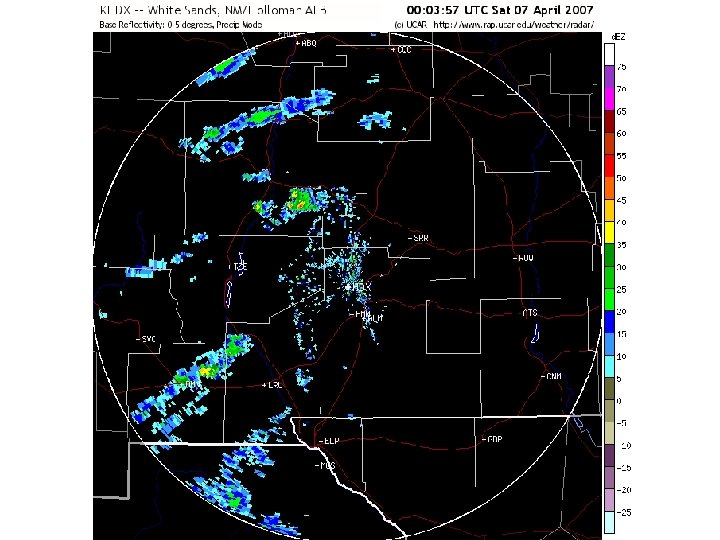
WSR-88 D Radar Images NM/Holloman AFB
Summary • The Southwest has a fascinating climate, with a number of aviation hazards • Many hazards may be anticipated using a vertical profile of the atmosphere • Suggest analyze forecast sounding prior to flight (http: //rucsoundings. noaa. gov/gifs/) • Spreadsheet tool is available on the ERAU Department of Meteorology website (http: //meteo. pr. erau. edu/links. php) Questions?