SIGMETS without PIREPs FORECASTING AVIATION WEATHER HAZARDS IN
- Slides: 31

SIGMETS without PIREPs FORECASTING AVIATION WEATHER HAZARDS IN A QUIET AIRSPACE TOM ADAMS AND CHRIS WEBSTER JULY 2015 Image by Michael Markieta based on 2011 data POWERFUL WEATHER INTELLIGENCE.

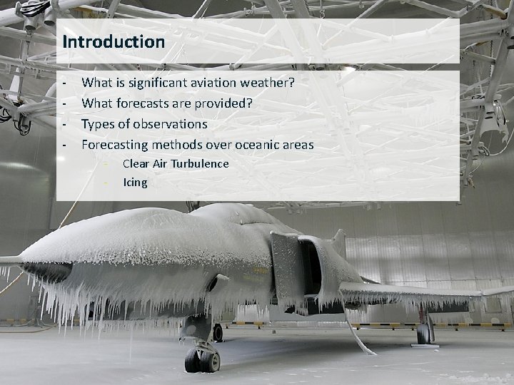
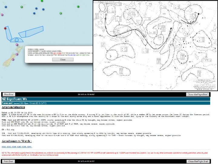
Introduction - What is significant aviation weather? What forecasts are provided? Types of observations Forecasting methods over oceanic areas - Clear Air Turbulence Icing POWERFUL WEATHER INTELLIGENCE.

POWERFUL WEATHER INTELLIGENCE.

POWERFUL WEATHER INTELLIGENCE.

POWERFUL WEATHER INTELLIGENCE.

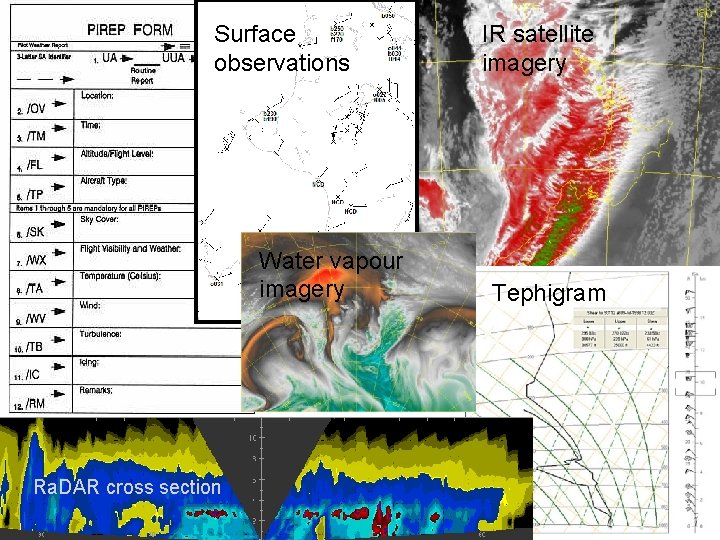
Surface observations IR satellite imagery Water vapour imagery Tephigram Ra. DAR cross section POWERFUL WEATHER INTELLIGENCE.

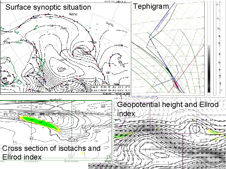
Surface synoptic situation Tephigram Geopotential height and Ellrod index Cross section of isotachs and Ellrod index POWERFUL WEATHER INTELLIGENCE.

Clear Air Turbulence (CAT) Courtesy of Matt Ford, cat expert POWERFUL WEATHER INTELLIGENCE.

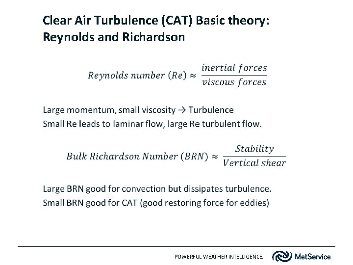
Clear Air Turbulence (CAT) Basic theory: Reynolds and Richardson POWERFUL WEATHER INTELLIGENCE.

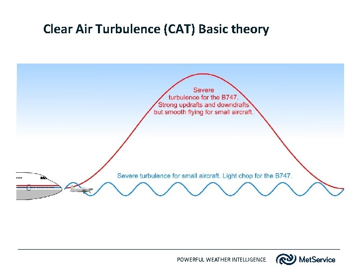
Clear Air Turbulence (CAT) Basic theory POWERFUL WEATHER INTELLIGENCE.

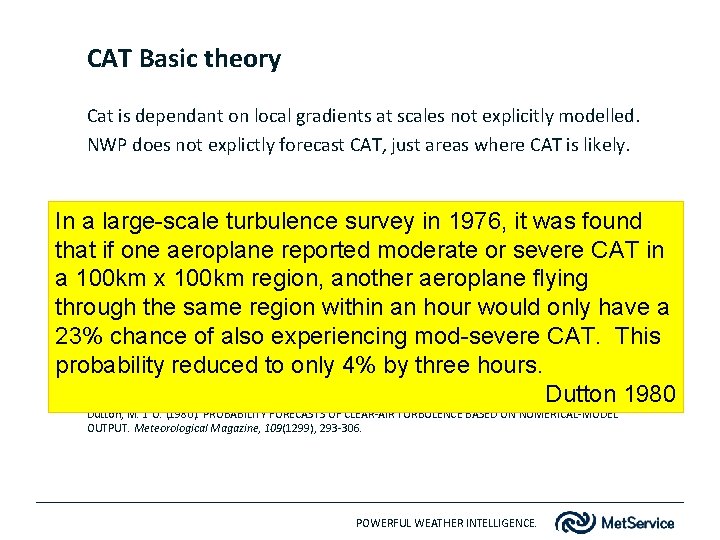
CAT Basic theory Cat is dependant on local gradients at scales not explicitly modelled. NWP does not explictly forecast CAT, just areas where CAT is likely. In a large-scale turbulence survey in 1976, it was found that if one aeroplane reported moderate or severe CAT in a 100 km x 100 km region, another aeroplane flying through the same region within an hour would only have a 23% chance of also experiencing mod-severe CAT. This probability reduced to only 4% by three hours. Dutton 1980 Dutton, M. J. O. (1980). PROBABILITY FORECASTS OF CLEAR-AIR TURBULENCE BASED ON NUMERICAL-MODEL OUTPUT. Meteorological Magazine, 109(1299), 293 -306. POWERFUL WEATHER INTELLIGENCE.

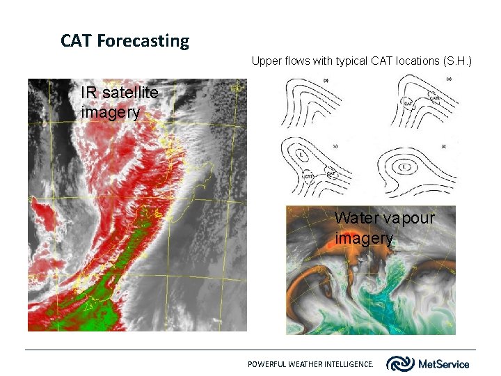
CAT Forecasting Upper flows with typical CAT locations (S. H. ) IR satellite imagery Water vapour imagery POWERFUL WEATHER INTELLIGENCE.

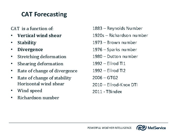
CAT Forecasting CAT is a function of: • Vertical wind shear • Stability • Divergence • Stretching deformation • Shearing deformation • Rate of change of divergence • Rate of change of stability Horizontal wind shear • Wind speed • Richardson number 1883 – Reynolds Number 1920 s – Richardson number 1973 – Brown number 1976 – Sparks number 1980 – Dutton number 1992 – Ellrod TI 1 1992 – Ellrod TI 2 2006 – GTG 2 2010 – Ellrod-Knox DTI 2011 - TBindex POWERFUL WEATHER INTELLIGENCE.

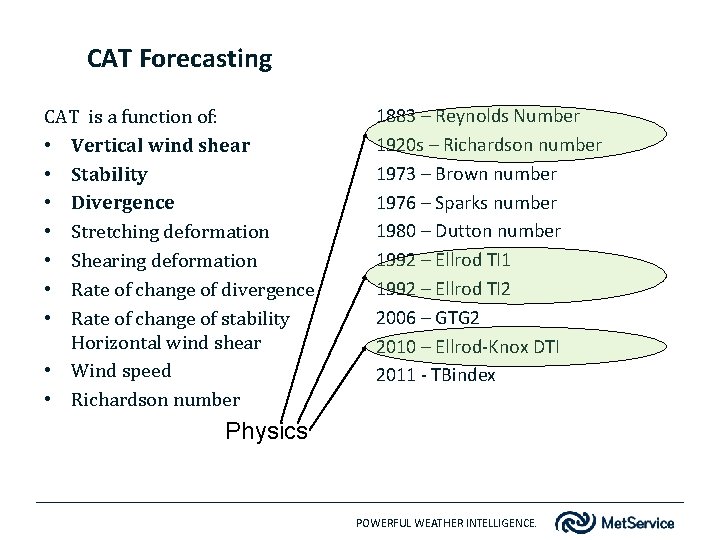
CAT Forecasting CAT is a function of: • Vertical wind shear • Stability • Divergence • Stretching deformation • Shearing deformation • Rate of change of divergence • Rate of change of stability Horizontal wind shear • Wind speed • Richardson number 1883 – Reynolds Number 1920 s – Richardson number 1973 – Brown number 1976 – Sparks number 1980 – Dutton number 1992 – Ellrod TI 1 1992 – Ellrod TI 2 2006 – GTG 2 2010 – Ellrod-Knox DTI 2011 - TBindex Physics POWERFUL WEATHER INTELLIGENCE.

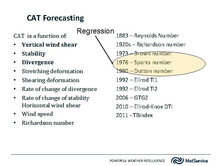
CAT Forecasting Regression CAT is a function of: • Vertical wind shear • Stability • Divergence • Stretching deformation • Shearing deformation • Rate of change of divergence • Rate of change of stability Horizontal wind shear • Wind speed • Richardson number 1883 – Reynolds Number 1920 s – Richardson number 1973 – Brown number 1976 – Sparks number 1980 – Dutton number 1992 – Ellrod TI 1 1992 – Ellrod TI 2 2006 – GTG 2 2010 – Ellrod-Knox DTI 2011 - TBindex POWERFUL WEATHER INTELLIGENCE.

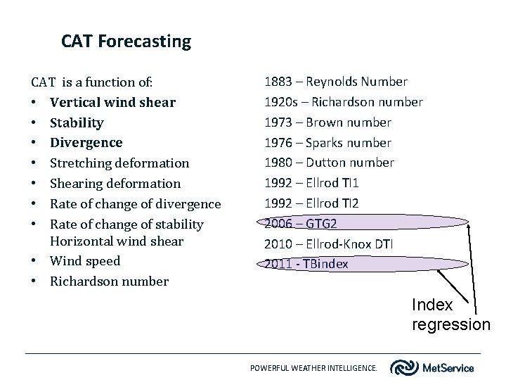
CAT Forecasting CAT is a function of: • Vertical wind shear • Stability • Divergence • Stretching deformation • Shearing deformation • Rate of change of divergence • Rate of change of stability Horizontal wind shear • Wind speed • Richardson number 1883 – Reynolds Number 1920 s – Richardson number 1973 – Brown number 1976 – Sparks number 1980 – Dutton number 1992 – Ellrod TI 1 1992 – Ellrod TI 2 2006 – GTG 2 2010 – Ellrod-Knox DTI 2011 - TBindex Index regression POWERFUL WEATHER INTELLIGENCE.

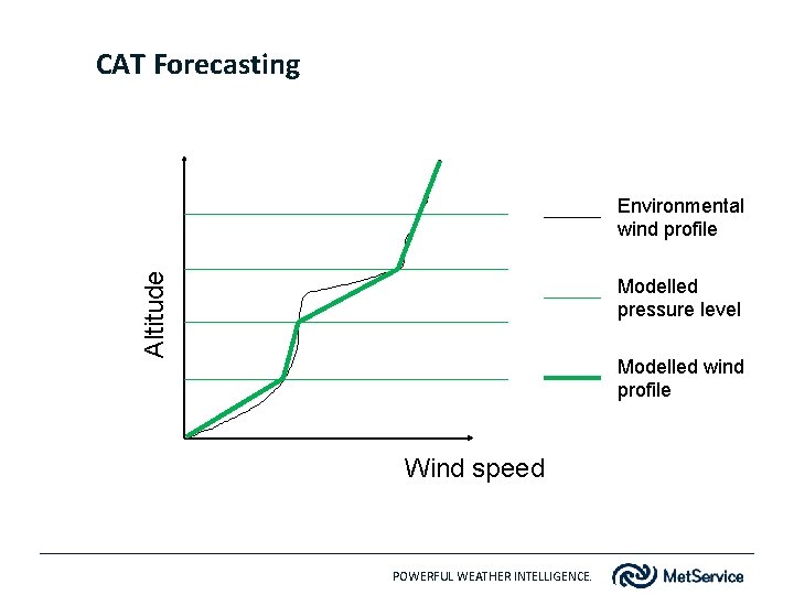
CAT Forecasting Altitude Environmental wind profile Modelled pressure level Modelled wind profile Wind speed POWERFUL WEATHER INTELLIGENCE.

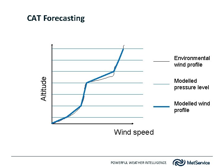
CAT Forecasting Altitude Environmental wind profile Modelled pressure level Modelled wind profile Wind speed POWERFUL WEATHER INTELLIGENCE.

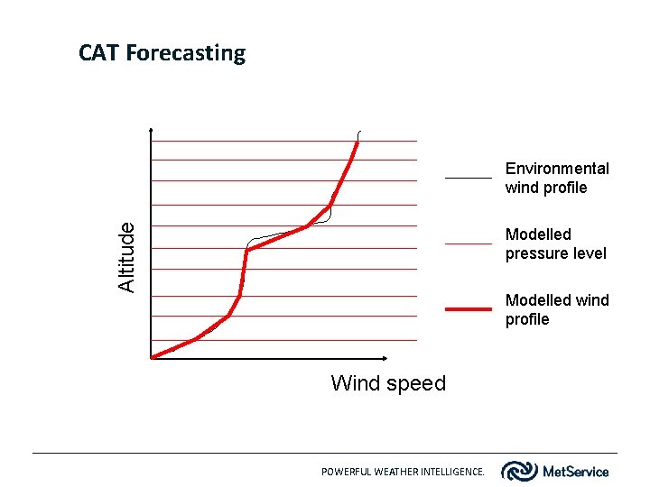
CAT Forecasting Altitude Environmental wind profile Modelled pressure level Modelled wind profile Wind speed POWERFUL WEATHER INTELLIGENCE.

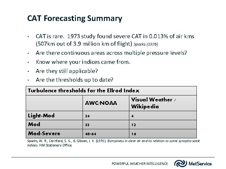
CAT Forecasting Summary - CAT is rare. 1973 study found severe CAT in 0. 013% of air kms (507 km out of 3. 9 million km of flight) Sparks (1976) Are there continuous areas across multiple pressure levels? Know where your indices came from. Are they still applicable? Are thresholds up to date? Turbulence thresholds for the Ellrod Index AWC/NOAA Visual Weather / Wikipedia Light-Mod 24 4 Mod 32 12 Mod-Severe 48 -64 16 Sparks, W. R. , Cornford, S. G. , & Gibson, J. K. (1976). Bumpiness in clear air and its relation to some synoptic-scale indices. HM Stationery Office. POWERFUL WEATHER INTELLIGENCE.

Aircraft Icing POWERFUL WEATHER INTELLIGENCE.

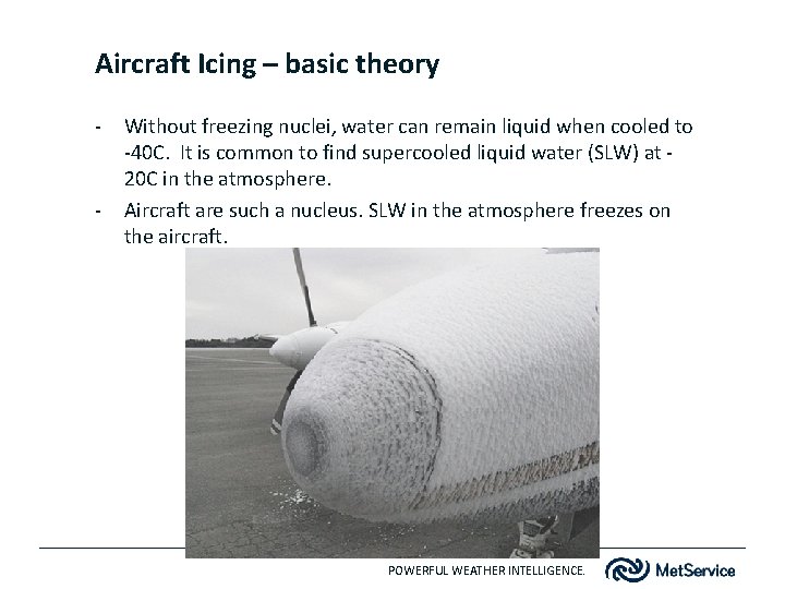
Aircraft Icing – basic theory - - Without freezing nuclei, water can remain liquid when cooled to -40 C. It is common to find supercooled liquid water (SLW) at 20 C in the atmosphere. Aircraft are such a nucleus. SLW in the atmosphere freezes on the aircraft. POWERFUL WEATHER INTELLIGENCE.

Aircraft Icing – basic theory Aircraft icing is a function of : - Moisture content Temperature Droplet phase Collection efficiency Collection rate Droplet size Upwards motion POWERFUL WEATHER INTELLIGENCE.

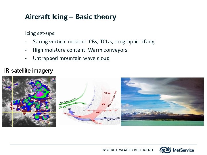
Aircraft Icing – Basic theory Icing set-ups: - Strong vertical motion: CBs, TCUs, orographic lifting - High moisture content: Warm conveyors - Untrapped mountain wave cloud IR satellite imagery POWERFUL WEATHER INTELLIGENCE.

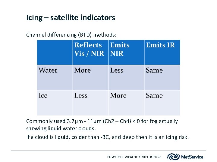
Icing – satellite indicators Channel differencing (BTD) methods: Commonly used 3. 7µm - 11µm (Ch 2 – Ch 4) < 0 for fog actually showing liquid water clouds. If a cloud is liquid, colder than -3 C, and deep then it is an icing risk. POWERFUL WEATHER INTELLIGENCE.

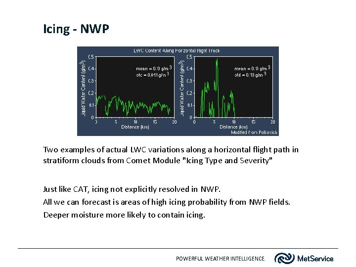
Icing - NWP Two examples of actual LWC variations along a horizontal flight path in stratiform clouds from Comet Module "Icing Type and Severity" Just like CAT, icing not explicitly resolved in NWP. All we can forecast is areas of high icing probability from NWP fields. Deeper moisture more likely to contain icing. POWERFUL WEATHER INTELLIGENCE.

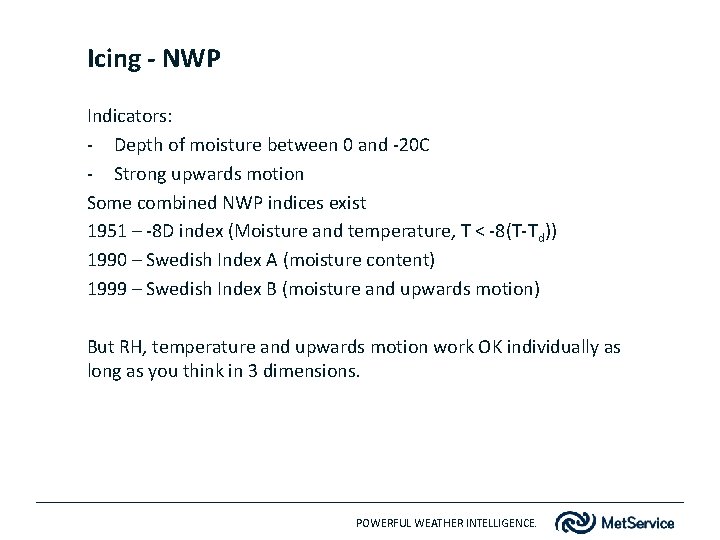
Icing - NWP Indicators: - Depth of moisture between 0 and -20 C - Strong upwards motion Some combined NWP indices exist 1951 – -8 D index (Moisture and temperature, T < -8(T-Td)) 1990 – Swedish Index A (moisture content) 1999 – Swedish Index B (moisture and upwards motion) But RH, temperature and upwards motion work OK individually as long as you think in 3 dimensions. POWERFUL WEATHER INTELLIGENCE.

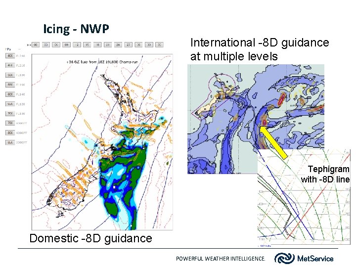
Icing - NWP International -8 D guidance at multiple levels Tephigram with -8 D line Domestic -8 D guidance POWERFUL WEATHER INTELLIGENCE.

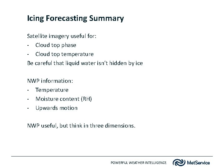
Icing Forecasting Summary Satellite imagery useful for: - Cloud top phase - Cloud top temperature Be careful that liquid water isn’t hidden by ice NWP information: - Temperature - Moisture content (RH) - Upwards motion NWP useful, but think in three dimensions. POWERFUL WEATHER INTELLIGENCE.

Forecasting examples…. . POWERFUL WEATHER INTELLIGENCE.

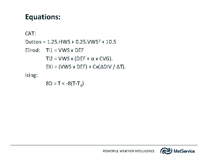
Equations: CAT: Dutton = 1. 25. HWS + 0. 25. VWS 2 + 10. 5 Ellrod: TI 1 = VWS x DEF TI 2 = VWS x (DEF + α x CVG). EKI = (VWS x DEF) + Cx(ΔDIV / ΔT). Icing: 8 D = T < -8(T-Td) POWERFUL WEATHER INTELLIGENCE.