Source NASA The What When Why and Where
- Slides: 20

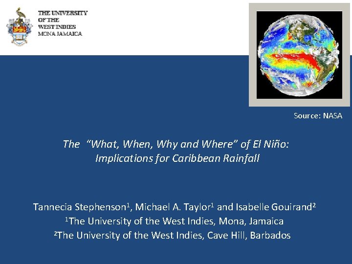
Source: NASA The “What, When, Why and Where” of El Niño: Implications for Caribbean Rainfall Tannecia Stephenson 1, Michael A. Taylor 1 and Isabelle Gouirand 2 1 The University of the West Indies, Mona, Jamaica 2 The University of the West Indies, Cave Hill, Barbados

The “What, When, Why and Where” of El Niño: Implications for Caribbean Rainfall • What?

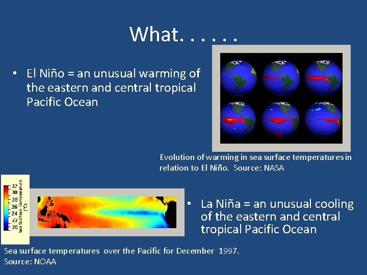
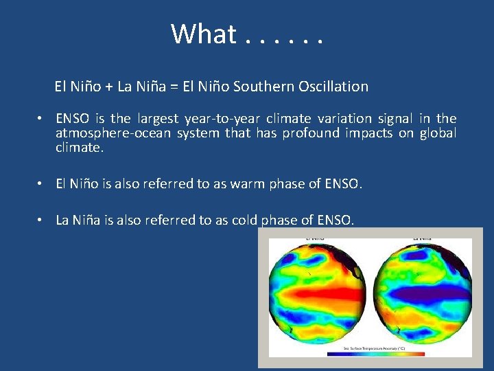
What. . . • El Niño = an unusual warming of the eastern and central tropical Pacific Ocean Evolution of warming in sea surface temperatures in relation to El Niño. Source: NASA • La Niña = an unusual cooling of the eastern and central tropical Pacific Ocean Sea surface temperatures over the Pacific for December 1997. Source: NOAA

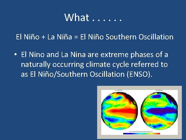
What. . . El Niño + La Niña = El Niño Southern Oscillation • El Nino and La Nina are extreme phases of a naturally occurring climate cycle referred to as El Niño/Southern Oscillation (ENSO).

What. . . El Niño + La Niña = El Niño Southern Oscillation • ENSO is the largest year-to-year climate variation signal in the atmosphere-ocean system that has profound impacts on global climate. • El Niño is also referred to as warm phase of ENSO. • La Niña is also referred to as cold phase of ENSO.

The “What, When, Why and Where” of El Niño: Implications for Caribbean Rainfall • What? • When?

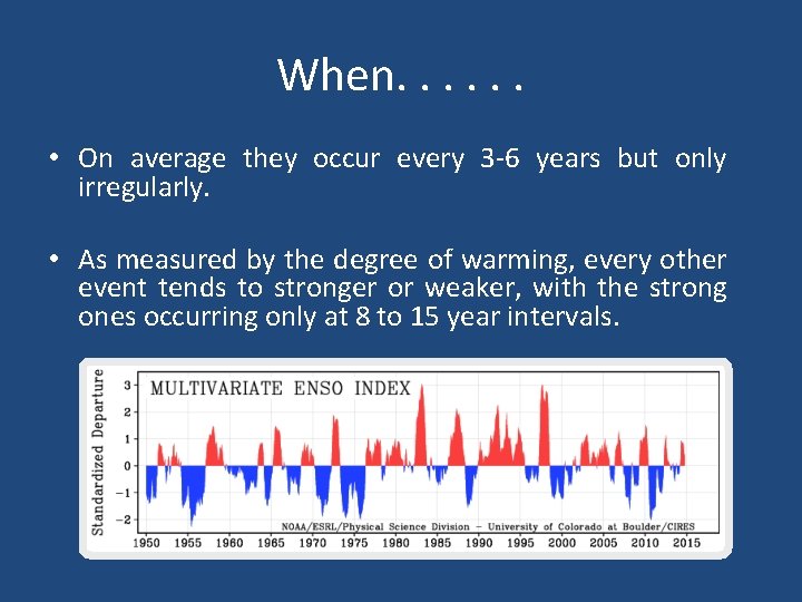
When. . . • On average they occur every 3 -6 years but only irregularly. • As measured by the degree of warming, every other event tends to stronger or weaker, with the strong ones occurring only at 8 to 15 year intervals.

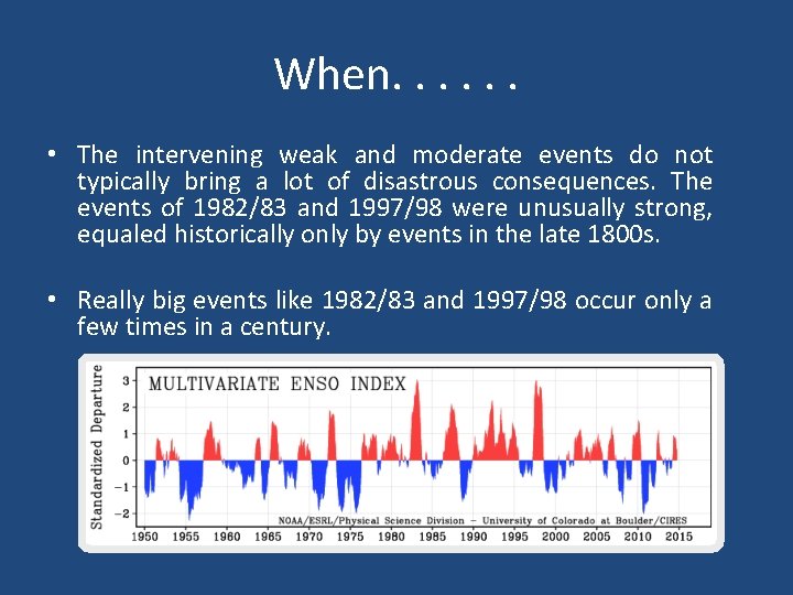
When. . . • The intervening weak and moderate events do not typically bring a lot of disastrous consequences. The events of 1982/83 and 1997/98 were unusually strong, equaled historically only by events in the late 1800 s. • Really big events like 1982/83 and 1997/98 occur only a few times in a century.

The “What, When, Why and Where” of El Niño: Implications for Caribbean Rainfall • What? • When? • Why?

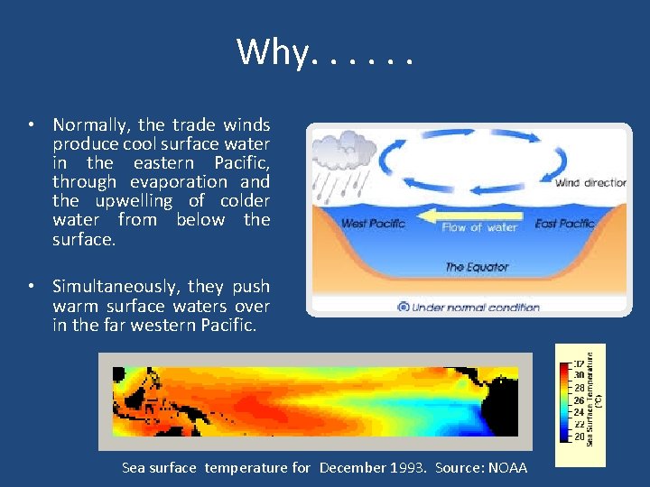
Why. . . • Normally, the trade winds produce cool surface water in the eastern Pacific, through evaporation and the upwelling of colder water from below the surface. • Simultaneously, they push warm surface waters over in the far western Pacific. Sea surface temperature for December 1993. Source: NOAA

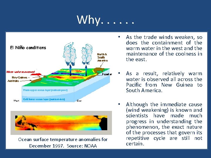
Why. . . • As the trade winds weaken, so does the containment of the warm water in the west and the maintenance of the coolness in the east. • As a result, relatively warm water is observed all across the Pacific from New Guinea to South America. Ocean surface temperature anomalies for December 1997. Source: NOAA • Although the immediate cause (wind weakening) is known and scientists have made much progress in understanding the phenomenon, the exact nature of the processes that govern its repetitive cycle are still not certain.

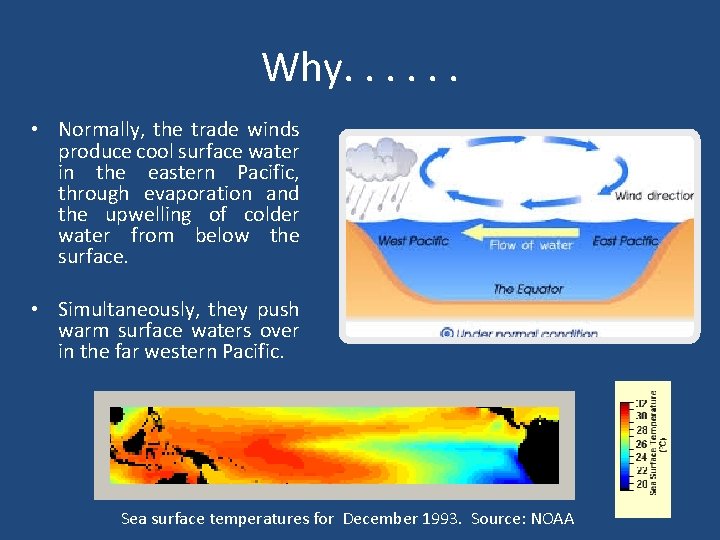
Why. . . • Normally, the trade winds produce cool surface water in the eastern Pacific, through evaporation and the upwelling of colder water from below the surface. • Simultaneously, they push warm surface waters over in the far western Pacific. Sea surface temperatures for December 1993. Source: NOAA

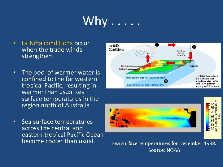
Why. . . • La Niña conditions occur when the trade winds strengthen • The pool of warmer water is confined to the far western tropical Pacific, resulting in warmer than usual sea surface temperatures in the region north of Australia. • Sea surface temperatures across the central and eastern tropical Pacific Ocean become cooler than usual. Sea surface temperatures for December 1998. Source: NOAA

The “What, When, Why and Where” of El Niño: Implications for Caribbean Rainfall • • What? When? Why? Where?

Where. . .

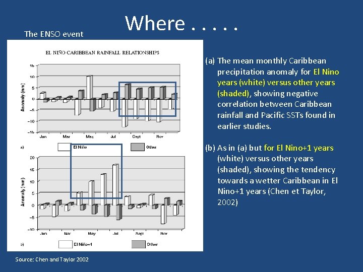
The ENSO event Where. . . (a) The mean monthly Caribbean precipitation anomaly for El Nino years (white) versus other years (shaded), showing negative correlation between Caribbean rainfall and Pacific SSTs found in earlier studies. (b) As in (a) but for El Nino+1 years (white) versus other years (shaded), showing the tendency towards a wetter Caribbean in El Nino+1 years (Chen et Taylor, 2002) Source: Chen and Taylor 2002

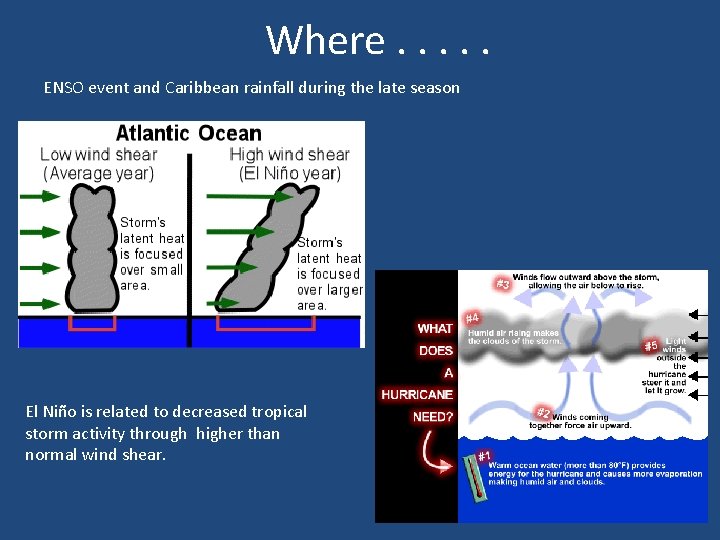
Where. . . ENSO event and Caribbean rainfall during the late season El Niño is related to decreased tropical storm activity through higher than normal wind shear.

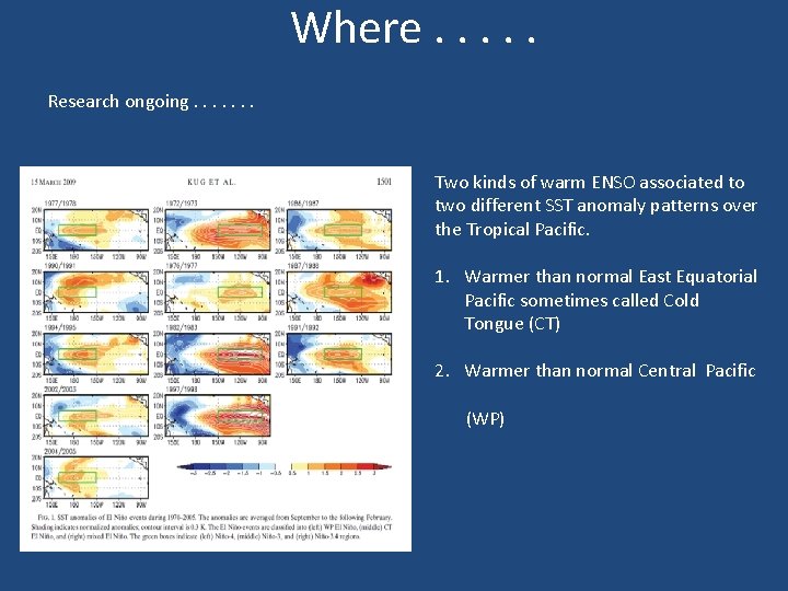
Where. . . Research ongoing. . . . Two kinds of warm ENSO associated to two different SST anomaly patterns over the Tropical Pacific. 1. Warmer than normal East Equatorial Pacific sometimes called Cold Tongue (CT) 2. Warmer than normal Central Pacific (WP)

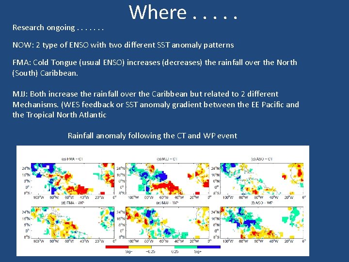
Research ongoing. . . . Where. . . NOW: 2 type of ENSO with two different SST anomaly patterns FMA: Cold Tongue (usual ENSO) increases (decreases) the rainfall over the North (South) Caribbean. MJJ: Both increase the rainfall over the Caribbean but related to 2 different Mechanisms. (WES feedback or SST anomaly gradient between the EE Pacific and the Tropical North Atlantic Rainfall anomaly following the CT and WP event

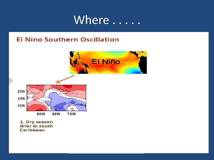
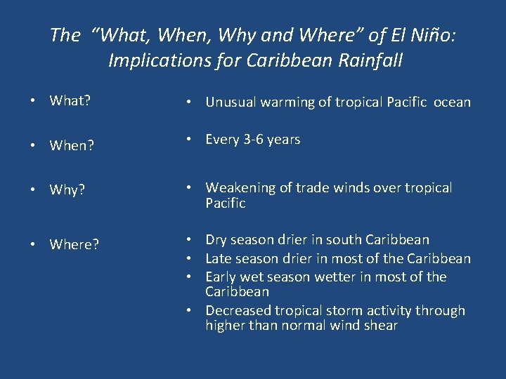
The “What, When, Why and Where” of El Niño: Implications for Caribbean Rainfall • What? • Unusual warming of tropical Pacific ocean • When? • Every 3 -6 years • Why? • Weakening of trade winds over tropical Pacific • Where? • Dry season drier in south Caribbean • Late season drier in most of the Caribbean • Early wet season wetter in most of the Caribbean • Decreased tropical storm activity through higher than normal wind shear