Recent AMDAR MDCRSACARS Activities at GSD New AMDARRUC


- Slides: 30

Recent AMDAR (MDCRS/ACARS) Activities at GSD • New AMDAR-RUC database that helps evaluate AMDAR data quality • Optimization study that suggests data can be “thinned” under certain circumstances 1

AMDAR-RUC Database • Stores AMDAR data (including MDCRS, TAMDAR, Canadian, other foreign carriers) • Also stores RHC (20 km grid) 1 h forecast values – valid at the hour nearest the ob time – interpolated to the location of the ob • Also keeps RUC reject reason(s) (if any) for each variable (new) • Only for the RUC domain (CONUS+) 2

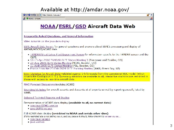
Available at http: //amdar. noaa. gov/ 3

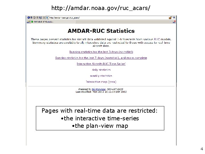
http: //amdar. noaa. gov/ruc_acars/ Pages with real-time data are restricted: • the interactive time-series • the plan-view map 4

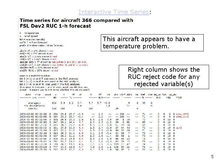
Interactive Time Series: This aircraft appears to have a temperature problem. Right column shows the RUC reject code for any rejected variable(s) 5

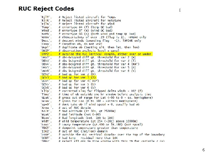
6

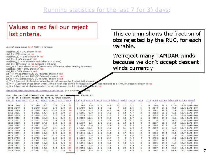
Running statistics for the last 7 (or 3) days: Values in red fail our reject list criteria. This column shows the fraction of obs rejected by the RUC, for each variable. We reject many TAMDAR winds because we don’t accept descent winds currently 7

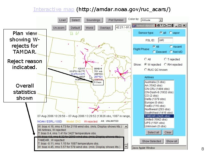
Interactive map (http: //amdar. noaa. gov/ruc_acars/) Plan view showing Wrejects for TAMDAR. Reject reason indicated. Overall statistics shown 8

Many statistics can be generated inhouse from the database • Vertical profiles • Time series' for specific fleets 9

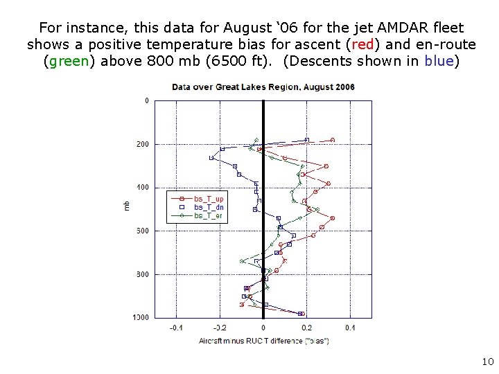
For instance, this data for August ‘ 06 for the jet AMDAR fleet shows a positive temperature bias for ascent (red) and en-route (green) above 800 mb (6500 ft). (Descents shown in blue) 10

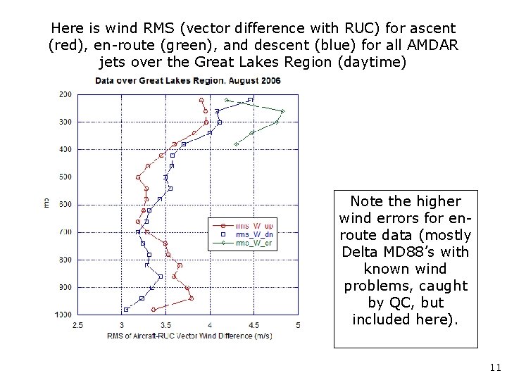
Here is wind RMS (vector difference with RUC) for ascent (red), en-route (green), and descent (blue) for all AMDAR jets over the Great Lakes Region (daytime) Note the higher wind errors for enroute data (mostly Delta MD 88’s with known wind problems, caught by QC, but included here). 11

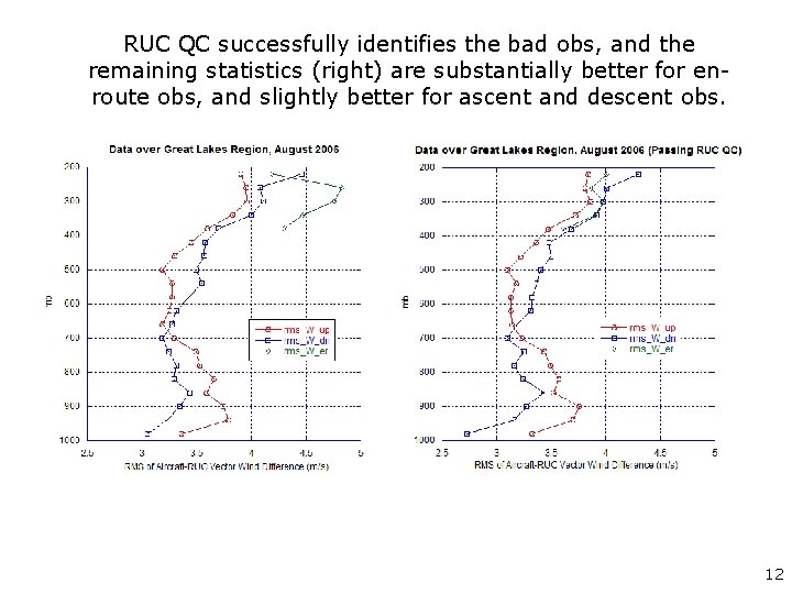
RUC QC successfully identifies the bad obs, and the remaining statistics (right) are substantially better for enroute obs, and slightly better for ascent and descent obs. 12

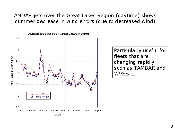
AMDAR jets over the Great Lakes Region (daytime) shows summer decrease in wind errors (due to decreased wind) Particularly useful for fleets that are changing rapidly, such as TAMDAR and WVSS-II 13

Truth? ? • We don’t claim the RUC is truth, but it does provide a common standard with which to compare different data sources. 14

AMDAR Optimization Study • FAA asked GSD to study whether AMDAR data can be “optimized” (I. e. , “thinned”) without degrading RUC forecast skill. • We presented out results at the January AMS meeting: – Moninger, W. R. , S. G. Benjamin, D. Devenyi, B. D. Jamison, B. E. Schwartz, T. L. Smith, and E. Szoke, 2006: AMDAR optimization studies at the Global Systems Division. 10 th Symposium on Integrated Observing and Assimilation Systems for Atmosphere, Oceans, and Land Surface (IOASAOLS), Atlanta, GA, Amer. Meteor. Soc. , CD-ROM, 2. 4 a. 15

The optimal amount of AMDAR data in a particular region depends on the purpose. In our paper, we consider • National Numerical Weather Prediction (NWP), 0 to 12 h forecasts • Subjective forecasting, primarily for aviation • Now, I’ll focus on NWP using the Rapid Update Cycle (RUC) 16

RUC AMDAR Observation Sensitivity Experiments (OSE) • We looked at RUC skill (verified with RAOBS) with – – All AMDAR data No TAMDAR data (see paper) Thinned AMDAR data • Time period: 22 - 28 April 2005, an active weather period • Focused on 0 to 12 h forecasts, particularly 3 h forecasts 17

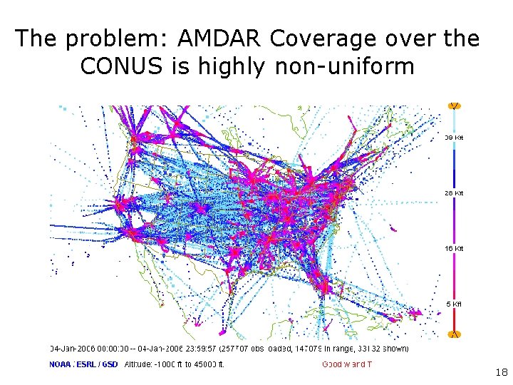
The problem: AMDAR Coverage over the CONUS is highly non-uniform 18

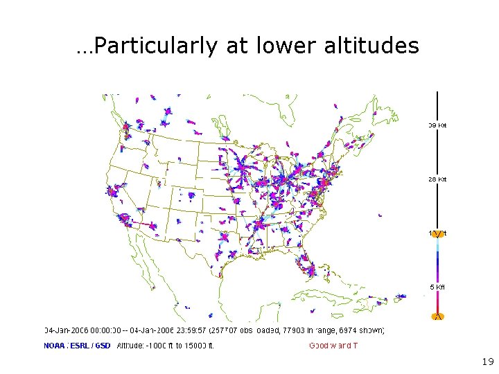
…Particularly at lower altitudes 19

Our thinning strategy • Instead of removing individual flights, we thinned data (post-hoc) on a grid • This is optimal for the RUC, but would be difficult to achieve in practice 20

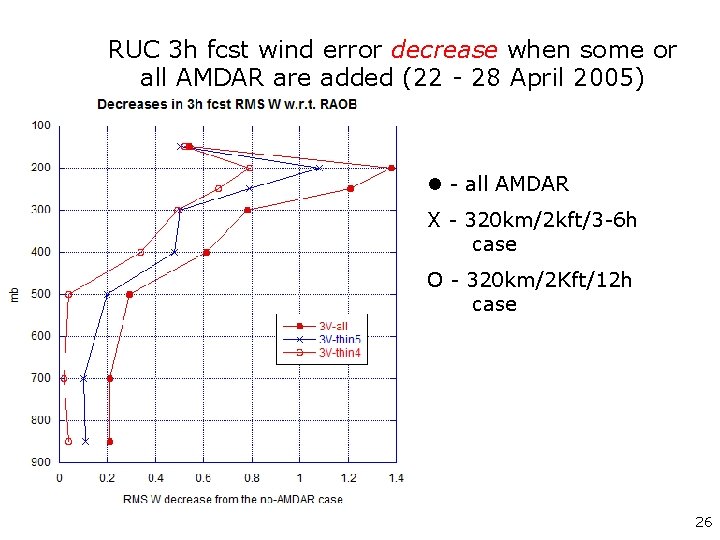
The 320 km/2 Kft/12 h case Data are thinned on a grid. The RUC ingests 1 data point… • in each 320 km x 320 km x 2000 ft box • every 12 hours • provides a very uniform distribution in space and time 21

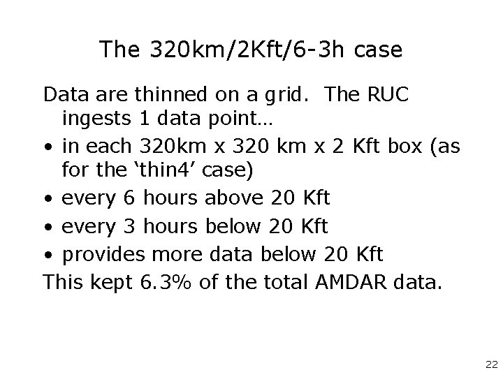
The 320 km/2 Kft/6 -3 h case Data are thinned on a grid. The RUC ingests 1 data point… • in each 320 km x 320 km x 2 Kft box (as for the ‘thin 4’ case) • every 6 hours above 20 Kft • every 3 hours below 20 Kft • provides more data below 20 Kft This kept 6. 3% of the total AMDAR data. 22

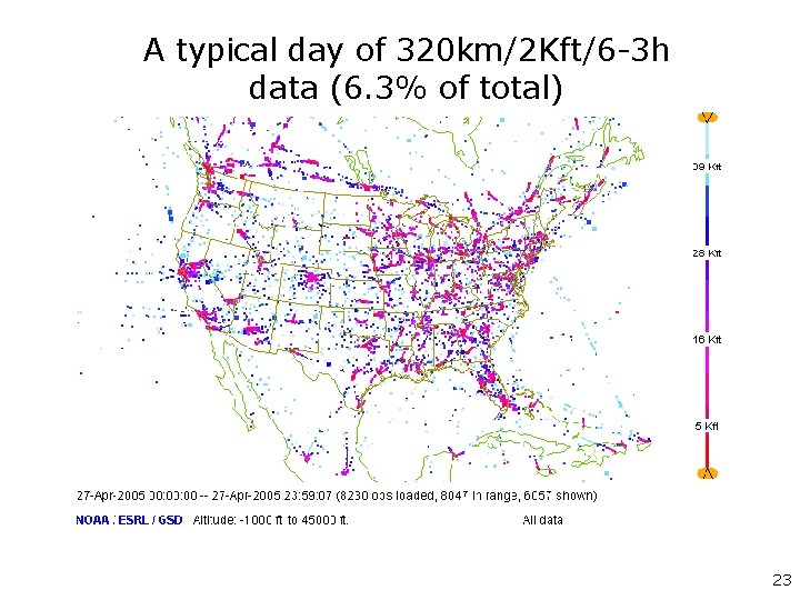
A typical day of 320 km/2 Kft/6 -3 h data (6. 3% of total) 23

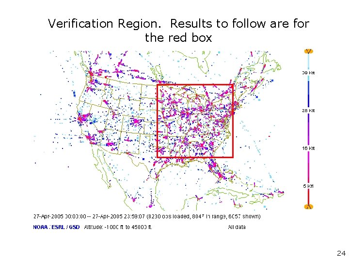
Verification Region. Results to follow are for the red box 24

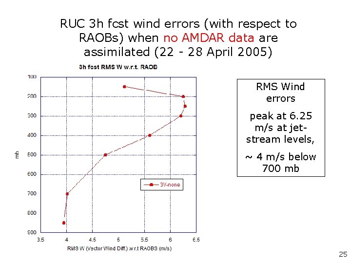
RUC 3 h fcst wind errors (with respect to RAOBs) when no AMDAR data are assimilated (22 - 28 April 2005) RMS Wind errors peak at 6. 25 m/s at jetstream levels, ~ 4 m/s below 700 mb 25

RUC 3 h fcst wind error decrease when some or all AMDAR are added (22 - 28 April 2005) - all AMDAR X - 320 km/2 kft/3 -6 h case O - 320 km/2 Kft/12 h case 26

When data are thinned uniformly in this way • the thinned samples yield positive impacts in terms of overall RMS wind error reduction, with small fractions of the data • however there are many caveats 27

Critical caveats (1) • It is unlikely such uniform thinning can be achieved in practice. – the best current avionics can turn flight segments (ascent, descent, en-route) on or off, not individual observations 28

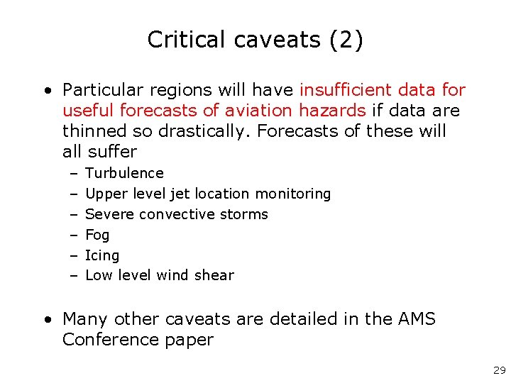
Critical caveats (2) • Particular regions will have insufficient data for useful forecasts of aviation hazards if data are thinned so drastically. Forecasts of these will all suffer – – – Turbulence Upper level jet location monitoring Severe convective storms Fog Icing Low level wind shear • Many other caveats are detailed in the AMS Conference paper 29

However, these results suggest an opportunity for Targeting • If data can routinely be thinned somewhat • The resources saved should be reused to target observations to regions of critical need • Targeted observations can be taken with 3 h to 6 h notice, by aircraft with modern avionics • Targeting can by guided by model-generated target fields • We have begun to develop such fields, based on RUC 3 - 6 h forecasts 30