Operational forecasts of strong precipitation events over complex
- Slides: 30

Operational forecasts of strong precipitation events over complex topography Pierre Eckert Ralf Kretschmar Christof Appenzeller Météo. Suisse

Operational forecasts of strong precipitation events over complex topography • • • Motivation: model bias, downscaling Three techniques: EFI, LEPS, ANN EFI ANN (Artificial Neural Networks) November 2002 case Conclusions

Probability forecasts • Usually based on an Ensemble Prediction System (EPS) • DMO • Statistical interpretation • … • Methodes usually not well suited for rare events: Positive skill scores for prob(rr>10 mm/24 h) Negative skill scores for prob(rr>50 mm/24 h)

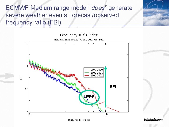
ECMWF Medium range model “does” generate severe weather events: forecast/observed frequency ratio (FBI) EFI LEPS

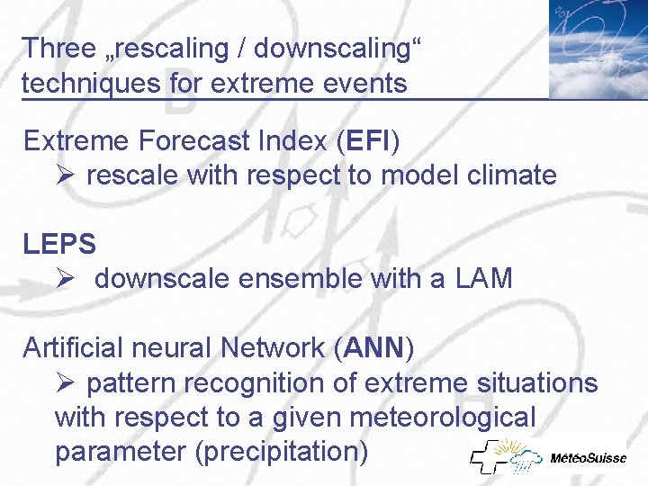
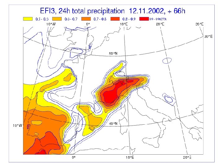
Three „rescaling / downscaling“ techniques for extreme events Extreme Forecast Index (EFI) Ø rescale with respect to model climate LEPS Ø downscale ensemble with a LAM Artificial neural Network (ANN) Ø pattern recognition of extreme situations with respect to a given meteorological parameter (precipitation)

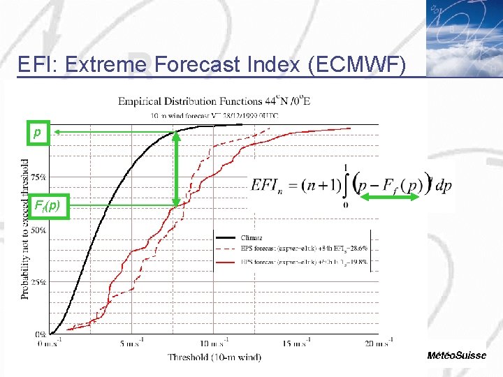
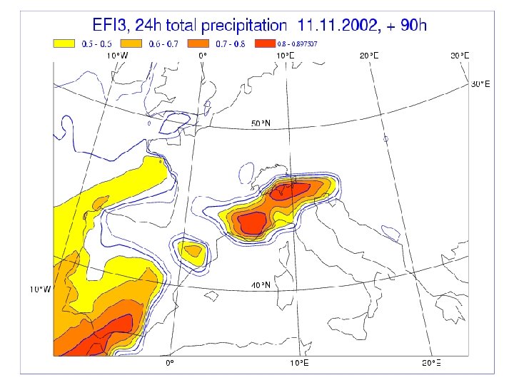
EFI: Extreme Forecast Index (ECMWF) p Ff(p)

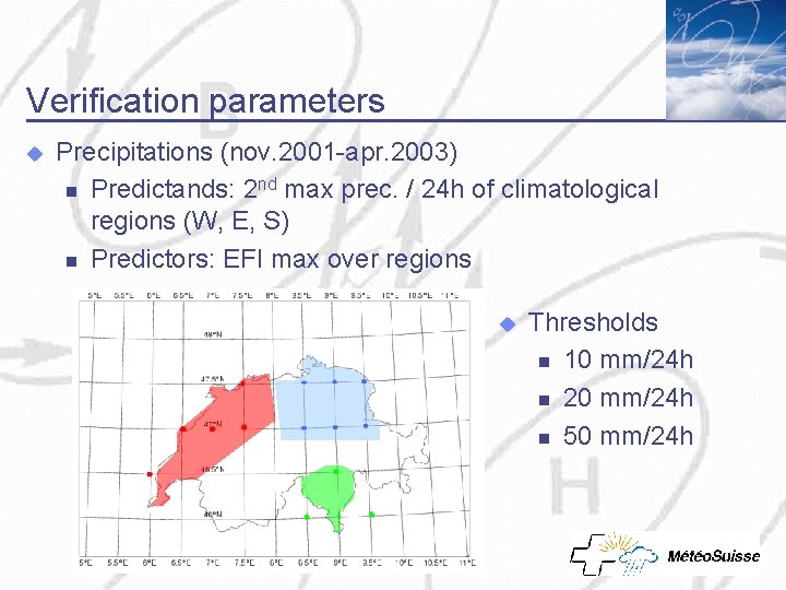
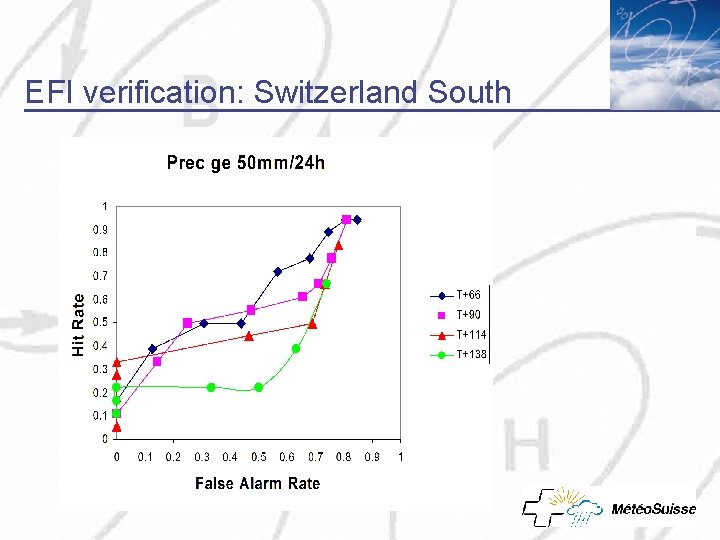
Verification parameters u Precipitations (nov. 2001 -apr. 2003) n Predictands: 2 nd max prec. / 24 h of climatological regions (W, E, S) n Predictors: EFI max over regions u Thresholds n 10 mm/24 h n 20 mm/24 h n 50 mm/24 h

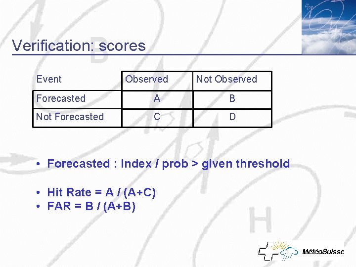
Verification: scores Event Observed Not Observed Forecasted A B Not Forecasted C D • Forecasted : Index / prob > given threshold • Hit Rate = A / (A+C) • FAR = B / (A+B)

EFI verification: Switzerland South

Recognition of extreme events with ANN • ANN: Artificial Neural Network Non linear classification method • Unsupervised vs supervised training •

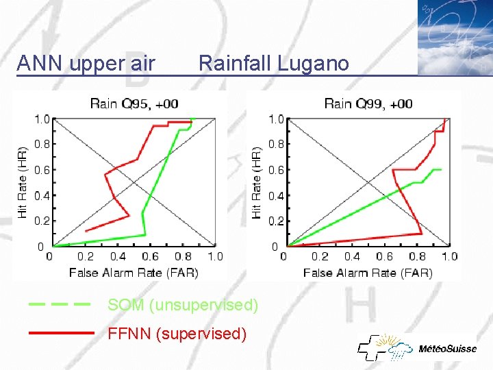
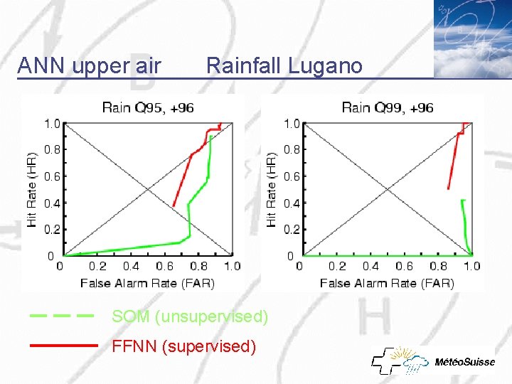
Unsuprevised training • • Self Organising Map (SOM) = classification of weather patterns irrespective of the predictand (precipitation) (unsupervised training) Interpretation in terms of weather elements made in a second step: probabilty to exceed some threshold for each element of the classification

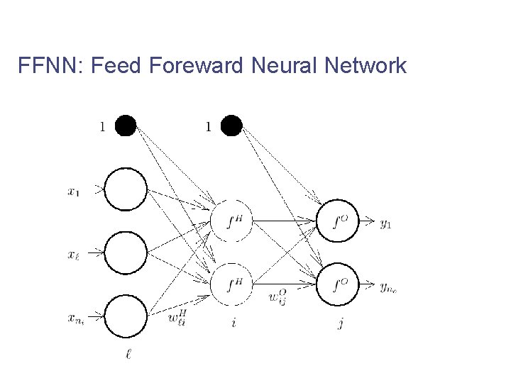
Suprevised training • • The predictors and the predictand (precipitation) have to be shown simultaneously to the network (supervised training) Feed Foreward Neural Network (FFNN) shown here

FFNN: Feed Foreward Neural Network

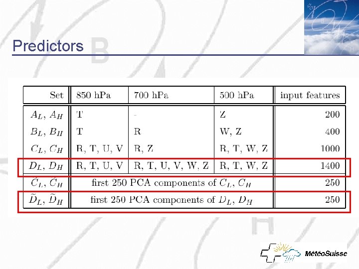
Predictors

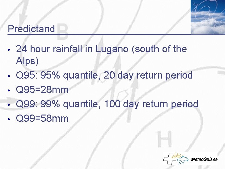
Predictand • • • 24 hour rainfall in Lugano (south of the Alps) Q 95: 95% quantile, 20 day return period Q 95=28 mm Q 99: 99% quantile, 100 day return period Q 99=58 mm

ANN upper air Rainfall Lugano SOM (unsupervised) FFNN (supervised)

ANN upper air Rainfall Lugano SOM (unsupervised) FFNN (supervised)

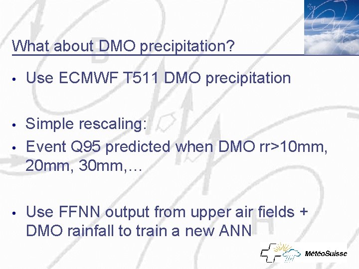
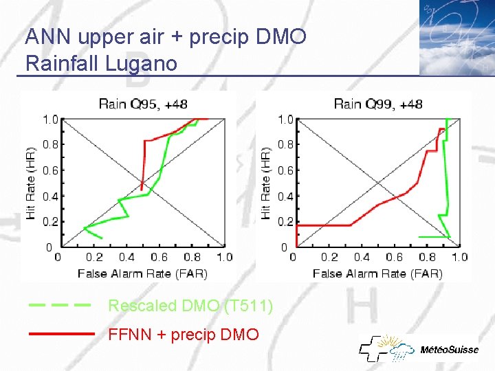
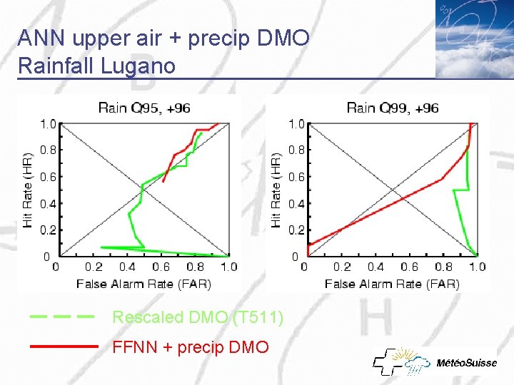
What about DMO precipitation? • Use ECMWF T 511 DMO precipitation • Simple rescaling: Event Q 95 predicted when DMO rr>10 mm, 20 mm, 30 mm, … • • Use FFNN output from upper air fields + DMO rainfall to train a new ANN

ANN upper air + precip DMO Rainfall Lugano Rescaled DMO (T 511) FFNN + precip DMO

ANN upper air + precip DMO Rainfall Lugano Rescaled DMO (T 511) FFNN + precip DMO

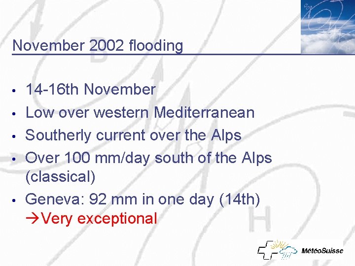
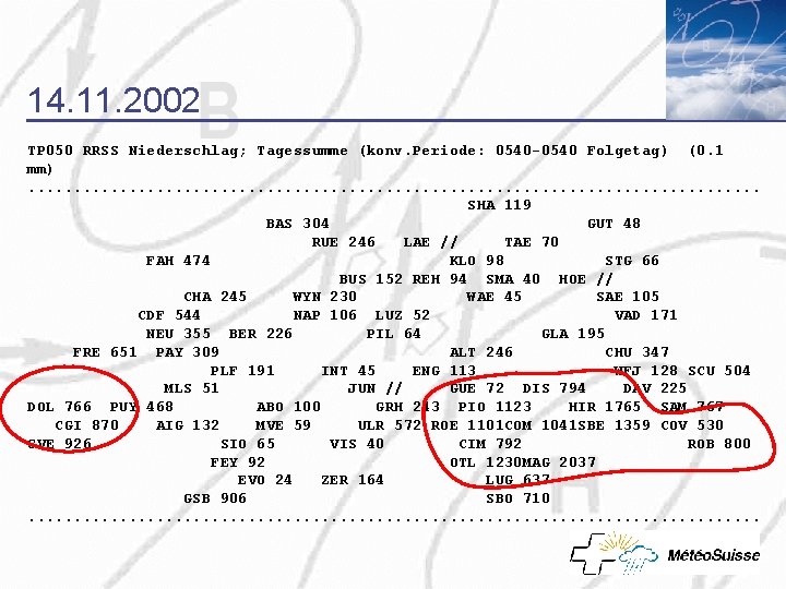
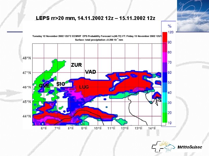
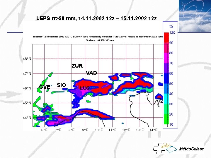
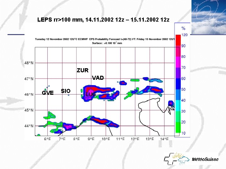
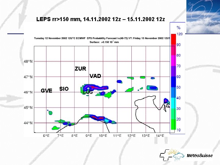
November 2002 flooding • • • 14 -16 th November Low over western Mediterranean Southerly current over the Alps Over 100 mm/day south of the Alps (classical) Geneva: 92 mm in one day (14 th) Very exceptional

14. 11. 2002 TP 050 RRSS Niederschlag; Tagessumme (konv. Periode: 0540 -0540 Folgetag) (0. 1 mm). . . . . SHA 119 BAS 304 GUT 48 RUE 246 LAE // TAE 70 FAH 474 KLO 98 STG 66 BUS 152 REH 94 SMA 40 HOE // CHA 245 WYN 230 WAE 45 SAE 105 CDF 544 NAP 106 LUZ 52 VAD 171 NEU 355 BER 226 PIL 64 GLA 195 FRE 651 PAY 309 ALT 246 CHU 347 PLF 191 INT 45 ENG 113 WFJ 128 SCU 504 MLS 51 JUN // GUE 72 DIS 794 DAV 225 DOL 766 PUY 468 ABO 100 GRH 243 PIO 1123 HIR 1765 SAM 767 CGI 870 AIG 132 MVE 59 ULR 572 ROE 1101 COM 1041 SBE 1359 COV 530 GVE 926 SIO 65 VIS 40 CIM 792 ROB 800 FEY 92 OTL 1230 MAG 2037 EVO 24 ZER 164 LUG 637 GSB 906 SBO 710. . . . .

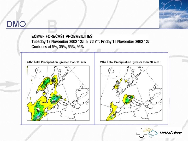
DMO


LEPS rr>20 mm, 14. 11. 2002 12 z – 15. 11. 2002 12 z ZUR VAD GVE SIO LUG

LEPS rr>50 mm, 14. 11. 2002 12 z – 15. 11. 2002 12 z ZUR VAD GVE SIO LUG

LEPS rr>100 mm, 14. 11. 2002 12 z – 15. 11. 2002 12 z ZUR VAD GVE SIO LUG

LEPS rr>150 mm, 14. 11. 2002 12 z – 15. 11. 2002 12 z ZUR VAD GVE SIO LUG

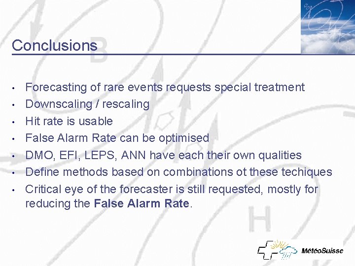
Conclusions • • Forecasting of rare events requests special treatment Downscaling / rescaling Hit rate is usable False Alarm Rate can be optimised DMO, EFI, LEPS, ANN have each their own qualities Define methods based on combinations ot these techiques Critical eye of the forecaster is still requested, mostly for reducing the False Alarm Rate.