Current Hydrological Research in Quintana Roo Presentation at


![[Photo: Jim Coke] Cave & karst research Simon Richards is studying cave formation and](https://slidetodoc.com/presentation_image_h/2238541eec853d5f09e2db1ff72aa4c8/image-4.jpg "[Photo: Jim Coke] Cave & karst research Simon Richards is studying cave formation and")


 floats on top of")


![Sistema Crustacea [Various explorers]](https://slidetodoc.com/presentation_image_h/2238541eec853d5f09e2db1ff72aa4c8/image-13.jpg "Sistema Crustacea [Various explorers]")
![Saline shuttle flow [Torres Talamante & Richards July 2007]](https://slidetodoc.com/presentation_image_h/2238541eec853d5f09e2db1ff72aa4c8/image-14.jpg "Saline shuttle flow [Torres Talamante & Richards July 2007]")

![Presumed outflow Outflow [Photo courtesy Daniel Diamant]](https://slidetodoc.com/presentation_image_h/2238541eec853d5f09e2db1ff72aa4c8/image-16.jpg "Presumed outflow Outflow [Photo courtesy Daniel Diamant]")
![Cenote Angelita [Video grabs: Aude & Mauricio Domenge]](https://slidetodoc.com/presentation_image_h/2238541eec853d5f09e2db1ff72aa4c8/image-20.jpg "Cenote Angelita [Video grabs: Aude & Mauricio Domenge]")
![Cenote Angelita [Diagram based on Octavio del Rio & personal observations]](https://slidetodoc.com/presentation_image_h/2238541eec853d5f09e2db1ff72aa4c8/image-21.jpg "Cenote Angelita [Diagram based on Octavio del Rio & personal observations]")


![The Pit [Video grabs: Beto Nava / Ejido Jacinto Pat Project]](https://slidetodoc.com/presentation_image_h/2238541eec853d5f09e2db1ff72aa4c8/image-24.jpg "The Pit [Video grabs: Beto Nava / Ejido Jacinto Pat Project]")


 B C TIME SIGNAL TIME A")


- Slides: 47
Current Hydrological Research in Quintana Roo Presentation at UNAM Puerto Morelos Field Station April 22, 2008 Simon Richards, M. A. (Cambridge)
Introduction Contents Overview of coastal hydrology Groundwater & ocean exchanges Hydrological research Inputs from speleogenetic research
Conservation groups Trip reports Donna Richards Simon Richards Other explorers Dry caves Underwater caves Morphological observations Photography Video Maps Hydrology Collaboration Scientific researchers Exploration QRSS Documentation Information cave-exploration. com
[Photo: Jim Coke] Cave & karst research Simon Richards is studying cave formation and hydrology in Quintana Roo, with the objective of obtaining a Doctor of Philosophy degree from Cambridge University under its Special Regulations. Patricia Beddows is acting as supervisor, and has additionally participated in fieldwork and made published & unpublished data available for analysis. Jim Coke of the Quintana Roo Speleological Survey has contributed through his extensive exploration and documentation of the dry caves of Quintana Roo and through the Tixik K’una studies in particular. Many explorers have made survey data available, including Kay & Gary Walten, Buddy Quattlebaum, Fred Devos, Bernd Birnbach, Robbie Schmittner, Bil Phillips, Steve Bogaerts, Chris Le Maillot, Daniel Riordan, Sac Actun Exploration Team, Yaxchen Project, Mexico Cave Exploration Project, Ejido Jacinto Pat Project and others.
Fieldwork One problem with hydrological research in Quintana Roo is lack of information on the underground flow systems. Collecting information is difficult and time-consuming, because access to the jungle is limited, and cave diving is required to access the flow systems. Much information has been collected by collaborative fieldwork with different groups of researchers. In general, these projects have involved the joint collection of information to be used by different researchers for different projects. In addition there have been some exchanges of data between different research groups. This research has benefited from collaborative fieldwork with Patricia Beddows, with Mc. Master University students under her supervision, with Patricia and the Mc. Master group studying microfossils (Ed Reinhart, Peter van Hengstum and Jeremy Gabriel), and with Olmo Torres Talamante, studying for his biology MSc at UNAM under collaborative supervision of Elva Escobar and Patricia Beddows. In addition, Nick Toussaint, Beto Nava and the Ejido Jacinto Pat Project collected data from deep cave dives in The Pit and Angelita.
“Yucabirds. com’s objective is to provide a means for others to appreciate avian species found in an area undergoing rapid development; hopefully it may encourage some small degree of conservation of habitat. ”
Introduction Contents Overview of coastal hydrology Groundwater & ocean exchanges Hydrological research Inputs from speleogenetic research
Flow systems and water stratigraphy Groundwater is density stratified. Flow is predominantly via dissolutionally enlarged flow paths – caves and “conduits” – which are also stratified. [Based on Beddows 2004] Groundwater is density stratified by salinity. Most fresh water flows through the caves. There is a deep saline inflow, possibly through a deeper level of older caves, and a “shuttle” flow of saline water. A fresh cap layer floats on top of the fresh water layer.
Flow systems and water stratigraphy Tannic fresh cap layer (yellow) floats on top of the fresh water layer in a dome.
Flow systems and water stratigraphy Fresh water layer over saline water. Light diffraction gives sharp visible “halocline”.
Introduction Contents Overview of coastal hydrology Groundwater & ocean exchanges Hydrological research Inputs from speleogenetic research
Sistema Crustacea
Sistema Crustacea [Various explorers]
Saline shuttle flow [Torres Talamante & Richards July 2007]
Saline shuttle flow Data from research currently in progress – UNAM graduate program collaboration between Patricia Beddows & Elva Escobar – Olmo Torres Talamante Cool fresh water layer over warmer saline water zone. In between is an even warmer “saline shuttle” layer, moving between ocean and cave with the tide (60 days shown).
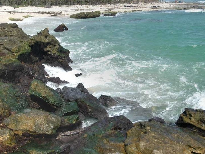
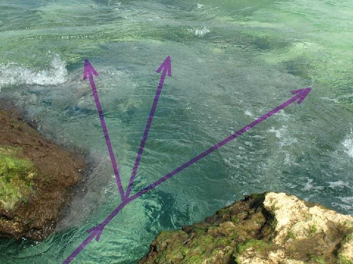
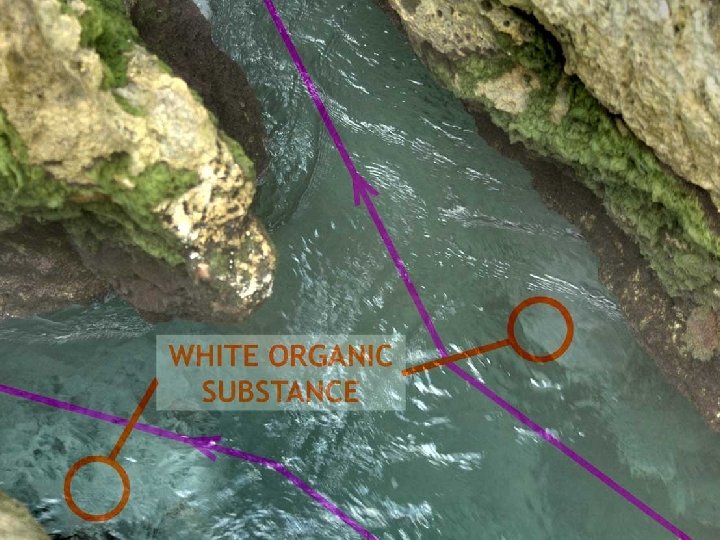
Presumed outflow Outflow [Photo courtesy Daniel Diamant]
Cenote Angelita [Video grabs: Aude & Mauricio Domenge]
Cenote Angelita [Diagram based on Octavio del Rio & personal observations]
Cenote Angelita July 2006 July 2007 November 2006
Cenote Angelita July 2006 July 2007 November 2006
The Pit [Video grabs: Beto Nava / Ejido Jacinto Pat Project]
Salinity profile – The Pit November 2006 courtesy Nick Toussaint, Beto Nava & EJPP [Video grab: Beto Nava / Ejido Jacinto Pat Project]
Deep saline zone profile – The Pit November 2006 courtesy Nick Toussaint, Beto Nava & EJPP
Xel Ha area caves Xel Ha
Xel Ha area caves
Tidal response
Introduction Contents Overview of coastal hydrology Groundwater & ocean exchanges Hydrological research Inputs from speleogenetic research
Research objectives & methods These observations collectively contain a lot of information about various aspects of the karst hydrology. But that information is unstructured, its interpretation is sometimes uncertain, and it is incomplete. The challenge is to use the information to build a complete model. The method being used is: (1) develop mathematical models of components of the karst flow system, and where possible validate those components individually (2) integrate those components into an overall model (3) where there are gaps in the information required from the model, take these on a statistical/structural basis from the research on cave formation.
The grand scheme Models of individual karst elements Existing information SPELEOGENETIC RESEARCH Cave morphology information Cave formation models Model of complete system TEST OF CAVE FORMATION MODELS HYDROLOGICAL RESEARCH “Signal tracing” results Resulting cave structure
Signal tracing approach SIGNAL TIME SIGNAL SOURCE (OCEAN) B C TIME SIGNAL TIME A INTENTION IS TO TRACE SIGNALS FROM THE OCEAN THROUGH THE FLOW SYSTEM, TO OBTAIN INFORMATION ABOUT THE FLOW SYSTEM. THE SIGNAL FROM THE OCEAN HAS COMPONENTS AT DIFFERENT FREQUENCIES, AND THESE CAN BE TRACED INDIVIDUALLY USING FREQUENCY DOMAIN ANALYSIS TECHNIQUES (FAST FOURIER TRANSFORMS & TIDAL HARMONICS ANALYSIS).
Model flow system element KARST ELEMENT FREQUENCY RESPONSE FLOW RESISTANCE X Y R STORAGE ELEMENT R. d. Y = X - Y dt C H(f) = 1 1 + (2 f. RC)² THE MODEL KARST ELEMENT CAN BE CHARACTERISED IN TERMS OF ITS FREQUENCY RESPONSE, WHICH CAN BE DERIVED ANALYTICALLY
Chain of karst elements X 1 2 Y 3 FREQUENCY RESPONSE THE COMBINED FREQUENCY RESPONSE OF A CHAIN OF ELEMENTS CAN BE CALCULATED FROM THE CHARACTERISTICS OF INDIVIDUAL ELEMENTS
Network of karst elements 4 X 1 5 2 6 3 7 8 9 Y FREQUENCY RESPONSE 10 11 12 13 FREQUENCY RESPONSES CAN BE CALCULATED AT ALL POINTS IN A COMPOSITE NETWORK. PARAMETERS DO NOT VARY SMOOTHLY IN SPACE, BECAUSE OF GEOLOGICAL CONTROL AND THE NATURE OF KARST FLOW SYSTEMS THEY MUST BE CONSISTENT WITH THE RESULTS OF RESEARCH ON CAVE FORMATION (SPELEOGENESIS).
Illustration – Yalku Laguna Akumal Bay & Yalku Laguna
Noise samples ~15 minutes
Power spectra ~15 minutes
Cumulative power spectra Akumal Bay Noise similar for periods > 150 seconds Noise < 100 seconds substantially reduced Yalku Laguna NB Bay and Laguna are not directly connected – they are connected via the ocean – so really we are looking at a ratio of two transfer functions. Nonetheless the method of analysis holds.
Transfer function: Akumal Bay –> Yalku Laguna / Akumal Bay transfer function approximates high order (4+) filter with time constant about 100 seconds. Filter order 5. 3 Cutoff period 100 s Wind generated noise in Yalku Laguna and/or instrumentation noise floor. Filter order 3. 6 Cutoff period 150 s Filter order 11. 5 Cutoff period 55 s
Introduction Contents Overview of coastal hydrology Groundwater & ocean exchanges Hydrological research Inputs from speleogenetic research
Geological control on cave morphology Some caves show clear signs of geological control of morphology. Controlling factors may include fractures and/or sedimentary structures such as the palaeo beach ridges. AUTOCORRELATION ANALYSIS REVEALS FOUR DISTINCT LINEAMENTS IN SAC ACTUN, ONE OF THE TWO LONGEST UNDERWATER CAVES. THESE SHOW INTERESTING CORRELATION WITH A SURVEY OF 200+ FRACTURE OBSERVATIONS IN TIXIK K’UNA DRY CAVE. [Map & fracture survey: Jim Coke/QRSS]
Karst drainage structures There are reasons to think that karst drainage structures develop to form hierarchical networks. Upper diagram shows the effect of structure development under a uniform field. Lower diagram shows simpler model which still captures the dynamics. Parameters vary smoothly over the networks, but not smoothly over space.
Introduction Contents Overview of coastal hydrology Groundwater & ocean exchanges Hydrological research Inputs from speleogenetic research
Key points to take away The groundwater in Quintana Roo is stratified into at least three distinct layers, distinguished by salinity and temperature. They remain distinct unless something mixes them together. The vast majority of water flow is via caves and conduits. These appear to exist only at discrete levels, so different water layers flow differently. The fresh cap layer and its flow system is poorly understood - it may hardly flow at all. Some freshwater/brackish layers flow rapidly from inland to coast, and we can directly observe parts of their flow system. Some saline layers flow slowly from coast to inland through a deeper flow system – we can see its effects, but direct observation is more difficult. The saline shuttle oscillates between ocean and caves. These ocean-land interchanges suggest that the near coast groundwater flow systems and the ocean may need to be treated as parts of the same system for some studies, particular in relation to the effects of human activities. Perhaps we can characterise the groundwater flow systems as “underground estuaries” in nature. Hydrological modelling needs to take into account the different water layers and their separate flow systems. Standard hydrological models ignore most of the known facts about the hydrology and so cannot be expected to give good results, but they have been used for hydrology studies without validation.
Current Hydrological Research in Quintana Roo Presentation at UNAM Puerto Morelos Field Station April 22, 2008 Simon Richards, M. A. (Cambridge)