Creating Modernizing the Geopotential Datum AKA Replacing NAVD
- Slides: 47
Creating Modernizing the Geopotential Datum AKA “Replacing NAVD 88” Dru Smith NSRS Modernization Manager NOAA’s National Geodetic Survey 2018 -05 -07 Modernizing the Geopotential Datum 1
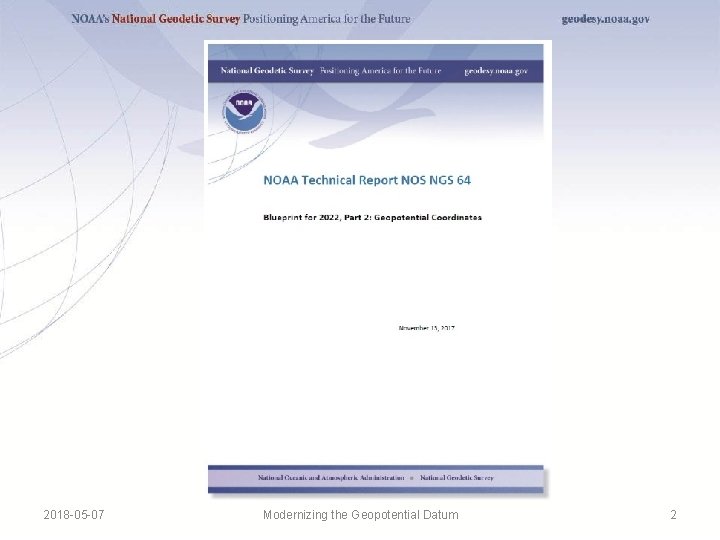
2018 -05 -07 Modernizing the Geopotential Datum 2
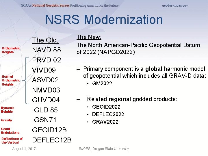
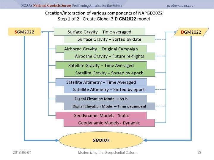
NSRS Modernization Orthometric Heights Normal Orthometric Heights Dynamic Heights Gravity Geoid Undulations Deflections of the Vertical The Old: NAVD 88 PRVD 02 VIVD 09 ASVD 02 NMVD 03 GUVD 04 IGLD 85 IGSN 71 GEOID 12 B DEFLEC 12 B August 1, 2017 The New: The North American-Pacific Geopotential Datum of 2022 (NAPGD 2022) – Primary component is a global harmonic model of geopotential which includes all GRAV-D data: • GM 2022 – Related regional gridded products: • GEOID 2022 • DEFLEC 2022 • GRAV 2022 Sa. GES, Oregon State University
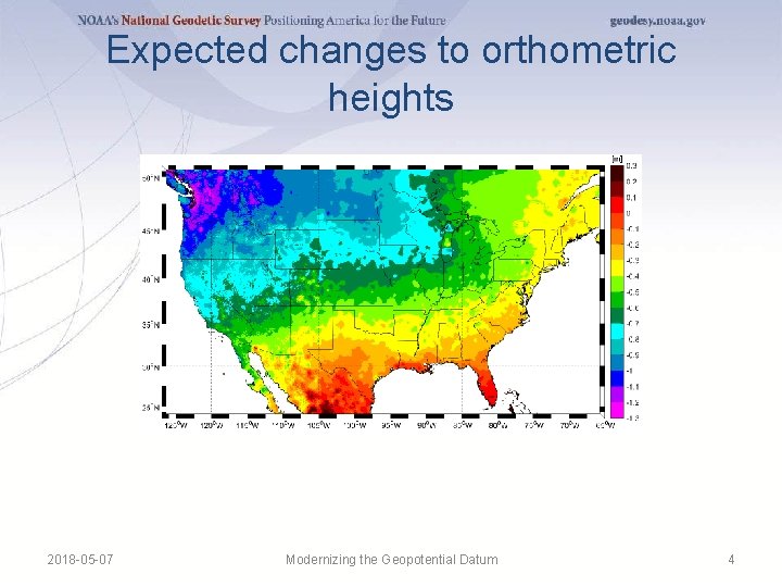
Expected changes to orthometric heights 2018 -05 -07 Modernizing the Geopotential Datum 4
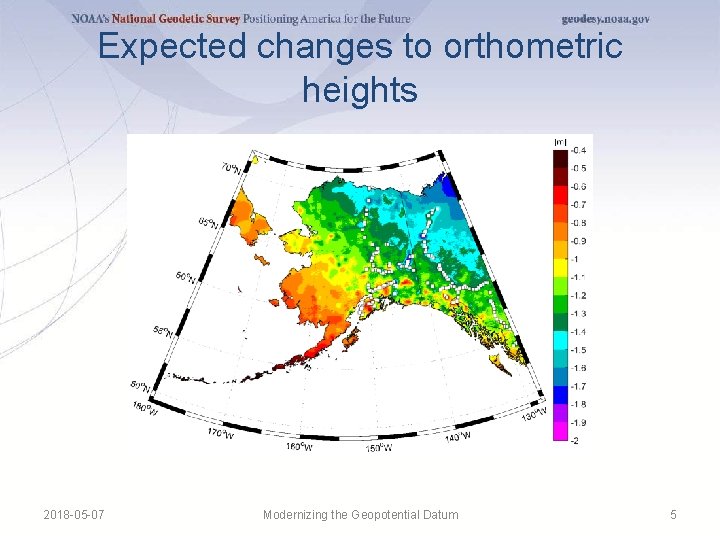
Expected changes to orthometric heights 2018 -05 -07 Modernizing the Geopotential Datum 5
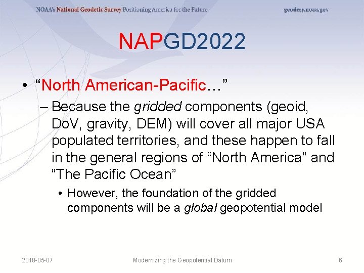
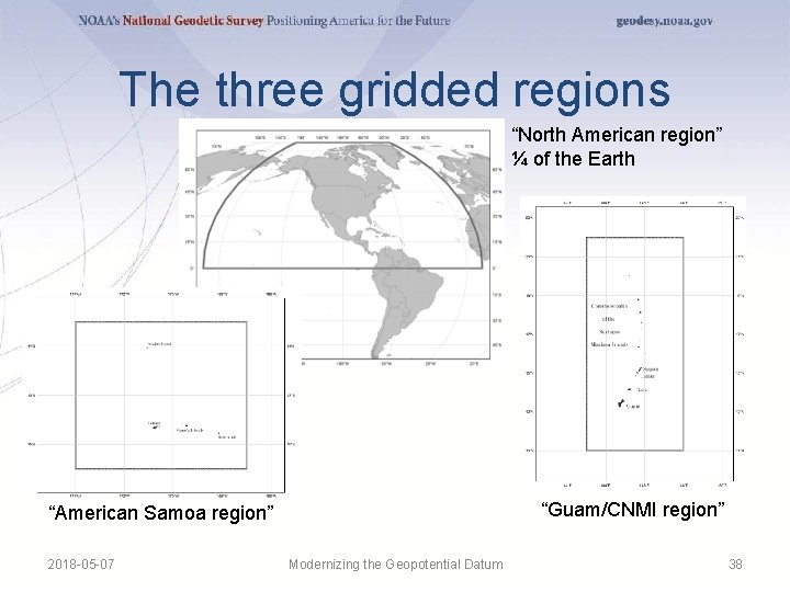
NAPGD 2022 • “North American-Pacific…” – Because the gridded components (geoid, Do. V, gravity, DEM) will cover all major USA populated territories, and these happen to fall in the general regions of “North America” and “The Pacific Ocean” • However, the foundation of the gridded components will be a global geopotential model 2018 -05 -07 Modernizing the Geopotential Datum 6
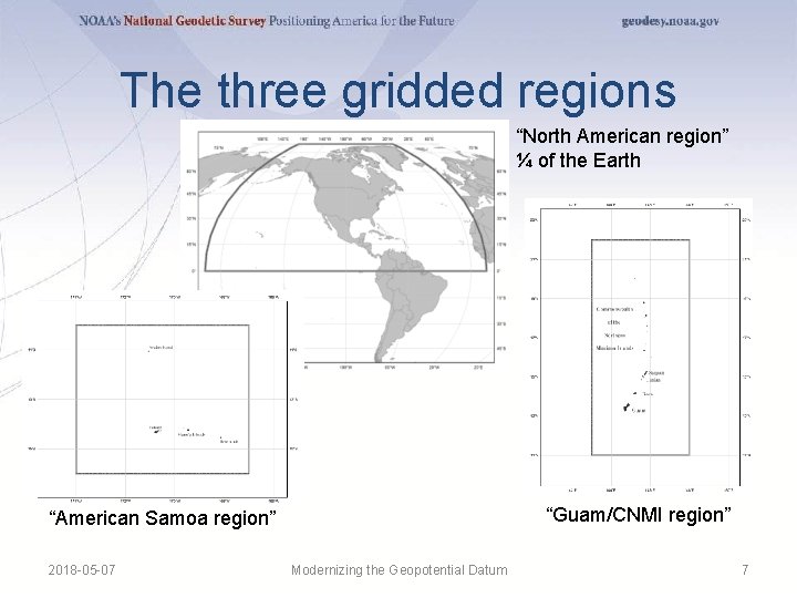
The three gridded regions “North American region” ¼ of the Earth “Guam/CNMI region” “American Samoa region” 2018 -05 -07 Modernizing the Geopotential Datum 7
NAPGD 2022 • “…Geopotential…” – Because it isn’t just about heights, but rather about all geodetic coordinates related to Earth’s geopotential field (geoid, deflections, etc) 2018 -05 -07 Modernizing the Geopotential Datum 8
NAPGD 2022 • “…Datum…” – Because a “geopotential reference frame” was, frankly, an unwieldy term that had no precedence in geodetic literature. • “Reference Frame” only carries a geometric connotation in geodesy – It is replacing, and expanding upon, the idea of a “vertical datum” 2018 -05 -07 Modernizing the Geopotential Datum 9
NAPGD 2022 • “… 2022” – Because that is our target release date 2018 -05 -07 Modernizing the Geopotential Datum 10
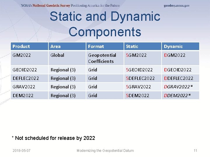
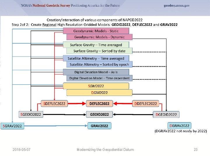
Static and Dynamic Components Product Area Format Static Dynamic GM 2022 Global Geopotential Coefficients SGM 2022 DGM 2022 GEOID 2022 Regional (3) Grid SGEOID 2022 DEFLEC 2022 Regional (3) Grid SDEFLEC 2022 DDEFLEC 2022 GRAV 2022 Regional (3) Grid SGRAV 2022 DGRAV 2022* DEM 2022 Regional (3) Grid SDEM 2022 DDEM 2022* * Not scheduled for release by 2022 2018 -05 -07 Modernizing the Geopotential Datum 11
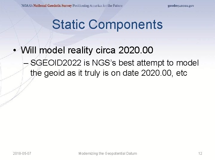
Static Components • Will model reality circa 2020. 00 – SGEOID 2022 is NGS’s best attempt to model the geoid as it truly is on date 2020. 00, etc 2018 -05 -07 Modernizing the Geopotential Datum 12
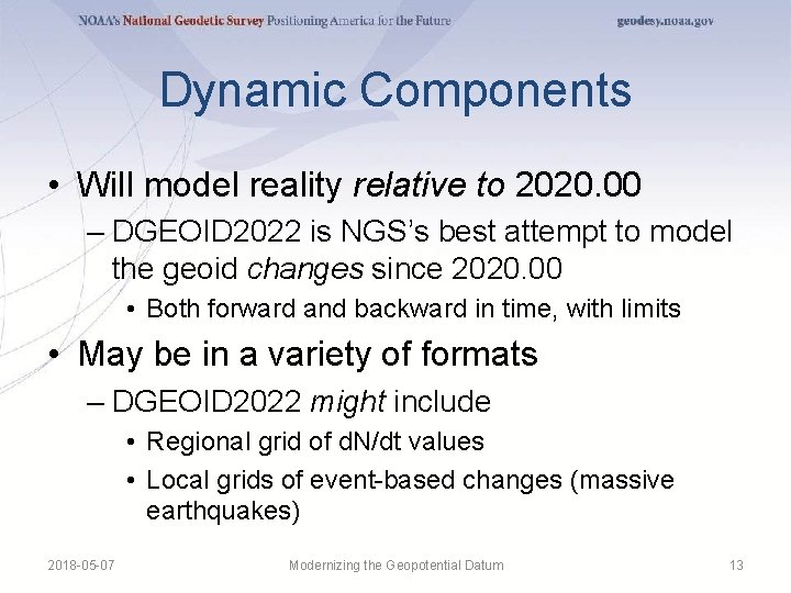
Dynamic Components • Will model reality relative to 2020. 00 – DGEOID 2022 is NGS’s best attempt to model the geoid changes since 2020. 00 • Both forward and backward in time, with limits • May be in a variety of formats – DGEOID 2022 might include • Regional grid of d. N/dt values • Local grids of event-based changes (massive earthquakes) 2018 -05 -07 Modernizing the Geopotential Datum 13
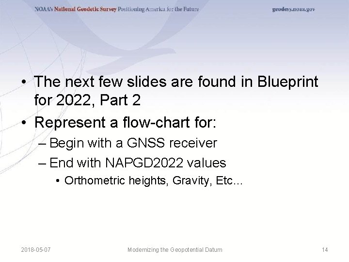
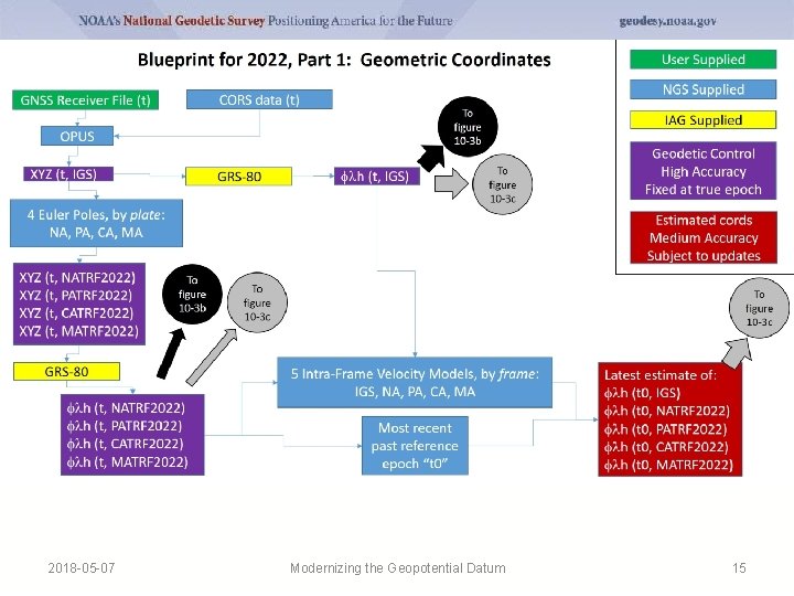
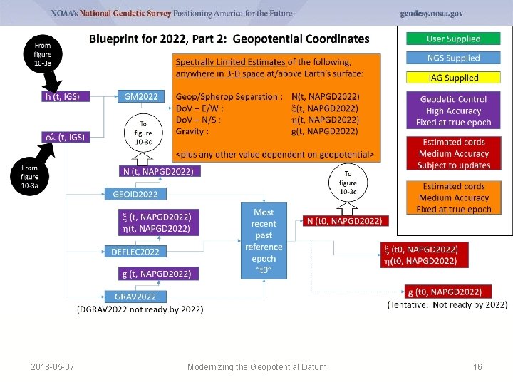
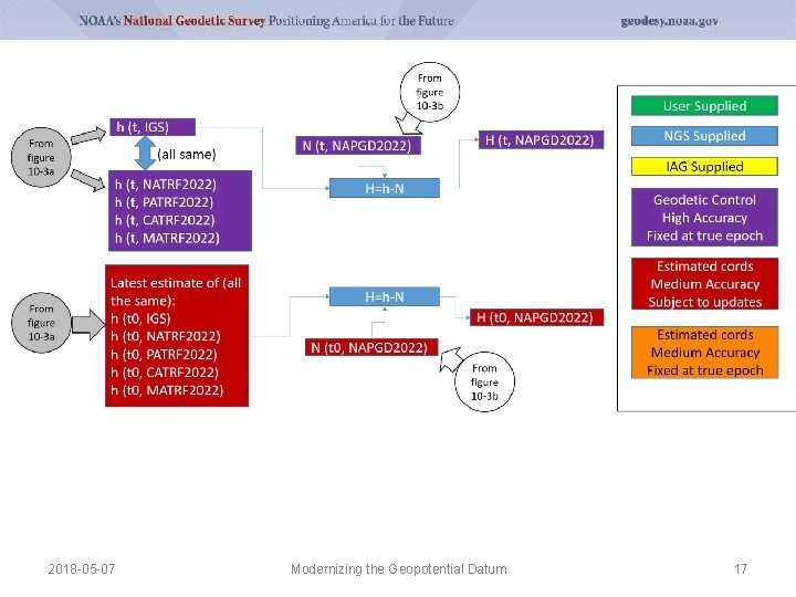
• The next few slides are found in Blueprint for 2022, Part 2 • Represent a flow-chart for: – Begin with a GNSS receiver – End with NAPGD 2022 values • Orthometric heights, Gravity, Etc… 2018 -05 -07 Modernizing the Geopotential Datum 14
2018 -05 -07 Modernizing the Geopotential Datum 15
2018 -05 -07 Modernizing the Geopotential Datum 16
2018 -05 -07 Modernizing the Geopotential Datum 17
Summary • NAPGD 2022 is a self-consistent set of values connected to Earth’s geopotential field – Replaces all vertical datums of the NSRS – Time dependent • GNSS/CORS/OPUS is the way to access all of these values – Passive control as well, but as a secondary Modernizing the Geopotential Datum 2018 -05 -07 18
Thank you 2018 -05 -07 Modernizing the Geopotential Datum 19
Questions 2018 -05 -07 Modernizing the Geopotential Datum 20
Extra Slides 2018 -05 -07 Modernizing the Geopotential Datum 21
2018 -05 -07 Modernizing the Geopotential Datum 22
2018 -05 -07 Modernizing the Geopotential Datum 23
Time Dependency 2018 -05 -07 Modernizing the Geopotential Datum 24
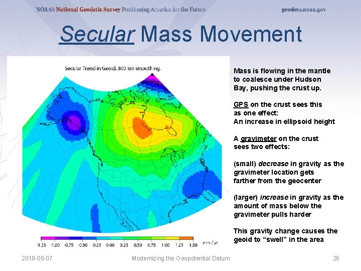
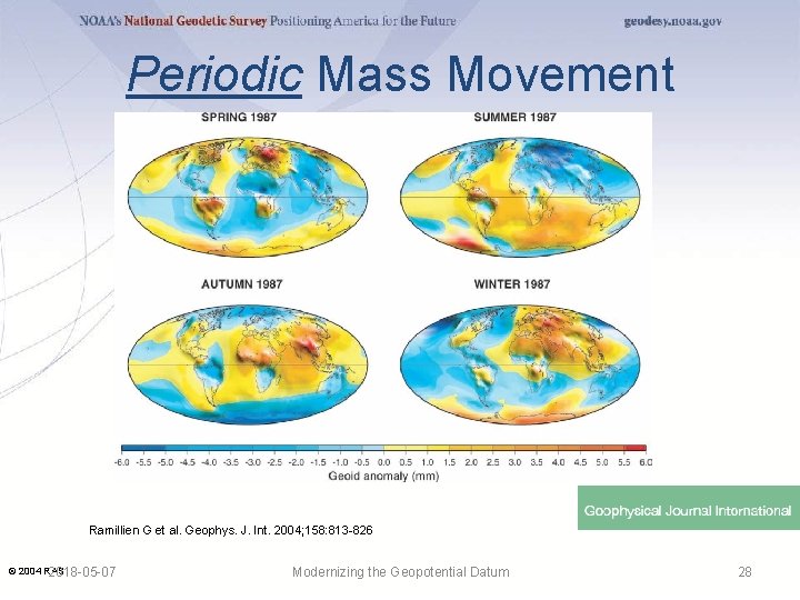
Time and Mass • Mass quantity in the Earth system is effectively constant • Mass distributions in the Earth system are time dependent and some are large enough to be measurable – Secular • Shape change to every equipotential surface (like the geoid) • Size change to global mean sea level – Episodic – Periodic 2018 -05 -07 Modernizing the Geopotential Datum 25
Secular Mass Movement Mass is flowing in the mantle to coalesce under Hudson Bay, pushing the crust up. GPS on the crust sees this as one effect: An increase in ellipsoid height A gravimeter on the crust sees two effects: (small) decrease in gravity as the gravimeter location gets farther from the geocenter (larger) increase in gravity as the amount of mass below the gravimeter pulls harder This gravity change causes the geoid to “swell” in the area 2018 -05 -07 Modernizing the Geopotential Datum 26
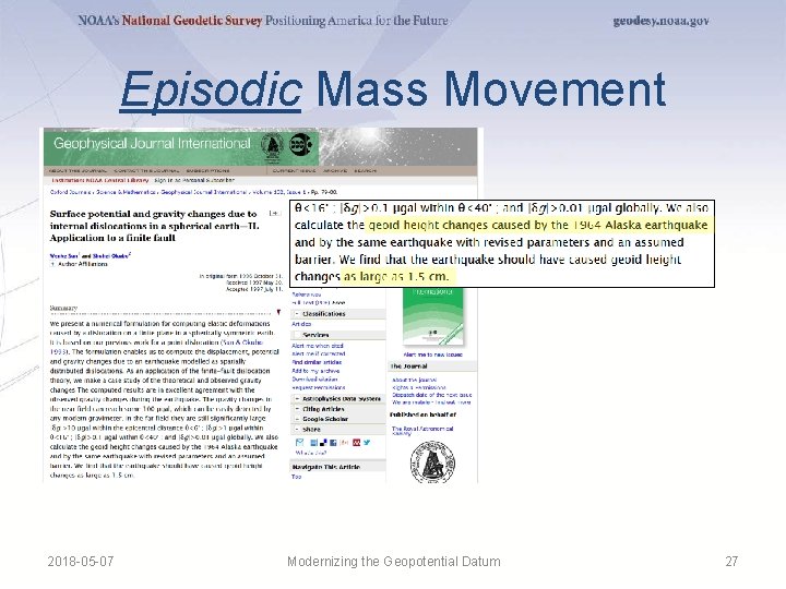
Episodic Mass Movement 2018 -05 -07 Modernizing the Geopotential Datum 27
Periodic Mass Movement Ramillien G et al. Geophys. J. Int. 2004; 158: 813 -826 © 2004 RAS 2018 -05 -07 Modernizing the Geopotential Datum 28
Geoid Monitoring Service (Ge. MS) • Goal: Track all changes to the geoid which would prevent 1 cm accuracy • Aspects included: – Shape, Secular: e. g. Hudson Bay – Shape, Episodic: e. g. Massive Earthquakes – W 0, Secular: Global Sea Level Change (see next slides) • Examples of things excluded: – Size, Secular: Mass quantity of Earth is effectively static 2018 -05 -07 Modernizing the Geopotential Datum – Shape, Periodic: Seasonal glacier cycle 29
Sea Level and The Geoid 2018 -05 -07 Modernizing the Geopotential Datum 30
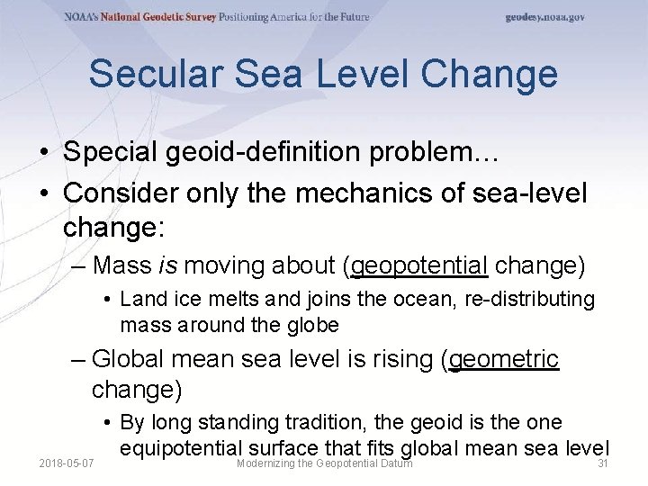
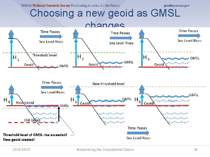
Secular Sea Level Change • Special geoid-definition problem… • Consider only the mechanics of sea-level change: – Mass is moving about (geopotential change) • Land ice melts and joins the ocean, re-distributing mass around the globe – Global mean sea level is rising (geometric change) 2018 -05 -07 • By long standing tradition, the geoid is the one equipotential surface that fits global mean sea level Modernizing the Geopotential Datum 31
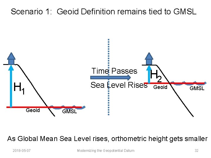
Scenario 1: Geoid Definition remains tied to GMSL Time Passes H 1 Sea Level Rises Geoid H 2 Geoid GMSL As Global Mean Sea Level rises, orthometric height gets smaller 2018 -05 -07 Modernizing the Geopotential Datum 32
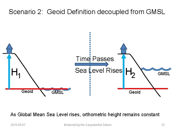
Scenario 2: Geoid Definition decoupled from GMSL Time Passes H 1 Sea Level Rises Geoid GMSL H 2 GMSL Geoid As Global Mean Sea Level rises, orthometric height remains constant 2018 -05 -07 Modernizing the Geopotential Datum 33
Choosing a new geoid as GMSL changes 2018 -05 -07 Modernizing the Geopotential Datum 34
NAPGD 2022 2018 -05 -07 Modernizing the Geopotential Datum 35
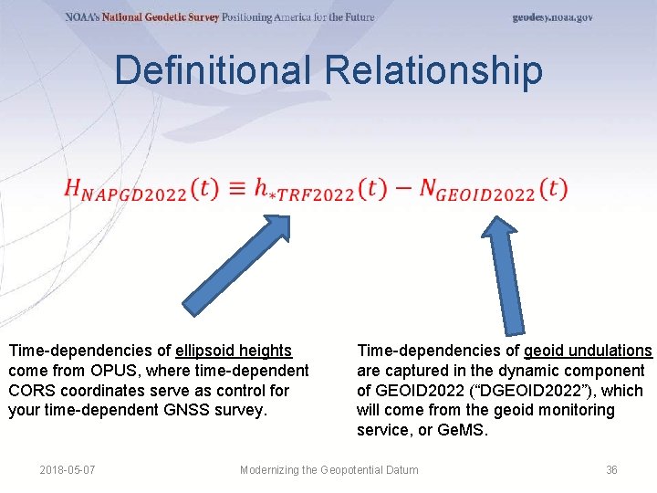
Definitional Relationship Time-dependencies of ellipsoid heights come from OPUS, where time-dependent CORS coordinates serve as control for your time-dependent GNSS survey. 2018 -05 -07 Time-dependencies of geoid undulations are captured in the dynamic component of GEOID 2022 (“DGEOID 2022”), which will come from the geoid monitoring service, or Ge. MS. Modernizing the Geopotential Datum 36
High resolution products • All will be 1 x 1 arcminute grids • All will cover three finite regions of the globe • All will have a static and dynamic component – Dynamic surface gravity not expected to be ready by 2022 • GEOID 2022 – Official converter of *TRF 2022 ellipsoid heights into NAPGD 2022 orthometric heights • DEFLEC 2022 – Surface deflections of the vertical in N/S and E/W • GRAV 2022 – Surface acceleration of gravity 2018 -05 -07 Modernizing the Geopotential Datum 37
The three gridded regions “North American region” ¼ of the Earth “Guam/CNMI region” “American Samoa region” 2018 -05 -07 Modernizing the Geopotential Datum 38
Leveling? Yes! 2018 -05 -07 Modernizing the Geopotential Datum 39
Leveling? Yes! • Leveling yields differential heights • If you want absolute heights, you need one or more known heights • Previously this was about finding a benchmark with a published NAVD 88 height – Does published mean “known”? – Does it mean “trusted”? – Does it mean “current”? 2018 -05 -07 Modernizing the Geopotential Datum 40
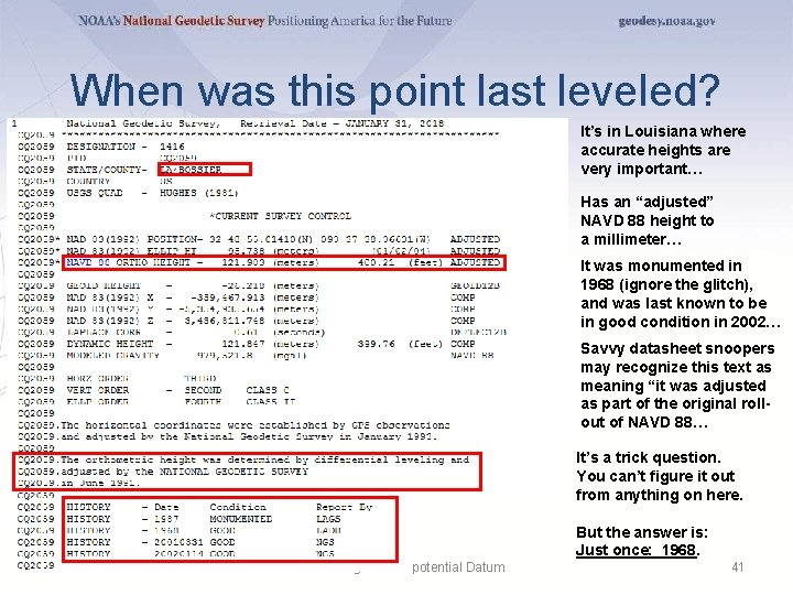
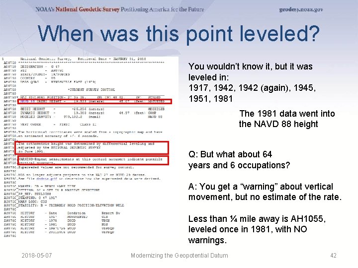
When was this point last leveled? It’s in Louisiana where accurate heights are very important… Has an “adjusted” NAVD 88 height to a millimeter… It was monumented in 1968 (ignore the glitch), and was last known to be in good condition in 2002… Savvy datasheet snoopers may recognize this text as meaning “it was adjusted as part of the original rollout of NAVD 88… It’s a trick question. You can’t figure it out from anything on here. But the answer is: Just once: 1968. 2018 -05 -07 Modernizing the Geopotential Datum 41
When was this point leveled? You wouldn’t know it, but it was leveled in: 1917, 1942 (again), 1945, 1951, 1981 The 1981 data went into the NAVD 88 height Q: But what about 64 years and 6 occupations? A: You get a “warning” about vertical movement, but no estimate of the rate. Less than ¼ mile away is AH 1055, leveled once in 1981, with NO warnings. 2018 -05 -07 Modernizing the Geopotential Datum 42
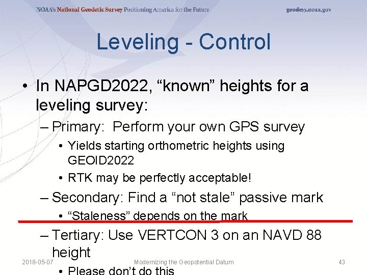
Leveling - Control • In NAPGD 2022, “known” heights for a leveling survey: – Primary: Perform your own GPS survey • Yields starting orthometric heights using GEOID 2022 • RTK may be perfectly acceptable! – Secondary: Find a “not stale” passive mark • “Staleness” depends on the mark – Tertiary: Use VERTCON 3 on an NAVD 88 height 2018 -05 -07 Modernizing the Geopotential Datum 43
Updates and Replacements • NAPGD 2022 will come with a version number • Updates will change the version – Bug fixes, new data, new theories, minor improvements • Replacements will change the name – When GMSL has changed by some threshold (20 cm) • About 50 -70 years 2018 -05 -07 Modernizing the Geopotential Datum 44
Content: Geoid Modeling History • Provides context as to why “sea level” has been a perpetual human choice for “surface of zero height” – Attempts to model the sea level go back to the 1800 s – Knowledge of currents and global sea level change have complicated the matter in the last 30 years or so • “Height above sea level” is too vague. – Which “sea level” and on what date? 2018 -05 -07 Modernizing the Geopotential Datum 45
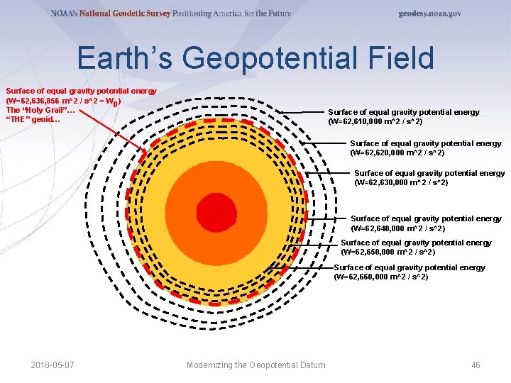
Earth’s Geopotential Field Surface of equal gravity potential energy (W=62, 636, 856 m^2 / s^2 = W 0 ) The “Holy Grail”… “THE” geoid… Surface of equal gravity potential energy (W=62, 610, 000 m^2 / s^2) Surface of equal gravity potential energy (W=62, 620, 000 m^2 / s^2) Surface of equal gravity potential energy (W=62, 630, 000 m^2 / s^2) Surface of equal gravity potential energy (W=62, 640, 000 m^2 / s^2) Surface of equal gravity potential energy (W=62, 650, 000 m^2 / s^2) Surface of equal gravity potential energy (W=62, 660, 000 m^2 / s^2) 2018 -05 -07 Modernizing the Geopotential Datum 46
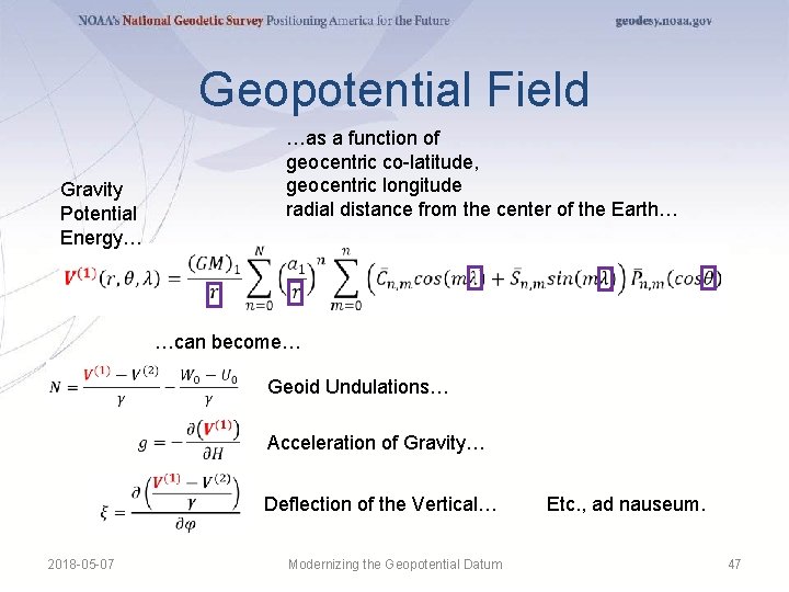
Geopotential Field Gravity Potential Energy… …as a function of geocentric co-latitude, geocentric longitude radial distance from the center of the Earth… …can become… Geoid Undulations… Acceleration of Gravity… Deflection of the Vertical… 2018 -05 -07 Modernizing the Geopotential Datum Etc. , ad nauseum. 47