Thermal Wind Temperature Advection and Doppler The Thermal


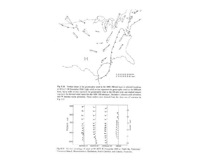
 of the geostrophic wind: cold advection")


- Slides: 32
Thermal Wind, Temperature Advection, and Doppler
The Thermal Wind • The thermal wind, VT, is a vector defined as the difference between the geostrophic wind at two levels of the atmosphere. • The name is really a misnomer, not a wind, but a difference of the winds at two levels.
Thermal Wind and Thickness • The thermal wind vector is parallel to thickness lines • The magnitude of thermal wind vector is proportional to the horizontal gradient of the thickness lines (or the mean temperature gradient of the layer).
You can convince yourself
Believe it or Not! • Much of the atmosphere is in approximately thermal wind balance (follows thermal wind equation). • Why? Because most the atmosphere is ~ geostrophic and in hydrostatic balance. • In most of the atmosphere, vertical wind shear is relative to horizontal temperature gradients.
Temperature Advection • Vertical geostrophic wind shear is associated with temperature gradients. • But the fun doesn’t stop there. The turning of the geostrophic wind with height is related to temperature advection.
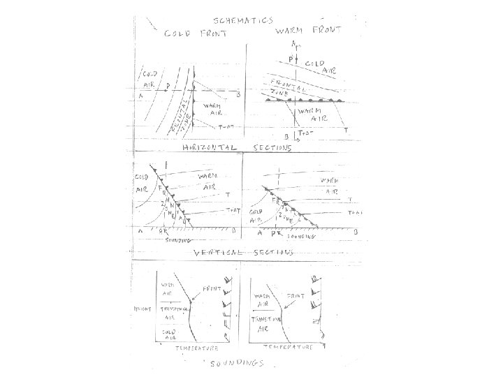
Temperature Advection • Backing (counterclockwise turning with height) of the geostrophic wind: cold advection • Veering (clockwise turning with height) of the geostrophic wind: warm advection • Thus, if the actual winds are ~geostrophic (not bad assumption above boundary layer) one can determine temperature advection from a single sounding
Does this make sense? Backing Veering
Frontal Zones • In cold frontal zones winds back with height • In warm frontal zones wind veer with height • In areas of little temperature advection, there is little turning with height
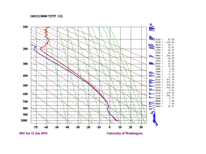
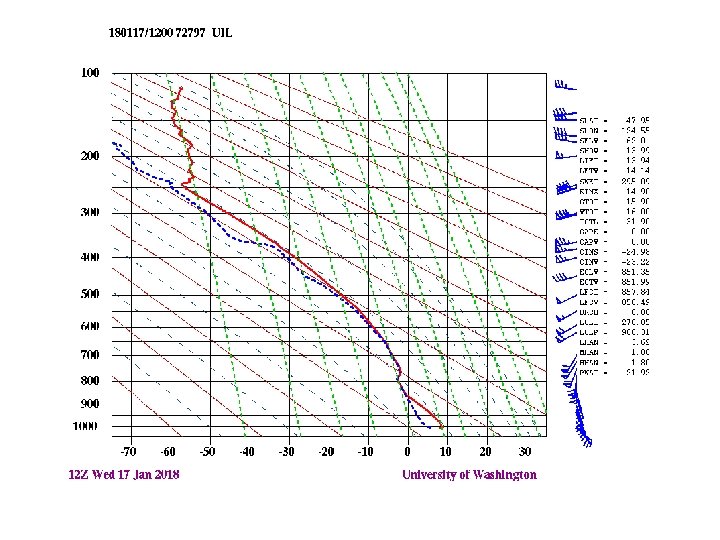
Warm Front Approaching UIL
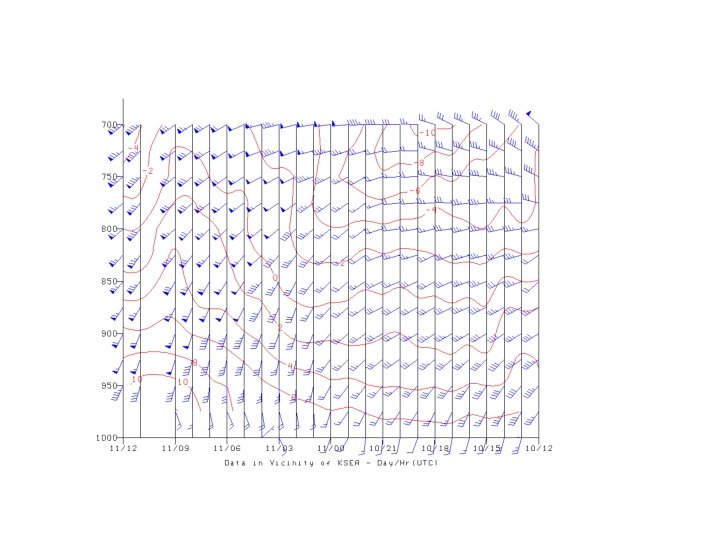
Cold advection sounding
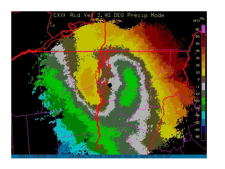
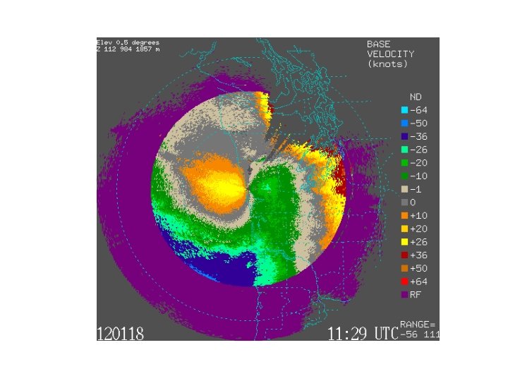
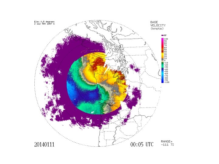
Weather Radar and Temperature Advection • You can tell whether warm or cold advection is occurring by looking at the Doppler Velocities • Specifically, the zero radial velocity line (usually gray)
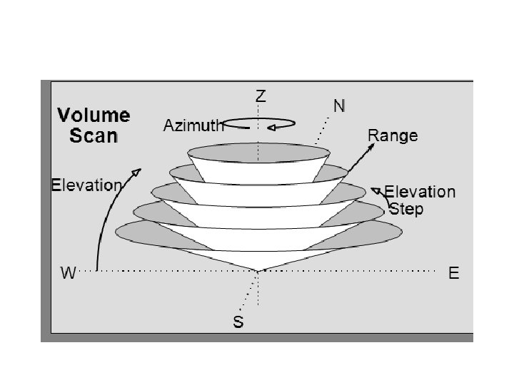
Radar Imagery is generally not for a level surface • Scans in azimuth ( 0 to 360°) at a series of increasing scan angles from the horizontal.
Each radar elevation angle shown on a polar-type chart with range circles
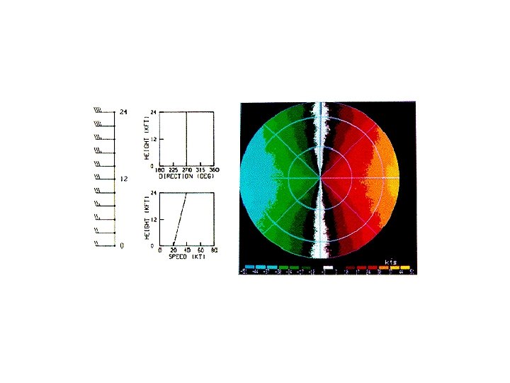
“ S “ shape: veering
Backing: Backwards S
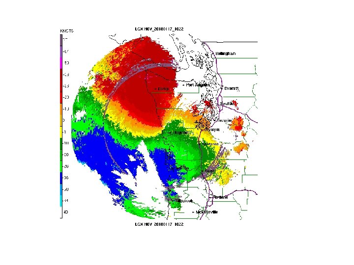
Fronts and Wind Shear Example: January 11, 2014 Washington Coast
Warm Front Approaching UIL