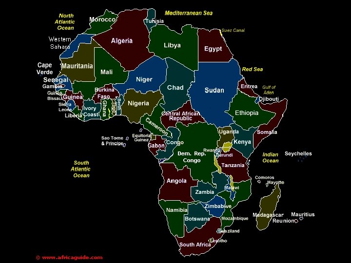
Physical Geography of Africa 1 Landforms Africa covers


 •")


 is the fourthlongest river in")


- Slides: 81
Physical Geography of Africa
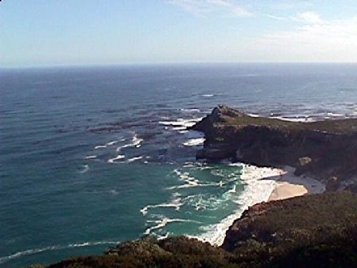
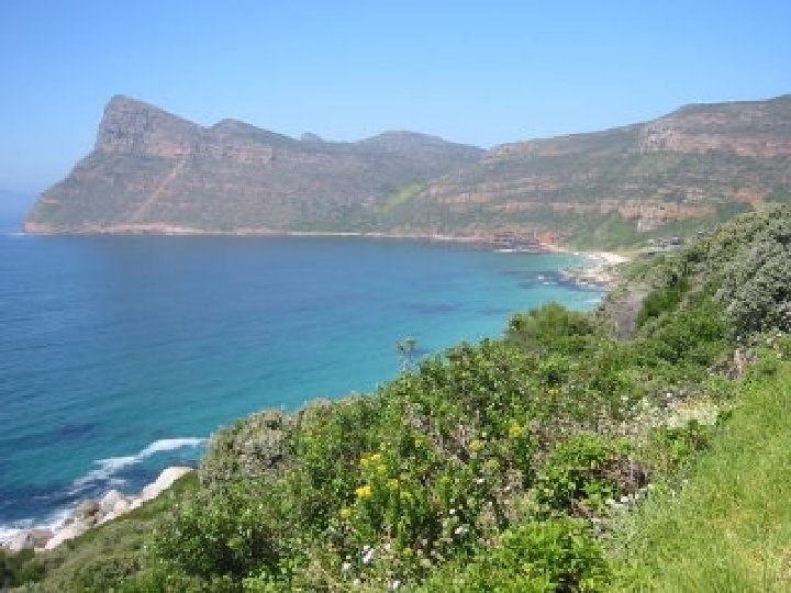
1. Landforms • Africa covers about 9. 5 million square miles. • It is bounded by the Sahara to the north and seas in all other directions. • The Atlantic and Indian Oceans meet at the Cape of Good Hope. • Remember Cape of Good Hope from the next two slides.
Africa’s Size 4600 MILES 5 0 0 0 M I L E S # Second largest continent 11, 700, 000 sq. mi. # 10% of the world’s population. # 2 ½ times the size of the U. S.
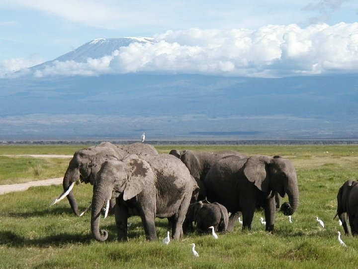
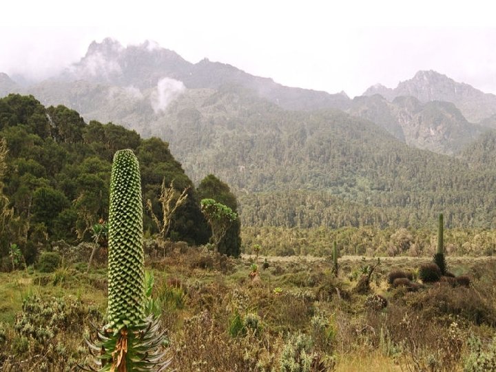
2. Landforms • Africa is made up of a series of plateaus which create escarpments and cataracts. • Escarpment: Step cliff or slope between a higher and lower land surface. • The Ethiopian Highlands are an example of the plateau landscape of Africa. • Found within the Highlands are the famous peaks of Mount Kilimanjaro and Mount Kenya.
Ethiopian Highlands http: //www. youtube. com/watch? v=B 7 k. Ah_JHqp 4
Mount Kilimanjaro (Tanzania) •
Mt. Kilimanjaro: Snow on the Equator? http: //video. nationalgeographic. com/video/p layer/places/parks-and-natureplaces/mountainsvolcanoes/tanzania_kilimanjaro. html
ts. M las At Mountains & Peaks Δ Mt. Kenya . ts i. M or z en w Ru Δ Mt. Kilimanjaro . ts rg je bu s n D ra M
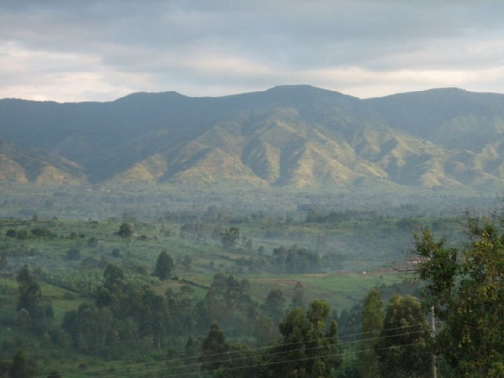
3. Landforms • The Ruwenzori Mountains divide Uganda and The Dem. Rep of Congo. • These mountains are called the “Mountains of the Moon”. • Air from the Indian Ocean is the cause for this phenomenon.
Ruwenzori Mountains
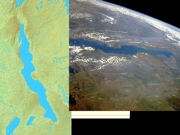
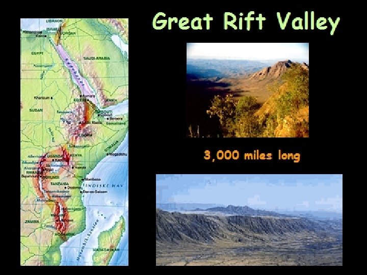
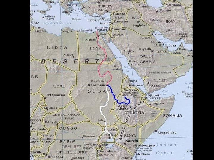
4. Landforms • The Great Rift Valley extends from Syria in the Middle East to Mozambique in Southern Africa. • http: //www. youtube. com/watch? v=IDWAPd 46 Q 7 A
5. Landforms • The Great Rift Valley is divided into two branches. • Mt. Kilimanjaro is located on the Eastern branch and Lake Tanganyika is on the west. • Other volcanic mountains are located near Kilimanjaro. • Lake Tanganyika is one of the largest freshwater lakes in the world.
6. Water systems • Most of the lakes in Africa are found in the Great Rift Valley. • Lake Victoria is one of the most well known of these lakes. • Lake Victoria is the largest lake in Africa. • Lake Victoria is the largest tropical lake in the world.
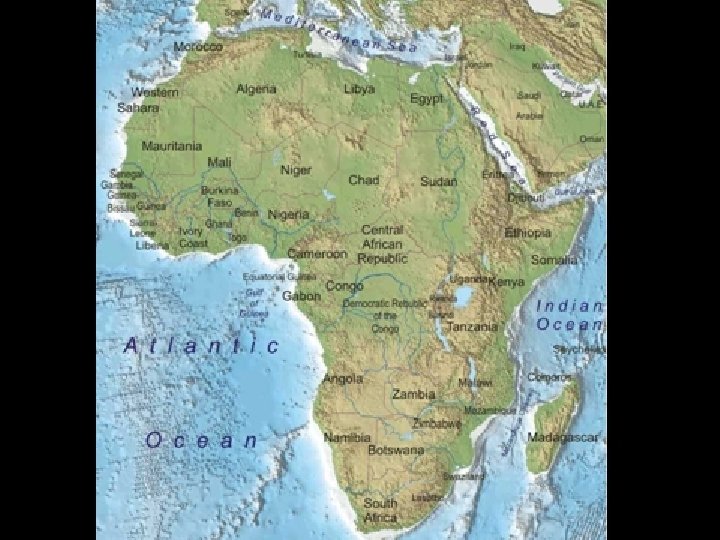
Mediterranean Sea ed R Bodies a Se er R L. Chad--> ive r of A Water lf Gu <-- Of Nile River Nig r ve L. Albert--> g den n Co i o. R L. Victoria L. Tanganyika-> Indian Ocean Atlantic Ocean Zambezi River Limpopo River Orange River Pacific Ocean
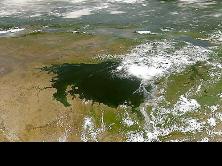
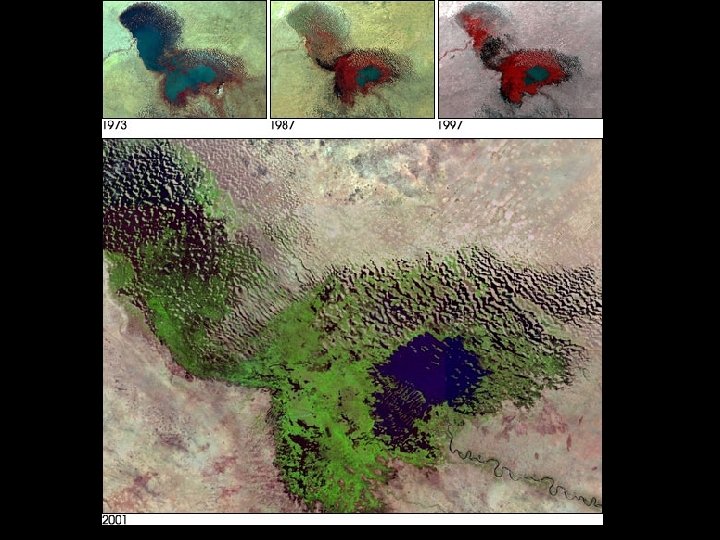
7. Water systems • Lake Chad located in western Africa is one of the few lakes located outside of the Rift Valley. • Water levels in Lake Chad are continually decreasing due to droughts. • A large northern portion of the lake has already dried up. • http: //www. youtube. com/watch? v=JTZUCy 8 tkg. I
8. Water Systems • Lake Chad is extremely important because it supplies water to nearly 20 million people in the surrounding countries. • The Chari River provides 90% of the water in Lake Chad. • The word “Chad” is a local word that mean a large expanse of water or lake.
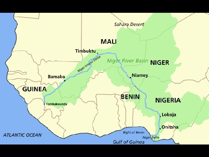
9. Water Systems • The Niger and Zambezi Rivers are two well-known river basins in Africa. • The Niger River is the principal river of western Africa, extending over 2500 miles (about 4180 km). • It runs in a crescent through Guinea, Mali, Niger, on the border with Benin and then through Nigeria, discharging through a massive delta, known as the Niger Delta.
The Niger River Basin # Covers 7. 5% of the continent. # Extends over 10 countries. # 2, 600 miles long.
10. Water Systems • The Zambezi (also spelled Zambesi) is the fourthlongest river in Africa, and the largest flowing into the Indian Ocean. • The Zambezi's most spectacular feature is Victoria Falls, one of the world's largest waterfalls. • The river rises in a black marshy bog in northwestern Zambia, in undulating forested hills about 1, 500 metres (4, 900 ft) above sea level. •
Victoria Falls
Victoria Falls •
Victoria Falls during the dry season 2003 •
Victoria Falls during the Rainy season •
http: //www. youtube. com/watch? v =PTu 8 k. X 99 h. XI •
11. Water Systems • The Zambezi River plummets 355 feet to create Victoria Falls. • The Congo river reaches the Atlantic Ocean through a deep estuary. • Estuary: an area where the tide meets a river current.
Congo River • Is the 2 nd longest river in Africa. • Second largest flow of any river in the world. Behind the Amazon. • Goes through the second biggest rain forest in the world.
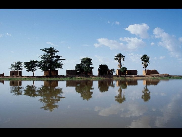
12. Nature and Economics • Lake Volta in Ghana is one of the largest man-made dams in the world. • It was created to supply energy to a local aluminum plant in the 1960 s. • Secondary benefits include: • A) Irrigation used to farming the surrounding area. • B) Hydroelectric power to most of Ghana.
Akosombo Dam •
Akosombo Dam • The dam provides electricity to Ghana and its neighboring West African countries, including Togo and Benin. The dam is 660 metres wide and 114 metres high. It cost £ 130 million to build. It was built between 1961 and 1965. • The loss of land experienced by the 80, 000 people forcibly relocated meant the loss of their primary economic activities from fishing and agriculture, loss of their homes, loss of their loved ones’ grave sites, loss of community stability, and the eventual loss of important social values.
Akosombo Dam
13. African Flora and Fauna • The climate of Africa ranges from tropical to subarctic on its highest peaks. • Central and southern areas contain both savanna plains and very dense jungle (rainforest) regions. • Africa boasts perhaps the world's largest combination of density and "range of freedom" of wild animal populations and diversity.
African animals •
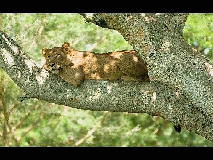
African Animals • Lions live for approximately 10– 14 years in the wild, while in captivity they can live over 20 years. • They typically inhabit savanna and grassland, although they may take to bush and forest. • The lion is an apex and keystone predator, though will resort to scavenging if the opportunity arises. • The lion is a vulnerable species, having seen a possibly irreversible population decline of 30 to 50% over the past two decades in its African range
• Distribution of lions in Africa
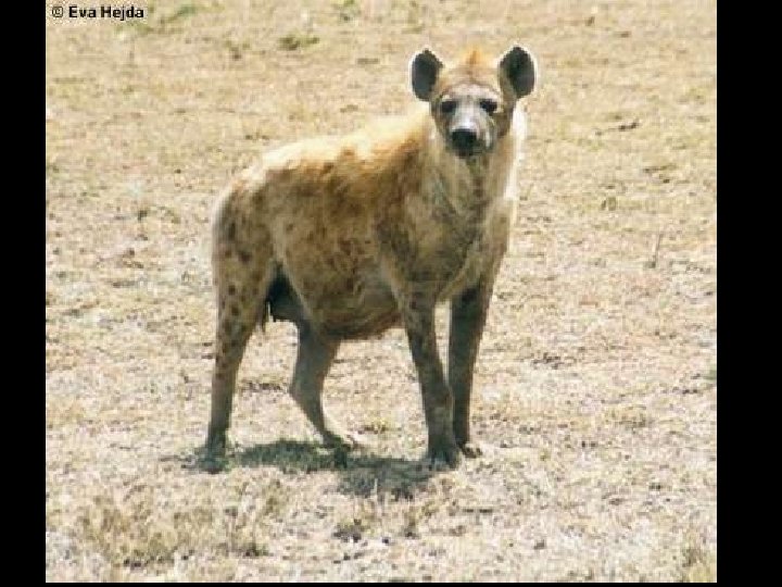
African Animals • Hyenas are highly intelligent animals, and some scientists claim they are of equal intelligence to certain apes. • One indication of hyena intelligence is that they will move their kills closer to each other to protect them from scavengers. • Negative associations have generally stemmed from Hyenas' tendency to scavenge graves for food. • They are one of the few creatures naturally suited for this due to their ability to devour and digest every part of a carcass, including bone
African Animals •
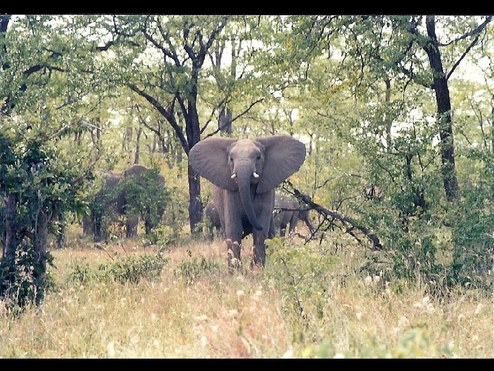
African Animals • Elephants are mammals, and the largest land animals alive today. • An elephant may live as long as 70 years, sometimes longer. • The largest elephant ever recorded was shot in Angola in 1956. This male weighed about 12, 000 kg (26, 400 lb), with a shoulder height of 4. 2 m (13. 8 ft), a metre (3 ft 4 in) taller than the average male African elephant.
Africa: The “Tropical” Continent Tropic of Cancer 20° N Equator 0° Tropic of Capricorn 20° S
14. Africa’s Tropical Rain Forest • Tropical Rain forests are the dominant form of vegetation found around the equator. • This area receives around 60’ of rain per year and has no real “dry” season. • This high percentage of rainfall allows for a wide variety of plant life. Starting on the forest floor and expanding 150 ft. high into the canopy.
African Rain Forest # Annual rainfall of up to 17 ft. # Rapid decomposition (very humid). # Covers 37 countries. # 15% of the land surface of Africa.
15. Economics/Clear Cutting • Rainfall can actually be curse in the region as it leads to leaching of precious nutrients from the soil. • Some plants are still able to grow such as bananas, pineapples, cocoa, tea and rubber trees. • Clear cutting of the forest to harvest more of these products poses a threat. As the trees are remove the fragile forest floor becomes exposed and susceptible to erosion.
Vegetation Zones
The African Savannah: 13 million sq. mi.
16. Savanna • The vast majority Sub-Saharan Africa is covered in a tropical grassland called the savanna. See pg 507 • Hot, dry NE trade winds known as a harmattans help to dry excess rains from summer rainfall. • Tornadoes sometimes occur as harmattans collide with southwestern winds.
African Trade Winds
West Africa: Home of our Hurricanes
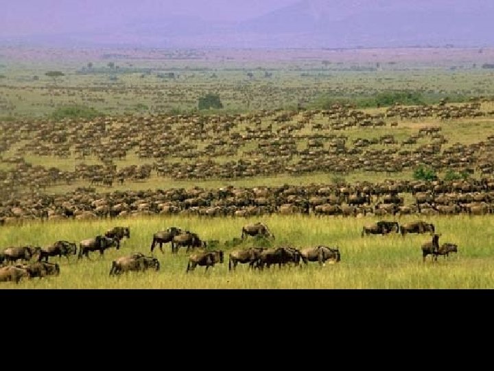
17. The Serengeti • The Serengeti Plain is one of the largest savanna plains in the world. • It is the home to 1 million gnu (wildebeast), 60, 000 zebras and many gazelles and their natural predators. • Many of these animals are protected in the Serengeti Nat’l Park in Tanzania. The Nat’l park is one of the most heavily fortified parks in all the world.
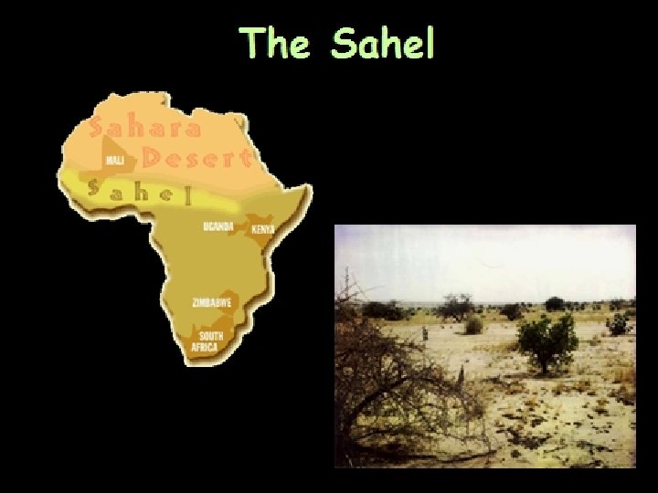
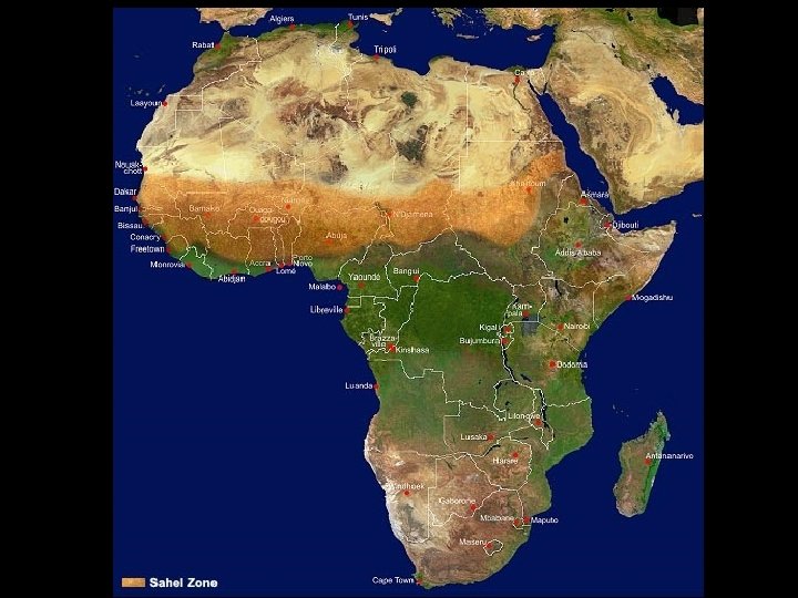
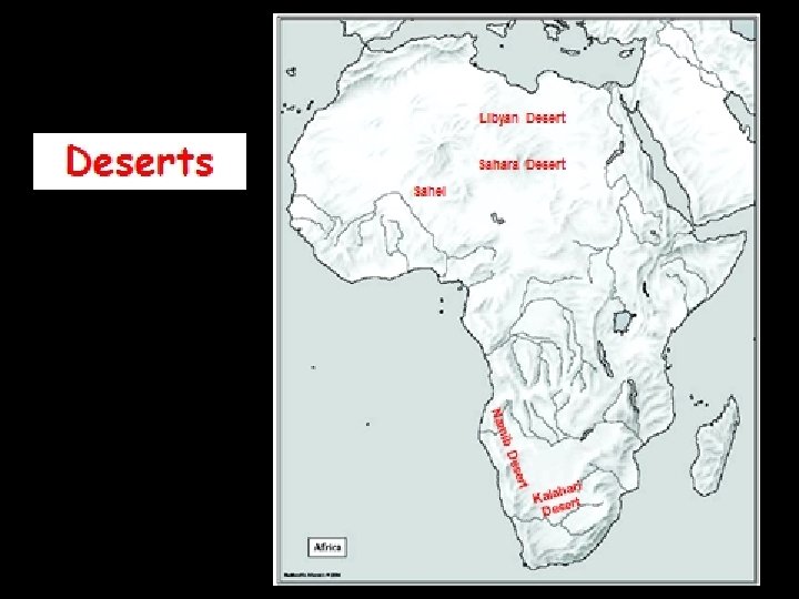
18. Steppe Climate • The steppe is what separates the Sahara from the savanna. • The Sahel is the steppe region that is the border or edge of the desert. It spreads across Africa from Senegal to the Sudan. • The Sahel receives very little annual rainfall (4 -8 inches)
19. Desertification • Desertification: Process by which arable land turns into desert. • This may be attributed to global warming. Some scientists argue that prolonged warm stretches speed up the desertification process. • Other contributing factors include overgrazing and stripping of trees for firewood.
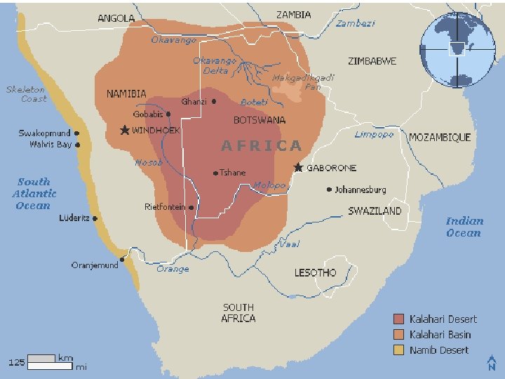
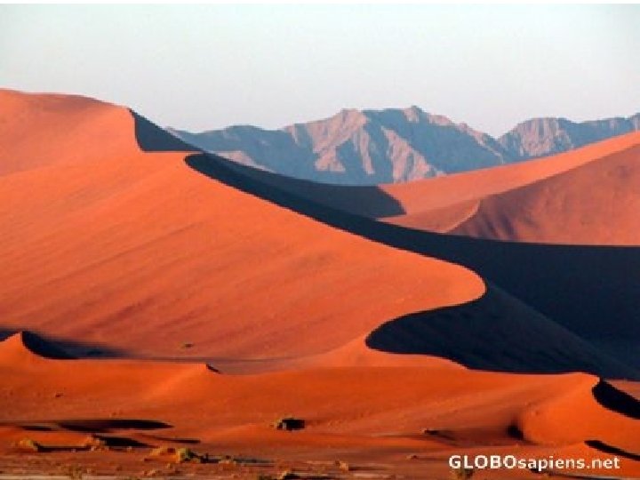
20. Desert • The Namib and Kalahari Desert are located in southern Africa. • The Kalahari is true wind-swept sandy desert. Daily temps can get as high as 150º F during the day and as low as 50 ºF at night. • Desert rainfall = not much…. bring a canteen.
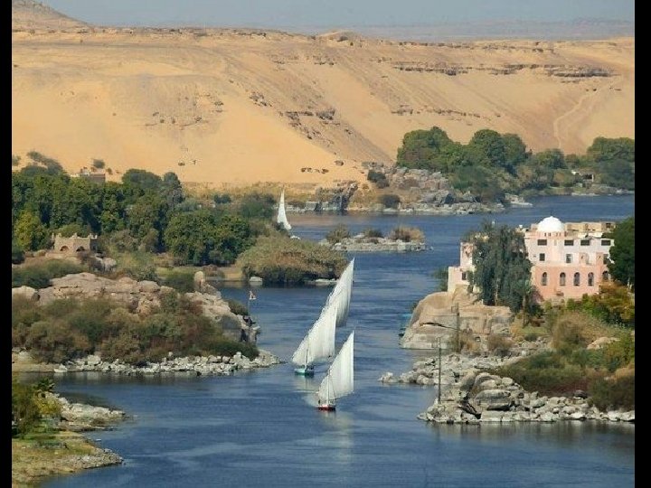
21. The Nile River • The Nile River is a major north-flowing river in Africa, generally regarded as the longest river in the world. • The Nile has two major tributaries, the White Nile and Blue Nile, the latter being the source of most of the Nile's water and fertile soil, but the former being the longer of the two.
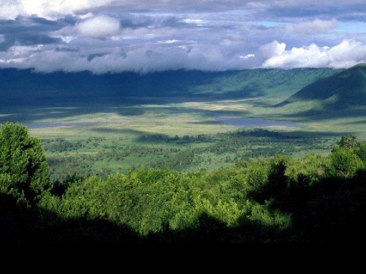
Ngorongoro Crater • The Ngorongoro Crater, which is the world's largest unbroken, unflooded volcanic caldera. • The Crater, which formed when a giant volcano exploded and collapsed on itself some two to three million years ago, is 2, 001 ft deep and its floor covers 102 square miles.
Ngorongoro Crater