The Physical Geography of North Africa Southwest and


- Slides: 11

The Physical Geography of North Africa, Southwest, and Central Asia Chapter 17, Section 1: The Land

Important Vocabulary Kum: dune-covered deserts; Southwest Asia. Alluvial Soil: a rich soil made up of sand mud deposited by moving water. Nile River. Wadi: a streambed that remains dry until a heavy rain. Arid regions. Phosphate: a chemical used in fertilizers.

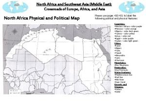
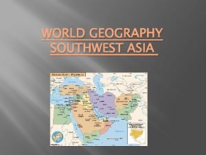
Physical Map of the Region(s) North Africa Southwest and Central Asia

Mountains Tectonic activity has shaped the landscape. Atlas Mountains: across Morocco and Algeria. In Southwest Asia: Hejaz and Asir ranges. Pontic and Taurus Mountains in Turkey.

Coastal Plains, Seas, and Peninsulas The Red Sea and Gulf of Aden. Gulfs of Suez and Aqaba flank in the Sinai Peninsula. Mediterranean, Black, and Aegean Seas surround the Anatolia Peninsula. Landlocked water bodies: Dead, Caspian, and Aral Seas.

Major Rivers Nile is world’s longest river. Aswan High Dam provides water for agriculture and hydroelectric power. Tigris and Euphrates Rivers in Ancient Mesopotamia. Fertile farm lands. Rainstorms create wadis in arid North Africa and Southwest Asia.

Natural Resources Over 60% of the world’s oil reserves, and 50% of natural gas. Vast mineral resources – sulfur, sulphate, manganese, gold, chromium, lead, iron, copper, and zinc.

The Physical Geography of North Africa, Southwest, and Central Asia Chapter 17, Section 2: Climate and Vegetation

Important Vocabulary Oasis: a place in the desert where underground water surfaces. Pastoralism: the raising and grazing of livestock. Way of life for those who live in a steppe climate. Cereal: food grains such as barley, oats, and wheat. Grown without irrigation.

Water and Climate Desert covers almost 50% of the region. Sahara is world’s largest desert. Extreme weather: cold to mild winters and long, hot summers. Steppe climate region: semi-arid, some trees and grasses.

Mid-Latitude Regions Mid-latitude weather: cool, rainy winters and hot, dry summers. High exports of citrus, olives, fruits, and grapes. Favorable weather increases tourism. Coastal and highland areas receive the most rain.
 Kums definition geography
 Southwest asia/north africa (swana) political map
 North africa southwest asia physical map
 Swana region
 North africa and southwest asia mountains
 Physical geography of north africa
 Chapter 15 lesson 1 physical geography of north africa
 Southwest asia/north africa (swana) political map
 Chapter 21 physical geography of southwest asia
 Peninsulas and waterways in southwest asia
 Locate the sahara and the sahel. label them on your map
 Chapter 22 human geography of southwest asia

