The Physical Geography of Latin America Mexico Mountains


- Slides: 16
The Physical Geography of Latin America
Mexico • Mountains dominate Mexico – Sierra Madre Occidental – Sierra Madre Oriental – Sierra Madre del Sur • Central Plateau: makes up more than half of the country’s area – Most of Mexico’s people live in the plateau region
Central America • Central America is an isthmus – Isthmus: a narrow strip of land that has water on both sides and joins two larger bodies of land. • Narrow plains run along the coasts • Between the plains are mountains – More then a dozen (12) of these mountains are active volcanoes
The Panama Canal • Human made waterway • Stretches across the Isthmus of Panama • Purpose is to shorten travel time between the Atlantic and Pacific Ocean
The Caribbean • The Caribbean is made up of two types of islands – Smaller islands are made up of coral (tiny sea animals that over hundreds of years meld together to create a rocklike substance) – Larger islands are the tops of huge underwater mountains
The Caribbean Breakdown • The Greater Antilles: – Larger islands (Cuba Hispaniola, Puerto Rico, and Jamaica) • The Lesser Antilles: – An archipelago: a group of islands – From the Virgin Islands down to Trinidad • The Bahamas – Another archipelago
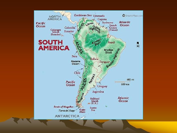
South America • Andes Mountains run along the western coast. – 2 nd highest mountain range in the world – World’s longest mountain system
South America • Highlands are located in Brazil, Venezuela, Guyana • The Brazilian Highlands end in an escarpment – Steep cliff at the edge of a plateau with a lowland area below
South America • The Amazon River Basin contains the largest tropical rain forest in the world – This rainforest covers more than 1/3 of South America
South America • Pampas are flat grassland regions that are very similar to the Great Plains of the U. S. – Located in Argentina and Uruguay
South America • Patagonia • Located in the southernmost part of Argentina and Chile • Made up of the Andes Mountains, plateaus, and glaciers
South America from Space
Rivers and Lakes • Amazon River – second longest river in the world – Flows 4, 000 miles from Peru across Brazil – Contains about 20% of all the fresh water on Earth – Collects more than 1, 000 tributaries • Tributaries: the rivers and streams that flow into a larger river.
Rivers and Lakes • The Rio de la Plata is made up of the Parana, Paraguay and Uruguay rivers. – Form the 2 nd largest river system in Latin America • The 3 rivers flow into an estuary – An area where river currents and ocean tides meet
Rivers and Lakes • Venezuela has the Orinoco River and Lake Maracaibo • Lake Titicaca is located in the Andes mountains – Highest lake in the world